Items Similar to 1756 Map of Brazil from Bahia to São Paulo by Bellin – French Colonial Engraving


Want more images or videos?
Request additional images or videos from the seller
1 of 10
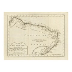
1756 Map of Brazil from Bahia to São Paulo by Bellin – French Colonial Engraving
$263.50
£195.27
€220
CA$359.73
A$400.19
CHF 209.78
MX$4,890.18
NOK 2,671.32
SEK 2,514.68
DKK 1,675.06
Shipping
Retrieving quote...The 1stDibs Promise:
Authenticity Guarantee,
Money-Back Guarantee,
24-Hour Cancellation
About the Item
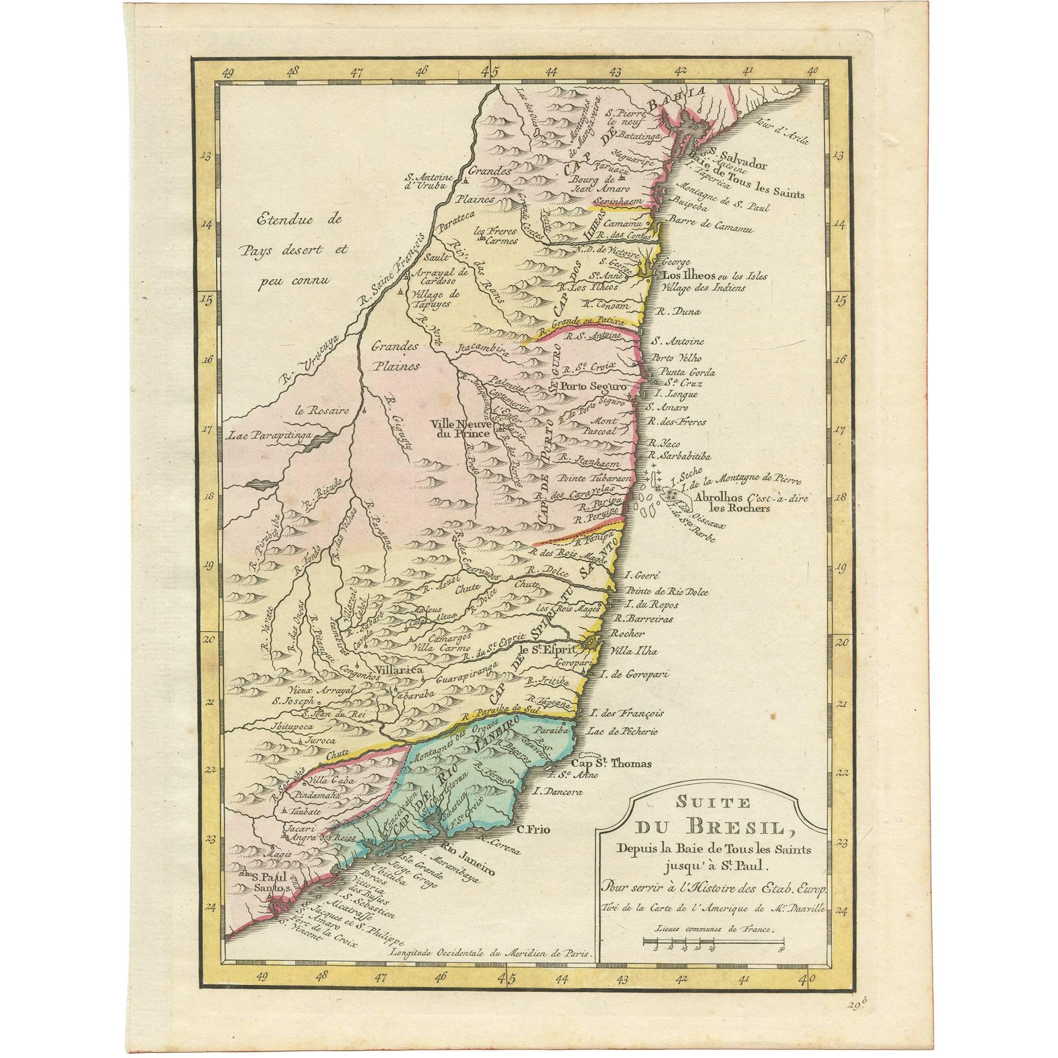
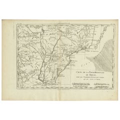
Antique Map of Brazil from Bahia to São Paulo – Bellin for L'Histoire des Voyages
This elegant 18th-century French map titled "Suite du Bresil, Depuis la Baie de Tous les Saints jusqu’à St. Paul" was engraved by Jacques-Nicolas Bellin for the famous travel compendium *L’Histoire Générale des Voyages*, published in Paris around 1756. It depicts the southeastern coastline of Brazil from Salvador da Bahia in the north to São Paulo and Santos in the south.
The map details the Atlantic shoreline, major rivers, settlements, capes, indigenous villages, missionary outposts, and Portuguese colonial towns of the time. Notable locations include Bahia (Salvador), Porto Seguro, Villarica, Cap St. Thomas, Rio de Janeiro, and Cap Frio. Inland, the map shows mountain ranges, rivers, and the unexplored interior labeled as “Etendue de Pays désert et peu connu” (extent of desert and little-known lands), emphasizing the colonial knowledge gap of the time.
One remarkable inclusion is the *Abrolhos Islands*, noted as *“Abrolhos, c'est à dire les Rochers”*, referring to the dangerous reefs well known to European navigators. The map also records Jesuit missions, mining areas (like the gold-rich *Minas Gerais*), and other important Portuguese colonial infrastructure.
Jacques-Nicolas Bellin (1703–1772) was one of the most respected French hydrographers and cartographers, known for his accuracy and elegant engraving style. His work for *L’Histoire Générale des Voyages* combined geographical exploration with scholarly detail, serving as a key source of information for Enlightenment-era European readers.
Cartographic Details:
* Copper engraving on laid paper
* Decorative title cartouche
* Engraved longitude marked from the Paris meridian
* Plate number “Tom. XX” in upper right corner, referencing the volume
Condition report:
Very good antique condition. Crisp impression with full margins. Light age toning and faint handling marks. No tears or repairs. Verso blank.
Framing suggestion:
Float-mount in a simple black or walnut frame with a light cream or ivory mat. Be sure to expose the plate mark and title cartouche. UV-protective glass recommended to preserve the paper tone and engraved detail.
- Dimensions:Height: 10.44 in (26.5 cm)Width: 7.17 in (18.2 cm)Depth: 0.01 in (0.2 mm)
- Materials and Techniques:Paper,Engraved
- Period:1750-1759
- Date of Manufacture:circa 1756
- Condition:Very good antique condition. Crisp impression with full margins. Light age toning and faint handling marks. No tears or repairs. Verso blank.
- Seller Location:Langweer, NL
- Reference Number:Seller: BG-034981stDibs: LU3054344978412
About the Seller
5.0
Recognized Seller
These prestigious sellers are industry leaders and represent the highest echelon for item quality and design.
Platinum Seller
Premium sellers with a 4.7+ rating and 24-hour response times
Established in 2009
1stDibs seller since 2017
2,494 sales on 1stDibs
Typical response time: 1 hour
- ShippingRetrieving quote...Shipping from: Langweer, Netherlands
- Return Policy
Authenticity Guarantee
In the unlikely event there’s an issue with an item’s authenticity, contact us within 1 year for a full refund. DetailsMoney-Back Guarantee
If your item is not as described, is damaged in transit, or does not arrive, contact us within 7 days for a full refund. Details24-Hour Cancellation
You have a 24-hour grace period in which to reconsider your purchase, with no questions asked.Vetted Professional Sellers
Our world-class sellers must adhere to strict standards for service and quality, maintaining the integrity of our listings.Price-Match Guarantee
If you find that a seller listed the same item for a lower price elsewhere, we’ll match it.Trusted Global Delivery
Our best-in-class carrier network provides specialized shipping options worldwide, including custom delivery.More From This Seller
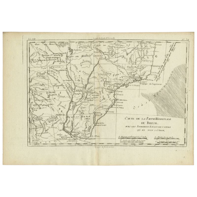
View AllBrazil Coastline Map – Broenner Carte du Bresil, 1772 Captaincies
Located in Langweer, NL
Carte du Bresil Map, Broenner Krefeld 1772 – Brazil Coastline Captaincies
This is an engraved map titled Carte du Bresil Prem. Partie, published in Krefeld (Germany) by J.J. Broenne...
Category
Antique Late 18th Century French Maps
Materials
Paper
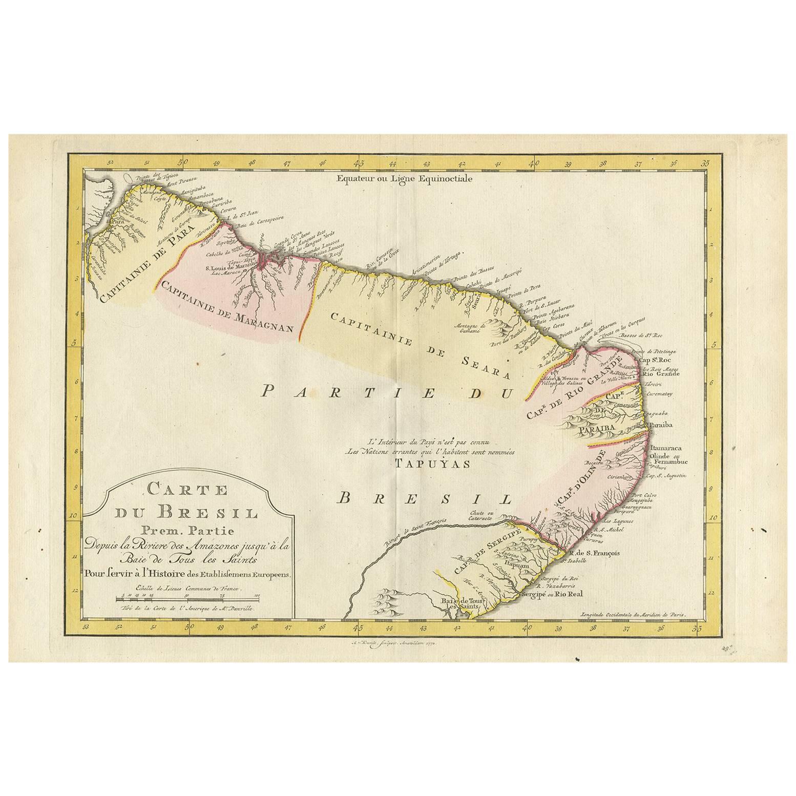
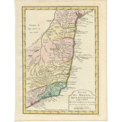
Antique Map of the Brazilian Coast by A. Van Krevelt
Located in Langweer, NL
Uncommon edition of this accurate map of part of Brazil, from San Salvador till Rio de Janeiro and S.Paulo. In lower right engraved "29b." Originates from 'Atlas Portatif pour servir...
Category
Antique Late 18th Century Brazilian Maps
Materials
Paper
$231 Sale Price
22% Off
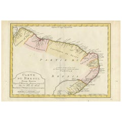
Antique Map of the Coast of Southern Brazil by Bellin, c.1755
By Jacques-Nicolas Bellin
Located in Langweer, NL
Antique map titled ‘Suite de Bresil’. Map of the coast of southern Brazil, with Lagoa Mirim, and Uruguay (here named as Paraguay). This print originates from 'Histoire générale des V...
Category
Antique 18th Century Maps
Materials
Paper
$93 Sale Price
20% Off
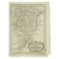
Antique Map of Northern Brazil by Bonne, c.1780
Located in Langweer, NL
Antique map titled 'Carte de la Partie Septentrionale du Bresil.' Detailed map of the northern portion of Brazil from Bahia to French Guiana, showing the eastern Amazon interior rivers, Mission Territories, Goyza and the coastal regions, including coastal currents. Source unknown, to be determined. Artists and Engravers: Rigobert Bonne (1727-1795 ) was one of the most important cartographers of the late 18th century. In 1773 he succeeded Jacques Bellin as Royal Cartographer to France in the office of the Hydrographer at the Depôt de la Marine. Working in his official capacity Bonne compiled some of the most detailed and accurate maps of the period. Bonne's work represents an important step in the evolution of the cartographic ideology away from the decorative work of the 17th and early 18th century towards a more detail oriented and practical aesthetic. With regard to the rendering of terrain Bonne maps...
Category
Antique 18th Century Maps
Materials
Paper

$119 Sale Price
20% Off
Antique Map of the Eastern Part of Brazil by A. Van Krevelt, 1772
Located in Langweer, NL
Rare edition of this accurate map of eastern part of Brazil. This map originates from 'Atlas Portatif pour servir a l'intelligence de l'Histoire Philosophique et Politique des etabli...
Category
Antique Late 18th Century Maps
Materials
Paper
$311 Sale Price
20% Off
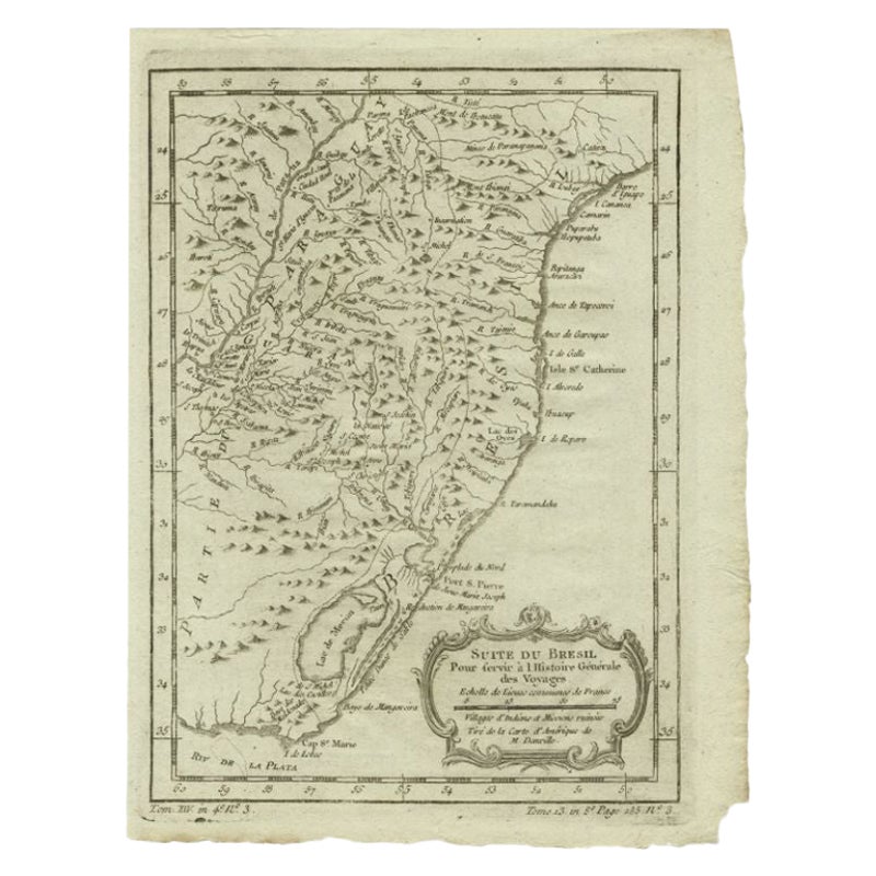
Antique Map of Southern Brazil and Uruguay by Bonne, c.1780
Located in Langweer, NL
"Antique map titled 'Carte de la Partie Meridional du Bresil avec les Possessions Espagnoles Voisines Qui en Sont a l'Ouest.' Map of southern Brazil and present-day Uruguay from Port...
Category
Antique 18th Century Maps
Materials
Paper
$134 Sale Price
20% Off
You May Also Like
Carte du Bresil, antique 1860s engraved map of Brazil
Located in Melbourne, Victoria
'Carte du Bresil'
Engraving with original outline colouring, circa 1860, by Alexandre Vuillemin, published in Paris.
31cm by 41cm (sheet)
21.5cm by 31.5cm (image)
Category
Late 19th Century Victorian More Prints
Materials
Lithograph

Portugal: A Large 17th Century Hand-colored Map by Sanson and Jaillot
By Nicholas Sanson d'Abbeville
Located in Alamo, CA
This large hand-colored map entitled "Le Royaume de Portugal et des Algarves Divisee en see Archeveches, Eveches et Territoires Par le Sr Sanson" was originally created by Nicholas S...
Category
1690s Landscape Prints
Materials
Engraving

Original Antique Map of South America. C.1780
Located in St Annes, Lancashire
Great map of South America
Copper-plate engraving
Published C.1780
Two small worm holes to left side of map
Unframed.
Category
Antique Early 1800s English Georgian Maps
Materials
Paper

Antique 1765 Wine Country Folding Map of France, Bordeau etc.
Located in Paonia, CO
Route du Carosse de Bordeaux, part de Paris tous les Mardis a 11 matin. a et pafse 1765 is a comprehensive map with two routes through the wine country of France starting in Paris going south...
Category
1760s Other Art Style Landscape Prints
Materials
Etching

West Coast of Africa, Guinea & Sierra Leone: An 18th Century Map by Bellin
By Jacques-Nicolas Bellin
Located in Alamo, CA
Jacques Bellin's copper-plate map entitled "Partie de la Coste de Guinee Dupuis la Riviere de Sierra Leona Jusquau Cap das Palmas", depicting the coast of Guinea and Sierra Leone in ...
Category
Antique Mid-18th Century French Maps
Materials
Paper

West Coast of Africa; Guinea & Sierra Leone: Bellin 18th Century Map
Located in Alamo, CA
This is a Jacques Bellin copper-plate map entitled "Partie de la Coste de Guinee Dupuis la Riviere de Sierra Leona Jusquau Cap das Palmas", depicting the coast of Guinea and Sierra L...
Category
1740s Old Masters Landscape Prints
Materials
Engraving

More Ways To Browse
French Colonial Furniture
Antique Ivory Collectables
Antique Compendium
Thomas Toner
Antique Glass Floats
French Santos
Brazilian Colonial Furniture
18th Century Santos
Portuguese Colonial Furniture
Thomas Ivory
Silver Bowl Large
Down Couch
Used Lighter Art
Blue Edge Glass
Mahogany 1950s Furniture
Solid Mahogany Table
Dessert Glasses
Geometric Glass Table