Items Similar to 1850-1960 Cram's Superior Latest Federal Census Texas Map

Want more images or videos?
Request additional images or videos from the seller
1 of 10
1850-1960 Cram's Superior Latest Federal Census Texas Map
$1,700
£1,289.92
€1,474.91
CA$2,374.44
A$2,640.05
CHF 1,378.49
MX$32,135.88
NOK 17,588.93
SEK 16,479.99
DKK 11,007.52
Shipping
Retrieving quote...The 1stDibs Promise:
Authenticity Guarantee,
Money-Back Guarantee,
24-Hour Cancellation
About the Item
The 1850-1960 Cram's Superior Latest Federal Census Texas Map, crafted from pine wood, steel, and canvas, is a valuable historical cartographic piece. Published by The George F. Cram Company, Inc. with the map number CST-40 and marked with Edition No. 1512, this map likely offers a comprehensive view of the demographic and geographical changes in Texas over a century. It serves as an important resource for studying the state's census data and territorial developments during this significant period. Please note, this item is located in one of our NYC locations.
- Creator:G. F. Cram Company (Manufacturer)
- Dimensions:Height: 56 in (142.24 cm)Width: 53.25 in (135.26 cm)Depth: 0.875 in (2.23 cm)
- Materials and Techniques:
- Place of Origin:
- Period:1910-1919
- Date of Manufacture:1910-1919
- Condition:Wear consistent with age and use.
- Seller Location:New York, NY
- Reference Number:Seller: Q2833291stDibs: LU973640843852
About the Seller
5.0
Vetted Professional Seller
Every seller passes strict standards for authenticity and reliability
Established in 2002
1stDibs seller since 2013
1,348 sales on 1stDibs
Typical response time: <1 hour
- ShippingRetrieving quote...Shipping from: New York City, NY
- Return Policy
Authenticity Guarantee
In the unlikely event there’s an issue with an item’s authenticity, contact us within 1 year for a full refund. DetailsMoney-Back Guarantee
If your item is not as described, is damaged in transit, or does not arrive, contact us within 7 days for a full refund. Details24-Hour Cancellation
You have a 24-hour grace period in which to reconsider your purchase, with no questions asked.Vetted Professional Sellers
Our world-class sellers must adhere to strict standards for service and quality, maintaining the integrity of our listings.Price-Match Guarantee
If you find that a seller listed the same item for a lower price elsewhere, we’ll match it.Trusted Global Delivery
Our best-in-class carrier network provides specialized shipping options worldwide, including custom delivery.More From This Seller
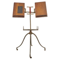
View AllAntique Victorian Cast Iron & Oak Dictionary Stand
Located in New York, NY
Antique 1890s dictionary stand with a cast iron base featuring four curved legs ending in small casters. The top features two adjustable oak book rests, designed to hold large books ...
Category
Antique Late 19th Century American Victorian Musical Instruments
Materials
Iron
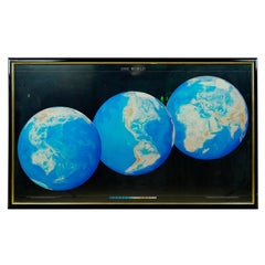
1990 Triple Perspective Planet Earth Map Framed Poster
Located in New York, NY
This decorative poster features a map of the Earth with a unique triple perspective view. It is enclosed in a black plastic frame, and the glass covering the poster is still intact. ...
Category
1990s American Posters
Materials
Glass, Plastic, Paper
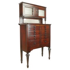
Antique American Cabinet Co. Mahogany Dental Cabinet
By American Cabinet Company
Located in New York, NY
Early 20th Century mahogany dental cabinet featuring 14 drawers with matching wood knobs, fluted legs, and an original mirrored backslash. The upper section has two embossed glass doors with milk glass inserts. Made by The American Cabinet Company...
Category
Early 20th Century American Cabinets
Materials
Glass, Milk Glass, Mirror, Mahogany
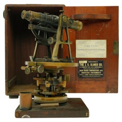
Antique J.C Ulmer Co. Survey Transit & Compass In Original Mahogany Box
Located in New York, NY
Brass and steel survey transit and compass in the original mahogany box. Made by J.C Ulmer Co. Good condition with appropriate wear from age. One availa...
Category
Early 20th Century American Industrial Scientific Instruments
Materials
Brass, Steel
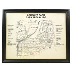
Framed Belmont Park Racetrack Barn Area Guide Map
Located in New York, NY
This piece was acquired from the Belmont Park racetrack in Elmont, New York. It displays an itemized map of the barn area at Belmont Park. It is made of acrylic with a black wood fra...
Category
20th Century American Maps
Materials
Acrylic, Wood
European Brass & Glass Vitrine Display Cabinet No Shelves or Brackets
Located in New York, NY
The vitrine features a clear glass door and sides, a mirrored back, and a simple metal ring handle. The bottom of the vitrine has a dark wooden base with a decorative gilt metal appl...
Category
Early 20th Century European Vitrines
Materials
Brass, Steel

You May Also Like
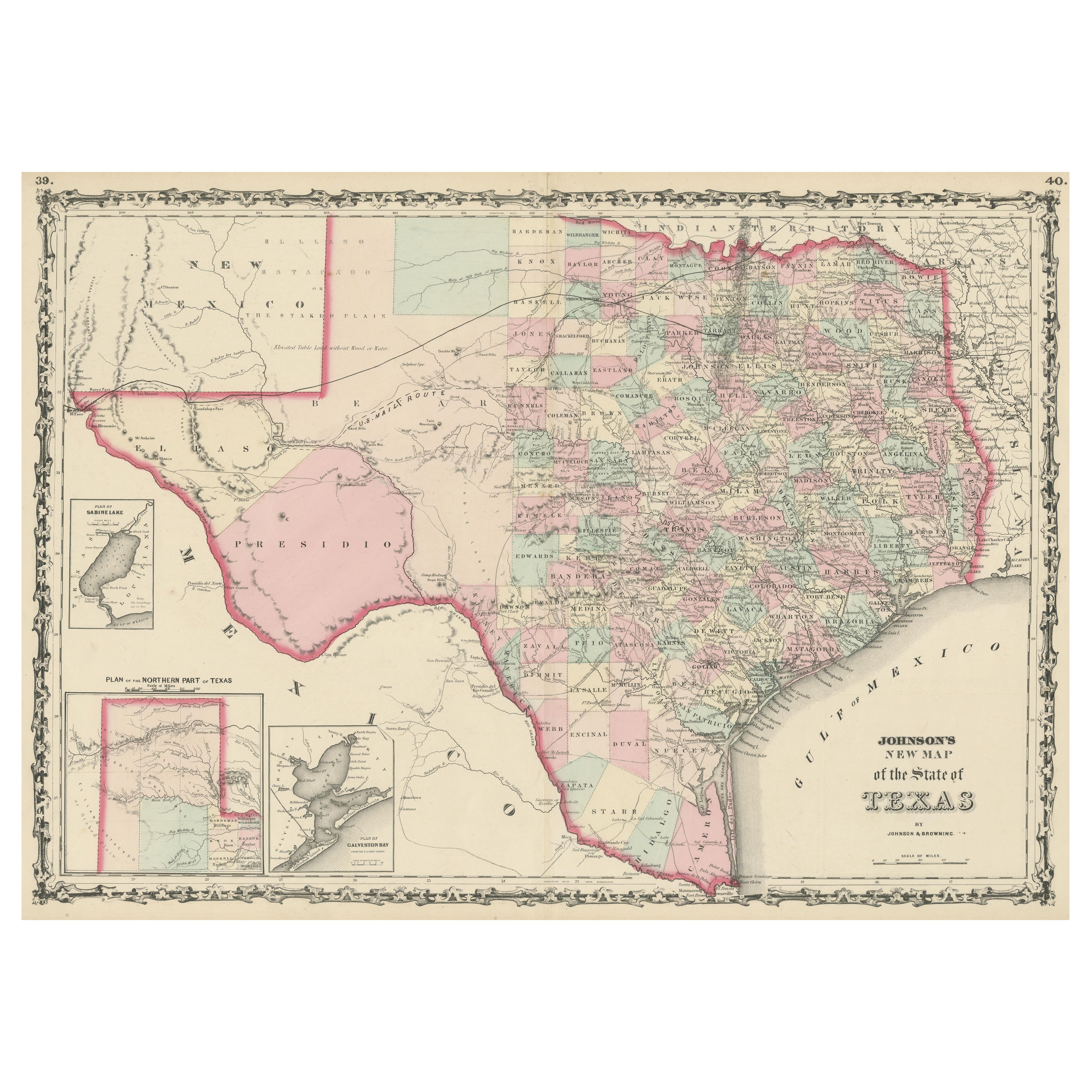
Large Antique Map of the State of Texas, 1861
Located in Langweer, NL
Antique map titled 'Johnson's New Map of the State of Texas' Large map of Texas, shows railroads, wagon roads, the U.S. Mail Route, rivers, ports, ...
Category
Antique Mid-19th Century American Maps
Materials
Paper

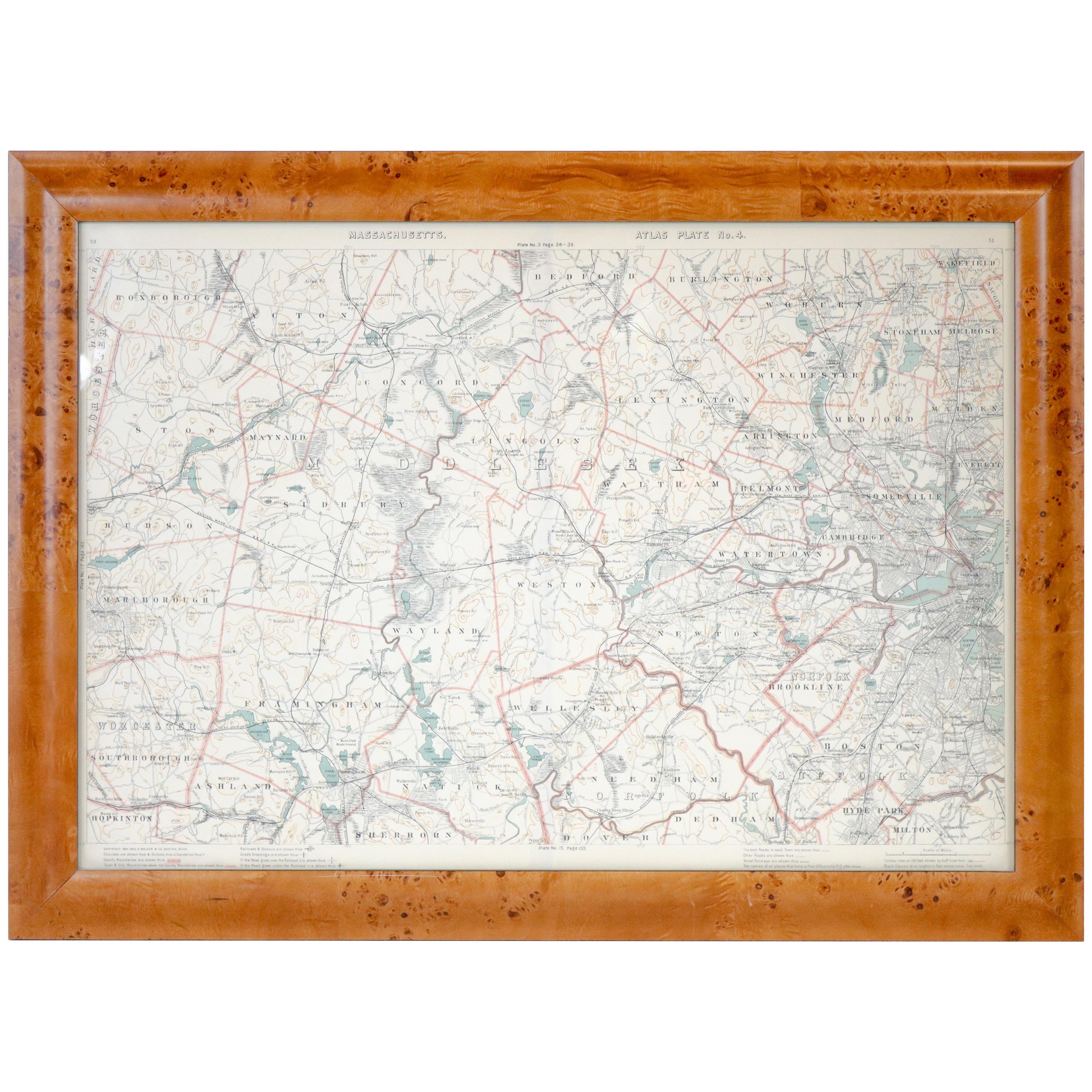
Original 1891 Walker Map
Located in Norwell, MA
Original 1891 map of Massachusetts by Walker. Towns include Cambridge, Boston, Dedham, Ashland, Brookline, Newton etc... burl wood frame. Measures...
Category
Antique 19th Century Maps

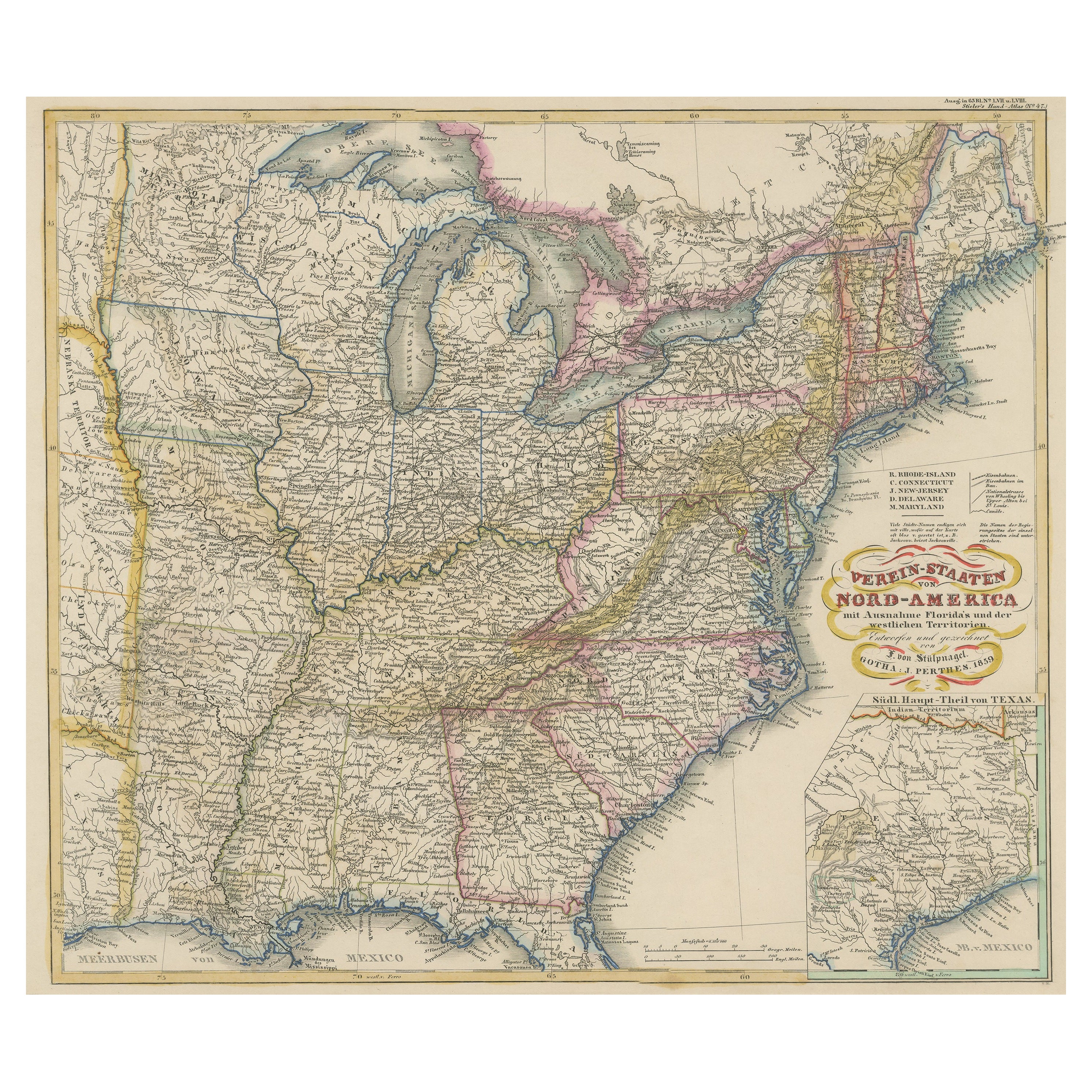
Antique Map of the Eastern United States with Inset Map of Texas
Located in Langweer, NL
Antique map titled 'Verein-Staaten von Nord-America mit Ausnahme Florida's und der Westlichen Territorien'. This map extends as far west as Louisiana and only includes the northern p...
Category
Antique Mid-19th Century Maps
Materials
Paper

$518 Sale Price
20% Off
Vintage Framed United States Map
Located in Queens, NY
Vintage aged paper map of the United States mounted on particle board and framed in a simple wooden frame.
Category
20th Century American Mid-Century Modern Maps
Materials
Wood, Paper

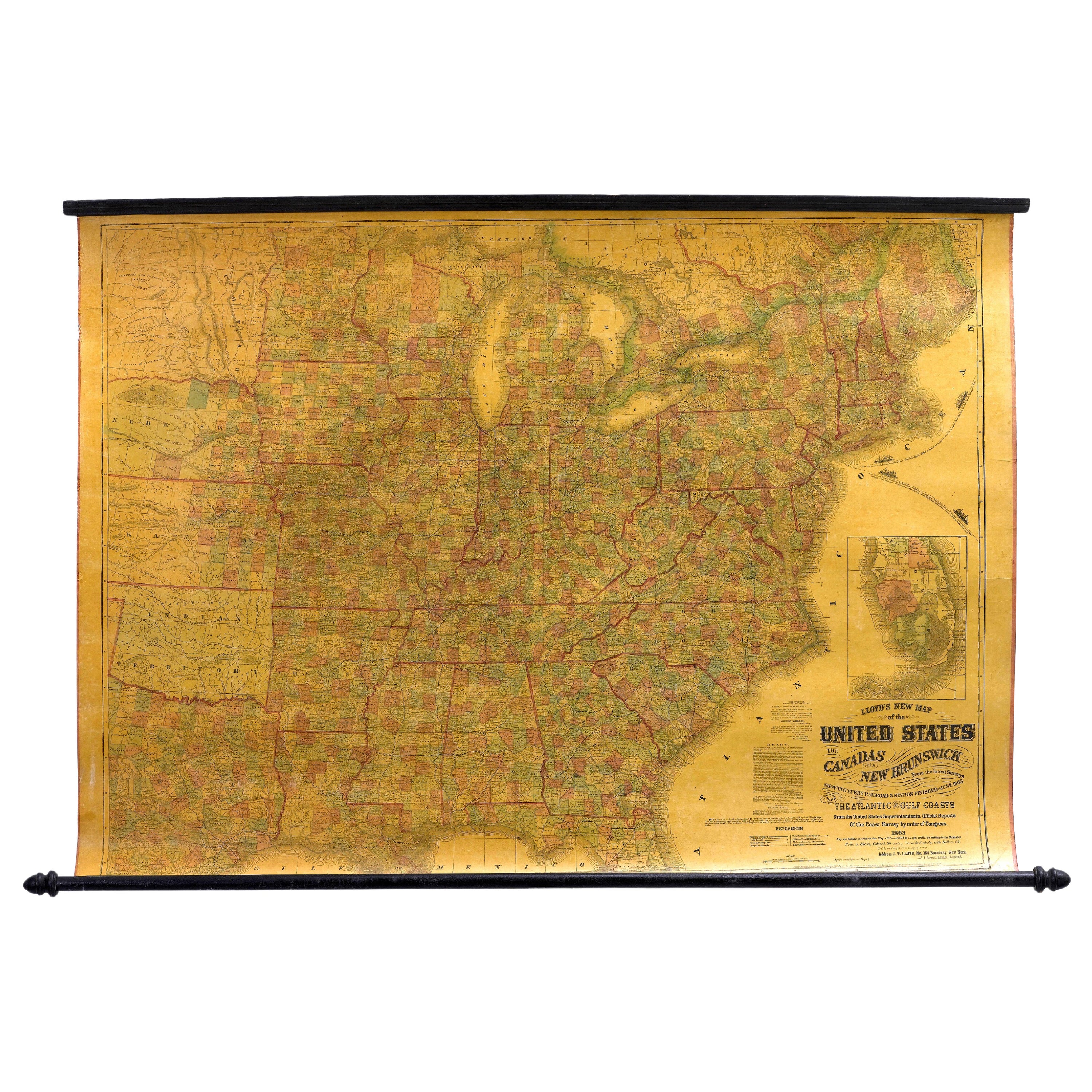
1863 "Lloyd's New Map of the United States, the Canadas, and New Brunswick"
Located in Colorado Springs, CO
Presented is “Lloyd's New Map of the United States, the Canadas and New Brunswick, From the latest Surveys, Showing Every Railroad & Station Finished to June 1863, and the Atlantic and Gulf Coasts.” A large, Civil War-era hanging map of the United States and adjacent territories, this map covers the area from the Atlantic Ocean and extends as far west as the 103 meridian, to “Dacotah,” Nebraska, Kansas, "Indian Territory," and Texas. The southern continuation of Florida is shown in an inset map along the right margin. This map was published by J. T. Lloyd, in New York, in 1863. According to the publisher’s marking at lower right, this map was originally issued in two states: "in Sheets, Colored" for 50 cents, and "Varnished nicely, with Rollers" for $1.
Throughout the map, the counties are colored and the towns and cities well labeled. A reference key in the bottom margin provides symbols for railroads, turnpikes and wagon roads, state capitals, cities and towns, and village post offices. As emphasized in the map’s title, this map is especially notable for the countless railway lines and stations depicted, with distances noted between points, listing “every railroad and finished station to June 1863.” Additionally, two shipping agents and their routes are drawn out of New York City. The map includes details of the steamship routes into New York and Philadelphia from Liverpool and on to California and Oregon via an overland Nicaraguan trek, presumably to assist gold rush emigrants.
This expansive and impressive map depicts the eastern half of the United States in the third year of the Civil War. In order not to recognize the legitimacy of the Confederate States of America, each state is shown in the same manner as the Union states. The only indication that the American Civil War was in progress when this map was published is a printed notice that Gideon Wells, Secretary of the Navy, wishes to acquire a quote on 100 copies of Lloyd’s Mississippi River map...
Category
Antique 1860s American Maps
Materials
Linen, Wood, Paper

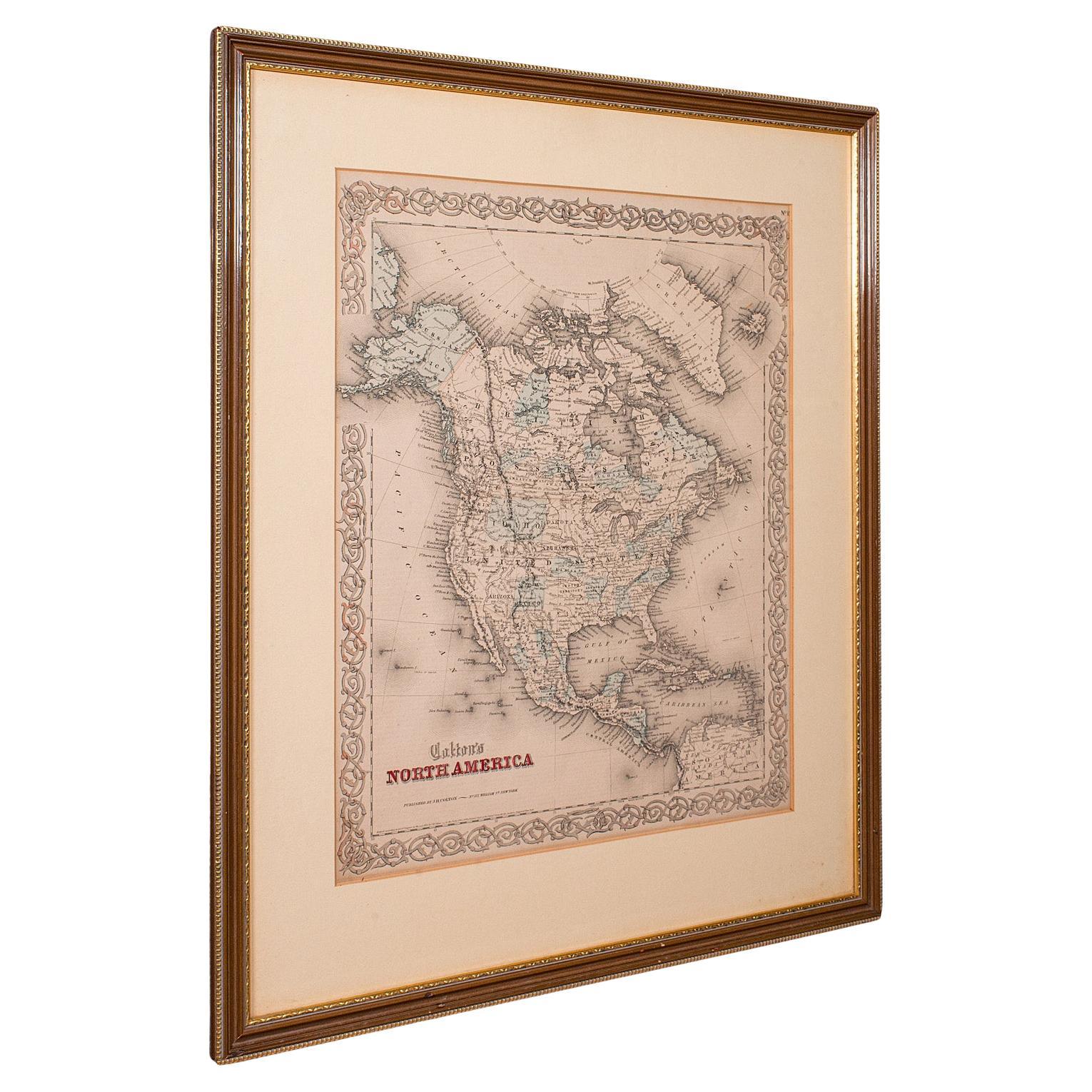
Antique North America Map, USA, Canada, Mexico, Cartography, Colton, Victorian
Located in Hele, Devon, GB
This is an antique North America map. A USA, framed lithography atlas engraving of the continent by JH Colton, dating to the Victorian period and later, circa 1860.
Fascinating, large framed map...
Category
Antique Mid-19th Century American Victorian Maps
Materials
Paper

More Ways To Browse
Used Furniture In Texas
Marked With F
Federal Period Furniture
Coffee Table Black Italian Modern
Christofle America
Iranian Silk Rug Carpet
Poul Moller
Tables With Inlaid Wood
World War Table
Antonio Jacobsen
Ariston Chairs
Coffee Tables Europe
Marble Top Dining Tables
Nordiska Argentina
Pink And Black Rug
Black Wooden Chair
Orrefors Embassy
Black Ebonized