Items Similar to Abyssinia and Upper Nubia, 1903 - Detailed Map of the Horn of Africa Region
Want more images or videos?
Request additional images or videos from the seller
1 of 10
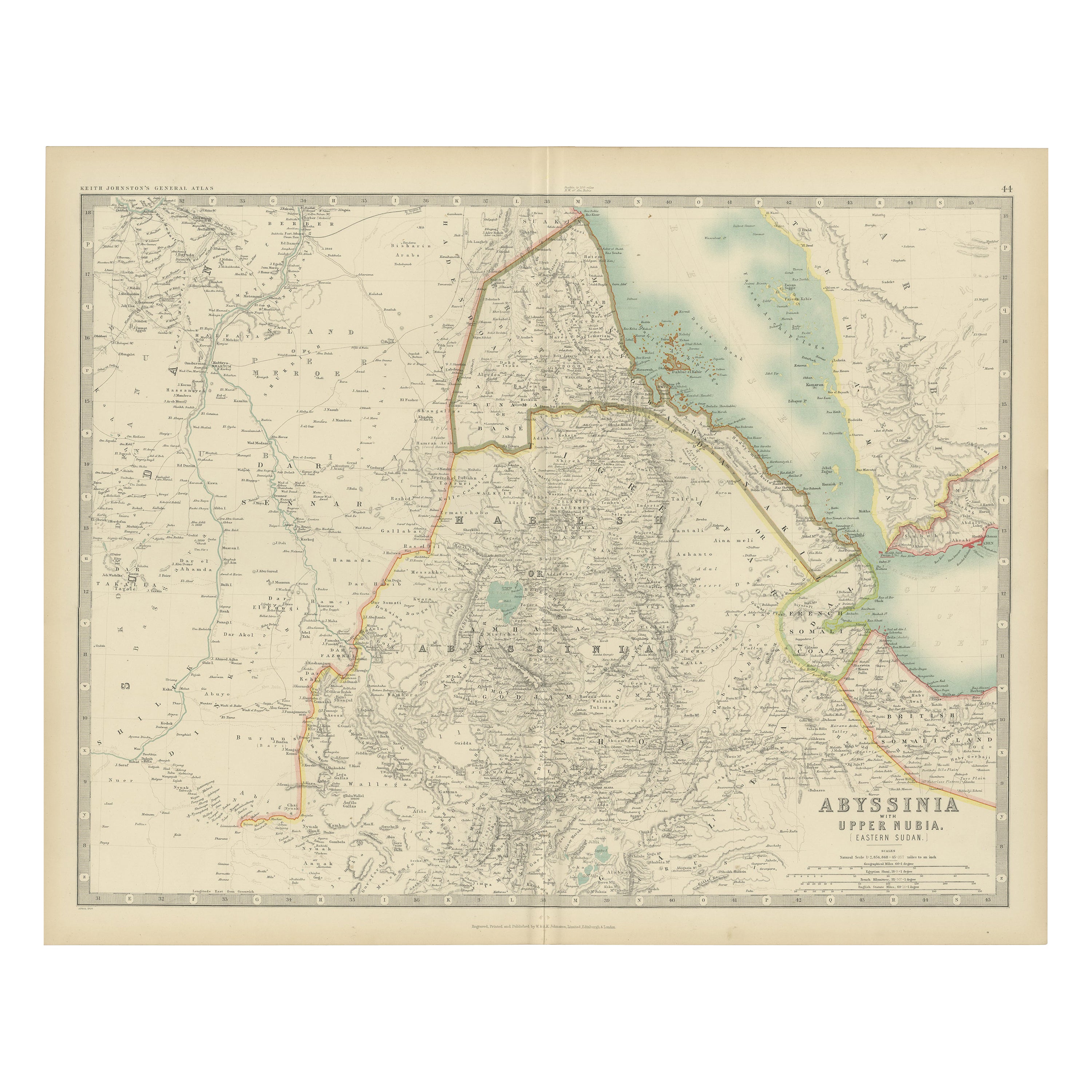
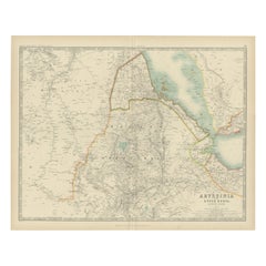
Abyssinia and Upper Nubia, 1903 - Detailed Map of the Horn of Africa Region
$330.21
£247.17
€280
CA$454.46
A$506.54
CHF 265.76
MX$6,185.69
NOK 3,365.16
SEK 3,180.58
DKK 2,131.56
About the Item
Title: Abyssinia and Upper Nubia, 1903 - Detailed Map of the Horn of Africa Region
This fascinating map titled "Abyssinia and Upper Nubia" was engraved, printed, and published by W. & A.K. Johnston in Edinburgh and London in 1903. It offers an intricate look at the political boundaries and natural features of the Horn of Africa region at the turn of the 20th century, capturing territories that are today part of Ethiopia, Eritrea, Sudan, and Djibouti.
The map meticulously details key regions such as Abyssinia (now Ethiopia), Upper Nubia, and the bordering lands along the Red Sea coast. Rivers, mountain ranges, and trade routes are clearly indicated, showing the geographical complexity of this historically rich area. Towns and settlements of the era, along with significant features like the Nile’s headwaters and the Gulf of Aden, are thoughtfully depicted.
A highlight of the map is its depiction of the rugged and mountainous terrain of Abyssinia, known for its unique Christian kingdom and resistance to European colonization. It also shows the coastal regions of the Red Sea, a vital link for trade and travel between Africa, the Middle East, and Asia.
Collectors and historians will appreciate this map’s clean, detailed engraving and muted color palette. It provides a glimpse into the geopolitical and cultural landscape of the region during an era of European imperial interest and local resistance.
Condition report:
This map is in very good condition for its age, with some light foxing and faint edge wear. The paper remains sturdy, with sharp printed details and vibrant yet subtle color accents.
Framing tips:
For best display, consider a dark wood or natural oak frame with a cream mat to complement the map’s classic look. A museum-quality glass will enhance the colors and protect this historical document, making it an excellent centerpiece for a study or library.
- Dimensions:Height: 14.49 in (36.8 cm)Width: 18.51 in (47 cm)Depth: 0.01 in (0.2 mm)
- Materials and Techniques:
- Period:
- Date of Manufacture:1903
- Condition:This map is in very good condition for its age, with some light foxing and faint edge wear. The paper remains sturdy, with sharp printed details and vibrant yet subtle color accents.
- Seller Location:Langweer, NL
- Reference Number:Seller: BG-13577-391stDibs: LU3054345272052
About the Seller
5.0
Recognized Seller
These prestigious sellers are industry leaders and represent the highest echelon for item quality and design.
Platinum Seller
Premium sellers with a 4.7+ rating and 24-hour response times
Established in 2009
1stDibs seller since 2017
2,513 sales on 1stDibs
Typical response time: <1 hour
- ShippingRetrieving quote...Shipping from: Langweer, Netherlands
- Return Policy
Authenticity Guarantee
In the unlikely event there’s an issue with an item’s authenticity, contact us within 1 year for a full refund. DetailsMoney-Back Guarantee
If your item is not as described, is damaged in transit, or does not arrive, contact us within 7 days for a full refund. Details24-Hour Cancellation
You have a 24-hour grace period in which to reconsider your purchase, with no questions asked.Vetted Professional Sellers
Our world-class sellers must adhere to strict standards for service and quality, maintaining the integrity of our listings.Price-Match Guarantee
If you find that a seller listed the same item for a lower price elsewhere, we’ll match it.Trusted Global Delivery
Our best-in-class carrier network provides specialized shipping options worldwide, including custom delivery.More From This Seller
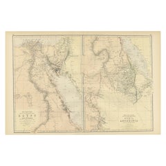
View AllAntique Map of Abyssinia with Upper Nubia by Johnston, '1909'
Located in Langweer, NL
Antique map titled 'Abyssinia with Upper Nubia'. Original antique map of Abyssinia with Upper Nubia. This map originates from the ‘Royal Atlas of Modern Geography’. Published by W. &...
Category
Early 20th Century Maps
Materials
Paper
$235 Sale Price
20% Off
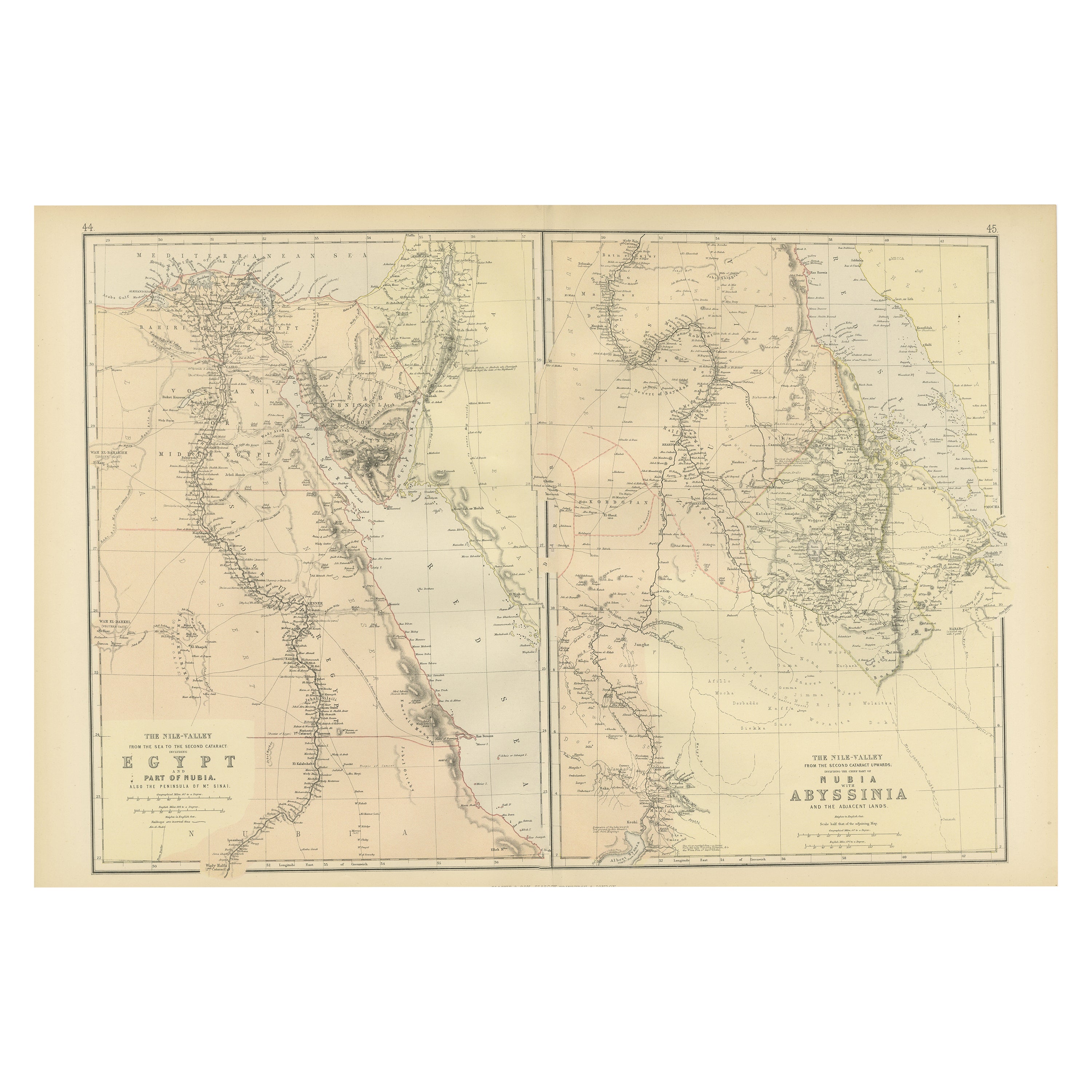
Antique Decorative Coloured Map Egypt, Nubia, Abyssinia and more, 1882
Located in Langweer, NL
This image contains two maps, with the left one being labeled "Egypt" and the right one "Nubia, Abyssinia and the Adjacent Lands." These maps highlight the Nile Valley and surrounding regions.
The maps from the Blackie & Son atlas published in 1882 are interesting for several reasons:
1. **Historical Context**: The year 1882 is significant because it falls within the period of European imperial expansion in Africa. It was also just before the British occupation of Egypt, which began that year. Therefore, the maps serve as historical documents showing the geopolitical state of the region just before a major shift in its colonial status.
2. **Cartographic Style**: The maps reflect the cartographic style of the late 19th century, which often featured detailed engravings and fine detail. They provide a snapshot of the cartographic knowledge and aesthetic of the time.
3. **Geographical Knowledge**: These maps were created during a time when much of Africa's interior was still being explored by Europeans. The representation of features like rivers, mountains, and settlements can tell us about the extent of geographical knowledge at the time.
4. **Cultural Representation**: The way the map represents different regions, peoples, and geographical features can give insights into the cultural and political views of the era. It may reflect the European understanding and biases towards these regions.
5. **Educational Purpose**: Blackie & Son were known for their educational materials...
Category
Antique 1880s Maps
Materials
Paper
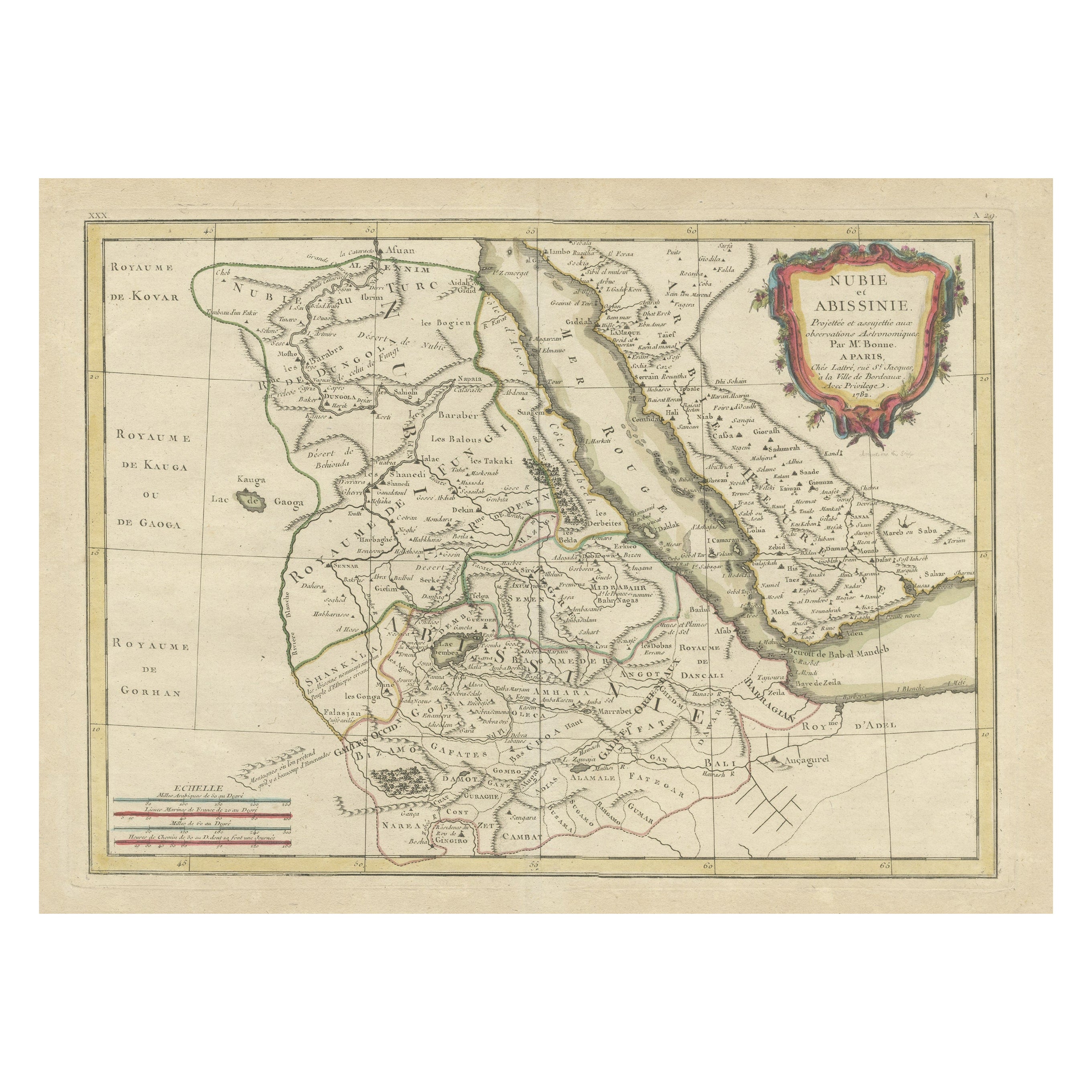
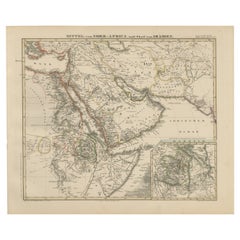
Antique Map of Arabia including Nubia and Abyssinia, also shows the Red Sea
Located in Langweer, NL
Antique map titled 'Nubie et Abissinie'. Original antique map of Nubia, a region along the Nile river, and Abyssinia or the Ethiopian Empire. This map o...
Category
Antique Late 18th Century Maps
Materials
Paper

$811 Sale Price
20% Off
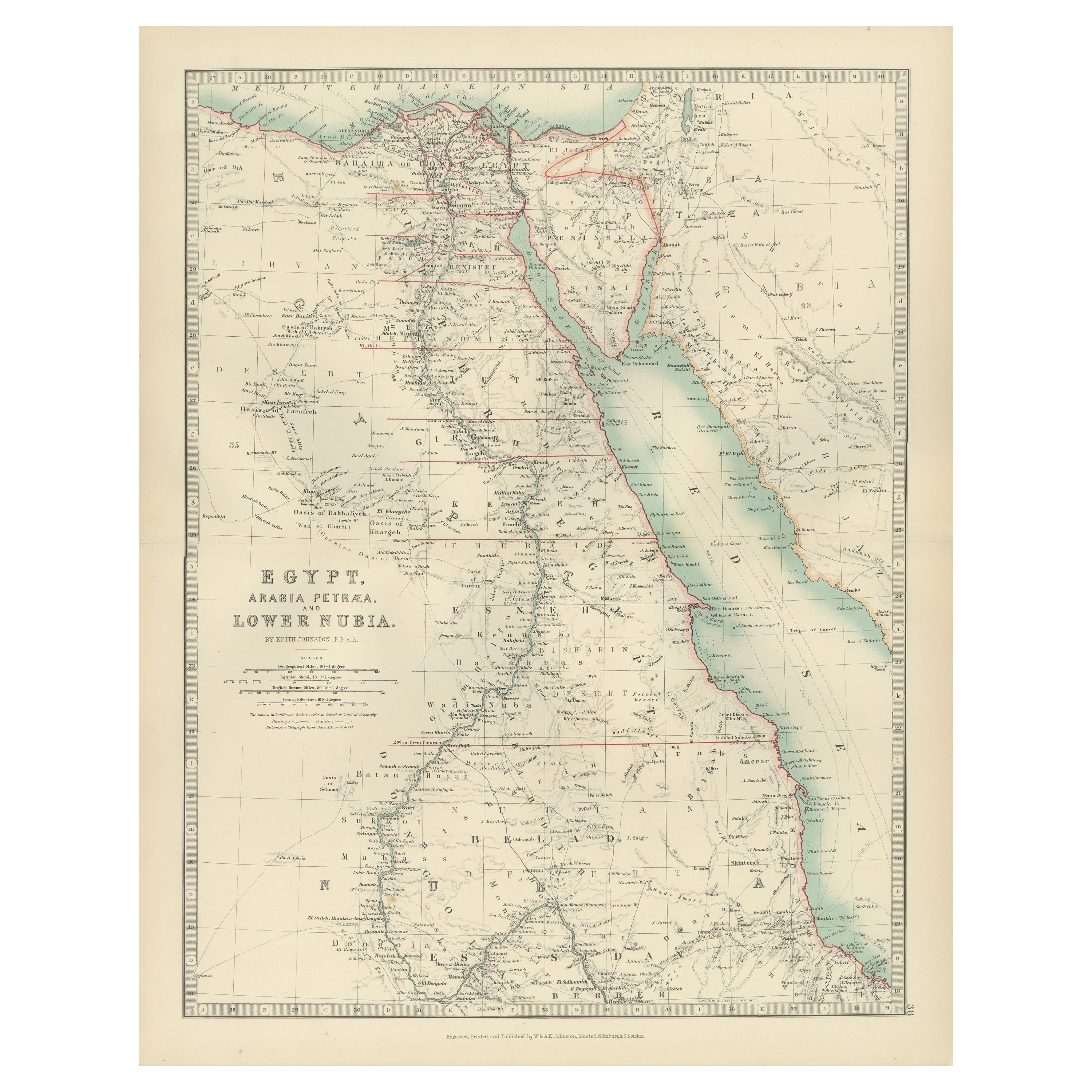
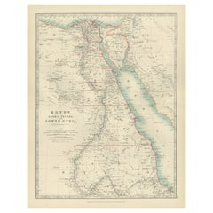
Egypt and Lower Nubia, 1903 - Historical Map Highlighting Nile and Red Sea
Located in Langweer, NL
Egypt and Lower Nubia, 1903 - Historical Map Highlighting Nile and Red Sea
This beautifully detailed map titled "Egypt, Arabia Petraea, and Lower Nubia" was engraved, printed, and p...
Category
Early 20th Century Maps
Materials
Paper
Historic 1857 Map of North-East Africa & Arabia – Fine Engraving
Located in Langweer, NL
North-East Africa and Arabia Map 1857
This detailed antique print shows “Mittel- und Nord-Afrika (östl. Theil) und Arabien” meaning “Central and North Africa (eastern part) and Arab...
Category
Antique Mid-19th Century German Maps
Materials
Paper
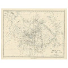
Antique Map of Upper Nubia and Abyssinia by A.K. Johnston, 1865
Located in Langweer, NL
Antique map titled 'Upper Nubia and Abyssinia'. Depicting Habesh (or Abyssinia), Arabia, Upper Nubia and more. This map originates from the ‘Royal Atlas of Modern Geography’ by Alexa...
Category
Antique Mid-19th Century Maps
Materials
Paper
$226 Sale Price
20% Off
You May Also Like
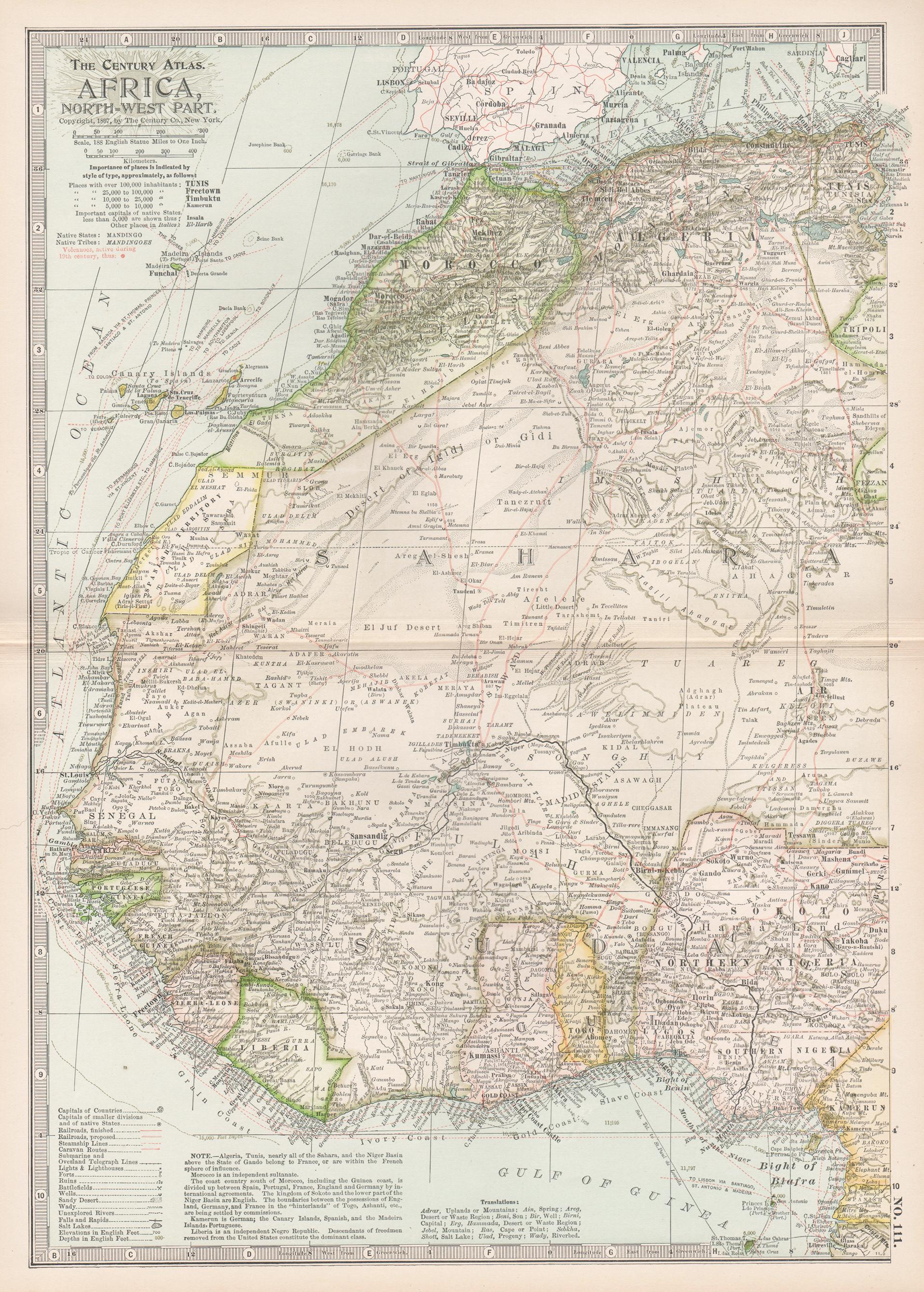
Africa. North-West Part. Century Atlas antique vintage map
Located in Melbourne, Victoria
'The Century Atlas. Africa. Southern Part'
Original antique map, 1903.
Central fold as issued. Map name and number printed on the reverse corners.
Sheet 40cm by 29.5cm.
Category
Early 20th Century Victorian More Prints
Materials
Lithograph

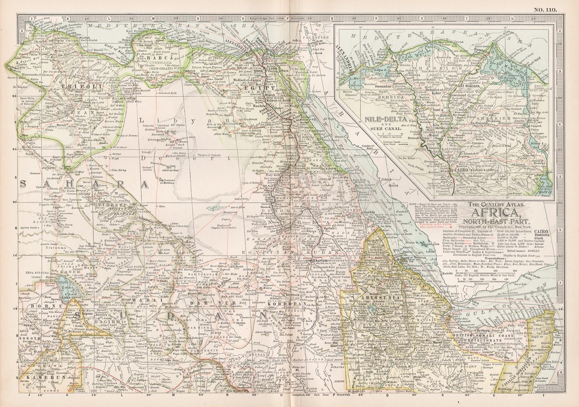
Africa. North-East Part. Century Atlas antique vintage map
Located in Melbourne, Victoria
'The Century Atlas. Africa. North-East Part'
Original antique map, 1903.
Inset map of 'Nile Delta and Suez Canal'.
Central fold as issued. Map name and nu...
Category
Early 20th Century Victorian More Prints
Materials
Lithograph

Africa. Central. Century Atlas antique vintage map
Located in Melbourne, Victoria
'The Century Atlas. Africa. Central'
Inset map of 'Madagascar'.
Original antique map, 1903.
Central fold as issued. Map name and number printed on the reverse corners.
Sheet 29.5cm...
Category
Early 20th Century Victorian More Prints
Materials
Lithograph

Large Original Antique Map of Afghanistan. Edward Weller, 1861
Located in St Annes, Lancashire
Great map of Afghanistan
Lithograph engraving by Edward Weller
Original colour
Published, 1861
Unframed
Good condition
Category
Antique 1860s English Victorian Maps
Materials
Paper

Africa. Southern Part. Century Atlas antique vintage map
Located in Melbourne, Victoria
'The Century Atlas. Africa. Southern Part'
Original antique map, 1903.
Inset maps of 'Cape Town', 'Johannesburg' and 'Ladysmith'.
Central fold as issued. Map name and number printe...
Category
Early 20th Century Victorian More Prints
Materials
Lithograph

Large Original Vintage Map of Egypt, circa 1920
Located in St Annes, Lancashire
Great map of Egypt
Unframed
Original color
By John Bartholomew and Co. Edinburgh Geographical Institute
Published, circa 1920
Free shipping.
Category
Vintage 1920s British Maps
Materials
Paper

More Ways To Browse
Antique Keys London
African Horns
Horner Oak
African Horn Furniture
Fox Horn
Ethiopian Wood
Solid Mahogany Table
Dessert Glasses
Geometric Glass Table
Mid Century Pin
6x10 Rug
Studded Furniture
Styles Of Antique Desks
Black And White Coffee Table
Metal Relief
Curved Velvet Couch
Velvet Curved Sofa
Wood Round Coffee Tables