Items Similar to Ancient World Map: Europe, Africa & Asia - 1802 Tardieu Atlas


Want more images or videos?
Request additional images or videos from the seller
1 of 7
Ancient World Map: Europe, Africa & Asia - 1802 Tardieu Atlas
$421.75
$527.1820% Off
£313.96
£392.4520% Off
€352
€44020% Off
CA$577.69
CA$722.1120% Off
A$642.51
A$803.1420% Off
CHF 335.50
CHF 419.3820% Off
MX$7,818.72
MX$9,773.4020% Off
NOK 4,284.86
NOK 5,356.0820% Off
SEK 4,018.44
SEK 5,023.0520% Off
DKK 2,679.65
DKK 3,349.5720% Off
Shipping
Retrieving quote...The 1stDibs Promise:
Authenticity Guarantee,
Money-Back Guarantee,
24-Hour Cancellation
About the Item
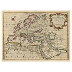
Antique Map Description with title: "Monde Connu Des Anciens"
Publication Details:
- Atlas Title: Nouvel Atlas Universel de Géographie Ancienne et Moderne
- Purpose: For the Nouvelle Edition de la Géographie de Guthrie
- Mapmakers: P. F. Tardieu, with contributions from various geographical works
- Publisher: Chez Hyacinthe Langlois, Libraire, quai des Augustins, n° 45
- Year: An X - 1802 (French Revolutionary Calendar)
Geographical Scope:
This antique map illustrates the "known world" of the ancients, focusing on Europe, northern Africa, and parts of Asia. The map reflects the geographical understanding and cartographic style of the early 19th century, with boundaries and regions marked according to historical knowledge and ancient texts.
Map Features:
- Continents Displayed: Europe, Northern Africa, and parts of Asia
- Notable Regions and Territories: Gaul, Iberia, Italy, Germania, Scythia, Arabia, India, and parts of the African continent like Libya, Aethiopia Interior, and Egypt.
- Seas and Bodies of Water: The Mediterranean Sea, Atlantic Ocean (Mare Atlanticum), Indian Ocean (Erythraeum Mare), and Red Sea (Sinus Arabicus).
- Ancient Names: Uses historical and ancient names for countries, regions, and bodies of water.
- Topographical Details: Includes mountain ranges, rivers, and other significant geographical features as understood in the ancient world.
- Cartographic Style: Detailed engraving with hand-colored boundaries, typical of early 19th-century cartography, emphasizing historical accuracy and artistic presentation.
Purpose and Use:
This map serves as a visual representation of ancient geographical knowledge, likely used for educational purposes in understanding the ancient world's extent and the geographical perspective of historical civilizations. The map was part of a larger atlas that includes 60 maps, providing a comprehensive view of both ancient and modern geography as known in 1802.
Conclusion
The antique map "Monde Connu Des Anciens," published in 1802 by Hyacinthe Langlois, represents a detailed and historically informed view of the ancient world, reflecting the cartographic and geographical knowledge of its time.
- Dimensions:Height: 16.3 in (41.4 cm)Width: 22.33 in (56.7 cm)Depth: 0.01 in (0.2 mm)
- Materials and Techniques:Paper,Engraved
- Period:
- Date of Manufacture:1802
- Condition:Condition: good, given age. Fold as published. General age-related toning and/or occasional minor defects, mainly in the margins, from handling. Please study scan carefully.
- Seller Location:Langweer, NL
- Reference Number:Seller: BG-13769-11stDibs: LU3054340555372
About the Seller
5.0
Recognized Seller
These prestigious sellers are industry leaders and represent the highest echelon for item quality and design.
Platinum Seller
Premium sellers with a 4.7+ rating and 24-hour response times
Established in 2009
1stDibs seller since 2017
2,510 sales on 1stDibs
Typical response time: <1 hour
- ShippingRetrieving quote...Shipping from: Langweer, Netherlands
- Return Policy
Authenticity Guarantee
In the unlikely event there’s an issue with an item’s authenticity, contact us within 1 year for a full refund. DetailsMoney-Back Guarantee
If your item is not as described, is damaged in transit, or does not arrive, contact us within 7 days for a full refund. Details24-Hour Cancellation
You have a 24-hour grace period in which to reconsider your purchase, with no questions asked.Vetted Professional Sellers
Our world-class sellers must adhere to strict standards for service and quality, maintaining the integrity of our listings.Price-Match Guarantee
If you find that a seller listed the same item for a lower price elsewhere, we’ll match it.Trusted Global Delivery
Our best-in-class carrier network provides specialized shipping options worldwide, including custom delivery.More From This Seller
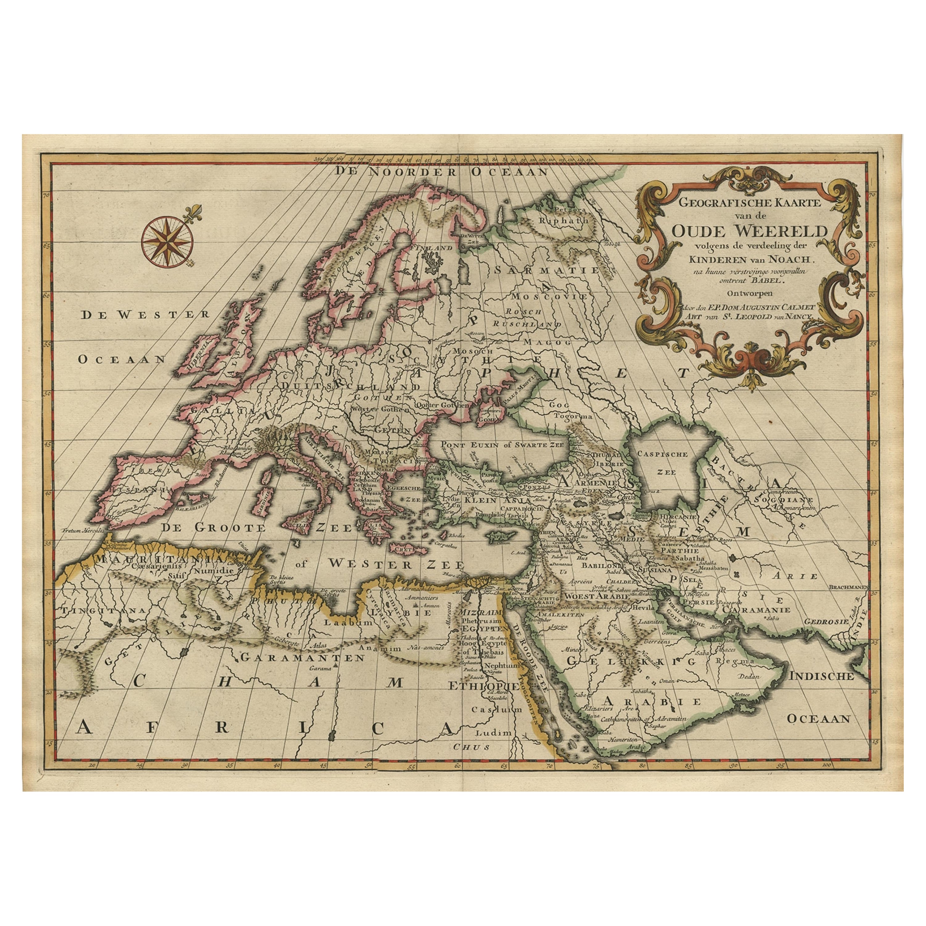
View AllAncient World Map of Europe, Asia & Northern Africa with Ancient Names, 1725
Located in Langweer, NL
Antique map titled 'Geografische Kaarte van de Oude Weereld (..).'
Original antique map of the ancient world depicting Europe, Asia, and northern Africa with ancient place names....
Category
Antique 1720s Maps
Materials
Paper
$1,123 Sale Price
24% Off
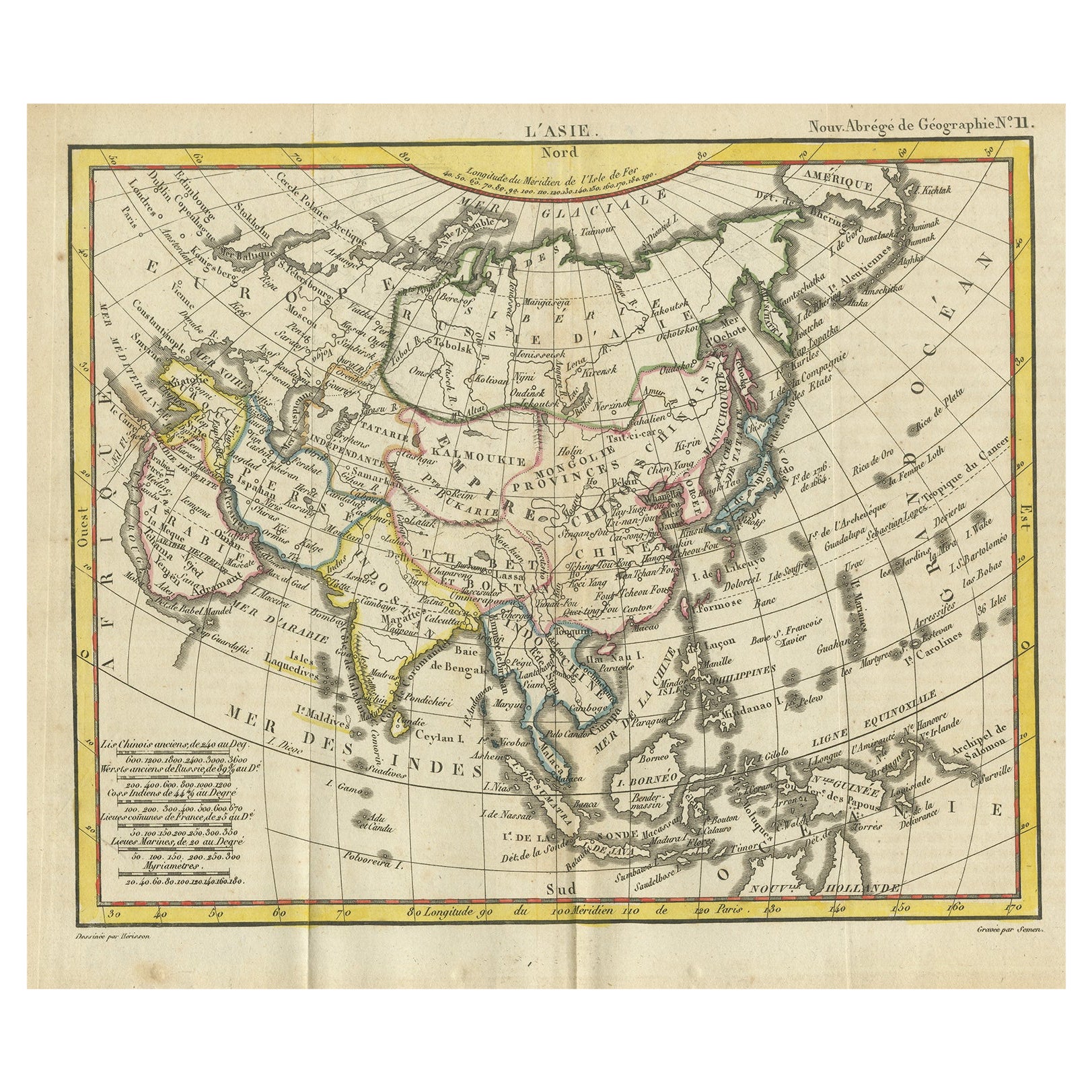
Antique Map of Asia from the Middle East to the Coast of Alaska, 1816
Located in Langweer, NL
Antique map titled ‘L’Asie‘. This is an original antique map of Asia, by Hérisson, taken from atlas ""Nouv. Abrége de Géographie"". An engraved map with coloring of Asia from the Mid...
Category
Antique 19th Century Maps
Materials
Paper
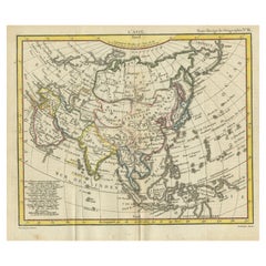
$153 Sale Price
20% Off
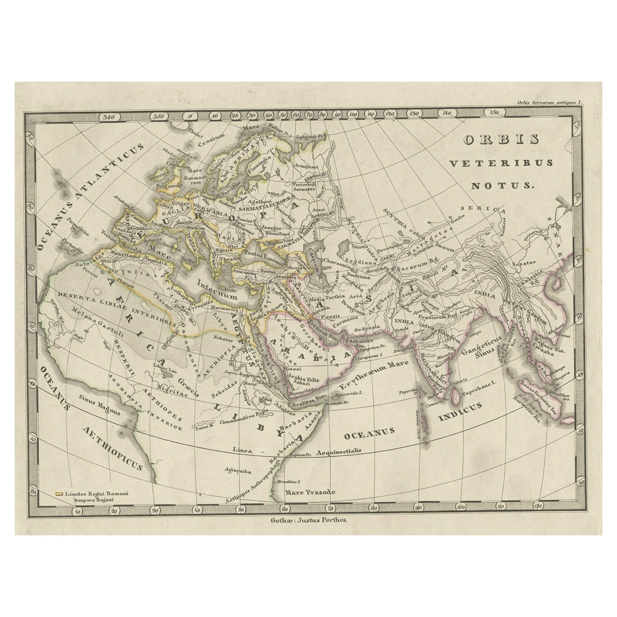
Antique Map of Europe and Part of Asia and Africa, 1848
Located in Langweer, NL
Antique map titled 'Orbis Veteribus Notus'. Old map of the European continent, also depicting a portion of Asia and Africa. Originating from 'Orbis Terrarum Antiquus in usum Scholaru...
Category
Antique 19th Century Maps
Materials
Paper
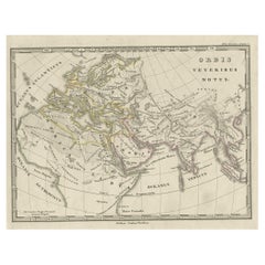
$94 Sale Price
20% Off
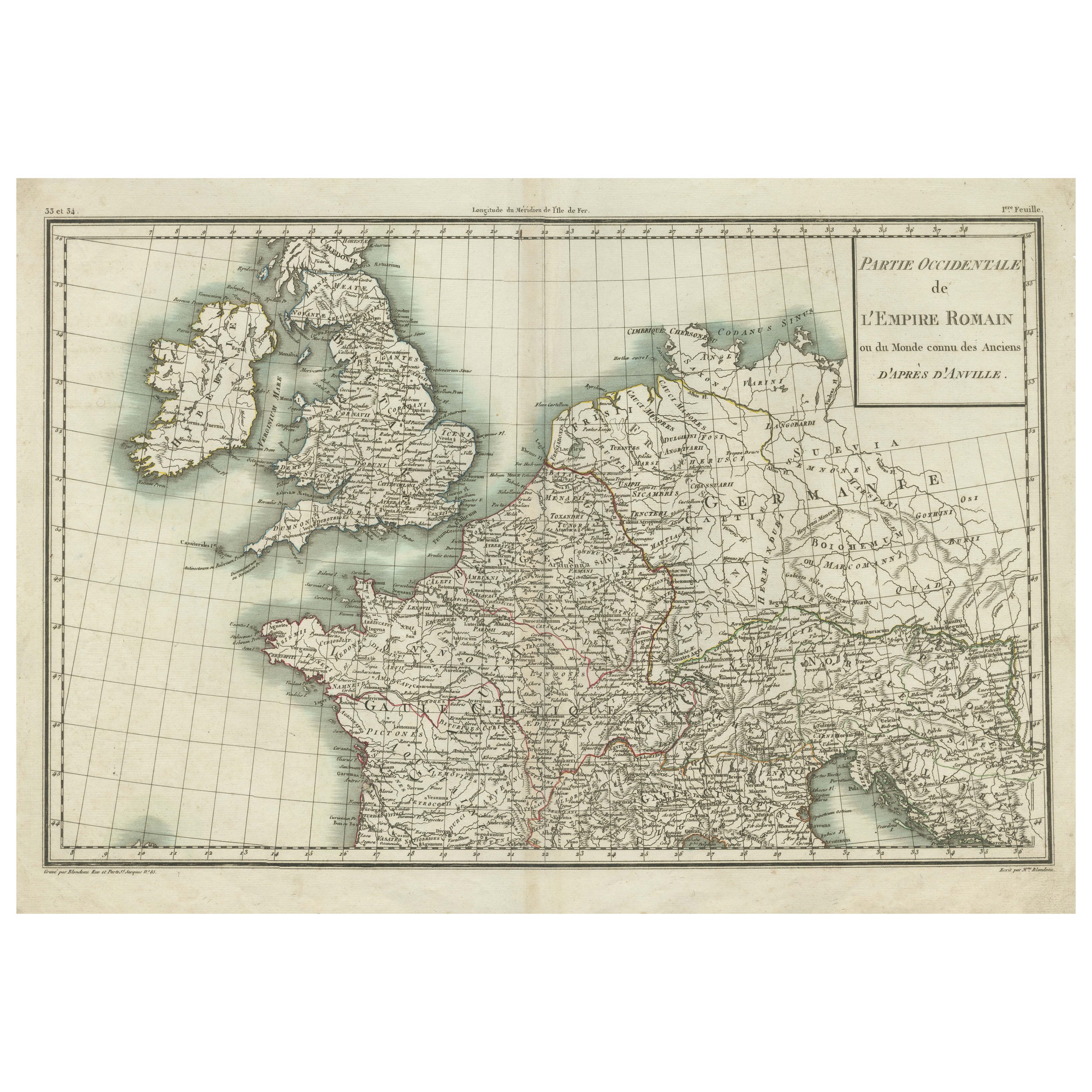
Western Roman Empire Map: British Isles & Gaul - 1802 Tardieu Atlas
Located in Langweer, NL
Antique Map Description and title: "Partie Occidentale de l'Empire Romain ou du Monde connu des Anciens d'Après d'Anville"
Publication Details:
- **Atlas Title:** Nouvel Atlas Univ...
Category
Antique Early 1800s Maps
Materials
Paper
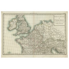
$421 Sale Price
20% Off
Very Attractive Antique Map of the World as Planisphere, Shows Cook's Voyages
Located in Langweer, NL
Antique map titled 'Chart of the World, according to Mercators Projection'. This world map shows the various discoveries of Captain James Cook during his 3 voyages between 1768 and 1780, and the English and French Explorers who followed immediately thereafter, including Vancouver and La Perouse. This edition of the map is significantly revised from the editions issued immediately after the official report of Cook's Voyages were integrated into the map, showing better detail in New Zealand, Australia, the Northwest Coast of America and North East coast of Asia, along with Greenland. A new large lake also appears for the first time in the Western part of North America, shortly before the commencement of the Lewis...
Category
Antique Late 18th Century Maps
Materials
Paper

$1,347 Sale Price
25% Off
Free Shipping
Very Decorative Original Antique Map of the World, Published in France in c.1780
By Rigobert Bonne
Located in Langweer, NL
Antique map titled 'L'Ancien Monde Et Le Nouveau en Deux Hemispheres' - Double hemisphere map of the World, showing the contemporary geographical...
Category
Antique 18th Century Maps
Materials
Paper

$738 Sale Price
20% Off
You May Also Like
Original Antique Map of The World by Thomas Clerk, 1817
Located in St Annes, Lancashire
Great map of The Eastern and Western Hemispheres
On 2 sheets
Copper-plate engraving
Drawn and engraved by Thomas Clerk, Edinburgh.
Published by Mackenzie And Dent, 1817
...
Category
Antique 1810s English Maps
Materials
Paper

Antique French Map of Asia Including China Indoneseia India, 1783
Located in Amsterdam, Noord Holland
Very nice map of Asia. 1783 Dedie au Roy.
Additional information:
Country of Manufacturing: Europe
Period: 18th century Qing (1661 - 1912)
Condition: Overall Condition B (Good Used)...
Category
Antique 18th Century European Maps
Materials
Paper

$648 Sale Price
20% Off
Antique 1803 Italian Map of Asia Including China Indoneseia India
Located in Amsterdam, Noord Holland
Antique 1803 Italian Map of Asia Including China Indoneseia India
Very nice map of Asia. 1803.
Additional information:
Type: Map
Country of Manufacturing: Europe
Period: 19th centu...
Category
Antique 19th Century European Maps
Materials
Paper

$584 Sale Price
20% Off
1790 Thomas Stackhouse Map, Entitled "Russia in Europe, " , Ric.a004
Located in Norton, MA
1790 Thomas Stackhouse map, entitled
"Russia in Europe"
Ric.a004
Stackhouse, Thomas
Russia in Europe [map]
London: T. Stackhouse, 1783. Map. Matted hand-colored copper engraving. Image size: 14.5 x 15.25 inches. Mat size: 22.75 x 23.75 inches. A beautiful example of this map of Eastern Europe...
Category
Antique 17th Century Unknown Maps
Materials
Paper

"Africa Vetus": a 17th Century Hand-Colored Map by Sanson
By Nicolas Sanson
Located in Alamo, CA
This original hand-colored copperplate engraved map of Africa entitled "Africa Vetus, Nicolai Sanson Christianiss Galliar Regis Geographi" was originally created by Nicholas Sanson d...
Category
Antique Late 17th Century French Maps
Materials
Paper

Africa: A Large 17th Century Hand-Colored Map by Sanson and Jaillot
By Nicolas Sanson
Located in Alamo, CA
This large original hand-colored copperplate engraved map of Africa entitled "L'Afrique divisee suivant l'estendue de ses principales parties ou sont distingues les uns des autres, L...
Category
Antique 1690s French Maps
Materials
Paper

More Ways To Browse
Silver Over Copper
Vintage Barware Glasses
Coffee Table Black Italian Modern
Christofle America
Iranian Silk Rug Carpet
Poul Moller
Tables With Inlaid Wood
World War Table
Antonio Jacobsen
Ariston Chairs
Coffee Tables Europe
Marble Top Dining Tables
Nordiska Argentina
Pink And Black Rug
Black Wooden Chair
Orrefors Embassy
Black Ebonized
Elios Chair