Items Similar to Antique 1803 Italian Map of Asia Including China Indoneseia India


Want more images or videos?
Request additional images or videos from the seller
1 of 5
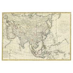
Antique 1803 Italian Map of Asia Including China Indoneseia India
$584
$73020% Off
£446.50
£558.1220% Off
€514.28
€642.8520% Off
CA$818.36
CA$1,022.9520% Off
A$913.63
A$1,142.0320% Off
CHF 478.73
CHF 598.4120% Off
MX$11,183.67
MX$13,979.5920% Off
NOK 6,079.82
NOK 7,599.7820% Off
SEK 5,732.50
SEK 7,165.6320% Off
DKK 3,838.10
DKK 4,797.6320% Off
About the Item
Antique 1803 Italian Map of Asia Including China Indoneseia India
Very nice map of Asia. 1803.
Additional information:
Type: Map
Country of Manufacturing: Europe
Period: 19th century Qing (1661 - 1912)
Condition: Overall Condition A (Good ): Some trace of use.
Dimension: 40 W x 32 H cm
- Dimensions:Height: 12.6 in (32 cm)Width: 15.75 in (40 cm)Depth: 0.04 in (1 mm)
- Materials and Techniques:
- Place of Origin:
- Period:
- Date of Manufacture:19th Century
- Condition:Overall Condition A (Good ): Some trace of use.
- Seller Location:Amsterdam, NL
- Reference Number:Seller: 1345372871261stDibs: LU4863235958202
About the Seller
5.0
Platinum Seller
Premium sellers with a 4.7+ rating and 24-hour response times
Established in 2015
1stDibs seller since 2019
264 sales on 1stDibs
Typical response time: 2 hours
- ShippingRetrieving quote...Shipping from: Amsterdam, Netherlands
- Return Policy
Authenticity Guarantee
In the unlikely event there’s an issue with an item’s authenticity, contact us within 1 year for a full refund. DetailsMoney-Back Guarantee
If your item is not as described, is damaged in transit, or does not arrive, contact us within 7 days for a full refund. Details24-Hour Cancellation
You have a 24-hour grace period in which to reconsider your purchase, with no questions asked.Vetted Professional Sellers
Our world-class sellers must adhere to strict standards for service and quality, maintaining the integrity of our listings.Price-Match Guarantee
If you find that a seller listed the same item for a lower price elsewhere, we’ll match it.Trusted Global Delivery
Our best-in-class carrier network provides specialized shipping options worldwide, including custom delivery.More From This Seller
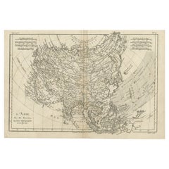
View AllAntique French Map of Asia Including China Indoneseia India, 1783
Located in Amsterdam, Noord Holland
Very nice map of Asia. 1783 Dedie au Roy.
Additional information:
Country of Manufacturing: Europe
Period: 18th century Qing (1661 - 1912)
Condition: Overall Condition B (Good Used)...
Category
Antique 18th Century European Maps
Materials
Paper

$648 Sale Price
20% Off
Super Rare Antique French Map of Chine and the Chinese Empire, 1780
Located in Amsterdam, Noord Holland
Super Rare Antique French Map of Chine and the Chinese Empire, 1780
Very nice map of Asia. 1780 Made by Bonne.
Additional information:
Type: Map
...
Category
Antique 18th Century European Maps
Materials
Paper

$584 Sale Price
32% Off
Antique Voc Print Holland Malaysia Old Map Melaka History, 1663
Located in Amsterdam, Noord Holland
From my own collection I offer this impressive Antique print of the city of Malakka
A very interesting piece for collectors . It is an museum piece from the Dutch Institute of Orien...
Category
Antique 17th Century European Paintings
Materials
Paper

$293 Sale Price
20% Off
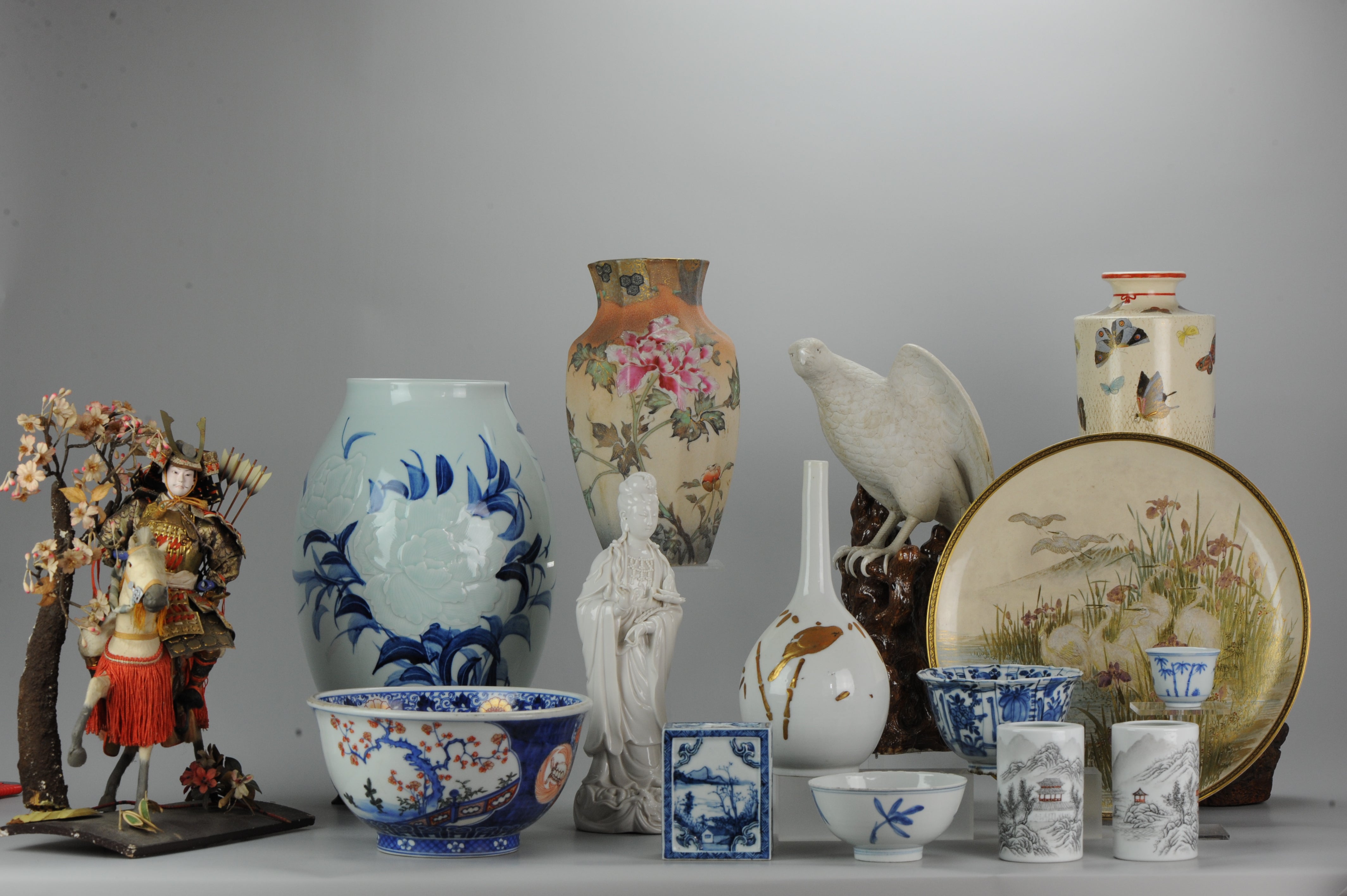
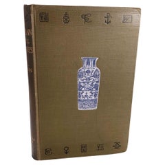
Reference Book Chinese & Japanese Porcelain of All Countries - Hobson, R.L.
Located in Amsterdam, Noord Holland
Porcelain__Oriental Continental and British (Porcelain of All Countries)
Hobson, R.L.
Title: Porcelain__Oriental Continental and British …
Publisher: Archibald Constable & Co. Ltd,...
Category
20th Century Books
Materials
Paper
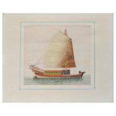
Antique Chinese Rice Pit painting of a Boat Top Quality Canton, 19th Century
Located in Amsterdam, Noord Holland
Antique Chinese Rice Pit painting of a Boat Top Quality Canton, 19th Century.
Fabulous painting.
Additional information:
Material: Porcelain & Pottery
Type:...
Category
Antique 19th Century Chinese Paintings
Materials
Porcelain
$659 Sale Price
20% Off
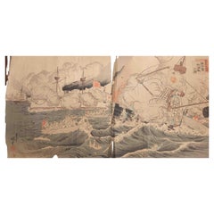
Antique 19th c Woodblock Print by Sino Japan War Naval Battle Haiyang Island
Located in Amsterdam, Noord Holland
A very strong woodblock print
- Fantastic depiction of the naval Battle of Haiyang Island during the Sino-Japanese War. An explosion rocks a Chinese ship at right, severing the mast...
Category
Antique 19th Century Chinese Meiji Paintings and Screens
Materials
Bronze
$1,257 Sale Price
20% Off
You May Also Like
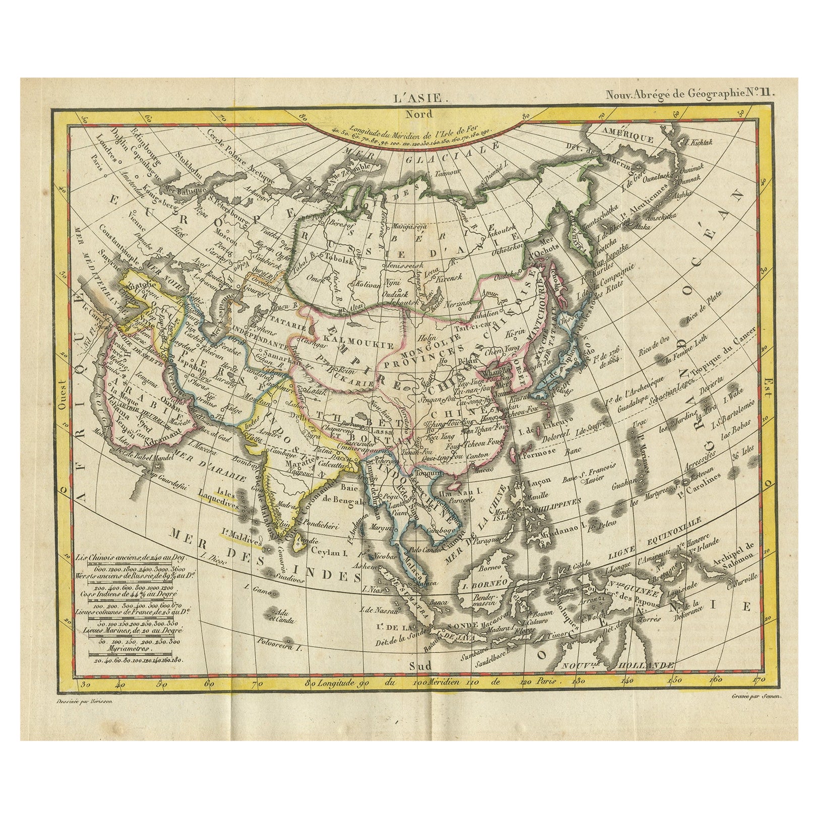
Antique Map of Asia from the Middle East to the Coast of Alaska, 1816
Located in Langweer, NL
Antique map titled ‘L’Asie‘. This is an original antique map of Asia, by Hérisson, taken from atlas ""Nouv. Abrége de Géographie"". An engraved map with coloring of Asia from the Mid...
Category
Antique 19th Century Maps
Materials
Paper
$151 Sale Price
20% Off
Antique Map of Asia by Balbi '1847'
Located in Langweer, NL
Antique map titled 'Asie'. Original antique map of Asia. This map originates from 'Abrégé de Géographie (..)' by Adrien Balbi. Published 1847.
Category
Antique Mid-19th Century Maps
Materials
Paper

$189 Sale Price
20% Off
Antique Map of Asia by A. Blondeau, circa 1800
Located in Langweer, NL
This is a fine circa 1800 map of Asia by Alexandre Blondeau. It covers the entire continent from Africa and the Mediterranean east to the Bering Sea and south as far as Java and New ...
Category
Antique Early 19th Century Maps
Materials
Paper

$264 Sale Price
20% Off
Large Antique Map of Asia including All of Southeast Asia, c.1792
Located in Langweer, NL
Antique map titled 'L' Asie Divisee en ses Empires, Royaumes, et Etats'. Attractive, large map of Asia including all of Southeast Asia. The cartography is archaic for the period with...
Category
Antique 18th Century Maps
Materials
Paper

$1,417 Sale Price
20% Off
Free Shipping
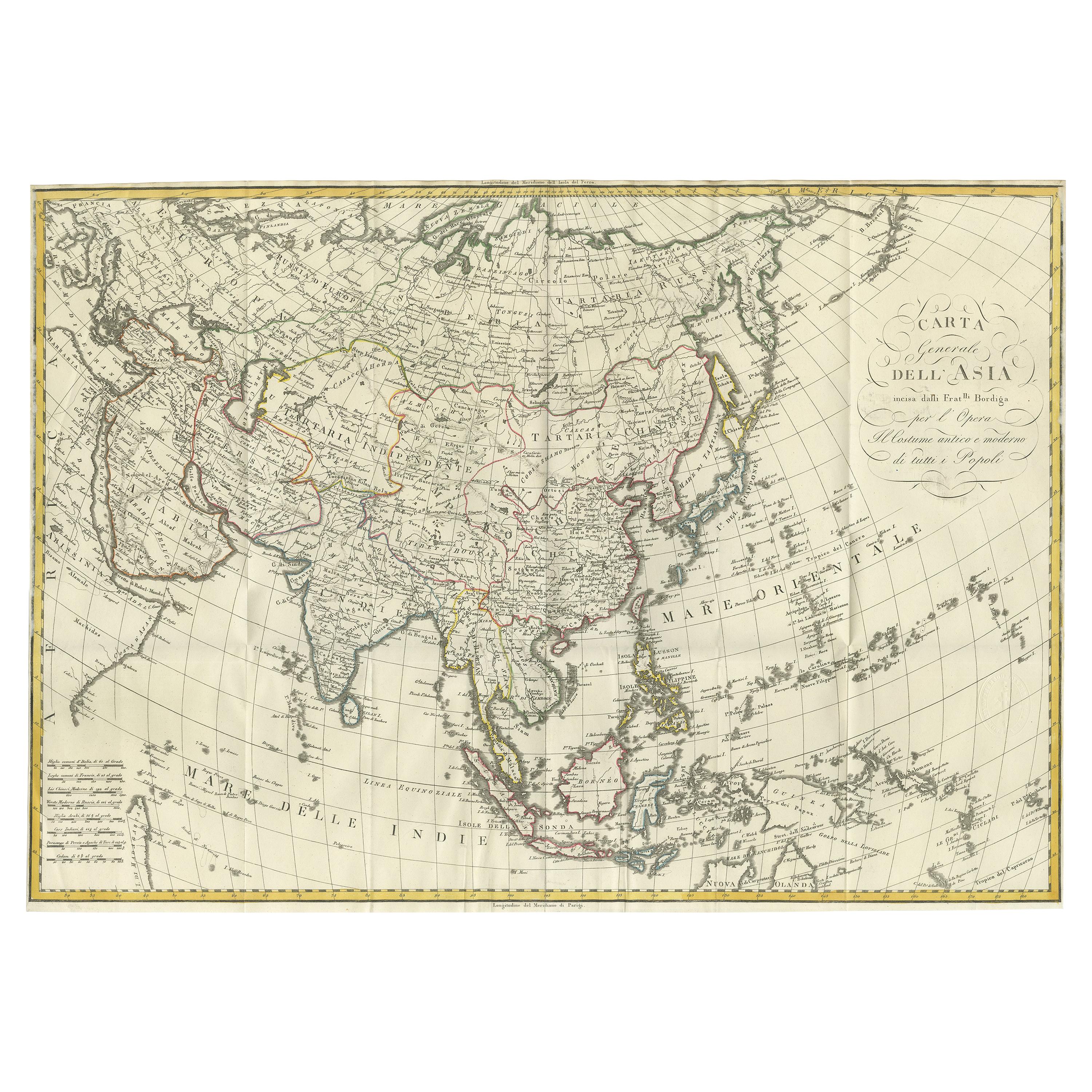
Antique Map of Asia by Ferrario '1815'
Located in Langweer, NL
Antique map titled 'Carta generale dell' Asia (..)'. Original antique map of Asia. This map originates from ' Le Costume Ancien et Moderne' by Jule...
Category
Antique Early 19th Century Maps
Materials
Paper
$897 Sale Price
20% Off
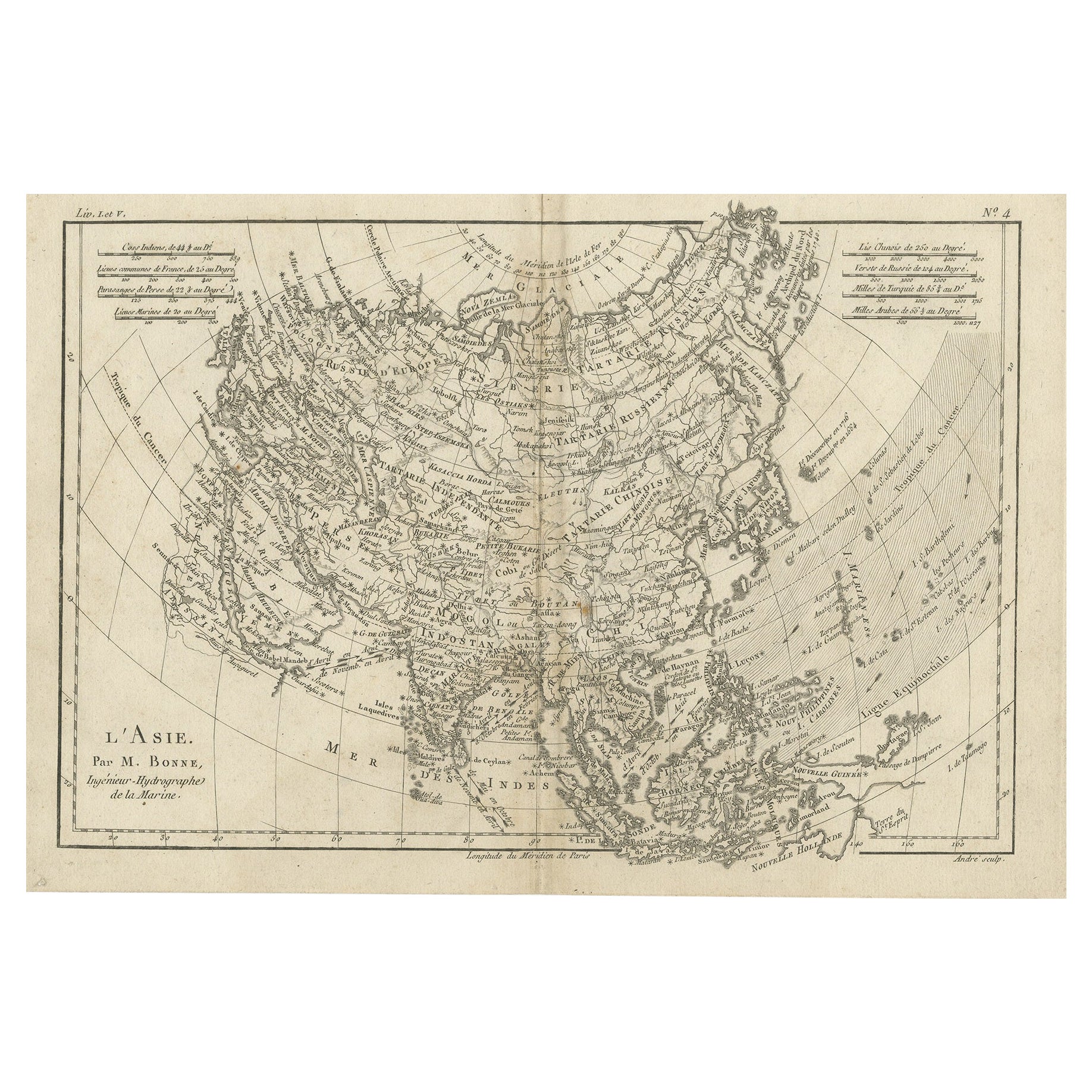
Original Antique Map of Asia
Located in Langweer, NL
Antique map titled 'l'Asie'. Original antique map of Asia. Engraved by André after Bonne. Published circa 1780.
Category
Antique Late 18th Century Maps
Materials
Paper
$274 Sale Price
20% Off
More Ways To Browse
Antique Italian China
Giacometti Chairs
Antique Rug Wool Navy Blue Red
Bauhaus Flower Stand
French Table With Drawers
North Carolina Furniture
Antique Silver Platter
Boat Blueprint
Cream Plates
Vintage Art Deco Rugs
Vintage Serving Forks
Brewery Signs
Herati Rug
Venice Wood
Gold Leaf Furniture Black
Italian Wood Console Tables
Maison Jansen Argentina
Antique Oushak