Items Similar to Antique 19th Century Map of China by Blackie & Son, 1882

Want more images or videos?
Request additional images or videos from the seller
1 of 6
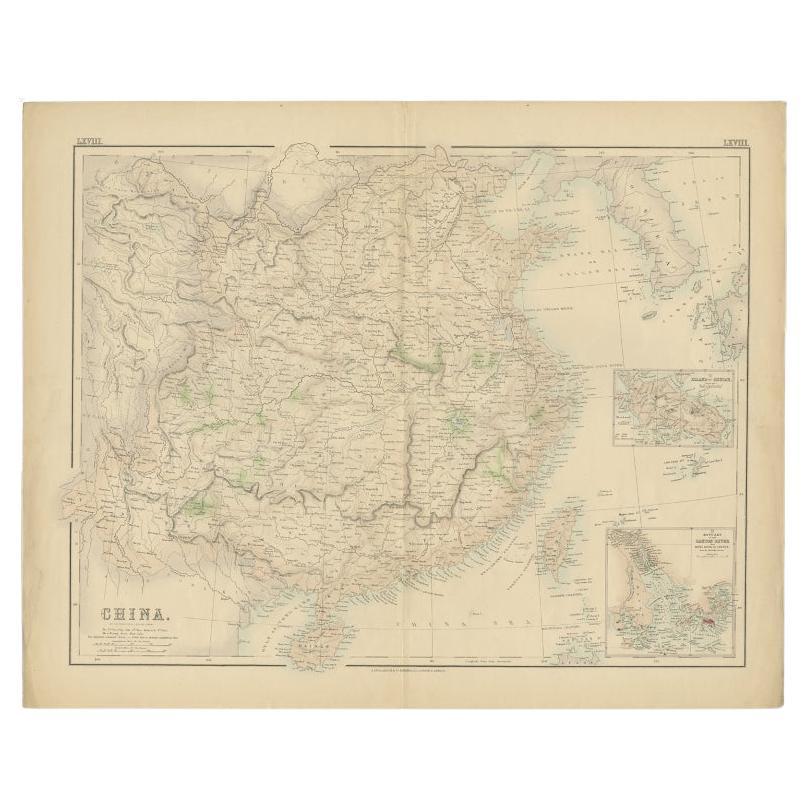
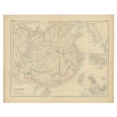
Antique 19th Century Map of China by Blackie & Son, 1882
$239.55
$299.4320% Off
£177.52
£221.9020% Off
€200
€25020% Off
CA$327.03
CA$408.7920% Off
A$363.81
A$454.7620% Off
CHF 190.71
CHF 238.3920% Off
MX$4,445.62
MX$5,557.0220% Off
NOK 2,428.47
NOK 3,035.5920% Off
SEK 2,286.07
SEK 2,857.5920% Off
DKK 1,522.78
DKK 1,903.4820% Off
Shipping
Retrieving quote...The 1stDibs Promise:
Authenticity Guarantee,
Money-Back Guarantee,
24-Hour Cancellation
About the Item
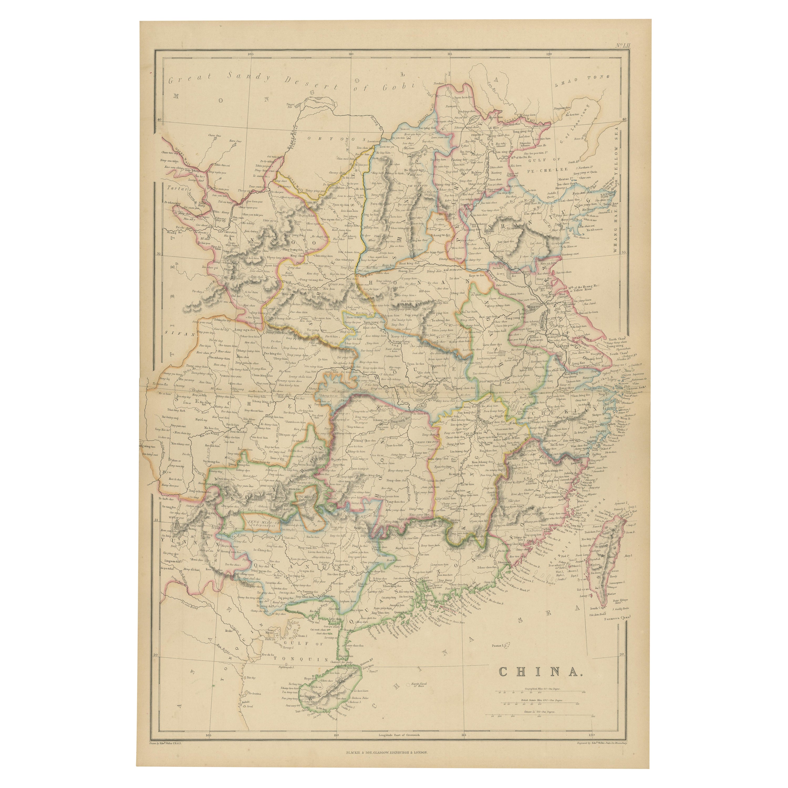
This map is an 1882 Blackie & Son map of China. The title "CHINA." is prominently displayed at the bottom. The map is colored to differentiate various regions, possibly indicating different provinces or territories within China at the time.
Notable geographic features include the "Great Sandy Desert of Gobi" in the north, depicted in a light yellow shade. The map shows a diverse range of topographical details, such as mountain ranges, rivers, and coastal lines, which are highlighted with hachures and contours to denote elevation and terrain.
The map is gridded with longitudinal and latitudinal lines, aiding in navigation and location. Various cities and towns are marked and labeled throughout, suggesting a comprehensive survey of populated places at the time. The scale of miles is present at the bottom right, allowing for the estimation of distances between different points on the map.
This map would serve not only as a geographical reference but also as an educational tool or a means for planning travel and understanding the regional division of 19th-century China. The cartography reflects the style and knowledge of the era and provides insights into the historical landscape of China.
- Dimensions:Height: 22.45 in (57 cm)Width: 14.97 in (38 cm)Depth: 0 in (0.02 mm)
- Materials and Techniques:
- Period:
- Date of Manufacture:1882
- Condition:Good condition, folding line in the middle. The outer borders are slightly discolored due to age, but not the image. This map is ideal for framing. Study the image carefully.
- Seller Location:Langweer, NL
- Reference Number:Seller: BG-13601-2-501stDibs: LU3054338775582
About the Seller
5.0
Recognized Seller
These prestigious sellers are industry leaders and represent the highest echelon for item quality and design.
Platinum Seller
Premium sellers with a 4.7+ rating and 24-hour response times
Established in 2009
1stDibs seller since 2017
2,494 sales on 1stDibs
Typical response time: 1 hour
- ShippingRetrieving quote...Shipping from: Langweer, Netherlands
- Return Policy
Authenticity Guarantee
In the unlikely event there’s an issue with an item’s authenticity, contact us within 1 year for a full refund. DetailsMoney-Back Guarantee
If your item is not as described, is damaged in transit, or does not arrive, contact us within 7 days for a full refund. Details24-Hour Cancellation
You have a 24-hour grace period in which to reconsider your purchase, with no questions asked.Vetted Professional Sellers
Our world-class sellers must adhere to strict standards for service and quality, maintaining the integrity of our listings.Price-Match Guarantee
If you find that a seller listed the same item for a lower price elsewhere, we’ll match it.Trusted Global Delivery
Our best-in-class carrier network provides specialized shipping options worldwide, including custom delivery.More From This Seller
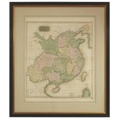
View AllAntique Map of China by W. G. Blackie, 1859
Located in Langweer, NL
Antique map titled 'China'. Original antique map of China. This map originates from ‘The Imperial Atlas of Modern Geography’. Published by W. G. Blackie, 1859.
Category
Antique Mid-19th Century Maps
Materials
Paper
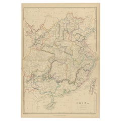
$239 Sale Price
20% Off
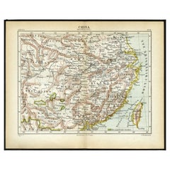
Antique Map of China, 1874
Located in Langweer, NL
Antique map titled 'China'. Detailed map of China originates from Blackie's 'The Comprehensive Atlas & Geography of the World'.
Artists and Engravers: ...
Category
Antique 19th Century Maps
Materials
Paper

$239 Sale Price
20% Off
Antique Map of China by A & C, Black, 1870
Located in Langweer, NL
Antique map titled 'China'. Original antique map of China. This map originates from ‘Black's General Atlas of The World’. Published by A & C. Black, 1870.
Category
Antique Late 19th Century Maps
Materials
Paper

$263 Sale Price
20% Off
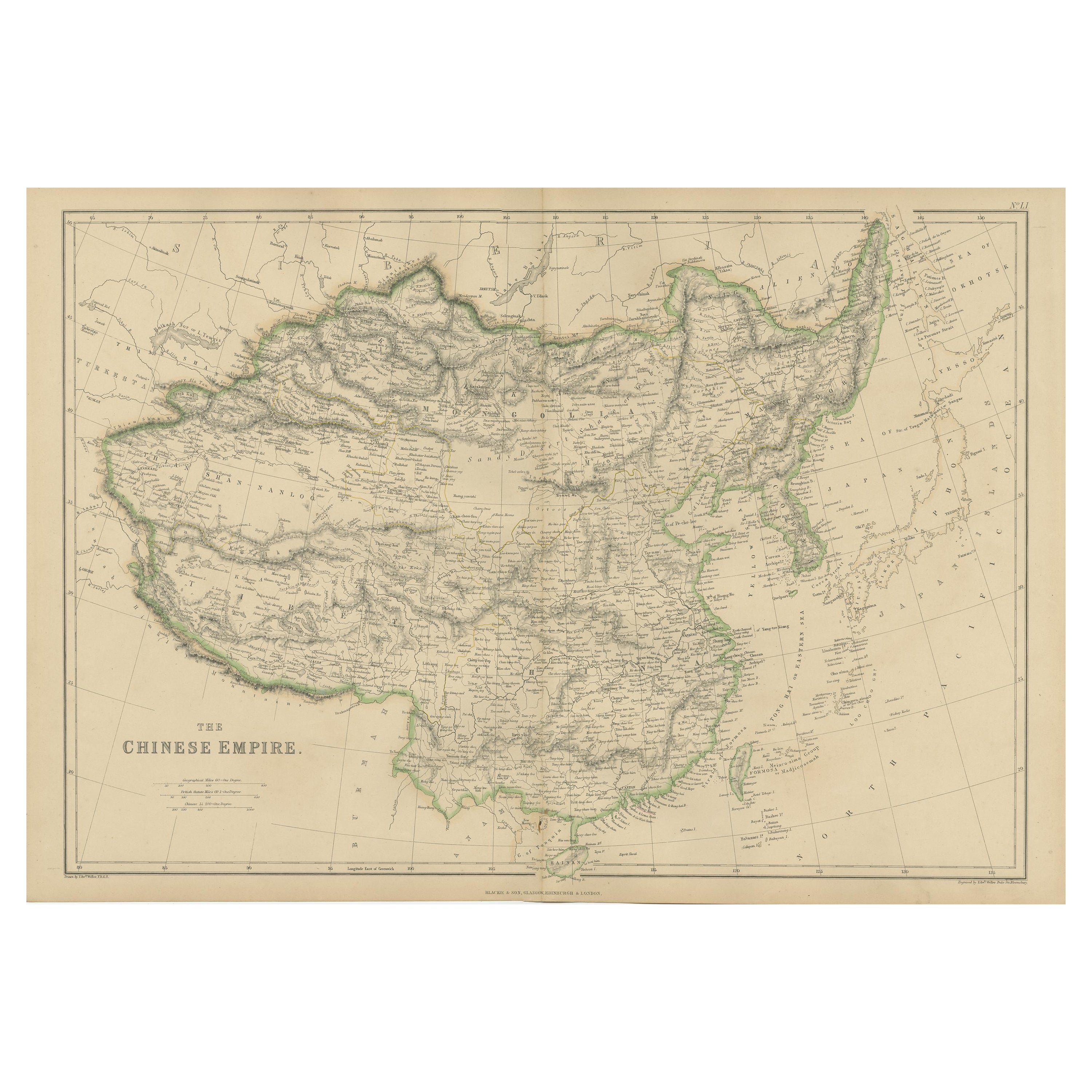
Antique Map of the Chinese Empire by W. G. Blackie, 1859
Located in Langweer, NL
Antique map titled 'The Chinese Empire'. Original antique map of the Chinese Empire. This map originates from ‘The Imperial Atlas of Modern Geography’. Published by W. G. Blackie, 1859.
Category
Antique Mid-19th Century Maps
Materials
Paper
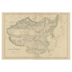
$239 Sale Price
20% Off
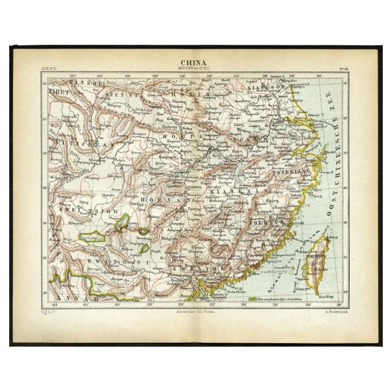
Antique Map of Central and Southern China by Kuyper, 1880
Located in Langweer, NL
Plate 53 : 'China, Midden en Zuid.' (China, Central and South). This lithographed map originates from: 'Wereld-atlas voor Kantoor en Huiskamer' (transl: World Atlas for the office an...
Category
Antique 19th Century Maps
Materials
Paper
$62 Sale Price
20% Off
Antique Map of China with insets the Island of Chusan and Canton River, c.1860
Located in Langweer, NL
Antique map titled 'China'. Large map of China, with insets the Island of Chusan, and the Estuary of the Canton River from Hong Kong to Canton. Korean peninsula shown.
Artists an...
Category
Antique 19th Century Maps
Materials
Paper
$114 Sale Price
20% Off
You May Also Like
Large Original Vintage Map of China, circa 1920
Located in St Annes, Lancashire
Great map of China.
Original color. Good condition.
Published by Alexander Gross
Unframed.
Category
Vintage 1920s English Edwardian Maps
Materials
Paper

Original Antique Map of China, Arrowsmith, 1820
Located in St Annes, Lancashire
Great map of China
Drawn under the direction of Arrowsmith
Copper-plate engraving
Published by Longman, Hurst, Rees, Orme and Brown, 1820
Unfr...
Category
Antique 1820s English Maps
Materials
Paper

Super Rare Antique French Map of Chine and the Chinese Empire, 1780
Located in Amsterdam, Noord Holland
Super Rare Antique French Map of Chine and the Chinese Empire, 1780
Very nice map of Asia. 1780 Made by Bonne.
Additional information:
Type: Map
...
Category
Antique 18th Century European Maps
Materials
Paper

$584 Sale Price
33% Off
Framed Early 19th Century Drawn and Engraved Map of China
By John Knighton Thomson
Located in San Francisco, CA
Hand drawn and tinted engraved map of China dated 1815
Created for Thomson's New General Atlas
Edinburgh
Beautifully framed with a linen covered mat.
Category
Antique Early 19th Century European Prints
Materials
Paper
China and Japan, English antique map by Alexander Keith Johnston, 1901
Located in Melbourne, Victoria
'China and Japan', antique lithographic map by Keith Johnston.
Central vertical fold as issued.
495mm by 625mm (sheet)
Alexander Keith Johnston FRS...
Category
Early 20th Century Victorian More Prints
Materials
Lithograph

Antique 1803 Italian Map of Asia Including China Indoneseia India
Located in Amsterdam, Noord Holland
Antique 1803 Italian Map of Asia Including China Indoneseia India
Very nice map of Asia. 1803.
Additional information:
Type: Map
Country of Manufacturing: Europe
Period: 19th centu...
Category
Antique 19th Century European Maps
Materials
Paper

$584 Sale Price
20% Off
More Ways To Browse
20th Century Spanish Table
Antonio Bellini
Antique Oushak Carpets
Blue Coffee Tables
German Bauhaus Posters
1945 Chair Juhl
Antique Three Leg Table
Folke Arstrom
Silver Over Copper
Vintage Barware Glasses
Antique Etched Glass
Antique French Shell
Coffee Table Black Italian Modern
Christofle America
Iranian Silk Rug Carpet
Poul Moller
Tables With Inlaid Wood
World War Table