Items Similar to Antique Map of British South Africa – Colonial Territories & Railways, c.1920s


Video Loading
Want more images or videos?
Request additional images or videos from the seller
1 of 11
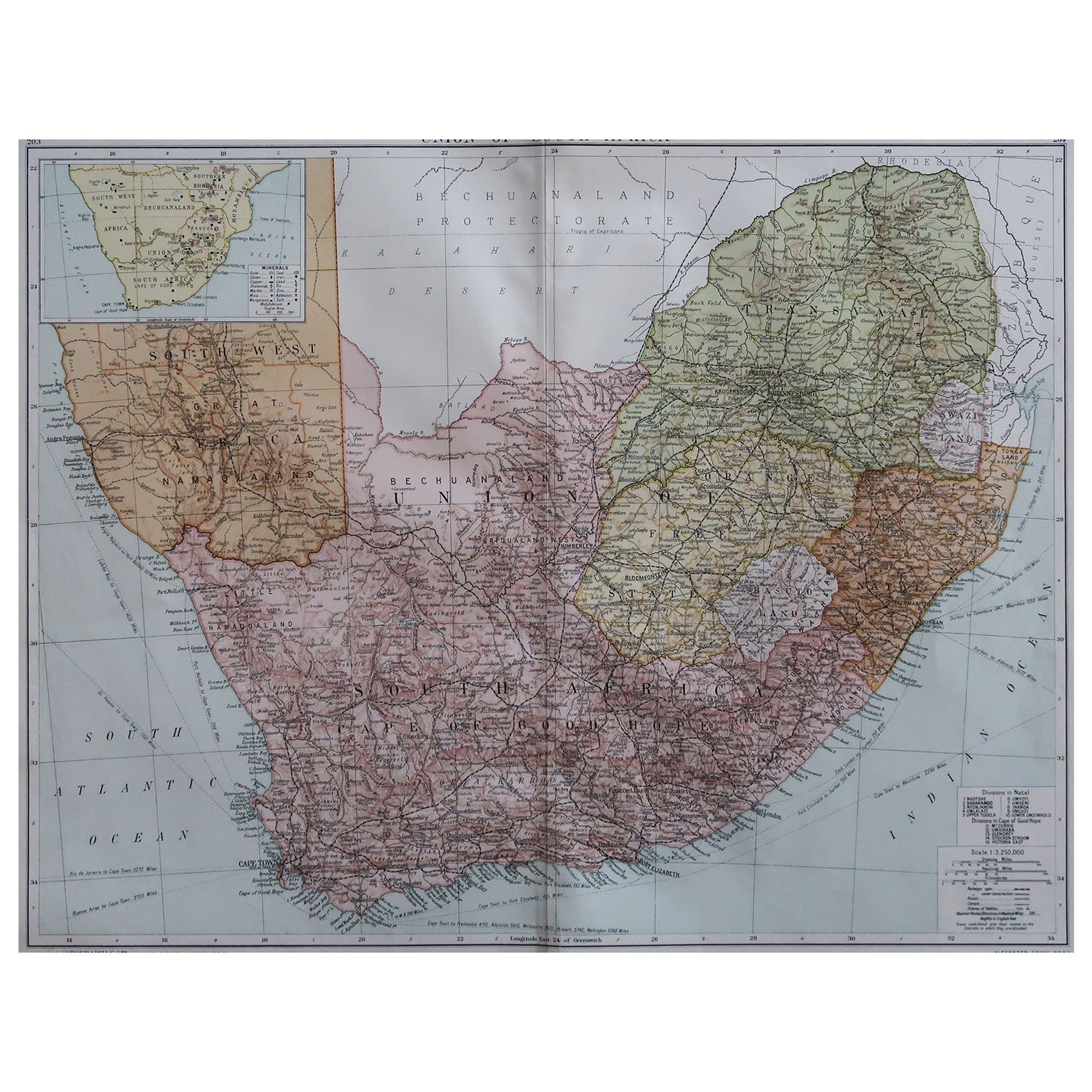
Antique Map of British South Africa – Colonial Territories & Railways, c.1920s
$764.01
£562.87
€640
CA$1,051.52
A$1,166.82
CHF 615.47
MX$14,244.42
NOK 7,786.91
SEK 7,293.07
DKK 4,871.72
About the Item
Antique Map of British South Africa – Colonial Territories & Railways, c.1920s
This large and detailed folding map depicts British South Africa during the early 20th century, showing the extent of British colonial territories and protectorates alongside neighbouring regions. The map covers the Union of South Africa, Bechuanaland Protectorate, Southern and Northern Rhodesia, Nyasaland, and British-administered areas of East Africa, as well as surrounding territories such as Portuguese East Africa (Mozambique), Angola, German South West Africa (marked as mandated to the Union of South Africa), and Madagascar. Key geographic features, settlements, railways, rivers, and mountain ranges are meticulously rendered.
Prominent political boundaries are highlighted in red, illustrating the colonial divisions of the period. The railways, an essential feature of the map, trace the vital transport links that supported both administrative control and economic exploitation, connecting ports such as Cape Town, Port Elizabeth, Durban, and Lourenço Marques to the interior. Elevation figures in feet are noted in select locations, adding to the geographical detail. The inclusion of the Caprivi Strip, Victoria Falls, Lake Nyasa, and Lake Tanganyika shows the scope of British ambitions and influence across southern and central Africa.
This map was printed using high-quality colour lithography, a common technique for atlas and folding maps of this era, allowing for precise line work and clear colour demarcations. The style, scale (1:6,000,000), and nomenclature strongly suggest a publication date in the interwar years, when the British Empire in Africa was at its height.
Condition summary: Very good overall for age. Light toning to paper, minor surface marks and faint handling creases from folding. No significant tears or repairs visible. Original colours remain clear and well-preserved. Paper retains good strength.
Framing tips: This map would present beautifully in a dark wood or black frame to contrast with the pale background, paired with an off-white or light cream mount to draw attention to the red boundary lines. For a more vintage look, consider a teak or mahogany frame with a slightly warm-toned mount to complement the map’s aged paper.
Technique: Colour lithograph
Maker: Unknown, British, c.1920s
- Dimensions:Height: 22.64 in (57.5 cm)Width: 29.14 in (74 cm)Depth: 0.01 in (0.2 mm)
- Materials and Techniques:
- Place of Origin:
- Period:
- Date of Manufacture:circca 1920
- Condition:Condition summary: Very good overall for age. Light toning to paper, minor surface marks and faint handling creases from folding. No significant tears or repairs visible. Original colours remain clear and well-preserved. Paper retains good strength.
- Seller Location:Langweer, NL
- Reference Number:Seller: BG-14089-11stDibs: LU3054346230982
About the Seller
5.0
Recognized Seller
These prestigious sellers are industry leaders and represent the highest echelon for item quality and design.
Platinum Seller
Premium sellers with a 4.7+ rating and 24-hour response times
Established in 2009
1stDibs seller since 2017
2,569 sales on 1stDibs
Typical response time: <1 hour
- ShippingRetrieving quote...Shipping from: Langweer, Netherlands
- Return Policy
Authenticity Guarantee
In the unlikely event there’s an issue with an item’s authenticity, contact us within 1 year for a full refund. DetailsMoney-Back Guarantee
If your item is not as described, is damaged in transit, or does not arrive, contact us within 7 days for a full refund. Details24-Hour Cancellation
You have a 24-hour grace period in which to reconsider your purchase, with no questions asked.Vetted Professional Sellers
Our world-class sellers must adhere to strict standards for service and quality, maintaining the integrity of our listings.Price-Match Guarantee
If you find that a seller listed the same item for a lower price elsewhere, we’ll match it.Trusted Global Delivery
Our best-in-class carrier network provides specialized shipping options worldwide, including custom delivery.More From This Seller
View AllAntique Map of Africa, Highlighting Colonial Divisions, Geographic Features 1903
Located in Langweer, NL
Title: Antique Map of Africa, 1903, Highlighting Colonial Divisions and Geographic Features
Description: This antique map, titled "Africa," was engraved and published in 1903 by W. ...
Category
Early 20th Century Maps
Materials
Paper

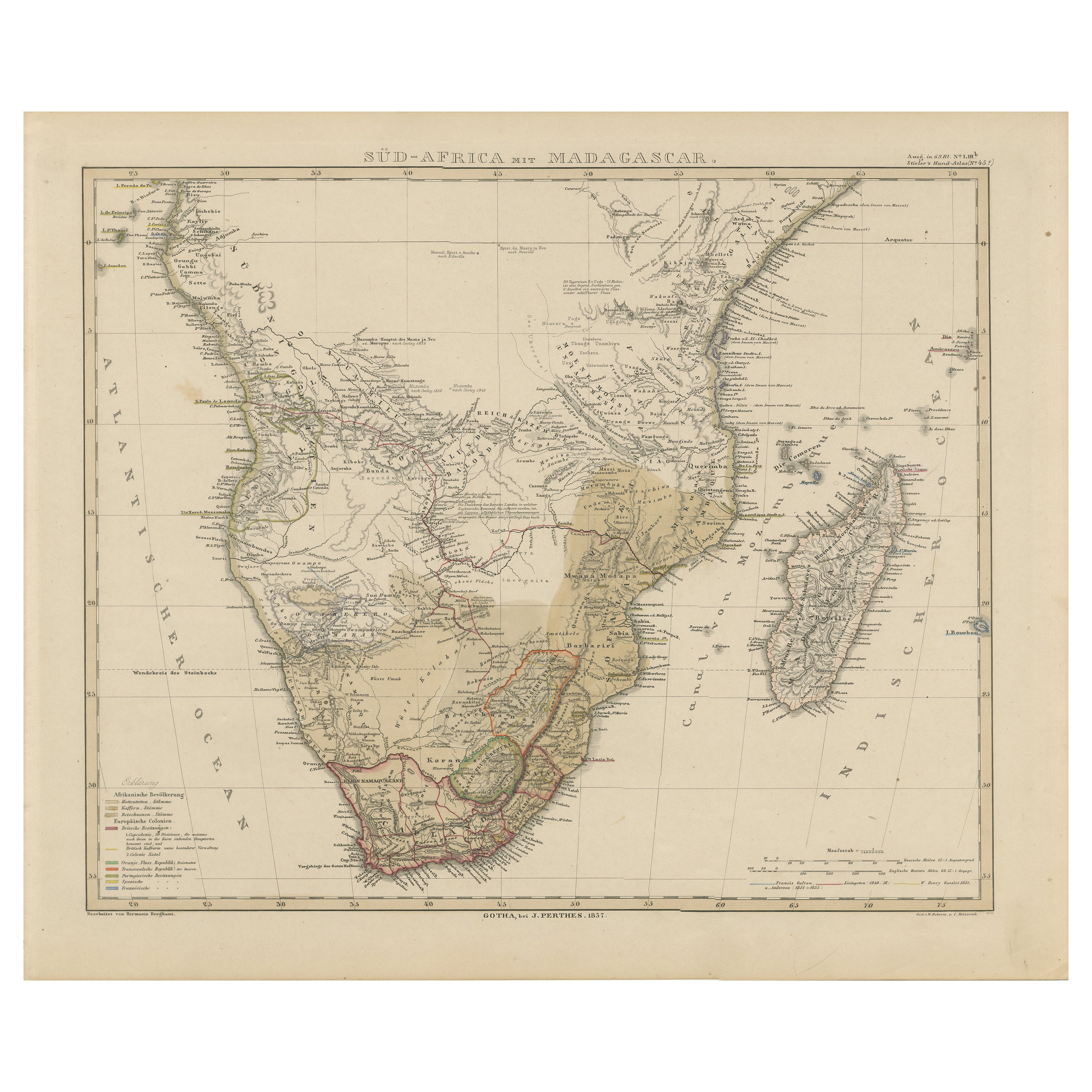
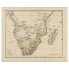
Southern Africa & Madagascar Antique Map – Beautiful 1857 Edition
Located in Langweer, NL
Southern Africa and Madagascar Map 1857
This detailed antique print shows “Süd-Africa mit Madagascar” meaning “Southern Africa with Madagascar,” published in 1857 by Justus Perthes ...
Category
Antique Mid-19th Century German Maps
Materials
Paper
Antique Map of Southern Africa by Levasseur, 1875
Located in Langweer, NL
Antique map titled 'Afrique Méridionale'. Large map of Southern Africa. This map originates from 'Atlas de Géographie Moderne Physique et Politique' b...
Category
Antique Late 19th Century Maps
Materials
Paper

$382 Sale Price
20% Off
Antique Map of Africa by Johnston (1909)
Located in Langweer, NL
Antique map titled 'Africa'. Original antique map of Africa. This map originates from the ‘Royal Atlas of Modern Geography’. Published by W. & A....
Category
Early 20th Century Maps
Materials
Paper

$238 Sale Price
20% Off
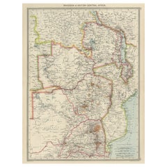
Antique Map of Rhodesia & British Central Africa – Published by Philip, 1895
Located in Langweer, NL
Antique Map of Rhodesia & British Central Africa – Published by George Philip & Son, 1895
This detailed antique map titled "Rhodesia & British Central Africa" was published in 1895 ...
Category
Antique Late 17th Century English Maps
Materials
Paper
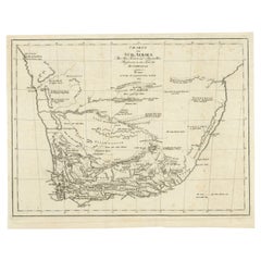
Antique Map of South Africa showing the Travels of Truter and Somerville
Located in Langweer, NL
Antique map titled 'Charte von Süd-Afrika'. Original antique map of South Africa showing the travels of Truter and Somerville. Published ci...
Category
Antique Early 19th Century Maps
Materials
Paper
$401 Sale Price
20% Off
You May Also Like
Large Original Vintage Map of South Africa, circa 1920
Located in St Annes, Lancashire
Great map of South Africa
Original color.
Good condition / repair to a minor edge tear middle bottom
Published by Alexander Gross
Unframed.
...
Category
Vintage 1920s English Edwardian Maps
Materials
Paper

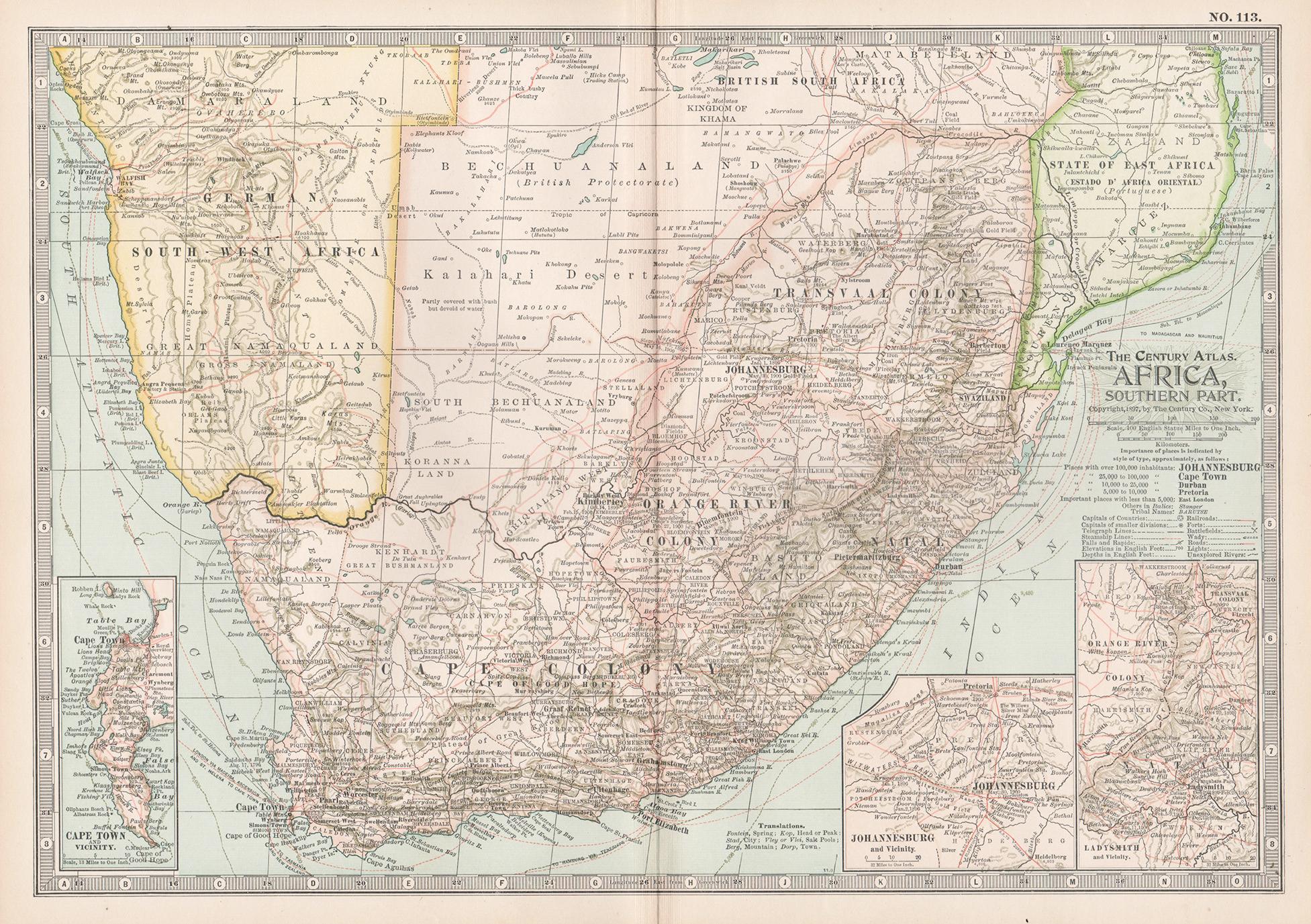
Africa. Southern Part. Century Atlas antique vintage map
Located in Melbourne, Victoria
'The Century Atlas. Africa. Southern Part'
Original antique map, 1903.
Inset maps of 'Cape Town', 'Johannesburg' and 'Ladysmith'.
Central fold as issued. Map name and number printe...
Category
Early 20th Century Victorian More Prints
Materials
Lithograph

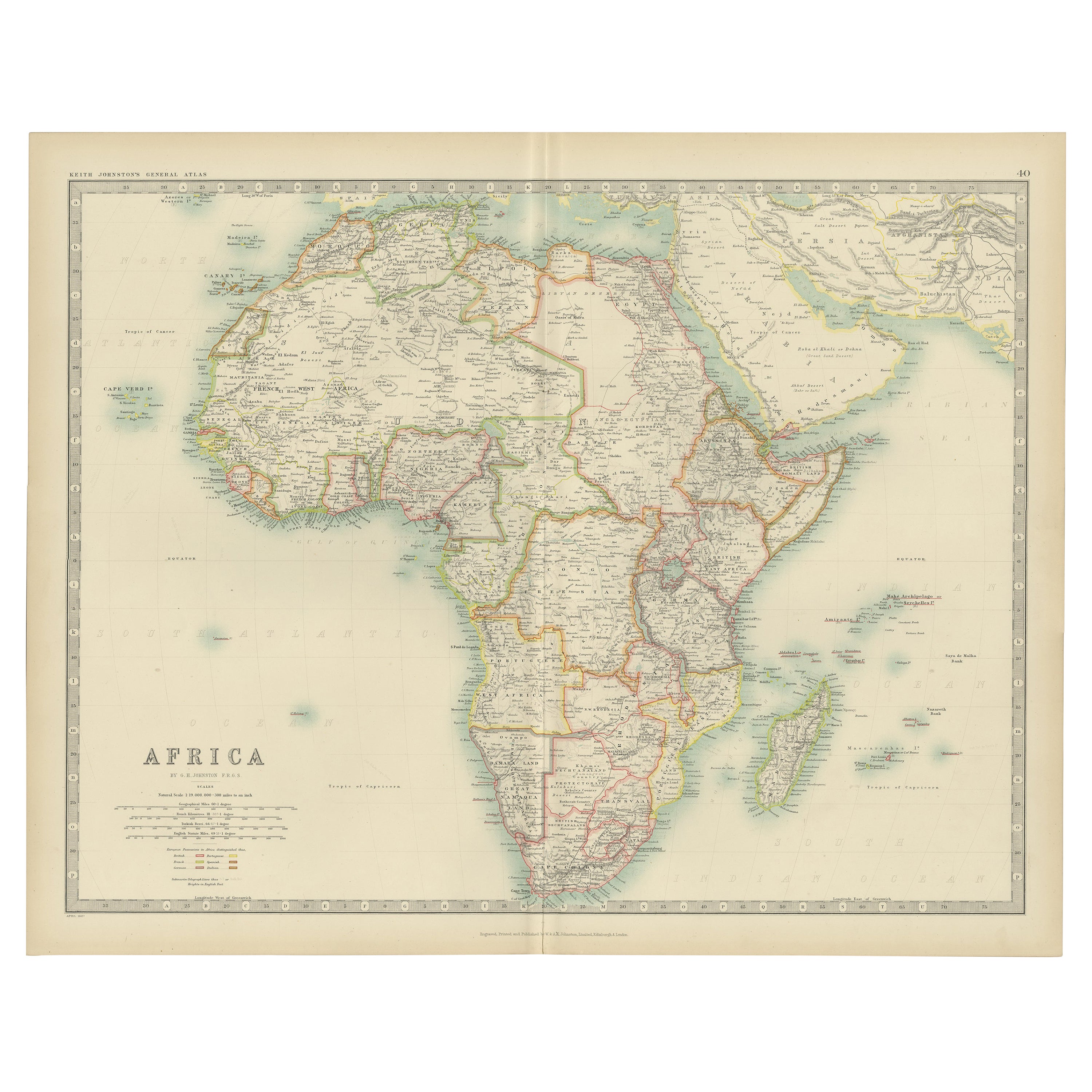
Original Antique Map of Africa by Dower, circa 1835
Located in St Annes, Lancashire
Nice map of Africa
Drawn and engraved by J.Dower
Published by Orr & Smith. C.1835
Unframed.
Free shipping
Category
Antique 1830s English Maps
Materials
Paper

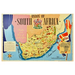
Original Vintage Poster Union Of South Africa Map Natural & Industrial Resources
Located in London, GB
Original vintage illustrated map poster for the Union of South Africa Her Natural and Industrial Resources featuring colourful images of the main cities including Cape Town, Pretoria...
Category
Vintage 1940s British Posters
Materials
Paper
Original Antique Map of South Africa, Arrowsmith, 1820
Located in St Annes, Lancashire
Great map of South Africa.
Drawn under the direction of Arrowsmith.
Copper-plate engraving.
Published by Longman, Hurst, Rees, Orme and Br...
Category
Antique 1820s English Maps
Materials
Paper

Africa. North-East Part. Century Atlas antique vintage map
Located in Melbourne, Victoria
'The Century Atlas. Africa. North-East Part'
Original antique map, 1903.
Inset map of 'Nile Delta and Suez Canal'.
Central fold as issued. Map name and nu...
Category
Early 20th Century Victorian More Prints
Materials
Lithograph
