Items Similar to Antique Map of the City of Ypres by Beaulieu, 1729


Want more images or videos?
Request additional images or videos from the seller
1 of 5
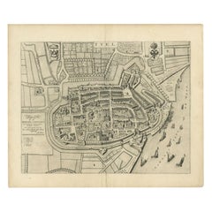
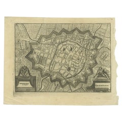
Antique Map of the City of Ypres by Beaulieu, 1729
$210.27
$262.8320% Off
£158.37
£197.9720% Off
€178.40
€22320% Off
CA$289.97
CA$362.4620% Off
A$325.76
A$407.2120% Off
CHF 170.21
CHF 212.7720% Off
MX$3,976.10
MX$4,970.1320% Off
NOK 2,161.20
NOK 2,701.5020% Off
SEK 2,034.31
SEK 2,542.8920% Off
DKK 1,357.91
DKK 1,697.3920% Off
About the Item
Antique map titled 'Plan de la Ville d'Ipren/Plan der Stadt Ipren'. Map of the city of Ieper/Ypres in Belgium. This map originates from 'Histoire Militaire du Prince Eugene de Savoye, du Prince et Duc de Marlborough, et du Prince de Nassau-Frise' by I. van der Kloot.
Artists and Engravers: Author: Sébastien Pontault d'Beaulieu.
Condition: Very good, please study image carefully.
Date: 1729
Overall size: 55 x 49 cm.
Image size: 48.5 x 40 cm.
We sell original antique maps to collectors, historians, educators and interior decorators all over the world. Our collection includes a wide range of authentic antique maps from the 16th to the 20th centuries. Buying and collecting antique maps is a tradition that goes back hundreds of years. Antique maps have proved a richly rewarding investment over the past decade, thanks to a growing appreciation of their unique historical appeal. Today the decorative qualities of antique maps are widely recognized by interior designers who appreciate their beauty and design flexibility. Depending on the individual map, presentation, and context, a rare or antique map can be modern, traditional, abstract, figurative, serious or whimsical. We offer a wide range of authentic antique maps for any budget
- Dimensions:Height: 19.3 in (49 cm)Width: 21.66 in (55 cm)Depth: 0 in (0.01 mm)
- Materials and Techniques:
- Period:
- Date of Manufacture:1729
- Condition:
- Seller Location:Langweer, NL
- Reference Number:Seller: BGI-002241stDibs: LU3054327794202
About the Seller
5.0
Recognized Seller
These prestigious sellers are industry leaders and represent the highest echelon for item quality and design.
Platinum Seller
Premium sellers with a 4.7+ rating and 24-hour response times
Established in 2009
1stDibs seller since 2017
2,534 sales on 1stDibs
Typical response time: <1 hour
- ShippingRetrieving quote...Shipping from: Langweer, Netherlands
- Return Policy
Authenticity Guarantee
In the unlikely event there’s an issue with an item’s authenticity, contact us within 1 year for a full refund. DetailsMoney-Back Guarantee
If your item is not as described, is damaged in transit, or does not arrive, contact us within 7 days for a full refund. Details24-Hour Cancellation
You have a 24-hour grace period in which to reconsider your purchase, with no questions asked.Vetted Professional Sellers
Our world-class sellers must adhere to strict standards for service and quality, maintaining the integrity of our listings.Price-Match Guarantee
If you find that a seller listed the same item for a lower price elsewhere, we’ll match it.Trusted Global Delivery
Our best-in-class carrier network provides specialized shipping options worldwide, including custom delivery.More From This Seller
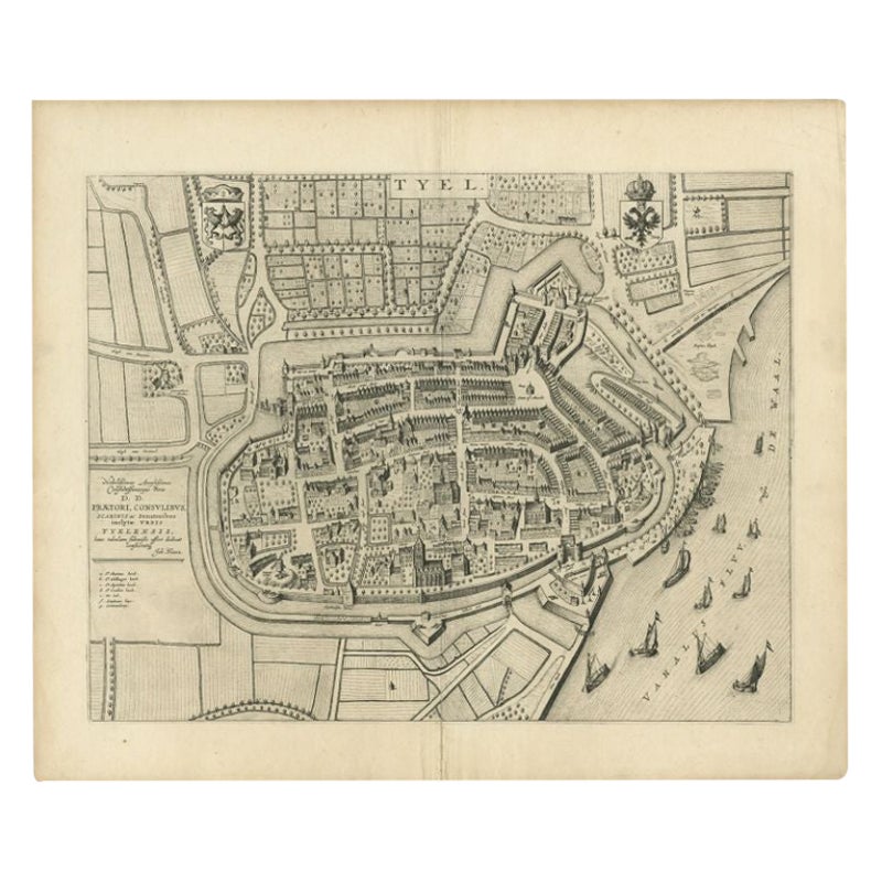
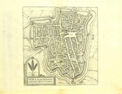
View AllAntique Map of the City of Tiel by Blaeu, 1649
Located in Langweer, NL
Antique map titled 'Tyel'. Beautiful map of the city of Tiel, The Netherlands. With a coat of arms and key of various locations. Originates from 'Toneel der Steeden' published by Joa...
Category
Antique 17th Century Maps
Materials
Paper
$563 Sale Price
20% Off
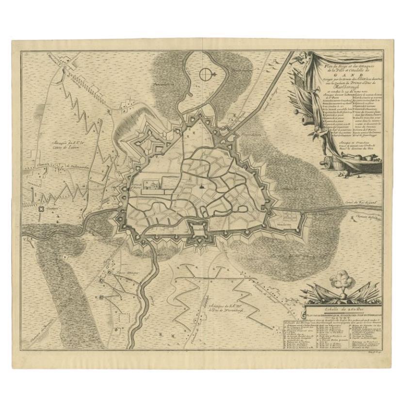
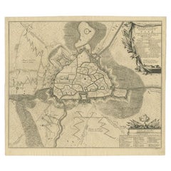
Antique Map of the Siege of Gent by Dumont, 1729
By Dumont
Located in Langweer, NL
Antique map titled 'Plan of the Siege and Attacks of the City and Citadel of Ghent'. Large map depicting the siege of the Belgian city of Gent in 1708 during the war of the Spanish S...
Category
Antique 18th Century Maps
Materials
Paper
$315 Sale Price
20% Off
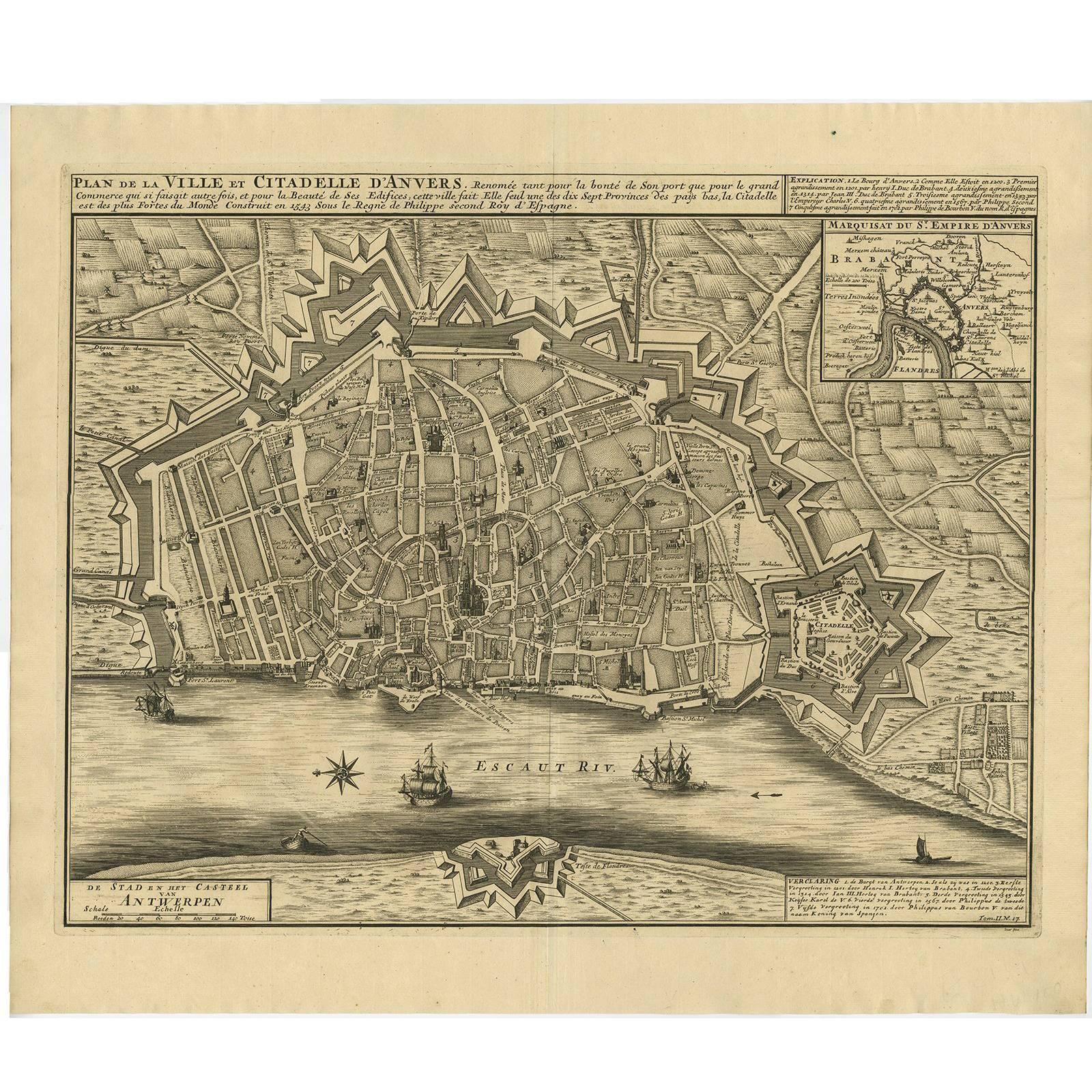
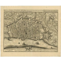
Antique Map of the City of Antwerpen ‘Belgium’ by A. Deur, 1729
Located in Langweer, NL
Copper-engraving by A. Deur. Published by I. van der Kloot in Den Haag, 1729. With French and Dutch title-cartouches and explanatory notes, several ships o...
Category
Antique Early 18th Century Maps
Materials
Paper
$726 Sale Price
20% Off
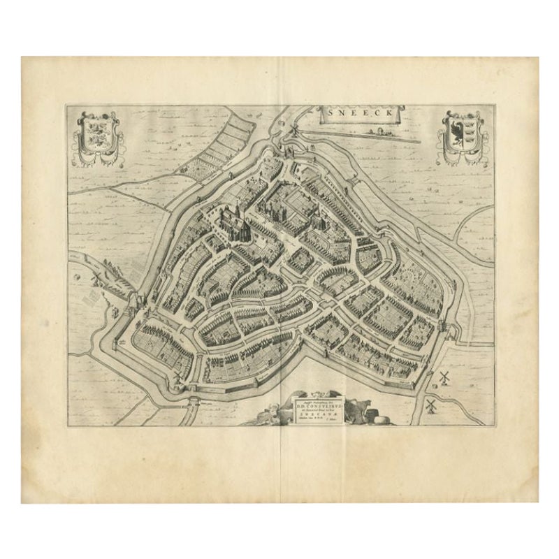
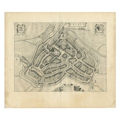
Antique Map of the City of Sneek by Blaeu, 1649
Located in Langweer, NL
Antique map Friesland titled 'Sneeck'. Bird's-eye view plan of Sneek, the Netherlands. This map originates from 'Toneel der Steeden' published by Joan Blaeu, 1649.
Artists and Eng...
Category
Antique 17th Century Maps
Materials
Paper
$412 Sale Price
20% Off
Antique Map of the City of Groningen Made After Harrewijn, C.1750
Located in Langweer, NL
Antique map titled 'Groeningue'. Old map of the city of Groningen, the Netherlands. Source unknown, to be determined.
Artists and Engravers: Most likely made after J. Harrewijn.
...
Category
Antique 18th Century Maps
Materials
Paper
$103 Sale Price
20% Off
Antique Map of the City of Geldern by Blaeu, 1649
Located in Langweer, NL
Antique map titled 'Gelre'. Old map of the city of Geldern, Germany. This map originates from 'Toonneel der Steden van de Vereenighde Nederlanden' by J. Blaeu.
Artists and Engrav...
Category
Antique 17th Century Maps
Materials
Paper

$374 Sale Price
20% Off
You May Also Like
18th Century Map Engraving - Newport, a Strong Sea-Port Town in Flanders
Located in Corsham, GB
A map of Nieuwpoort, anglicised to 'Newport', in northern Belgium. There is a panorama in the upper quarter depicting major landmarks. Below is a plan of the town, including its strong defences and ships at the port in the lower register. Inscribed with the title in plate to the lower edge, 'Newport a Strong Sea-Port Town...
Category
18th Century More Prints
Materials
Engraving

$269 Sale Price
20% Off
Map of Ypres - Etching by G. Braun and F. Hogenberg - Late 16th Century
By Franz Hogenberg
Located in Roma, IT
This map of Hypra is an original etching realized by George Braun and Franz Hogenberg as part of famous series "Civitates Orbis Terrarum".
The state of preservation of the artwork ...
Category
16th Century Figurative Prints
Materials
Etching
Original Antique Map or City Plan of Geneva, Switzerland. Circa 1835
Located in St Annes, Lancashire
Nice map of Geneva
Drawn and engraved by J.Dower
Published by Orr & Smith. C.1835
Unframed.
Free shipping
Category
Antique 1830s English Maps
Materials
Paper

17th Century Toulouse, Savve, Sommieres Topographical Map by Iohan Peeters
Located in New York, NY
Fine topographical 17th century map of Toulouse, Savve and Sommieres by Iohan Peeters
Beautiful engraving of the capital of France's Occitanie Region, Toulouse, called La Ville Rose- the Pink City, for the terracotta bricks used in its many buildings, giving the city a distinct apricot-rose hue. An important cultural and educational center, the city's residents included Nobel Prize winners and world renown artists- Henri de Toulouse-Lautrec, Henri Martin, Jean-Auguste-Dominique Ingres, Antonin Mercie, Alexandre Falguiere and more recently Cyril Kongo...
Category
Antique 17th Century Dutch Maps
Materials
Paper

18th Century Map Engraving - Mechlin, or Malines
Located in Corsham, GB
A map of Mechelen, known as Malines in French and Mechlin in English, a city and municipality in the province of Antwerp in the Flemish Region of Belgium. A birds-eye view plan of th...
Category
18th Century More Prints
Materials
Engraving

$269 Sale Price
20% Off
Map of Cambridge, engraving Pieter van der Aa after David Loggan
By Pieter Van Der Aa
Located in London, GB
Pieter van der Aa (1659 - 1733), after David Loggan (1634 - 1692)
Map of Cambridge
Engraving
12 x 16 cm
An eighteenth-century view of Cambridge, engraved by Pieter van der Aa after ...
Category
Early 18th Century Realist Prints and Multiples
Materials
Engraving

More Ways To Browse
Prince Eugene
French School Map
Nova Scotia Antique Furniture
Richard Wentworth
Antique Mace
Map Of Madagascar
Map Of Normandy
Bali Map
Croatia Map
Gibraltar Antique Map
Albania Antique Map
Antique Furniture Kingston
Antique Louisiana Map
Armenia Map
L Tardieu
Chinese Wall Pocket
18th Century Nautical Engraving
Antique Map Burgundy