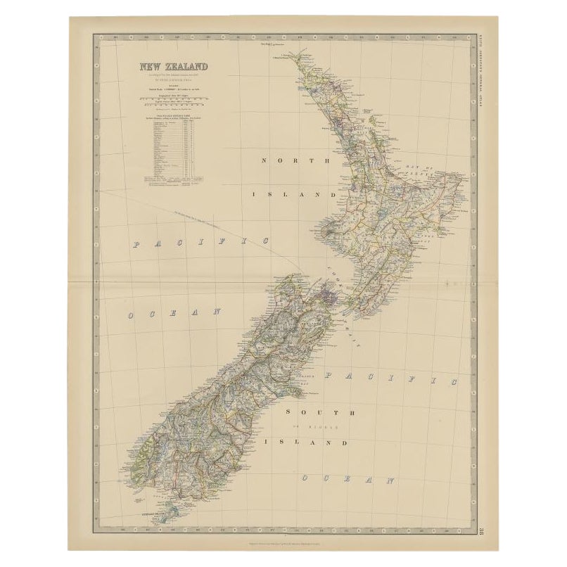
Items Similar to Antique Map of New Zealand, 1903, Featuring the North and South Islands and Alps


Want more images or videos?
Request additional images or videos from the seller
1 of 12
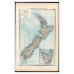
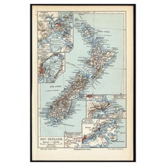
Antique Map of New Zealand, 1903, Featuring the North and South Islands and Alps
$381.47
£283.01
€320
CA$522.25
A$585.08
CHF 304.54
MX$7,125.19
NOK 3,879.37
SEK 3,653.27
DKK 2,436.53
Shipping
Retrieving quote...The 1stDibs Promise:
Authenticity Guarantee,
Money-Back Guarantee,
24-Hour Cancellation
About the Item
Title: Antique Map of New Zealand, 1903, Featuring the North and South Islands and the Southern Alps
Description:
This antique map, titled "New Zealand," was engraved and published in 1903 by W. & A.K. Johnston in Edinburgh and London. It provides a beautifully detailed depiction of New Zealand during a period of remarkable growth and change, capturing the rich cultural and natural diversity of this island nation.
Hand-colored in soft pastel shades to delineate regional boundaries, the map traces major cities, towns, rivers, and mountain ranges, including an inset illustration of the Southern Alps that beautifully captures the grandeur of New Zealand’s alpine landscapes. The map’s fine engraving and delicate typography highlight the rugged coastline, the lush green interior, and the intricate maritime connections that link the islands to the wider Pacific world.
The North Island and South Island are presented with a sense of balance and unity, underscoring the natural beauty and strategic importance of New Zealand within the British Empire at the time. This map is a fascinating window into the history and geography of New Zealand at the dawn of the 20th century, offering a unique blend of artistry and cartographic precision.
For collectors, historians, and those with a deep appreciation for the cultural and natural heritage of New Zealand, this map is a treasure—a reflection of both the enduring spirit of the land and the historical forces that have shaped it.
Condition report:
This map is in very good antique condition, with minor foxing and gentle toning along the edges, typical for its age. The colors remain vibrant and the paper is stable and well-preserved.
Framing tips:
A classic wooden frame in walnut or cherry will beautifully enhance the soft pastel tones and historical detail of the map. Use a cream or off-white matting to highlight the refined linework and create a sophisticated, timeless focal point for any home, library, or study.
- Dimensions:Height: 18.51 in (47 cm)Width: 14.49 in (36.8 cm)Depth: 0.01 in (0.2 mm)
- Materials and Techniques:
- Period:
- Date of Manufacture:1903
- Condition:This map is in very good antique condition, with minor foxing and gentle toning along the edges, typical for its age. The colors remain vibrant and the paper is stable and well-preserved. Folding line as issued.
- Seller Location:Langweer, NL
- Reference Number:Seller: BG-13577-341stDibs: LU3054345263522
About the Seller
5.0
Recognized Seller
These prestigious sellers are industry leaders and represent the highest echelon for item quality and design.
Platinum Seller
Premium sellers with a 4.7+ rating and 24-hour response times
Established in 2009
1stDibs seller since 2017
2,493 sales on 1stDibs
Typical response time: <1 hour
- ShippingRetrieving quote...Shipping from: Langweer, Netherlands
- Return Policy
Authenticity Guarantee
In the unlikely event there’s an issue with an item’s authenticity, contact us within 1 year for a full refund. DetailsMoney-Back Guarantee
If your item is not as described, is damaged in transit, or does not arrive, contact us within 7 days for a full refund. Details24-Hour Cancellation
You have a 24-hour grace period in which to reconsider your purchase, with no questions asked.Vetted Professional Sellers
Our world-class sellers must adhere to strict standards for service and quality, maintaining the integrity of our listings.Price-Match Guarantee
If you find that a seller listed the same item for a lower price elsewhere, we’ll match it.Trusted Global Delivery
Our best-in-class carrier network provides specialized shipping options worldwide, including custom delivery.More From This Seller
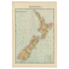
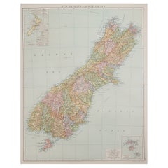
View AllAntique Map of New Zealand and Tasmania, 1904
Located in Langweer, NL
This large antique map is taken from; 'Andrees Allgemeiner Handatlas in 126 Haupt-Und 139 Nebenkarten', Bielefeld; Leipzig: Velhagen & Klasing 1899. Andrees Allgemeiner Handatlas was...
Category
20th Century Maps
Materials
Paper
$85 Sale Price
20% Off
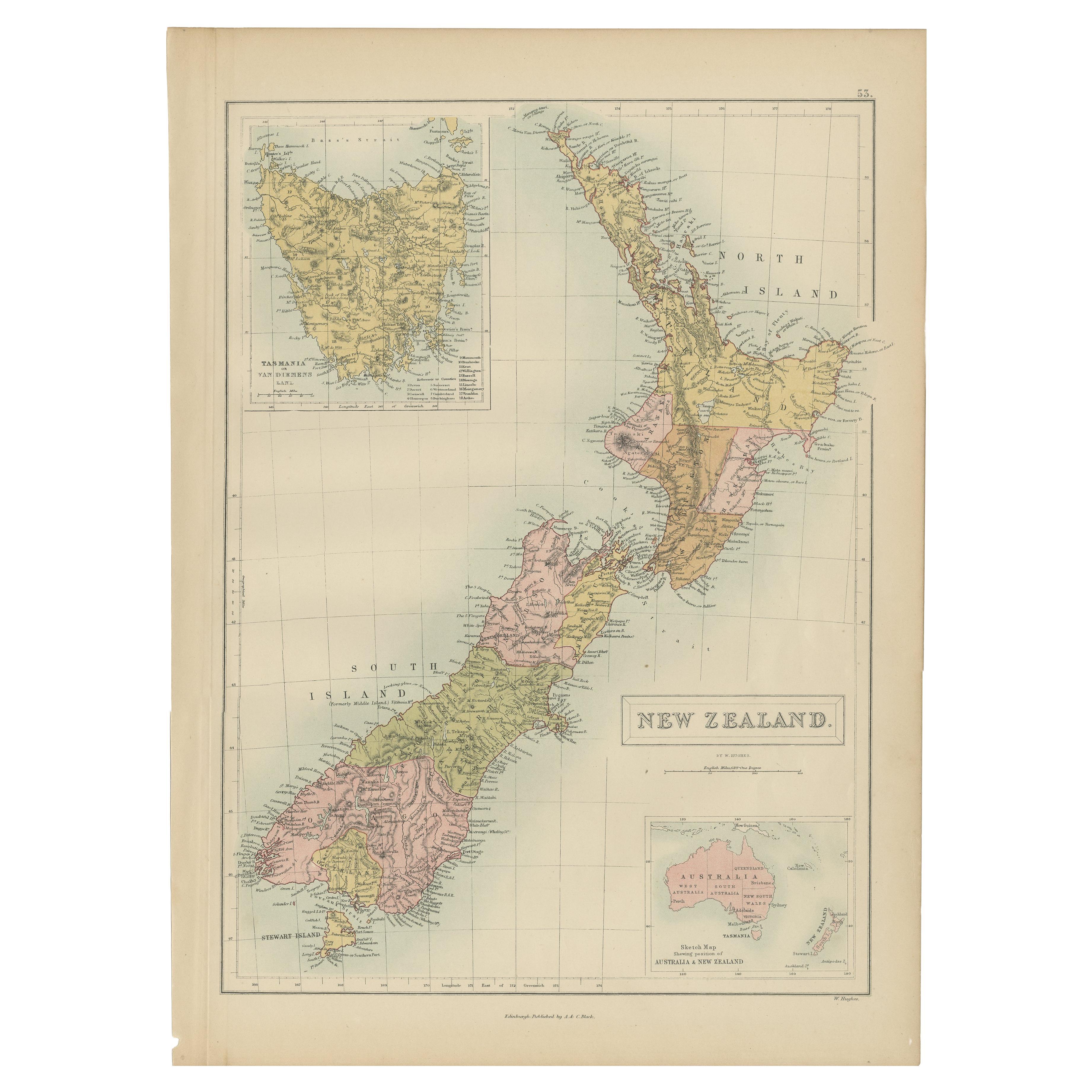
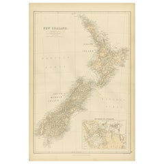
Antique Map of New Zealand by A & C. Black, 1870
Located in Langweer, NL
Antique map titled 'New Zealand'. Original antique map of New Zealand with inset Maps of Australia, New Zealand and Tasmania. This map origi...
Category
Antique Late 19th Century Maps
Materials
Paper

$166 Sale Price
20% Off
Antique Map of New Zealand by G.F. Cram, 'circa 1906'
Located in Langweer, NL
Antique map titled 'New Zealand'. Large map of New Zealand with a small legend of the Chatham Islands. On the verso, a map of the North Polar regions and a map of Tasmania can be fou...
Category
20th Century Maps
Materials
Paper
$333 Sale Price
20% Off
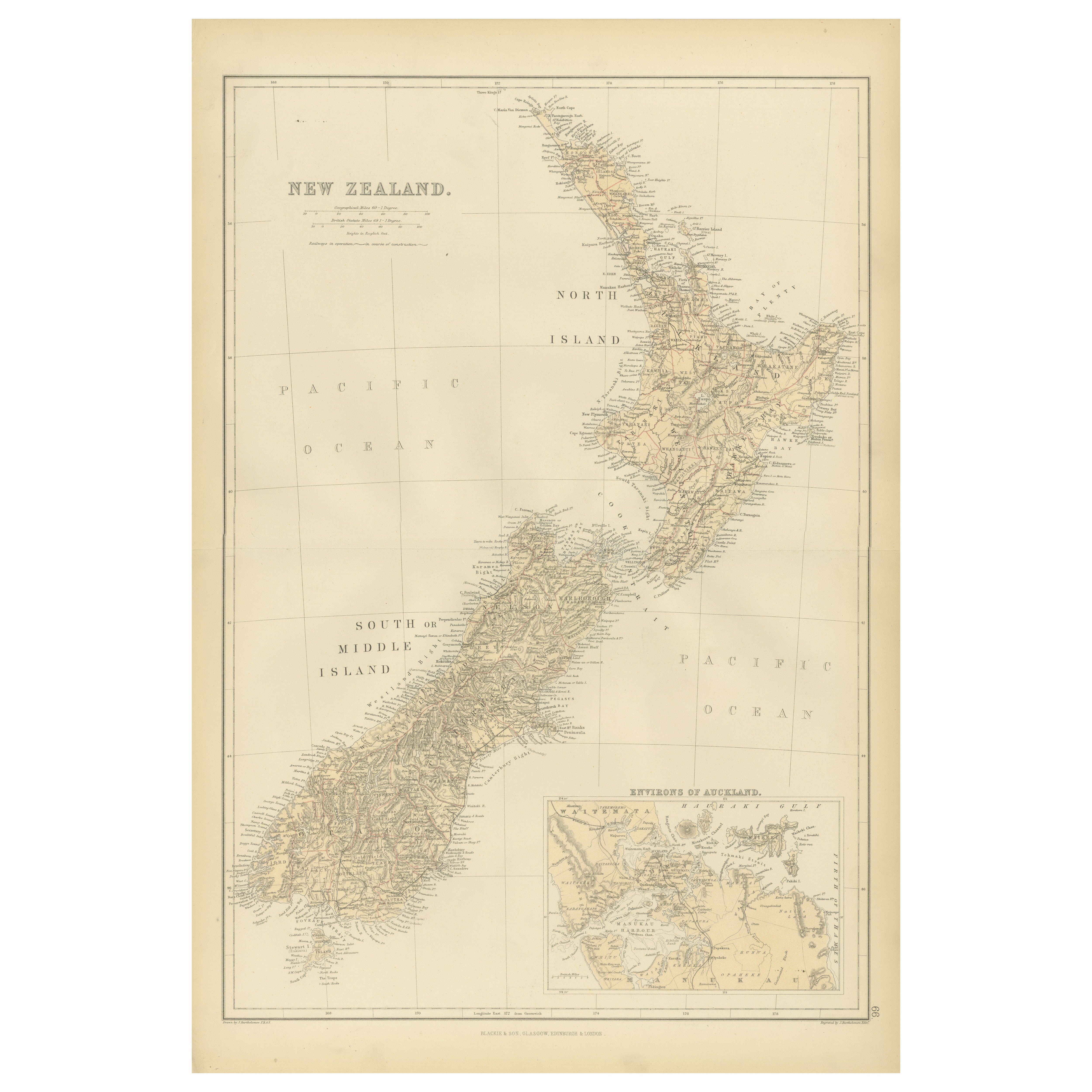
1882 Original Antique Map of New Zealand with Inset of Auckland's Environs
Located in Langweer, NL
This 1882 map of New Zealand, published by Blackie and Son as part of the 'Comprehensive Atlas and Geography of the World,' provides a detailed representation of the North Island and...
Category
Antique 1880s Maps
Materials
Paper
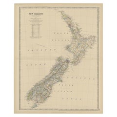
Antique Map of New Zealand by Scottish Geographer Johnston, 1882
Located in Langweer, NL
Antique map titled 'New Zealand'.
Old map of New Zealand. This map originates from 'The Royal Atlas of Modern Geography, Exhibiting, in a Series of Entirely Original and Authentic ...
Category
Antique 19th Century Maps
Materials
Paper
$305 Sale Price
20% Off
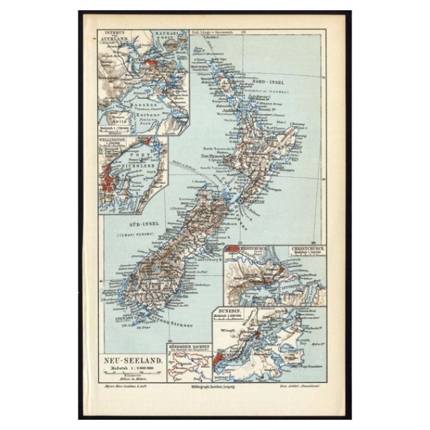
Antique Map of New Zealand, 1895
Located in Langweer, NL
Antique map titled 'Neu-Seeland.' Map of New Zealand. With inset maps of the large cities. This attractive original old antique print / plate / map ...
Category
Antique 19th Century Maps
Materials
Paper
$114 Sale Price
20% Off
You May Also Like
Large Original Vintage Map of New Zealand, North Island, circa 1920
Located in St Annes, Lancashire
Great map of North Island, New Zealand
Original color.
Good condition / minor foxing to right edge
Published by Alexander Gross
Unframed.
Category
Vintage 1920s English Edwardian Maps
Materials
Paper

Large Original Vintage Map of New Zealand, South Island, circa 1920
Located in St Annes, Lancashire
Great map of South Island, New Zealand
Original color.
Good condition / repair to a minor tear on right edge
Published by Alexander Gross
Unframed.
Category
Vintage 1920s English Edwardian Maps
Materials
Paper
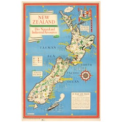
Original WWII Map of New Zealand - Natural & Industrial Resources in War & Peace
By "Leslie MacDonald ""Max"" Gill"
Located in London, GB
Original vintage World War Two pictorial map for New Zealand her natural and Industrial resources featuring a great illustration by the notable graphic designer, cartographer and artist MacDonald Gill (Leslie MacDonald Gill aka Max Gill...
Category
Vintage 1940s British Posters
Materials
Paper
Original Antique Map of Australia by Dower, circa 1835
Located in St Annes, Lancashire
Nice map of Australia
Drawn and engraved by J.Dower
Published by Orr & Smith. C.1835
Unframed.
Free shipping
Category
Antique 1830s English Maps
Materials
Paper

Large Original Antique Map of Australia by Sidney Hall, 1847
Located in St Annes, Lancashire
Great map of Australia
Drawn and engraved by Sidney Hall
Steel engraving
Original colour outline
Published by A & C Black. 1847
Unframed
Free shipping.
Category
Antique 1840s Scottish Maps
Materials
Paper

Original Antique Map of US Possessions In The Pacific Ocean, C.1900
Located in St Annes, Lancashire
Fabulous map of US possessions in the Pacific Ocean
Original color.
Engraved and printed by the George F. Cram Company, Indianapolis.
Published, C.1900.
Unframed.
Free shipping.
Category
Antique 1890s American Maps
Materials
Paper

More Ways To Browse
Alps Furniture
Empire Library
Solid Mahogany Table
Dessert Glasses
Geometric Glass Table
Mid Century Pin
6x10 Rug
Studded Furniture
Styles Of Antique Desks
Black And White Coffee Table
Metal Relief
Curved Velvet Couch
Velvet Curved Sofa
Wood Round Coffee Tables
Antique Paper Flowers
Oak Brutalist
Used College Furniture
Wood Minimalist Chair