Items Similar to Antique Map of the Province of Navarre with the City of Pamplona, Spain


Want more images or videos?
Request additional images or videos from the seller
1 of 7
Antique Map of the Province of Navarre with the City of Pamplona, Spain
$557.65
$697.0620% Off
£417.99
£522.4920% Off
€472
€59020% Off
CA$766.11
CA$957.6420% Off
A$855.29
A$1,069.1120% Off
CHF 448.16
CHF 560.2020% Off
MX$10,469.59
MX$13,086.9920% Off
NOK 5,691.63
NOK 7,114.5320% Off
SEK 5,366.48
SEK 6,708.1020% Off
DKK 3,593.04
DKK 4,491.3020% Off
About the Item
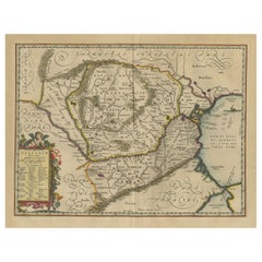
Antique map titled 'Royaume de Navarre (..)'. Decorative map of the province Navarre (Spanish: Navarra) in Northern Spain centered on the city of Pamplona. Published by N. Sanson, 1652.
Nicholas Sanson (1600-1667) is considered the father of French cartography in its golden age from the mid-seventeenth century to the mid-eighteenth. Over the course of his career he produced over 300 maps; they are known for their clean style and extensive research. Sanson was largely responsible for beginning the shift of cartographic production and excellence from Amsterdam to Paris in the later-seventeenth century.
The map depicts the historical region of Navarre (Royaume de Navarre) and its surrounding areas, including parts of the Basque Country and Aragón. Here are some key areas and notable places within this region:
1. **Pamplona (Iruña)**: The capital of Navarre, famous for the annual Running of the Bulls (San Fermín festival). Pamplona is a city rich in history and culture, with landmarks such as the Pamplona Cathedral and the Citadel.
2. **Olite (Erriberri)**: Known for the impressive Olite Castle, a Gothic-style palace that was one of the most luxurious in Europe during the medieval period. The town itself has charming streets and historical buildings.
3. **Tudela**: A significant town in the Ribera region, famous for its historic architecture, including the Cathedral of Tudela. The town also serves as a gateway to the Bardenas Reales, a semi-desert natural region with unique landscapes.
4. **Estella (Lizarra)**: An important stop on the Camino de Santiago pilgrimage route. Estella is known for its medieval architecture, including the Church of San Pedro de la Rúa and the Palace of the Kings of Navarre.
5. **Baztán Valley**: Located in the northern part of Navarre, this valley is known for its picturesque villages, lush landscapes, and traditional Basque culture. Highlights include the town of Elizondo and the scenic beauty of the Pyrenees.
6. **Roncesvalles (Orreaga)**: A small village with a big historical significance, as it is another key stop on the Camino de Santiago. It is known for the Collegiate Church of Roncesvalles and its medieval hospital for pilgrims.
7. **Merindades**: The map divides Navarre into different administrative regions called merindades. Each merindad has its own historical significance and includes various towns and villages with local traditions and architectural highlights.
8. **Lumbier and Arbayún Gorges**: These natural gorges are impressive sites for hiking and bird-watching, with dramatic cliffs and rich biodiversity.
These areas are steeped in history and culture, offering a mix of medieval architecture, religious significance, natural beauty, and vibrant traditions. Visitors to this region can enjoy a wide variety of activities, from exploring historical sites to hiking in scenic landscapes.
- Dimensions:Height: 23.71 in (60.2 cm)Width: 17.72 in (45 cm)Depth: 0.02 in (0.5 mm)
- Materials and Techniques:
- Period:Mid-17th Century
- Date of Manufacture:1652
- Condition:General age-related toning. Original folding line. Minor wear and soiling, blank verso. Please study image carefully.
- Seller Location:Langweer, NL
- Reference Number:Seller: BG-13430-2A1stDibs: LU3054338241282
About the Seller
5.0
Recognized Seller
These prestigious sellers are industry leaders and represent the highest echelon for item quality and design.
Platinum Seller
Premium sellers with a 4.7+ rating and 24-hour response times
Established in 2009
1stDibs seller since 2017
2,513 sales on 1stDibs
Typical response time: <1 hour
- ShippingRetrieving quote...Shipping from: Langweer, Netherlands
- Return Policy
Authenticity Guarantee
In the unlikely event there’s an issue with an item’s authenticity, contact us within 1 year for a full refund. DetailsMoney-Back Guarantee
If your item is not as described, is damaged in transit, or does not arrive, contact us within 7 days for a full refund. Details24-Hour Cancellation
You have a 24-hour grace period in which to reconsider your purchase, with no questions asked.Vetted Professional Sellers
Our world-class sellers must adhere to strict standards for service and quality, maintaining the integrity of our listings.Price-Match Guarantee
If you find that a seller listed the same item for a lower price elsewhere, we’ll match it.Trusted Global Delivery
Our best-in-class carrier network provides specialized shipping options worldwide, including custom delivery.More From This Seller
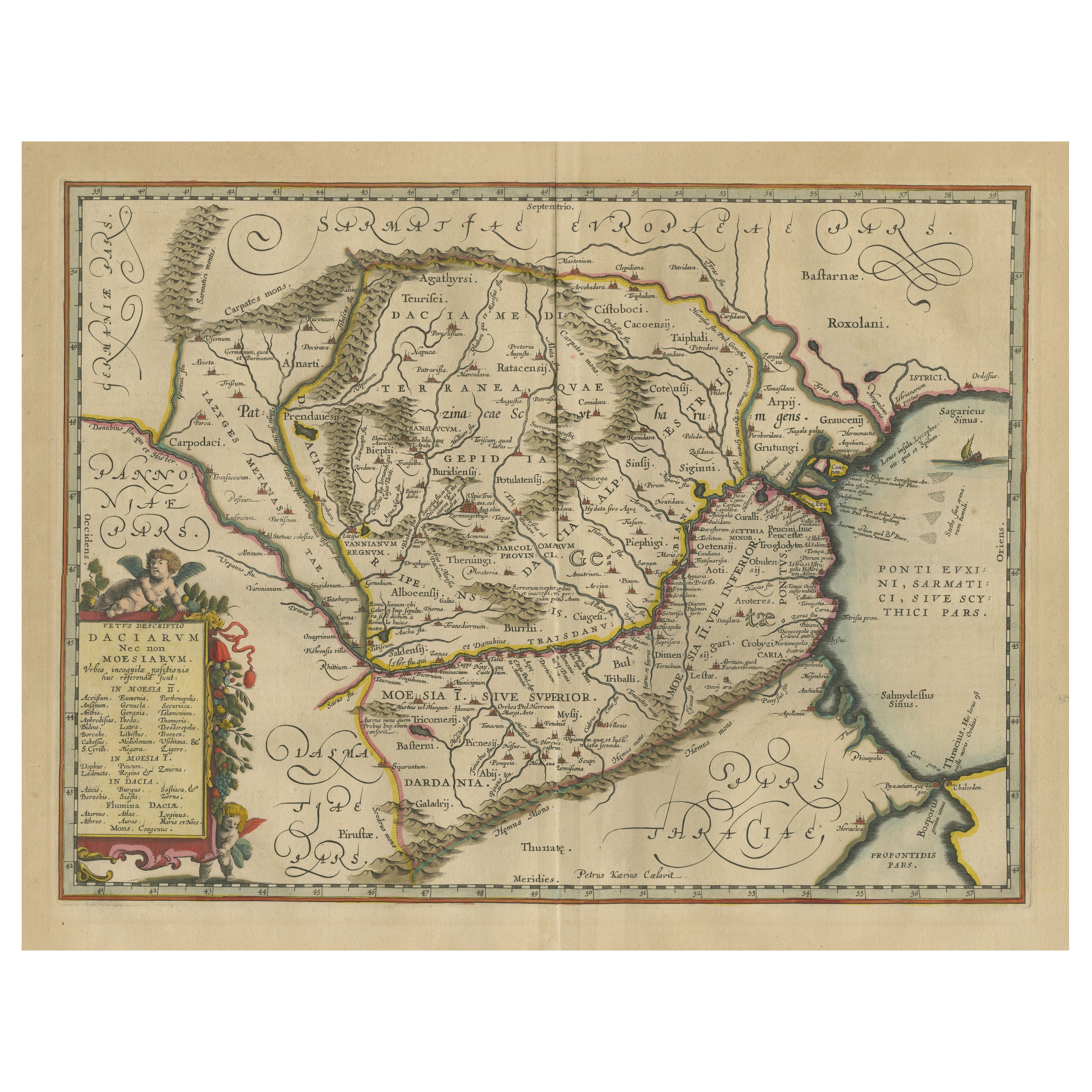
View AllAntique Map of Romania and Bulgaria Centered on the Danube River
Located in Langweer, NL
Antique map titled 'Vetus descriptio Daciarum nec non Moesiarum'. Impressive map of the area of Romania and Bulgaria centered on the Danube River. The map is based on Ortelius' map o...
Category
Antique Mid-17th Century Maps
Materials
Paper
$652 Sale Price
20% Off
Antique Map of the Alsace Region of France by Schenk 'circa 1700'
Located in Langweer, NL
Antique map titled 'Superioris atque Inferioris Alsatiae'. Beautiful map of the Alsace region, from Basel in the south to Philipsburg in the north, centered on Strassburg. Published ...
Category
Antique Early 18th Century Maps
Materials
Paper

$567 Sale Price
20% Off
Antique Map of the Limoges Region in France, c.1690
Located in Langweer, NL
Antique map titled 'Le Diocèse de Limoges'. Large map of the Limoges region, France.
The map is dedicated to the bishop of Limoges, Antoine de Charpin.
Artists and Engravers:...
Category
Antique 17th Century Maps
Materials
Paper

$614 Sale Price
20% Off
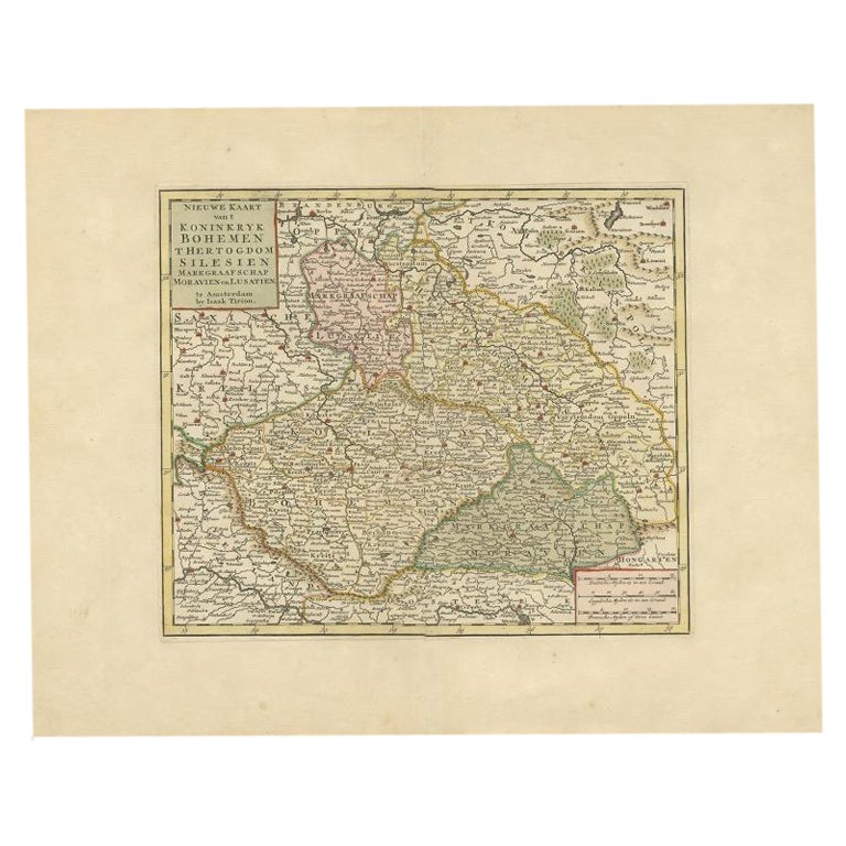
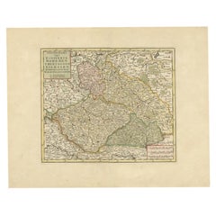
Antique Map of Bohemia in the Present-Day Chech Repubic, 1730
Located in Langweer, NL
Antique map titled 'Nieuwe Kaart van t Koninkryk Bohemen t Hertogdom Silesien markgraafschap Moravien (Moravia) en Lusatien' (Lusatia). Map of Bohemia (Czech Republic) with the surro...
Category
Antique 18th Century Maps
Materials
Paper
$519 Sale Price
20% Off
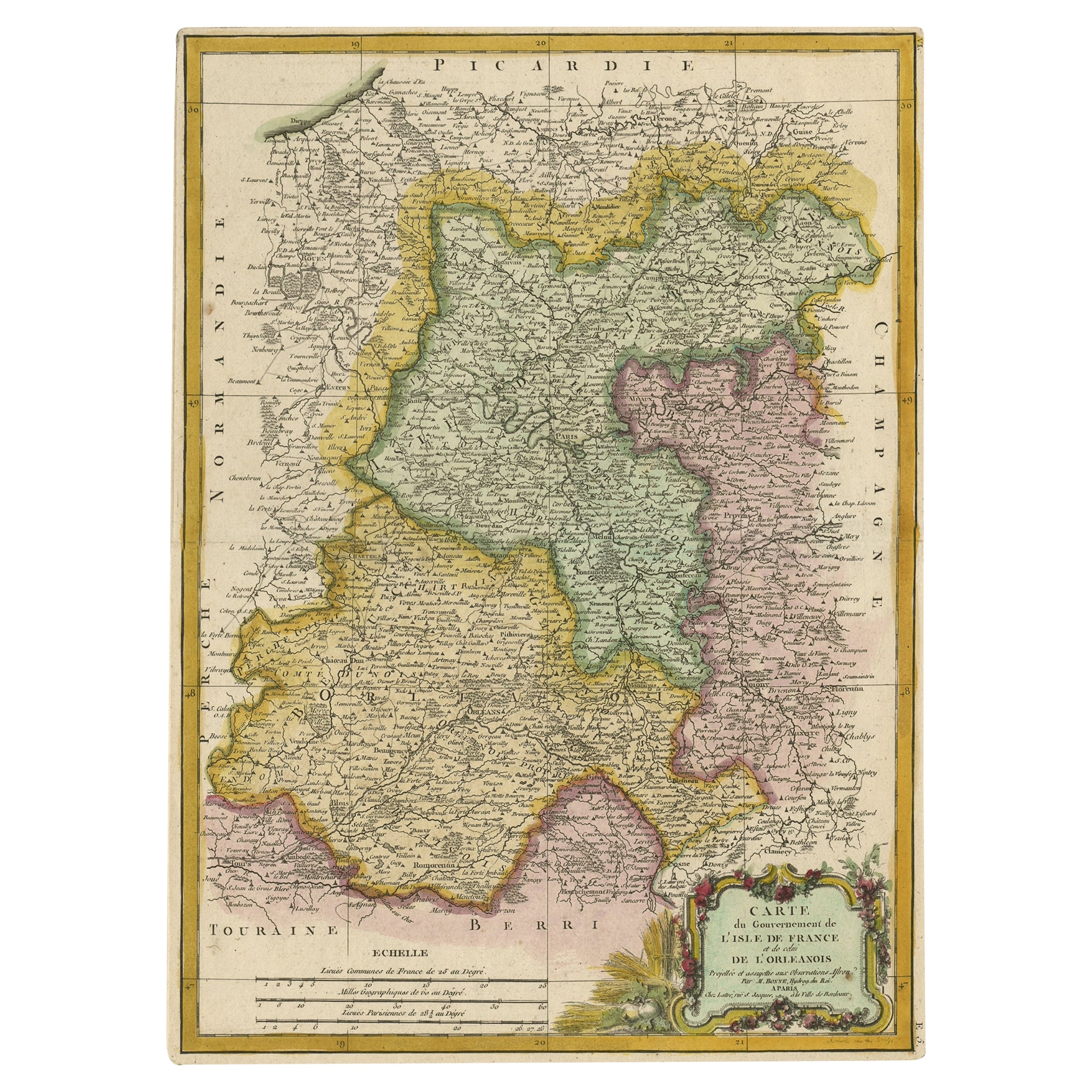
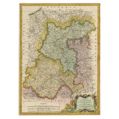
Decorative Rare Map of the French Regions of Isle De France and Orleans, ca.1780
Located in Langweer, NL
Antique map titled 'Carte du Gouvernment de L'Isle de France et de edlui de L'Orleanois (..).'
A fine example of Rigobert Bonne's c. 1780 decorative map of the French regions of ...
Category
Antique 1780s Maps
Materials
Paper
$652 Sale Price
20% Off
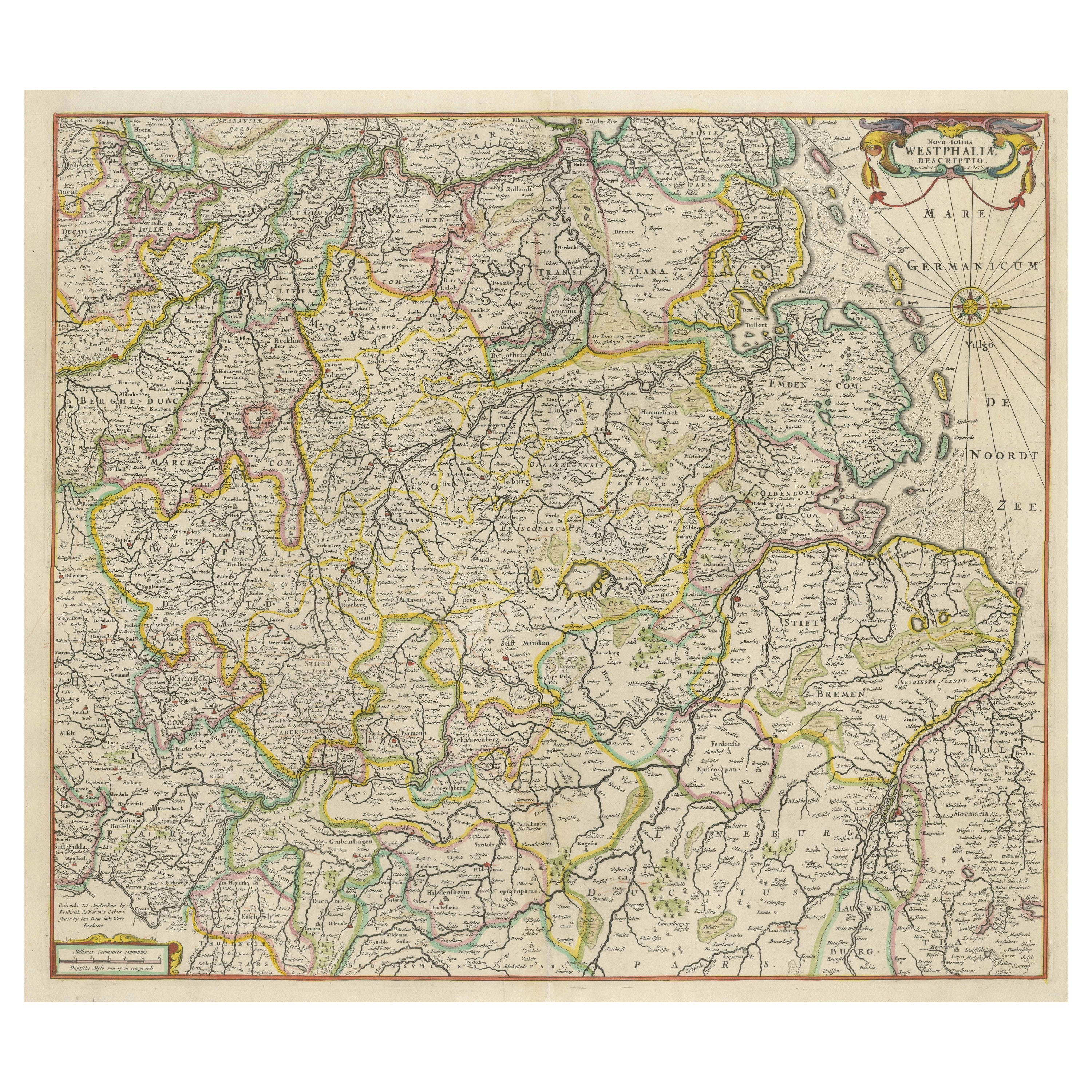
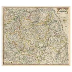
Antique Map of Westphalia, West Orientation
Located in Langweer, NL
Antique map titled 'Nova totius Westphaliae Descriptio'. Detailed map of Westphalia, Northern Germany. Oriented to the west. The area shown extends from Ha...
Category
Antique Late 17th Century Maps
Materials
Paper
$586 Sale Price
20% Off
You May Also Like
17th Century Hand-Colored Map of a Region in West Germany by Janssonius
By Johannes Janssonius
Located in Alamo, CA
This attractive highly detailed 17th century original hand-colored map is entitled "Archiepiscopatus Maghdeburgensis et Anhaltinus Ducatus cum terris adjacentibus". It was published ...
Category
Antique Mid-17th Century Dutch Maps
Materials
Paper

Prussia, Poland, N. Germany, Etc: A Hand-colored 17th Century Map by Janssonius
By Johannes Janssonius
Located in Alamo, CA
This is an attractive hand-colored copperplate engraved 17th century map of Prussia entitled "Prussia Accurate Descripta a Gasparo Henneberg Erlichensi", published in Amsterdam by Joannes Janssonius in 1664. This very detailed map from the golden age of Dutch cartography includes present-day Poland, Latvia, Lithuania, Estonia and portions of Germany. This highly detailed map is embellished by three ornate pink, red, mint green and gold...
Category
Antique Mid-17th Century Dutch Maps
Materials
Paper

1849 Map of "Europaische Russland", 'Meyer Map of European Russia', Ric. R017
Located in Norton, MA
1849 Map of
"Europaische Russland"
( Meyer Map of European Russia)
Ric.r017
A lovely map of European Russia dating to 1849 by Joseph Meyer. It covers the European portions of...
Category
Antique 19th Century Unknown Maps
Materials
Paper

1656 Jansson Map Metz Region of France Entitled "Territorium Metense" Ric0014
Located in Norton, MA
1656 Jansson map Metz Region of France entitled "Territorium Metense."
Ric0014
" Authentic" - Map of the historical region surrounding Metz, in Lorraine, France.
Oriented with ...
Category
Antique 17th Century Dutch Maps
Materials
Paper

1752 Vaugoundy Map of Flanders : Belgium, France, and the Netherlands, Ric.a002
Located in Norton, MA
Large Vaugoundy Map of Flanders:
Belgium, France, and the Netherlands
Colored -1752
Ric.a002
Description: This is a 1752 Didier Robert de Vaugondy map of Flanders. The map de...
Category
Antique 17th Century Unknown Maps
Materials
Paper

Original Antique Map of Hungary, Arrowsmith, 1820
Located in St Annes, Lancashire
Great map of Hungary
Drawn under the direction of Arrowsmith.
Copper-plate engraving.
Published by Longman, Hurst, Rees, Orme and Brown, 1820
Unframed.
Category
Antique 1820s English Maps
Materials
Paper

More Ways To Browse
Antique Hospital Furniture
Gothic Castle
17th Century Watch
Antique Basque
Antique Stop Watch
Early American Chairs
Hans Muller
Vintage Wood Table With Glass Top
19th Century Square Table
Antonio Bonet
Galle Chairs
Large Chinese Rug
1940s Vintage French Art Deco
20th Century Spanish Table
Antonio Bellini
Retro Fiberglass Furniture
Shipping Crate
Antique Oushak Carpets