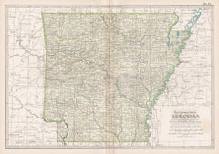
Items Similar to Arkansas Map by Colton, USA Published c.1864 – Hand-Colored County Map
Want more images or videos?
Request additional images or videos from the seller
1 of 10
Arkansas Map by Colton, USA Published c.1864 – Hand-Colored County Map
$384.35
£291.15
€330
CA$532.46
A$597.19
CHF 312.74
MX$7,256.47
NOK 3,971.28
SEK 3,765.05
DKK 2,512.54
About the Item
Arkansas Map by Colton, USA Published c.1864 – Hand-Colored County Map
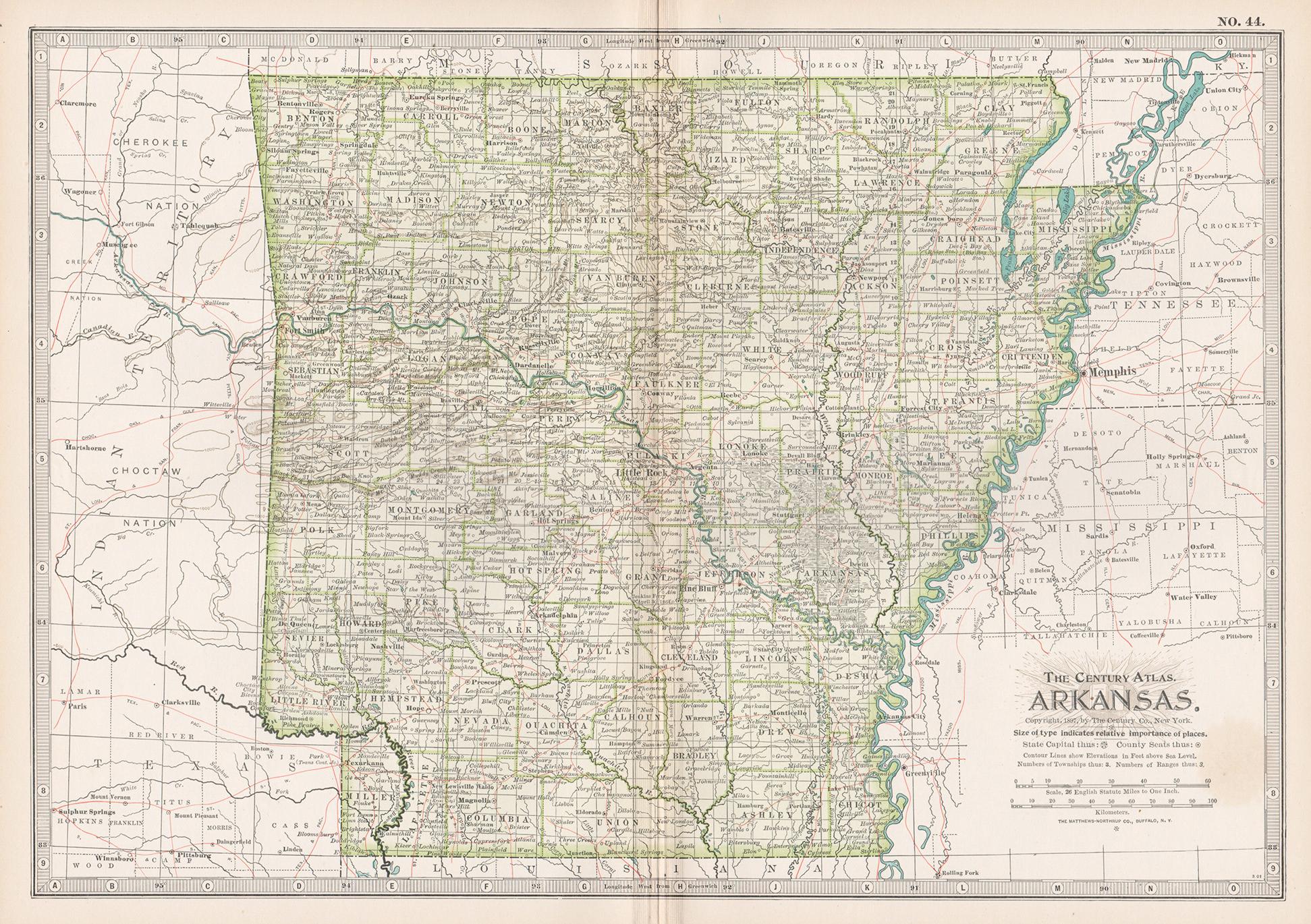
This is a finely engraved and hand-colored map titled Arkansas, published by G.W. & C.B. Colton & Co. in New York circa 1864. It shows the state of Arkansas in detail, with counties individually shaded in pastel pink, green, yellow, and tan colors. The map clearly labels towns, cities, counties, railroads, rivers, and topographical features.
Major towns and cities such as Little Rock, Fort Smith, Helena, Pine Bluff, Camden, and Hot Springs are marked. Railroads are indicated with fine black lines, reflecting the rapid expansion of rail networks in the southern United States after the Civil War. County boundaries are outlined in red for clarity.
Colton was a leading American cartographic publisher in the mid-19th century, known for producing high-quality atlases and wall maps combining accuracy with attractive hand coloring. His maps of U.S. states remain highly collectible for their historic detail, clear layout, and decorative appeal, ideal for Americana collections or interior decoration.
Condition report:
Good condition. Strong impression with original hand coloring remaining bright. Light general age toning and minor marginal spots or handling marks typical for antique atlas maps. No tears or repairs visible. Wide margins and plate mark intact.
Framing suggestion:
Frame with a simple dark wood or black frame and an archival off-white or cream mat to highlight the pastel coloring and engraved detail. Use UV-protective glass to preserve paper quality and prevent fading.
- Dimensions:Height: 14.06 in (35.7 cm)Width: 18 in (45.7 cm)Depth: 0.01 in (0.2 mm)
- Materials and Techniques:
- Place of Origin:
- Period:
- Date of Manufacture:circa 1864
- Condition:Good condition. Strong impression with original hand coloring remaining bright. Light general age toning and minor marginal spots or handling marks typical for antique atlas maps. No tears or repairs visible. Wide margins and plate mark intact.
- Seller Location:Langweer, NL
- Reference Number:Seller: BG-13952-331stDibs: LU3054345729782
About the Seller
5.0
Recognized Seller
These prestigious sellers are industry leaders and represent the highest echelon for item quality and design.
Platinum Seller
Premium sellers with a 4.7+ rating and 24-hour response times
Established in 2009
1stDibs seller since 2017
2,517 sales on 1stDibs
Typical response time: <1 hour
- ShippingRetrieving quote...Shipping from: Langweer, Netherlands
- Return Policy
Authenticity Guarantee
In the unlikely event there’s an issue with an item’s authenticity, contact us within 1 year for a full refund. DetailsMoney-Back Guarantee
If your item is not as described, is damaged in transit, or does not arrive, contact us within 7 days for a full refund. Details24-Hour Cancellation
You have a 24-hour grace period in which to reconsider your purchase, with no questions asked.Vetted Professional Sellers
Our world-class sellers must adhere to strict standards for service and quality, maintaining the integrity of our listings.Price-Match Guarantee
If you find that a seller listed the same item for a lower price elsewhere, we’ll match it.Trusted Global Delivery
Our best-in-class carrier network provides specialized shipping options worldwide, including custom delivery.More From This Seller
View AllAntique Map of Arkansas
Located in Langweer, NL
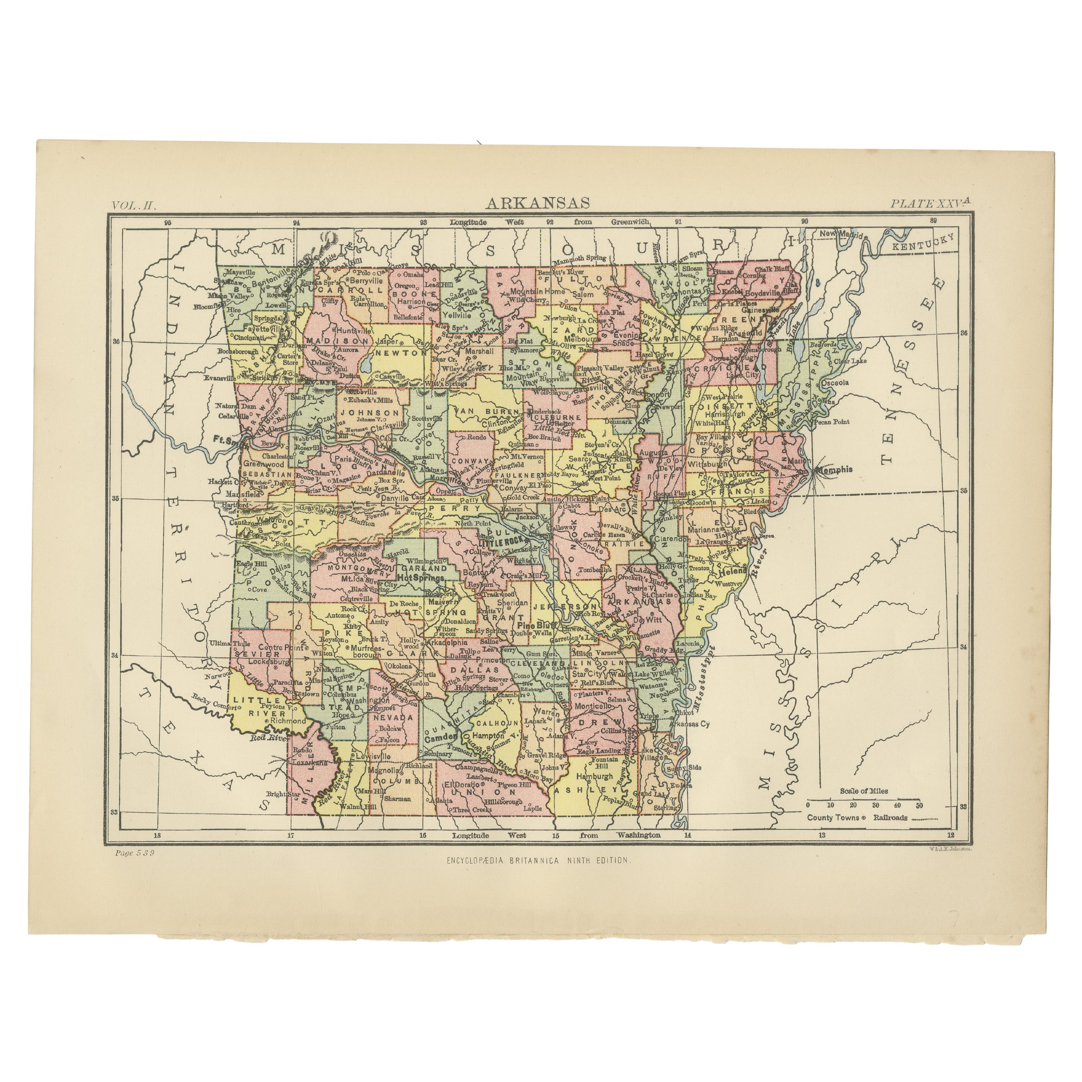
Antique map titled 'Arkansas'. Original antique map of Arkansas, United States. This print originates from 'Encyclopaedia Britannica', Ninth Edition. P...
Category
Antique Late 19th Century Maps
Materials
Paper
$270 Sale Price
20% Off
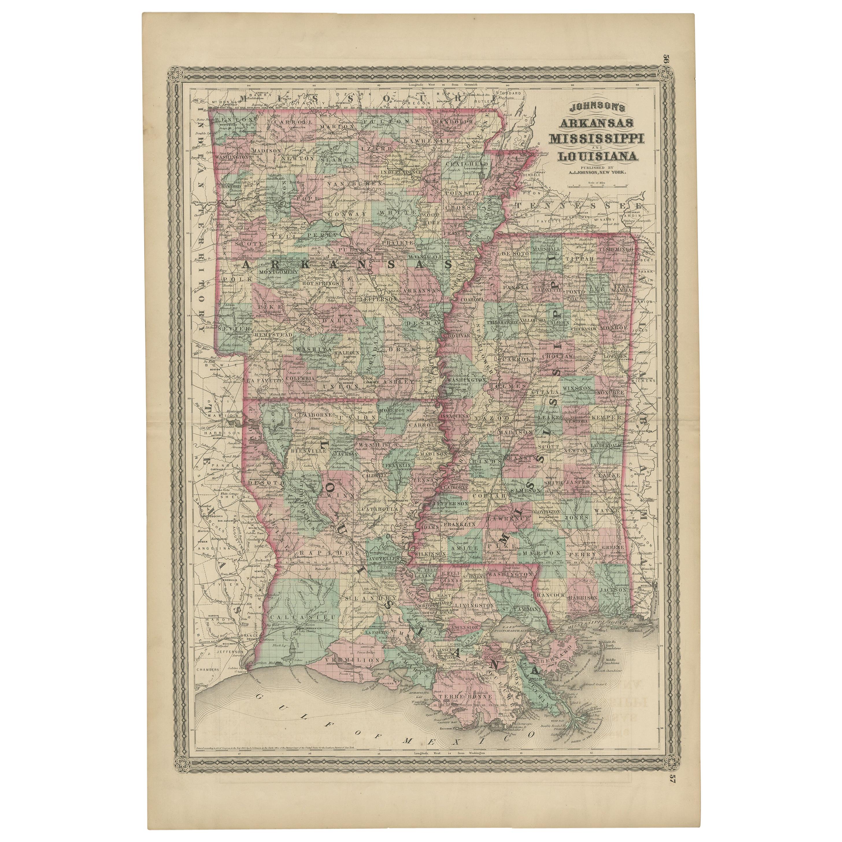
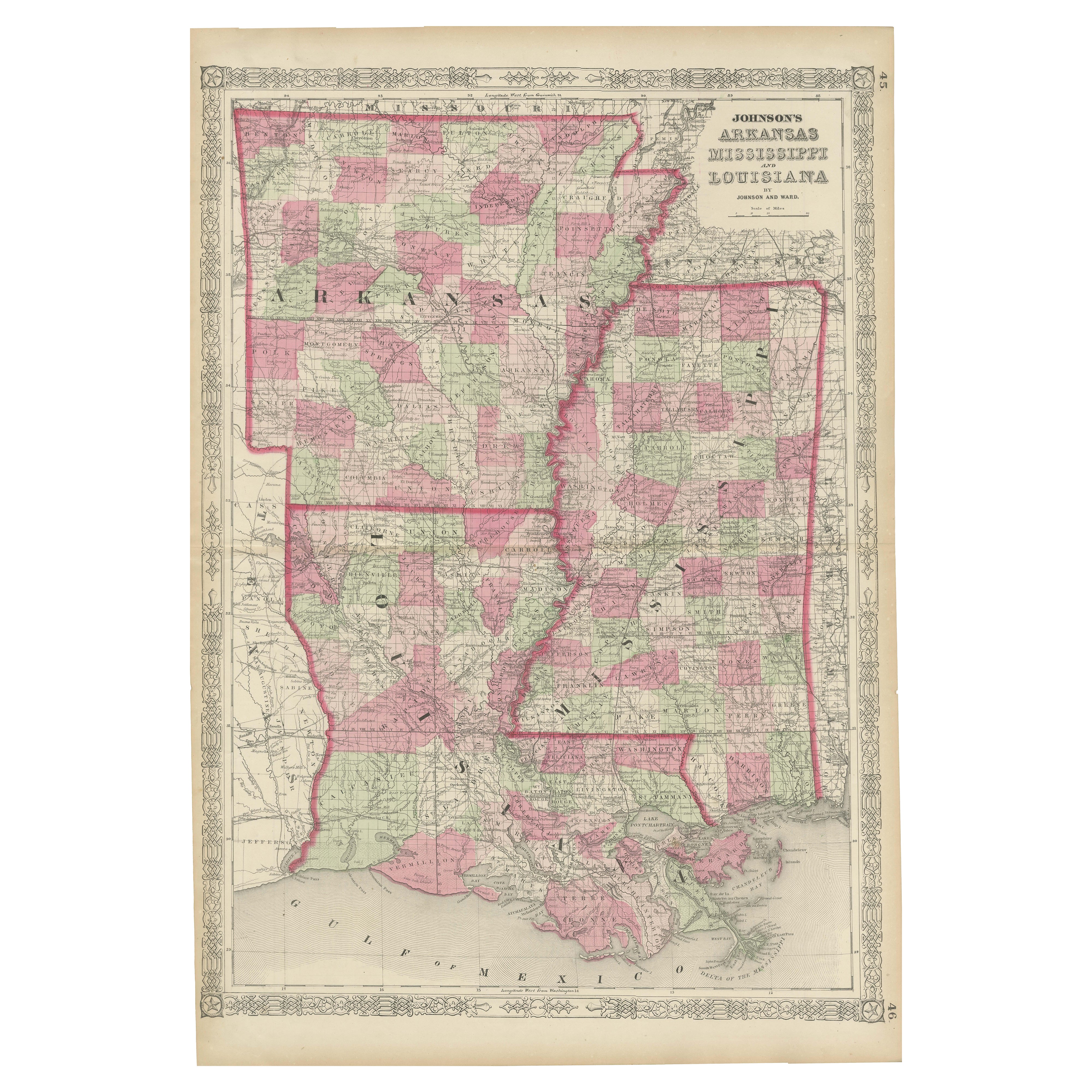
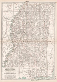
Antique Map of Arkansas, Mississippi and Louisiana by Johnson, 1872
Located in Langweer, NL
Antique map titled 'Johnson's Arkansas (..)'. Original map of Arkansas, Mississippi and Louisiana. This map originates from 'Johnson's New Illustrated ...
Category
Antique Late 19th Century Maps
Materials
Paper

$233 Sale Price
20% Off
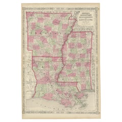
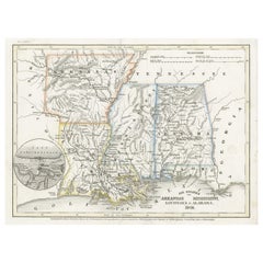
Rare 1864 Civil War Era Map of Arkansas, Mississippi, and Louisiana
Located in Langweer, NL
Title: Rare 1864 Civil War Era Map of Arkansas, Mississippi, and Louisiana
Description: This captivating antique map, titled "Johnson's Arkansas, Mississippi, and Louisiana," was pu...
Category
Antique 1860s Maps
Materials
Paper
Antique Map of the Southern United States with Inset Map of New Orleans
Located in Langweer, NL
Antique map titled 'Die Staaten von Arkansas Mississippi, Louisiana & Alabama'. Detailed map of the region, which includes the Florida Panhandle. Shows many roads, rivers, forts, etc...
Category
Antique Mid-19th Century Maps
Materials
Paper
$130 Sale Price
20% Off
Antique Map of The United States Southern Section by A & C. Black, 1870
Located in Langweer, NL
Antique map titled 'United States Southern Section'. Original antique map of Map of The United States Southern Section. This map originates from ‘Black's General Atlas of The World’....
Category
Antique Late 19th Century Maps
Materials
Paper

$233 Sale Price
20% Off
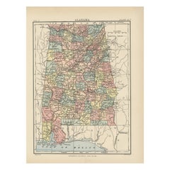
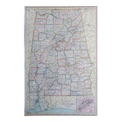
Antique Map of Alabama
Located in Langweer, NL
Antique map titled 'Alabama'. Original antique map of Alabama, United States. This print originates from 'Encyclopaedia Britannica', Ninth Editi...
Category
Antique Late 19th Century Maps
Materials
Paper
$270 Sale Price
20% Off
You May Also Like
Arkansas. USA. Century Atlas state antique vintage map
Located in Melbourne, Victoria
'The Century Atlas. Arkansas.'
Original antique map, 1903.
Central fold as issued. Map name and number printed on the reverse corners.
Sheet 29.5cm by 40cm.
Category
Early 20th Century Victorian More Prints
Materials
Lithograph
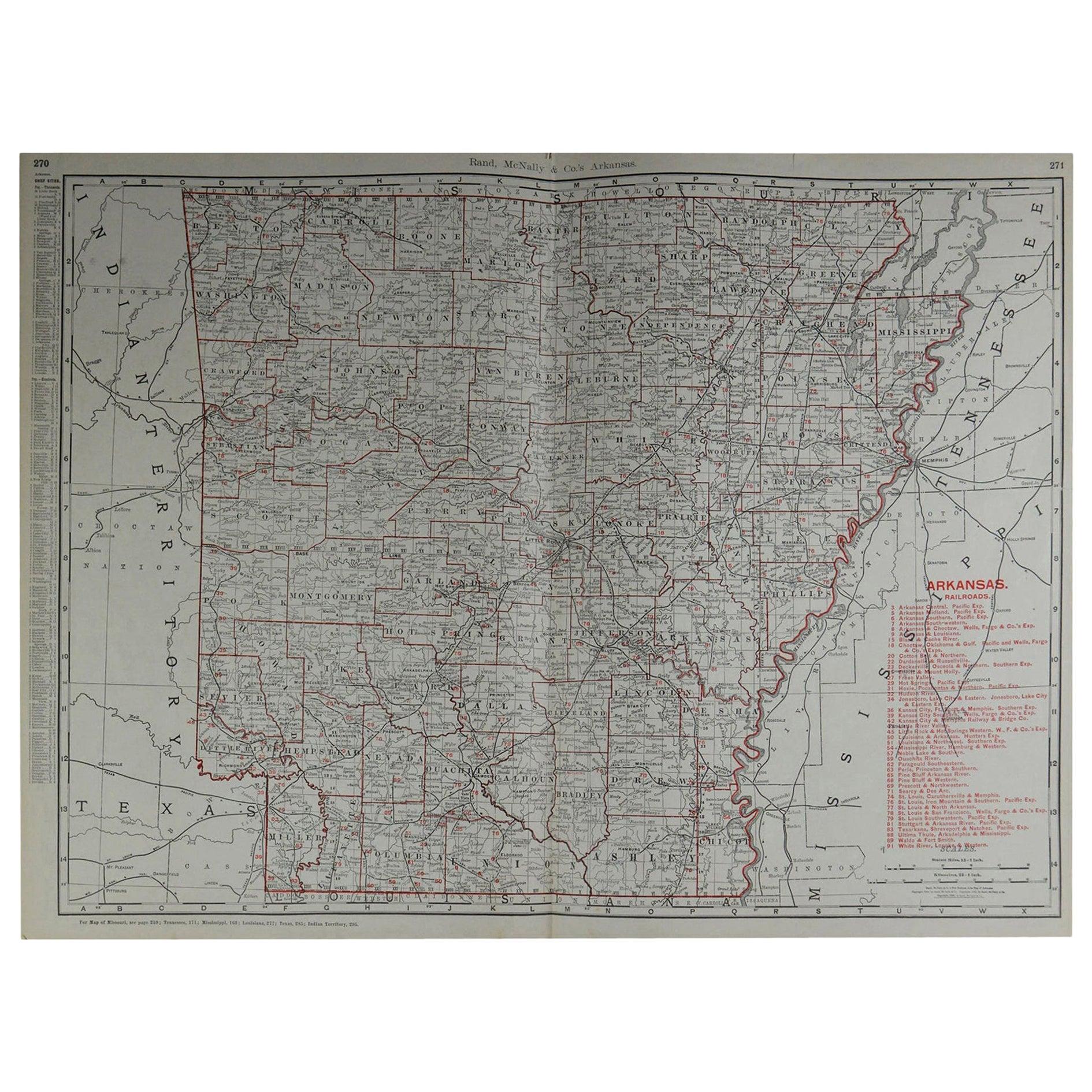
Large Original Antique Map of Arkansas by Rand McNally, circa 1900
By Rand McNally & Co.
Located in St Annes, Lancashire
Fabulous monochrome map with red outline color
Original color
By Rand, McNally & Co.
Published, circa 1900
Unframed
Minor edge tears.
Category
Antique Early 1900s American Edwardian Maps
Materials
Paper

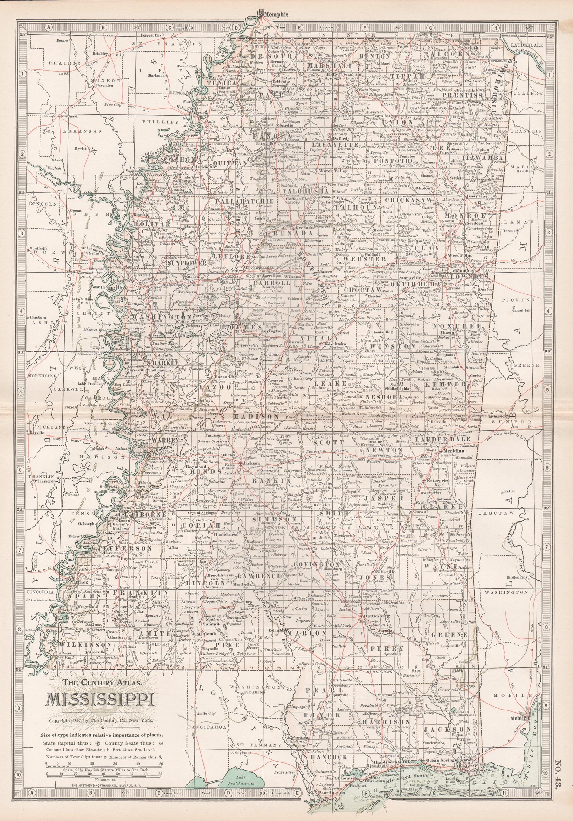
Mississippi. USA Century Atlas state antique vintage map
Located in Melbourne, Victoria
'The Century Atlas. Mississippi'
Original antique map, 1903.
Central fold as issued. Map name and number printed on the reverse corners.
Sheet 40cm by 29.5cm.
Category
Early 20th Century Victorian More Prints
Materials
Lithograph
Original Antique Map of the American State of Mississippi, 1903
Located in St Annes, Lancashire
Antique map of Mississippi
Published By A & C Black. 1903
Original colour
Good condition
Unframed.
Free shipping
Category
Antique Early 1900s English Maps
Materials
Paper

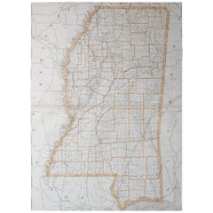
Large Original Antique Map of Mississippi, USA, 1894
By Rand McNally & Co.
Located in St Annes, Lancashire
Fabulous map of Mississippi
Original color
By Rand, McNally & Co.
Published, 1894
Unframed
Free shipping.
Category
Antique 1890s American Maps
Materials
Paper
Large Original Antique Map of Alabama, USA, C.1900
Located in St Annes, Lancashire
Fabulous map of Alabama
Original color
Engraved and printed by the George F. Cram Company, Indianapolis.
Published, C.1900
Unframed
Repair to a minor edge tear top left corner
...
Category
Antique 1890s American Maps
Materials
Paper
More Ways To Browse
Arkansas Furniture
Antique Hot Plate
Used Furniture Little Rock
Antique Black Americana Black Americana
Used Furniture In Arkansas
Off The Wall Antiques
Curved Velvet Couch
Velvet Curved Sofa
Wood Round Coffee Tables
Oak Brutalist
Used College Furniture
Wood Minimalist Chair
Antique Imperial Furniture
Gold Modern Coffee Table
Large Side Tables
18th Century Gilded Furniture
Fluted Column
Japanese Silver Ceramics