Items Similar to Dakota Territory Railroad Map 1888 – Rand McNally Antique Lithograph
Want more images or videos?
Request additional images or videos from the seller
1 of 11
Dakota Territory Railroad Map 1888 – Rand McNally Antique Lithograph
$550
£406.71
€460
CA$761.11
A$847.45
CHF 441
MX$10,228.58
NOK 5,530.51
SEK 5,223.92
DKK 3,502.92
About the Item
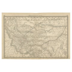
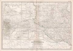
Antique Map of Dakota Territory – Rand McNally Railroad Map, 1888
This detailed 1888 map of Dakota by Rand, McNally & Co. captures the region in the final year before its division into the states of North Dakota and South Dakota in 1889. At the time, Dakota Territory was undergoing rapid transformation, driven by the expansion of railroads, settlement, and the ongoing reduction of Native American lands through government treaties and agreements. The map offers an extraordinary snapshot of this transitional moment in American history.
The map highlights Dakota’s counties, many of which existed only briefly in name before being reorganized or absorbed after statehood. Examples include Wallace, Garfield, and Boreman counties, now lost to history. The depiction of railroads is especially striking, with red and blue lines marking major routes of the Chicago, Milwaukee & St. Paul, the Chicago & North Western, the St. Paul, Minneapolis & Manitoba, and the Northern Pacific. These lines illustrate the importance of railroads in connecting the prairies with larger markets, fueling settlement, and reshaping the territory’s economy.
Equally significant are the numerous Native American reservations and agencies that dominate the western and central parts of the territory. The Rosebud and Pine Ridge Reservations, Standing Rock, and Yankton Agencies are all clearly marked, as are Fort Bennett, Fort Randall, Fort Stevenson, and Fort Totten, reminders of the ongoing military presence in the region. The map also notes diminished reservations, such as Garfield County’s proposed reductions under the agreement of December 14, 1886. Together, these features underscore the contested nature of the land at this time, where Indigenous communities faced forced resettlement and encroachment from settlers.
Geographical features are carefully engraved, including the Missouri River winding through the center of the territory, the Black Hills with Custer, Deadwood, and Rapid City, and smaller rivers and lakes such as Lake Traverse and Big Stone Lake. Towns like Sioux Falls, Fargo, Bismarck, Huron, Aberdeen, and Yankton appear alongside smaller frontier settlements and railway stations, charting the spread of population across the plains.
This map is not only a fine example of Rand, McNally & Co.’s precision and cartographic style but also an invaluable historical artifact, illustrating Dakota at a moment of political, cultural, and economic transformation. For collectors of American frontier history, railroadiana, or maps of the Great Plains, it provides a rich and compelling piece of the past.
Condition: Good, with some age toning, light foxing, and minor edge wear consistent with age. Plate mark faintly visible. No major tears or losses; paper remains strong.
Framing tips: A dark wood frame with a cream or light tan mat would emphasize the historic character of the map. Alternatively, a black frame with a double mat (cream over dark brown) would provide contrast and highlight the railroad detail.
Technique: Lithograph with printed color
Maker: Rand, McNally & Co., Chicago, 1888
- Dimensions:Height: 20.67 in (52.5 cm)Width: 14.18 in (36 cm)Depth: 0.01 in (0.2 mm)
- Materials and Techniques:Paper,Engraved
- Place of Origin:
- Period:
- Date of Manufacture:1888
- Condition:Condition: Good, with some age toning, light foxing, and minor edge wear consistent with age. Plate mark faintly visible. No major tears or losses; paper remains strong.
- Seller Location:Langweer, NL
- Reference Number:Seller: BG-12794-531stDibs: LU3054346382042
About the Seller
5.0
Recognized Seller
These prestigious sellers are industry leaders and represent the highest echelon for item quality and design.
Platinum Seller
Premium sellers with a 4.7+ rating and 24-hour response times
Established in 2009
1stDibs seller since 2017
2,587 sales on 1stDibs
Typical response time: <1 hour
- ShippingRetrieving quote...Shipping from: Langweer, Netherlands
- Return Policy
Authenticity Guarantee
In the unlikely event there’s an issue with an item’s authenticity, contact us within 1 year for a full refund. DetailsMoney-Back Guarantee
If your item is not as described, is damaged in transit, or does not arrive, contact us within 7 days for a full refund. Details24-Hour Cancellation
You have a 24-hour grace period in which to reconsider your purchase, with no questions asked.Vetted Professional Sellers
Our world-class sellers must adhere to strict standards for service and quality, maintaining the integrity of our listings.Price-Match Guarantee
If you find that a seller listed the same item for a lower price elsewhere, we’ll match it.Trusted Global Delivery
Our best-in-class carrier network provides specialized shipping options worldwide, including custom delivery.More From This Seller
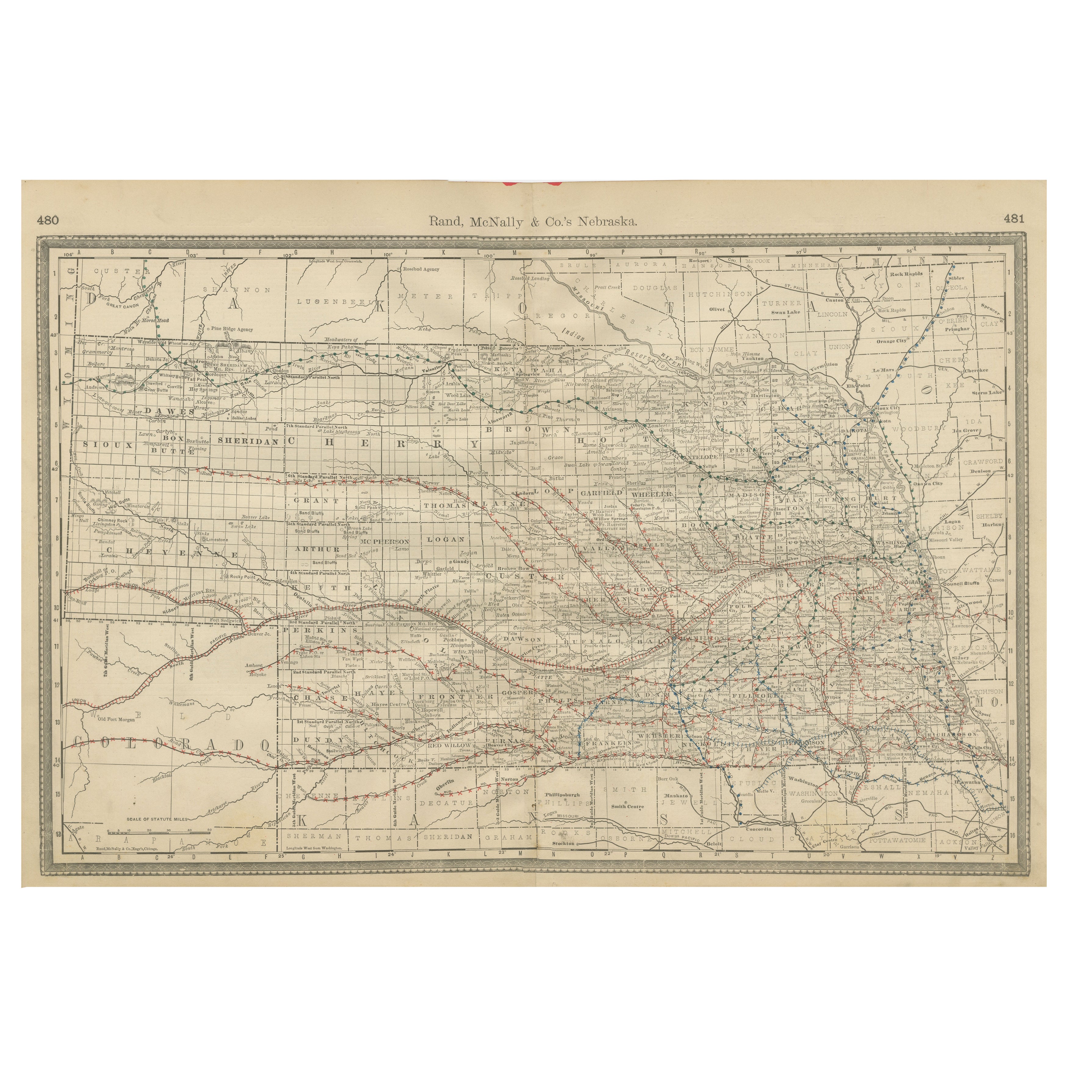
View AllNebraska Railroad Map 1888 – Rand McNally Antique Lithograph
Located in Langweer, NL
Nebraska Railroad Map 1888 – Rand McNally Antique Lithograph
This finely detailed map of Nebraska, published by Rand, McNally & Co. in 1888, provides an excellent overview of the st...
Category
Antique Late 19th Century American Maps
Materials
Paper
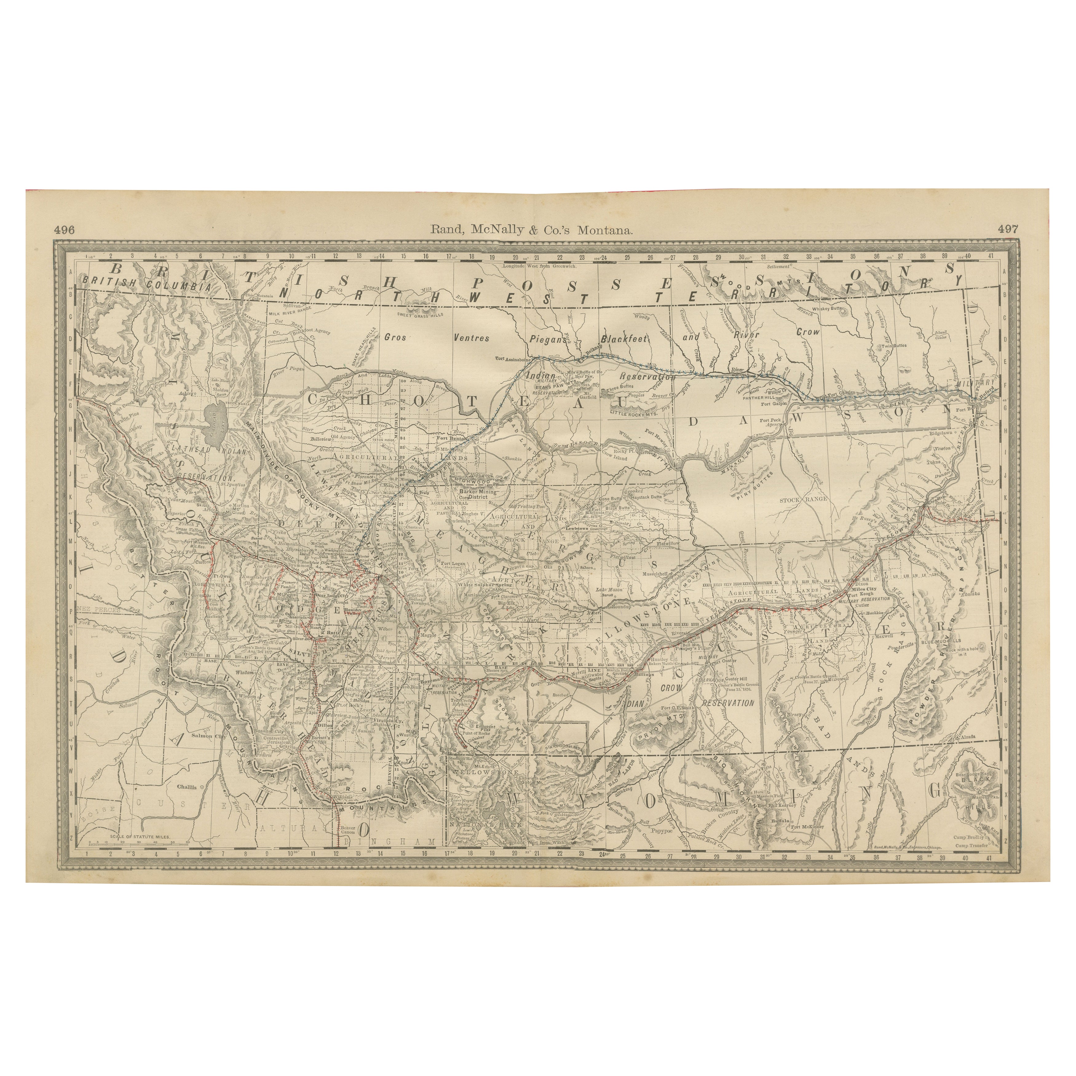
Old Map of Montana – Railroads, Indian Reservations & Frontier Settlements 1888
Located in Langweer, NL
Antique Map of Montana – Railroads, Indian Reservations & Frontier Settlements, 1888
This antique engraved map depicts the Territory of Montana in 1888, engraved and published by Ra...
Category
Antique Late 19th Century American Maps
Materials
Paper
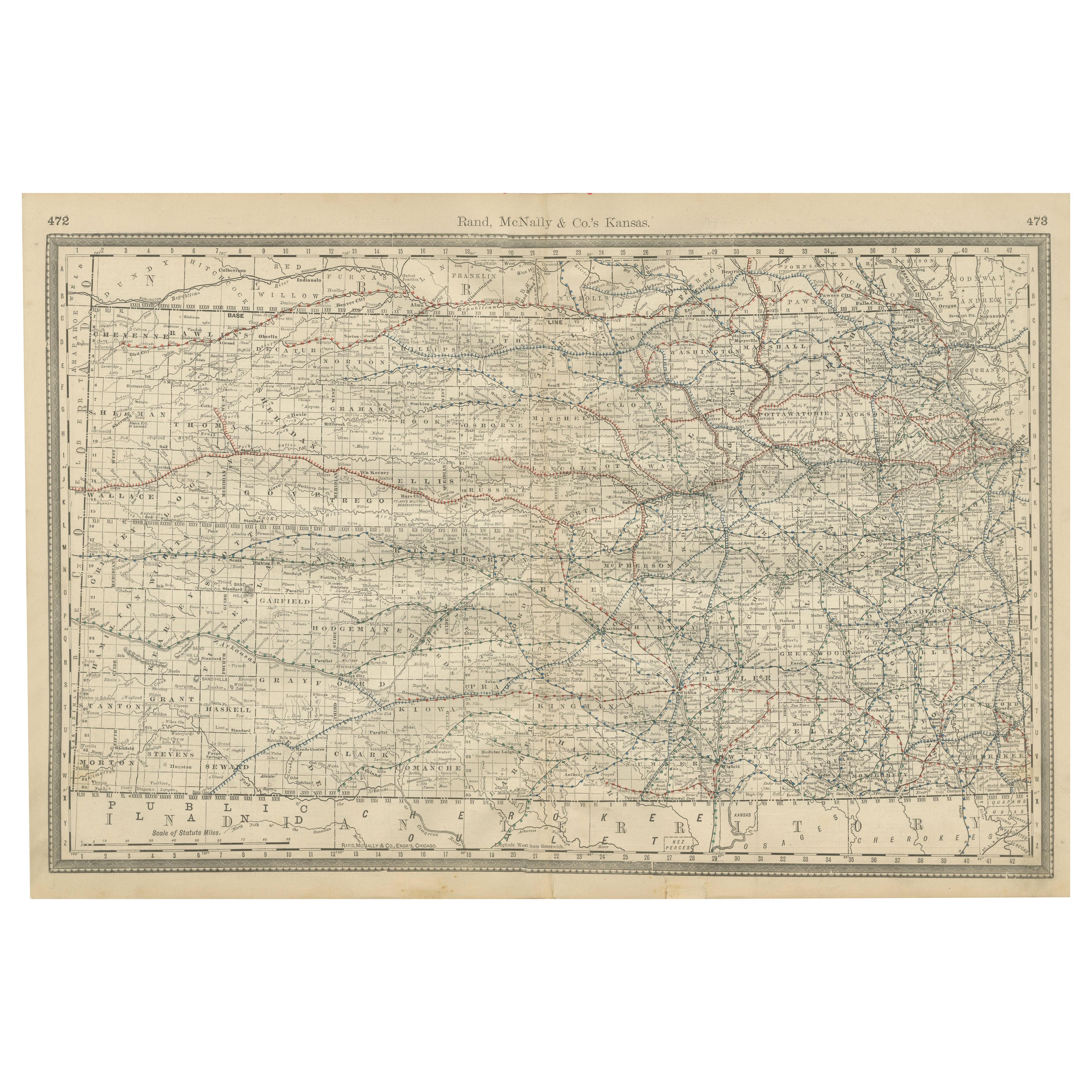
Kansas Railroad Map 1888 – Rand McNally Antique Lithograph
Located in Langweer, NL
Kansas Railroad Map 1888 – Rand McNally Antique Lithograph
This antique 1888 map of Kansas by Rand, McNally & Co. offers a detailed view of the state during a period of rapid expans...
Category
Antique Late 19th Century American Maps
Materials
Paper
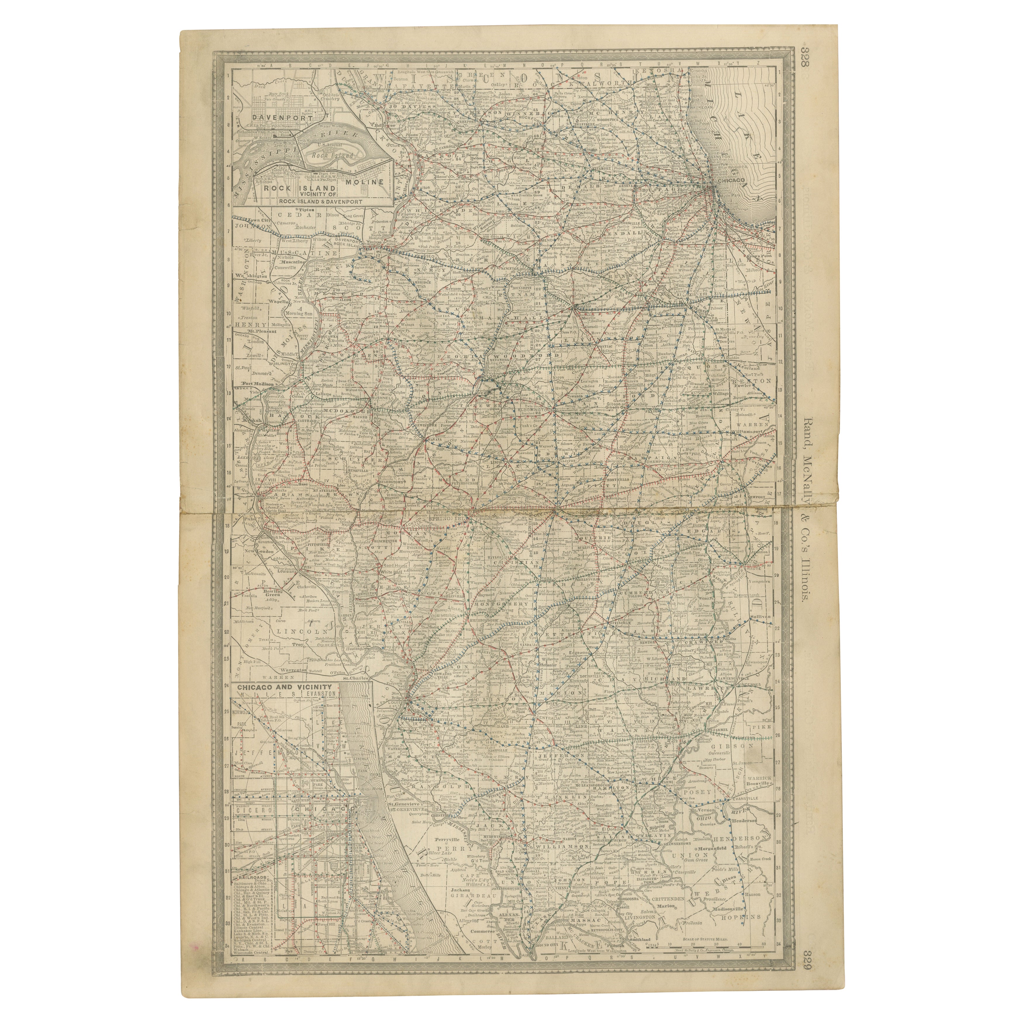
Detailed Antique Map of Illinois – Railroads, Cities & Counties, 1888
Located in Langweer, NL
Antique Map of Illinois – Railroads, Cities & Counties, 1888
This finely detailed antique map shows the state of Illinois in the late 19th century, engraved and published in 1888 by...
Category
Antique Late 19th Century American Maps
Materials
Paper

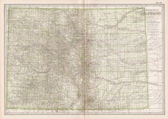
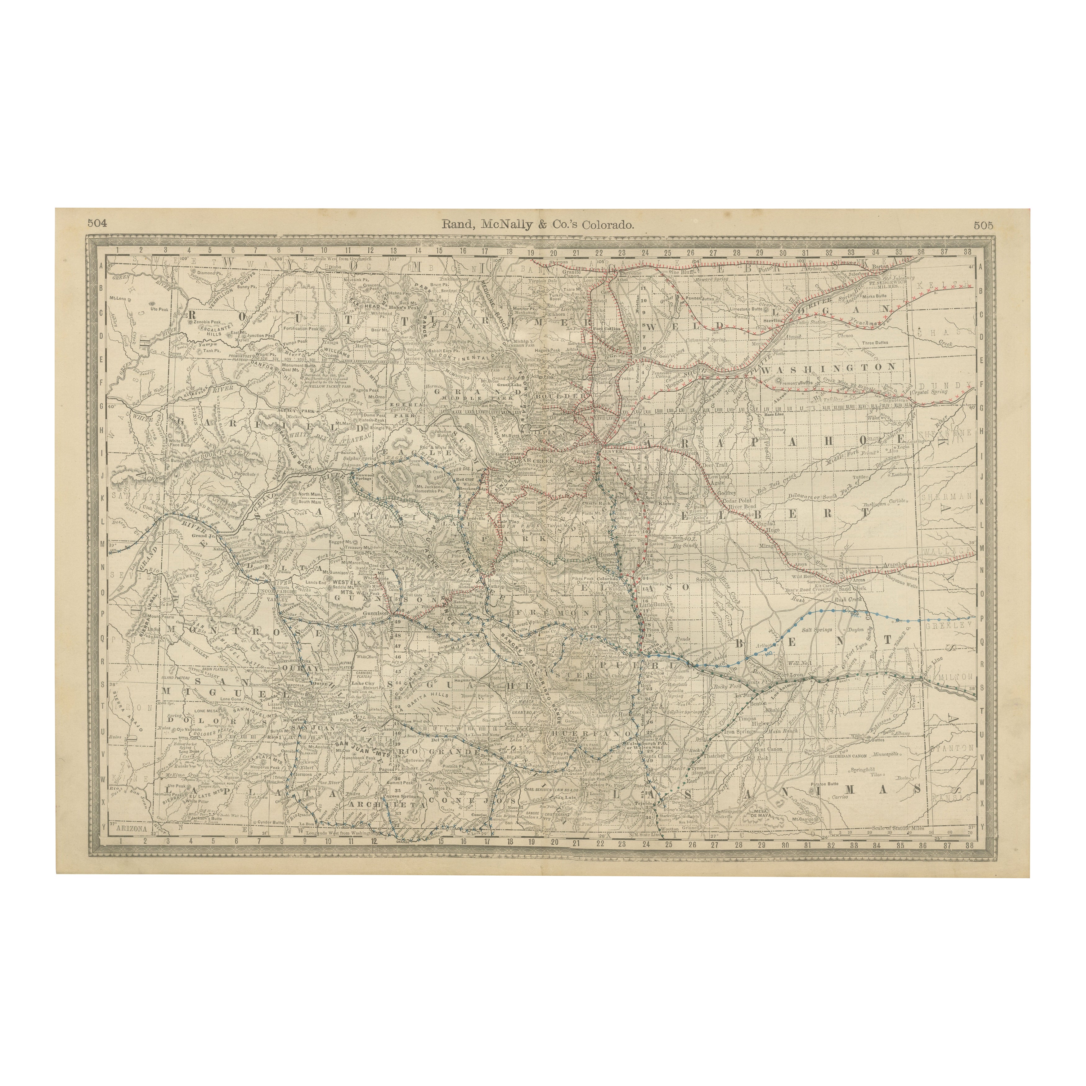
1888 Colorado Map – The Centennial State’s Railroads, Mines & Counties
Located in Langweer, NL
Antique Map of Colorado – Railroads, Mining Towns & Counties, 1888
This antique engraved map depicts the state of Colorado in 1888, published by Rand, McNally & Co. in Chicago for t...
Category
Antique Late 19th Century American Maps
Materials
Paper
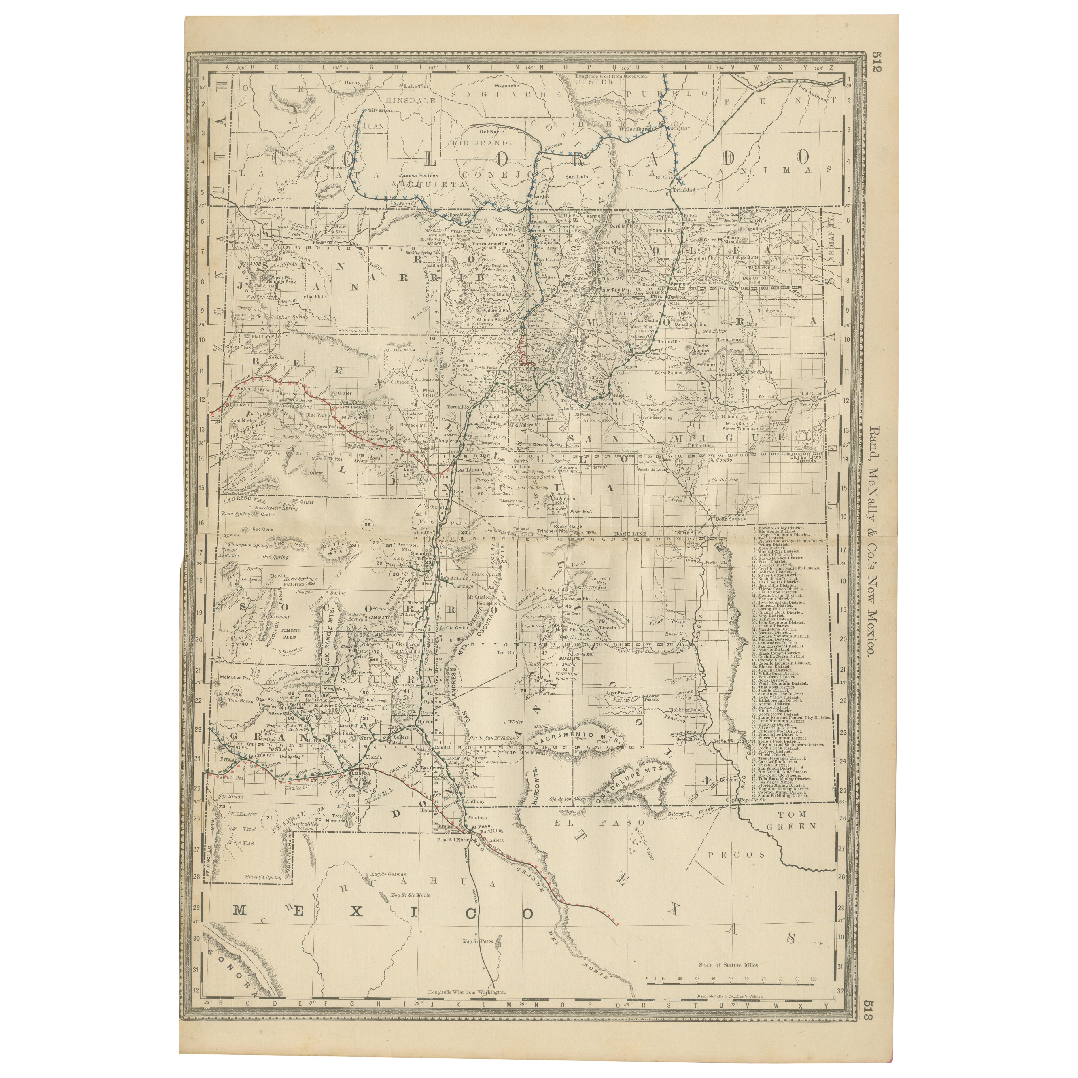
1888 New Mexico Map – Railroads, Counties & The Land of Enchantment
Located in Langweer, NL
Antique Map of New Mexico – Railroads, Counties & Frontier Settlements, 1888
This antique engraved map depicts the Territory of New Mexico in 1888, engraved and published by Rand, M...
Category
Antique Late 19th Century American Maps
Materials
Paper

You May Also Like
Original Antique Map of the American State of South Dakota, 1903
Located in St Annes, Lancashire
Antique map of South Dakota
Published By A & C Black. 1903
Original colour
Good condition
Unframed.
Free shipping
Category
Antique Early 1900s English Maps
Materials
Paper

Original Antique Map of South Dakota by Rand McNally, circa 1900
By Rand McNally & Co.
Located in St Annes, Lancashire
Fabulous monochrome map with red outline color
Original color
By Rand, McNally & Co.
Published, circa 1900
Unframed
Minor edge tears.
Category
Antique Early 1900s American Edwardian Maps
Materials
Paper

Original Antique Map of the American State of Colorado, 1903
Located in St Annes, Lancashire
Antique map of Colorado
Published By A & C Black. 1903
Original colour
Good condition
Unframed.
Free shipping
Category
Antique Early 1900s English Maps
Materials
Paper

Original 1917 Railroad Map of Washington State railway map
Located in Spokane, WA
This is an Original Lithograph Vintage Railroad Map of Washington State; it is not a reproduction.
“Railroad Map of Washington, 1917, The Public Servi...
Category
1910s Academic Landscape Prints
Materials
Lithograph
$680 Sale Price
20% Off
South Dakota. USA. Century Atlas state antique vintage map
Located in Melbourne, Victoria
'The Century Atlas. South Dakota.'
Original antique map, 1903.
Central fold as issued. Map name and number printed on the reverse corners.
Sheet 29.5cm ...
Category
Early 20th Century Victorian More Prints
Materials
Lithograph
Colorado. USA. Century Atlas state antique vintage map
Located in Melbourne, Victoria
'The Century Atlas. Colorado.'
Original antique map, 1903.
Central fold as issued. Map name and number printed on the reverse corners.
Sheet 29.5cm by 40cm.
Category
Early 20th Century Victorian More Prints
Materials
Lithograph