Items Similar to Dresden Germany, Old Town Plan by Baldwin & Cradock 1833
Want more images or videos?
Request additional images or videos from the seller
1 of 8
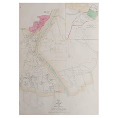
Dresden Germany, Old Town Plan by Baldwin & Cradock 1833
$287.80
£214.10
€240
CA$394.10
A$438.19
CHF 228.80
MX$5,333.79
NOK 2,919.35
SEK 2,735.29
DKK 1,826.99
Shipping
Retrieving quote...The 1stDibs Promise:
Authenticity Guarantee,
Money-Back Guarantee,
24-Hour Cancellation
About the Item
Dresden, depicted in this antique map by Baldwin & Cradock from 1833, was a historically significant city in Saxony, Germany. This map, published under the supervision of the Society for the Diffusion of Useful Knowledge, offers an intricate look at Dresden and its surrounding areas, showing the urban layout as it was in the early 19th century. Hand-colored and finely engraved, the map highlights landmarks, streets, fortifications, and the flowing course of the Elbe River. The old town area is distinctively marked, reflecting Dresden's status as a major center of art, culture, and commerce during that period.
Dresden, often called the "Florence on the Elbe" due to its remarkable art collections and Baroque architecture, was an important cultural hub in Europe. During the 18th and 19th centuries, Dresden flourished as the capital of the Kingdom of Saxony, known for its royal palace, the Frauenkirche, Zwinger Palace, and numerous museums. This map captures the grandeur of Dresden before many modern changes reshaped its layout, preserving a snapshot of its historical prominence.
World War II brought tragedy to Dresden. On February 13-15, 1945, Allied forces bombed the city in a series of devastating air raids, leading to widespread destruction. The beautiful Baroque and Rococo architecture, as well as significant cultural and historical buildings, were reduced to rubble. The bombings killed tens of thousands of people and erased centuries of architectural heritage, turning Dresden from a symbol of cultural prosperity to a stark example of the devastation of war. The post-war years saw considerable reconstruction efforts to restore some of its lost landmarks, and Dresden today stands as a city that has rebuilt itself while still bearing the scars of its wartime past.
This map provides historical context to Dresden's cityscape before the devastation of World War II, offering an invaluable look into the original layout and splendor of this once culturally rich city. It is a powerful reminder of Dresden's historical importance and the profound impact of the war on European cities.
Condition report: The map is in very good condition, with minor aging and some slight toning along the margins, typical for a piece of this age.
- Dimensions:Height: 13.39 in (34 cm)Width: 15.95 in (40.5 cm)Depth: 0.01 in (0.2 mm)
- Materials and Techniques:
- Period:
- Date of Manufacture:1833
- Condition:Condition report: The map is in very good condition, with minor aging and some slight toning along the margins, typical for a piece of this age.
- Seller Location:Langweer, NL
- Reference Number:Seller: BG-13842-151stDibs: LU3054342579052
About the Seller
5.0
Recognized Seller
These prestigious sellers are industry leaders and represent the highest echelon for item quality and design.
Platinum Seller
Premium sellers with a 4.7+ rating and 24-hour response times
Established in 2009
1stDibs seller since 2017
2,511 sales on 1stDibs
Typical response time: <1 hour
- ShippingRetrieving quote...Shipping from: Langweer, Netherlands
- Return Policy
Authenticity Guarantee
In the unlikely event there’s an issue with an item’s authenticity, contact us within 1 year for a full refund. DetailsMoney-Back Guarantee
If your item is not as described, is damaged in transit, or does not arrive, contact us within 7 days for a full refund. Details24-Hour Cancellation
You have a 24-hour grace period in which to reconsider your purchase, with no questions asked.Vetted Professional Sellers
Our world-class sellers must adhere to strict standards for service and quality, maintaining the integrity of our listings.Price-Match Guarantee
If you find that a seller listed the same item for a lower price elsewhere, we’ll match it.Trusted Global Delivery
Our best-in-class carrier network provides specialized shipping options worldwide, including custom delivery.More From This Seller
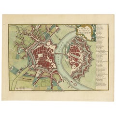
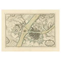
View AllOriginal Antique Map of Dresden, Germany by J. Stockdale, 1800
Located in Langweer, NL
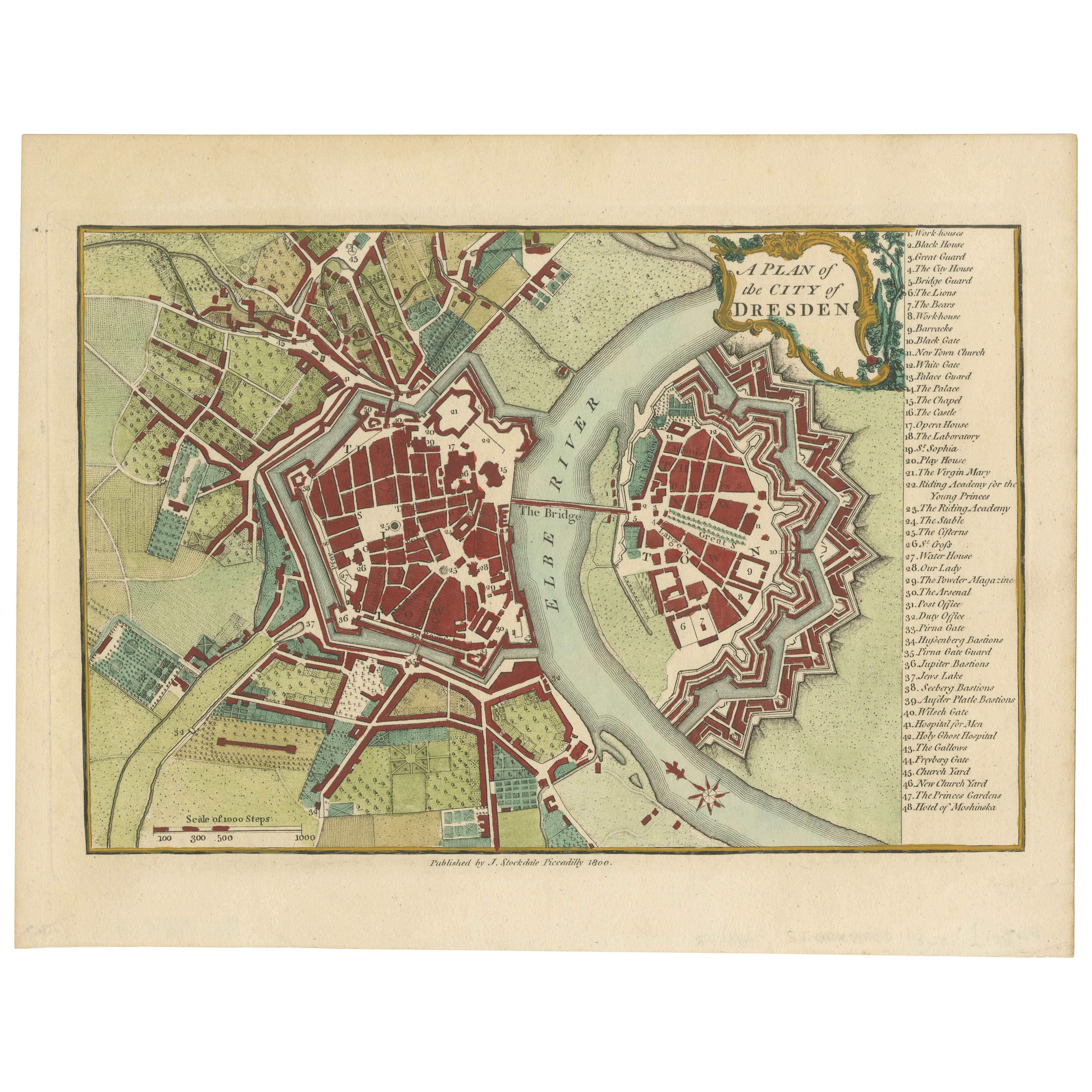
Vintage Map of Dresden, Germany by J. Stockdale, 1800
This vintage map titled "A Plan of the City of Dresden" was published by J. Stockdale in Piccadilly, London, in 1800. It provid...
Category
Antique Early 1800s Maps
Materials
Paper
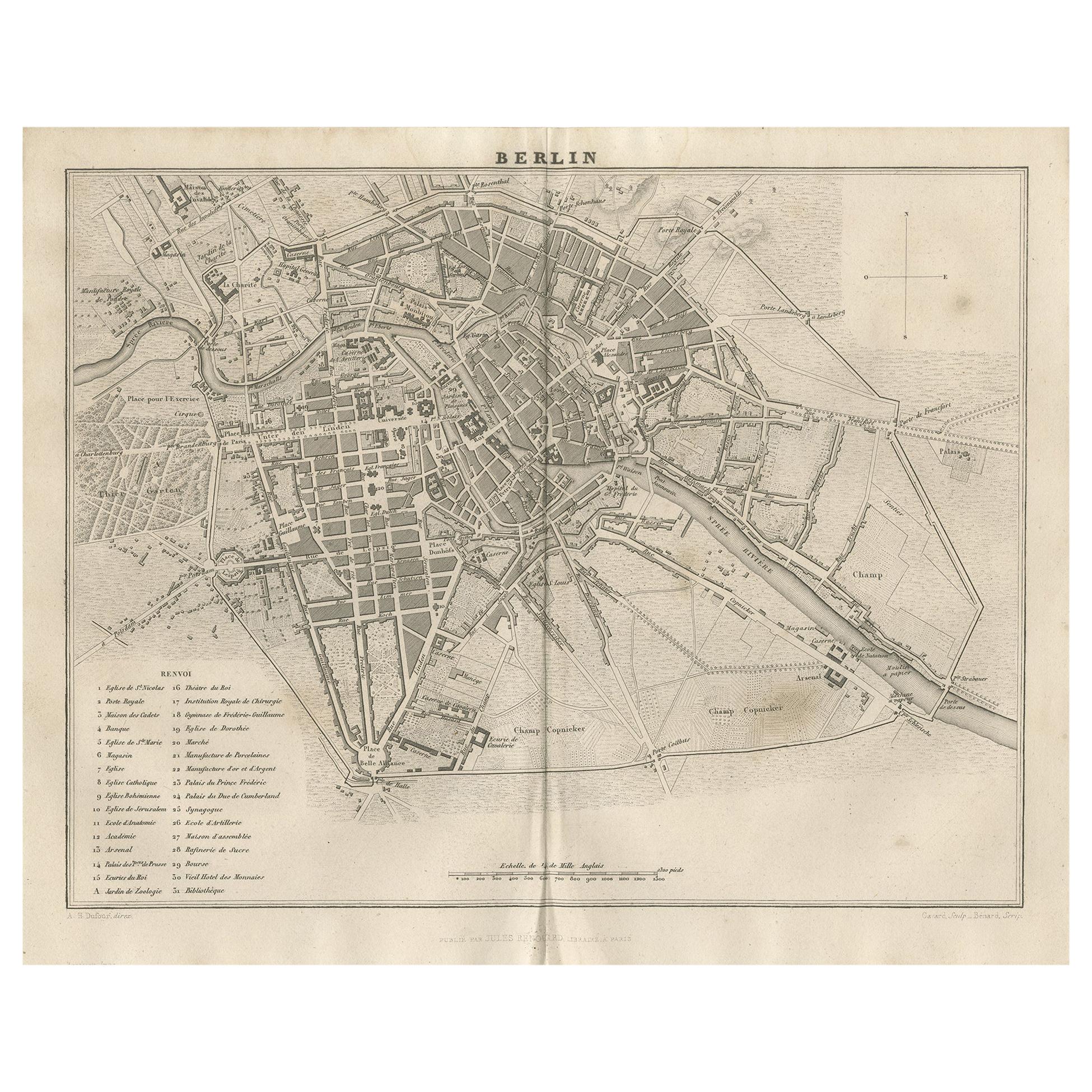
Antique Map of the City of Berlin in Germany, '1847'
Located in Langweer, NL
Antique map titled 'Berlin'. Original antique map of the city of Berlin, Germany. This map originates from 'Abrégé de Géographie (..)' by Adrien Balbi. Published 1847.
Category
Antique Mid-19th Century Maps
Materials
Paper

$143 Sale Price
20% Off
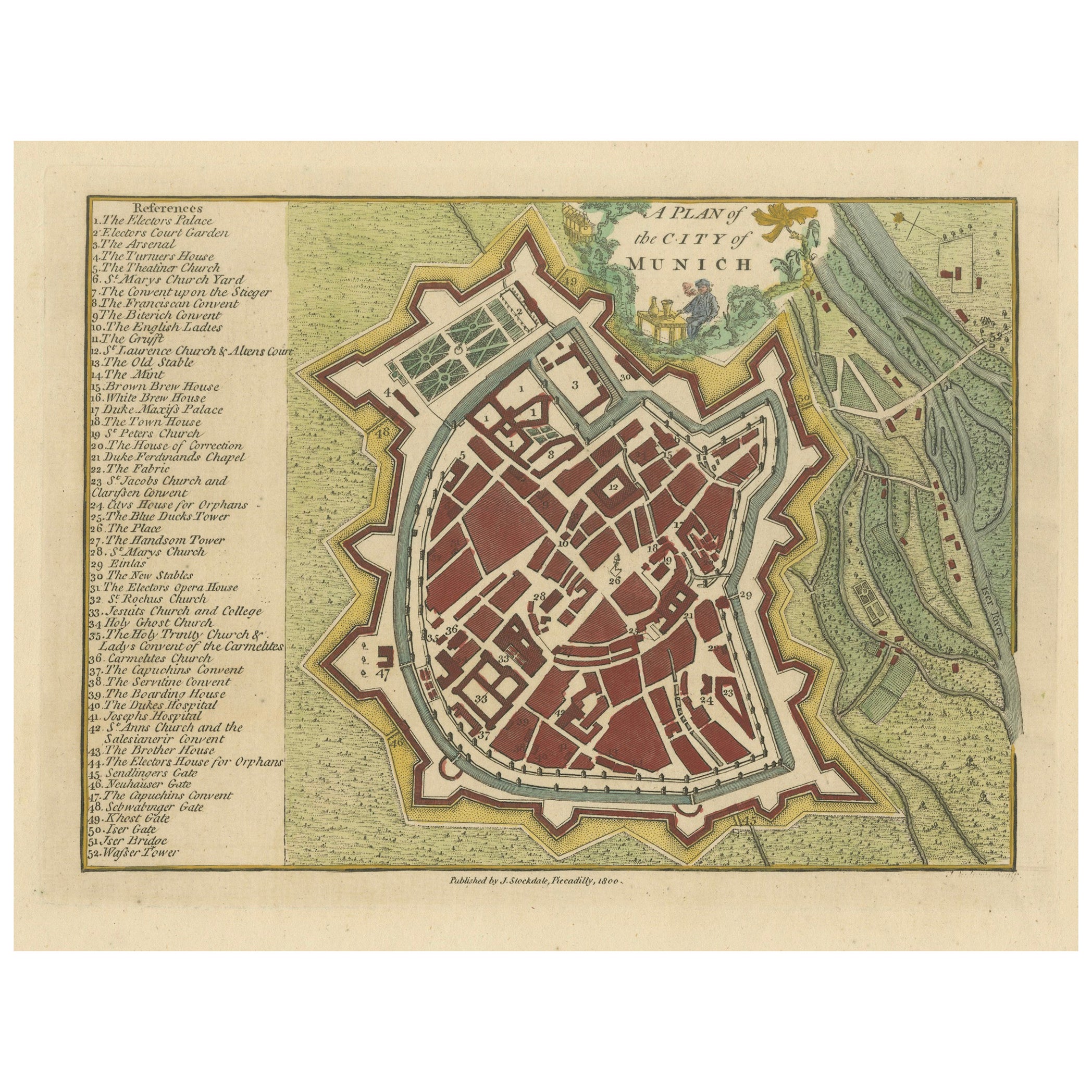
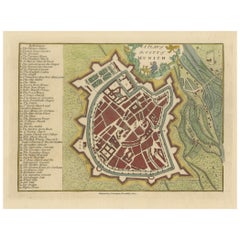
Original Antique Map of Munich, Germany by J. Stockdale, 1800
Located in Langweer, NL
Title: Vintage Map of Munich, Germany by J. Stockdale, 1800
This vintage map, titled "A Plan of the City of Munich," was published by J. Stockdale in Piccadilly, London, in 1800. Th...
Category
Antique Early 1800s Maps
Materials
Paper
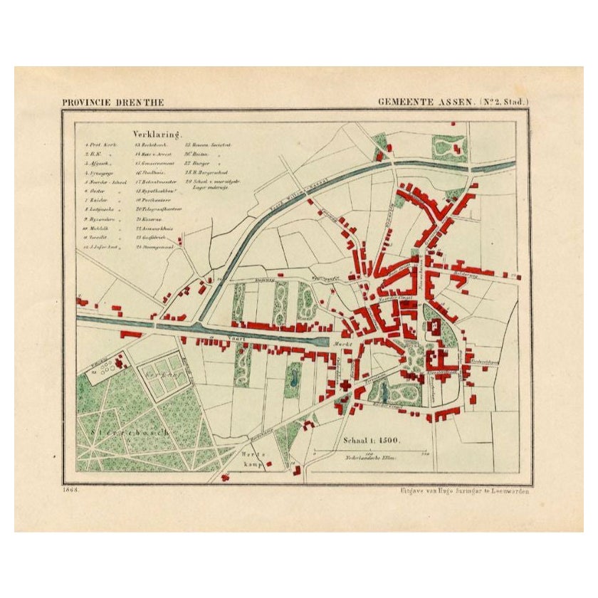
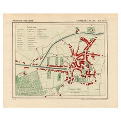
Antique Map of the City of Assen in The Netherlands, 1865
Located in Langweer, NL
Drenthe - Gemeente Assen. (no 2, Stad). These scarse detailed maps of Dutch Towns originate from the 'Gemeente-atlas' of Jacob Kuyper. This atlas of all towns in the Netherlands was ...
Category
Antique 19th Century Maps
Materials
Paper
$278 Sale Price
20% Off
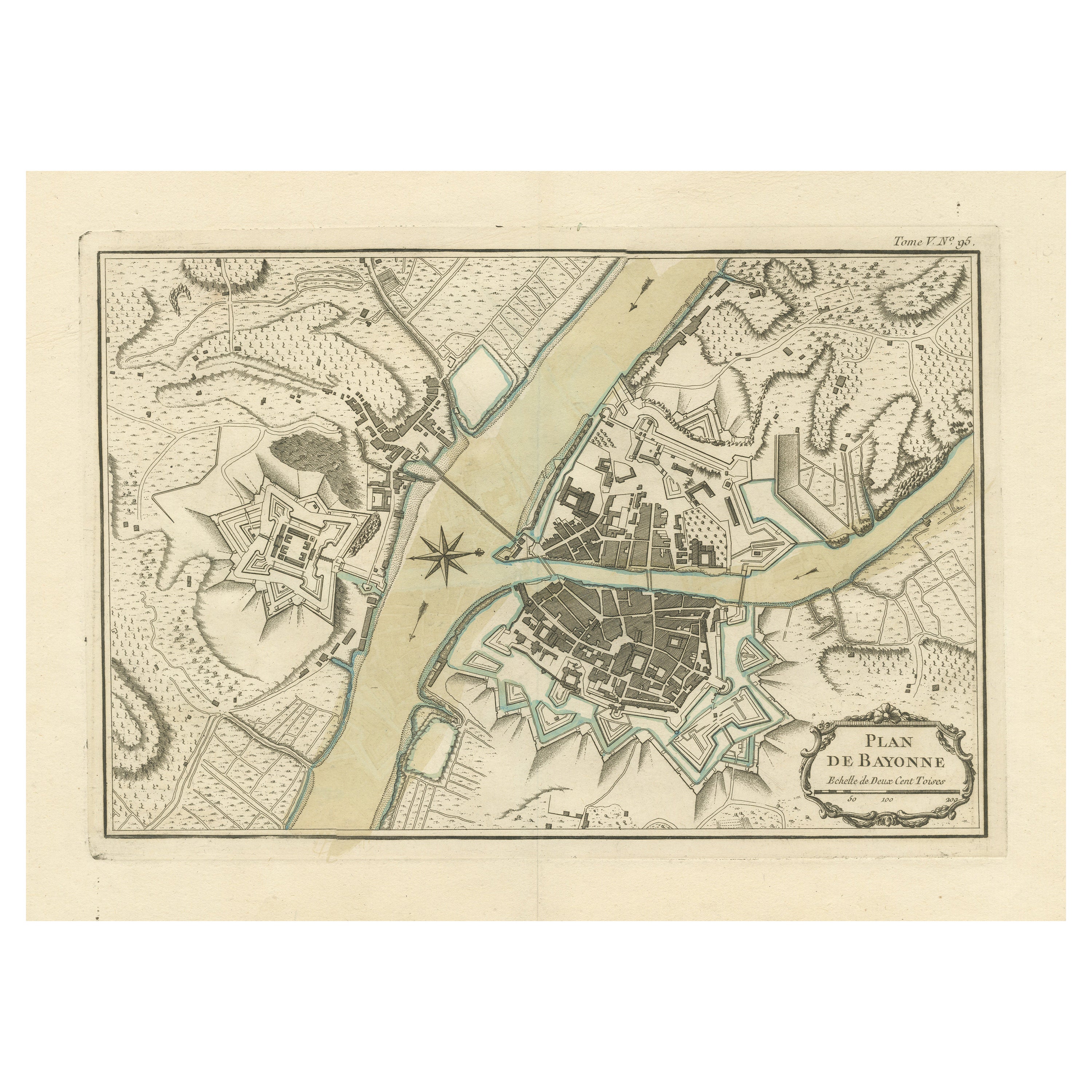
Antique Plan of the City of Bayonne, France
Located in Langweer, NL
Antique map titled 'Plan de Bayonne'. Original old plan of the city of Bayonne, France. This map originates from 'Le Petit Atlas Maritime (..)' by J.N. Bellin. Published 1764.
Be...
Category
Antique Mid-18th Century Maps
Materials
Paper
$326 Sale Price
20% Off
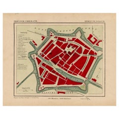
Antique Map of Dokkum a City in the North of Friesland, the Netherlands, 1868
Located in Langweer, NL
Antique map titled 'Provincie Friesland - Gemeente Dokkum'. Map of the township of Dokkum, Friesland. This map originates from 'Gemeente-Atlas van Nederland' by J. Kuyper.
The best-known event in Dokkum's history is the martyrdom of the Anglo-Saxon missionary Saint Boniface (Dutch: Bonifatius) in 754. Oliver of Cologne preached the Fifth Crusade in Dokkum in 1214 and Dokkum sent a contingent; the crescent in the coat of arms of Dokkum refers to this event. Dokkum acquired city rights in 1298. In 1572 Dokkum was sacked by the Spaniards after it had joined the Dutch Revolt...
Category
Antique 19th Century Maps
Materials
Paper
$172 Sale Price
20% Off
You May Also Like
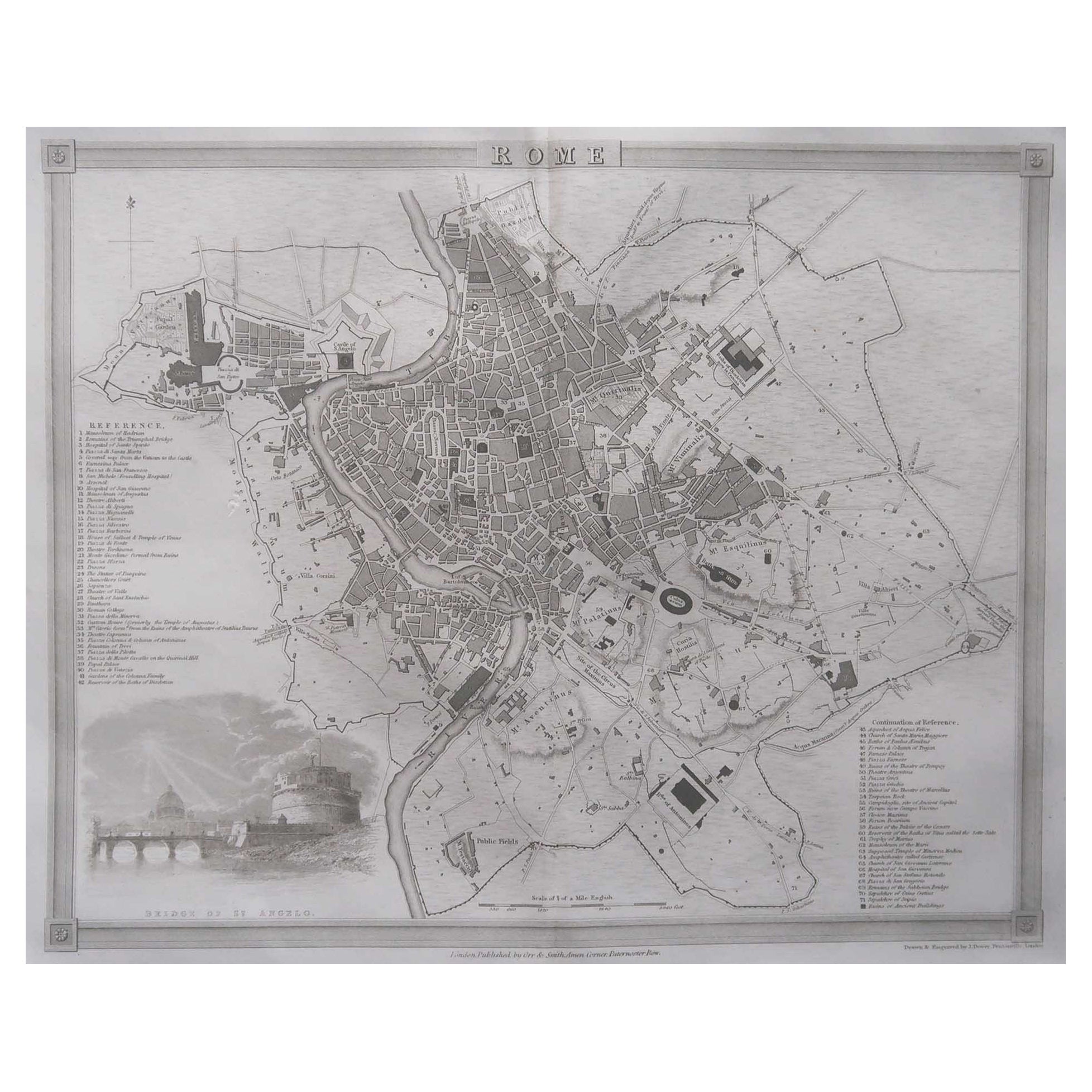
Original Antique Map or City Plan of Rome, Italy. Circa 1835
Located in St Annes, Lancashire
Nice map of Rome
Drawn and engraved by J.Dower
Published by Orr & Smith. C.1835
Unframed.
Free shipping
Category
Antique 1830s English Maps
Materials
Paper

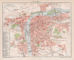
Prague, Czechoslovakia. Antique Map City Plan Chromolithograph, circa 1895
Located in Melbourne, Victoria
'Prag'
Colour lithograph. 1895.
250mm by 305mm (sheet).
Late 19th century German lithograph plan of Prague, Czechoslovakia.
Central vertical fold. Printed street index on the ...
Category
Late 19th Century Victorian More Prints
Materials
Lithograph
Original Antique Map or City Plan of Geneva, Switzerland. Circa 1835
Located in St Annes, Lancashire
Nice map of Geneva
Drawn and engraved by J.Dower
Published by Orr & Smith. C.1835
Unframed.
Free shipping
Category
Antique 1830s English Maps
Materials
Paper

Original Antique Map or City Plan of Madrid, Spain. Circa 1835
Located in St Annes, Lancashire
Nice map of Madrid
Drawn and engraved by J.Dower
Published by Orr & Smith. C.1835
Unframed.
Free shipping
Category
Antique 1830s English Maps
Materials
Paper

1851 Original map by Maillard - Plan de Paris et ses Fortifications
Located in PARIS, FR
In the world of cartography, maps transcend mere geography; they are historical records and works of art, encapsulating the essence of a place at a specific moment in time. The 1851 ...
Category
1850s Prints and Multiples
Materials
Paper, Lithograph, Linen

Large Original Antique City Plan of Lucknow, India. Edward Weller, 1861
Located in St Annes, Lancashire
Great city plan of Lucknow
Lithograph engraving by Edward Weller
Original colour
Published, 1861
Unframed
Good condition / slight corner loss bottom right shown in last image
...
Category
Antique 1860s English Victorian Maps
Materials
Paper
More Ways To Browse
Antique Dresden
Rococo Architecture
Early Dresden
World War Ii Germany
Antique Architectural Plans
Antique Bombs
Erased Heritage
Elios Chair
Plata Lappas
Red Retro Dining Set
Antique Bouquet
Antique Silver Glasses Case
Carlo Scarpa 1934 Chairs
Christofle Marly
1900 Antique Chairs
Glass Table Italian Round
Mid Century Colonial
Alvar Aalto Poster