Items Similar to Hand-Colored Map of Northwest France – Brittany to Loire, 1858


Video Loading
Want more images or videos?
Request additional images or videos from the seller
1 of 10
Hand-Colored Map of Northwest France – Brittany to Loire, 1858
$518.59
£390.60
€440
CA$715.16
A$803.45
CHF 419.81
MX$9,806.53
NOK 5,330.31
SEK 5,017.36
DKK 3,349.11
About the Item
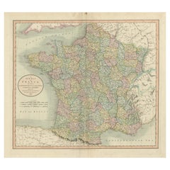
Antique Map of Northwestern France – Stülpnagel Engraving, Justus Perthes 1858
Impressively detailed mid-19th-century map of northwestern France titled "Frankreich in IV Blättern – Nordwestliches Frankreich", created by Friedrich von Stülpnagel and published by Justus Perthes in Gotha in 1858. This is one of four sectional plates depicting the full territory of France and focuses on the northwest region, including Brittany (Bretagne), Normandy (Normandie), and parts of the Loire Valley.
Rendered in fine copperplate engraving and delicately hand-colored, the map shows the intricate administrative divisions, cities, towns, rivers, and road networks that characterized France under the Second Empire. Each département is outlined in subtle color, with prominent labeling of provincial capitals and numerous secondary towns. The Atlantic coast, the English Channel (La Manche), and parts of southern England, including the Isle of Wight, are also visible.
The inset cartouche at top left is classically styled and indicates that the full France map consists of four sheets, with this being the northwestern section. The map also includes a detailed mileage scale and notes the use of longitude measured from the Paris meridian.
The regions covered include:
* Brittany (Bretagne)
* Normandy (Normandie)
* Anjou
* Maine
* Poitou
* Parts of Île-de-France and the Loire Valley
This map is a fine example of precision German cartography by one of the 19th century's foremost geographical publishers. It not only serves as a decorative piece but also as a valuable reference for historians and collectors of European cartographic history.
Condition report:
Very good condition. Clean plate impression with rich detail. Minor toning in the lower margin, but no tears, repairs, or major blemishes. Original hand-coloring well-preserved.
Framing tips:
Frame in a warm wood tone (walnut or cherry) with a light beige or ivory mat to draw attention to the subtle coloring. An inner burgundy or French grey accent line can echo the departmental borders. Ideal for display alongside other regional maps of France.
Technique: Copperplate engraving with original hand-coloring
Maker: F. von Stülpnagel, published by Justus Perthes, Gotha, 1858
- Dimensions:Height: 14.77 in (37.5 cm)Width: 17.88 in (45.4 cm)Depth: 0.01 in (0.2 mm)
- Materials and Techniques:Paper,Engraved
- Place of Origin:
- Period:
- Date of Manufacture:1858
- Condition:Very good condition. Clean plate impression with rich detail. Minor toning in the lower margin, but no tears, repairs, or major blemishes. Original hand-coloring well-preserved.
- Seller Location:Langweer, NL
- Reference Number:Seller: BG-05552-151stDibs: LU3054346116122
About the Seller
5.0
Recognized Seller
These prestigious sellers are industry leaders and represent the highest echelon for item quality and design.
Platinum Seller
Premium sellers with a 4.7+ rating and 24-hour response times
Established in 2009
1stDibs seller since 2017
2,533 sales on 1stDibs
Typical response time: <1 hour
- ShippingRetrieving quote...Shipping from: Langweer, Netherlands
- Return Policy
Authenticity Guarantee
In the unlikely event there’s an issue with an item’s authenticity, contact us within 1 year for a full refund. DetailsMoney-Back Guarantee
If your item is not as described, is damaged in transit, or does not arrive, contact us within 7 days for a full refund. Details24-Hour Cancellation
You have a 24-hour grace period in which to reconsider your purchase, with no questions asked.Vetted Professional Sellers
Our world-class sellers must adhere to strict standards for service and quality, maintaining the integrity of our listings.Price-Match Guarantee
If you find that a seller listed the same item for a lower price elsewhere, we’ll match it.Trusted Global Delivery
Our best-in-class carrier network provides specialized shipping options worldwide, including custom delivery.More From This Seller
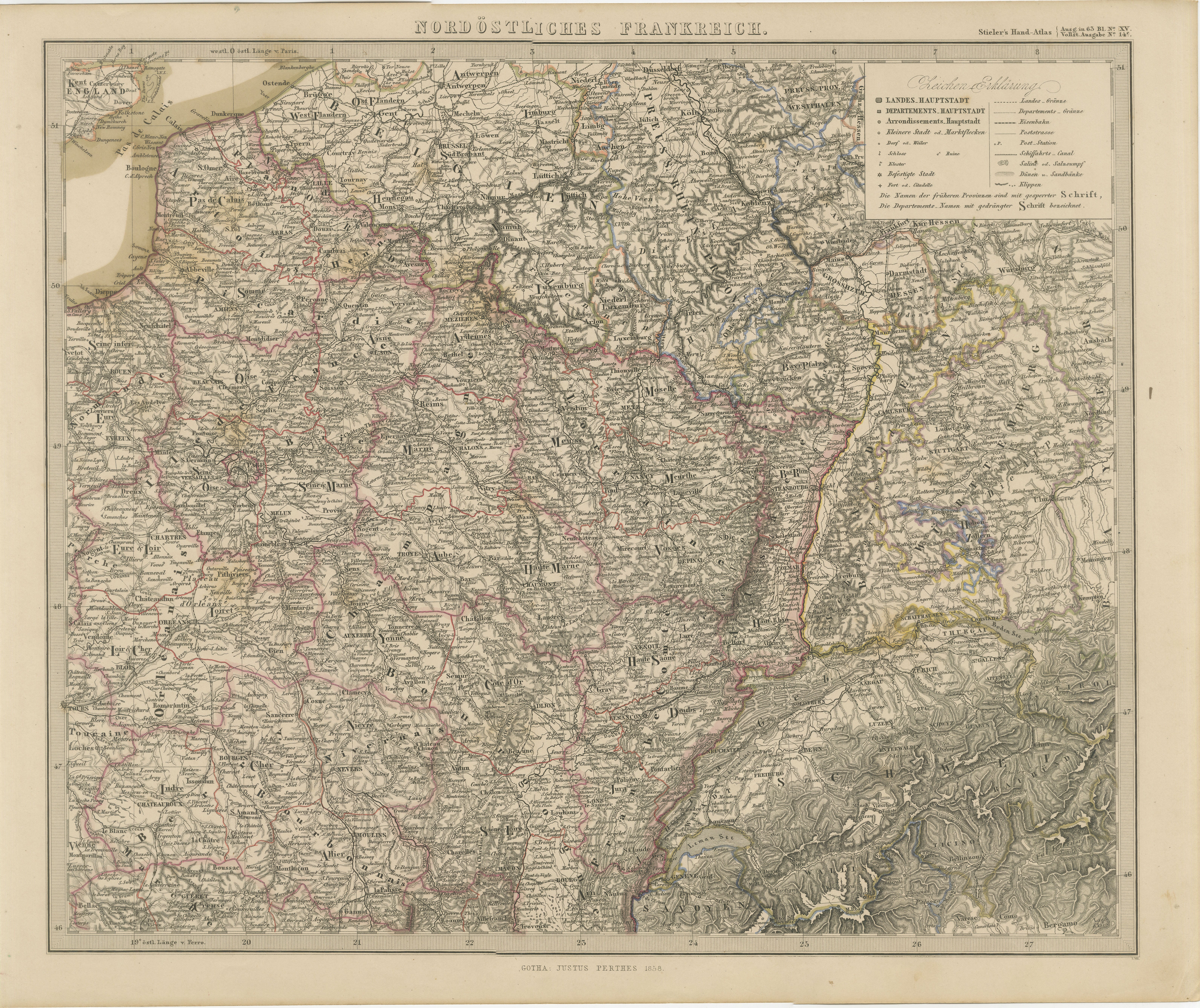
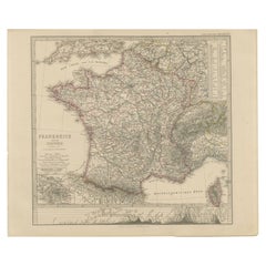
View AllAntique Map of Northeastern France – Alsace, Lorraine & Champagne, 1858
Located in Langweer, NL
Antique Map of Northeastern France – Alsace, Lorraine & Champagne, 1858
Detailed 19th-century engraved map titled "Nordöstliches Frankreich", drawn by Friedrich von Stülpnagel and p...
Category
Antique Mid-19th Century German Maps
Materials
Paper
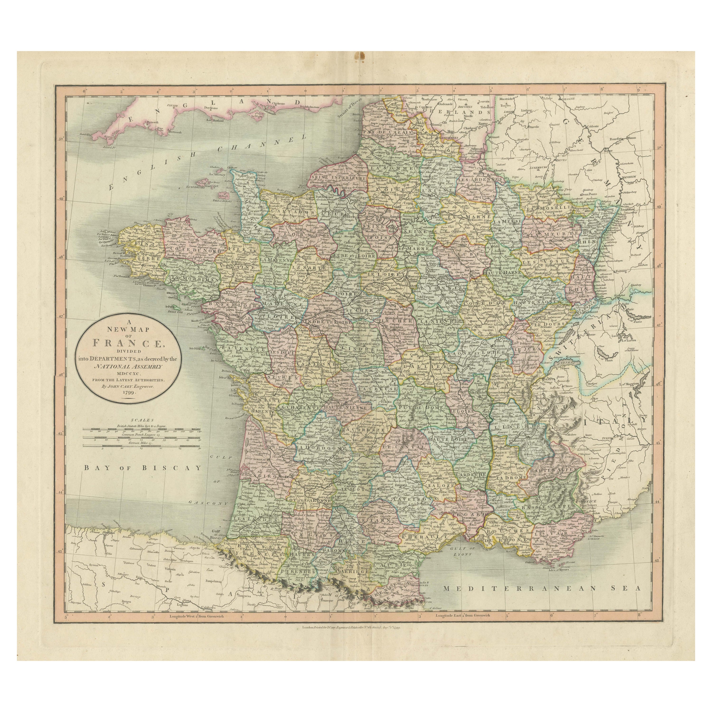
Antique Map of France Divided into Departments, with Original Hand Coloring
Located in Langweer, NL
Antique map titled 'A New Map of France (..)'. Original old map of France, divided into departments. With original/contemporary hand coloring. Published by John Cary, 1799. John Cary was an important and prolific London map seller...
Category
Antique Late 18th Century Maps
Materials
Paper
$414 Sale Price
20% Off
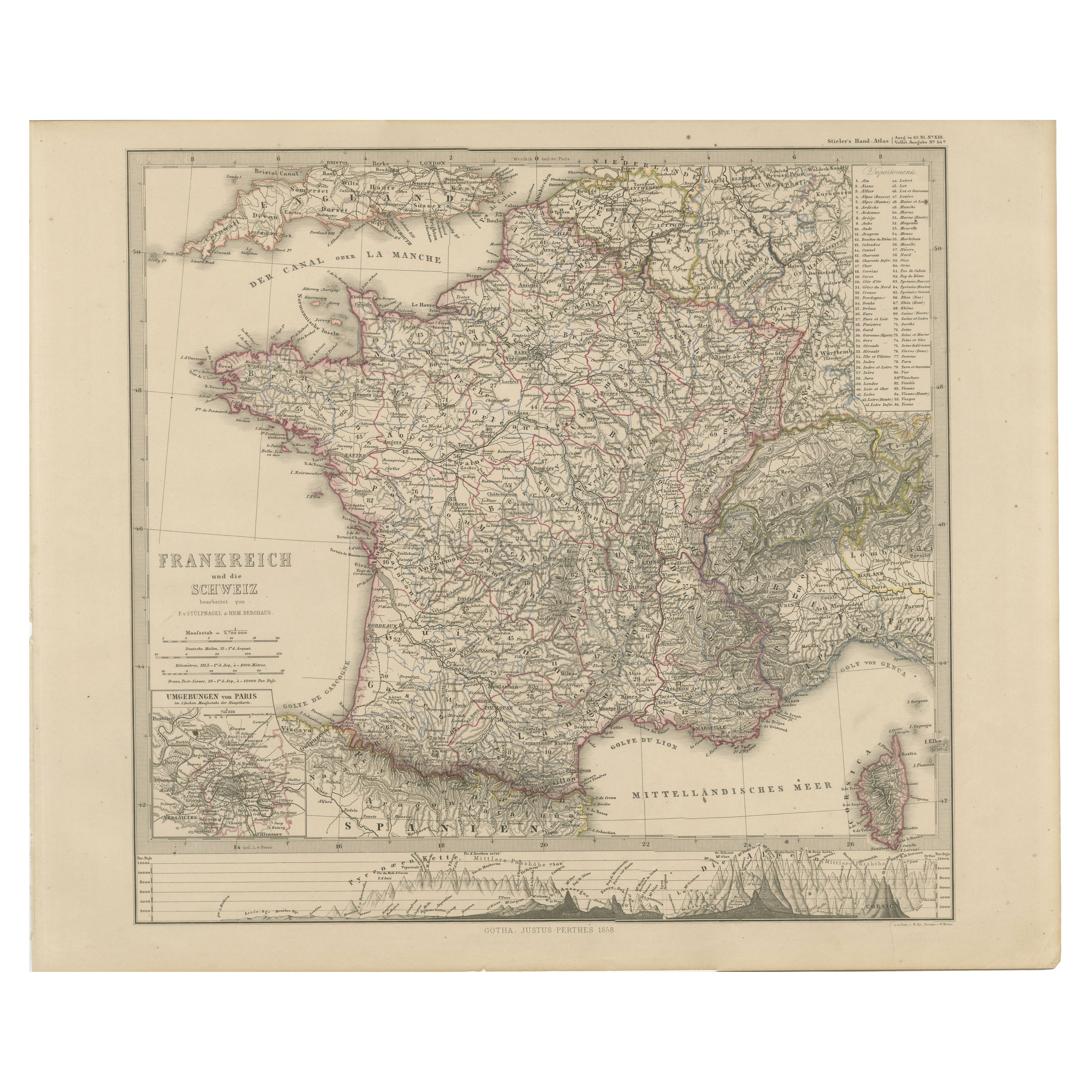
1856 France and Switzerland Map with Mountain Profiles
Located in Langweer, NL
1856 Map of France and Switzerland with Paris Inset by Stülpnagel
This finely detailed antique map of France and Switzerland was published in 1856 by the esteemed German cartographe...
Category
Antique Mid-19th Century German Maps
Materials
Paper
Antique Map of France by A & C. Black, 1870
Located in Langweer, NL
Antique map titled 'France'. Original antique map of France with inset map of France as divided into provinces, before the revolution of 1789 and map of Corsica...
Category
Antique Late 19th Century Maps
Materials
Paper

$259 Sale Price
20% Off
Antique Map of France, 1903, with Inset of Paris and Corsica
Located in Langweer, NL
Title: Antique Map of France, 1903, with Inset of Paris and Corsica
Description:
This antique map, titled "France," was engraved and published in 1903 by the renowned W. & A.K. John...
Category
Early 20th Century Maps
Materials
Paper

Map of Côtes-du-Nord France with Saint-Brieuc and Brittany Coastline, c.1850
Located in Langweer, NL
Map of Côtes-du-Nord France with Saint-Brieuc and Brittany Coastline, 19th c
Description:
This elegant 19th-century map of Côtes-du-Nord, the historic name for what is now known as ...
Category
Antique Mid-19th Century French Maps
Materials
Paper

You May Also Like
France, Northern Part. Century Atlas antique map
Located in Melbourne, Victoria
'The Century Atlas. France, Northern Part.'
Original antique map, 1903.
Inset maps of 'France in Provinces' and 'Paris and Vicinity'.
Central fold as issued. Map name and number pr...
Category
Early 20th Century Victorian More Prints
Materials
Lithograph

France in Departments - Lithograph - 1872
Located in Roma, IT
France in Departments is a map realized by an artist of the 19th century.
Lithograph, printed in 1872 by Milliam Mackenzie, London.
Category
1870s Modern Figurative Prints
Materials
Lithograph
France in Departments - Lithograph - 1872
Located in Roma, IT
France in Departments is an artwork realized by an artist of the 19th century.
Lithograph, printed in 1872 by Milliam Mackenzie, London.
Good condition.
Category
1870s Modern Figurative Prints
Materials
Lithograph

Large 19th Century Map of France
Located in Pease pottage, West Sussex
Large 19th Century Map of France.
Remarkable condition, with a pleasing age worn patina.
Recently framed.
France Circa 1874.
Category
Antique Late 19th Century French Maps
Materials
Linen, Paper

Map of France - Etching - 1820
Located in Roma, IT
Map of France is an Original Etching realized by an unknown artist of 19th century in 1820.
Very good condition on two sheets of white paper joined at t...
Category
1820s Modern Figurative Prints
Materials
Etching

The Normandy Region of France: A 17th C. Hand-colored Map by Sanson and Jaillot
By Nicholas Sanson d'Abbeville
Located in Alamo, CA
This large hand-colored map entitled "Le Duché et Gouvernement de Normandie divisée en Haute et Basse Normandie en divers Pays; et par evêchez, avec le Gouvernement General du Havre ...
Category
1690s Landscape Prints
Materials
Engraving
