Items Similar to Imperial map of Northern Russia with Archangel, Lapland and Permia, c.1730


Want more images or videos?
Request additional images or videos from the seller
1 of 10
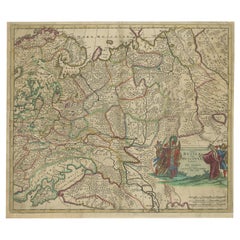
Imperial map of Northern Russia with Archangel, Lapland and Permia, c.1730
$563.61
£419.27
€470
CA$771.78
A$858.11
CHF 448.06
MX$10,445.35
NOK 5,717.05
SEK 5,356.61
DKK 3,577.85
Shipping
Retrieving quote...The 1stDibs Promise:
Authenticity Guarantee,
Money-Back Guarantee,
24-Hour Cancellation
About the Item
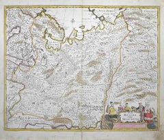
Imperial map of Northern Russia with Archangel, Lapland, and Permia, c.1730
Description:
This intricately engraved and hand-colored map presents the northern reaches of the Russian Empire as it was known in the early 18th century. Created by Matthäus Seutter of Augsburg, one of the leading German mapmakers of the period, the map is titled *Mappae Imperii Moscovitici pars Septentrionalis*, or “Map of the Northern Part of the Muscovite Empire.”
The composition focuses on the regions from St. Petersburg and Ingria in the west to the Ural regions of Perm and Yugoria in the east. The map also includes parts of Lapland, the White Sea (labeled Mare Album or Biar More), and the coastlines of the Barents Sea (Mare Moscoviticum). Important geographic features such as Lacus Onega and Ladoga are finely rendered, as are major rivers like the Dvina and the Northern Dvina.
Seutter divides the territory into color-coded regions such as Regio Czarn, Permia, Jugoria, and Tzernia, reflecting administrative and historical divisions within the empire. Cities including Archangel (Archangelsk), Novgorod, and Vologda are marked, while dense forests and mountain ranges are illustrated using fine hachuring techniques and symbolic trees.
The cartouche in the upper right corner is decorated in classical baroque style with scrollwork, flags, and figures, flanked by a heraldic crest and a depiction of trading ships—emphasizing the region’s commercial and imperial importance. This map is printed in Latin, underscoring its intended audience of learned European elites.
What makes this print especially appealing is its blend of scientific ambition and artistic flourish. It captures a region that was still largely mysterious to Western Europeans in the 18th century, offering insight into how the Russian north was perceived and mapped by German scholars and cartographers.
Condition:
Fair condition. Original hand coloring is well-preserved with minimal age toning. Central fold with water staining; some paper waviness and discoloration present. Study the images carefully.
Framing tips:
For best presentation, consider a dark wood or black frame with a linen or neutral mat to draw attention to the map’s subtle coloring. The ornate cartouche would benefit from generous spacing to let it stand out visually. Use UV-protective glass to safeguard the hand-applied color. Given the map’s vertical orientation and historical interest, it’s ideal for a study, library, or gallery wall focused on exploration and empire.
- Dimensions:Height: 20.08 in (51 cm)Width: 23.23 in (59 cm)Depth: 0.01 in (0.2 mm)
- Materials and Techniques:Paper,Engraved
- Place of Origin:
- Period:
- Date of Manufacture:circa 1730
- Condition:Fair condition. Original hand coloring is well-preserved with minimal age toning. Central fold with water staining; some paper waviness and discoloration present. Study the images carefully.
- Seller Location:Langweer, NL
- Reference Number:Seller: BG-14068-31stDibs: LU3054345402132
About the Seller
5.0
Recognized Seller
These prestigious sellers are industry leaders and represent the highest echelon for item quality and design.
Platinum Seller
Premium sellers with a 4.7+ rating and 24-hour response times
Established in 2009
1stDibs seller since 2017
2,511 sales on 1stDibs
Typical response time: <1 hour
- ShippingRetrieving quote...Shipping from: Langweer, Netherlands
- Return Policy
Authenticity Guarantee
In the unlikely event there’s an issue with an item’s authenticity, contact us within 1 year for a full refund. DetailsMoney-Back Guarantee
If your item is not as described, is damaged in transit, or does not arrive, contact us within 7 days for a full refund. Details24-Hour Cancellation
You have a 24-hour grace period in which to reconsider your purchase, with no questions asked.Vetted Professional Sellers
Our world-class sellers must adhere to strict standards for service and quality, maintaining the integrity of our listings.Price-Match Guarantee
If you find that a seller listed the same item for a lower price elsewhere, we’ll match it.Trusted Global Delivery
Our best-in-class carrier network provides specialized shipping options worldwide, including custom delivery.More From This Seller
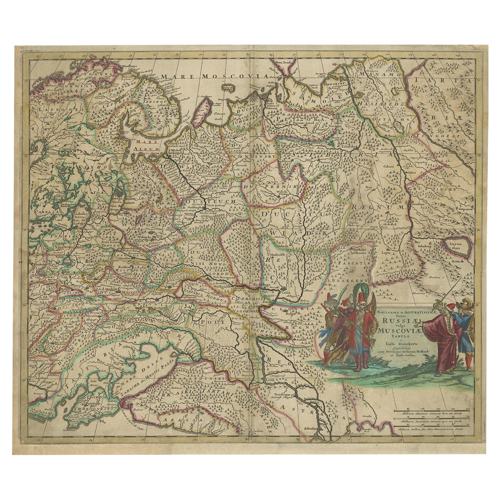
View AllAntique Hand-Colored Map of Western Russia and Ukraine, c.1680
Located in Langweer, NL
Description: Antique map titled 'Novissima et Accuratissima Totius Russiae vulgo Muscoviae Tabula'.
Antique map of Western Russia and Ukraine, published by Justus Danckerts. The ma...
Category
Antique 1680s Maps
Materials
Paper
$719 Sale Price
20% Off
Antique Map of Western Russia by Covens & Mortier, 1740
Located in Langweer, NL
Antique map titled 'Carte de Moscovie'. Antique map of the western portion of Russia. The map centers on Moscow (shown near the top of the lower sheet) and spans from the Sea of Azov...
Category
Antique Mid-18th Century Maps
Materials
Paper

$911 Sale Price
20% Off
Map of the Duchy of Pomerania – Antique Engraving by P. Schenk Jr., c. 1750
Located in Langweer, NL
Map of the Duchy of Pomerania – Antique Engraving by P. Schenk Jr., c. 1750
Antique map titled 'Ducatus Pomeraniae Tabula Generalis'. This historical map presents the Duchy of Pomer...
Category
Antique Mid-18th Century Dutch Maps
Materials
Paper

$479 Sale Price
20% Off
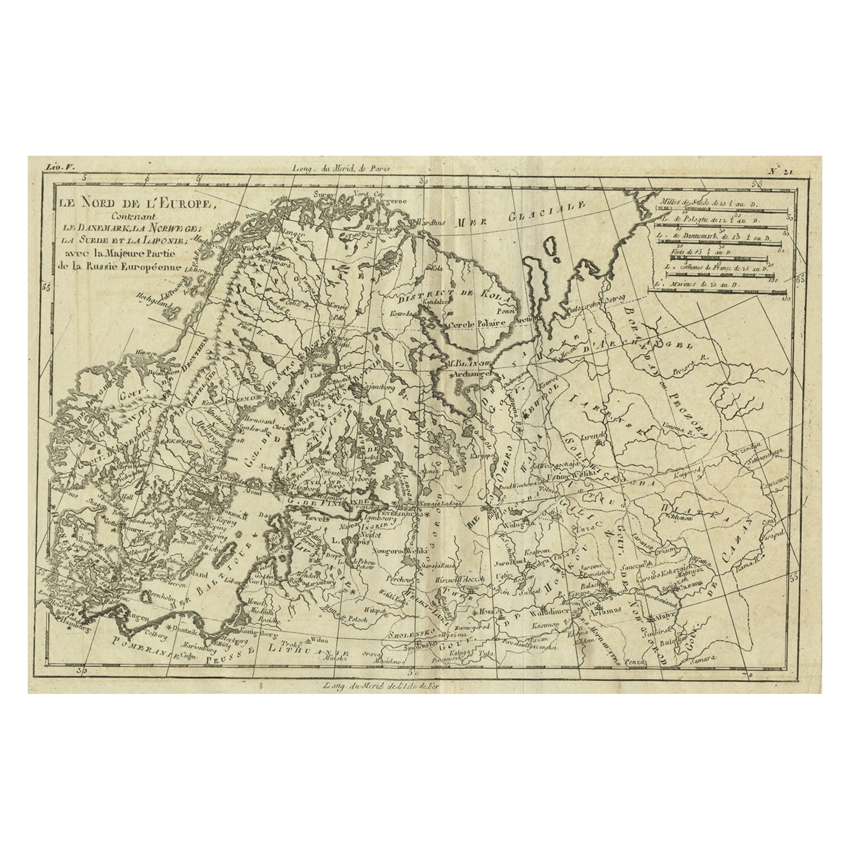
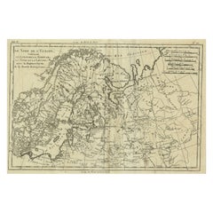
Antique Map of Northern Europe and European Russia, ca.1780
Located in Langweer, NL
Antique map titled 'Le Nord de L'Europe, Contenant Le Danemark, La Norwege; La Suede et La Laponie avec la Majeure Partie de al Russie Europeenne.'
Map of Northern Europe and Eur...
Category
Antique 1780s Maps
Materials
Paper
$182 Sale Price
20% Off
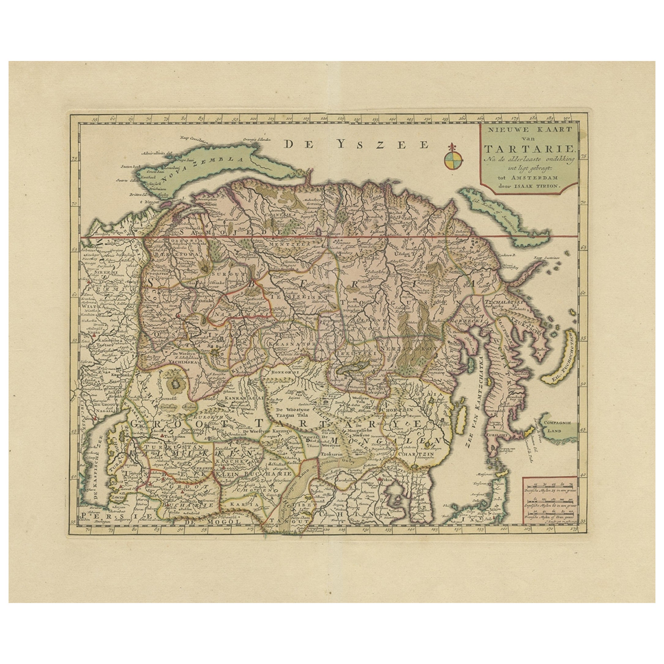
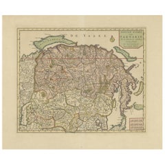
Antique Map of Siberia and Chinese Tartary, Incl Nova Zembla, ca.1732
Located in Langweer, NL
Antique map of Tartary titled 'Nieuwe Kaart van Tartarie na de alderlaatste ondekking int ligt gebracht tot Amsterdam door Isaak Tirion'.
Map op Siberia and Chinese tartary. In t...
Category
Antique 1730s Maps
Materials
Paper
$825 Sale Price
20% Off
Free Shipping
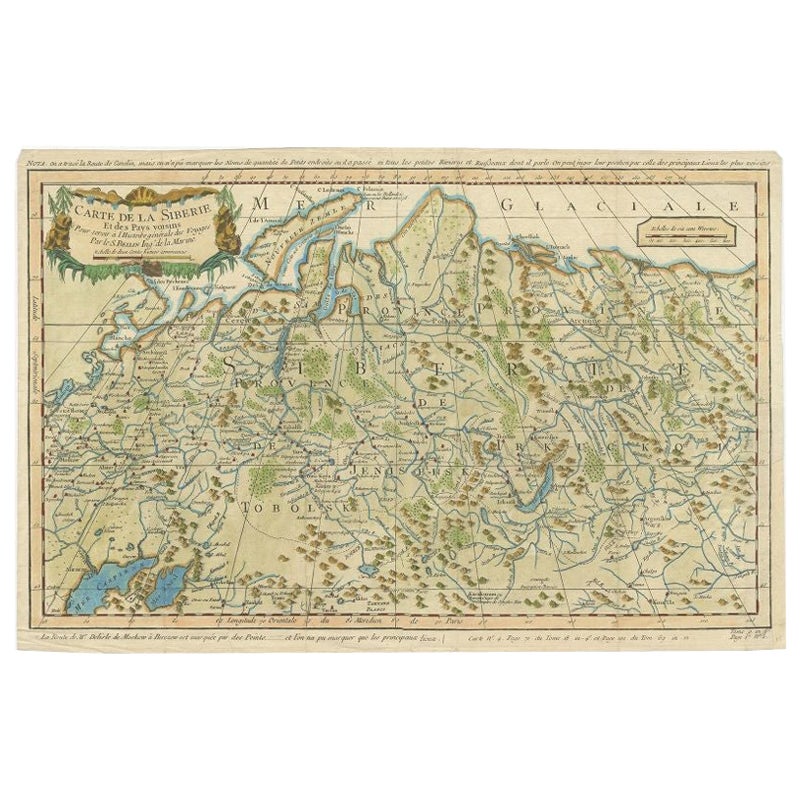
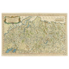
Antique Map of Siberia by Bellin, 1754
Located in Langweer, NL
Antique map titled 'Carte de la Siberie'. Detailed map of Siberia, extending from the White Sea and the Caspian Sea in the west to Irkuckoi Province, Jakutky on the Lena River and regions just to the east. Centered on the Jenisi River. Originates from Prévost's 'Histoire Générale des Voyages'. Artists and Engravers: Jacques-Nicolas Bellin (1703-1772) was among the most important mapmakers of the eighteenth century. In 1721, at age 18, he was appointed hydrographer (chief cartographer) to the French Navy. In August 1741, he became the first Ingénieur de la Marine of the Depot des cartes...
Category
Antique 18th Century Maps
Materials
Paper
$335 Sale Price
20% Off
You May Also Like
Map of the Russian Empire: An Original 18th Century Hand-colored Map by E. Bowen
Located in Alamo, CA
This is an original 18th century hand-colored map entitled "A New & Accurate Map of The Whole Russian Empire, As Contain'd Both In Europe and Asia, Drawn from Authentic Journals, Sur...
Category
Mid-18th Century Old Masters Landscape Prints
Materials
Engraving

Scandinavia & Portions of Eastern Europe: 18th Century Hand-Colored Homann Map
By Johann Baptist Homann
Located in Alamo, CA
An early 18th century hand-colored copper-plate map entitled "Regni Sueciae in omnes suas Subjacentes Provincias accurate divisi Tabula Generalis" by Johann Baptist Homann (1663-1724...
Category
Antique Early 18th Century German Maps
Materials
Paper

Ancient Map-Poli Arctici (Map of the Poles)-Etching by Johannes Janssonius-1650s
By Johannes Janssonius
Located in Roma, IT
Poli Arctici is an ancient map realized in 1650 by Johannes Janssonius (1588-1664).
The Map is a Hand-colored etching, with coeval watercoloring.
Good conditions with slight foxing...
Category
1650s Modern Figurative Prints
Materials
Etching

1790 Thomas Stackhouse Map, Entitled "Russia in Europe, " , Ric.a004
Located in Norton, MA
1790 Thomas Stackhouse map, entitled
"Russia in Europe"
Ric.a004
Stackhouse, Thomas
Russia in Europe [map]
London: T. Stackhouse, 1783. Map. Matted hand-colored copper engraving. Image size: 14.5 x 15.25 inches. Mat size: 22.75 x 23.75 inches. A beautiful example of this map of Eastern Europe...
Category
Antique 17th Century Unknown Maps
Materials
Paper

1646 Jansson Map Entitled "Procinvia Connactiae, " Ric.a006
Located in Norton, MA
1646 Jansson map entitled
"Procinvia connactiae,"
Ric.a006
Description: The PROVINCE of CONNAVGT 490 x 380From vol 4 of Jansson's Atlas Novus 1646, published in Amsterdam with...
Category
Antique 17th Century Unknown Maps
Materials
Paper

Tabula Russia Vulgo Moscovia - Etching by Frederick de Wit - 1680ca
By Frederick de Wit
Located in Roma, IT
This double-page etching with contemporary coloring, entitled Tabula Russia vulgo Moscovia, was realized by the cartographer Frederick de Wit for the famous Atlas published in Amster...
Category
1680s Modern Figurative Prints
Materials
Etching
More Ways To Browse
Imperial German
Empire Library
Heraldic Crest
Stained Glass Divider
Imperial Russian Glass
Flag Empire
Styles Of Antique Desks
Black And White Coffee Table
Curved Velvet Couch
Velvet Curved Sofa
Wood Round Coffee Tables
Antique Paper Flowers
Oak Brutalist
Used College Furniture
Wood Minimalist Chair
2002 Lamp
Antique Imperial Furniture
Gold Modern Coffee Table