Items Similar to Large Original Antique Map of Maine, USA, C.1900
Want more images or videos?
Request additional images or videos from the seller
1 of 5
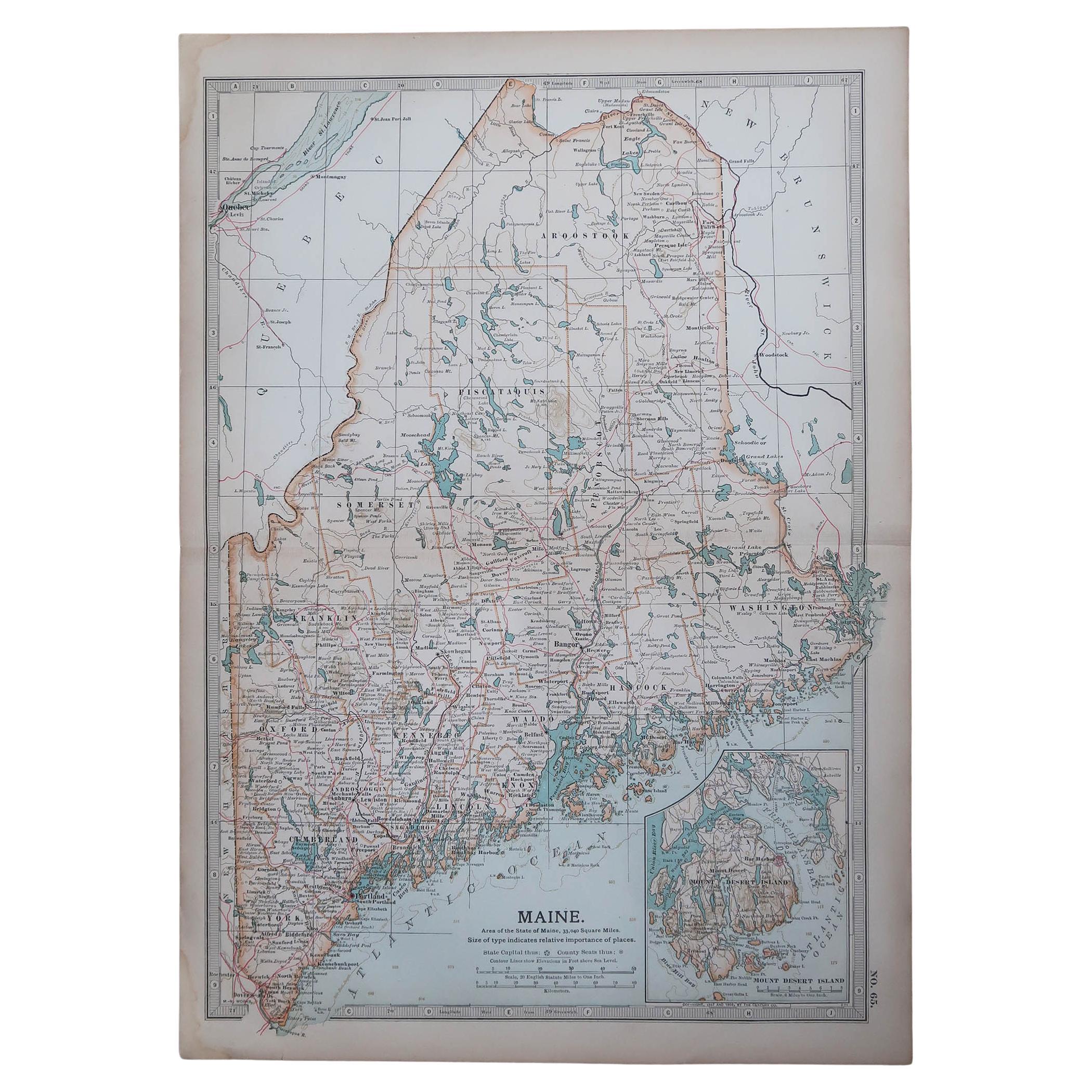
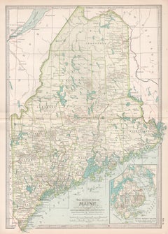
Large Original Antique Map of Maine, USA, C.1900
$90
£69.14
€79.45
CA$126.60
A$142.23
CHF 74.31
MX$1,735.92
NOK 943.56
SEK 888.16
DKK 592.85
About the Item
Fabulous map of Maine
Original color
Engraved and printed by the George F. Cram Company, Indianapolis.
Published, C.1900
Unframed
Free shipping.
- Dimensions:Height: 22 in (55.88 cm)Width: 15 in (38.1 cm)Depth: 0.07 in (1.78 mm)
- Materials and Techniques:Paper,Other
- Place of Origin:
- Period:
- Date of Manufacture:1900
- Condition:Wear consistent with age and use.
- Seller Location:St Annes, GB
- Reference Number:1stDibs: LU1836332470152
About the Seller
4.9
Platinum Seller
Premium sellers with a 4.7+ rating and 24-hour response times
1stDibs seller since 2016
3,120 sales on 1stDibs
Typical response time: 1 hour
Associations
International Confederation of Art and Antique Dealers' Associations
- ShippingRetrieving quote...Shipping from: St Annes, United Kingdom
- Return Policy
Authenticity Guarantee
In the unlikely event there’s an issue with an item’s authenticity, contact us within 1 year for a full refund. DetailsMoney-Back Guarantee
If your item is not as described, is damaged in transit, or does not arrive, contact us within 7 days for a full refund. Details24-Hour Cancellation
You have a 24-hour grace period in which to reconsider your purchase, with no questions asked.Vetted Professional Sellers
Our world-class sellers must adhere to strict standards for service and quality, maintaining the integrity of our listings.Price-Match Guarantee
If you find that a seller listed the same item for a lower price elsewhere, we’ll match it.Trusted Global Delivery
Our best-in-class carrier network provides specialized shipping options worldwide, including custom delivery.More From This Seller
View AllOriginal Antique Map of the American State of Maine, 1903
Located in St Annes, Lancashire
Antique map of Maine
Published By A & C Black. 1903
Original colour
Good condition
Unframed.
Free shipping
Category
Antique Early 1900s English Maps
Materials
Paper

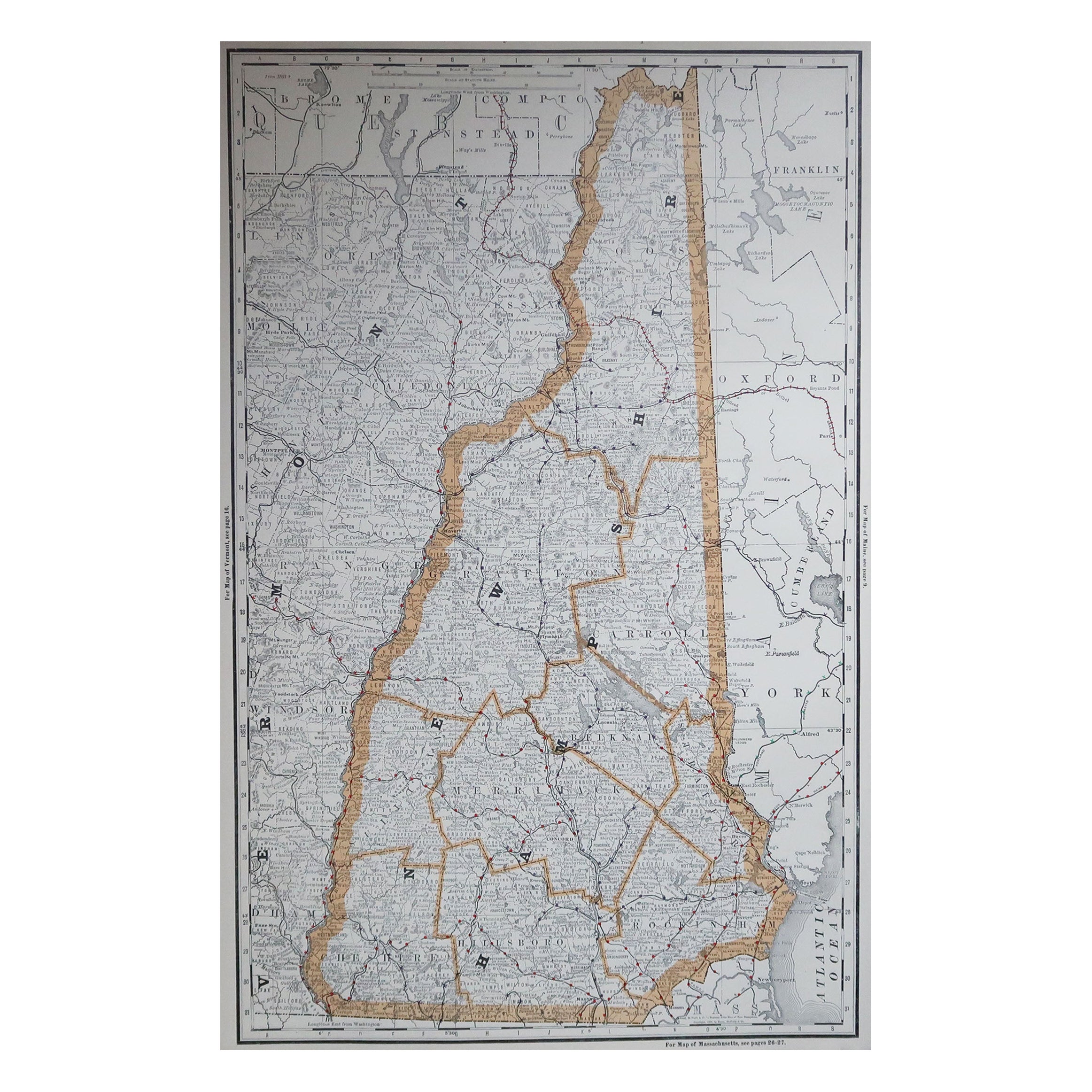
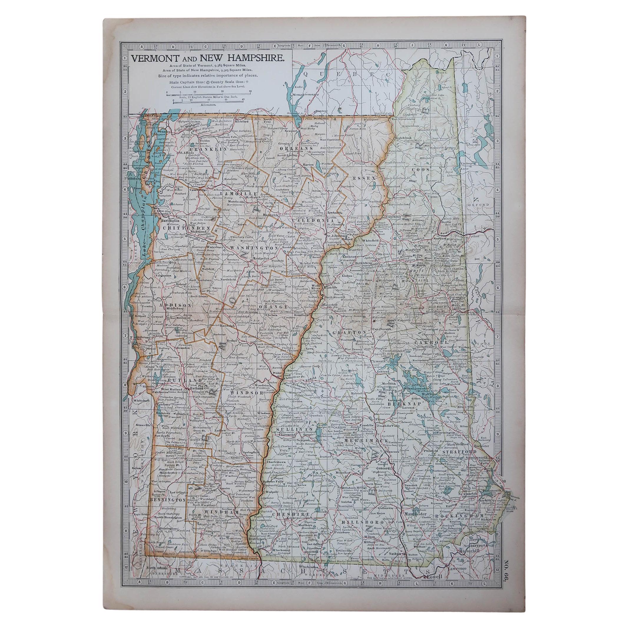
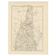
Large Original Antique Map of New Hampshire, USA, 1894
By Rand McNally & Co.
Located in St Annes, Lancashire
Fabulous map of New Hampshire
Original color
By Rand, McNally & Co.
Published, 1894
Unframed
Free shipping.
Category
Antique 1890s American Maps
Materials
Paper
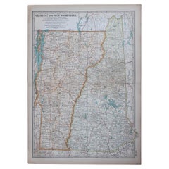
Original Antique Map of the American States of Vermont & New Hampshire, 1903
Located in St Annes, Lancashire
Antique map of Vermont and New Hampshire
Published By A & C Black. 1903
Original colour
Good condition
Unframed.
Free shipping
Category
Antique Early 1900s English Maps
Materials
Paper
Large Original Antique Map of Massachusetts, USA, circa 1900
Located in St Annes, Lancashire
Fabulous map of Massachusetts
In 2 sheets. They can be joined but I have not done it
Original color
Engraved and printed by the George F. Cram ...
Category
Antique 1890s American Maps
Materials
Paper

Original Antique Map of the American State of Massachusetts, 1903
Located in St Annes, Lancashire
Antique map of Vermont and New Hampshire
Published By A & C Black. 1903
Original colour
Good condition
Unframed.
Free shipping
Category
Antique Early 1900s English Maps
Materials
Paper

Original Antique Map of the American State of Connecticut & Rhode Island, 1903
Located in St Annes, Lancashire
Antique map of Connecticut and Rhode Island
Published By A & C Black. 1903
Original colour
Good condition
Unframed.
Free shipping
Category
Antique Early 1900s English Maps
Materials
Paper

You May Also Like
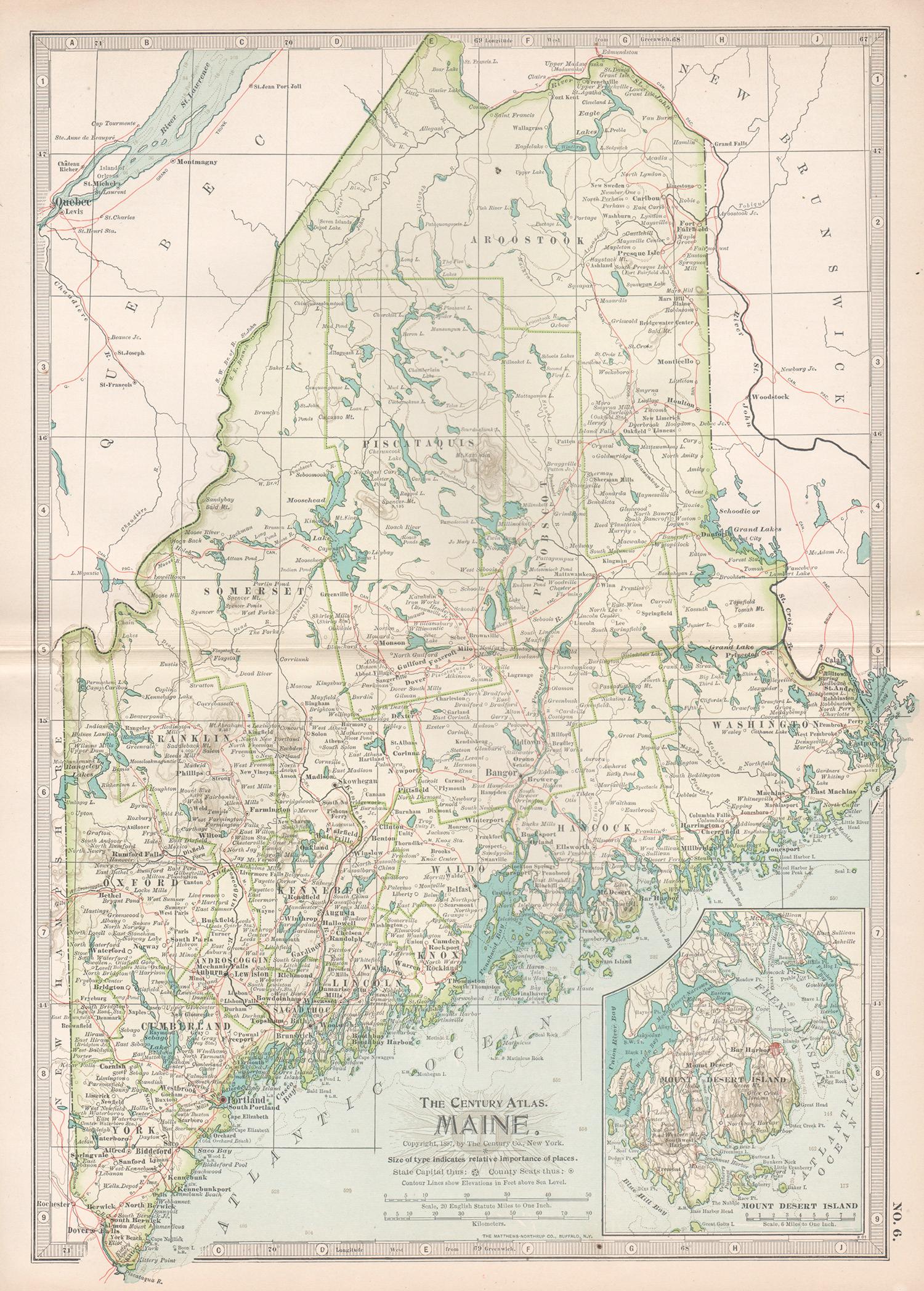
Maine. USA Century Atlas state antique vintage map
Located in Melbourne, Victoria
'The Century Atlas. Maine'
Original antique map, 1903.
Central fold as issued. Map name and number printed on the reverse corners.
Sheet 40cm by 29.5cm.
Category
Early 20th Century Victorian More Prints
Materials
Lithograph
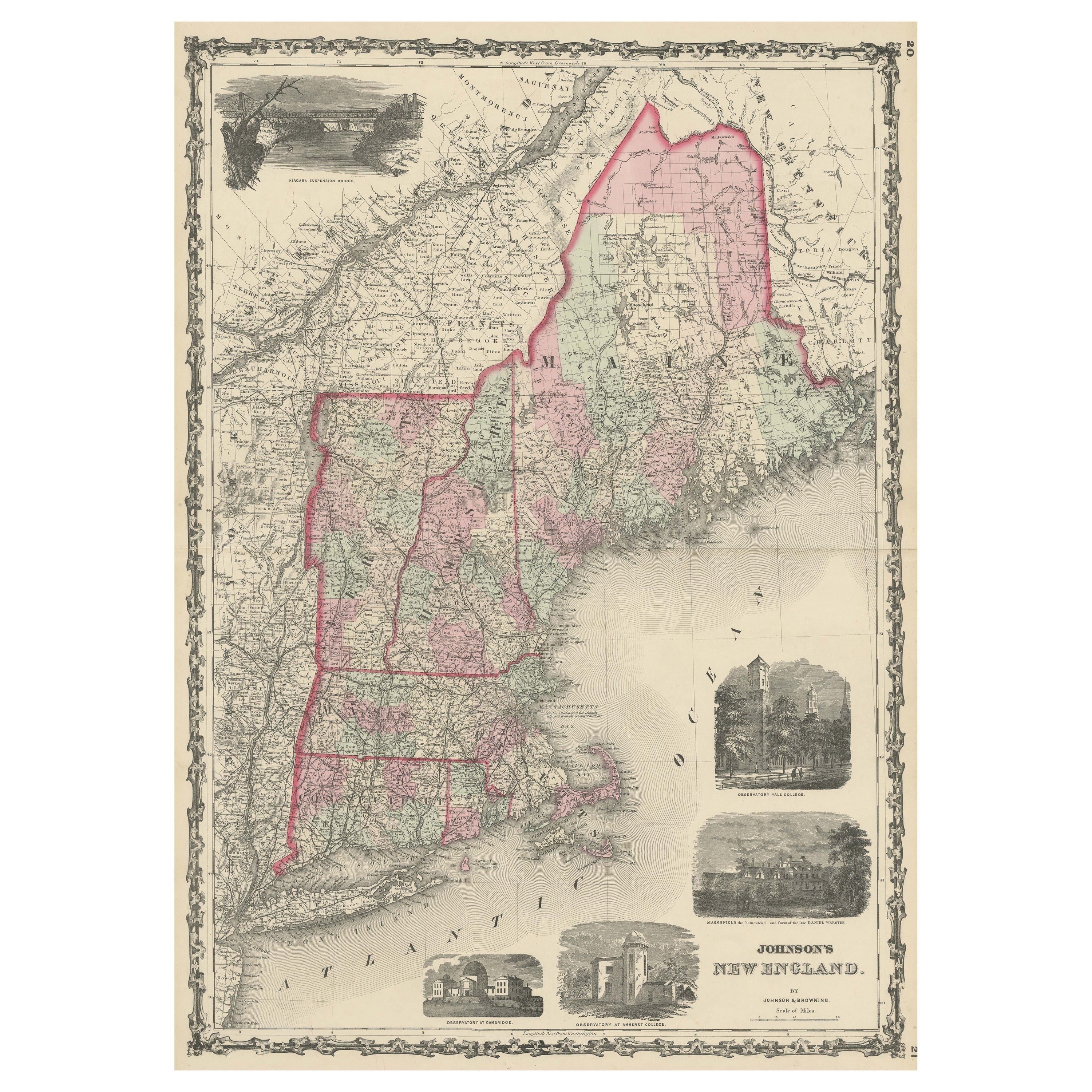
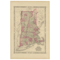
Large Antique Map of New England with decorative Vignettes
Located in Langweer, NL
Antique map titled 'Johnson's New England'. Large map of New England, comprising the states Connecticut, Maine, Massachusetts, New Hampshire, Rhode ...
Category
Antique Mid-19th Century Maps
Materials
Paper
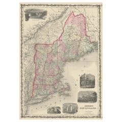
$367 Sale Price
20% Off
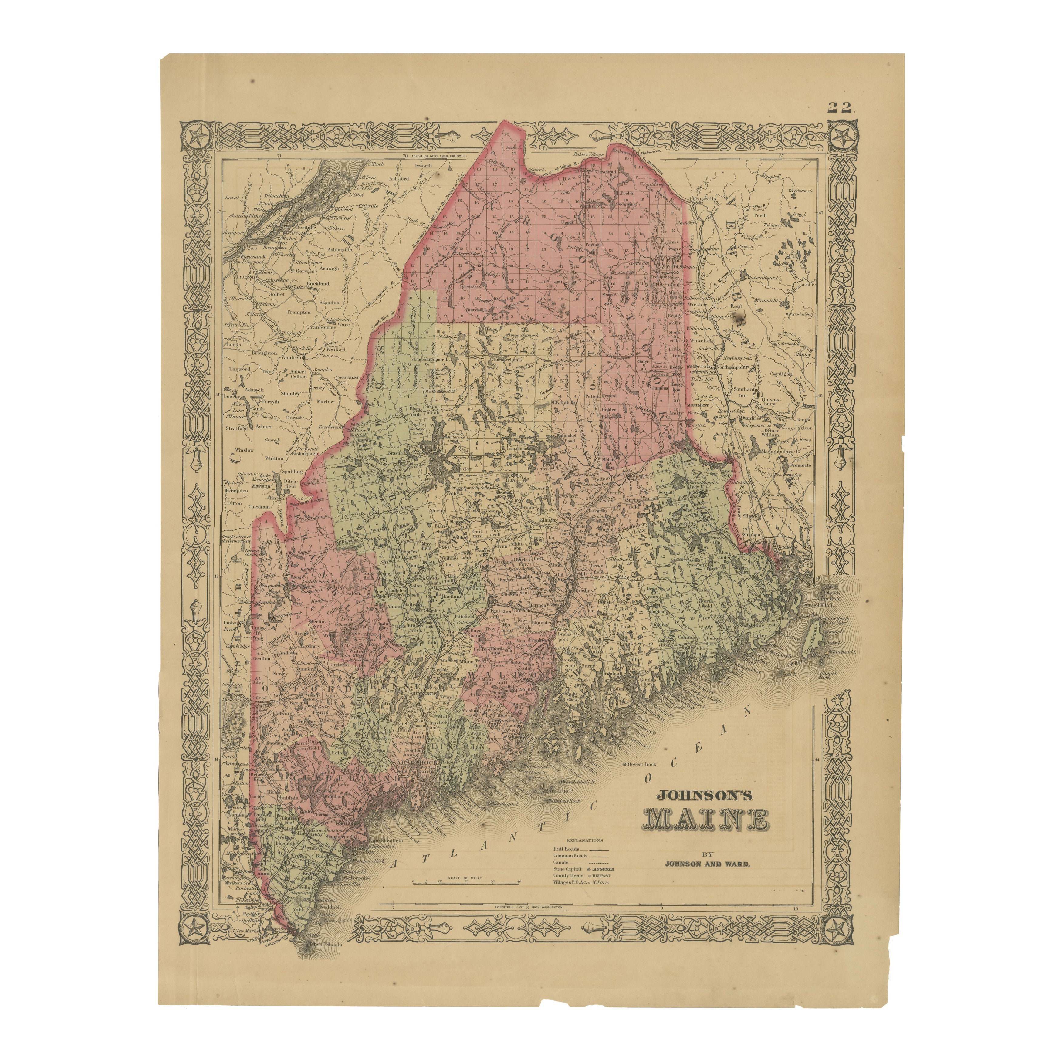
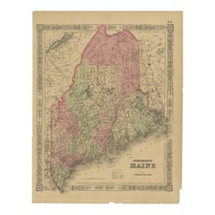
Maine County Map – Johnson, Hand-Colored, USA c.1864
Located in Langweer, NL
Johnson’s Maine Map, USA Published c.1864 – Hand-Colored County Map
This is a finely engraved and hand-colored map titled Johnson’s Maine, published by Johnson and Ward in New York ...
Category
Antique Mid-19th Century American Maps
Materials
Paper
Antique Map of New Hampshire
Located in Langweer, NL
Antique map titled 'New Hampshire'. Original antique map of New Hampshire, United States. This print originates from 'Encyclopaedia Britan...
Category
Antique Late 19th Century Maps
Materials
Paper
$273 Sale Price
20% Off
Rare 1864 Civil War Era Map of Vermont, New Hampshire, and Southern New England
Located in Langweer, NL
Title: Rare 1864 Civil War Era Map of Vermont, New Hampshire, and Southern New England
Description: This finely detailed antique map, titled "Johnson's Vermont, New Hampshire, Massa...
Category
Antique 1860s Maps
Materials
Paper
Antique Map of the United States ' North East ' by Johnston '1909'
Located in Langweer, NL
Antique map titled 'United States of North America'. Original antique map of United States of North America ( North East ). This map orig...
Category
Early 20th Century Maps
Materials
Paper

$235 Sale Price
20% Off
More Ways To Browse
Used Furniture Maine
Used Furniture Indianapolis
J And C Bavaria
Map Of Barbados
Montreal Map
Antique Furniture Toledo Ohio
Laos Antique Map
Orinoco Furniture
Johann Baptist Homann On Sale
Rand Mcnally Vintage Maps
Tipu Sultan
Antique Map Bermuda
Antique Map Holder
Lancashire Map
Maltese Falcon
Raised Relief Map
William Dampier
Antique Chesapeake Bay Map