Items Similar to Map of Ariège France with Foix and Pyrenees Landscape by Vuillemin, 19th c


Want more images or videos?
Request additional images or videos from the seller
1 of 11
Map of Ariège France with Foix and Pyrenees Landscape by Vuillemin, 19th c
$143.90
£107.05
€120
CA$197.05
A$219.09
CHF 114.40
MX$2,666.90
NOK 1,459.67
SEK 1,367.64
DKK 913.49
Shipping
Retrieving quote...The 1stDibs Promise:
Authenticity Guarantee,
Money-Back Guarantee,
24-Hour Cancellation
About the Item
Map of Ariège France with Foix and Pyrenees Landscape by Vuillemin, 19th c
Description:
This beautifully detailed 19th-century map of the Ariège department in southwestern France was drawn by the French cartographer Alexandre Vuillemin and published by Migeon in Paris as part of the illustrated Nouvel Atlas Illustré. Rich in visual and historical content, the map offers a fascinating portrait of this mountainous border region adjacent to Spain and Andorra.
The map shows the full expanse of Ariège with clear labeling of towns, rivers, roads, and departmental borders, the latter highlighted in hand-applied yellow watercolor. The department is nestled against the Pyrenees mountain range, with Foix, Saint-Girons, and Pamiers as its major towns. The topographical relief hints at the region's rugged alpine character.
To the lower left is a picturesque vignette of Foix, the departmental capital, with its famous medieval castle perched dramatically on a rocky hill above the town. On the lower right is a view of the southern borderlands facing the Spanish frontier. At the upper right appears a portrait of General Bertrand Clausel, a native of Ariège who served in the Napoleonic Wars and later became governor of Algeria. Beneath him is the coat of arms of the department, with its vertical stripes and laurel branch motif.
Ariège is known for its striking mountain scenery, medieval fortresses, Cathar heritage, and natural thermal springs. Although not widely recognized as a major wine-producing area, it does have a tradition of small-scale viticulture, especially in the foothills, with rustic wines from local grapes. The area is more renowned for sheep cheese (such as tomme and Bethmale), honey, and mountain herbal products. Today, it is popular among hikers, cyclists, and nature lovers for its unspoiled valleys and ancient hilltop villages.
Alexandre Vuillemin was a leading 19th-century French cartographer noted for integrating history, culture, and art into his maps. His works were both educational and decorative, making them highly collectible. The publisher, Migeon, specialized in atlases that appealed to a broad public through refined design and engraving quality.
Condition summary:
Very good condition with light age toning and a few minor foxing marks in the margins. Engraved lines are sharp, and the hand coloring is clean and well preserved.
Framing tips:
This map would look excellent in a walnut or natural wood frame to complement its rustic and mountainous theme. A soft cream or ivory mat will enhance the engraved detail and yellow border. Museum glass is recommended for optimal preservation.
- Dimensions:Height: 10.28 in (26.1 cm)Width: 12.8 in (32.5 cm)Depth: 0.01 in (0.2 mm)
- Materials and Techniques:Paper,Engraved
- Place of Origin:
- Period:
- Date of Manufacture:circa 1850
- Condition:Very good condition with light age toning and a few minor foxing marks in the margins. Engraved lines are sharp, and the hand coloring is clean and well preserved.
- Seller Location:Langweer, NL
- Reference Number:Seller: BG-13331-81stDibs: LU3054345359562
About the Seller
5.0
Recognized Seller
These prestigious sellers are industry leaders and represent the highest echelon for item quality and design.
Platinum Seller
Premium sellers with a 4.7+ rating and 24-hour response times
Established in 2009
1stDibs seller since 2017
2,510 sales on 1stDibs
Typical response time: <1 hour
- ShippingRetrieving quote...Shipping from: Langweer, Netherlands
- Return Policy
Authenticity Guarantee
In the unlikely event there’s an issue with an item’s authenticity, contact us within 1 year for a full refund. DetailsMoney-Back Guarantee
If your item is not as described, is damaged in transit, or does not arrive, contact us within 7 days for a full refund. Details24-Hour Cancellation
You have a 24-hour grace period in which to reconsider your purchase, with no questions asked.Vetted Professional Sellers
Our world-class sellers must adhere to strict standards for service and quality, maintaining the integrity of our listings.Price-Match Guarantee
If you find that a seller listed the same item for a lower price elsewhere, we’ll match it.Trusted Global Delivery
Our best-in-class carrier network provides specialized shipping options worldwide, including custom delivery.More From This Seller
View AllMap of Ardèche France with Annonay and Vineyards by Vuillemin, 19th c
Located in Langweer, NL
Map of Ardèche France with Annonay and Vineyards by Vuillemin, 19th c
This beautifully engraved 19th-century map of Ardèche, a department in southeastern France, comes from Alexandr...
Category
Antique Mid-19th Century French Maps
Materials
Paper

Map of Côtes-du-Nord France with Saint-Brieuc and Brittany Coastline, c.1850
Located in Langweer, NL
Map of Côtes-du-Nord France with Saint-Brieuc and Brittany Coastline, 19th c
Description:
This elegant 19th-century map of Côtes-du-Nord, the historic name for what is now known as ...
Category
Antique Mid-19th Century French Maps
Materials
Paper

Map of Allier France with Saint-Pourçain Wine Region by Vuillemin, 19th c
Located in Langweer, NL
Map of Allier France with Saint-Pourçain Wine Region by Vuillemin, 19th c
This decorative 19th-century map of Allier, a central department of France, comes from the celebrated Nouve...
Category
Antique Mid-19th Century French Maps
Materials
Paper

Map of Aude France with Carcassonne and Languedoc Vineyards, 19th Century
Located in Langweer, NL
Map of Aude France with Carcassonne and Languedoc Vineyards, 19th Century
Description:
This elegant 19th-century map of Aude, a department in southern France along the Mediterranean...
Category
Antique Mid-19th Century French Maps
Materials
Paper

Map of Aisne France with Soissons and Champagne Vineyards by Vuillemin, 19th c
Located in Langweer, NL
Map of Aisne France with Soissons and Champagne Vineyards by Vuillemin, 19th c
Description:
This richly detailed 19th-century engraved and hand-colored map of the department of Aisn...
Category
Antique Mid-19th Century French Maps
Materials
Paper

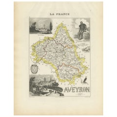
Map of Aveyron France with Rodez, Millau and Wine Routes, 19th Century
Located in Langweer, NL
Map of Aveyron France with Rodez, Millau and Wine Routes, 19th Century
Description:
This detailed and decorative 19th-century map of Aveyron, a department in southern France, was dr...
Category
Antique Mid-19th Century French Maps
Materials
Paper
You May Also Like
Lozere, France. Antique map of a French department, 1856
By Victor Levasseur
Located in Melbourne, Victoria
'Dept. de La Lozere', steel engraving with original outline hand-colouring., 1856, from Levasseur's 'Atlas National Illustre'.
This remote mountainous part of Languedoc is rural, s...
Category
19th Century Naturalistic Landscape Prints
Materials
Engraving

L'Isere, France. Antique map of French department, 1856
By Victor Levasseur
Located in Melbourne, Victoria
'Dept. de L'Isere', Steel engraving with original outline hand-colouring., 1856, from Levasseur's 'Atlas National Illustre'.
This area is known for its production of Bleu du Vercor...
Category
19th Century Naturalistic Landscape Prints
Materials
Engraving

Pyrenees Orientales, France. Antique map of a French department, 1856
By Victor Levasseur
Located in Melbourne, Victoria
'Dept. des Pyrenees Orientales', steel engraving with original outline hand-colouring., 1856, from Levasseur's 'Atlas National Illustre'.
This area is well-known wine producing reg...
Category
19th Century Naturalistic Landscape Prints
Materials
Engraving

Aude, France. Antique map of a French department, 1856
By Victor Levasseur
Located in Melbourne, Victoria
'Dept. de L' Aude', steel engraving with original outline hand-colouring., 1856, from Levasseur's 'Atlas National Illustre'.
This area of France is famous for its wide variety of v...
Category
19th Century Naturalistic Landscape Prints
Materials
Engraving

Aube, France. Antique map of a French department, 1856
By Victor Levasseur
Located in Melbourne, Victoria
'Dept. de L'Aube', steel engraving with original outline hand-colouring., 1856, from Levasseur's 'Atlas National Illustre'.
This area of France is known for its production of Chaou...
Category
19th Century Naturalistic Landscape Prints
Materials
Engraving

Hautes Alpes, France. Antique map of a French department, 1856
By Victor Levasseur
Located in Melbourne, Victoria
'Dept. des Hautes Alpes', steel engraving with original outline hand-colouring., 1856, from Levasseur's 'Atlas National Illustre'.
This area of France i...
Category
19th Century Naturalistic Landscape Prints
Materials
Engraving

More Ways To Browse
Antique Ivory Collectables
Medieval Castle
Antique Governor
French Wine Map
Antique Wine Labels
Yellow Wine Glass
Antique Spring Scale
Nouvel Glass
6x10 Rug
Styles Of Antique Desks
Black And White Coffee Table
Metal Relief
Curved Velvet Couch
Velvet Curved Sofa
Wood Round Coffee Tables
Antique Paper Flowers
Oak Brutalist
Used College Furniture