Items Similar to Map of Cantal France with Aurillac, Volcanic Peaks and Rural Life, 19th Century


Want more images or videos?
Request additional images or videos from the seller
1 of 10
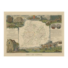
Map of Cantal France with Aurillac, Volcanic Peaks and Rural Life, 19th Century
$141.52
£105.93
€120
CA$194.77
A$217.09
CHF 113.90
MX$2,651.01
NOK 1,442.21
SEK 1,363.11
DKK 913.52
About the Item
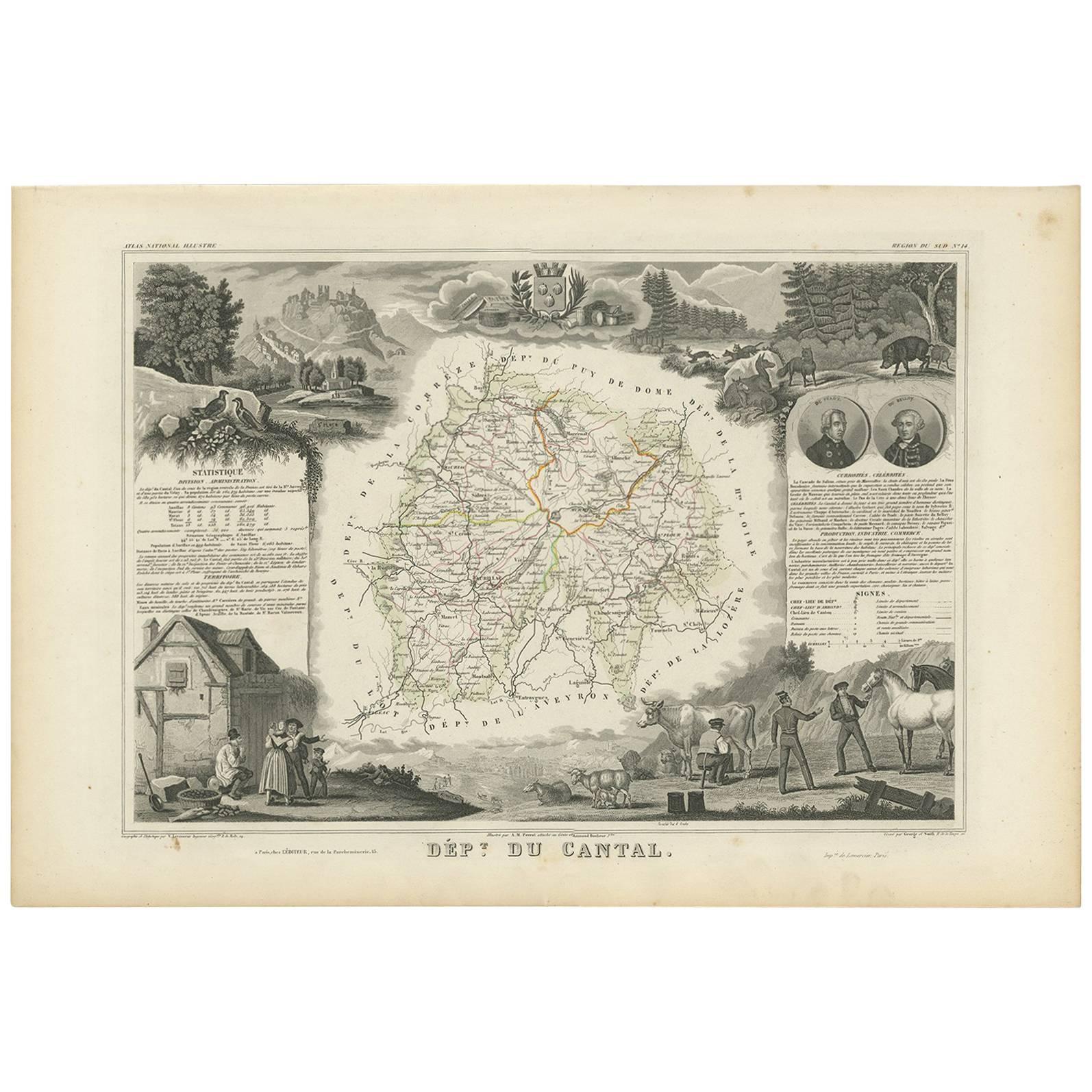
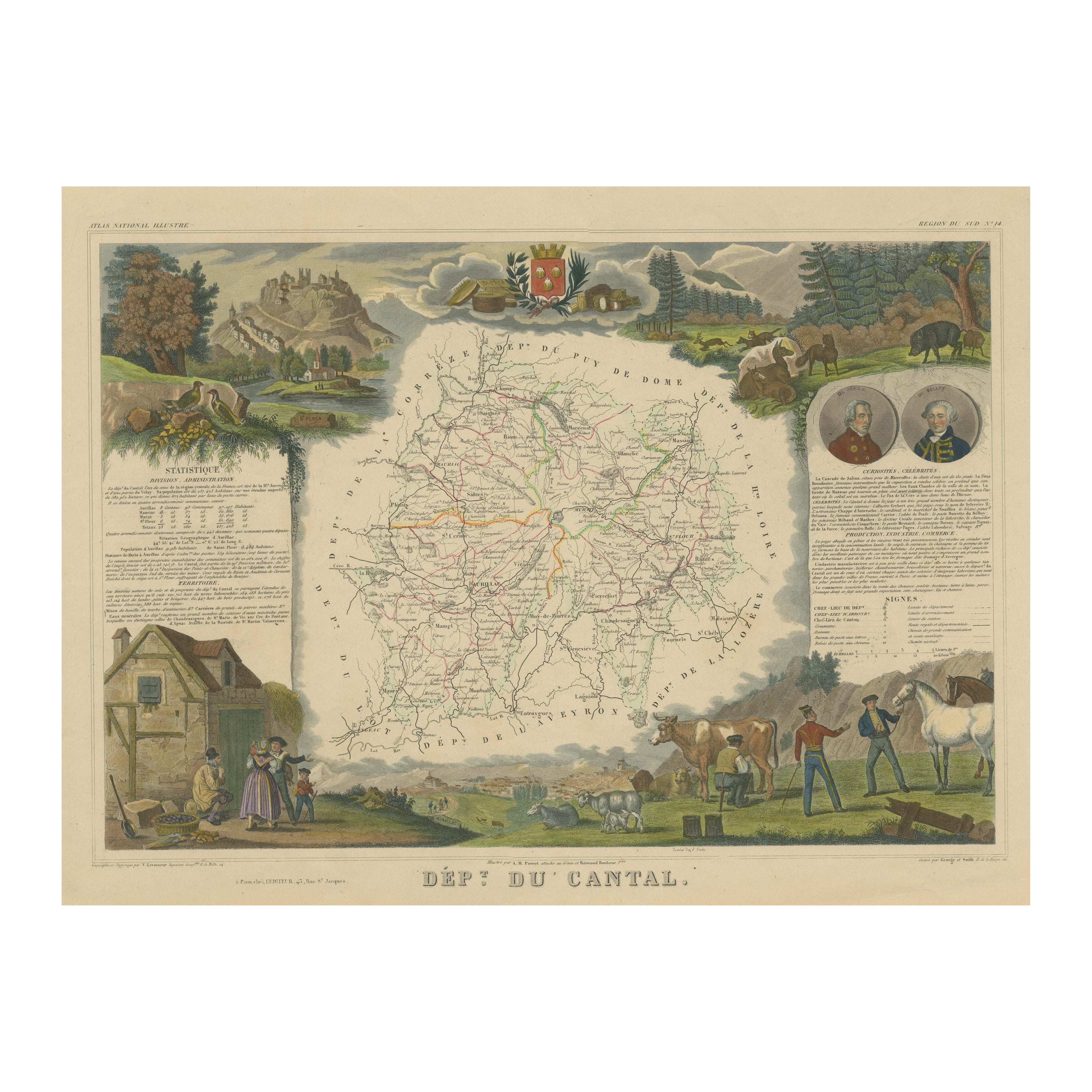
Map of Cantal France with Aurillac, Volcanic Peaks and Rural Life, 19th Century
Description:
This finely engraved and hand-colored 19th-century map of Cantal, a mountainous department in south-central France, was published by Migeon in Paris as part of the *Nouvel Atlas Illustré*. Drawn with detailed accuracy and surrounded by charming vignettes, the map offers a rich geographical and cultural overview of this rural region in the heart of the Massif Central.
Cantal is shown with finely detailed topography, roads, rivers, and towns, including Aurillac, Murat, and Saint-Flour. The borders of the department are carefully hand-colored in light pink, while the internal communes are clearly labeled. In the top left corner is a portrait of Élie Decazes, a statesman born in Saint-Martin-Cantalès who served under Louis XVIII. To the right, the department’s coat of arms is included in a decorative frame with oak and laurel motifs.
The lower corners of the map are enriched with engraved illustrations: on the left, a mountain goat rests in a rocky landscape, representing the wild terrain of the Monts du Cantal, one of the largest extinct volcanic massifs in Europe. To the right, a picturesque scene of the town of Saint-Flour shows its dramatic clifftop position, underlining the rugged beauty and historical significance of the region.
Cantal is known for its high-altitude pastoral economy, with a strong focus on cattle raising and cheese production. The region is famous for Cantal cheese, one of France’s oldest and most traditional cow’s milk cheeses, aged in cellars dug into volcanic rock. Though not a major wine-producing department, Cantal’s agricultural products, pure air, and volcanic soil give it a strong rural identity, making it beloved among lovers of French terroir and countryside traditions.
This map is a wonderful historical and decorative tribute to one of France’s most untouched and geologically fascinating departments, ideal for collectors with interests in French geography, rural life, or historic natural landscapes.
Condition summary:
Very good condition with some age toning and light foxing in the margins. The engraved lines are clear, and the original hand coloring remains vibrant and well applied.
Framing tips:
Ideal for framing in a natural wood or deep walnut frame. A warm white or soft grey mat will highlight the pink border and mountainous motifs. Use UV-protective glass to ensure long-term preservation of the paper and coloring.
- Dimensions:Height: 10.28 in (26.1 cm)Width: 12.8 in (32.5 cm)Depth: 0.01 in (0.2 mm)
- Materials and Techniques:Paper,Engraved
- Place of Origin:
- Period:
- Date of Manufacture:circa 1850
- Condition:Very good condition with some age toning and light foxing in the margins. The engraved lines are clear, and the original hand coloring remains vibrant and well applied.
- Seller Location:Langweer, NL
- Reference Number:Seller: BG-13331-141stDibs: LU3054345359822
About the Seller
5.0
Recognized Seller
These prestigious sellers are industry leaders and represent the highest echelon for item quality and design.
Platinum Seller
Premium sellers with a 4.7+ rating and 24-hour response times
Established in 2009
1stDibs seller since 2017
2,517 sales on 1stDibs
Typical response time: <1 hour
- ShippingRetrieving quote...Shipping from: Langweer, Netherlands
- Return Policy
Authenticity Guarantee
In the unlikely event there’s an issue with an item’s authenticity, contact us within 1 year for a full refund. DetailsMoney-Back Guarantee
If your item is not as described, is damaged in transit, or does not arrive, contact us within 7 days for a full refund. Details24-Hour Cancellation
You have a 24-hour grace period in which to reconsider your purchase, with no questions asked.Vetted Professional Sellers
Our world-class sellers must adhere to strict standards for service and quality, maintaining the integrity of our listings.Price-Match Guarantee
If you find that a seller listed the same item for a lower price elsewhere, we’ll match it.Trusted Global Delivery
Our best-in-class carrier network provides specialized shipping options worldwide, including custom delivery.More From This Seller
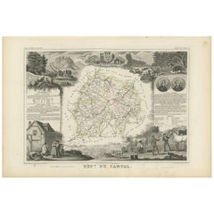
View AllAntique Map of Cantal ‘France’ by V. Levasseur, 1854
By Victor Levasseur
Located in Langweer, NL
Antique map titled 'Dépt. du Cantal'. Map of the French department of Cantal, France. This area of France is known for its production of Cantal, a firm cheese, named after the region...
Category
Antique Mid-19th Century Maps
Materials
Paper
$169 Sale Price
20% Off
Map of Côtes-du-Nord France with Saint-Brieuc and Brittany Coastline, c.1850
Located in Langweer, NL
Map of Côtes-du-Nord France with Saint-Brieuc and Brittany Coastline, 19th c
Description:
This elegant 19th-century map of Côtes-du-Nord, the historic name for what is now known as ...
Category
Antique Mid-19th Century French Maps
Materials
Paper

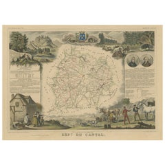
Hand Colored Antique Map of the department of Cantal, France
By Victor Levasseur
Located in Langweer, NL
Antique map titled 'Dépt. du Cantal'. Map of the French department of Cantal, France. This area of France is known for its production of Cantal, a firm cheese, named after the region...
Category
Antique Mid-19th Century Maps
Materials
Paper
$320 Sale Price
20% Off
Map of Ariège France with Foix and Pyrenees Landscape by Vuillemin, 19th c
Located in Langweer, NL
Map of Ariège France with Foix and Pyrenees Landscape by Vuillemin, 19th c
Description:
This beautifully detailed 19th-century map of the Ariège department in southwestern France wa...
Category
Antique Mid-19th Century French Maps
Materials
Paper

Old Map of the French Department of Cantal, France
By Victor Levasseur
Located in Langweer, NL
Antique map titled 'Dépt. du Cantal'. Map of the French department of Cantal, France. This area of France is known for its production of Cantal, a firm cheese, named after the region...
Category
Antique Mid-19th Century Maps
Materials
Paper
$320 Sale Price
20% Off
Map of Ain France with Vineyards of Bugey and Notable Portraits, c.1850
Located in Langweer, NL
Map of Ain France with Portraits of Bichat and Joubert by Vuillemin, 19th c
This highly decorative 19th-century map of the French department of Ain is taken from the celebrated Nouv...
Category
Antique Mid-19th Century French Maps
Materials
Paper

You May Also Like
Large 19th Century Map of France
Located in Pease pottage, West Sussex
Large 19th Century Map of France.
Remarkable condition, with a pleasing age worn patina.
Recently framed.
France Circa 1874.
Category
Antique Late 19th Century French Maps
Materials
Linen, Paper

Hautes-Pyrénées Map - Original Lithograph - 19th Century
Located in Roma, IT
Hautes-Pyrénées Map is an original lithograph realized by an Anonymous engraver of the 19th Century.
Printed in series of "France Pittoresque" at the top center.
The state of prese...
Category
19th Century Modern Figurative Prints
Materials
Paper, Lithograph

Hautes Alpes, France. Antique map of a French department, 1856
By Victor Levasseur
Located in Melbourne, Victoria
'Dept. des Hautes Alpes', steel engraving with original outline hand-colouring., 1856, from Levasseur's 'Atlas National Illustre'.
This area of France i...
Category
19th Century Naturalistic Landscape Prints
Materials
Engraving

Jura, France. Antique map of a French department, 1856
By Victor Levasseur
Located in Melbourne, Victoria
'Dept. du Jura', steel engraving with original outline hand-colouring., 1856, from Levasseur's 'Atlas National Illustre'.
The Jura wines are very distinctive and unusual, such as V...
Category
19th Century Naturalistic Landscape Prints
Materials
Engraving

Lozere, France. Antique map of a French department, 1856
By Victor Levasseur
Located in Melbourne, Victoria
'Dept. de La Lozere', steel engraving with original outline hand-colouring., 1856, from Levasseur's 'Atlas National Illustre'.
This remote mountainous part of Languedoc is rural, s...
Category
19th Century Naturalistic Landscape Prints
Materials
Engraving

Pyrenees Orientales, France. Antique map of a French department, 1856
By Victor Levasseur
Located in Melbourne, Victoria
'Dept. des Pyrenees Orientales', steel engraving with original outline hand-colouring., 1856, from Levasseur's 'Atlas National Illustre'.
This area is well-known wine producing reg...
Category
19th Century Naturalistic Landscape Prints
Materials
Engraving

More Ways To Browse
French Wine Map
Louis Xviii
Antique Wine Labels
Colored Wine Glass
Pink Wine Glass
Milk Cow
Nouvel Glass
Wine Glasses Saint Louis
6x10 Rug
Styles Of Antique Desks
Black And White Coffee Table
Metal Relief
Curved Velvet Couch
Velvet Curved Sofa
Wood Round Coffee Tables
Antique Paper Flowers
Oak Brutalist
Used College Furniture