Items Similar to Map of Independent Tartary with Vignettes of the Region's Culture, 1851


Want more images or videos?
Request additional images or videos from the seller
1 of 6
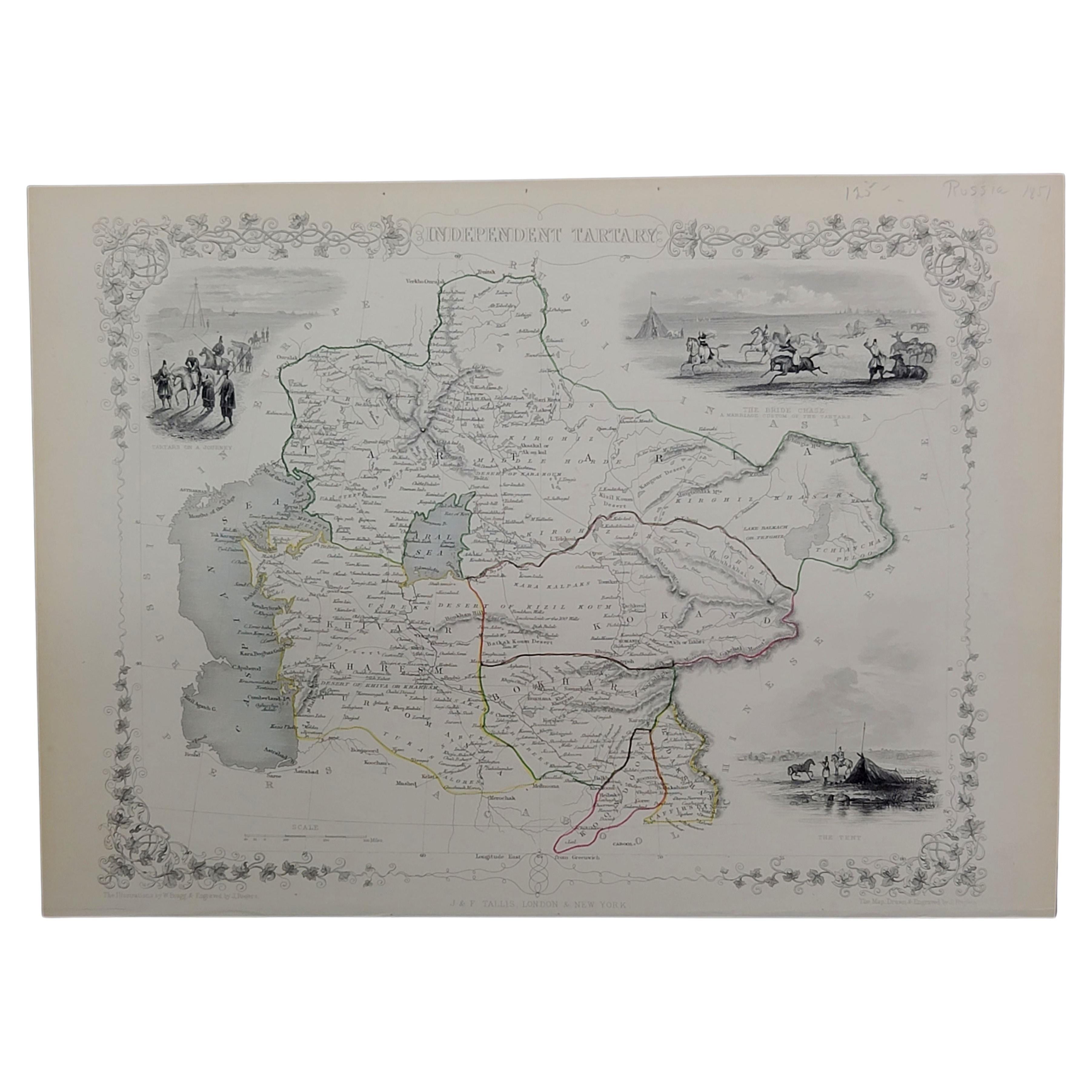
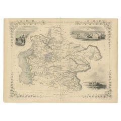
Map of Independent Tartary with Vignettes of the Region's Culture, 1851
$277.97
$347.4620% Off
£206.89
£258.6120% Off
€232
€29020% Off
CA$380.75
CA$475.9420% Off
A$423.48
A$529.3420% Off
CHF 221.13
CHF 276.4120% Off
MX$5,153.25
MX$6,441.5620% Off
NOK 2,824.11
NOK 3,530.1420% Off
SEK 2,648.52
SEK 3,310.6520% Off
DKK 1,766.14
DKK 2,207.6720% Off
Shipping
Retrieving quote...The 1stDibs Promise:
Authenticity Guarantee,
Money-Back Guarantee,
24-Hour Cancellation
About the Item
The map of Independent Tartary is part of the collection by John Tallis & Company, which were unique for their elaborate decorative elements and detailed illustrations.
**The Maker - John Tallis & Company:**
Known for the high level of detail and ornate borders, Tallis maps are works of art in the field of cartography. John Tallis, the founder, along with his company, are celebrated for their mid-19th-century maps that combined precise geographic detail with engaging artistic embellishments.
**The Map - Independent Tartary:**
"Independent Tartary" referred to the region of Central Asia that was not under the control of Russia or other major powers at the time. This would have included parts of what is now Turkmenistan, Kazakhstan, Tajikistan, Uzbekistan, and Kyrgyzstan. It was a region known for its nomadic cultures, significant trade routes like the Silk Road, and strategic geopolitical importance.
**The Countries and the Tallis Series:**
The regions depicted were historically home to various Turkic and Mongolic peoples, and the map would have been part of efforts to better understand the geography and political divisions of an area of considerable interest to the British Empire and other European powers.
The series "The British Colonies" by Robert Montgomery Martin aimed to provide detailed accounts of areas under British influence as well as those of interest to British explorers, traders, and diplomats. Though not a British colony, Independent Tartary would have been included due to its strategic importance.
**The Images on the Map:**
The vignettes and scenes in the Tallis maps serve to illustrate aspects of local life, culture, and geography, and they often include:
- Scenes of local people and their daily activities, such as traveling or hunting, depicted in the region’s vast and varied landscapes.
- Important landmarks or typical architecture of the region.
- Scenes of trade or transportation, reflecting the economic activities in the area.
These maps are a bridge between art and practical cartography, offering a window into the past perceptions and understandings of regions that were largely mysterious to the Western world at the time. They are prized by collectors today for their unique combination of accurate cartographic detail and artistic interpretation.
More details on the insets:
The insets on the map of Independent Tartary showcase various cultural and social aspects of the region:
1. **The Tent**: This inset likely illustrates the nomadic lifestyle of the peoples of the Central Asian steppes. The tent shown is a traditional yurt, which is portable and commonly used by nomadic tribes in the region.
2. **The Bride Chase**: Depicting a marriage custom of the Tartars, this scene shows horsemen and possibly a horse-drawn carriage involved in a ritual or celebration, which could involve the groom having to chase the bride on horseback as part of the matrimonial traditions.
3. **Tartars on a Journey**: This vignette presents a group of Tartars traveling, possibly depicting a caravan with loaded camels or horses, showing the nomadic nature of life on the steppes.
These insets were designed to give map readers a glimpse into the way of life and traditions of the people who lived in the vast region known as Independent Tartary, which spanned much of what is now Central Asia. The detailed artwork in these insets adds both charm and educational value to the map, reflecting the 19th-century European interest in exotic cultures and distant lands.
- Dimensions:Height: 10.71 in (27.2 cm)Width: 14.26 in (36.2 cm)Depth: 0 in (0.02 mm)
- Materials and Techniques:
- Period:
- Date of Manufacture:1851
- Condition:Good given age. Original fold in middle as published. General age-related toning, please study scan carefully.
- Seller Location:Langweer, NL
- Reference Number:Seller: BG-13736-61stDibs: LU3054339291832
About the Seller
5.0
Recognized Seller
These prestigious sellers are industry leaders and represent the highest echelon for item quality and design.
Platinum Seller
Premium sellers with a 4.7+ rating and 24-hour response times
Established in 2009
1stDibs seller since 2017
2,508 sales on 1stDibs
Typical response time: <1 hour
- ShippingRetrieving quote...Shipping from: Langweer, Netherlands
- Return Policy
Authenticity Guarantee
In the unlikely event there’s an issue with an item’s authenticity, contact us within 1 year for a full refund. DetailsMoney-Back Guarantee
If your item is not as described, is damaged in transit, or does not arrive, contact us within 7 days for a full refund. Details24-Hour Cancellation
You have a 24-hour grace period in which to reconsider your purchase, with no questions asked.Vetted Professional Sellers
Our world-class sellers must adhere to strict standards for service and quality, maintaining the integrity of our listings.Price-Match Guarantee
If you find that a seller listed the same item for a lower price elsewhere, we’ll match it.Trusted Global Delivery
Our best-in-class carrier network provides specialized shipping options worldwide, including custom delivery.More From This Seller
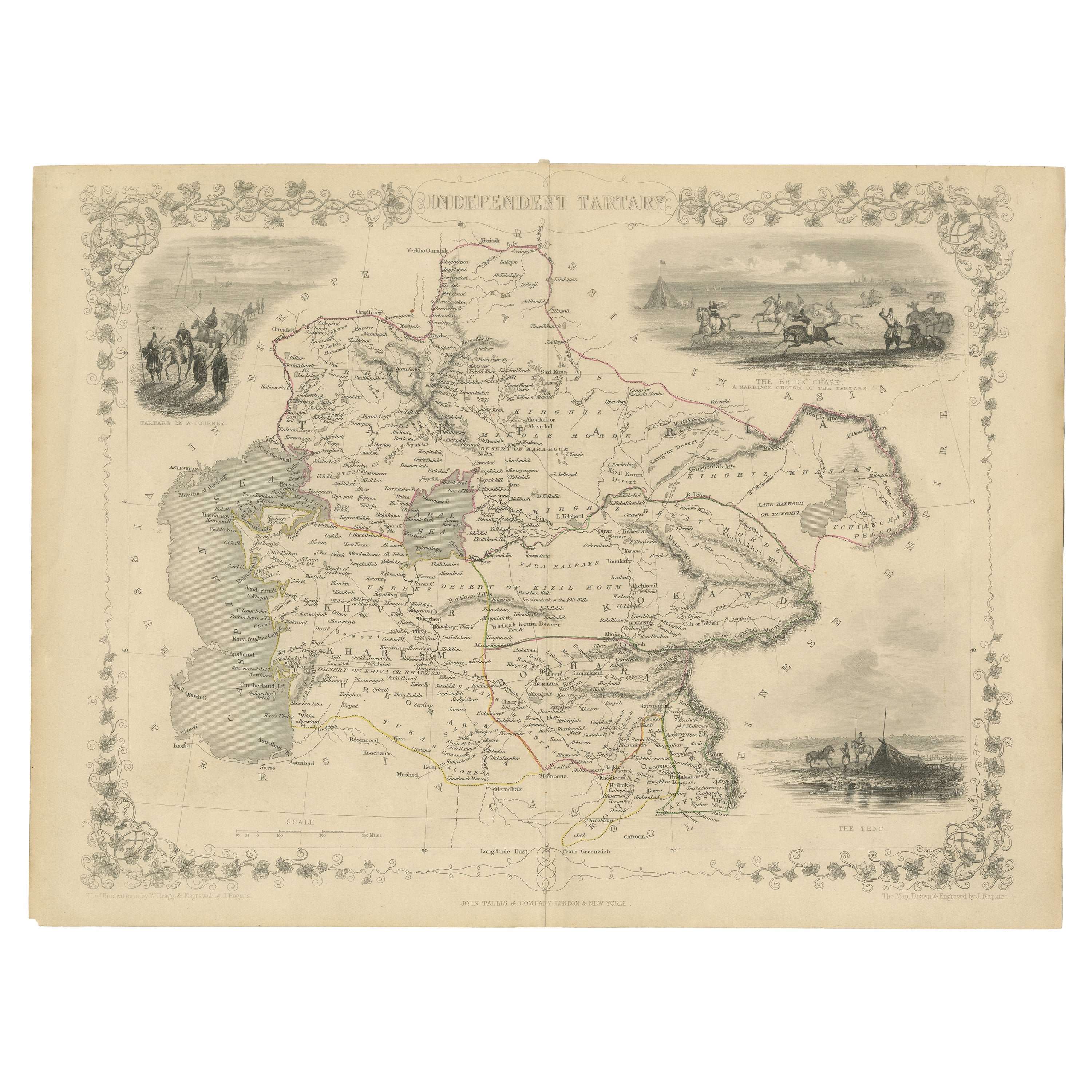
View AllGateway to the Steppes: Tallis's Masterpiece Map of Indepent Tartary, 1851
Located in Langweer, NL
The map is of "Independent Tartary," a historical region in Central Asia that covered parts of what are now Kazakhstan, Uzbekistan, Turkmenistan, and surrounding areas. The map was p...
Category
Antique 1850s Maps
Materials
Paper
$316 Sale Price
20% Off
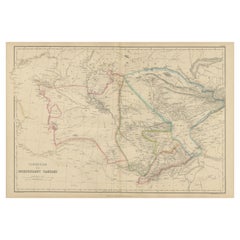
Antique Map of Independent Tartary by W. G. Blackie, 1859
Located in Langweer, NL
Antique map titled 'Turkestan or Independent Tartary'. Original antique map of Turkestan or Independent Tartary. This map originates from ‘The Imperial Atlas of Modern Geography’. Pu...
Category
Antique Mid-19th Century Maps
Materials
Paper
$239 Sale Price
20% Off
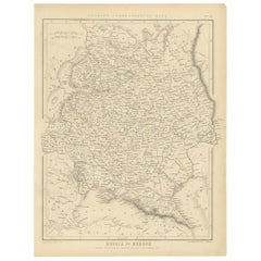
Antique Map of Russia in Europe by Tallis, '1851'
Located in Langweer, NL
Antique map titled 'Russia in Europe'. Map of European Russia. Showing vignettes of the Neoskoi Prospect, St. Petersburg, Polish Captives on their way to Siberia, a Russian Bear...
Category
Antique Mid-19th Century Maps
Materials
Paper

$239 Sale Price
20% Off
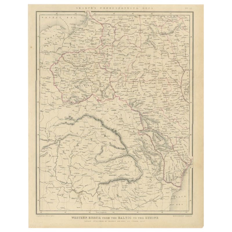
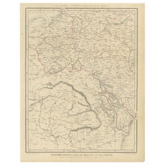
Antique Map of Russia from the Baltic to the Black Sea by Sharpe, 1849
Located in Langweer, NL
Antique map titled 'Western Russia from the Baltic to the Euxine'. Old map of Western Russia from the Baltic to the Black Sea. This map originates from 'Sharpe's Corresponding Atlas ...
Category
Antique 19th Century Maps
Materials
Paper
$91 Sale Price
20% Off
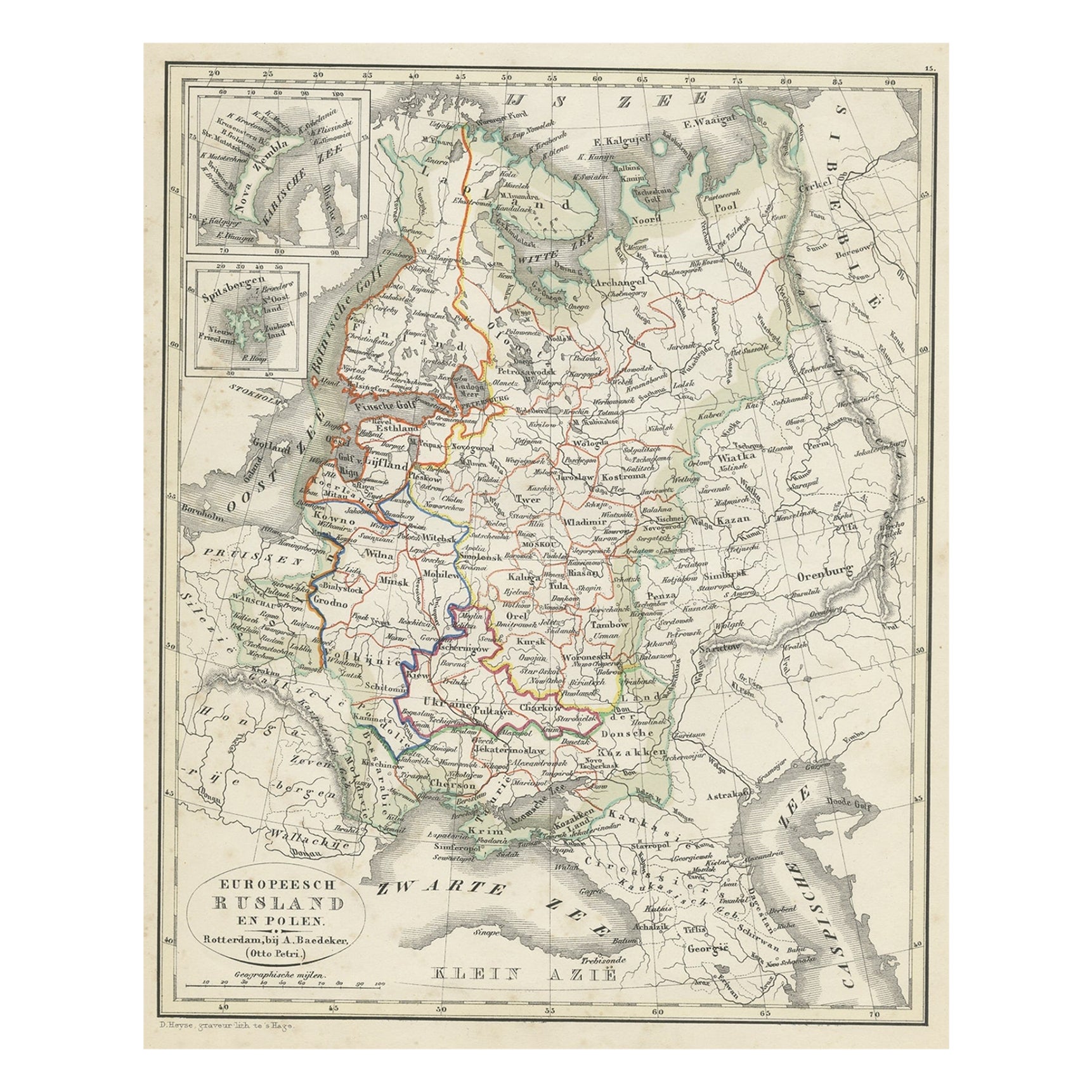
Antique Map of Russia in Europe and Poland from an d Old Dutch Atlas, 1852
Located in Langweer, NL
Description: Antique map titled 'Europeesch Rusland en Polen'.
Map of Russia in Europe and Poland. This map originates from 'School-Atlas van alle deelen der Aarde' by Otto Petri...
Category
Antique 1850s Maps
Materials
Paper

$115 Sale Price
20% Off
Old Original Map of Russia in Europe, 1849
Located in Langweer, NL
Antique map titled 'Russia in Europe'.
Old map of Russia in Europe. This map originates from 'Sharpe's Corresponding Atlas (..)' by J. Sharpe.
Artists and Engravers: Published by Chapman and Hall.
Category
Antique 1840s Maps
Materials
Paper
$172 Sale Price
20% Off
You May Also Like
1851 Map of "Independent Tartary", Ric. R018
Located in Norton, MA
1851 Map of
Independent Tartary
"Russia"
Ric.r018
A highly decorative 1851 map of Independent Tartary by John Tallis and John Rapkin. Covers the regions between the Caspian Sea and Lake Bakquash and between Russia and Afghanistan. These include the ancient Silk Route kingdoms of Khiva, Tartaria, Kokand, and Bokhara. Today this region roughly includes Kazakhstan, Uzbekistan, Turkmenistan, Kyrgyzstan, and Tajikistan. This wonderful map offers a wealth of detail for anyone with an interest in the Central Asian portion of the ancient Silk Road. Identifies various caravan routes, deserts, wells, and stopping points, including the cities of Bokhara and Samarkand. Three vignettes by W. Bragg decorate the map, these including an image of Tartars on a Journey, a horseback Bride Chase, and a tartar camp site. Surrounded by a vine motif border. Engraved by J. Rapkin for John Tallis's 1851 Illustrated Atlas .
Tartary Antique Map...
Category
Antique 19th Century Unknown Maps
Materials
Paper

1839 Map of Karte Des "Russischen Reiches in Europa Und Asien" Ric.R0013
Located in Norton, MA
1839 map of Karte Des
"Russischen Reiches in Europa and Asien"
Ric.r013
Map of the European and Asian parts of Russian Empire. Karte der Russischen Reiches in Europa und Asien...
Category
Antique 19th Century Unknown Maps
Materials
Paper

1849 Map of "Europaische Russland", 'Meyer Map of European Russia', Ric. R017
Located in Norton, MA
1849 Map of
"Europaische Russland"
( Meyer Map of European Russia)
Ric.r017
A lovely map of European Russia dating to 1849 by Joseph Meyer. It covers the European portions of...
Category
Antique 19th Century Unknown Maps
Materials
Paper

1853 Map of "Russia in Europe Including Poland" Ric.r016
Located in Norton, MA
Description
Russia in Europe incl. Poland by J Wyld c.1853
Hand coloured steel engraving
Dimension: Paper: 25 cm W x 33 cm H ; Sight: 22 cm W x 28 cm H
Condition: Good ...
Category
Antique 19th Century Unknown Maps
Materials
Paper

1790 Thomas Stackhouse Map, Entitled "Russia in Europe, " , Ric.a004
Located in Norton, MA
1790 Thomas Stackhouse map, entitled
"Russia in Europe"
Ric.a004
Stackhouse, Thomas
Russia in Europe [map]
London: T. Stackhouse, 1783. Map. Matted hand-colored copper engraving. Image size: 14.5 x 15.25 inches. Mat size: 22.75 x 23.75 inches. A beautiful example of this map of Eastern Europe...
Category
Antique 17th Century Unknown Maps
Materials
Paper

Original Antique Map of Hungary, Arrowsmith, 1820
Located in St Annes, Lancashire
Great map of Hungary
Drawn under the direction of Arrowsmith.
Copper-plate engraving.
Published by Longman, Hurst, Rees, Orme and Brown, 1820
Unframed.
Category
Antique 1820s English Maps
Materials
Paper

More Ways To Browse
Antique Hunting Collectibles
Antique Curiosities Artwork
Silk Map
Carriage Trade
Used Yurt
John Powers
Antique Oushak Carpets
Blue Coffee Tables
1945 Chair Juhl
Antique Three Leg Table
Folke Arstrom
Silver Over Copper
Vintage Barware Glasses
Antique Etched Glass
Antique French Shell
Coffee Table Black Italian Modern
Christofle America
Iranian Silk Rug Carpet