Items Similar to Map of The Italian Peninsula with the islands of Sicily, Sardinia, Corsica, 1880


Want more images or videos?
Request additional images or videos from the seller
1 of 6
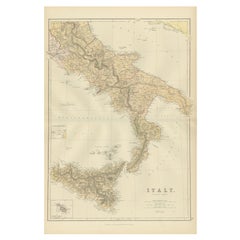
Map of The Italian Peninsula with the islands of Sicily, Sardinia, Corsica, 1880
$354.65
$443.3120% Off
£264.01
£330.0220% Off
€296
€37020% Off
CA$485.78
CA$607.2320% Off
A$540.30
A$675.3720% Off
CHF 282.13
CHF 352.6620% Off
MX$6,574.83
MX$8,218.5420% Off
NOK 3,603.18
NOK 4,503.9720% Off
SEK 3,379.15
SEK 4,223.9320% Off
DKK 2,253.34
DKK 2,816.6820% Off
Shipping
Retrieving quote...The 1stDibs Promise:
Authenticity Guarantee,
Money-Back Guarantee,
24-Hour Cancellation
About the Item
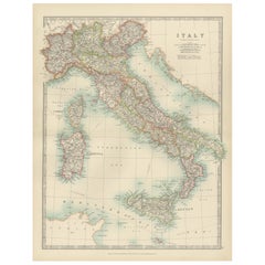
This map, titled "ITALIA, Sicilia, Sardinia, Corsica," represents the Italian Peninsula along with the islands of Sicily, Sardinia, and Corsica. Inset maps offer detailed views of "Roma" with an elaborate depiction of the ancient Roman Forum, signifying its significance as a center of political, religious, and social life in the Roman Republic and Empire.
From the "Spruner-Menke Atlas Antiquus," this map is a work by Karl Spruner von Merz, later revised by Theodorus Menke. Known for meticulous historical cartography, the atlas served as an academic resource, depicting various regions through different historical eras.
The period depicted might be during the Roman Republic or early Empire, indicated by the prominent display of the Roman Forum in the inset, which was the core of Roman public life during these times.
The map is interesting for several reasons:
1. **Historical Insight**: It provides a visualization of Italy's ancient regional divisions, roads, and cities.
2. **Cultural Heritage**: The detailed inset of Rome's Forum is a snapshot of one of history's most influential urban centers.
3. **Topographical Detail**: The map shows the topography of Italy, including the Apennine mountain range, the Po Valley, and the volcanic areas, critical to Italy's ancient and modern history.
4. **Island Representation**: The inclusion of the major islands underscores their historical importance in the Mediterranean context.
5. **Navigation and Trade**: The map may detail ancient trade routes and ports, reflecting the maritime prowess of ancient Rome.
6. **Military Campaigns**: It likely includes sites of major battles and military campaigns, which were instrumental in Rome's expansion.
This map would be particularly useful for those interested in the geographical aspects of ancient Rome, the development of its provinces, and the broader historical context of the Mediterranean region during antiquity.
- Dimensions:Height: 15.56 in (39.5 cm)Width: 18.51 in (47 cm)Depth: 0 in (0.02 mm)
- Materials and Techniques:
- Period:
- Date of Manufacture:1880
- Condition:Good, given age. General age-related toning, especially around the edges. The vertical folding line as issued. Please study scan carefully.
- Seller Location:Langweer, NL
- Reference Number:Seller: BG-13686-2-301stDibs: LU3054338558162
About the Seller
5.0
Recognized Seller
These prestigious sellers are industry leaders and represent the highest echelon for item quality and design.
Platinum Seller
Premium sellers with a 4.7+ rating and 24-hour response times
Established in 2009
1stDibs seller since 2017
2,510 sales on 1stDibs
Typical response time: <1 hour
- ShippingRetrieving quote...Shipping from: Langweer, Netherlands
- Return Policy
Authenticity Guarantee
In the unlikely event there’s an issue with an item’s authenticity, contact us within 1 year for a full refund. DetailsMoney-Back Guarantee
If your item is not as described, is damaged in transit, or does not arrive, contact us within 7 days for a full refund. Details24-Hour Cancellation
You have a 24-hour grace period in which to reconsider your purchase, with no questions asked.Vetted Professional Sellers
Our world-class sellers must adhere to strict standards for service and quality, maintaining the integrity of our listings.Price-Match Guarantee
If you find that a seller listed the same item for a lower price elsewhere, we’ll match it.Trusted Global Delivery
Our best-in-class carrier network provides specialized shipping options worldwide, including custom delivery.More From This Seller
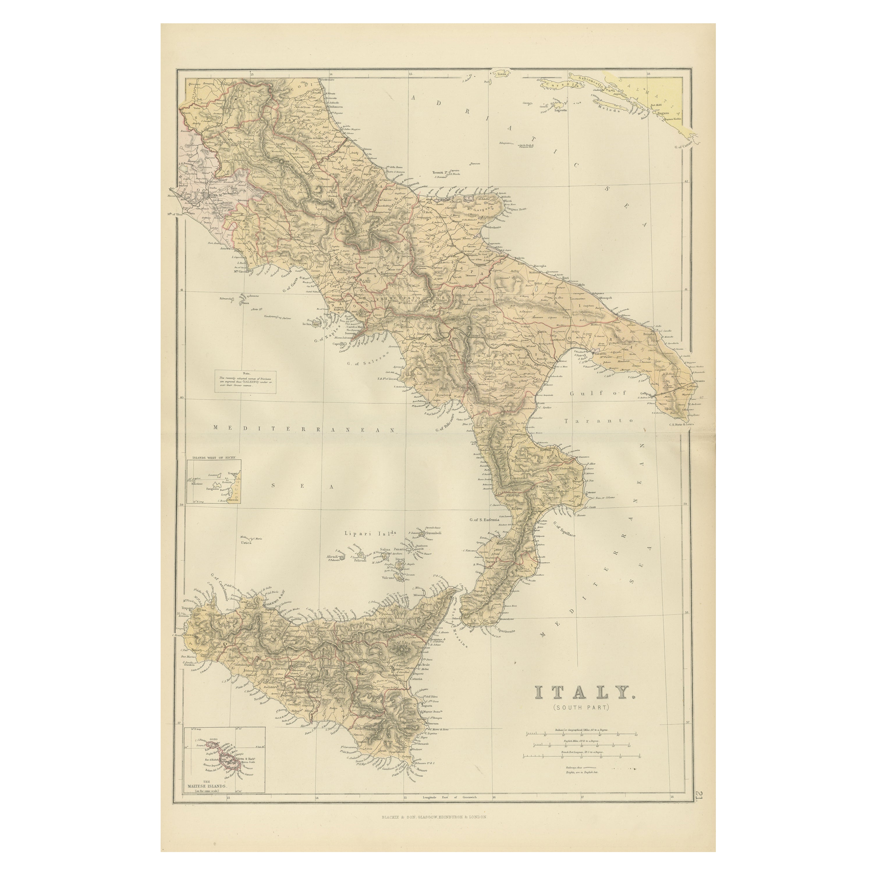
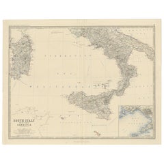
View AllOriginal Antique Map of the South Part of Italy with an Inset of Malta, 1882
Located in Langweer, NL
Embark on a captivating journey through the southern part of Italy with an original Antique Map from the esteemed 'Comprehensive Atlas and Geography of the World,' meticulously craft...
Category
Antique 1880s Maps
Materials
Paper
$201 Sale Price
20% Off
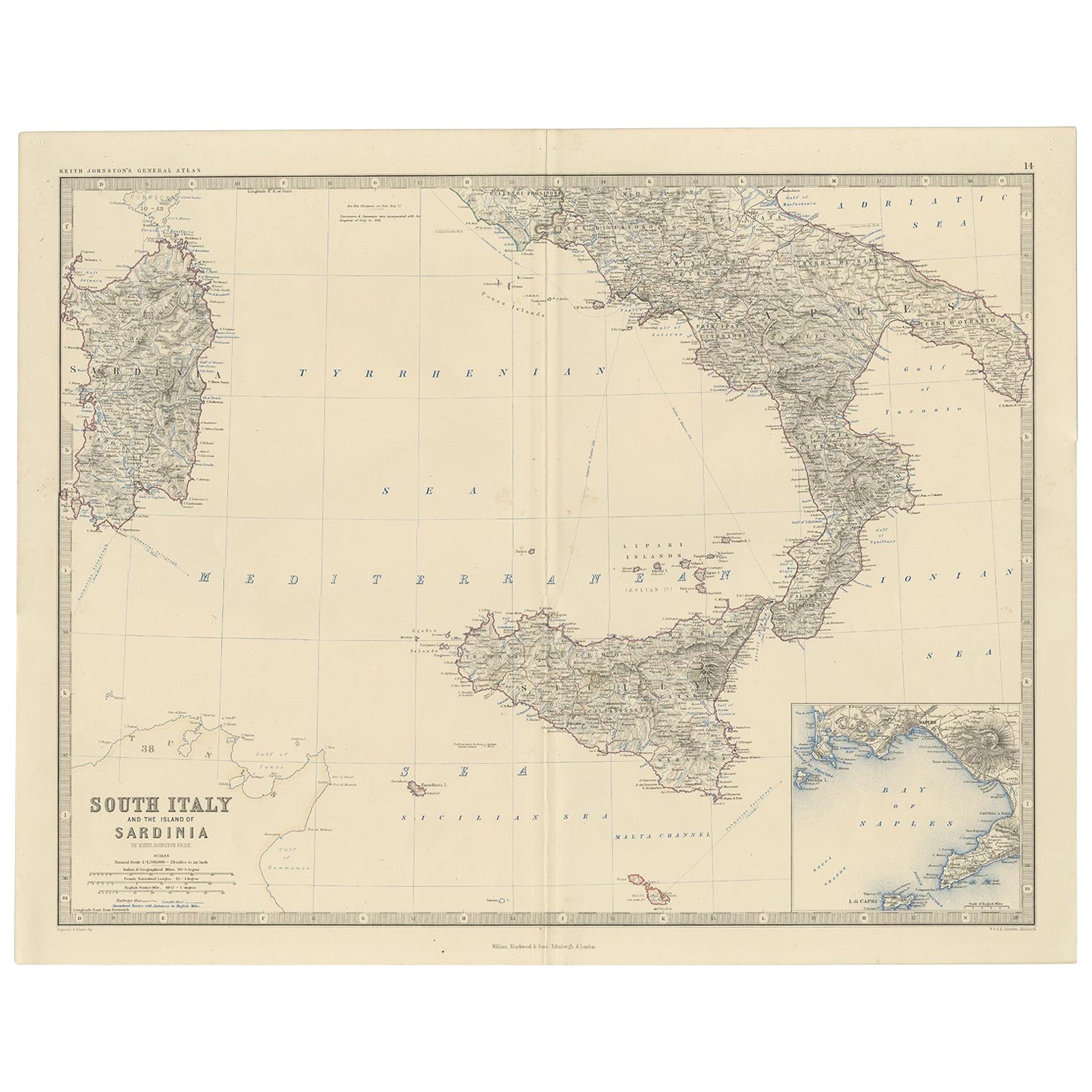
Map of Southern Italy inlcluding Sardinia and Inset of the Bay of Naples, c.1860
Located in Langweer, NL
Antique map titled 'South Italy and the Island of Sardinia'.
Old map of Southern Italy and the island of Sardinia. With an inset map of the B...
Category
Antique 1860s Maps
Materials
Paper
$325 Sale Price
20% Off
Antique Map of Italy, 1903, Featuring Islands of Sardinia and Sicily
Located in Langweer, NL
Title: Antique Map of Italy, 1903, Featuring Islands of Sardinia and Sicily
Description:
This finely detailed antique map, titled "Italy," was engraved and published in 1903 by the ...
Category
Early 20th Century Maps
Materials
Paper
Original Antique Map of Italy with an Inset of Sardinia, 1882
Located in Langweer, NL
Embark on a historical odyssey with an original Antique Map of Italy from the esteemed 'Comprehensive Atlas and Geography of the World,' meticulously crafted in 1882. This captivatin...
Category
Antique 1880s Maps
Materials
Paper

$201 Sale Price
20% Off
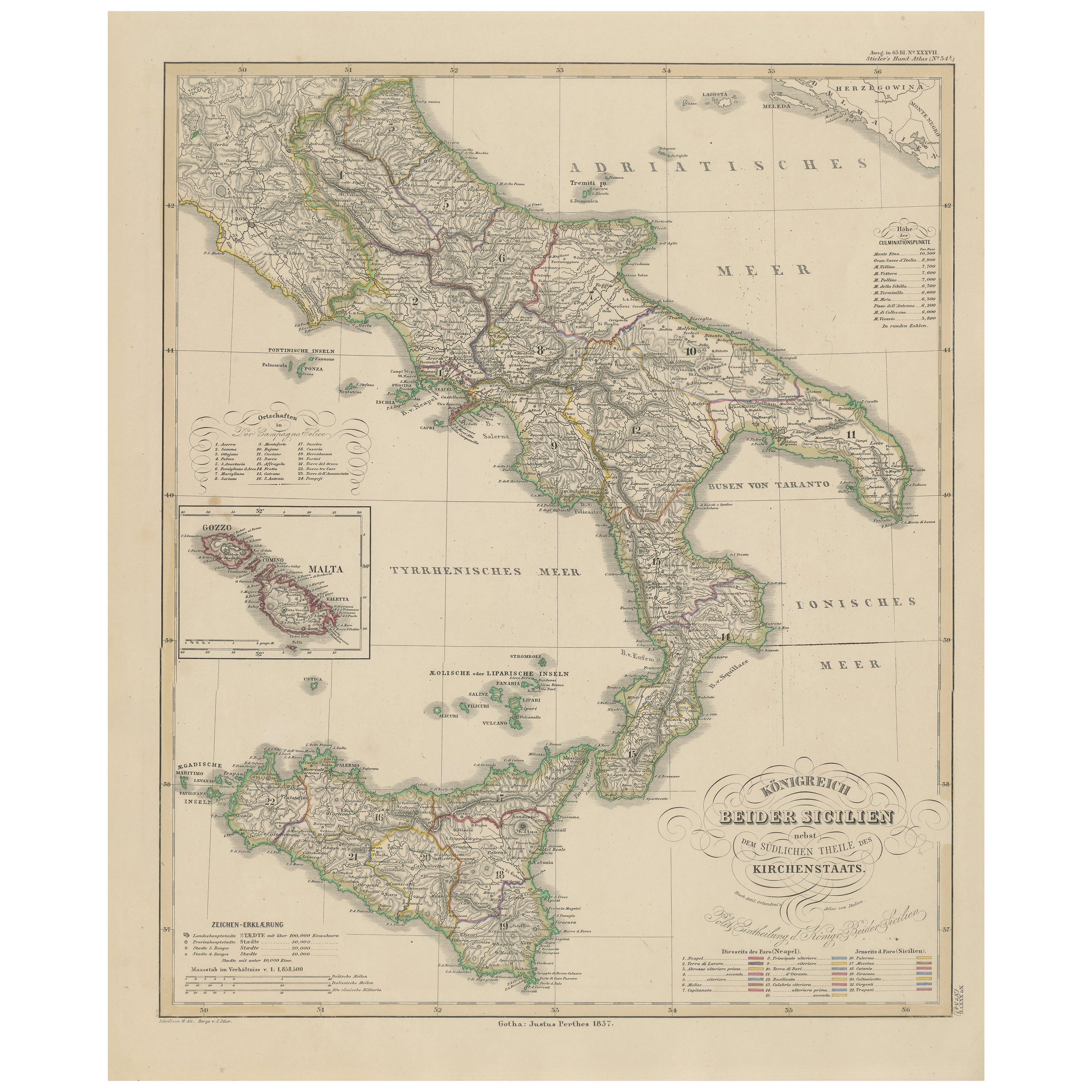
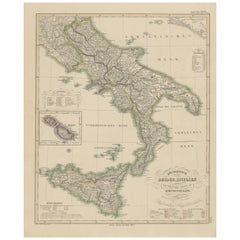
Kingdom of the Two Sicilies Map – Southern Italy and Sicily 1857
Located in Langweer, NL
Kingdom of the Two Sicilies Map – Southern Italy and Sicily 1857
This detailed antique print shows the “Königreich Beider Sicilien nebst dem südlichen Theile des Kirchenstaats” mean...
Category
Antique Mid-19th Century German Maps
Materials
Paper
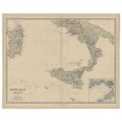
Antique Map of Southern Italy and Sardinia by Johnston, 1882
Located in Langweer, NL
"Antique map titled 'South Italy and the Island of Sardinia'. Old map of Southern Italy and the island of Sardinia. With an inset map of the Bay ...
Category
Antique 19th Century Maps
Materials
Paper
$95 Sale Price
20% Off
You May Also Like
Italy, Central and Southern Part. Century Atlas antique map
Located in Melbourne, Victoria
'The Century Atlas. Italy, Central and Southern Part.'
Original antique map, 1903.
Inset maps of Sicily and Naples.
Central fold as issued. Map name an...
Category
Early 20th Century Victorian More Prints
Materials
Lithograph

Large Original Antique Map of Italy. John Dower, 1861
Located in St Annes, Lancashire
Great map of Italy
Lithograph engraving by John Dower
Original colour
Published, 1861
Unframed
Good condition / repair to top right corner seen in last image
Category
Antique 1860s English Victorian Maps
Materials
Paper

Large Original Antique Map of South Italy and Malta by Sidney Hall, 1847
Located in St Annes, Lancashire
Great map of South Italy and Malta
Drawn by Sidney Hall
Steel engraving by G.Aikman
Original color outline
Published by A & C Black. 1847
Un...
Category
Antique 1840s Scottish Maps
Materials
Paper

Large Original Antique Map of The South of Italy. John Dower, 1861
Located in St Annes, Lancashire
Great map of the South of Italy
Lithograph engraving by John Dower
Original colour
Published, 1861
Unframed
Good condition
Free shipping
Category
Antique 1860s English Victorian Maps
Materials
Paper

Geographical Map of Italy
Located in Alessandria, Piemonte
BOLIS Publishing House - Bergamo.
A beautiful large map of Italy, on paper but suitably reinforced to preserve it correctly. The maps were usually p...
Category
Mid-20th Century Italian Other Prints
Materials
Paper

Italy, Northern Part. Century Atlas antique vintage map
Located in Melbourne, Victoria
'The Century Atlas. Italy, Northern Part.'
Original antique map, 1903.
Central fold as issued. Map name and number printed on the reverse corners.
Sheet 29.5cm by 40cm.
Category
Early 20th Century Victorian More Prints
Materials
Lithograph

More Ways To Browse
Antique Forum
Vintage Wood Table With Glass Top
19th Century Square Table
Galle Chairs
Large Chinese Rug
1940s Vintage French Art Deco
20th Century Spanish Table
Antonio Bellini
Retro Fiberglass Furniture
Shipping Crate
Antique Oushak Carpets
Blue Coffee Tables
German Bauhaus Posters
1945 Chair Juhl
Antique Three Leg Table
Folke Arstrom
Silver Over Copper
Vintage Barware Glasses