Items Similar to An Original Antique Mid-17th Century Blaeu Map of Styria in Southeastern Austria

Want more images or videos?
Request additional images or videos from the seller
1 of 6
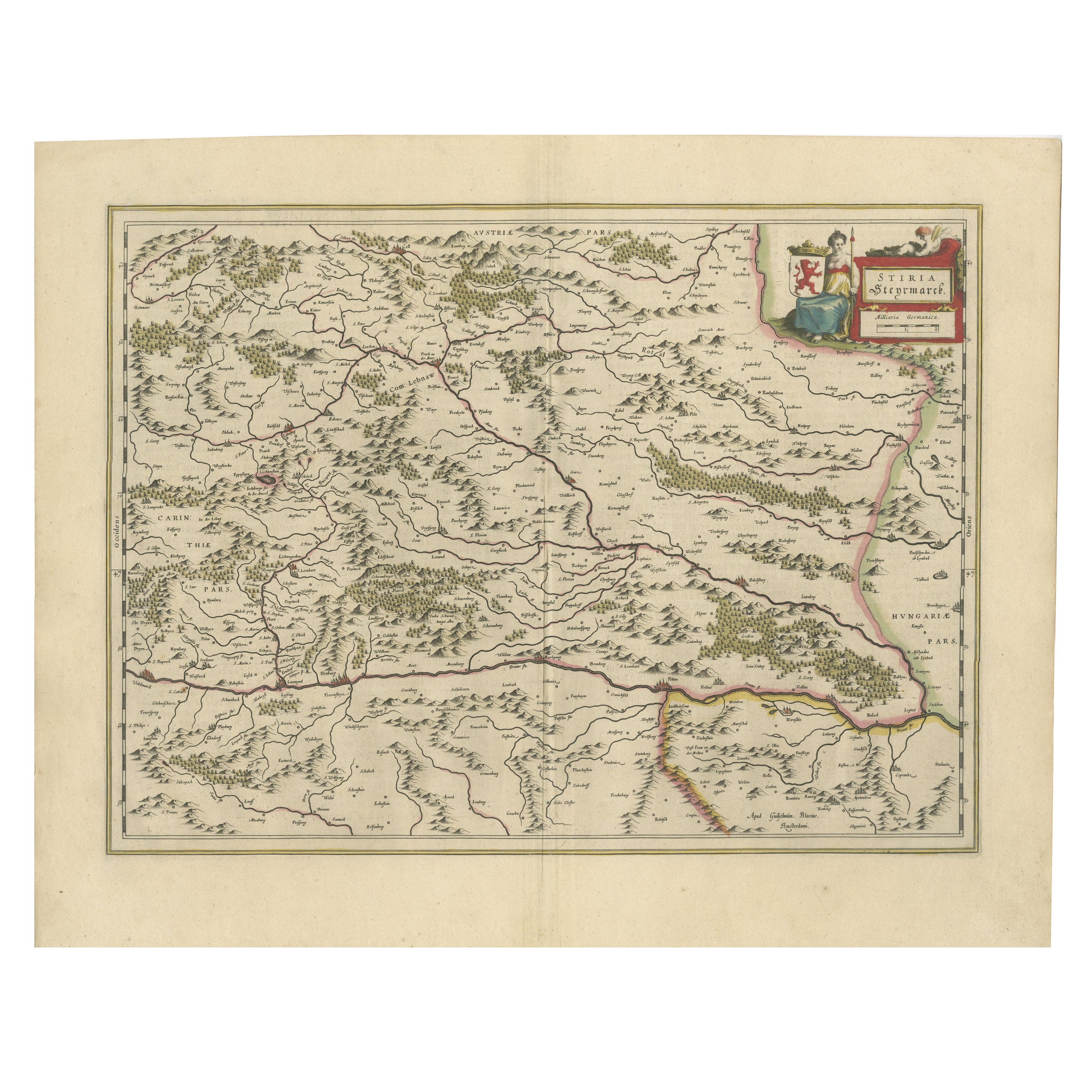
An Original Antique Mid-17th Century Blaeu Map of Styria in Southeastern Austria
$389.88
£292.24
€330
CA$535.63
A$597.98
CHF 313.33
MX$7,319.84
NOK 3,979.31
SEK 3,751.99
DKK 2,512.08
Shipping
Retrieving quote...The 1stDibs Promise:
Authenticity Guarantee,
Money-Back Guarantee,
24-Hour Cancellation
About the Item
This is an antique map of Styria (referred to as “Stiria” or “Steyrmarck”), published by the renowned Dutch cartographer Willem Janszoon Blaeu (often simply “Blaeu”). The first edition of this map was produced in 1634. It is a copperplate engraving on paper, printed during a period when Blaeu’s workshop was producing high-quality atlases and individual maps that were prized for their accuracy, artistic quality, and decorative style.
Like many Blaeu maps, this one is known for its fine engraving, detailed depiction of the region’s terrain, and elegant cartouche. The use of original hand-coloring makes the different territorial divisions and landscape features more distinguishable and aesthetically pleasing. It was not uncommon for Blaeu’s maps to have text on the reverse side, and the presence of Dutch text on the verso suggests it may have been part of one of Blaeu’s Dutch editions of his atlases or map collections.
"Styria" (in German "Steiermark") is a region located primarily in southeastern Austria. Historically, it was a duchy in the Holy Roman Empire and later part of the Austrian Empire. Today, most of Styria lies within the borders of modern Austria, where it is one of the country’s nine federal states. Its capital city is Graz, Austria's second-largest city. A smaller portion of the historic Styria extends into present-day Slovenia.
Overall, the map’s condition is good, and has been well-preserved. The paper shows slight age-toning or minor irregularities typical for an artifact of this era, but the coloring and engraving detail remain clear and vibrant. As a result, it stands as both a valuable historical document and a fine example of 17th-century Dutch cartographic art.
- Dimensions:Height: 22.25 in (56.5 cm)Width: 16.66 in (42.3 cm)Depth: 0.01 in (0.2 mm)
- Materials and Techniques:Paper,Engraved
- Period:1640-1649
- Date of Manufacture:circa 1640
- Condition:Overall, the map’s condition is good, and has been well-preserved. The paper shows slight age-toning or minor irregularities typical for an artifact of this era, but the coloring and engraving detail remain clear and vibrant. Centrefold as issued.
- Seller Location:Langweer, NL
- Reference Number:Seller: BG-13664-21stDibs: LU3054342814382
About the Seller
5.0
Recognized Seller
These prestigious sellers are industry leaders and represent the highest echelon for item quality and design.
Platinum Seller
Premium sellers with a 4.7+ rating and 24-hour response times
Established in 2009
1stDibs seller since 2017
2,511 sales on 1stDibs
Typical response time: <1 hour
- ShippingRetrieving quote...Shipping from: Langweer, Netherlands
- Return Policy
Authenticity Guarantee
In the unlikely event there’s an issue with an item’s authenticity, contact us within 1 year for a full refund. DetailsMoney-Back Guarantee
If your item is not as described, is damaged in transit, or does not arrive, contact us within 7 days for a full refund. Details24-Hour Cancellation
You have a 24-hour grace period in which to reconsider your purchase, with no questions asked.Vetted Professional Sellers
Our world-class sellers must adhere to strict standards for service and quality, maintaining the integrity of our listings.Price-Match Guarantee
If you find that a seller listed the same item for a lower price elsewhere, we’ll match it.Trusted Global Delivery
Our best-in-class carrier network provides specialized shipping options worldwide, including custom delivery.More From This Seller
View AllMap of Styria by William Blaeu, 1645: A Masterpiece of 17th-Century Cartography
Located in Langweer, NL
This 1645 map, created by Willem Janszoon Blaeu, represents Styria (Steyrmark), a historical region in present-day Austria, located in the Alpine regions. Blaeu, one of the most sign...
Category
Antique 1640s Maps
Materials
Paper
Antique Map of Styria by Mercator 'circa 1650'
Located in Langweer, NL
Antique map titled 'Stiria'. Original antique map of Styria, Austria. Published by G. Mercator, circa 1650.
Category
Antique Mid-17th Century Maps
Materials
Paper

$425 Sale Price
20% Off
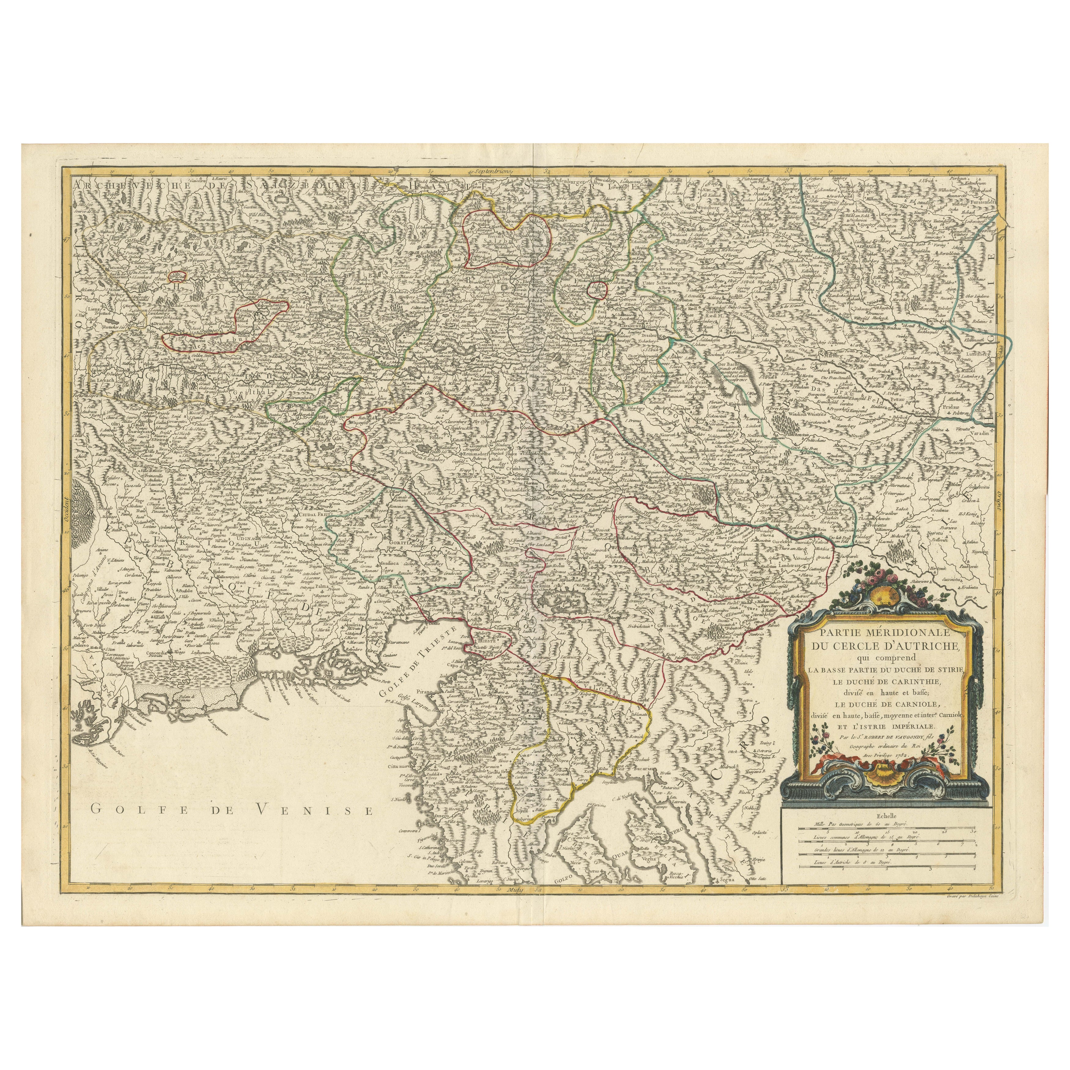
Original 18th-Century Map of Southern Austria, Carinthia, Carniola, and Styria
Located in Langweer, NL
title: 18th-Century Map of Southern Austria, Carinthia, Carniola, and Styria by Robert de Vaugondy
Description: This finely engraved 18th-century map by Gilles Robert de Vaugondy ...
Category
Antique 1750s Maps
Materials
Paper

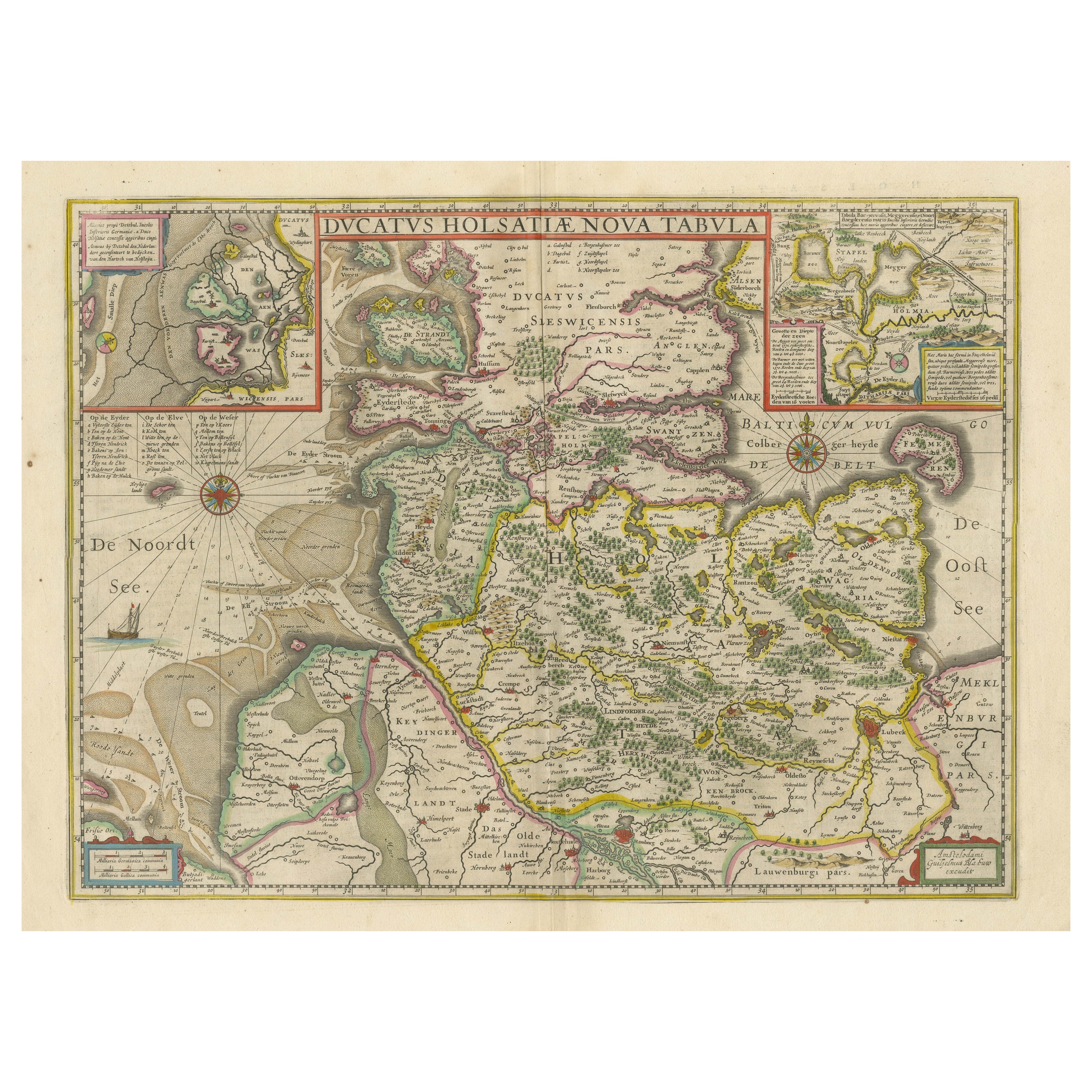
Original Antique Map of the Duchy of Holstein
By Willem Blaeu
Located in Langweer, NL
Antique map titled 'Ducatus Holsatiae Nova Tabula'. Original old map of the Duchy of Holstein, the northernmost territory of the Holy Roman Empire, from the mid-17th Century. To the ...
Category
Antique Mid-17th Century Maps
Materials
Paper
$1,039 Sale Price
20% Off
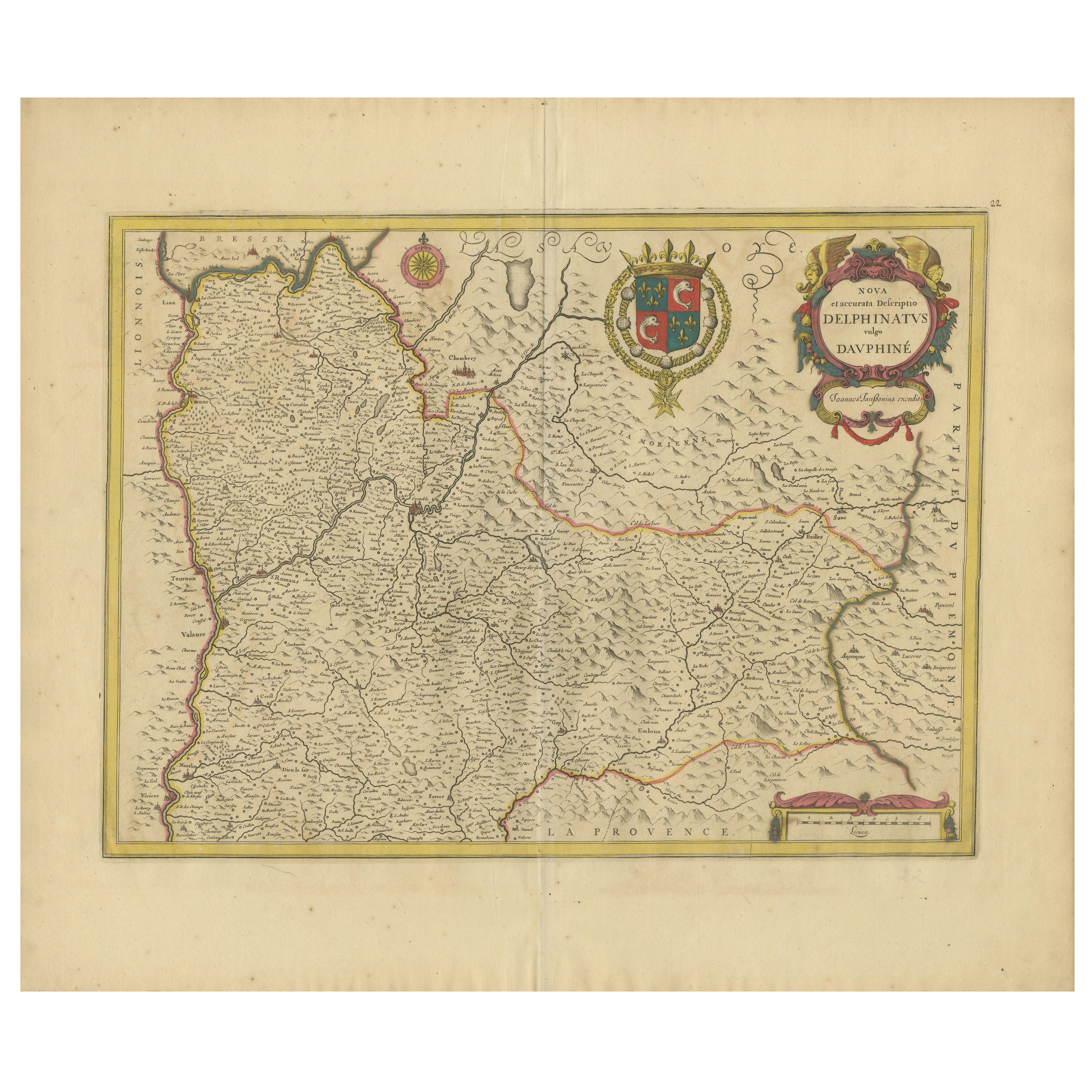
Rare 17th-Century Map of Dauphiné in Southeastern France by F. De Wit, ca.1688
Located in Langweer, NL
Title: Rare Hand-Colored 17th-Century Map of Dauphiné by Frederik De Wit c. 1688
Description: This captivating 17th-century map of Dauphiné, titled "Nova et Accurata Delphinatus Vul...
Category
Antique 1680s Maps
Materials
Paper

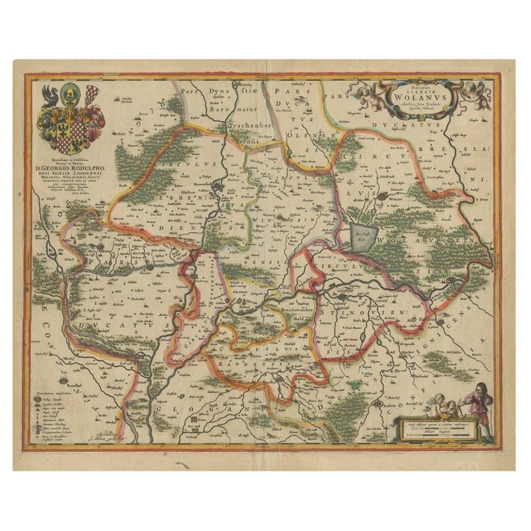
Antique Map of Lower Silesia of The Famous Mapmaker Blaeu, c.1650
Located in Langweer, NL
Antique map titled 'Ducatus Silesiae Wolanus'. \
Antique map depicting lower Silesia with the cities of Wolow (Wohlau), Winsko (Winzig), Herrnstadt, Chobie (Koben), Lubin (Lüben), R...
Category
Antique 17th Century Maps
Materials
Paper

$803 Sale Price
20% Off
You May Also Like
17th Century Nicolas Visscher Map of Southeastern Europe
Located in Hamilton, Ontario
A beautiful, highly detailed map of southeastern Europe by Nicolas Visscher. Includes regions of Northern Italy (showing the cities Bologna, Padua, and Venice), Bohemia, Austria (sho...
Category
Antique 17th Century Dutch Maps
Materials
Paper

$1,350 Sale Price
38% Off
1640 Willem Blaeu Map Entitled "Contado di molise et principato vltra, " Ric.a003
By Willem Blaeu
Located in Norton, MA
1640 Willem Blaeu map entitled
"Contado di molise et principato vltra,"
Colored
Ric. a003
Measures: 38 x 49.6 cm and wide margins
DBLAEU.
Cou...
Category
Antique 17th Century Dutch Maps
Materials
Paper

17th Century Hand-Colored Map of a Region in West Germany by Janssonius
By Johannes Janssonius
Located in Alamo, CA
This attractive highly detailed 17th century original hand-colored map is entitled "Archiepiscopatus Maghdeburgensis et Anhaltinus Ducatus cum terris adjacentibus". It was published ...
Category
Antique Mid-17th Century Dutch Maps
Materials
Paper

Hand Colored 18th Century Homann Map of Austria Including Vienna and the Danube
By Johann Baptist Homann
Located in Alamo, CA
"Archiducatus Austriae inferioris" is a hand colored map of Austria created by Johann Baptist Homann (1663-1724) and published in Nuremberg, Germany in 1728 shortly after his death. ...
Category
Antique Early 18th Century German Maps
Materials
Paper

Prussia, Poland, N. Germany, Etc: A Hand-colored 17th Century Map by Janssonius
By Johannes Janssonius
Located in Alamo, CA
This is an attractive hand-colored copperplate engraved 17th century map of Prussia entitled "Prussia Accurate Descripta a Gasparo Henneberg Erlichensi", published in Amsterdam by Joannes Janssonius in 1664. This very detailed map from the golden age of Dutch cartography includes present-day Poland, Latvia, Lithuania, Estonia and portions of Germany. This highly detailed map is embellished by three ornate pink, red, mint green and gold...
Category
Antique Mid-17th Century Dutch Maps
Materials
Paper

Vienna, Austria: A Large 17th Century Hand-Colored Map by Sanson and Jaillot
By Nicolas Sanson
Located in Alamo, CA
This large 17th century hand-colored map of Vienna, Austria and the surrounding countryside and villages entitled "Plan de la Ville de Vienne en Austrich...
Category
Antique 1690s French Maps
Materials
Paper

More Ways To Browse
Austrian Empire
17th Century German Engravings
Roman Capital
Red Retro Dining Set
Antique Silver Glasses Case
Carlo Scarpa 1934 Chairs
Christofle Marly
1900 Antique Chairs
Glass Table Italian Round
Mid Century Colonial
Alvar Aalto Poster
Geometric Metal Table
Post Modern High Chairs
United Nations
Vintage Vine Rug
Cancel An Order
Antique Framing Square
Silver Metal Chair