Items Similar to Palermo – 1620 Braun & Hogenberg Bird’s-Eye Map of Palermo, Sicily
Want more images or videos?
Request additional images or videos from the seller
1 of 10
Palermo – 1620 Braun & Hogenberg Bird’s-Eye Map of Palermo, Sicily
$1,677.40
£1,248.72
€1,400
CA$2,297.62
A$2,555.46
CHF 1,334.38
MX$31,097.17
NOK 17,042.06
SEK 15,982.44
DKK 10,657.71
Shipping
Retrieving quote...The 1stDibs Promise:
Authenticity Guarantee,
Money-Back Guarantee,
24-Hour Cancellation
About the Item
Palermo – 1620 Braun & Hogenberg Bird’s-Eye Map of Palermo, Sicily
This beautifully detailed bird’s-eye view of Palermo, Sicily, was created by Georg Braun and Frans Hogenberg around 1620 and published in Civitates Orbis Terrarum, Volume IV. This work, a monumental city atlas of the late 16th and early 17th centuries, provided the most comprehensive depiction of the world's major cities at the time. With six volumes published between 1572 and 1617, the series included 531 town and city views on 363 plates, offering viewers a detailed and artistic representation of urban life without the necessity of travel.
This striking plan presents Palermo from a northeastern perspective, showing its fortified medieval city layout, bustling harbor, and the surrounding cultivated countryside. The intricate detailing reflects the city's prominence as a major port and cultural center in the Mediterranean during this period. The prominent 'Palazzo dei Normanni', or Palace of the Norman Kings, stands at the top of the image, emphasizing its historical significance as the oldest royal residence in Europe. The port, located at the bottom right, is filled with large galleys, a testament to Palermo's importance in maritime trade and military defense.
A key feature of this map is the numbered legend at the bottom, identifying 162 locations within the city, from religious institutions and fortifications to public squares and significant landmarks. The plate is highly decorative, featuring elegant strapwork cartouches, a detailed compass rose, and meticulously illustrated ships sailing in the Mediterranean. The map is further enhanced by vibrant hand-coloring, accentuating the city's red-roofed buildings, green agricultural areas, and the deep blue of the harbor waters.
Beyond its geographic detail, 'Civitates Orbis Terrarum' aimed to capture the economic, cultural, and social essence of each city. Braun’s accompanying texts provided descriptions of trade, governance, and local customs, creating an invaluable historical record of urban life in the early modern period. The French text on the verso of this edition provides additional context and historical notes. This map is referenced in Fussel, pages 338, 340-341.
Condition: Very good. A crisp, well-preserved impression on watermarked paper. The map has undergone professional restoration, including minor repairs to a centerfold separation near the center of the image and a large chip in the blank margin at the top left. These restorations do not affect the printed area, ensuring the map remains visually striking and historically valuable.
Framing Advice: To best showcase this remarkable historical piece, it is recommended to frame it using acid-free, museum-grade materials to protect the delicate paper. UV-protective glass or acrylic will prevent fading of the hand-applied colors. A classic dark wood or gold-leaf frame will complement its antique aesthetic, while a parchment-colored mat will enhance its fine detailing. Conservation mounting should be used to ensure the map remains undamaged by adhesives or pressure, preserving its value for future generations.
This exquisite map is a must-have for collectors of antique cartography, Mediterranean history enthusiasts, and those fascinated by the rich cultural heritage of Sicily and its capital, Palermo.
- Dimensions:Height: 12.8 in (32.5 cm)Width: 19.61 in (49.8 cm)Depth: 0.01 in (0.2 mm)
- Materials and Techniques:Paper,Engraved
- Period:1620-1629
- Date of Manufacture:1620
- Condition:Very good. A crisp, well-preserved impression on watermarked paper. The map has undergone professional restoration, including minor repairs to a centerfold separation near the center of the image and a large chip in the blank margin at the top left.
- Seller Location:Langweer, NL
- Reference Number:Seller: BHZ130511stDibs: LU3054343904222
About the Seller
5.0
Recognized Seller
These prestigious sellers are industry leaders and represent the highest echelon for item quality and design.
Platinum Seller
Premium sellers with a 4.7+ rating and 24-hour response times
Established in 2009
1stDibs seller since 2017
2,508 sales on 1stDibs
Typical response time: <1 hour
- ShippingRetrieving quote...Shipping from: Langweer, Netherlands
- Return Policy
Authenticity Guarantee
In the unlikely event there’s an issue with an item’s authenticity, contact us within 1 year for a full refund. DetailsMoney-Back Guarantee
If your item is not as described, is damaged in transit, or does not arrive, contact us within 7 days for a full refund. Details24-Hour Cancellation
You have a 24-hour grace period in which to reconsider your purchase, with no questions asked.Vetted Professional Sellers
Our world-class sellers must adhere to strict standards for service and quality, maintaining the integrity of our listings.Price-Match Guarantee
If you find that a seller listed the same item for a lower price elsewhere, we’ll match it.Trusted Global Delivery
Our best-in-class carrier network provides specialized shipping options worldwide, including custom delivery.More From This Seller
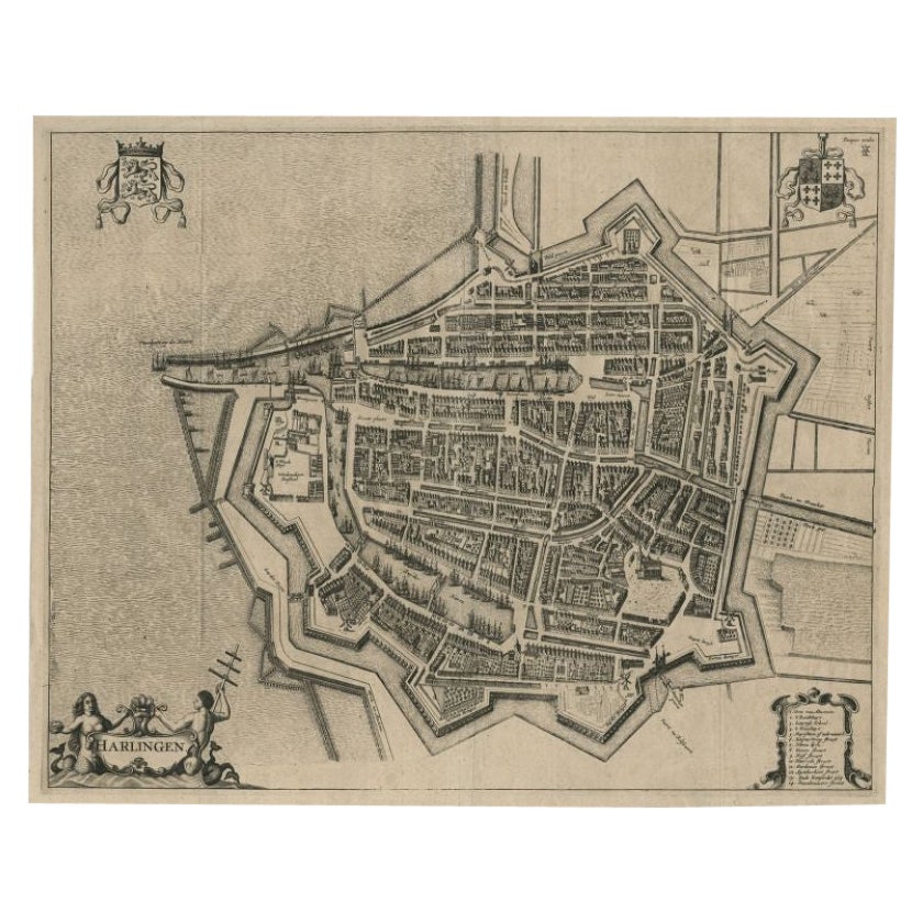
View AllAntique Map of the City of Harlingen by Janssonius, c.1657
By Johannes Janssonius
Located in Langweer, NL
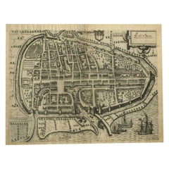
Antique map titled ‘Harlingen‘. This map depicts the city of Harlingen (Friesland, The Netherlands). Published by J. Janssonius, Amsterdam, c.1657.
Artists and Engravers: Johannes...
Category
Antique 17th Century Maps
Materials
Paper
$402 Sale Price
20% Off
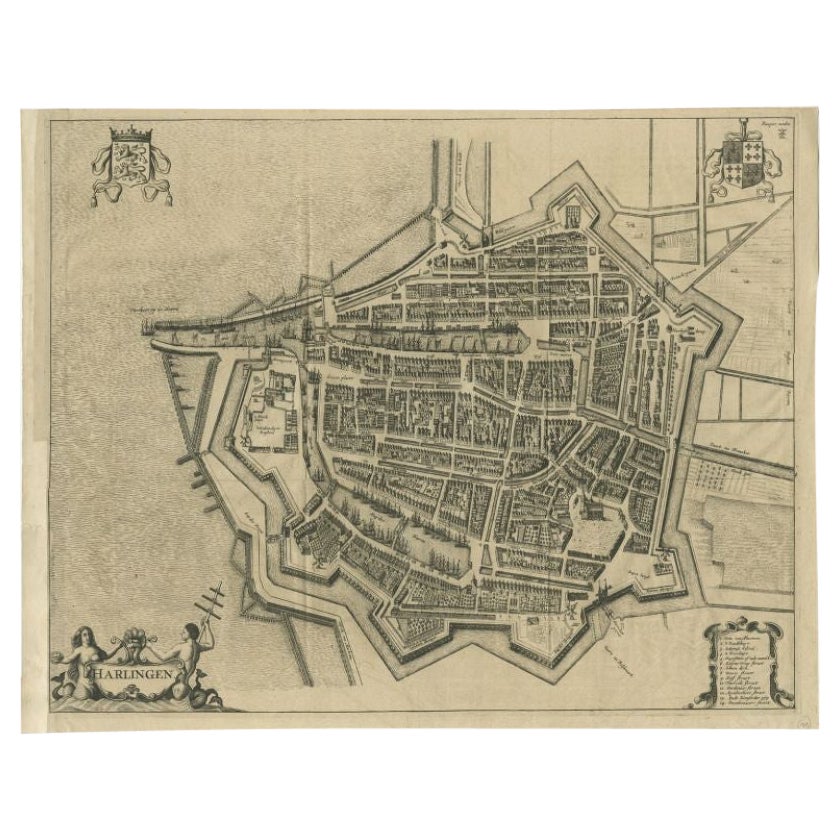
Antique Map of the City of Harlingen by Janssonius, c.1657
By Johannes Janssonius
Located in Langweer, NL
Antique map titled ‘Harlingen‘. This map depicts the city of Harlingen (Friesland, The Netherlands). Published by J. Janssonius, Amsterdam, c.1657.
Artists and Engravers: Johannes...
Category
Antique 17th Century Maps
Materials
Paper
$372 Sale Price
20% Off
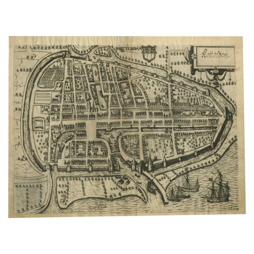
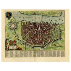
Antique Map of the City of Rotterdam by Guicciardini, C.1600
Located in Langweer, NL
Antique map titled 'Rotterdam'. Bird's eye view plan of Rotterdam in the province of Zuid-Holland, The Netherlands, Holland. This map originates from one of the editions of 'Discritt...
Category
Antique 17th Century Maps
Materials
Paper
$378 Sale Price
20% Off
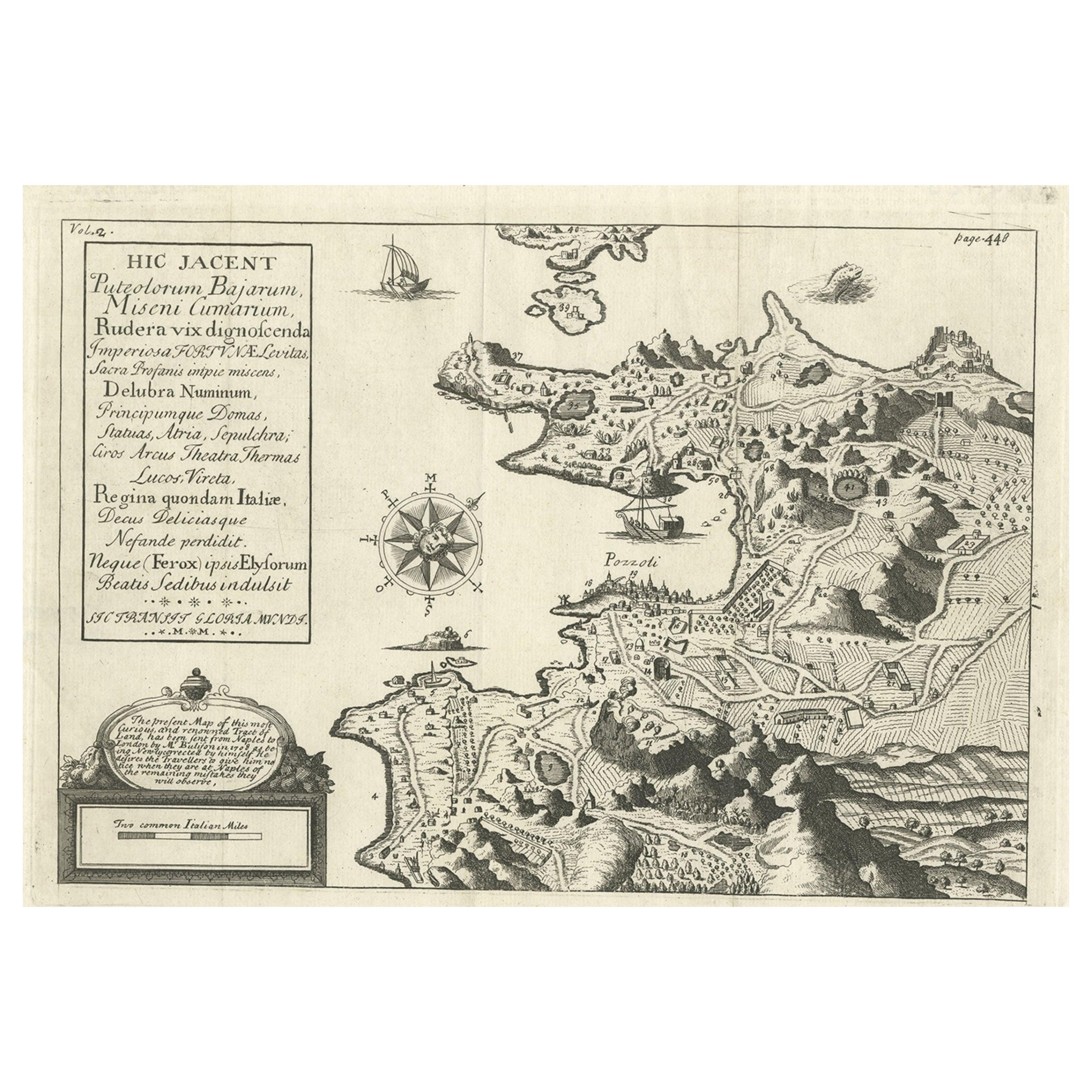
Old Original Map of Pozzuoli Near Naples in the Campania Region, Italy, ca.1740
Located in Langweer, NL
Antique map titled 'Hic Jacent Puteolorum Bajarum (..)'. Old map of the region of Pozzuoli showing the topographic and architectural features of interest. Pozzuoli is a city and comu...
Category
Antique 1740s Maps
Materials
Paper

$335 Sale Price
20% Off
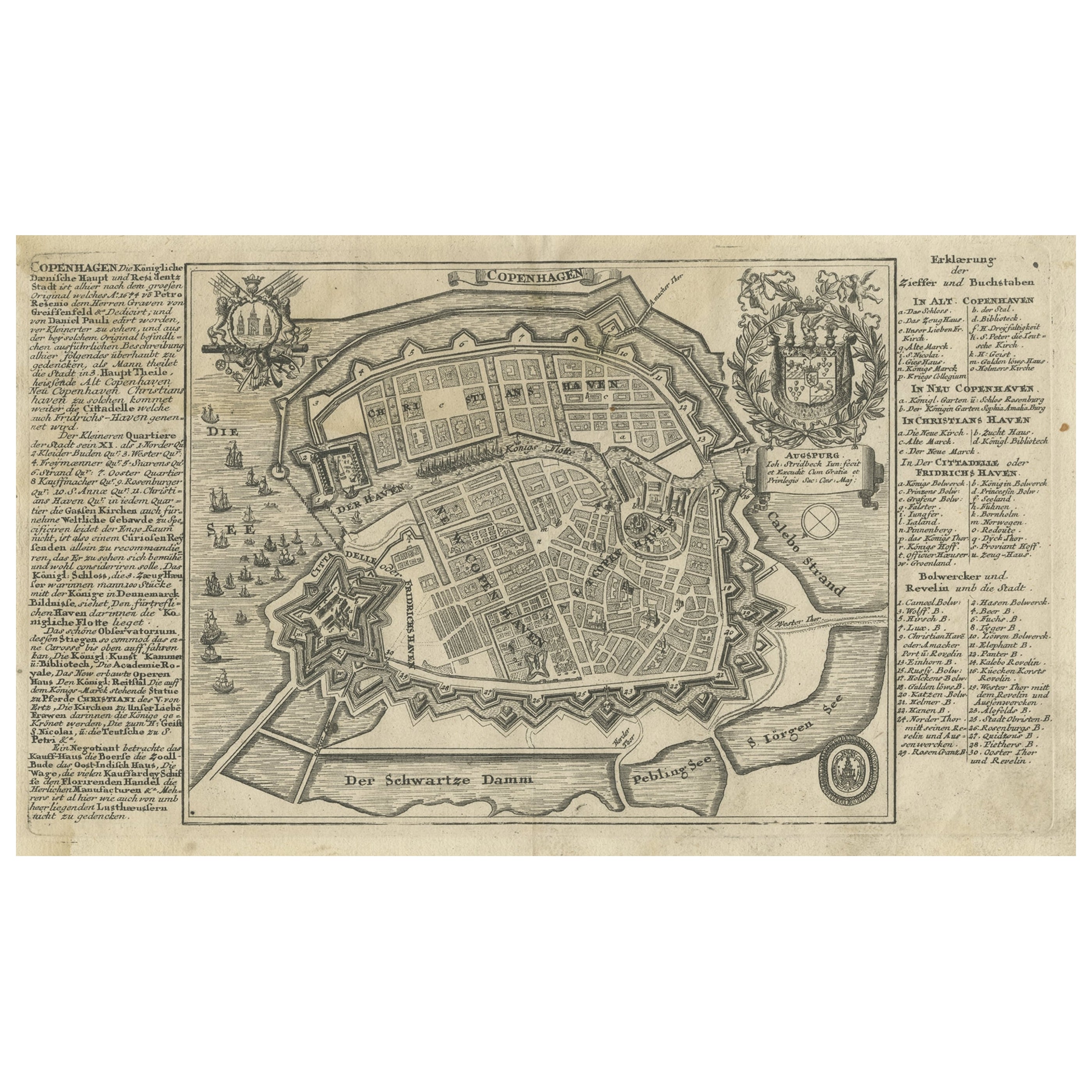
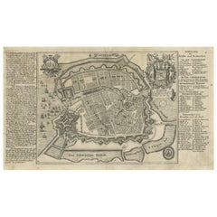
Antique Map of the City of Copenhagen in Denmark c.1720
Located in Langweer, NL
Antique map titled 'Copenhagen'. Original antique map of the city of Copenhagen, Denmark. This map originates from 'Unterschiedliche dieser Zeit Beruffene Laender, Gegenden, Staedte ...
Category
Antique 18th Century Danish Maps
Materials
Paper
Beautiful Original Antique Map of Antwerp, Belgium by Mapmaker Blaeu, ca.1652
Located in Langweer, NL
Description: Antique map titled 'Antverpia; Gallis Anvers. Vernacule Antwerpen.'
A very nicely coloured plan of Antwerp in Flanders, Belgium. West-oriented, with the river Scheld...
Category
Antique 1650s Maps
Materials
Paper
$2,396 Sale Price
20% Off
You May Also Like
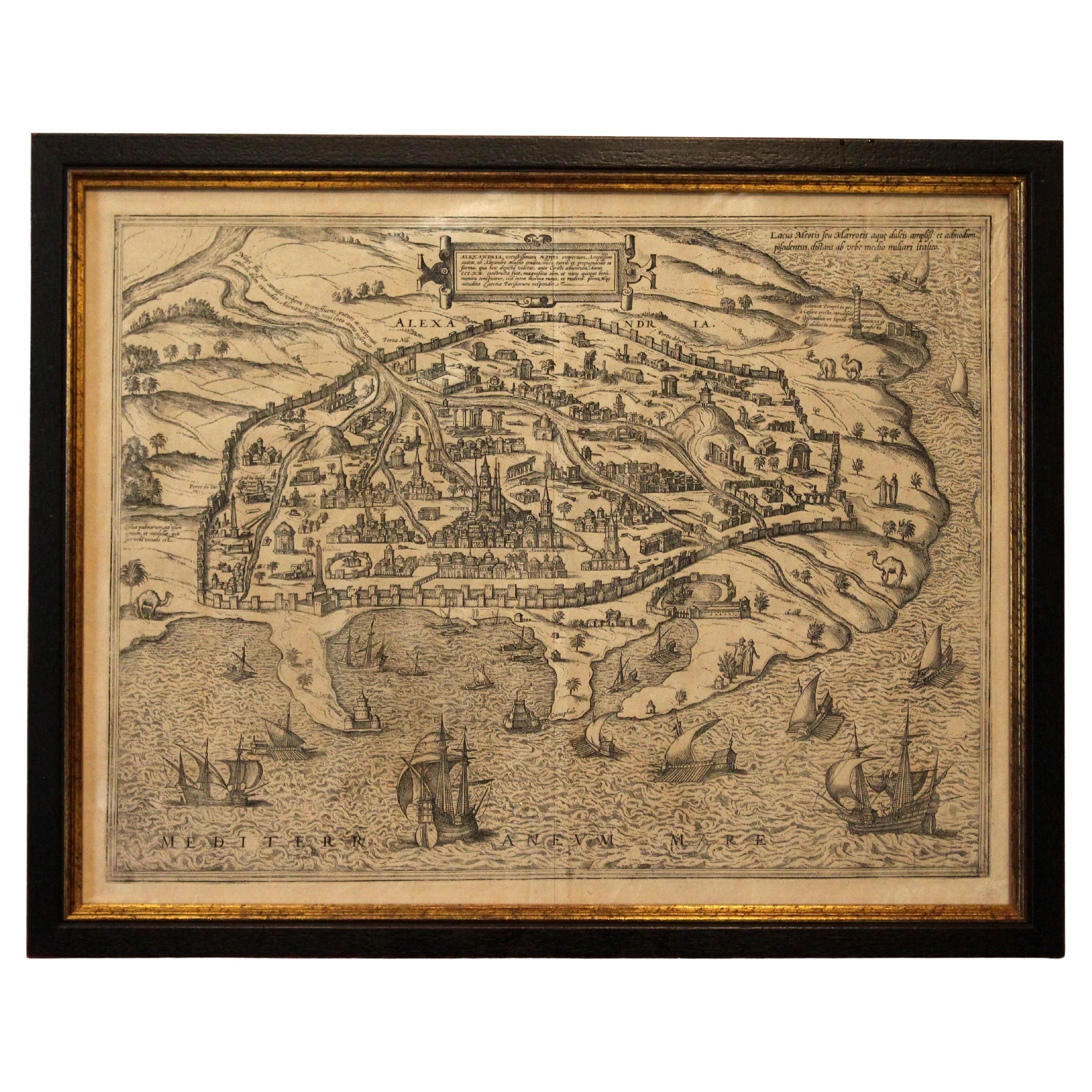
1597 German Map of Alexandria by Georg Braun and Frans Hogenberg
By Georg Braun and Frans Hogenberg
Located in Chapel Hill, NC
1597 Map of Alexandria by Georg Braun and Frans Hogenberg, Germany. From "Civitas Orbis Terrarum", part 2, published in Cologne by Bertram Buchholz. Printed in 2 parts. Title: "Alexa...
Category
Antique 16th Century German Renaissance Maps
Materials
Paper

Italian Parchment Map of the City of Pisa Dated, 1640
By Matthäus Merian the Elder
Located in Florence, Tuscany
An antique map of the Tuscan city of Pisa engraved for The 'Itinerarium Italiæ Nov-antiquæ' by Matthäus Merian the Elder and printed in 1640....
Category
Antique 1640s Italian Maps
Materials
Paper

18th Century Map Engraving - Plan of the Works of the City of Messina, Sicily
Located in Corsham, GB
A map of Messina, a harbour city in northeast Sicily. Inscribed with the title in plate to the lower edge, 'Plan of the Works of the City of Messina, one of the strongest and most co...
Category
18th Century More Prints
Materials
Engraving

$285 Sale Price
20% Off
Map of Embden - Original Etching by G. Braun e F. Hogenberg - Late 16th Century
By Franz Hogenberg
Located in Roma, IT
This map of Embdena is an original etching realized by George Braun and Franz Hogenberg in the Late 16th Century, as part of the famous Series "Civitates Orbis Terrarum" (Atlas of t...
Category
16th Century Figurative Prints
Materials
Etching

Prussia, Poland, N. Germany, Etc: A Hand-colored 17th Century Map by Janssonius
By Johannes Janssonius
Located in Alamo, CA
This is an attractive hand-colored copperplate engraved 17th century map of Prussia entitled "Prussia Accurate Descripta a Gasparo Henneberg Erlichensi", published in Amsterdam by Joannes Janssonius in 1664. This very detailed map from the golden age of Dutch cartography includes present-day Poland, Latvia, Lithuania, Estonia and portions of Germany. This highly detailed map is embellished by three ornate pink, red, mint green and gold...
Category
Antique Mid-17th Century Dutch Maps
Materials
Paper

1640 Willem Blaeu Map Entitled "Contado di molise et principato vltra, " Ric.a003
By Willem Blaeu
Located in Norton, MA
1640 Willem Blaeu map entitled
"Contado di molise et principato vltra,"
Colored
Ric. a003
Measures: 38 x 49.6 cm and wide margins
DBLAEU.
Cou...
Category
Antique 17th Century Dutch Maps
Materials
Paper

More Ways To Browse
Captured Bird
Antique Gold Compass
Compass Rose Gold
Medieval Parchment
Military Compass
Vintage Scandanavian Chairs
19th Century Red Glass
Antique French Console Table Tables
Silver Bowl Large
Antique French Silk
Down Couch
Used Lighter Art
Blue Edge Glass
Mahogany 1950s Furniture
Solid Mahogany Table
Dessert Glasses
Geometric Glass Table
Mid Century Pin