Items Similar to Rare Original Map of New Amsterdam (New York) – “Restitutio”, ca. 1674 –

Want more images or videos?
Request additional images or videos from the seller
1 of 21
Rare Original Map of New Amsterdam (New York) – “Restitutio”, ca. 1674 –
$24,950
£18,772.76
€21,744.39
CA$35,128.15
A$39,031.21
CHF 20,517.16
MX$476,418.51
NOK 259,410.06
SEK 243,202.73
DKK 162,284.43
About the Item
An exceptionally rare and original 17th-century engraving of New Amsterdam, now New York City, published by the renowned Amsterdam cartographer Carel (Carolus) Allard around 1674. Known as the “Restitutio” map, this piece commemorates the brief Dutch recapture of the city from the English in 1673 — a pivotal episode in early colonial history.
This highly detailed copperplate engraving presents the region of New Netherland, including Manhattan (’t Lange Eylandt), the Hudson River valley, surrounding Native American territories, and key settlements. Most striking is the panoramic city view of New Amsterdam across the bottom, depicting Dutch merchant ships, Fort Amsterdam, traditional stepped-gable houses, windmills, and prominent civic buildings.
The Latin cartouche, rich with allegorical figures — including classical deities and the Dutch Maiden — celebrates the Dutch “restoration” of the city, hence the inscription “Restitutio”. The engraving bears the imprint “Typis Caroli Allard”, confirming its original 17th-century origin.
Condition:
Very fine condition for its age. Printed on handmade laid paper, with period hand-coloring. Minor age-related toning, edge wear and restorations consistent with historical works on paper. Not a reproduction — this is a genuine early impression, rarely seen outside institutional collections.
Rarity:
Original copies of this map are extremely scarce and held in major museum and library collections, including the New York Public Library and the Rijksmuseum. Few ever reach the open market.
An extraordinary opportunity for collectors of early American history, Dutch colonial artifacts, antique maps, or museum-grade engravings.
- Dimensions:Height: 20.16 in (51.2 cm)Width: 23.35 in (59.3 cm)Depth: 0.4 in (1 cm)
- Materials and Techniques:
- Place of Origin:
- Period:
- Date of Manufacture:1674
- Condition:Repaired: Paper restorations visible from behind when taken out of the frame. Wear consistent with age and use.
- Seller Location:Dronten, NL
- Reference Number:1stDibs: LU931445631572
About the Seller
4.9
Platinum Seller
Premium sellers with a 4.7+ rating and 24-hour response times
Established in 1995
1stDibs seller since 2012
945 sales on 1stDibs
Typical response time: <1 hour
- ShippingRetrieving quote...Shipping from: Dronten, Netherlands
- Return Policy
Authenticity Guarantee
In the unlikely event there’s an issue with an item’s authenticity, contact us within 1 year for a full refund. DetailsMoney-Back Guarantee
If your item is not as described, is damaged in transit, or does not arrive, contact us within 7 days for a full refund. Details24-Hour Cancellation
You have a 24-hour grace period in which to reconsider your purchase, with no questions asked.Vetted Professional Sellers
Our world-class sellers must adhere to strict standards for service and quality, maintaining the integrity of our listings.Price-Match Guarantee
If you find that a seller listed the same item for a lower price elsewhere, we’ll match it.Trusted Global Delivery
Our best-in-class carrier network provides specialized shipping options worldwide, including custom delivery.More From This Seller
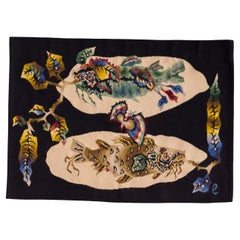
View AllHandwoven and Signed Jean Lurcat Aubusson Tapestry
By Jean Lurçat
Located in Dronten, NL
Unique midcentury tapestry designed by Jean Lurcat (1892-1966) and woven at Atelier Suzanne Goubely-Gatien in Aubusson, France. Handwoven in wool, they date to circa 1950. The revers...
Category
Vintage 1950s French Mid-Century Modern Tapestries
Materials
Wool
Vintage Persian Gabbeh Rug
Located in Dronten, NL
Large mid-20th century hand-knotted Persian Gabbeh rug with a very minimalist design in natural colors, mostly beige and brown.
Recently professionally dry-cleaned, would work very ...
Category
Mid-20th Century Persian Minimalist Persian Rugs
Materials
Wool

Handwoven and Signed Jean Lurcat Aubusson Tapestry
By Jean Lurçat
Located in Dronten, NL
Unique midcentury tapestry designed by Jean Lurcat (1892-1966) and woven at Atelier Suzanne Goubely-Gatien in Aubusson, France. Handwoven in wool, they date to circa 1950. The revers...
Category
Vintage 1950s French Mid-Century Modern Tapestries
Materials
Wool
Maurice André 'Cavalcade' Rug, 1960
By Maurice André
Located in Dronten, NL
Large wool rug 'Cavalcade'.
French tapestry based on a pattern by Maurice André for SF Carpets France.
Limited to 300 copies.
Original example with label on verso, signed by the art...
Category
Vintage 1960s French Mid-Century Modern Western European Rugs
Materials
Wool
Matching Pair of Handwoven and Hand Signed Jean Lurcat Aubusson Tapestries, 1950
By Jean Lurçat
Located in Dronten, NL
A matching pair of midcentury tapestries designed by Jean Lurcat (1892-1966) and woven at Atelier Suzanne Goubely-Gatien in Aubusson, France. Handwoven in wool, they date to circa 19...
Category
Vintage 1950s French Mid-Century Modern Tapestries
Materials
Wool
Robert Pansart Neoclassical Mirror
By Robert Pansart
Located in Dronten, NL
Neoclassical mirror with eglomised mirror glass frame decorated in gold designed by Robert Pansart.
Robert Pansart was a French furniture designer and d...
Category
Vintage 1940s French Neoclassical Wall Mirrors
Materials
Mirror, Wood

You May Also Like
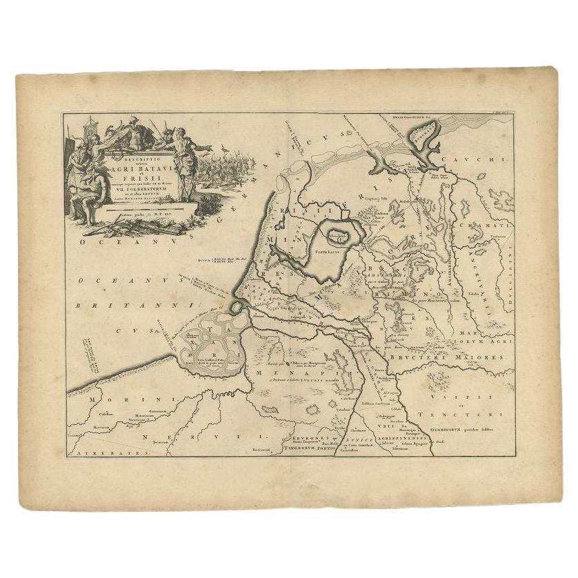
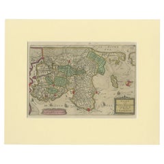
Antique Map of the Old Land of Batavia and FriesLand, The Netherlands, 1697
Located in Langweer, NL
Antique map Friesland titled 'Descriptio veteris Agri Batavi et Frisii (..)'. Old map of Friesland, the Netherlands. Depicts the old land of Batavia and Friesland. This map originate...
Category
Antique 17th Century Maps
Materials
Paper
$180 Sale Price
20% Off
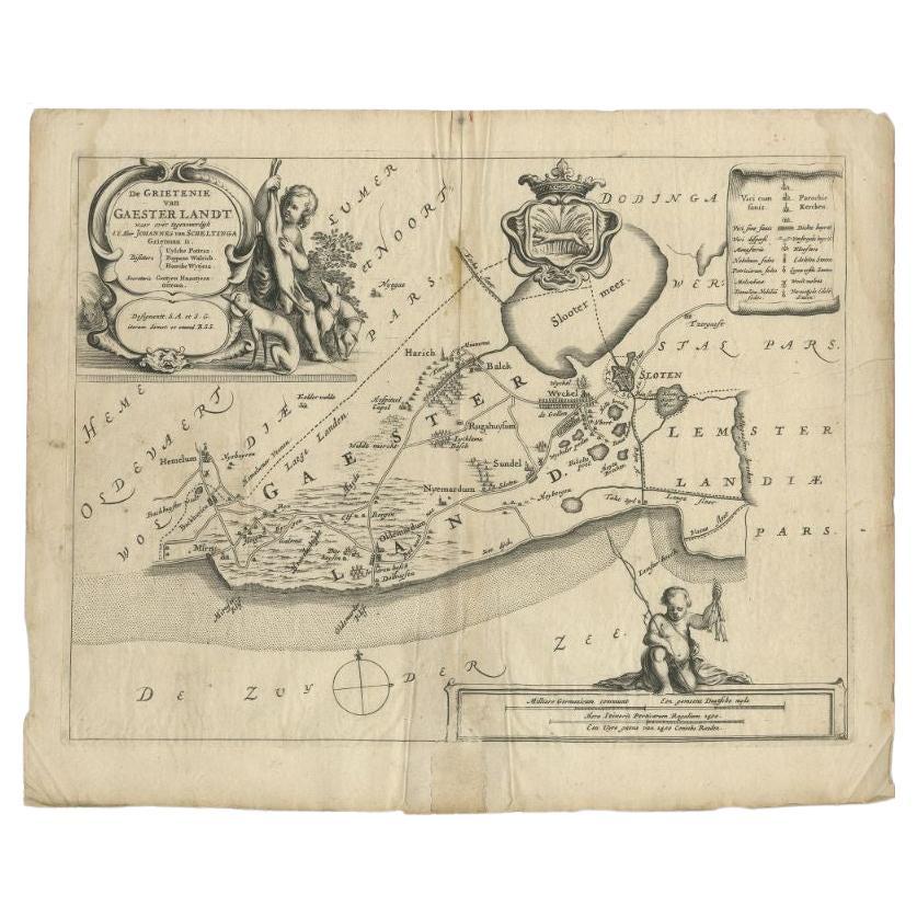
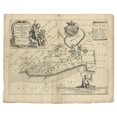
Antique Map of the Region of Gaasterland, Friesland, The Netherlands, 1664
Located in Langweer, NL
Antique map titled 'De Grietenie van Gaesterlandt (..)'. Map of the region of Gaasterland in Friesland, the Netherlands. This region includes the villages of Balk, Sloten, Wyckel and...
Category
Antique 17th Century Maps
Materials
Paper
$114 Sale Price
20% Off
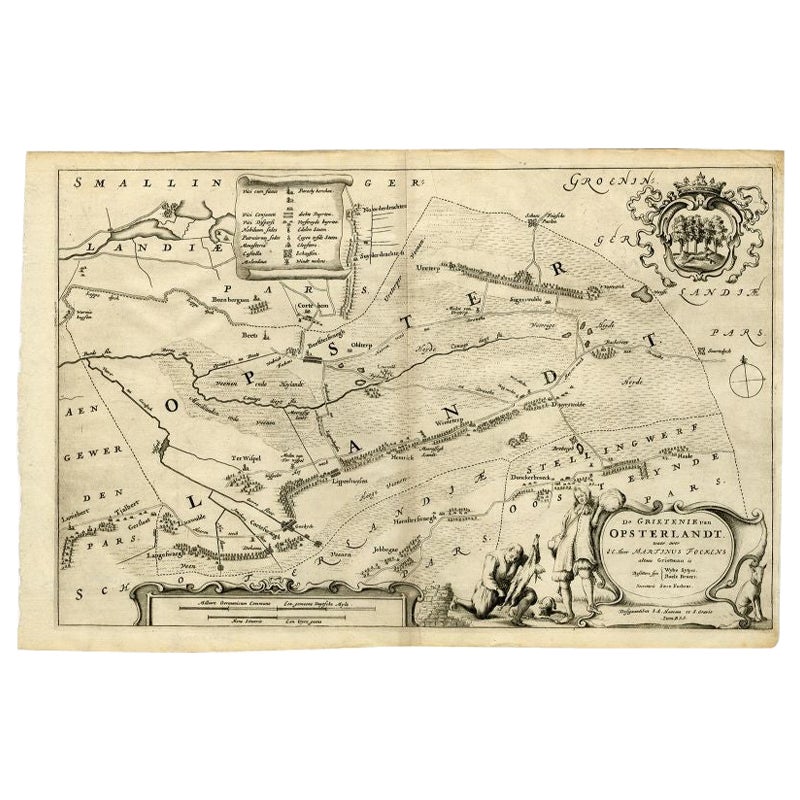
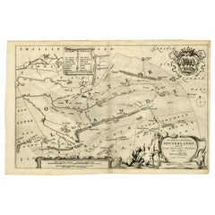
Antique Map of the Region of Opsterland by Schotanus, 1664
By B. Schotanus
Located in Langweer, NL
Antique map titled 'De Grietenie van Opsterlandt : waer over d'e. heer Martinus Fockens altans grietman is, bysitters syn Wybe Sytjes, Boele Broers, secretaris Saco Fockens.' Detaile...
Category
Antique 17th Century Maps
Materials
Paper
$257 Sale Price
20% Off
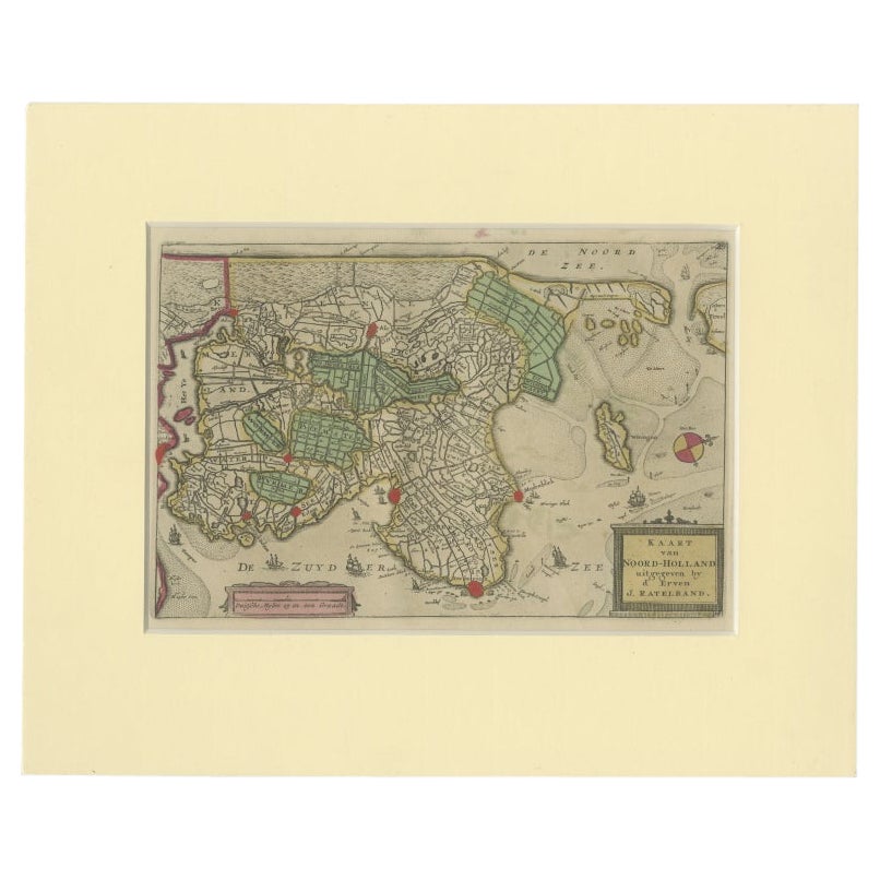
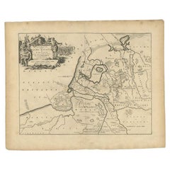
Rare Antique Map of Noord-Holland, Province in The Netherlands, c.1750
Located in Langweer, NL
Antique map titled 'Kaart van Noord-Holland'. Map of the province of Noord-Holland, the Netherlands. Published circa 1750. Artists and Engravers: Published by 'de Erven van J. Ratelb...
Category
Antique 18th Century Maps
Materials
Paper
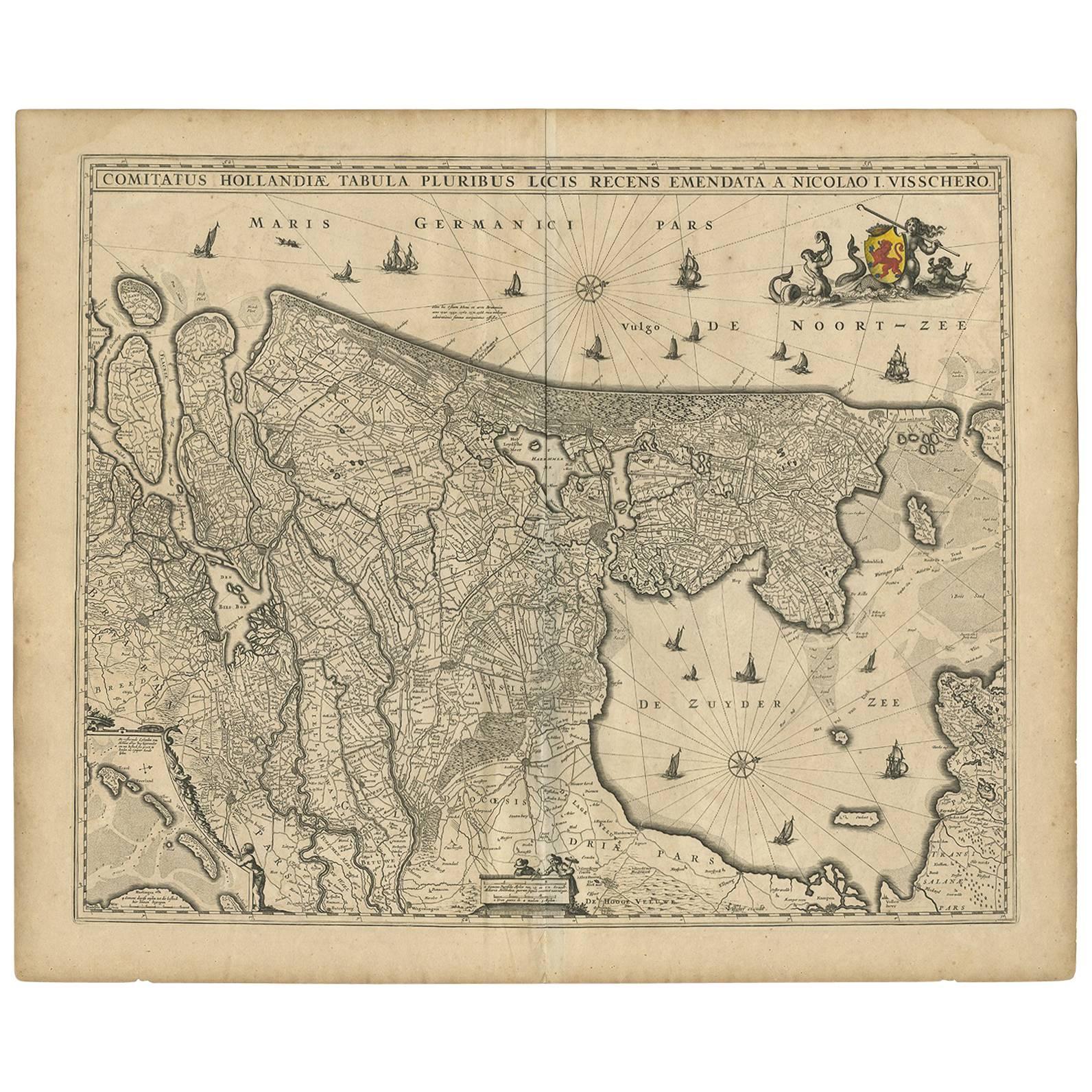
Antique Map of the Netherlands by N. Visscher, 1684
Located in Langweer, NL
Antique map titled 'Comitatus Hollandiae Tabula Pluribus Locis Recens Emendata a Nicolao I. Visschero'. West to the top. Lower left inset of the Wadden Islands, Texel, Vlieland, Ters...
Category
Antique Late 17th Century Maps
Materials
Paper

$1,050 Sale Price
20% Off
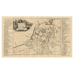
Antique Map of the Old Land of Batavia and Friesland by Halma, 1718
Located in Langweer, NL
Antique map Friesland titled 'Descriptio veteris Agri Batavi et Frisii (..)'. Old map of Friesland, the Netherlands. This map depicts the old land of Batavia and Friesland. Originate...
Category
Antique 18th Century Maps
Materials
Paper
$219 Sale Price
20% Off
More Ways To Browse
Library Collection
17th Century Engravings
Rare Antique Keys
Merchant Ship
Latin America Antique
Dutch Windmill
Early American Reproduction
Antique Gables
Latin American Colonial Furniture
17th Century American Colonial
Styles Of Antique Desks
Black And White Coffee Table
Curved Velvet Couch
Velvet Curved Sofa
Wood Round Coffee Tables
Antique Paper Flowers
Oak Brutalist
Used College Furniture