Carved Maps

to
1
4
3
7
2
1
1
4
2
1
7
6
3
2
1
6
3
3
2
1
7
7
7
1
1
1
1
Technique: Carved
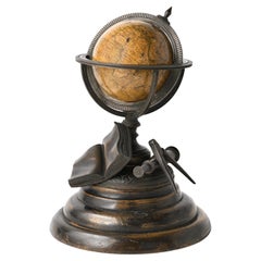
Miniature Terrestrial Globe Newton & Son London, Post 1833, Ante 1858
Located in Milano, IT
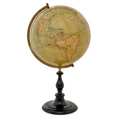
Miniature Terrestrial Globe Newton & Son London, post 1833, ante 1858 Paper, papier-mâché, bronze and wood It measures: sphere diameter 2.95 in (7.6 cm); diameter of the wooden base 6.02 in (15.3 cm); height 8.36 in (21.24 cm). Weight: 2,067 lb. State of conservation: the globe still bears its original paint, but has various small gaps, abrasions and stains on the surface. The globe is hinged with two pins at the meridian circle, which is in turn inserted perpendicular to the horizon circle; this is supported by four semi-arches connected at the bottom by a small goblet-shaped foot, resting on a wooden bell-shaped base. Apart from the wooden base, the entire support structure is made of bronze; on the foot there are the scale reproductions of a compass, a telescope and an open book. The sphere is made of papier-mâché and is covered with twelve printed paper gores. In the North Pacific Ocean the globe bears a cartouche with the inscription (about 30% of the writing is illegible, but the missing parts can be easily integrated based on the rest): NEWTON’S New & Improved TERRESTRIAL Globe Published by Newton & Son 66 Chancery Lane LONDON On the globe, much of central Africa is empty and the great lakes Tanganyika and Victoria are not marked (Europeans would begin to explore the area after 1858). Canada is called "British Territory" and Alaska "Russian Territory" (it would become part of the United States in 1867). Australia already bears its modern name (until 1829 it had been called New Holland) and its coasts are completely designed; Tasmania is listed as an island (Matthew Flinders circumnavigated it in 1798). The routes of Cook's various voyages are plotted; both the route followed by Biscoe in 1831 and the "Land of Enderby" which he discovered on the coast of Antarctica, south of Africa, are marked. Bibliography P. Van der Krogt, Old Globes...
Category

1840s English Early Victorian Antique Carved Maps

Materials

Bronze

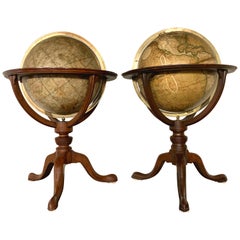
Pair of 19th Century English J & W Cary Celestial/Terrestrial Table Model Globes
Located in Milford, NH
A fine assembled pair of 12-inch English table model globes on stands manufactured by J & W. Cary, the left globe with cartouche labeled “The New Celestial Globe, on which are correc...
Category

Early 19th Century English Antique Carved Maps

Materials

Brass

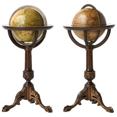
Pair of Miniature Globes Lane’s on Tripod Bases, London post 1833, ante 1858
Located in Milano, IT
Pair of miniature globes Lane’s, London, post 1833, ante 1858 Papier-mâché, wood and paper They measure: Height 9.44 in (24 cm); Sphere diameter 2.75 in (7 cm); Diameter of t...
Category

1840s English Early Victorian Antique Carved Maps

Materials

Paper, Wood

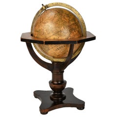
German Globe by C. Abel-Klinger, Nuremberg, circa 1860
Located in Milano, IT
Terrestrial globe Artistic company C. Abel - Klinger Nuremberg, circa 1860 H cm 31 x 22 cm (12.20 x 8.66 in); sphere 14 cm (5.51 in) in diameter lb 2.30 (kg 1.04) State of conservation: good. On the sphere there are slight visible signs of accidental bumping at the poles, as well as on New Guinea and England (vertical and more visible); some ink stains, especially at the South Pole and on the meridian that crosses North America. The globe is composed of twelve whole gores of printed paper, juxtaposed and glued on a sphere made with a chalky base mixture. The circle of the meridian, made of brass...
Category

1860s German Other Antique Carved Maps

Materials

Wood, Paper

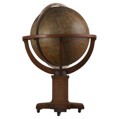
Antique Weber Costello 30" Floor Globe 1914-1924
Located in Los Angeles, CA
Lucky to find a 30" globe in this condition. The best that Weber Constello ever put out.
Category

20th Century American American Craftsman Carved Maps

Materials

Brass

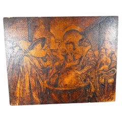
The Astronomer Unique Historical Folk Art Painting Signed 1918
Located in South Burlington, VT
Unique Historical Work of Art Dated 1918 "L' Astronome (The Astronomer) by Fedinant Roybet. This is an original and one-of-a-kind artistic presentation- a superb pyrography incis...
Category

Early 20th Century French Carved Maps

Materials

Wood

French Framed Copper Engraved Hand Colored Map of Carolina & Georgia, Circa 1757
Located in Charleston, SC
French copper engraved hand colored map of Carolina & Georgia matted under glass with a painted frame, mid-18th century
Category

1750s French Louis XV Antique Carved Maps

Materials

Glass, Wood, Paint, Paper

Related Items
ANTiQUE CIR 1880 J LEBEGUE & CIE PARIS TERRESTRIAL LITHOGRAPH GLOBE CAST IRON
Located in West Sussex, Pulborough
Royal House Antiques Royal House Antiques is delighted to offer for sale this absolutely exquisite original Circa 1860-1880 Globe Terrestre by J Lebegue & Cie on an ornately cast sw...
Category

1880s European Victorian Antique Carved Maps

Materials

Iron

Miniature Iron Maiden of Nuremberg
Located in Hanover, MA
Miniature "Iron Maiden" in blackened cast metal attached to its original round wood base. The front doors are pin-hinged and open to reveal pointed spikes. At base of doors is printe...
Category

1890s German Gothic Antique Carved Maps

Materials

Iron

Didactic Flower Model German Manufacture of 1860 circa Made of Painted Plaster
Located in Milan, IT
Didactic flower, German manufacture of 1860 circa, depicting Marchantia Polymorpha L., made of painted plaster on a wooden base; the seed is removab...
Category

1860s German Antique Carved Maps

Materials

Plaster

American Legion Baseball and Basketball Folk Art Paintings
Located in Santa Monica, CA
Pair of baseball and basketball paintings found in a Midwestern American Legion hall. These were proudly displayed behind the legion hall bar. Grea...
Category

1940s American Folk Art Vintage Carved Maps

7 Vol. Set- Charles Merivale, A History Of The Romans Under The Empire, 1858
Located in Bridgeport, CT
London, Longman, Brown, Green, Longmans, & Roberts, various publishing dates. Bound in tan leather with red and brown with gilt spines. Marbelized end papers. All with bookplates ins...
Category

19th Century English Victorian Antique Carved Maps

Materials

Leather, Paper

Antique Hammond's 6-Inch Terrestrial Globe on Stand
Located in Philadelphia, PA
Offered here for your consideration is, A fine antique 6-inch terrestrial globe. Additional Details: By C.S. Hammond & Co. The globe likely dates from 1927 to 1930 due to the ...
Category

20th Century Unknown Art Deco Carved Maps

Materials

Wood, Paper

Antique World Globe From Fleet Street London 1923 on Wooden Stand
Located in Reading, Berkshire
Antique Terrestrial Geographia of Fleet Street London 12"inch World Globe on handcrafted Wooden Three Legged Base 1923 Made 55 Fleet Street, London Beautiful desktop globe, sho...
Category

1920s British Art Deco Vintage Carved Maps

Materials

Wood, Paper

Antique World Globe From Fleet Street London 1923 on Wooden Stand
$1,344 Sale Price
25% Off
H 18.51 in Dm 11.82 in
19th Century Terrestrial Globe by G. Thomas, Editeur & Globe Maker, Paris, 1890s
By G. Thomas, Éditeur
Located in San Francisco, CA
Rare 19th century terrestrial globe by G. Thomas, Editeur & Globe Maker, Paris, circa 1890s The globe sits atop a wooden stand and measures 4" diameter x 6.5" high. The globe i...
Category

Late 19th Century French Antique Carved Maps

Materials

Paper

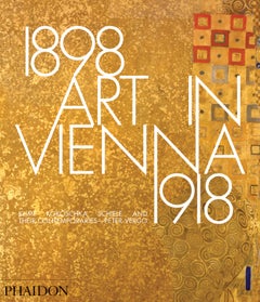
Art in Vienna 1898-1918, 4th Edition book
Located in New York, NY
The rebel artists of Vienna overwhelmed the artistic establishment of Europe at the end of the 19th century, having seceded from the traditional Viennese institutions of fine art and named themselves the Vienna Secession. Their works shocked a conservative public, but their daring sensibilities and dedication to the applied arts and architecture soon brought them an enthusiastic following and wealthy patronage. The boldly modernist paintings of Gustav Klimt, Egon Schiele, Oskar Kokoschka and others were matched by the buildings and applied designs of architects such as Joseph Maria Olbrich, who created the Secession Building as an architectural manifesto for the group. This classic book, now updated and with additional colour illustrations and a completely new introductory chapter, brilliantly traces the course of this influential artistic movement.

Contents and sections:

Introduction

Vienna 1900

Secession The Beginnings The First Exhibition The Dedication of the House: Second Exhibition Ver Sacrum III–VI Exhibitions The ‘Klimt Affair’ – The University Paintings Exhibitions 1900–1902 Beethoven 1902 XVI–XVIII Exhibitions, 1903 The Split within the Secession Architecture and the Applied Arts The Ringstrasse and the Architecture of Historicisim Otto Wagner, 1841–1918 Joseph Maria Olbrich, 1867–1908 Josef Hoffmann, 1870–1956 The Wiener Werkstätte Palais Stoclet – The Stoclet Frieze Kabarett Fledermaus Alfred Roller, 1864–1935 Hoffmann’s Later Work Adolf Loos, 1870–1933 Kunstschau 1908 – 1909: The Early Work of Kokoschka and Schiele Kunstschau 1908 Oskar Kokoschka, 1886–1980 Richard Gerstl, 1883–1908 Kunstschau 1909 – Vienna before the War...

Category

21st Century and Contemporary Chinese Carved Maps

Materials

Paper

Art in Vienna 1898-1918, 4th Edition book
$60 / item
H 11.38 in W 9.88 in D 1 in
Terrestrial Globe By E. Girard And Boite Paris - 19th Century
Located in Brussels, Brussels
Very beautiful terrestrial globe made by E. Girard and Boite Paris from the end of the 19th century Terrestrial globe with double graduated circles meridian and equatorial in brass....
Category

19th Century French Napoleon III Antique Carved Maps

Materials

Paper

1941 Folk Art Patience Bottle Signed And Dated
Located in Bridgeport, CT
A symbolic Christian patience bottle with a cross flanked by miniature bells, the front with a ladder, tools, plants and rooster. The bottle contains a signed paper label, dated Octo...
Category

20th Century Argentine Folk Art Carved Maps

Materials

Other

Bruce Weber by Bruce Weber, 1st Limited Edition
Located in valatie, NY
Bruce Weber by Bruce Weber. Published by Twelvetrees Press, Los Angeles, 1983. Stated 1st Limited Edition (1/5000) hardcover with dust jacket. Beautifully illustrated with over 50 full-page photogravure plates of male models and actors, a few tinted with halftone colors. Contains subjects: Brothers, Matt...
Category

1980s American Vintage Carved Maps

Materials

Paper

Previously Available Items
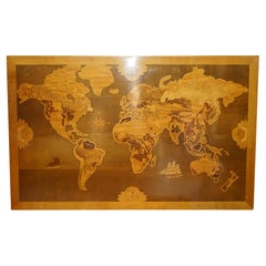
EXTRA LARGE 127CM X 204CM WORLD GLOBE MAP HAND CARVED AND INLAiD IN WOOD
Located in West Sussex, Pulborough
Royal House Antiques Royal House Antiques is delighted to offer for sale this rare and collectable full sized 127cm x 204cm world map view in inlaid timber such as Oak, Walnut, Burr...
Category

Late 20th Century European Mid-Century Modern Carved Maps

Materials

Wood

Large early 20th century globe on stand by Jordglob
Located in Debenham, Suffolk
Large early 20th century globe on stand by jordglob circa 1909. Beautiful Swedish globe of generous proportions.  A 1909 globe in good condition suspended on a brass arm, which sits...
Category

Early 20th Century Swedish Edwardian Carved Maps

Materials

Metal

Rare 19th Century Philips Graphic Globe
Located in London, GB
Rare 19th century Philips graphic globe. Dated to the mid-19th century this geometric paper Philips graphic globe stands on an ebonised turned base. Stamped, Philips graphic globe land areas in white, George Philips and sons ltd 32 fleet St. A rare example in this model and in overall presentable condition considering its age and use. Size in inches: H 9” x W 4” x D 4” Origin: United Kingdom Material: wood and paper Date: mid-19th century Completely solid in structure and form without any breaks. Detail loss across the printed paper surface as shown. We sell antique...
Category

1850s British Early Victorian Antique Carved Maps

Materials

Wood

Anglo Indian Coconut Earth Globe
Located in Palm Beach, FL
Rare and unusual Anglo Indian globe on stand, crafted with a polished coconut having a surprisingly detailed inscribed map of earth. Including seven continents, oceans, tropic of Cap...
Category

Mid-20th Century Indian Anglo-Indian Carved Maps

Materials

Coconut

Anglo Indian Coconut Earth Globe
H 11.5 in W 5 in D 4.5 in
English Map of West Indies with a Gilt Wood Frame Under Glass, Late 19th Cent
Located in Charleston, SC
English hand colored accurate map of the West Indies with a foliage gilt wood and gesso frame under glass, Late 19th century. Long West from London.
Category

Late 19th Century English Victorian Antique Carved Maps

Materials

Gesso, Glass, Giltwood, Paint, Paper

Framed Britannia Map Hand Tinted and Colored, Signed Matthaus Seutter, C. 1725
Located in Charleston, SC
Framed and Matted Britannia Map hand tinted and colored with gilt frame. Signed Matthaus Seutter, 1725 Seutter was one of the most important and prolific German map publishers of t...
Category

1720s German George II Antique Carved Maps

Materials

Glass, Giltwood, Paper

Antique Table Globe Schedler's New York Mahogany Paper
Located in Munich, DE
This rare table globe, signed schedler's New York on the sphere, is mounted on an elegant mahogany stand and has brass and steel fittings, Weight 3,30kg.
Category

1860s American Victorian Antique Carved Maps

Materials

Mahogany, Paper

Imperial Map Desk of the Habsburg Empire
Located in New Orleans, LA
This monumental, one-of-a-kind map desk hails from the Imperial Palace of the Habsburg Emperor Franz Joseph I, ruler of both Austria and Hungary from 1848 until 1916. The incredible, massive desk features 28 flat drawers — seven on each side — which were used to store not only important maps of the empire, but also irreplaceable architectural drawings of palaces, cathedrals and other civil structures. Biedermeier in style, it is crafted from birch, which was then one of the rarest, most expensive materials used by cabinet makers. It is absolutely, without question, the finest desk of its kind in existence, and it is certainly without peer in terms of engineering, craftsmanship and provenance. The entire surface of the giant desk...
Category

19th Century Austrian Other Antique Carved Maps

Materials

Satinwood, Walnut, Wood

Recently Viewed

View All