Items Similar to Topographic Map of Mount Sinai Summit – Antique Engraving by Pococke, 1776
Want more images or videos?
Request additional images or videos from the seller
1 of 10
Topographic Map of Mount Sinai Summit – Antique Engraving by Pococke, 1776
$283.03
£211.86
€240
CA$389.54
A$434.18
CHF 227.80
MX$5,302.02
NOK 2,884.42
SEK 2,726.22
DKK 1,827.05
About the Item
Topographic Map of Mount Sinai Summit – Antique Engraving by Pococke, 1776
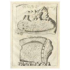
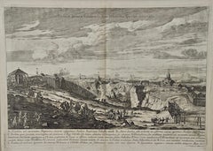
This antique engraving offers a rare and detailed view of the summit plateau of Mount Sinai, titled "Grondtekening der Oppervlakte des Bergs Sinai" (Ground Plan of the Summit of Mount Sinai). It originates from the Dutch edition of Richard Pococke's celebrated travel narrative, *Beschryving van het Oosten* (Description of the East), published in 1776 in Utrecht, Rotterdam, and Amsterdam.
The print, marked *Pl. LIII b.*, presents an aerial-style topographic rendering of the sacred mountain’s uppermost region, renowned as the traditional site where Moses received the Ten Commandments. Prominent buildings and features, including chapels and monastic enclosures, are delineated with shaded structures and labeled in lowercase script, possibly indicating cells, cisterns, or ecclesiastical constructions. The drawing employs delicate hachure lines to suggest elevation, slope, and rocky terrain, evoking the barren yet historically charged landscape of the Sinai Peninsula.
This map is part of Pococke’s wider survey of biblical lands and ancient topographies, which helped inspire Enlightenment-era interest in geography, sacred archaeology, and comparative history. Pococke, an English churchman and early explorer, traveled extensively in the Middle East, recording monuments, ruins, and religious sites with scholarly precision. His works were highly influential in European antiquarian circles and this Dutch edition, translated by Ernst Willem Cramerus, helped disseminate his findings further on the continent.
The engraving is both a cartographic document and a spiritual artifact, ideal for collectors of biblical history, Middle Eastern travel literature, or historical mapping.
Condition report:
Very good condition. Light age toning and a central fold as issued. A few minor creases and faint edge wear, particularly on the right side, but no tears or losses. The image is sharp with a strong impression.
Framing tips:
This engraving would look excellent in a dark wood or antique gilt frame with a cream or sand-colored mat to highlight its sepia tone. Suitable for display in a study, library, or alongside other religious or topographic prints.
Technique: Engraving
Maker: Richard Pococke, Dutch edition by E.W. Cramerus, Utrecht/Rotterdam/Amsterdam, 1776
- Dimensions:Height: 10.36 in (26.3 cm)Width: 13.55 in (34.4 cm)Depth: 0.01 in (0.2 mm)
- Materials and Techniques:Paper,Engraved
- Place of Origin:
- Period:
- Date of Manufacture:1776
- Condition:Very good condition. Light age toning and a central fold as issued. A few minor creases and faint edge wear, particularly on the right side, but no tears or losses. The image is sharp with a strong impression.
- Seller Location:Langweer, NL
- Reference Number:Seller: BG-14102-641stDibs: LU3054346057972
About the Seller
5.0
Recognized Seller
These prestigious sellers are industry leaders and represent the highest echelon for item quality and design.
Platinum Seller
Premium sellers with a 4.7+ rating and 24-hour response times
Established in 2009
1stDibs seller since 2017
2,513 sales on 1stDibs
Typical response time: <1 hour
- ShippingRetrieving quote...Shipping from: Langweer, Netherlands
- Return Policy
Authenticity Guarantee
In the unlikely event there’s an issue with an item’s authenticity, contact us within 1 year for a full refund. DetailsMoney-Back Guarantee
If your item is not as described, is damaged in transit, or does not arrive, contact us within 7 days for a full refund. Details24-Hour Cancellation
You have a 24-hour grace period in which to reconsider your purchase, with no questions asked.Vetted Professional Sellers
Our world-class sellers must adhere to strict standards for service and quality, maintaining the integrity of our listings.Price-Match Guarantee
If you find that a seller listed the same item for a lower price elsewhere, we’ll match it.Trusted Global Delivery
Our best-in-class carrier network provides specialized shipping options worldwide, including custom delivery.More From This Seller
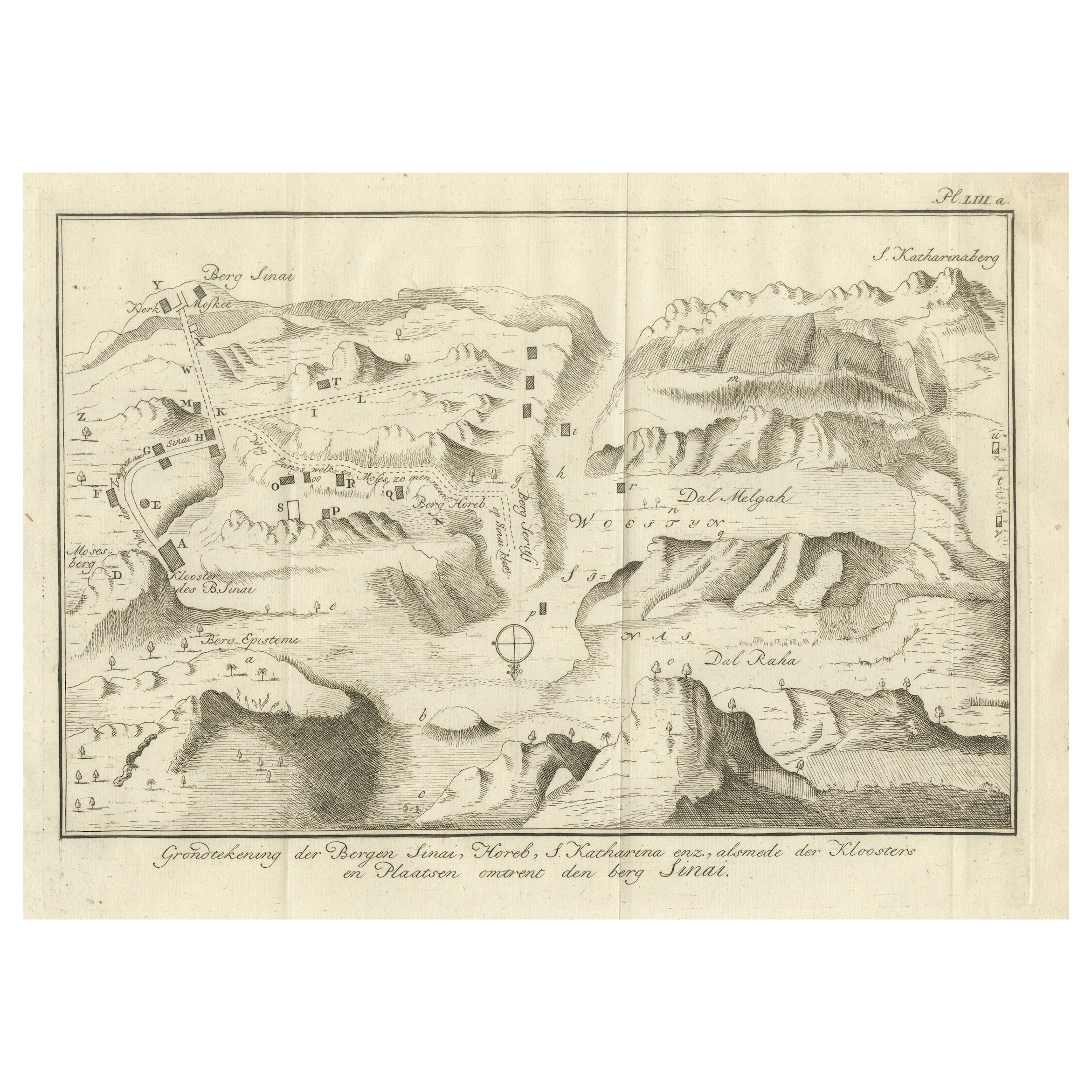
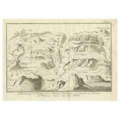
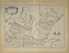
View AllMount Sinai & St. Catherine's – Antique Map of the Sinai Monasteries, 1776
Located in Langweer, NL
Mount Sinai & St. Catherine's – Antique Map of the Sinai Monasteries, 1776
Description:
This finely engraved antique map depicts the mountainous region of the Sinai Peninsula, focus...
Category
Antique Late 18th Century Dutch Maps
Materials
Paper
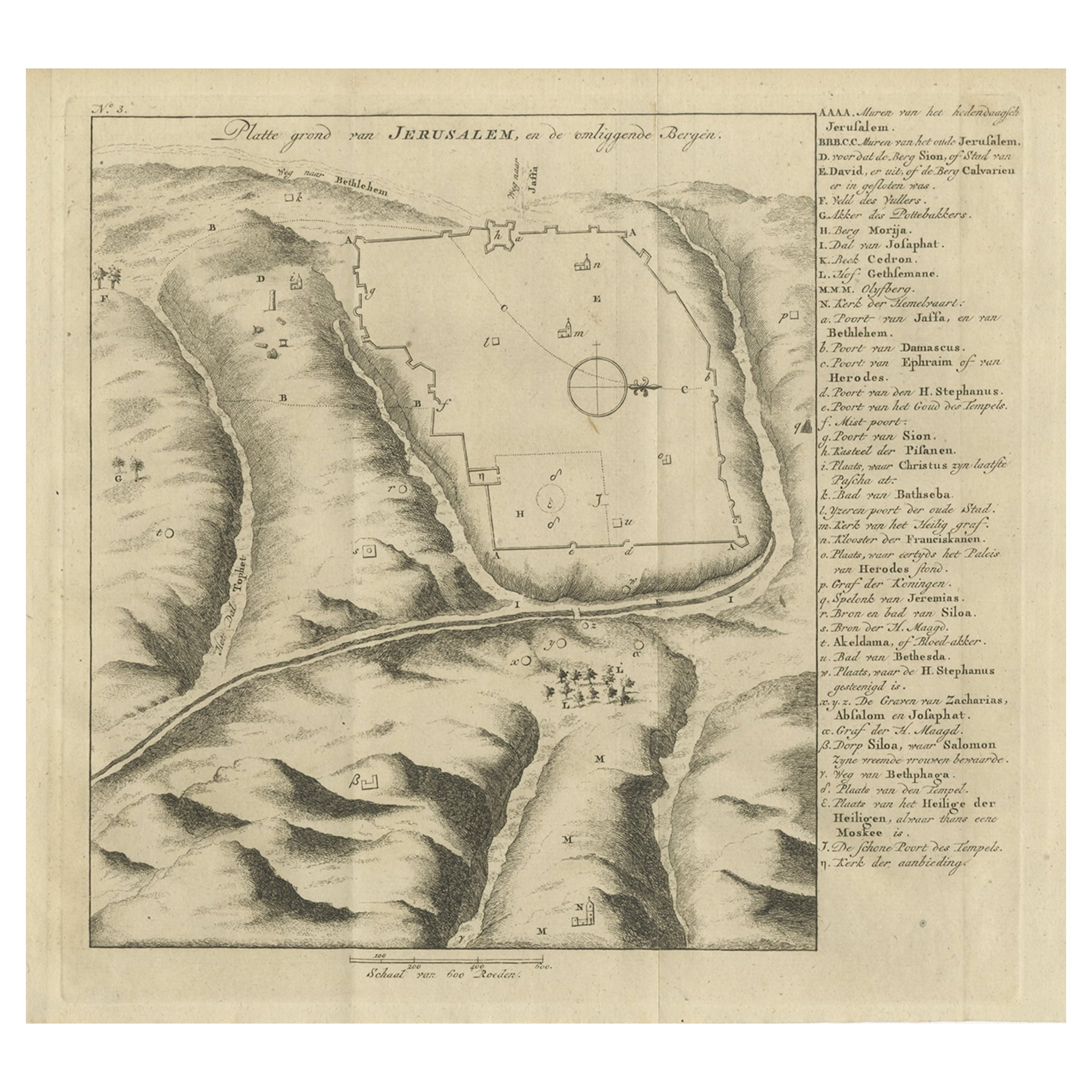
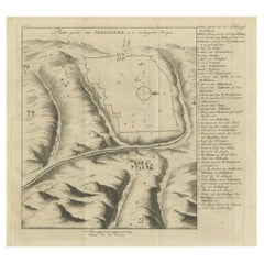
Antique Engraving of a Map or Plan of Jerusalem and Surrounding Mountains, 1773
Located in Langweer, NL
Antique map titled 'Platte grond van Jerusalem, en de omliggende Bergen'. Plan of the city of Jerusalem, with surrounding mountains. Originates from the first Dutch editon of an inte...
Category
Antique 18th Century Maps
Materials
Paper
$254 Sale Price
20% Off
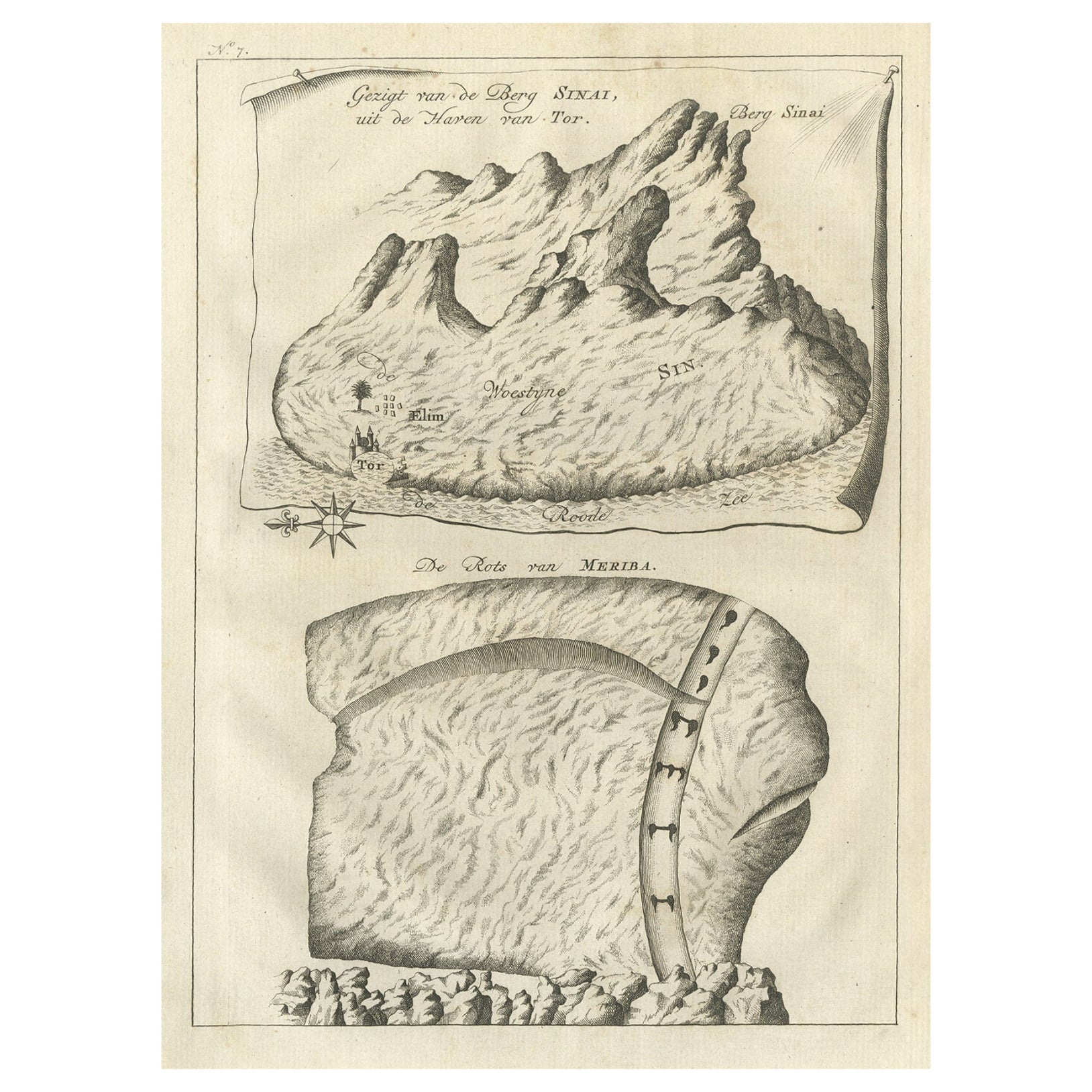
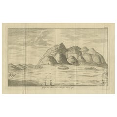
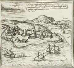
Antique Print of Mount Sinai in Egypt, 1773
Located in Langweer, NL
Antique print titled 'Gezigt van de Berg Sinai uit de haven van Tor'. Old print depicting Mount Sinai and the rock of Meriba. Originates from the first Dut...
Category
Antique 18th Century Prints
Materials
Paper
$339 Sale Price
20% Off
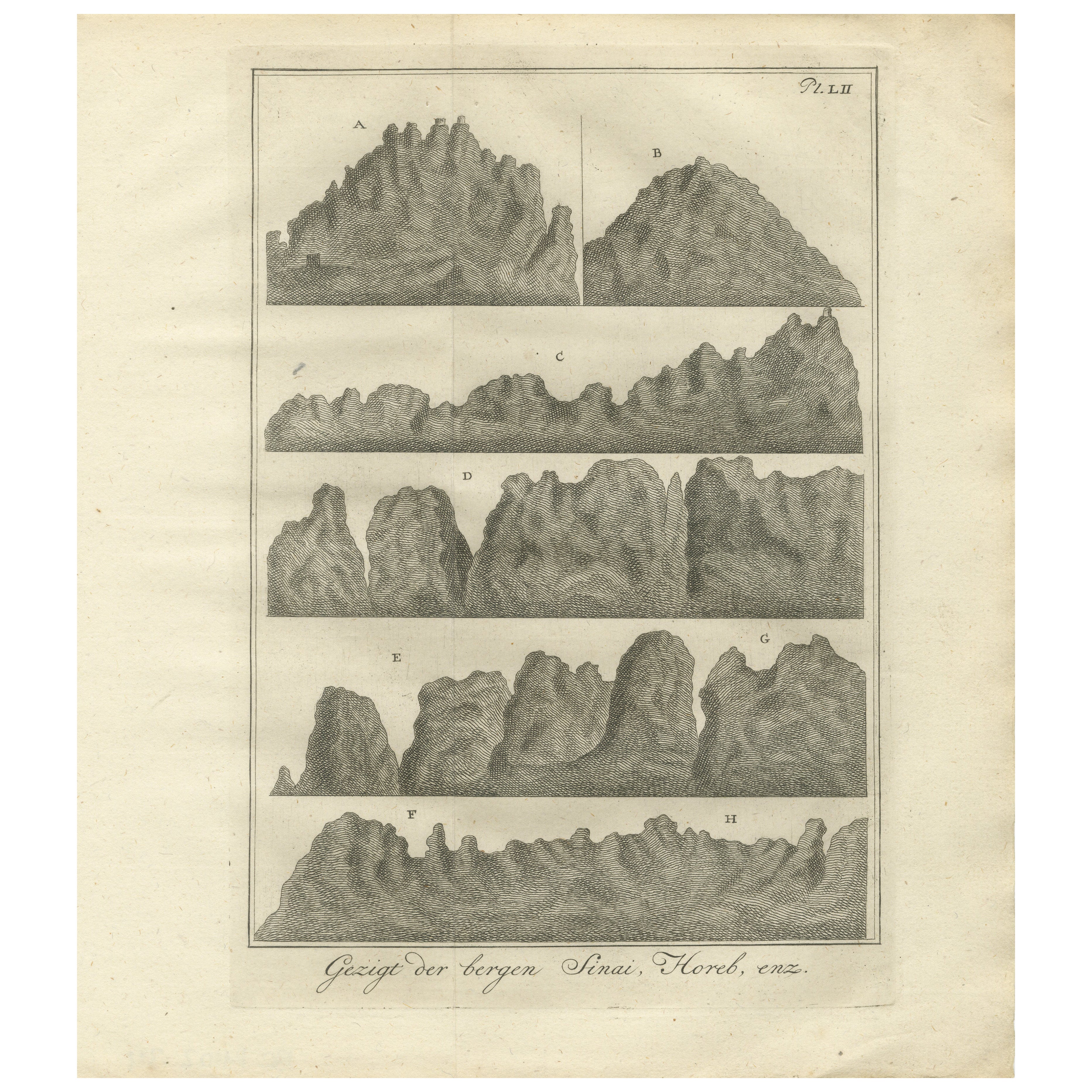
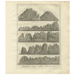
Mountain Views of Sinai and Horeb – Old Engraving of Biblical Landscapes, c.1776
Located in Langweer, NL
Mountain Views of Sinai and Horeb – Antique Engraving of Biblical Landscapes, c.1790
Description:
This striking 18th-century engraving presents a series of eight scenic views of mou...
Category
Antique Late 18th Century Dutch Prints
Materials
Paper
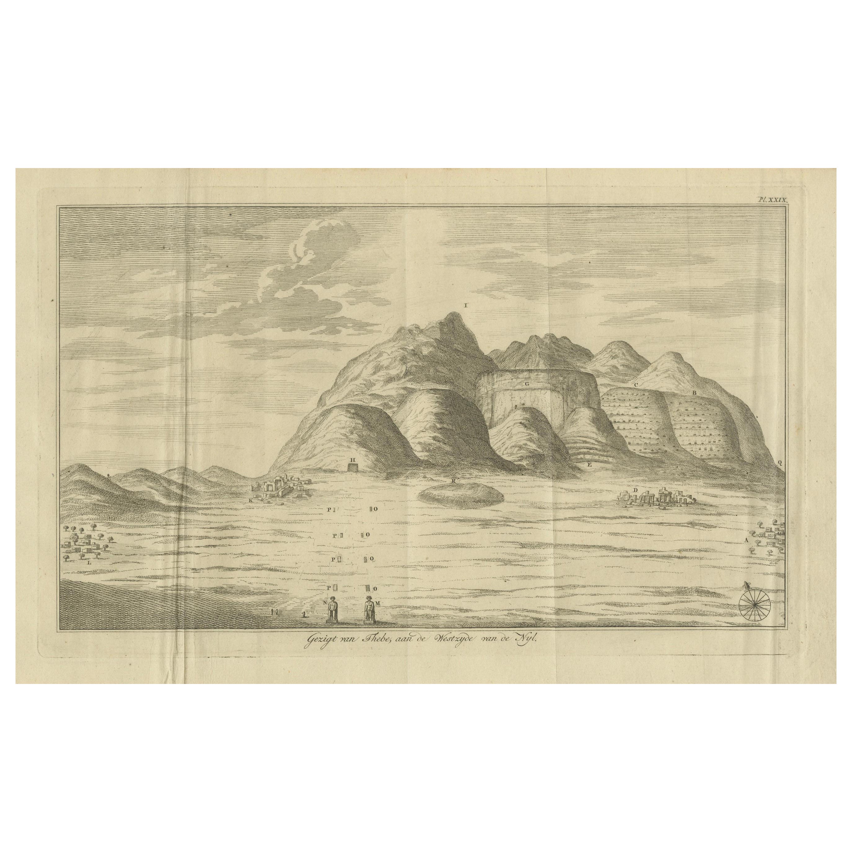
View of Thebes from the West Bank of the Nile – Engraving by Pococke, 1776
Located in Langweer, NL
View of Thebes from the West Bank of the Nile – Engraving by Pococke, 1776
This striking antique engraving, titled "Gezigt van Thebe, aan de Westzyde van de Nyl" (View of Thebes, on...
Category
Antique Late 18th Century Dutch Prints
Materials
Paper
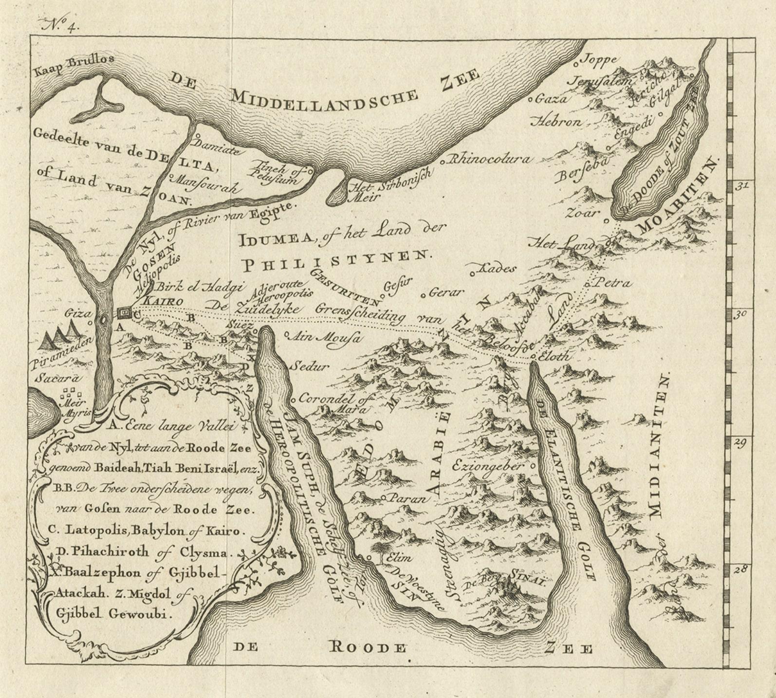
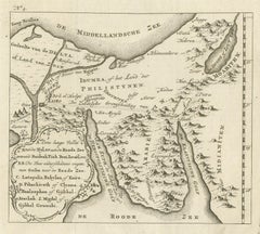
Antique Map of Edom, an Ancient Kingdom in Transjordan, 1773
Located in Langweer, NL
Antique print titled 'Idumea, of thet Land der Philistynen'. Old map of Edom, an ancient kingdom in Transjordan located between Moab to the northeast, the Arabah to the west and the ...
Category
Antique 18th Century Maps
Materials
Paper
$302 Sale Price
20% Off
You May Also Like
Map of Nubia and Abissinia - Original Etching by Antonio Zatta - 1784
Located in Roma, IT
This Map of Nubia and Abissinia is an etching realized by Antonio Zatta in Venice in 1784.
The state of preservation of the artwork is good expect for the worn paper with some littl...
Category
1770s Landscape Prints
Materials
Etching

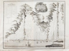
An Antique Engraved View of Copper Mining in Sweden in the 17th C. by Dahlberg
By Erik Dahlberg
Located in Alamo, CA
This is an antique engraved view entitled "Fodinae aerariae Falunenfis, qui orientem fpectat, delineatio" (Copper mining in Falun), Sweden in 1705 from "Sueciae Antiquae et Hodiernae"' published in Stockholm by Erik Dahlberg (1625-1703). The engraving was created by Johannes van den Aveelen (1650-1727), who was an accomplished copperplate engraver who emigrated to Sweden to work on Dahlberg's spectacular book, "Sueciae Antiquae et Hodiernae", which was focused on the views and architecture of Sweden, both in the ancient past and at the time of the publication.
This engraving depicts a very active 17th century working scene...
Category
Early 18th Century Naturalistic Landscape Prints
Materials
Laid Paper, Engraving
Southerlandia Map - Etching by Johannes Janssonius - 1650
By Johannes Janssonius
Located in Roma, IT
Southerlandia Map is an ancient map realized in 1650 by Johannes Janssonius (1588-1664).
The Map is Hand-colored etching, with coeval watercoloring.
Good conditions.
From Atlantis...
Category
1650s Modern Figurative Prints
Materials
Etching

Map of Scotland - Etching by Johannes Blaeu - 1650s
Located in Roma, IT
Map of Scotland is an geographic map realized by Johannes Blaeu.
Etching, printed in 1660 ca.
Copper engraving, colored (coeval coloring), on paper, with center fold;
Latin text. ...
Category
1650s Modern Figurative Prints
Materials
Etching
$442 Sale Price
20% Off
Map of San Georgi - Etching by G. Braun/F. Hogenberg - 1575
Located in Roma, IT
Etching by Georg Braun and Frans Hogenberg, realized in 1575 and belonging to the Suite "Civitates Orbis Terrarum".
The first volume of the Civitates Orbis Terrarum was published in ...
Category
16th Century Modern Figurative Prints
Materials
Etching
John Thomson (1777-1840) - 1830 Map Engraving, The Rivers of the World
By John Thomson
Located in Corsham, GB
A fine engraved chart table showing the lengths of the principal rivers across the world, from the second edition of John Thomson's 'New General Atlas' published in 1830. On paper.
Category
Early 19th Century More Prints
Materials
Engraving
$349 Sale Price
20% Off