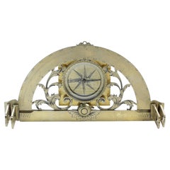
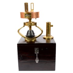
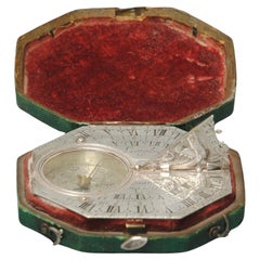
Langlois Graphometer - Circa 1730
View Similar Items


Video Loading
1 of 8
Langlois Graphometer - Circa 1730
$4,500List Price
About the Item
- Dimensions:Height: 8 in (20.32 cm)Width: 13 in (33.02 cm)Depth: 8 in (20.32 cm)
- Materials and Techniques:
- Place of Origin:
- Period:
- Date of Manufacture:Circa 1730
- Condition:Refinished. Wear consistent with age and use. A lovely graphometer - will make a for a really nice display - wood stand not included.
- Seller Location:Placerville, CA
- Reference Number:1stDibs: LU9222236298102
Authenticity Guarantee
In the unlikely event there’s an issue with an item’s authenticity, contact us within 1 year for a full refund. DetailsMoney-Back Guarantee
If your item is not as described, is damaged in transit, or does not arrive, contact us within 7 days for a full refund. Details24-Hour Cancellation
You have a 24-hour grace period in which to reconsider your purchase, with no questions asked.Vetted Professional Sellers
Our world-class sellers must adhere to strict standards for service and quality, maintaining the integrity of our listings.Price-Match Guarantee
If you find that a seller listed the same item for a lower price elsewhere, we’ll match it.Trusted Global Delivery
Our best-in-class carrier network provides specialized shipping options worldwide, including custom delivery.You May Also Like
Antique Map of Denmark by Moll 'circa 1730'
By Herman Moll
Located in Langweer, NL
Antique map titled 'Denmark, agreeable to Modern History'. Uncommon map of Denmark by Herman Moll, published, circa 1730.
Category
Antique Mid-18th Century Maps
Materials
Paper

$334 Sale Price
20% Off
Antique Italian Nautical Graphometer with its Original Wooden Box Genoa, 1940s
By CAIM, Genova 1
Located in Milan, IT
Brass, copper and lead graphometer complete with the original wooden box signed CAIM Genova Via S. Sabina two of the 1940s. Measures of box 28 x 29 cm H 24. CAIM Genoa was company ac...
Category
Vintage 1940s Italian Nautical Objects
Materials
Brass
Antique Map of Northern Germany by M. Seutter, circa 1730
By Matthew Seutter
Located in Langweer, NL
Antique map titled 'Saxoniae Inferioris Circulus'. Old map of the northern part of Germany by M. Seutter. Covering the area of Lower Saxony, Mecklenburg-Vorpommern and Schleswig-Hols...
Category
Antique Mid-18th Century Maps
Materials
Paper

$564 Sale Price
20% Off
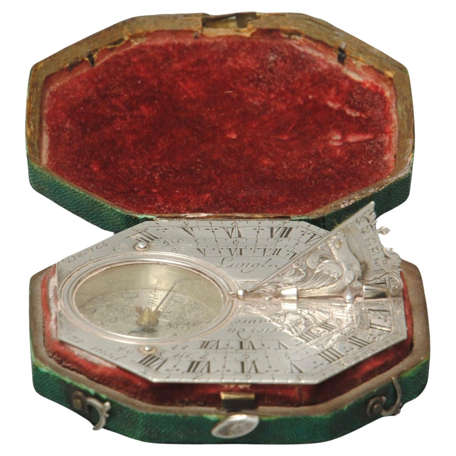
18th Century Silver Butterfield Dial By Langlois Paris
By Pierre Langlois
Located in Lincolnshire, GB
A fine example of a silver Butterfield type sundial in the original green shagreen case. The finely engraved dial has Premier cadran (first dial) engraved with the city names and lat...
Category
Antique Mid-18th Century French Scientific Instruments
Materials
Silver
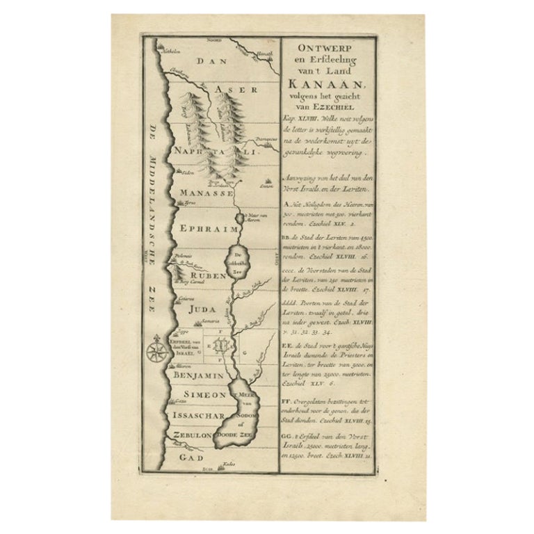
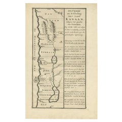
Antique Dutch Map of the Twelve Tribes of Israel – After Ezekiel, circa 1730
Located in Langweer, NL
Antique Dutch Map of the Twelve Tribes of Israel – After Ezekiel, circa 1730
This uncommon early 18th-century Dutch map is titled "Ontwerp en Erfdeeling van’t Land Kanaan, volgens h...
Category
Antique Early 18th Century Dutch Maps
Materials
Paper
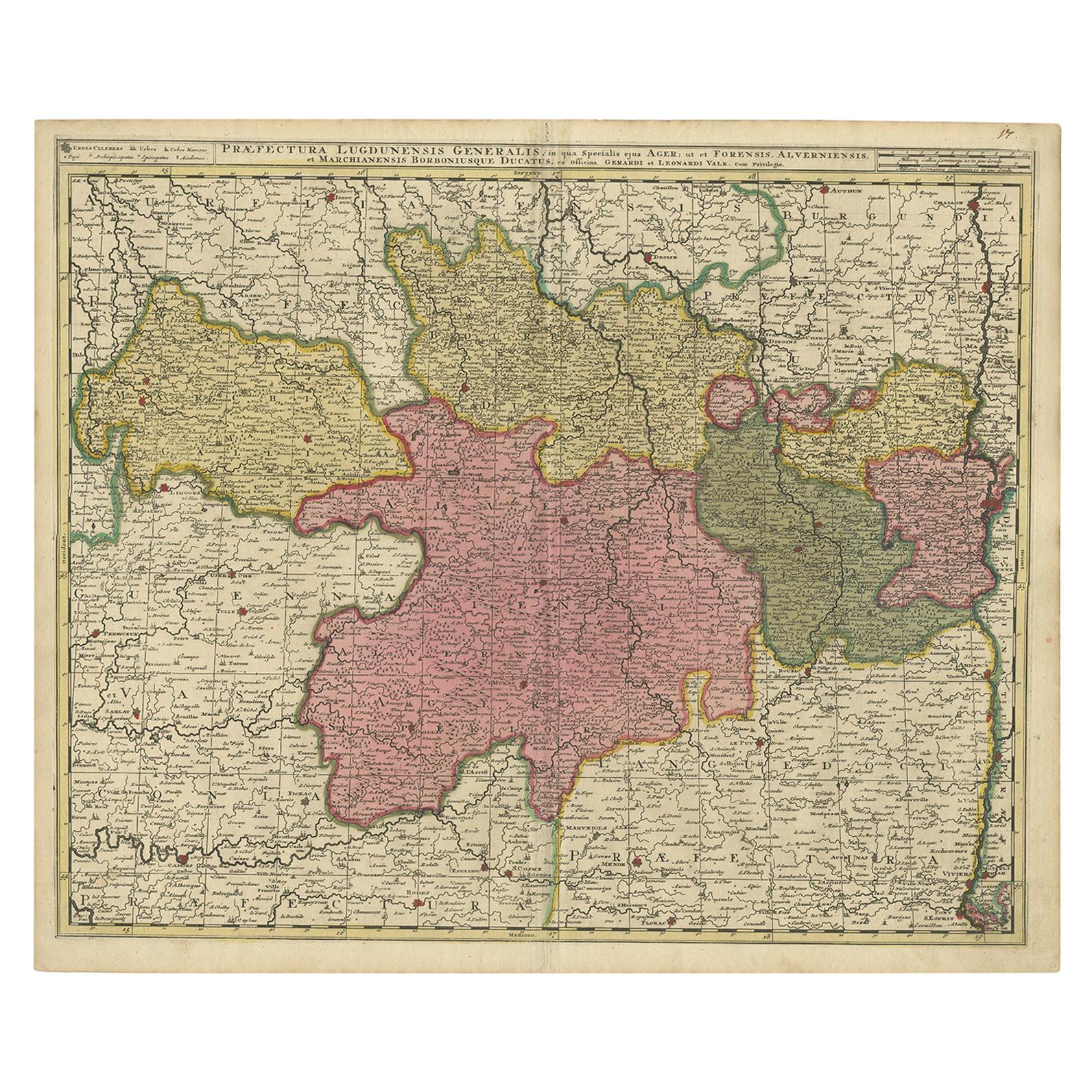
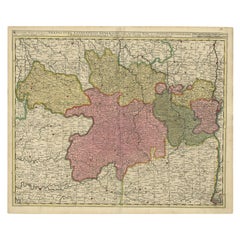
Antique Map of the Auvergne-Rhône-Alpes region of France by Valk, circa 1730
Located in Langweer, NL
Antique map titled 'Praefectura Lugdunensis Generalis'. Detailed map of the Auvergne-Rhône-Alpes region in the southeast of France. To the east the Rhône from Chalon-sur-Saône, Mâcon...
Category
Antique Mid-18th Century Maps
Materials
Paper
$478 Sale Price
20% Off
Recently Viewed
View AllMore Ways To Browse
Transit Level Used
Brass Surveyor
Surveying Instrument
Antique Survey Instruments
Antique Surveying Instruments
Surveyors Level
Antique Brass Surveying Instruments
Brass Surveyors Level
Antique Theodolite
Antique Brass Theodolite
Brass Theodolite
Theodolite Used
Used Surveyor Transit
Antique Cameras Folding Cameras
Antique Folding Camera
Antique Wood Gear
Telescope Tripod
18th Century French Barometer