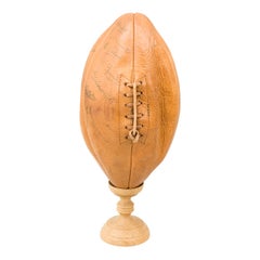
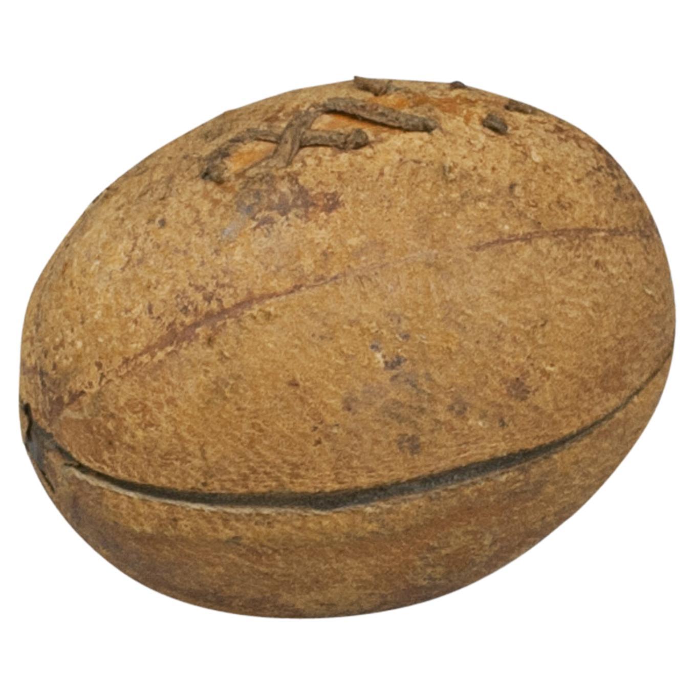
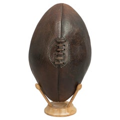
Sykes Rugby Ball, Signed by 1954 England, Scotland, Wales & Ireland Rugby Teams
View Similar Items


Want more images or videos?
Request additional images or videos from the seller
1 of 16
Sykes Rugby Ball, Signed by 1954 England, Scotland, Wales & Ireland Rugby Teams
$613.21List Price
About the Item
- Dimensions:Height: 11.03 in (28 cm)Width: 6.11 in (15.5 cm)Depth: 6.11 in (15.5 cm)
- Materials and Techniques:
- Place of Origin:
- Period:
- Date of Manufacture:circa 1950s
- Condition:Wear consistent with age and use. The ball holds its shape but the bladder does not hold air.
- Seller Location:Oxfordshire, GB
- Reference Number:Seller: 276741stDibs: LU975716622972
About the Seller
5.0
Platinum Seller
Premium sellers with a 4.7+ rating and 24-hour response times
Established in 1977
1stDibs seller since 2013
788 sales on 1stDibs
Typical response time: 2 hours
Associations
LAPADA - The Association of Arts & Antiques Dealers
Authenticity Guarantee
In the unlikely event there’s an issue with an item’s authenticity, contact us within 1 year for a full refund. DetailsMoney-Back Guarantee
If your item is not as described, is damaged in transit, or does not arrive, contact us within 7 days for a full refund. Details24-Hour Cancellation
You have a 24-hour grace period in which to reconsider your purchase, with no questions asked.Vetted Professional Sellers
Our world-class sellers must adhere to strict standards for service and quality, maintaining the integrity of our listings.Price-Match Guarantee
If you find that a seller listed the same item for a lower price elsewhere, we’ll match it.Trusted Global Delivery
Our best-in-class carrier network provides specialized shipping options worldwide, including custom delivery.More From This Seller
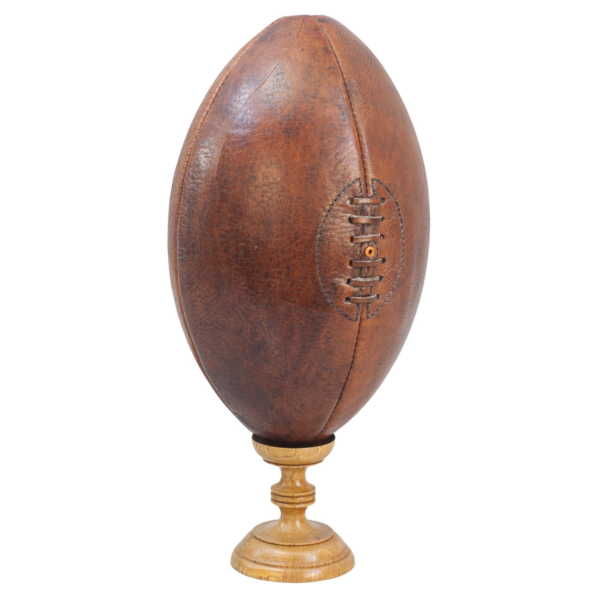
View AllLeather Rugby Ball
Located in Oxfordshire, GB
Vintage Leather Rugby Ball.
A great looking traditional leather rugby ball made from four leather panels. The ball is with good colour and patination. The top is with lacing so the b...
Category
Mid-20th Century Unknown Sports Equipment and Memorabilia
Materials
Leather

Vintage Rugby Ball Inkwell.
Located in Oxfordshire, GB
Rare Novelty Rugby Inkwell.
A wonderful leather covered travelling inkwell in the shape of a rugby ball. This is a very desirable, rare and unusual object made from brass and covered...
Category
Antique Early 1900s British Sports Equipment and Memorabilia
Materials
Brass
Antique Football, Rugby Clay Pipe
Located in Oxfordshire, GB
Victorian Sporting Clay Tobacco Pipe.
An early embossed Football & Rugby clay pipe. The large bowl decorated in relief with three football players on one side and three rugby players...
Category
Antique 1890s British Sporting Art Sports Equipment and Memorabilia
Materials
Clay
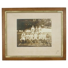
Military Hockey Team Photograph in India.
Located in Oxfordshire, GB
Team Photograph, Hockey Team.
A team photograph of a military hockey team in India, 1919 - 1920. The sepia team photo is mounted on the official Cambridge photographers mount 'Charle...
Category
Vintage 1920s British Sporting Art Sports Equipment and Memorabilia
Materials
Wood, Paper
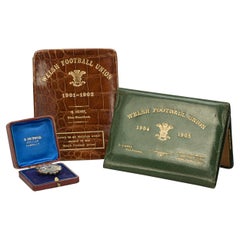
Welsh Rugby Union Tickets and Lapel Pin, Welsh Football Union
Located in Oxfordshire, GB
Three Rare Items Once belonging To The Welsh Rugby Union Vice-President, G. Henry.
These wonderful rare items belonged to the Welsh Rugby Union Vice-President, G. Henry and comprise of a 1896 lapel-pin (medal), leather crocodile wallet (season ticket 1901-1902), green leather wallet...
Category
Antique 1890s British Sporting Art Sports Equipment and Memorabilia
Materials
Silver
Wooden Football/Rug by Ball Display Stand
Located in Oxfordshire, GB
Oak ball stands.
Modern wooden ball stands, ideal for rugby or football balls. The rugby ball can be displayed standing up or on its side. A great way to display your prized balls.
The price shown is for the stand only...
Category
2010s English Sports Equipment and Memorabilia
Materials
Oak
$129 / item
You May Also Like
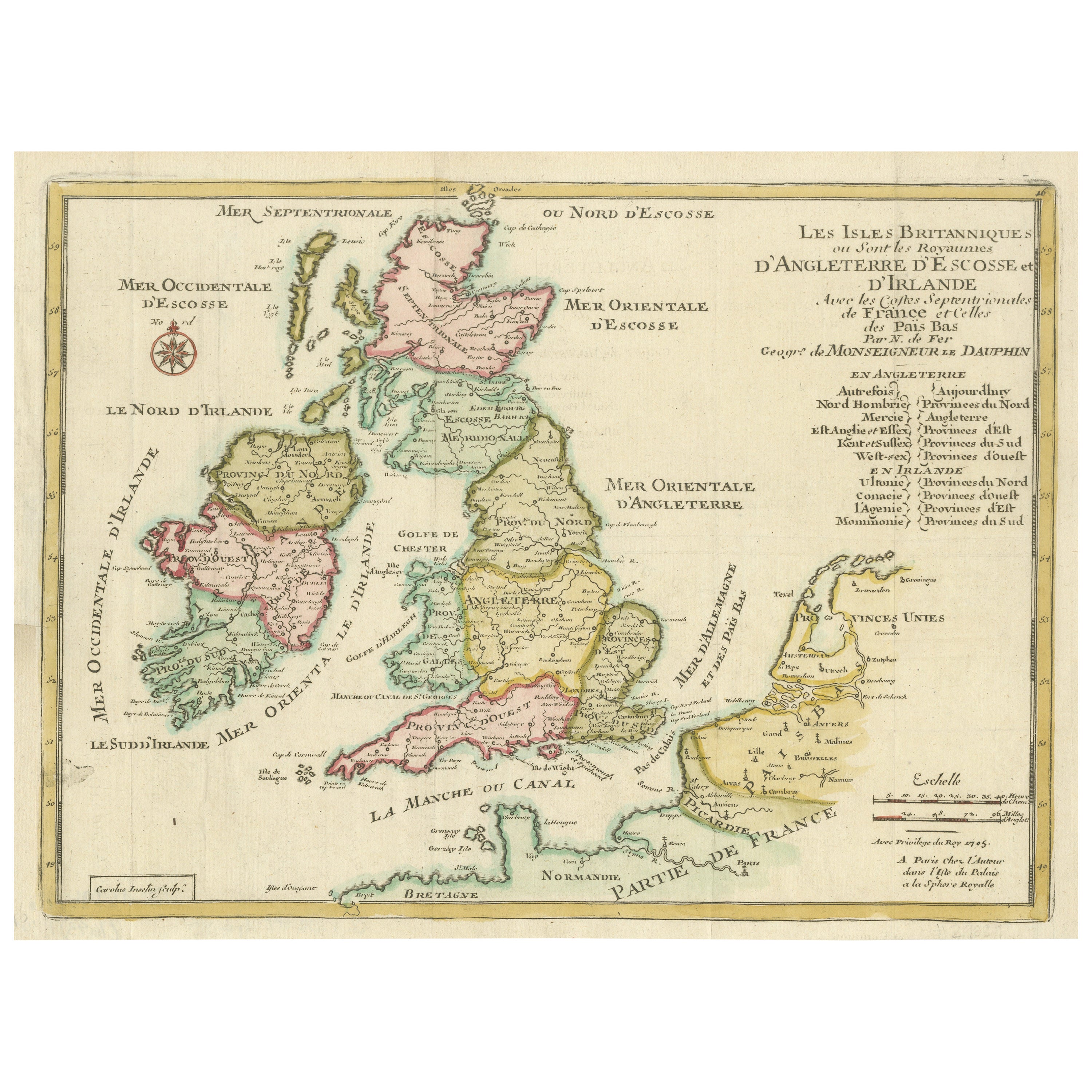
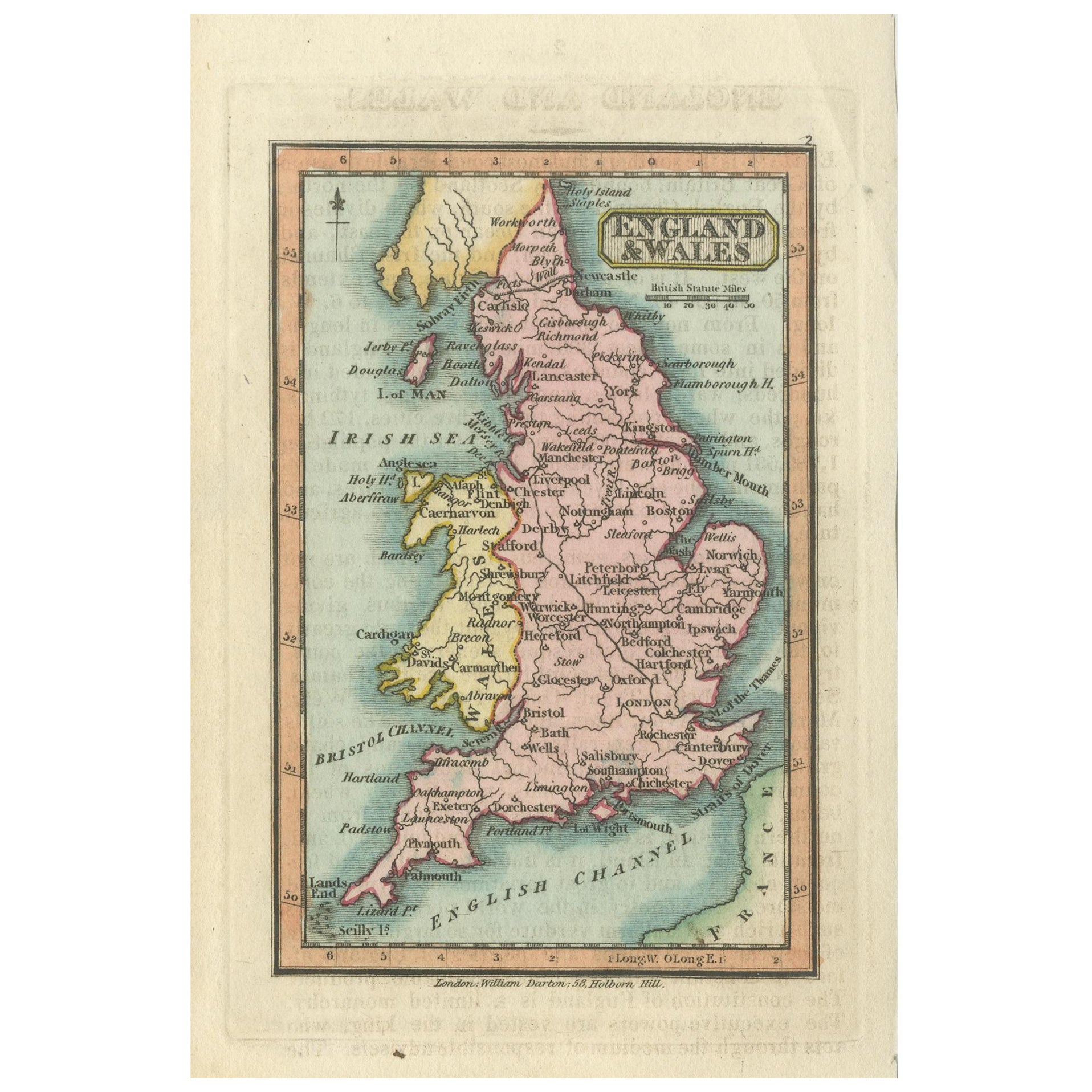
Original Antique Map of England, Ireland, Scotland and Wales
Located in Langweer, NL
Antique map titled 'Les Isles Britanniques, ou sont les Royaumes d Angleterre (..)'. Detailed map of England, Ireland, Scotland and Wales, with French coast and part of the Netherlan...
Category
Antique Early 18th Century Maps
Materials
Paper

$273 Sale Price
20% Off
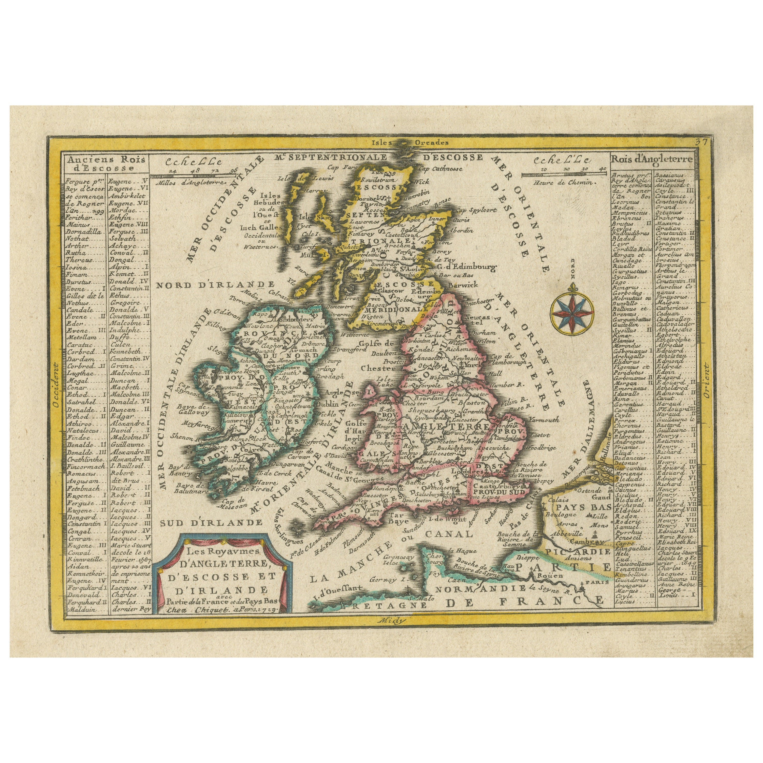
Small Antique Map of England, Wales, Scotland and Ireland with Original Coloring
Located in Langweer, NL
Antique map titled 'Les Royaumes d'Angleterre d'Escosse et d'Irlande (..)'. A lovely, small map of England, Wales, Scotland and Ireland with a portion of the coastline of France and ...
Category
Antique Early 18th Century Maps
Materials
Paper

$433 Sale Price
20% Off
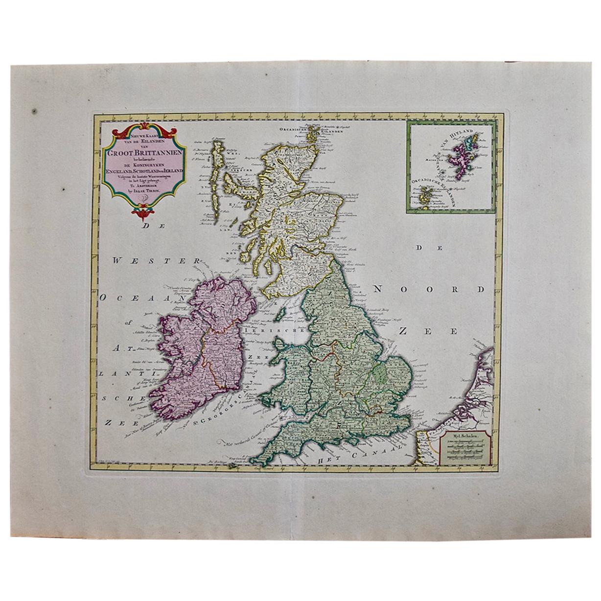
England, Scotland & Ireland: A Hand Colored Map of Great Britain by Tirion
By Isaak Tirion
Located in Alamo, CA
This is a hand-colored double page copperplate map of Great Britain entitled "Nieuwe Kaart van de Eilanden van Groot Brittannien Behelzende de Kon...
Category
Antique Mid-18th Century Dutch Maps
Materials
Paper

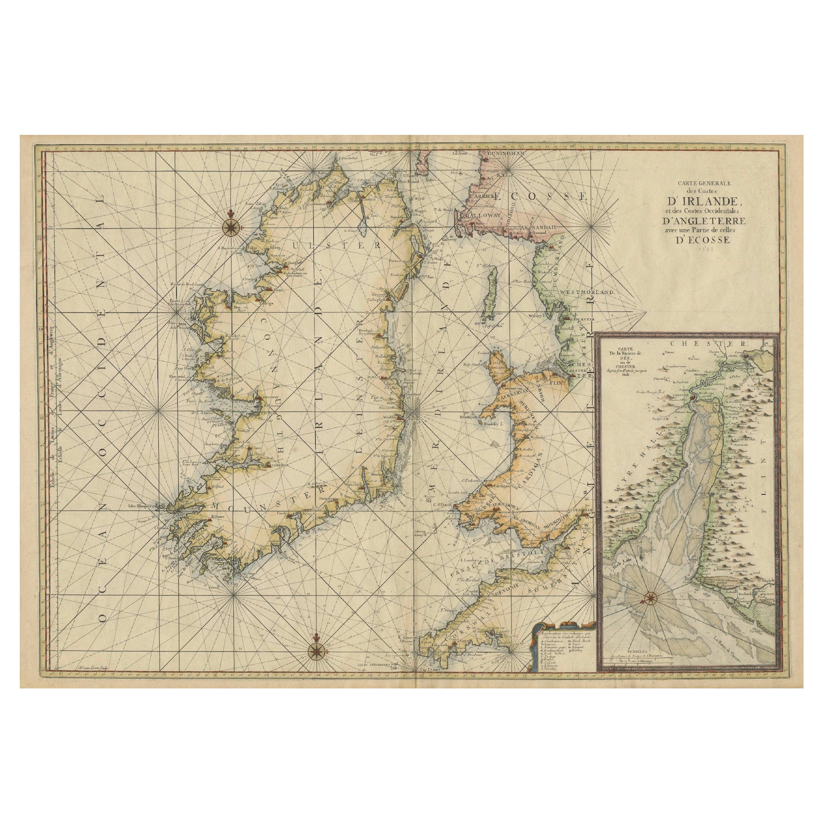
Large 1693 Maritime Map of Irish Sea, West Coasts of Ireland, England, Scotland
Located in Langweer, NL
This is a historical sea chart titled "Carte Generale des Costes d'Irlande, et des Costes Occidentales d'Angleterre avec une Partie de celles d'Ecosse," which translates to "General Map of the Coasts of Ireland and the Western Coasts of England with a Part of Scotland."
The map was first published in 1693 in the atlas "La Neptune Francois," created by Jaillot and published by Pieter Mortier in Amsterdam. This initiative was started by the French minister Colbert to improve maritime navigation.
Details of the Map:
1. **Geographical Coverage:**
- The map primarily focuses on the Irish coast.
- It also includes the west coast of England and Wales.
- Parts of the west coast of Scotland are also depicted.
2. **Inset Map:**
- There is a detailed inset map showing the area around Chester and the course of the River Dee.
3. **Features:**
- **Depth Soundings:** The Irish Sea is detailed with depth soundings to assist in navigation.
- **Coastal Towns and Islands:** Numerous coastal towns, islands, and geographical features are indicated.
- **Rhumb Lines:** The map includes extensive rhumb lines, which are lines used by navigators to plot a straight-line course.
- **Key:** There is a key describing the quality of the terrain along the coast, important for navigators to understand the nature of the coastal landscape.
4. **Labels and Annotations:**
- **Coastal Settlements:** Ports, forts, and villages along the coast are labeled.
- **Geographical Features:** Islands and other significant features are marked.
5. **Artistic and Practical Elements:**
- The map is printed on thick paper and is hand-colored, reflecting contemporary coloring techniques.
- Detailed lines and soundings are included to help ships navigate around the numerous small islands and narrow inlets safely.
6. **Historical Context:**
- The map was part of a significant French maritime project aimed at improving navigation and charting European waters more accurately.
- It reflects the high level of cartographic skill and knowledge of the late 17th century.
This map would have been a valuable tool for mariners of the time, providing them with crucial information about the coastal features, depth soundings, and safe passage routes around the complex coastlines of Ireland, England, and Scotland.
About the Makers and the Atlas
**1. Alexis-Hubert Jaillot (1632-1712):**
- **Background:** Jaillot was a prominent French cartographer and publisher in the 17th century. He was known for his detailed and accurate maps and atlases.
- **Work:** He collaborated with other notable cartographers of his time and played a key role in improving and publishing detailed maps. Jaillot's work was characterized by its precision and artistic quality.
- **Contribution:** He was instrumental in the creation of "La Neptune Francois," a maritime atlas aimed at improving French naval navigation.
**2. Pieter Mortier (1661-1711):**
- **Background:** Mortier was a Dutch engraver, publisher, and mapmaker based in Amsterdam. He was well-known for his high-quality prints and maps.
- **Work:** Mortier published several important atlases and maps, often collaborating with other cartographers and engravers. His work was recognized for its detailed craftsmanship and accuracy.
- **Contribution:** Mortier published "La Neptune Francois" in Amsterdam, making significant contributions to maritime navigation by providing highly detailed sea charts.
About the Atlas "La Neptune Francois":
**1. Purpose:**
- The atlas was created as part of an initiative led by Jean-Baptiste Colbert, the French minister of finance under King Louis XIV. The goal was to enhance the accuracy and availability of maritime charts for French naval and commercial vessels.
- "La Neptune Francois" was designed to be a comprehensive and detailed reference for navigators, covering various European waters with a focus on the French coast and adjacent regions.
**2. Content:**
- The atlas includes a series of sea charts, each providing detailed information on coastal regions, depth soundings, rhumb lines, and other navigational aids.
- The maps were printed on high-quality paper and hand-colored, reflecting the artistic standards of the time.
**3. Historical Significance:**
- "La Neptune Francois" was a landmark in the history of cartography, representing a significant advancement in the accuracy and detail of maritime maps...
Category
Antique 1690s Maps
Materials
Paper
$2,452 Sale Price
20% Off
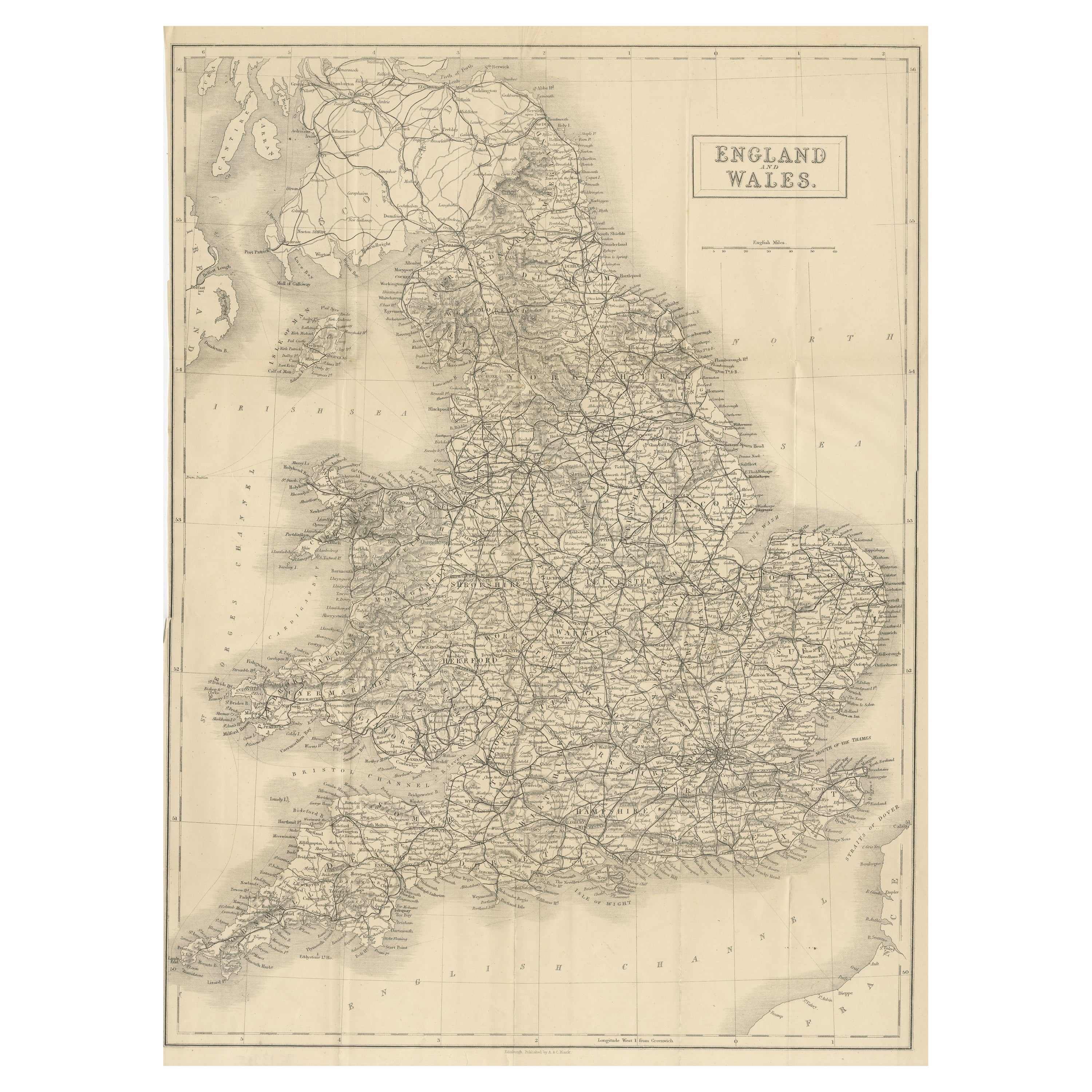
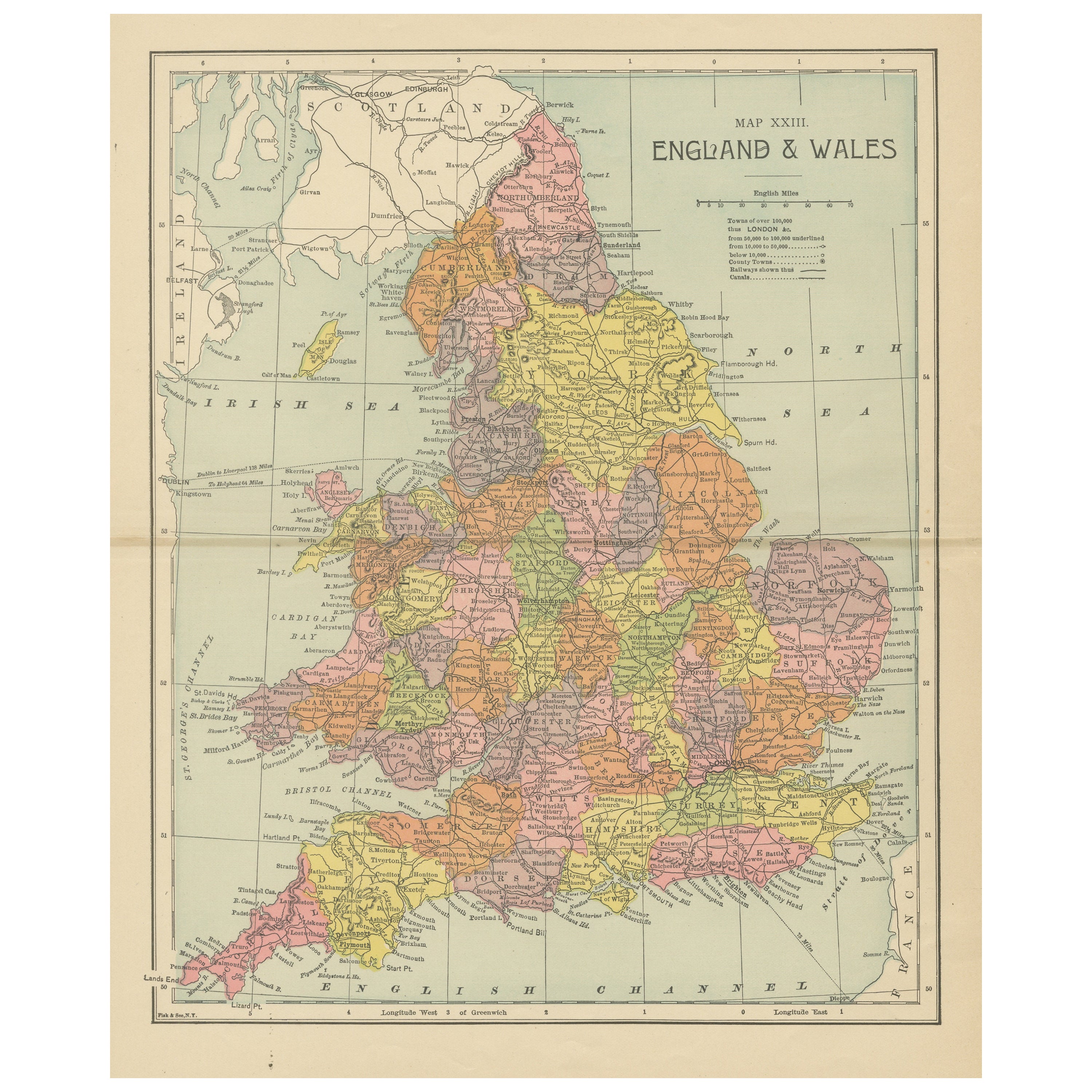
Antique Map of England & Wales by Wyld '1845'
Located in Langweer, NL
Antique map titled 'England & Wales'. Original antique map of England & Wales. This map originates from 'An Atlas of the World, Comprehending Se...
Category
Antique Mid-19th Century Maps
Materials
Paper

$133 Sale Price
24% Off
Antique Map of England and Wales by Johnston, 1882
Located in Langweer, NL
Antique map titled 'England and Wales'. Old map of England and Wales, with an inset map of Scilly Islands. This map originates from 'The Royal Atlas of Modern Geography, Exhibiting, ...
Category
Antique 19th Century Maps
Materials
Paper

$134 Sale Price
20% Off
Recently Viewed
View AllMore Ways To Browse
Donald Roberts
John Willis Good
Rees Roberts
Rugby Ball
Donald Ross
Used Rugby Ball
John Cameron Furniture
Ray Williams
Jones And Willis
Tennis Racket
Antique Walking Cane Handles
Antique Wood Walking Cane
Collectable Tennis
Vintage Fishing Collectibles
Hawaiian Collectibles
French Walking Stick
Antique Football
Sports Rings