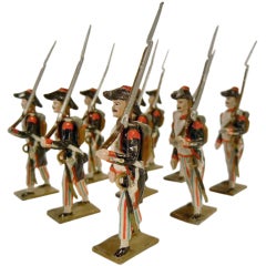
Mignot 12-Piece Set of French Revolutionary Volunteers of 1793
View Similar Items


1 of 10
Mignot 12-Piece Set of French Revolutionary Volunteers of 1793
$475List Price
About the Item
- Sold As:Set of 12
- Place of Origin:
- Period:
- Date of Manufacture:1945-55
- Condition:Very good, with very light wear due to age. No box.
- Seller Location:Quechee, VT
- Reference Number:Seller: T210-015-JGS1stDibs: U120804928675
Authenticity Guarantee
In the unlikely event there’s an issue with an item’s authenticity, contact us within 1 year for a full refund. DetailsMoney-Back Guarantee
If your item is not as described, is damaged in transit, or does not arrive, contact us within 7 days for a full refund. Details24-Hour Cancellation
You have a 24-hour grace period in which to reconsider your purchase, with no questions asked.Vetted Professional Sellers
Our world-class sellers must adhere to strict standards for service and quality, maintaining the integrity of our listings.Price-Match Guarantee
If you find that a seller listed the same item for a lower price elsewhere, we’ll match it.Trusted Global Delivery
Our best-in-class carrier network provides specialized shipping options worldwide, including custom delivery.You May Also Like
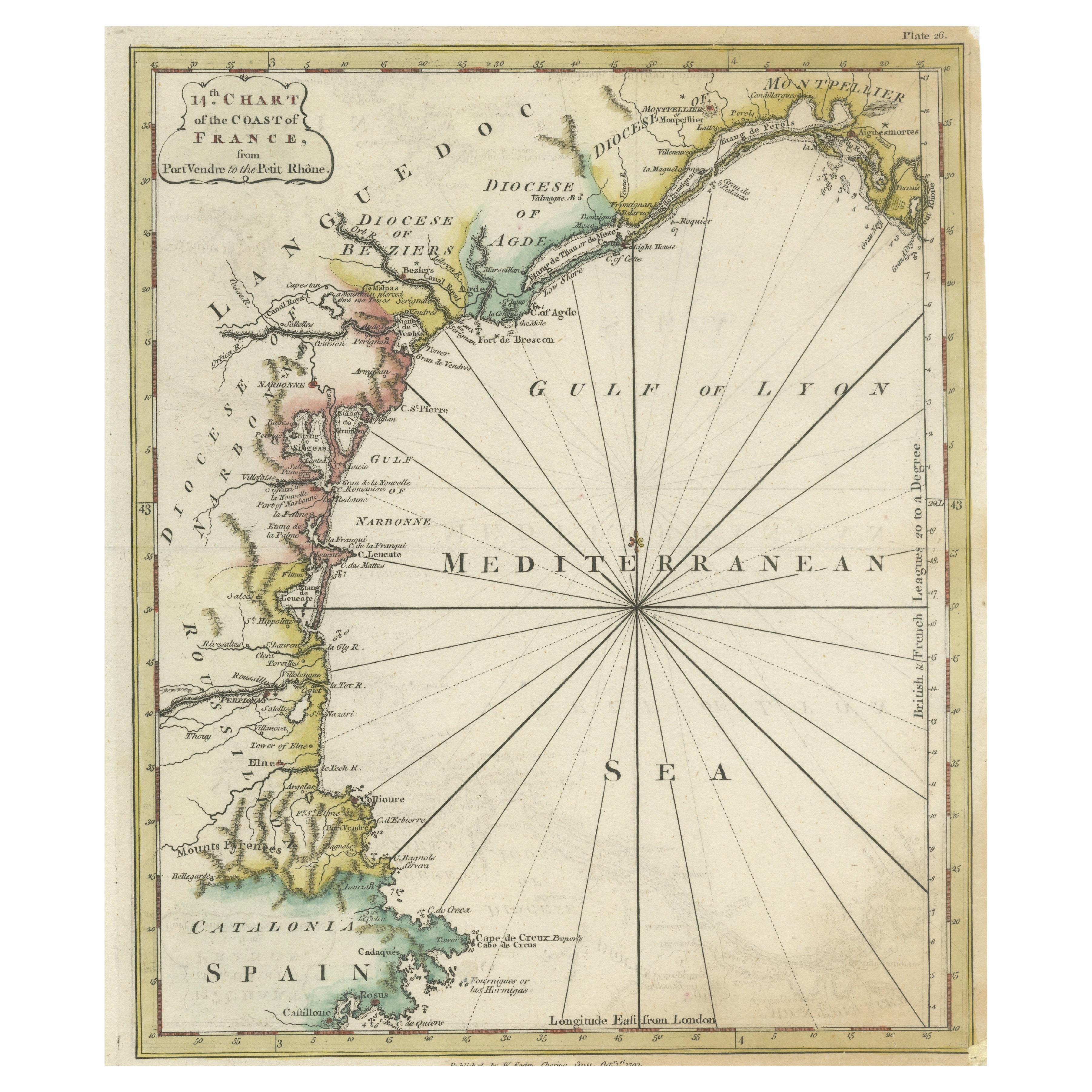
Antique Map of the Coast of Southern France, 1793
Located in Langweer, NL
Antique map titled '14th Chart of the Coast of France, from Port Vendres to the Petit Rhône'. Original map with later hand coroling of the coast of Southern France.
The "14th Chart of the Coast of France, from Port Vendres to the Petit Rhône" is an antique map that offers a detailed depiction of the southern coast of France, specifically highlighting the Mediterranean coastline. This map, which dates back to 1793, was originally part of "Le Petit Neptune Français; Or, French Coasting Pilot," a publication designed for maritime navigation along the French coastlines.
Key Features of the Map:
1. **Geographic Coverage**:
- The map covers the southern French coastline from Port Vendres in the west to the Petit Rhône in the east.
- It includes notable regions such as Languedoc, the Gulf of Lyon, and parts of Catalonia (Spain).
2. **Notable Places**:
- **Montpellier**: A major city in the Diocese of Montpellier, an important cultural and economic center.
- **Narbonne**: Located in the Diocese of Narbonne, a historical city with Roman heritage.
- **Agde**: Situated in the Diocese of Agde, known for its ancient Greek colony origins.
- **Béziers**: Part of the Diocese of Béziers, another city with deep historical roots dating back to Roman times.
- **Port Vendres**: A critical port near the Spanish border.
- **Catalonia**: Including parts of northeastern Spain, emphasizing the coastal connection between France and Spain.
3. **Dioceses and Regions**:
- The map is marked with various dioceses such as Montpellier, Agde, Narbonne, and Béziers, indicating ecclesiastical boundaries.
- It highlights the broader region of Languedoc, a historical province known for its wine production and medieval history.
4. **Navigational Aids**:
- The map features a compass rose with radiating lines, a common navigational aid in maritime maps...
Category
Antique Late 18th Century Maps
Materials
Paper

$226 Sale Price
20% Off
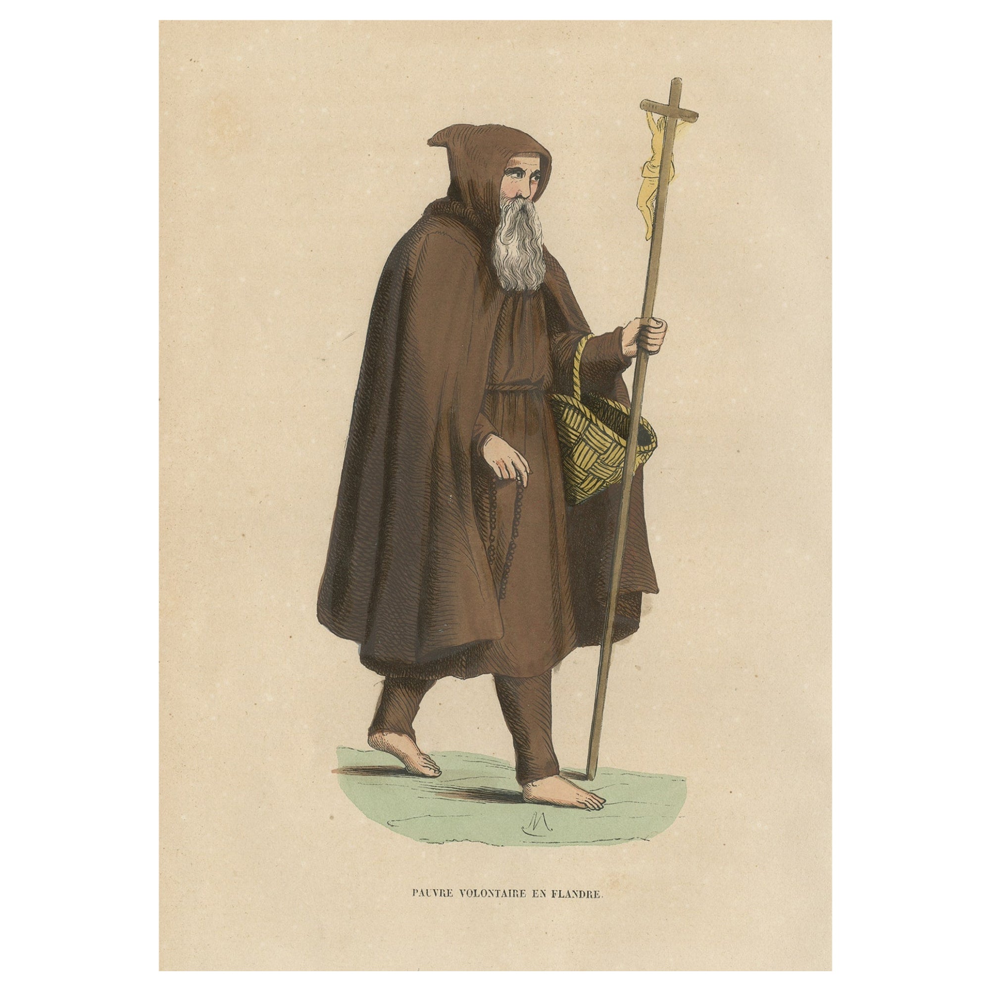
Print of a Monk of the Order of Poor Volunteers with Crucifix, 1845
Located in Langweer, NL
Antique print titled 'Pauvre Volontaire en Flandre'.
Print of a Monk of the order of Poor Volunteers with crucifix and basket. This print originates from 'Histoire et Costumes de...
Category
Antique 1840s Prints
Materials
Paper

$168 Sale Price
24% Off
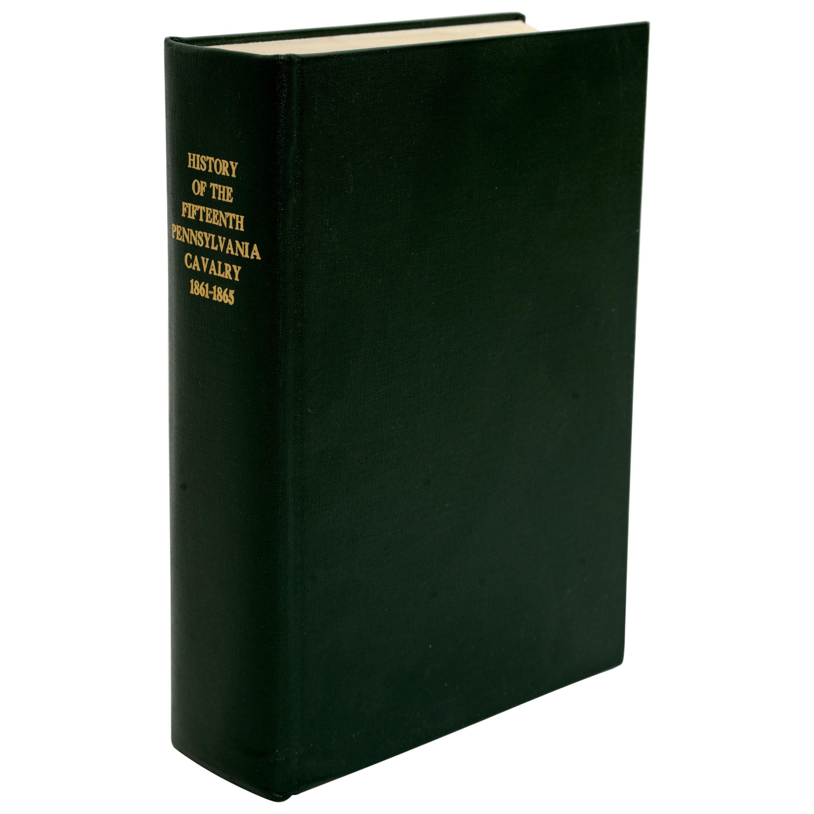
History of the Fifteenth Pennsylvania Volunteer Cavalry by Charles H. Kirk
Located in valatie, NY
History of the Fifteenth Pennsylvania Volunteer Cavalry Which Was Recruited and Known as the Anderson Cavalry in the Rebellion of 1861-1865 by Charles H. Kirk. Reprint of the 1906 or...
Category
Vintage 1980s American Books
Materials
Paper

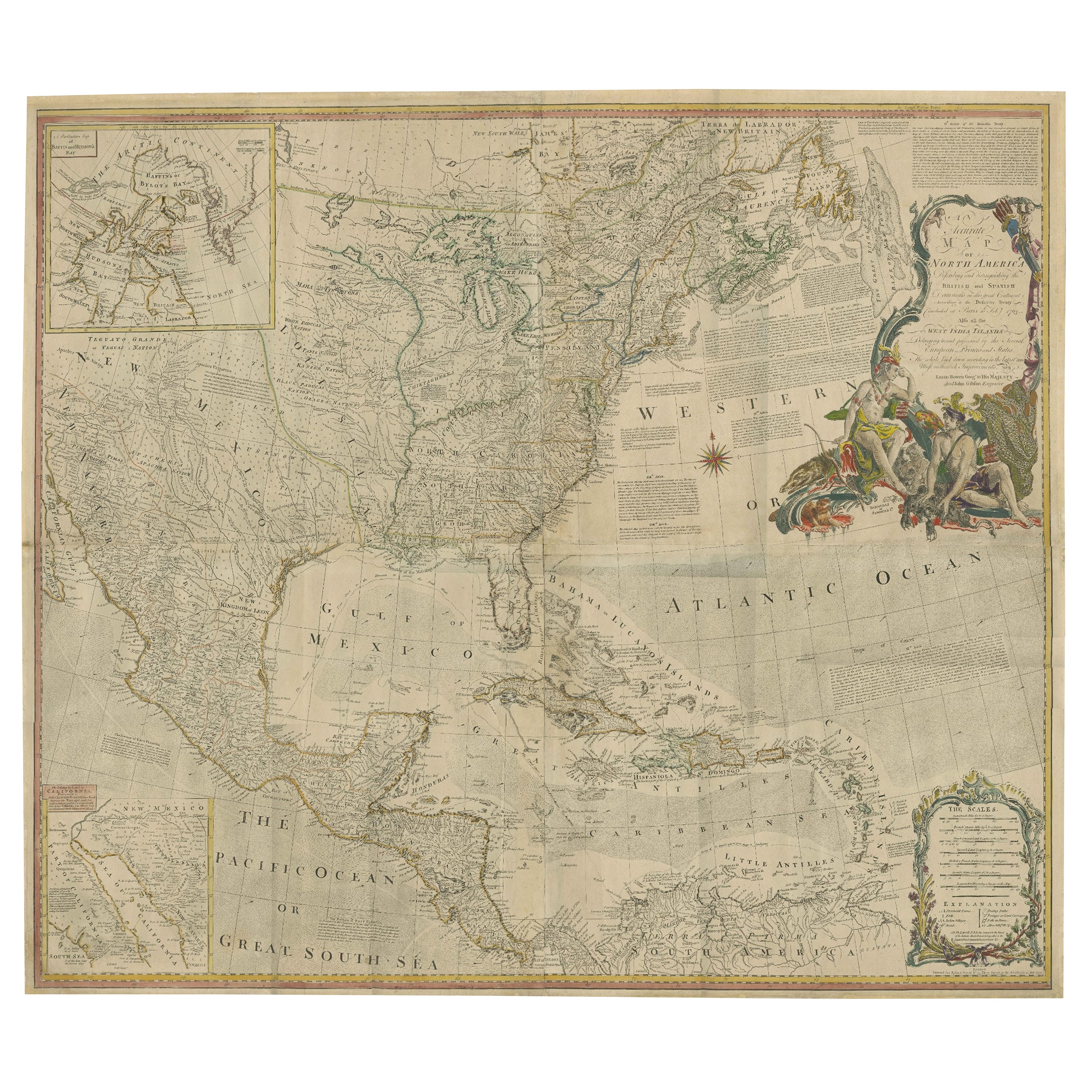
Rare Antique Wall-Map of North America: French and Indian War Boundaries, 1793
Located in Langweer, NL
Rare 1793 Map of North America: French and Indian War Boundaries and Historical Notes
This remarkable engraved map of North America, printed in 1793 by Emanuel Bowen and John Gibs...
Category
Antique 1790s Maps
Materials
Paper
David, Delacroix, and Revolutionary France: Drawings from the Louvre Louis-Antoi
Located in valatie, NY
David, Delacroix, and Revolutionary France: Drawings from the Louvre, by Louis-Antoine Prat, Jennifer Tonkovich, Esther Bell, Alison Hokanson, and Kori Lisa Yee Litt. Publisher Morga...
Category
21st Century and Contemporary American Books
Materials
Paper

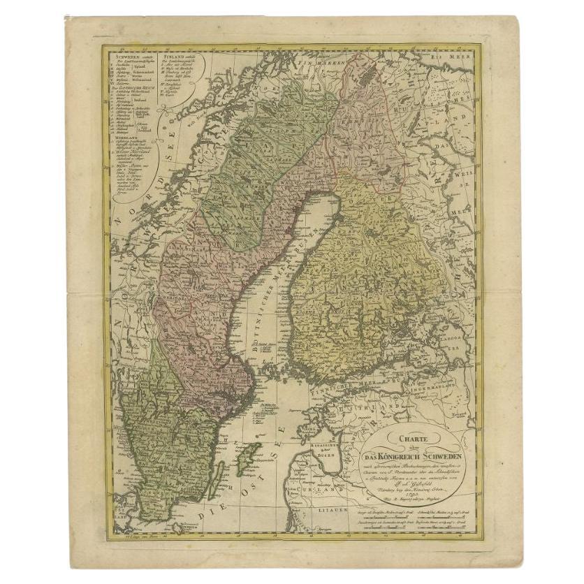
Sweden and Scandinavia – Antique Map by F.L. Güssefeld, Homann Heirs, c.1793s
Located in Langweer, NL
Sweden and Scandinavia – Antique Map by F.L. Güssefeld, Homann Heirs, c.1793s
This finely engraved antique map, titled Charte über das Königreich Schweden, presents an expansive vie...
Category
Antique 18th Century German Maps
Materials
Paper
$226 Sale Price
20% Off
Recently Viewed
View AllMore Ways To Browse
Vintage Lead Soldiers Vintage
Vintage Tricycles
Vintage 1950 S Toys
Vintage Toys 1960s 1970s
Vintage Wooden Dolls
Reproduction Vintage Toys
Stuffed Toys
Horse On Wheels
Vintage Steering Wheel
1950s Plastic Dolls
Antique Glass Dolls
Coin Mechanical
Vintage Christmas Toys
Vintage Leather Toy
Antique Tin Toys
Danish Wood Toys
Antique Dolls Early 1900s
Antique Dolls 1920S