Items Similar to Earth globe edited in the late 19th century by French geographer J. Forest

Want more images or videos?
Request additional images or videos from the seller
1 of 17
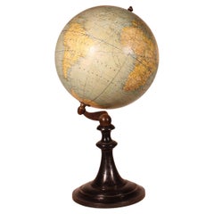
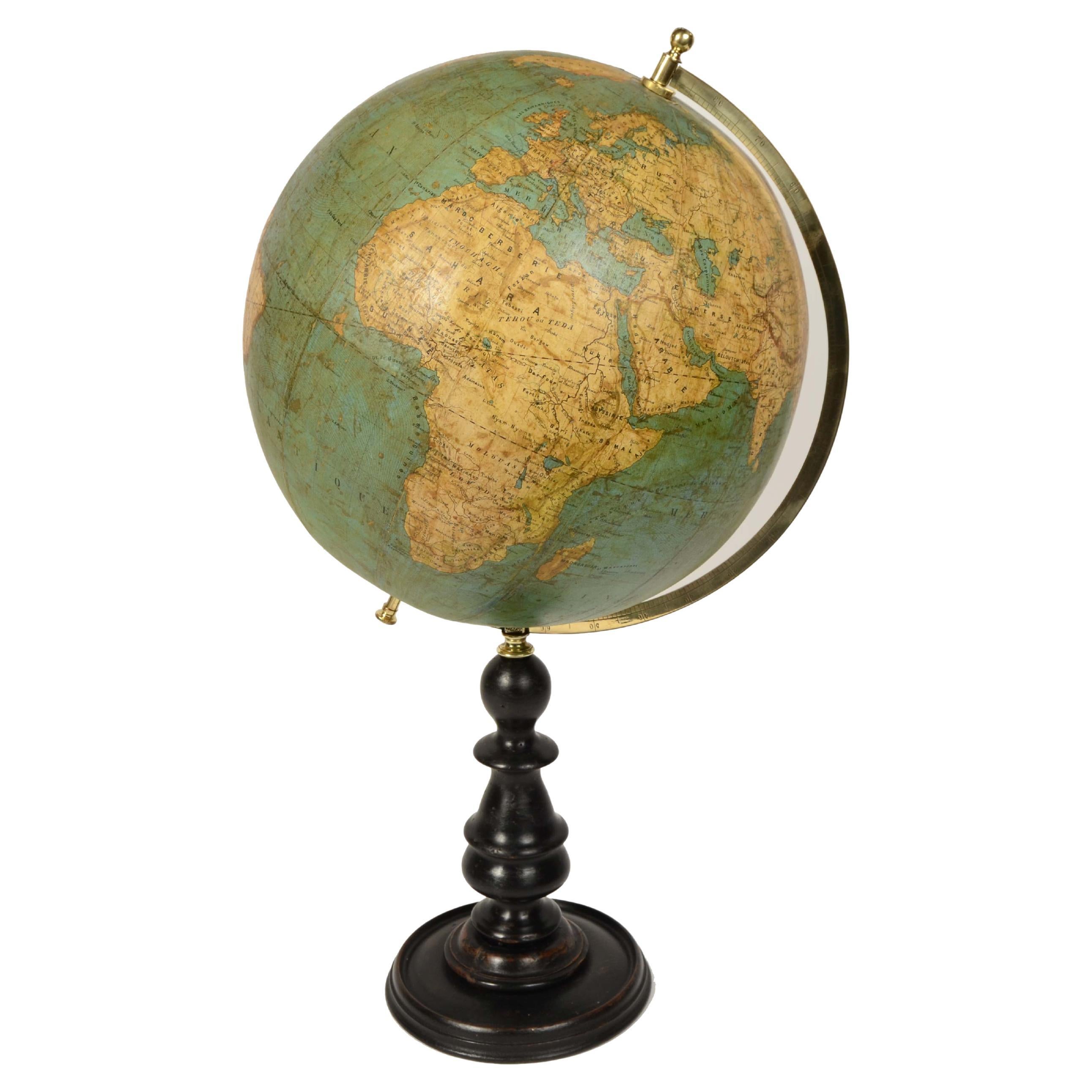
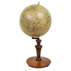
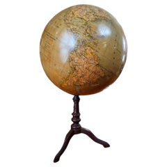
Earth globe edited in the late 19th century by French geographer J. Forest
$1,741.43
£1,282.56
€1,450
CA$2,369.08
A$2,632.57
CHF 1,379.49
MX$32,283.78
NOK 17,594.65
SEK 16,552.40
DKK 11,038.63
Shipping
Retrieving quote...The 1stDibs Promise:
Authenticity Guarantee,
Money-Back Guarantee,
24-Hour Cancellation
About the Item
Terrestrial globe edited in the late 19th century by French geographer J. Forest; in addition to the spatial map, ocean currents and major trade routes of the period are depicted. Papier-mâché and plaster sphere covered with the segments of copperplate etching paper and watercolor, turned and ebonized wood base. Height cm 35 - inches 13.8, sphere diameter cm 19 - inches 7.5. Good condition, signs of use and restored woodworm marks on base..
J. Forest made a wide variety of globes in the late 19th and early 20th centuries, mainly for educational use. His varied production included table globes, some on turned and ebonized wooden bases, floor globes, and innovative globes, such as those with mechanized rotating bases, or globes that included lighters. In the 20th century Forest produced illuminated globes with modern aluminum bases. The Paris meridian was defined on June 21, 1667 by mathematicians of the Académie, but the measurement of the meridian was not completed until 1718 by Giovanni Domenico Cassini and his son Jacques Cassini. In 1740, César-François Cassini rectified the track and then the meridian was measured again from 1792 to 1798 by Jean-Baptiste Joseph Delambre and Pierre Méchain as the basis for establishing the exact length of the meter in 1799. The Paris meridian was abandoned in favor of the Greenwich meridian during the 1884 Washington International Conference. Some of the reasons were that there was almost no inhabited land at the antipodes of Greenwich, the British promise to adopt the metric system in exchange for the French relinquishing the Paris meridian, and the fact that at the time most nautical cartography was of English origin and therefore adopting a meridian other than Greenwich would force the replacement of more nautical charts. In France, the Greenwich meridian was not officially adopted until 1911.
The earliest known globe is the one attributed by Strabo, historian and geographer, to the Greek Cratetes of Mallo (c.a. 150 B.C.). The first globes in the early 16th century were built under the impetus of the great geographical explorations and immediately began to be used for educational purposes at princely courts, monasteries, and colleges; the globe later began to conquer university circles and high and lower schools. In the 18th century, the official geographer of Louis XV King of France, Didier Robert de Vaugondy, thanks to the practice he had gained in globe-making, expanded the "Globe" article of the Encyclopédie by detailing the distinction between a celestial globe (representing the concave surface of the sky with its constellations) and a terrestrial globe (representing instead the surface of the Earth with its seas, islands, rivers, cities, etc.) and the techniques for making them: two papier-mâché hemispheres pressed and molded on or inside a hemispherical mold, dried and strengthened inside with a wooden board, then glued and covered with a thin layer of plaster on which the globe spindles of areas between two meridians, usually twelve, were pasted, made of paper previously printed by engraving on a copper plate and colored, each covering 30 degrees of longitude. It will be with the nineteenth century of great commerce, circulation and the introduction of compulsory schooling that the desire to learn about distant countries will increase, making the old method of globe construction inadequate. Spindles printed from engraved plates no longer suffice, and the only real resource becomes lithography through which it is possible to print and update maps in a timely manner, which as more and more geographical discoveries are made in different countries become obsolete faster and faster.
- Dimensions:Height: 13.8 in (35.06 cm)Diameter: 7.5 in (19.05 cm)
- Materials and Techniques:
- Period:
- Date of Manufacture:1890
- Condition:Wear consistent with age and use.
- Seller Location:Milan, IT
- Reference Number:1stDibs: LU1020245262732
About the Seller
5.0
Vetted Professional Seller
Every seller passes strict standards for authenticity and reliability
Established in 1999
1stDibs seller since 2014
397 sales on 1stDibs
Typical response time: 1 hour
- ShippingRetrieving quote...Shipping from: Milan, Italy
- Return Policy
Authenticity Guarantee
In the unlikely event there’s an issue with an item’s authenticity, contact us within 1 year for a full refund. DetailsMoney-Back Guarantee
If your item is not as described, is damaged in transit, or does not arrive, contact us within 7 days for a full refund. Details24-Hour Cancellation
You have a 24-hour grace period in which to reconsider your purchase, with no questions asked.Vetted Professional Sellers
Our world-class sellers must adhere to strict standards for service and quality, maintaining the integrity of our listings.Price-Match Guarantee
If you find that a seller listed the same item for a lower price elsewhere, we’ll match it.Trusted Global Delivery
Our best-in-class carrier network provides specialized shipping options worldwide, including custom delivery.More From This Seller
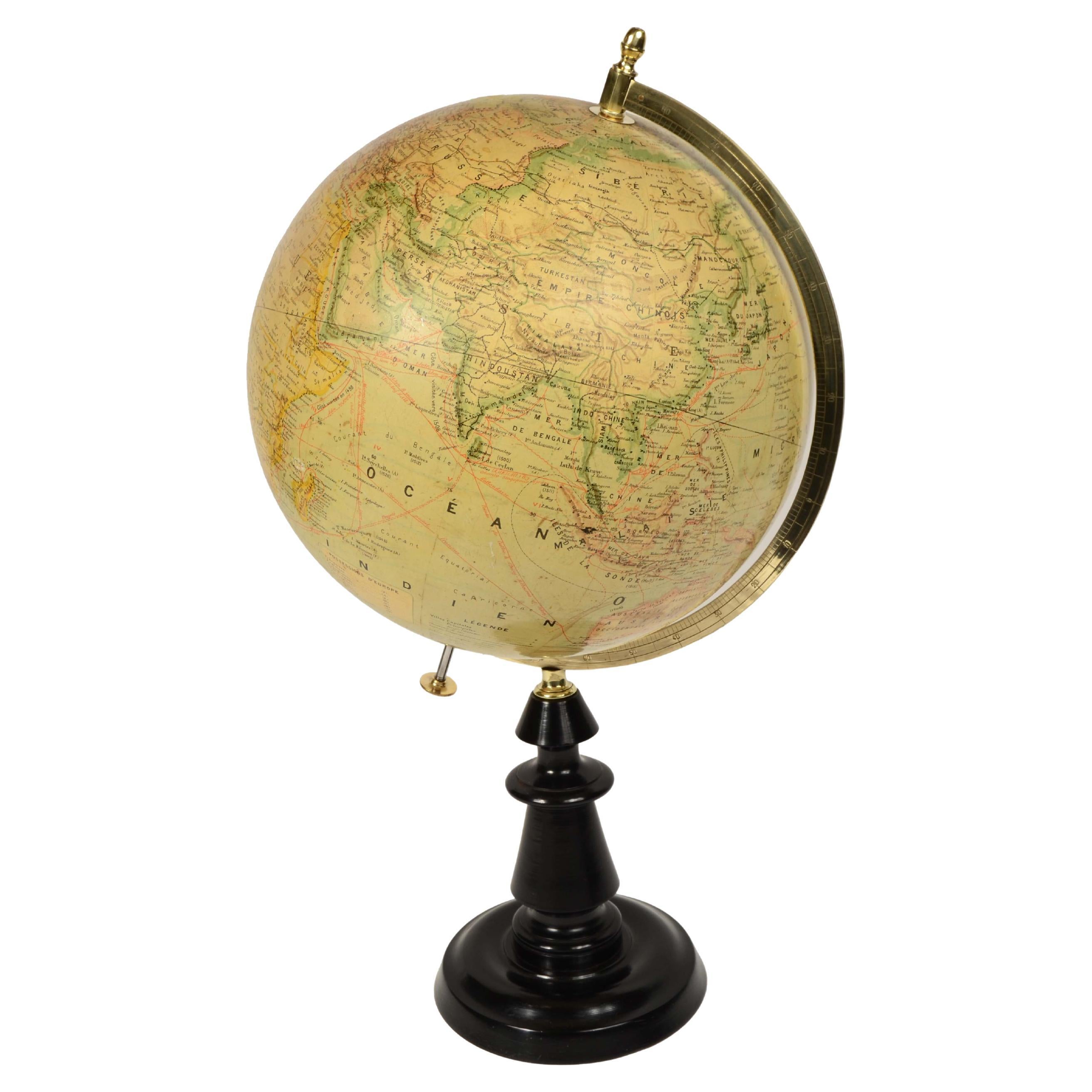
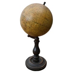
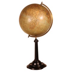
View AllEarth globe published in the late 1800s by the french geographer Joseph Forest
Located in Milan, IT
Earth globe published in the second half of the 19th century by the french geographer Joseph Forest; in addition to the spatial map, ocean currents and major trade routes of the per...
Category
Antique Late 19th Century Globes
Materials
Paper

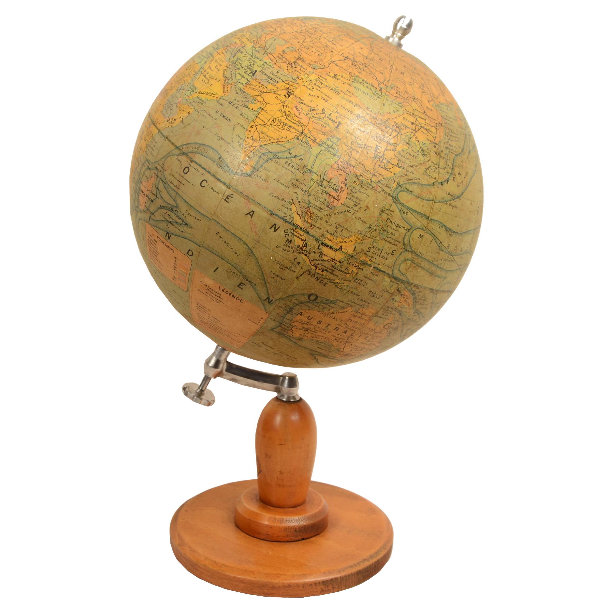
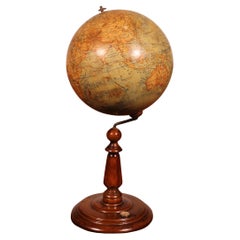
Earth globe drafted late 1940s by French geographer J. Forest
Located in Milan, IT
Earth globe redacted at the end of the 1940s by French geographer J. Forest, the cartouche reads Dressé par J. FOREST Géographe - Girard, Barrèere & Thomas Editeurs 17 - 19 Rue de Buci. Paris. In addition to the very well delineated spatial map are depicted the ocean currents and prncipal trade routes of the period. Good condition, good readability. Turned wooden base and aluminum ball coated with printed paper. Height 39 cm - inches 15.4, sphere diameter 23 cm - inches 9.
Girard et Barrère...
Category
Vintage 1940s Globes
Materials
Paper

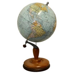
Earth globe published in about 1930 by French cartographer J. Forest
Located in Milan, IT
Earth globe edited circa 1930 by French cartographer J. Forest edition for the Ministry of Education. In addition to the spatial map, ocean currents and major trade routes of the per...
Category
Vintage 1930s Globes
Materials
Paper
Earth globe from the second half of the 19th century by Ernst Schotte and Hachette
Located in Milan, IT
Earth globe made in the second half of the 19th century by Ernst Schotte of Berlin revised and corrected by M. Vivien de Saint-Martin for Hachette & C.ie Paris.
In addition to the s...
Category
Antique 1870s Globes
Materials
Paper
Globe of the cartographer geographer of the Austro-Hungarian Empire Jan Felkl of 1870
Located in Milan, IT
Tabletop globe made by Austro-Hungarian Empire geographer and cartographer Jan Felkl in the second half of the 19th century.
In addition to the spatial map, ocean currents are shown...
Category
Antique 1870s Globes
Materials
Paper

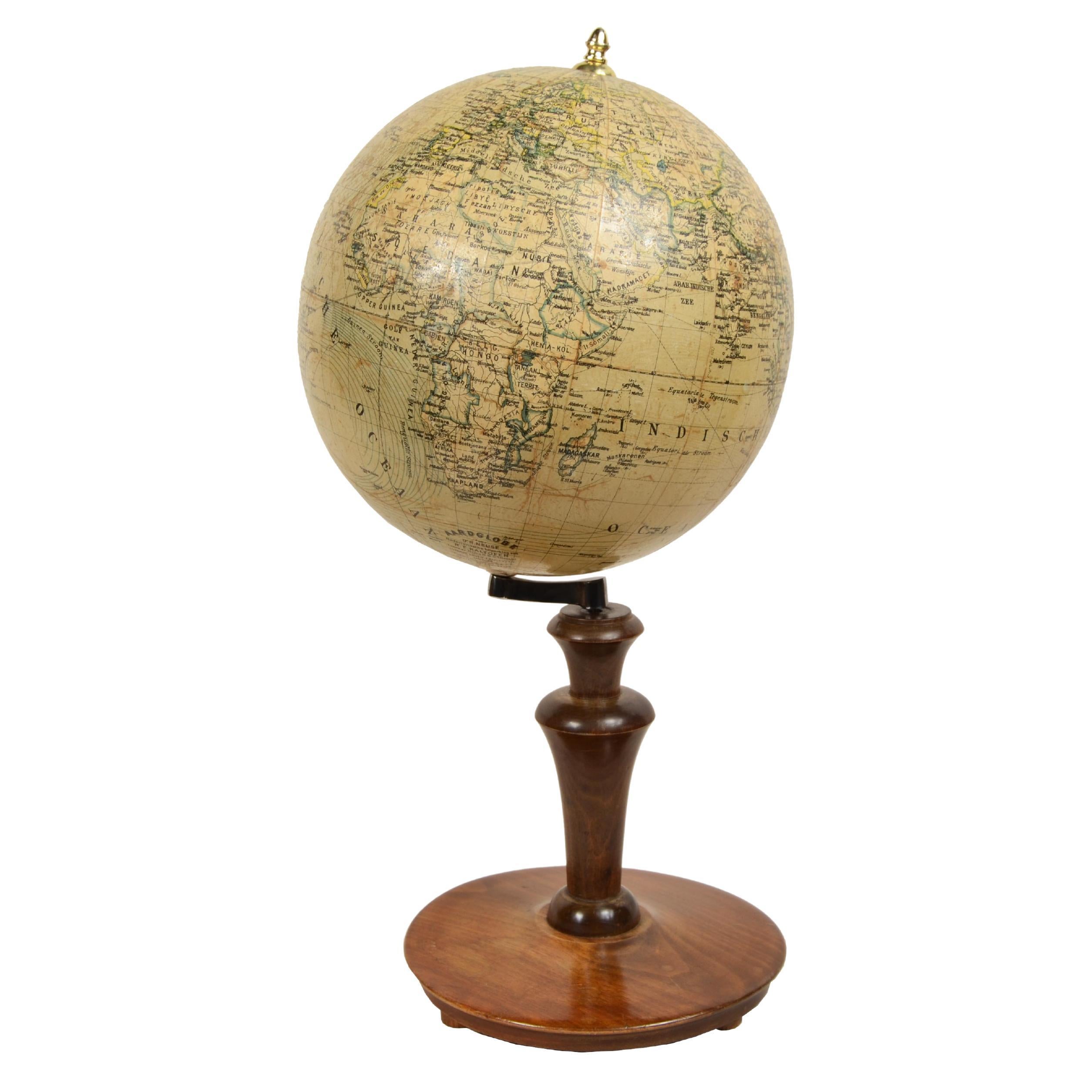
Earth globe edited for the Dutch market early 1900s Columbus-Verlag G.m.b.H
Located in Milan, IT
Earth globe published for the Dutch market in the early 20th century by the Columbus publishing house, the cartouche reads: Dr. R. Neuse's Aardglobe. Nederlandsche bewerking van R.E....
Category
Antique Early 1900s Globes
Materials
Paper
You May Also Like
Antique Terrestrial Globe By G. Thomas, Publisher, Paris, 1890
Located in Bilzen, BE
Terrestrial globe from the end of the 19th century from the house of G. Thomas, Publisher, Paris, 1890
Globe fixed on a central axis connected to a turned black wooden foot.
The glob...
Category
Antique Late 19th Century French Napoleon III Globes
Materials
Wood, Paper
Terrestrial Globe Erd Globus - 19th Century
Located in Brussels, Brussels
Lovely 19th century Erd Globus terrestrial globe
Very beautiful little unusual model with a natural wooden base with a compass
Globe in superb condition. No pock some traces of wea...
Category
Antique Late 19th Century German Aesthetic Movement Globes
Materials
Paper
Large French Terrestrial Globe or World Atlas by Girard Et Barrère
Located in Godshill, Isle of Wight
A large French terrestrial globe or world atlas by Girard et Barrère.
This is a very large stylish French terrestrial globe from the 1930...
Category
Vintage 1930s Arts and Crafts Globes
Materials
Beech
globe globe globe design guido cora for paravia 1920 - early 1900s
By Paravia
Located in taranto, IT
extremely rare early 20th century world map made by Paravia Italia on illustrations by Guido Cora, one of the most important illustrators ever.
Made of parchment-coated material, cas...
Category
Vintage 1920s Italian Industrial Globes
Materials
Metal
Large Terrestrial Globe From Handels Und Verkehrsglobus 69cm High
Located in Brussels, Brussels
Superb terrestrial globe by Handels Und Verkehrsglobus from the beginning of the 20th century from Leipzig
Very large model which has a height of 69 cm and a very beautiful blackene...
Category
Early 20th Century German Aesthetic Movement Globes
Materials
Paper
Terrestrial Globe By G. Thomas Paris
Located in Brussels, Brussels
Very beautiful Terrestrial Globe from the beginning of the 20th century circa 1910 by G.Thomas publisher Paris
The Terrestrial Globe has an exceptional blackened wooden base with a ...
Category
Antique 19th Century French Napoleon III Globes
Materials
Wood