Items Similar to Antique Map of the Burmese Empire and Upper Indochina – by Dalrymple, c.1800


Want more images or videos?
Request additional images or videos from the seller
1 of 10
Antique Map of the Burmese Empire and Upper Indochina – by Dalrymple, c.1800
$464.02
£347.32
€390
CA$637.34
A$712.62
CHF 373.80
MX$8,631.56
NOK 4,718.49
SEK 4,457.83
DKK 2,969.18
About the Item
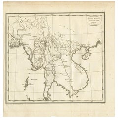
Map of the Burmese Empire and Upper Indochina – Dutch Edition after Dalrymple, circa 1800
This antique map titled “Eene Schets van het Birmansche Ryk, volgens een Kaart van Indie boven den Ganges door Dalrymple” (“A Sketch of the Burmese Empire, according to a Map of India above the Ganges by Dalrymple”) is a rare Dutch-language copper-engraved chart published around 1800. It is adapted from an earlier English map by Alexander Dalrymple, a prominent hydrographer for the British East India Company and one of the first Europeans to systematically chart parts of Southeast Asia.
The map depicts the territories of Burma (Myanmar), Assam, Yunnan, Laos, Cambodia, Siam (Thailand), and parts of southern China and eastern India. The Irrawaddy River and its tributaries dominate the center, flowing from the mountainous northern frontiers to the delta near modern-day Yangon (Rangoon). Notable regions such as Cassay (Cachar), Yodompra Shan, Layn Sany Shan, and Tavoy are clearly marked, alongside historical cities including Ava, Pegu, Amarapura, and Cheduba.
To the west, the Bay of Bengal is shown with the Andamanen (Andaman Islands) and the Mond van de Ganges (mouth of the Ganges). To the east lies Cochin China (Vietnam) and Canton (Guangzhou), connecting the Burmese and Chinese spheres of trade and influence.
This map reflects Enlightenment-era efforts to understand the political geography of Asia based on new diplomatic and commercial information gathered during British and Dutch missions. It would have served as an educational tool for readers interested in Asian empires and colonial enterprise.
Condition: Good condition with strong impression. Original horizontal and vertical folds, as issued. Some toning along folds and edges. Minor creases and a few small tears at margins, but image remains clear and intact.
Framing tips: A dark walnut or black frame with a wide off-white mat enhances its historical and cartographic interest. Float-mounting is recommended to showcase the fold lines and full engraved border.
Technique: Copper engraving
Maker: C. van Baak, after Alexander Dalrymple, Netherlands, circa 1800
- Dimensions:Height: 10.24 in (26 cm)Width: 11.97 in (30.4 cm)Depth: 0 in (0.02 mm)
- Materials and Techniques:Paper,Engraved
- Place of Origin:
- Period:
- Date of Manufacture:circa 1800
- Condition:Condition: Good condition with strong impression. Original horizontal and vertical folds, as issued. Some toning along folds and edges. Minor creases and a few small tears at margins, but image remains clear and intact.
- Seller Location:Langweer, NL
- Reference Number:Seller: BG-11645-1-71stDibs: LU3054346161072
About the Seller
5.0
Recognized Seller
These prestigious sellers are industry leaders and represent the highest echelon for item quality and design.
Platinum Seller
Premium sellers with a 4.7+ rating and 24-hour response times
Established in 2009
1stDibs seller since 2017
2,565 sales on 1stDibs
Typical response time: <1 hour
- ShippingRetrieving quote...Shipping from: Langweer, Netherlands
- Return Policy
Authenticity Guarantee
In the unlikely event there’s an issue with an item’s authenticity, contact us within 1 year for a full refund. DetailsMoney-Back Guarantee
If your item is not as described, is damaged in transit, or does not arrive, contact us within 7 days for a full refund. Details24-Hour Cancellation
You have a 24-hour grace period in which to reconsider your purchase, with no questions asked.Vetted Professional Sellers
Our world-class sellers must adhere to strict standards for service and quality, maintaining the integrity of our listings.Price-Match Guarantee
If you find that a seller listed the same item for a lower price elsewhere, we’ll match it.Trusted Global Delivery
Our best-in-class carrier network provides specialized shipping options worldwide, including custom delivery.More From This Seller
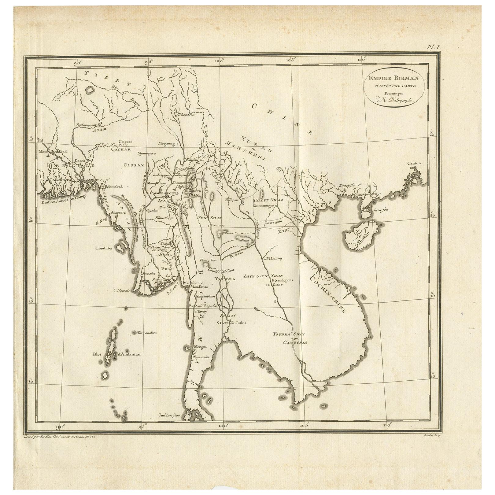
View AllAntique Map of the Burmese Empire by Symes, '1800'
Located in Langweer, NL
Antique map titled 'Empire Birman d'après une carte'. Map of the Burmese Empire. This map originates from 'Relation de l'Ambassade Anglaise, envoyée en 1795 dans le Royaume d'Ava, ou...
Category
Antique Early 19th Century Maps
Materials
Paper
$166 Sale Price
20% Off
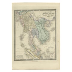
Antique Map of the Burmese Empire by Wyld, '1845'
Located in Langweer, NL
Antique map titled 'Map of Burman Empire, Siam, Cochin China and Ton-King'. Original antique map of the Burmese Empire. This map originates from 'An Atlas of the World, Comprehending...
Category
Antique Mid-19th Century Maps
Materials
Paper
$237 Sale Price
20% Off
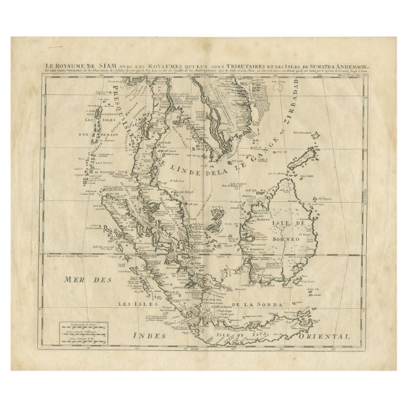
Antique Map of Southeast Asia by Chatelain, c.1732
Located in Langweer, NL
"Antique map titled 'La Royaume de Siam avec les Royaumes qui luy sont Tributaires et les Isles de Sumatra Andemaon'. It shows: Southeast Asia; Borneo, Java, Siam (Thailand), Malacca...
Category
Antique 18th Century Maps
Materials
Paper

$737 Sale Price
20% Off
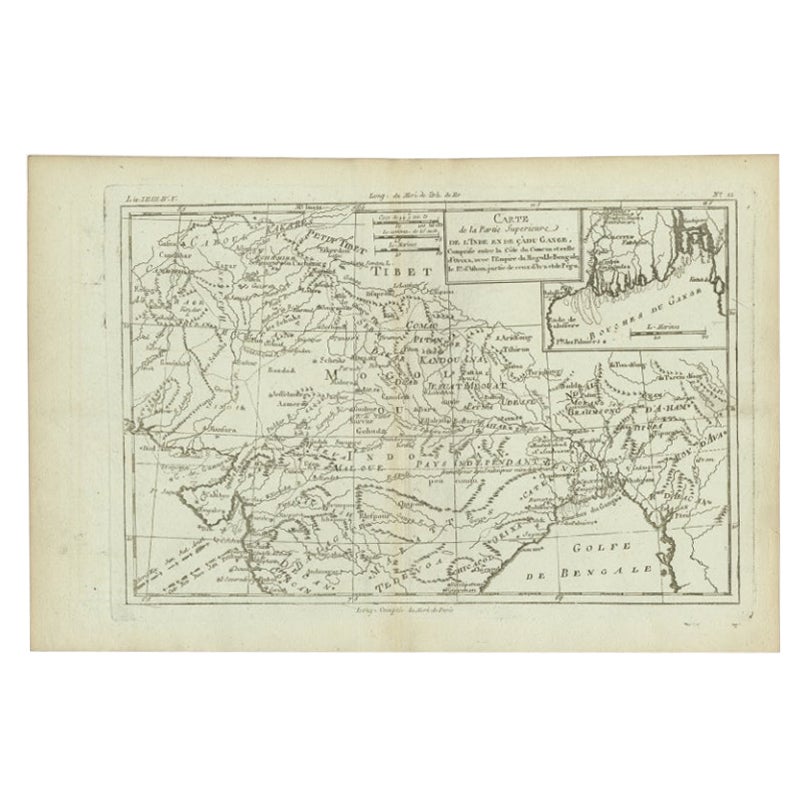
Antique Map of Part of Southern Asia by Bonne, c.1780
Located in Langweer, NL
Antique map titled 'Carte de la Partie Superieure de l'Inde en deca du Gange. Comprise entre la Cote du Concan et celle d'Orixa, avec l'Empire du Mogol, le Bengale, le R. d'Asham, pa...
Category
Antique 18th Century Maps
Materials
Paper
$118 Sale Price
20% Off
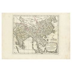
Large Antique Map of Asia including All of Southeast Asia, c.1792
Located in Langweer, NL
Antique map titled 'L' Asie Divisee en ses Empires, Royaumes, et Etats'. Attractive, large map of Asia including all of Southeast Asia. The cartography is archaic for the period with...
Category
Antique 18th Century Maps
Materials
Paper

$1,427 Sale Price
20% Off
Free Shipping
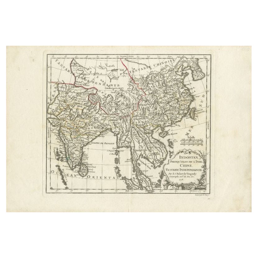
Antique Map of Southeast Asia by Dussy, 1778
Located in Langweer, NL
"Antique map titled 'Indostan presqu'isles de l'Inde, Chine, Tartarie Independante.' - A map of Asia: Hindustan, India and China. This map originates from 'Nouvel Atlas Portatif dest...
Category
Antique 18th Century Maps
Materials
Paper
$209 Sale Price
20% Off
You May Also Like
Antique 1803 Italian Map of Asia Including China Indoneseia India
Located in Amsterdam, Noord Holland
Antique 1803 Italian Map of Asia Including China Indoneseia India
Very nice map of Asia. 1803.
Additional information:
Type: Map
Country of Manufacturing: Europe
Period: 19th centu...
Category
Antique 19th Century European Maps
Materials
Paper

$584 Sale Price
20% Off
Original Antique Map of China, Arrowsmith, 1820
Located in St Annes, Lancashire
Great map of China
Drawn under the direction of Arrowsmith
Copper-plate engraving
Published by Longman, Hurst, Rees, Orme and Brown, 1820
Unfr...
Category
Antique 1820s English Maps
Materials
Paper

Antique French Map of Asia Including China Indoneseia India, 1783
Located in Amsterdam, Noord Holland
Very nice map of Asia. 1783 Dedie au Roy.
Additional information:
Country of Manufacturing: Europe
Period: 18th century Qing (1661 - 1912)
Condition: Overall Condition B (Good Used)...
Category
Antique 18th Century European Maps
Materials
Paper

$648 Sale Price
20% Off
Original Antique Map of South East Asia by Thomas Clerk, 1817
Located in St Annes, Lancashire
Great map of South East Asia
Copper-plate engraving
Drawn and engraved by Thomas Clerk, Edinburgh.
Published by Mackenzie And Dent, 1817
Unframed.
Category
Antique 1810s English Maps
Materials
Paper

Large Original Vintage Map of S.E Asia, with a Vignette of Singapore
Located in St Annes, Lancashire
Great map of South East Asia
Original color. Good condition
Published by Alexander Gross
Unframed.
Category
Vintage 1920s English Maps
Materials
Paper

Super Rare Antique French Map of Chine and the Chinese Empire, 1780
Located in Amsterdam, Noord Holland
Super Rare Antique French Map of Chine and the Chinese Empire, 1780
Very nice map of Asia. 1780 Made by Bonne.
Additional information:
Type: Map
...
Category
Antique 18th Century European Maps
Materials
Paper

$584 Sale Price
32% Off