Items Similar to Antique Portrait of Algernon Percy, 10th Earl of Northumberland, 4th Baron Percy
Want more images or videos?
Request additional images or videos from the seller
1 of 6
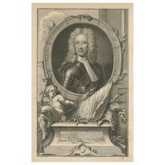
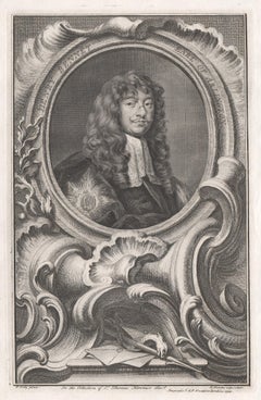
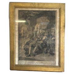
Antique Portrait of Algernon Percy, 10th Earl of Northumberland, 4th Baron Percy
$383.41
$383.41
£285.42
£285.42
€320
€320
CA$525.17
CA$525.17
A$584.10
A$584.10
CHF 305
CHF 305
MX$7,107.92
MX$7,107.92
NOK 3,895.33
NOK 3,895.33
SEK 3,653.13
SEK 3,653.13
DKK 2,436.05
DKK 2,436.05
Shipping
Retrieving quote...The 1stDibs Promise:
Authenticity Guarantee,
Money-Back Guarantee,
24-Hour Cancellation
About the Item
Antique portrait titled 'Algernoon Piercy, Earl of Northumberland'. Old portrait of Algernon Percy. Algernon Percy, 10th Earl of Northumberland, 4th Baron Percy, (1602-1668) was an English military leader and a prominent supporter of the Parliamentary cause in the English Civil War. This print originates from 'The Heads of Illustrious Persons of Great Britain, engraven by Mr. Houbracken, and Mr. Vertuewith their Lives and Characters by Thomas Birch, A.M., F.R.S'.
Artists and Engravers: Published in London by John and Paul Knapton 1742-1756.
Condition: Very good, original text page included. Please study image carefully.
Date: c.1750
Overall size: 36 x 53 cm.
Image size: 22 x 36 cm.
We sell original antique maps to collectors, historians, educators and interior decorators all over the world. Our collection includes a wide range of authentic antique maps from the 16th to the 20th centuries. Buying and collecting antique maps is a tradition that goes back hundreds of years. Antique maps have proved a richly rewarding investment over the past decade, thanks to a growing appreciation of their unique historical appeal. Today the decorative qualities of antique maps are widely recognized by interior designers who appreciate their beauty and design flexibility. Depending on the individual map, presentation, and context, a rare or antique map can be modern, traditional, abstract, figurative, serious or whimsical. We offer a wide range of authentic antique maps for any budget.
- Dimensions:Height: 20.87 in (53 cm)Width: 14.18 in (36 cm)Depth: 0 in (0.01 mm)
- Materials and Techniques:
- Period:
- Date of Manufacture:circa 1750
- Condition:Condition: Very good, original text page included. Please study image carefully.
- Seller Location:Langweer, NL
- Reference Number:Seller: BG-11857-31stDibs: LU3054329257172
About the Seller
5.0
Recognized Seller
These prestigious sellers are industry leaders and represent the highest echelon for item quality and design.
Platinum Seller
Premium sellers with a 4.7+ rating and 24-hour response times
Established in 2009
1stDibs seller since 2017
2,508 sales on 1stDibs
Typical response time: <1 hour
- ShippingRetrieving quote...Shipping from: Langweer, Netherlands
- Return Policy
Authenticity Guarantee
In the unlikely event there’s an issue with an item’s authenticity, contact us within 1 year for a full refund. DetailsMoney-Back Guarantee
If your item is not as described, is damaged in transit, or does not arrive, contact us within 7 days for a full refund. Details24-Hour Cancellation
You have a 24-hour grace period in which to reconsider your purchase, with no questions asked.Vetted Professional Sellers
Our world-class sellers must adhere to strict standards for service and quality, maintaining the integrity of our listings.Price-Match Guarantee
If you find that a seller listed the same item for a lower price elsewhere, we’ll match it.Trusted Global Delivery
Our best-in-class carrier network provides specialized shipping options worldwide, including custom delivery.More From This Seller
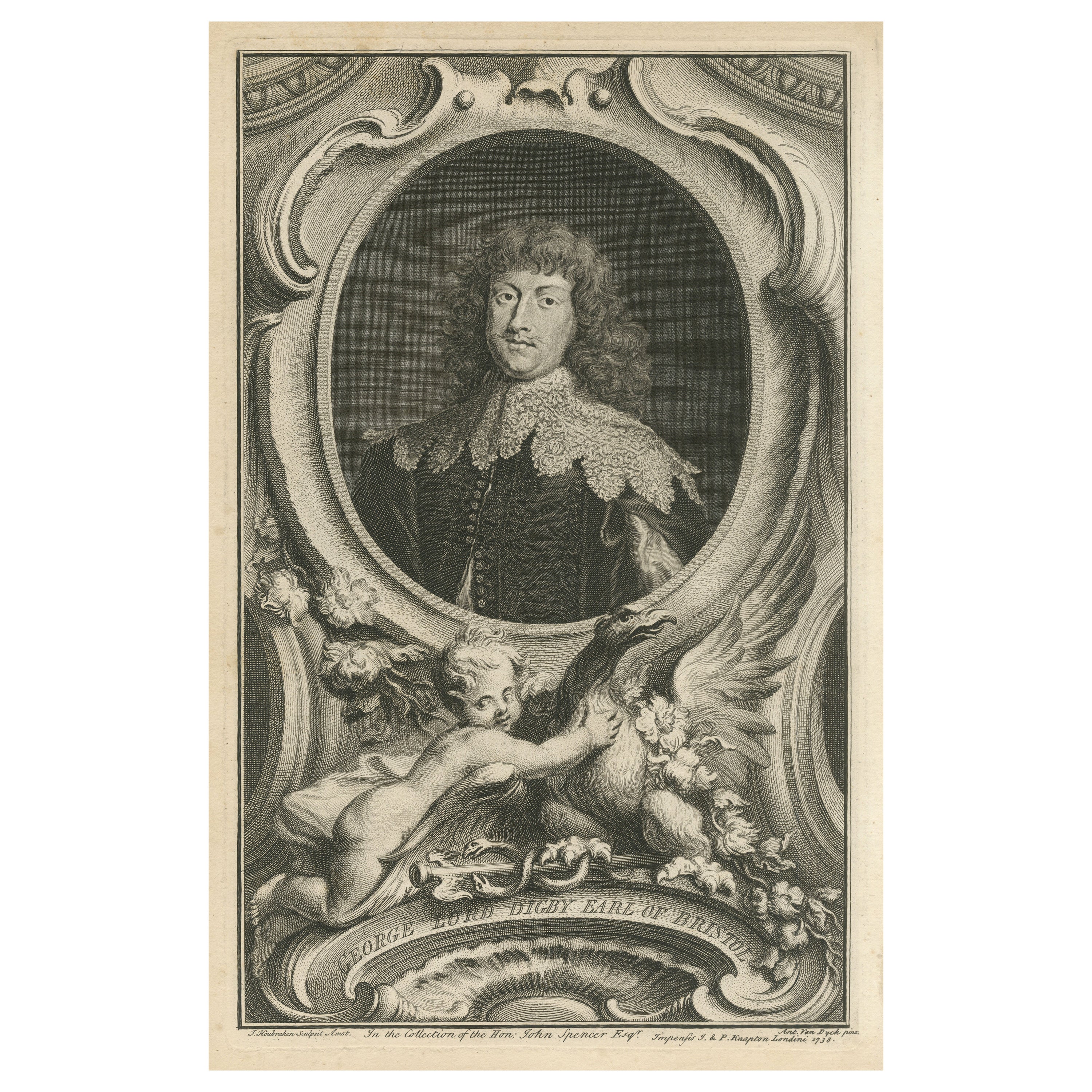
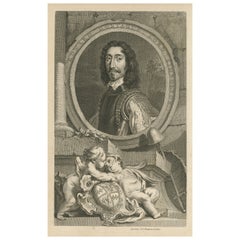
View AllAntique Portrait of George Digby, 2nd Earl of Bristol
By Jacobus Houbraken
Located in Langweer, NL
Antique portrait titled 'George Lord Digby Earl of Bristol'. George Digby, 2nd Earl of Bristol, KG (bapt. 5 November 1612 – 20 March 1677) was an English politician who as Lord Digby...
Category
Antique Mid-18th Century Prints
Materials
Paper
$364 Sale Price
20% Off
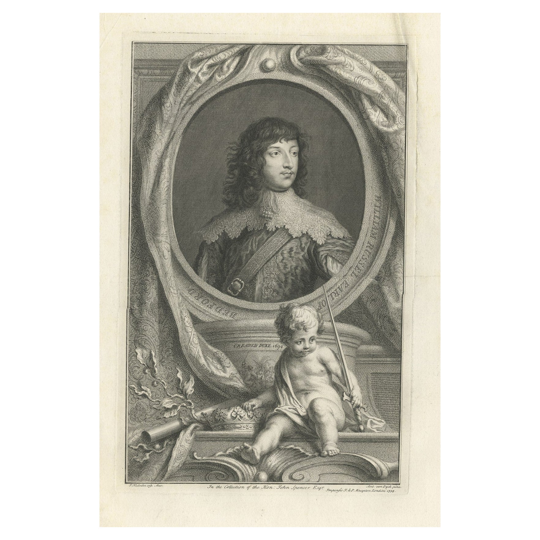
Portrait of William Russell, an English Nobleman and Politician, Earl of Bedford
Located in Langweer, NL
Antique portrait titled 'William Russel, Earl of Bedford'. William Russell, 1st Duke of Bedford (1616-1700) was an English nobleman and politician who ...
Category
Antique 18th Century Prints
Materials
Paper
$345 Sale Price
20% Off
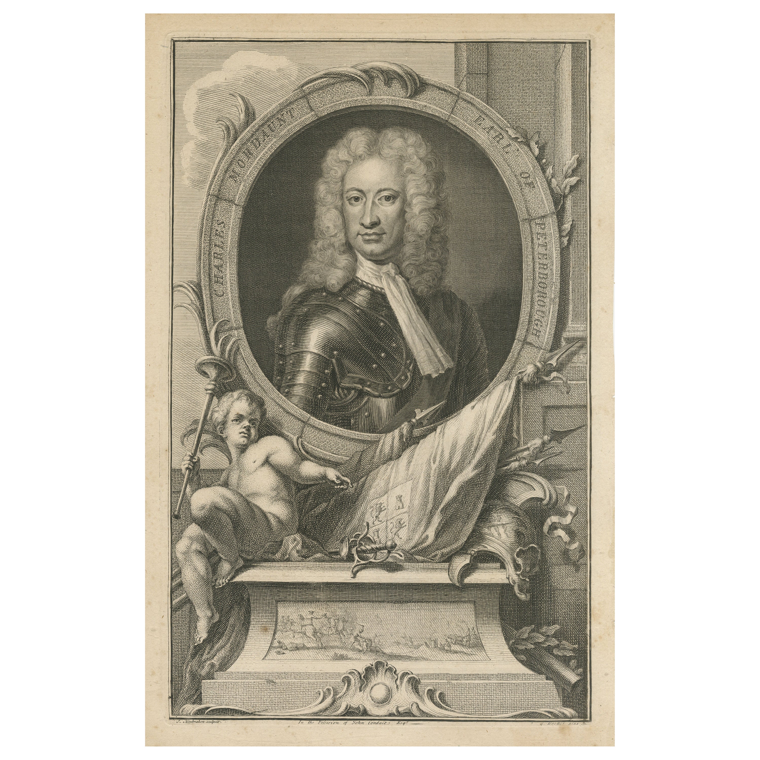
Antique Portrait of Charles Mordaunt, 3rd Earl of Peterborough
By Jacobus Houbraken
Located in Langweer, NL
Antique portrait titled 'Charles Mordaunt Earl of Peterborough'. Charles Mordaunt, 3rd Earl of Peterborough and 1st Earl of Monmouth, KG, PC (1658 – 25 October 1735) was an English n...
Category
Antique Mid-18th Century Prints
Materials
Paper
$318 Sale Price
30% Off
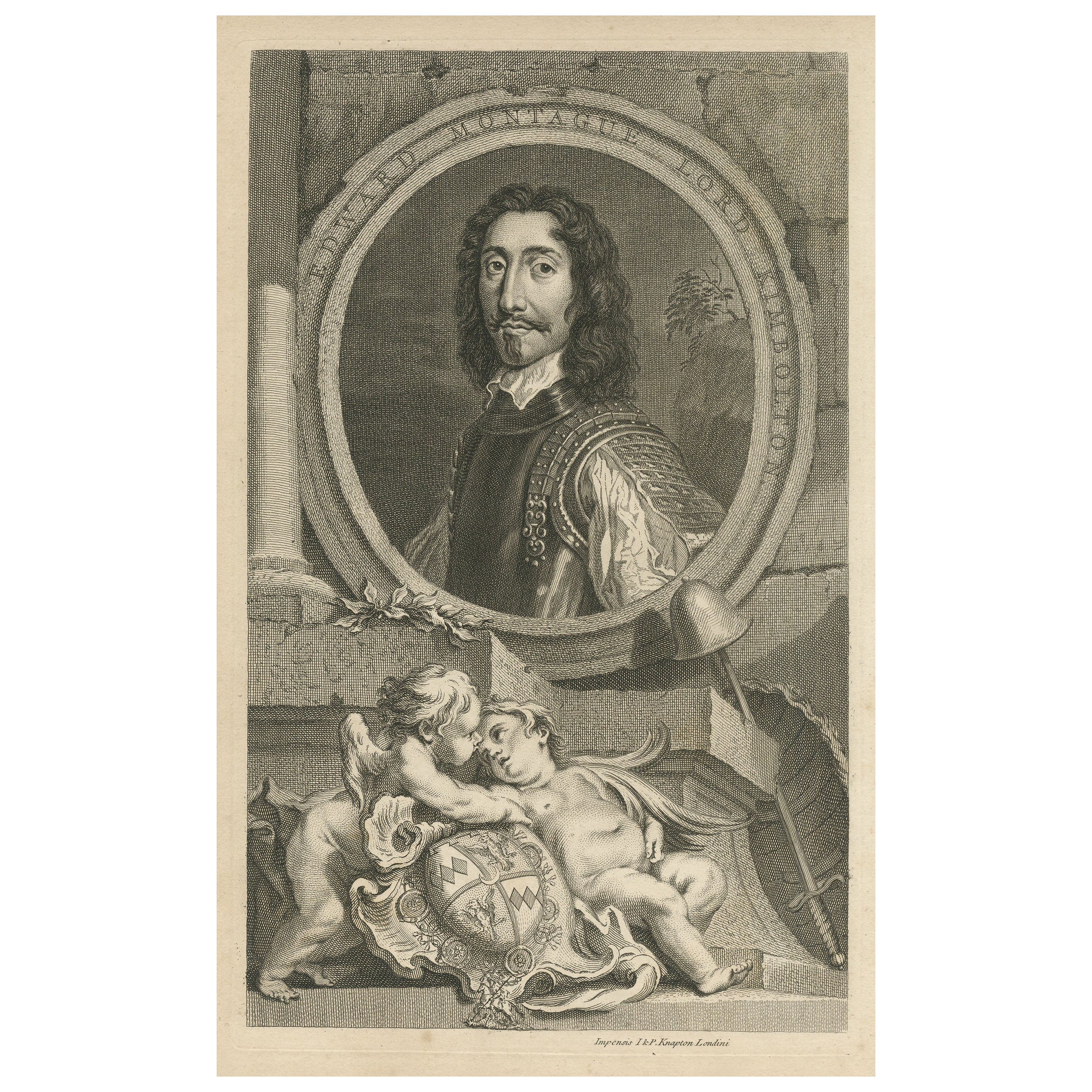
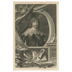
Antique Portrait of Edward Montagu, 2nd Earl of Manchester
By Jacobus Houbraken
Located in Langweer, NL
Antique portrait titled 'Edward Montague Lord Kimbolton'. Edward Montagu, 2nd Earl of Manchester, KG, KB, FRS (1602 – 5 May 1671) was an important commander of Parliamentary forces in the First English Civil War, and for a time Oliver Cromwell's superior.
This print originates from Thomas Birch...
Category
Antique Mid-18th Century Prints
Materials
Paper
$341 Sale Price
25% Off
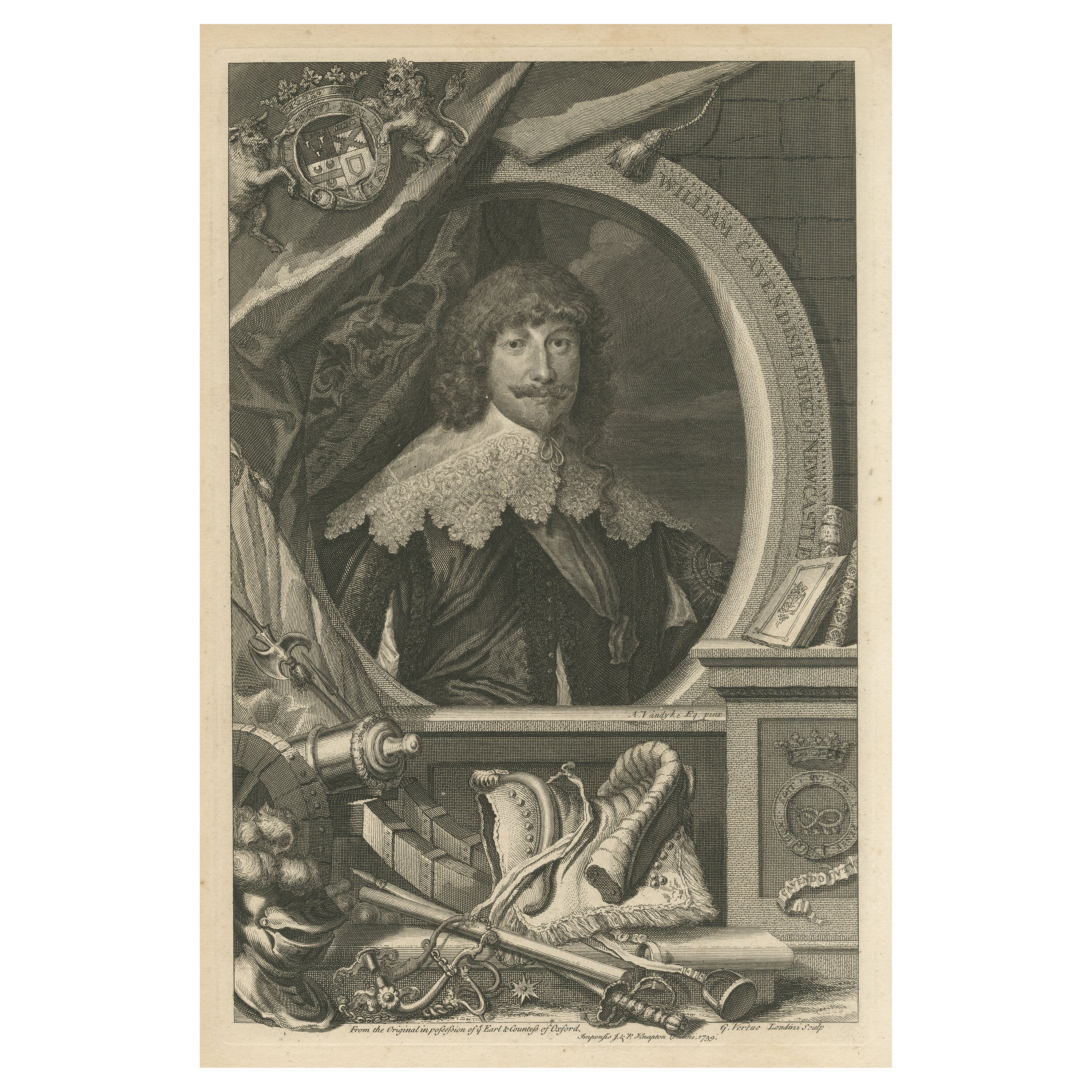
Antique Portrait of William Cavendish, 1st Duke of Newcastle upon Tyne
By Jacobus Houbraken
Located in Langweer, NL
Antique portrait titled 'William Cavendish Duke of Newcastle'. William Cavendish, 1st Duke of Newcastle upon Tyne, KG, KB, PC (c.?16 December 1593 – ...
Category
Antique Mid-18th Century Prints
Materials
Paper
$364 Sale Price
20% Off
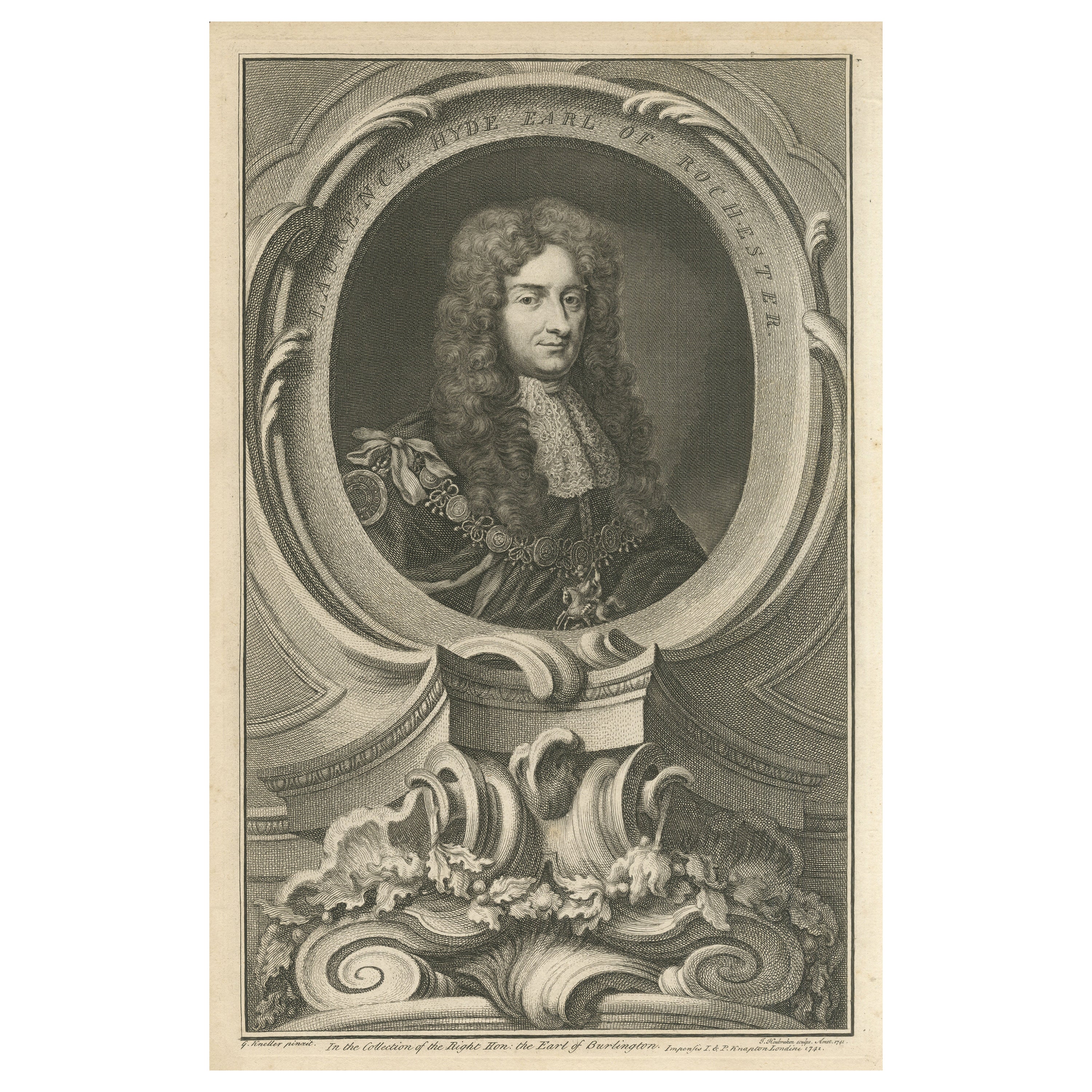
Original Antique Portrait of Laurence Hyde, 1st Earl of Rochester
By Jacobus Houbraken
Located in Langweer, NL
Antique engraving titled 'Laurence Hyde Earl of Rochester'. Laurence Hyde, 1st Earl of Rochester, KG, PC (March 1642 – 2 May 1711) was an English statesman and writer. He was originally a supporter of James II but later supported the Glorious Revolution...
Category
Antique Mid-18th Century Prints
Materials
Paper
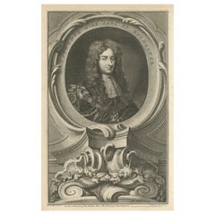
$364 Sale Price
20% Off
You May Also Like
Henry Bennet Earl of Arlington, English Civil War, portrait engraving, c1820
By Jacobus Houbraken 1
Located in Melbourne, Victoria
Copper-line engraving by Jacobus Houbraken (1698-1780) after Peter Lely.
Houbraken was a Dutch engraver famous for his series of portraits of famous English historical figures with elaborate cartouches.
Originally published 1739, this impression c1820.
360mm by 230mm (platemark)
Henry Bennet, 1st earl of Arlington, 1618-85, was an English statesman who fought for the royalists in the English civil war...
Category
Early 19th Century Renaissance Portrait Prints
Materials
Engraving
Portrait of Sir Edward Longville
Located in Cheshire, GB
A very good looking portrait of Sir Edward Longville with good detail to the face and hands.
Category
Antique 16th Century English Paintings
Materials
Paint
$9,262 Sale Price
23% Off
Large Portrait of an English Gentlemen/Duke, 19th Century
Located in Southall, GB
A large beautifully hand painted oil painting of an English gentleman, possibly a lord or duke. Set in the country side with trees and foliage, typical English landscape. Surrounded in a carved wood...
Category
Antique 19th Century English Paintings
Materials
Wood, Paint
$5,480 Sale Price
20% Off
Original Antique Print of A French Aristocratic Gentleman After Lebrun. C.1900
Located in St Annes, Lancashire
Beautiful image by Elisabeth Lebrun
Photogravure
Published by Connoisseur. C.1900
The measurement is the paper size
Unframed
Category
Antique Early 1900s English Louis XV Prints
Materials
Paper
Portrait of Samuel Bernard 1729
Located in Los Angeles, CA
Samuel Bernard, Chevalier de l'ordre de Saint Michel, comte de Coubert
Portrait of Samuel Bernard, Counselor of State by Pierre Imbert Drevet.
1729
Category
Antique 18th Century French French Provincial Decorative Art
Materials
Other
EARLY 18th CENTURY PORTRAIT OF A GENTLEMAN
Located in Firenze, FI
Beautiful oil painting on canvas depicting a gentleman belonging to the ancient chivalric order of Saints Maurice and Lazarus, founded in 1572 by the House of Savoy. The protagonist ...
Category
Antique Early 18th Century Italian Louis XIV Paintings
Materials
Canvas, Wood
More Ways To Browse
Voc Silver
William The Conqueror
Wood Carousel Animals
18 X 17 Rug
1850s Kitchen Cabinets
18th Century Bracket Clock
1930 Outdoor Chairs
19th Century Chinese Blue White Jar
19th Century Chinese Buffet
2 Doves White Gold
20th Century Mahogany Secretary Desk
6 Panel Chinese Screen
80s Chrome Tables
American 4 Drawer Chest
Antique 6 Drawer Chest
Antique Camel Table
Antique Chest Federal
Antique Farm Cabinet