Items Similar to Antique Print of the Bay of Sierra Leone by J. Van Der Schley, 1758
Want more images or videos?
Request additional images or videos from the seller
1 of 5
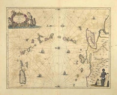
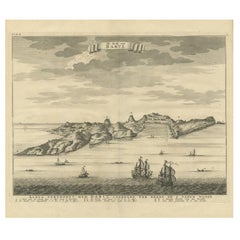
Antique Print of the Bay of Sierra Leone by J. Van Der Schley, 1758
$153.49
$191.8720% Off
£114.18
£142.7320% Off
€128
€16020% Off
CA$210.19
CA$262.7320% Off
A$233.70
A$292.1220% Off
CHF 122.02
CHF 152.5320% Off
MX$2,844.69
MX$3,555.8620% Off
NOK 1,556.98
NOK 1,946.2320% Off
SEK 1,458.82
SEK 1,823.5320% Off
DKK 974.39
DKK 1,217.9920% Off
Shipping
Retrieving quote...The 1stDibs Promise:
Authenticity Guarantee,
Money-Back Guarantee,
24-Hour Cancellation
About the Item
Beautiful map and bird's-eye view of the Bay of Sierra Leone. While these maps by Van Schley after Bellin were initially made for 'Histoire Generale des Voyages' (Paris, 1746-1759), this print originates from the 1758, Dutch edition of that work published by Arkstee & Merkus.
- Dimensions:Height: 7.88 in (20 cm)Width: 10.56 in (26.8 cm)Depth: 0.02 in (0.5 mm)
- Materials and Techniques:
- Period:
- Date of Manufacture:1758
- Condition:Please study image carefully.
- Seller Location:Langweer, NL
- Reference Number:Seller: BG-034891stDibs: LU305439520591
About the Seller
5.0
Recognized Seller
These prestigious sellers are industry leaders and represent the highest echelon for item quality and design.
Platinum Seller
Premium sellers with a 4.7+ rating and 24-hour response times
Established in 2009
1stDibs seller since 2017
2,511 sales on 1stDibs
Typical response time: <1 hour
- ShippingRetrieving quote...Shipping from: Langweer, Netherlands
- Return Policy
Authenticity Guarantee
In the unlikely event there’s an issue with an item’s authenticity, contact us within 1 year for a full refund. DetailsMoney-Back Guarantee
If your item is not as described, is damaged in transit, or does not arrive, contact us within 7 days for a full refund. Details24-Hour Cancellation
You have a 24-hour grace period in which to reconsider your purchase, with no questions asked.Vetted Professional Sellers
Our world-class sellers must adhere to strict standards for service and quality, maintaining the integrity of our listings.Price-Match Guarantee
If you find that a seller listed the same item for a lower price elsewhere, we’ll match it.Trusted Global Delivery
Our best-in-class carrier network provides specialized shipping options worldwide, including custom delivery.More From This Seller
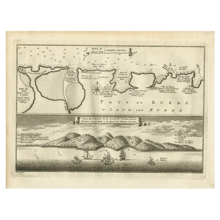
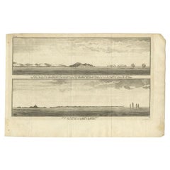
View AllAntique Map and View of the Bay of Sierra Leone in Africa, C.1750
Located in Langweer, NL
Antique print titled 'Baye de Sierra Leona (..) - Baai van Sierra Leona (..)'. Map and view of the bay of Sierra Leone. This print originates from 'Historische beschryving der Reizen...
Category
Antique 18th Century Prints
Materials
Paper
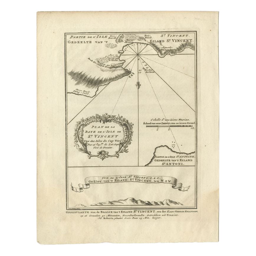
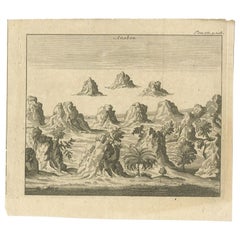
Antique Print of the Bay of the Island of St. Vincent, Capeverdian Islands
By Jakob van der Schley
Located in Langweer, NL
Antique print titled 'Oppervlakte van de Baaije van 't Eiland St. Vincent (..)'. View of the Bay of the Island of St. Vincent, one of the Capeverdian Islands. Originates from a Dutch...
Category
Antique 18th Century Prints
Materials
Paper

$134 Sale Price
20% Off
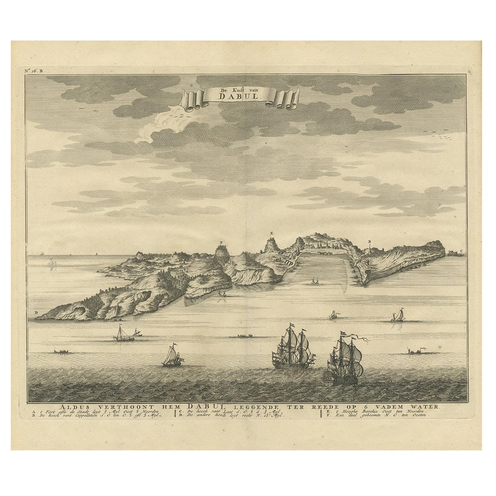
Antique Print of the Coast of Dabhol 'India', 1726
By F. Valentijn
Located in Langweer, NL
Antique print titled 'De Kust van Dabul'. Antique print of the coastline near Dabhol in India. This print originates from 'Oud en Nieuw Oost-Indiën' by F. Valentijn.
Category
Antique Early 18th Century Dutch Prints
Materials
Paper
$345 Sale Price
23% Off
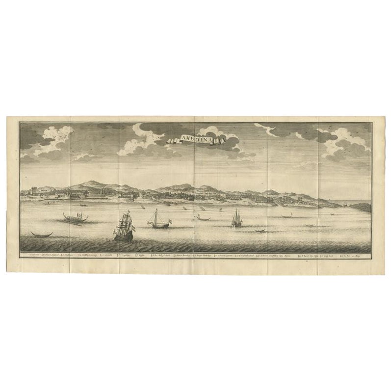
Antique Print of Ambon, Indonesia by Valentijn, 1726
Located in Langweer, NL
Antique print Indonesia titled 'Amboina'. Beautiful view of Ambon, Indonesia. With several ships in the foreground. This print originates from 'Oud en Nieuw Oost-Indiën' by F. Valent...
Category
Antique 18th Century Prints
Materials
Paper

$498 Sale Price
20% Off
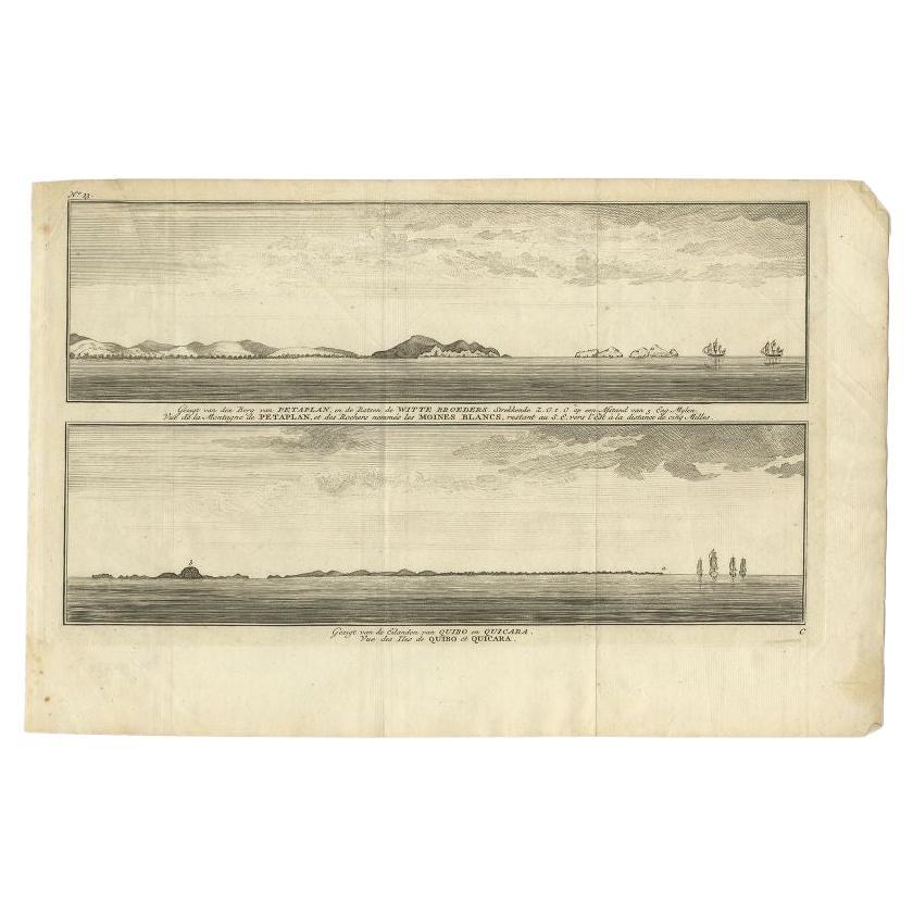
Antique Print of Petatlan and Coiba Island, Near Mexico and Panama, 1749
Located in Langweer, NL
Antique print titled 'Vue de la Montagne de Petaplan, et des rochers nommés les Moines Blancs, restant au S.E. vers l'est a la distance de cinq milles' and Vue des Iles de Quibo et Q...
Category
Antique 18th Century Prints
Materials
Paper
$134 Sale Price
20% Off
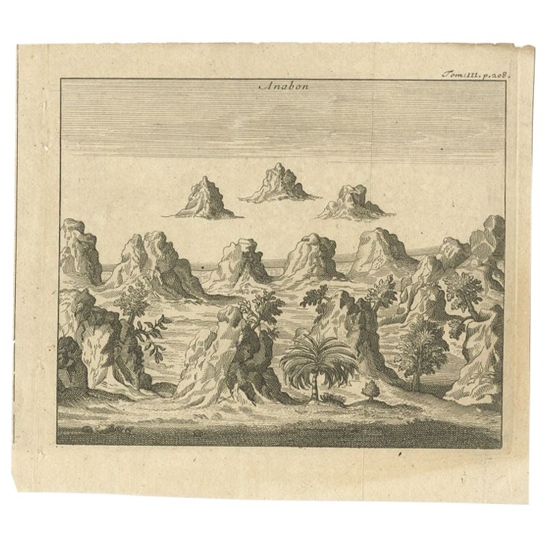
Antique Print of Ambon, Indonesia, c.1740
Located in Langweer, NL
Antique print Ambon titled 'Anabon'. Antique print of the island of Ambon, Indonesia. Source unknown, to be determined.
Artists and Engravers: Anonymous.
Condition: Good, gener...
Category
Antique 18th Century Prints
Materials
Paper
$94 Sale Price
20% Off
You May Also Like
West Coast of Africa, Guinea & Sierra Leone: An 18th Century Map by Bellin
By Jacques-Nicolas Bellin
Located in Alamo, CA
Jacques Bellin's copper-plate map entitled "Partie de la Coste de Guinee Dupuis la Riviere de Sierra Leona Jusquau Cap das Palmas", depicting the coast of Guinea and Sierra Leone in ...
Category
Antique Mid-18th Century French Maps
Materials
Paper

West Coast of Africa; Guinea & Sierra Leone: Bellin 18th Century Map
Located in Alamo, CA
This is a Jacques Bellin copper-plate map entitled "Partie de la Coste de Guinee Dupuis la Riviere de Sierra Leona Jusquau Cap das Palmas", depicting the coast of Guinea and Sierra L...
Category
1740s Old Masters Landscape Prints
Materials
Engraving

Antique Voc Print Holland Malaysia Old Map Melaka History, 1663
Located in Amsterdam, Noord Holland
From my own collection I offer this impressive Antique print of the city of Malakka
A very interesting piece for collectors . It is an museum piece from the Dutch Institute of Orien...
Category
Antique 17th Century European Paintings
Materials
Paper

$293 Sale Price
20% Off
1844 French Antique Nautical print Engraved Portolano of Syrie by Antoine Roux
By Antoine Roux
Located in Milan, IT
Antique portolano, nautical map of Syrie engraved on a copper plate by Antoine Roux, Marseille France 1844, from his work Recueil des principaux plans des ports et de Rades de la Mer...
Category
Antique 1840s French Nautical Objects
Materials
Paper
Antique Map - Mare Pacificum - Etching by Johannes Janssonius - 1650s
By Johannes Janssonius
Located in Roma, IT
Mare Pacificum is an antique map realized in 1650 by Johannes Janssonius (1588-1664).
The Map is Hand-colored etching, with coeval watercolorang.
Good conditions with slight foxing...
Category
1650s Modern Figurative Prints
Materials
Etching

S.Juan de Puerto Rico - Etching by Johannes Janssonius - 1650s
By Johannes Janssonius
Located in Roma, IT
S.Juan de Puerto Rico is an ancient map realized in 1650 by Johannes Janssonius (1588-1664).
Good conditions.
From Atlantis majoris quinta pars, Orbem maritimum [Novus Atlas, volum...
Category
1650s Modern Figurative Prints
Materials
Etching