Items Similar to Antique Print of Hanseatic City of Lübeck in Northern Germany by Merian, c.1650
Want more images or videos?
Request additional images or videos from the seller
1 of 6
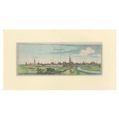
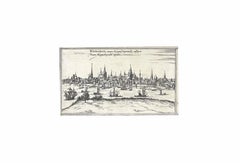
Antique Print of Hanseatic City of Lübeck in Northern Germany by Merian, c.1650
$373.82
$467.2820% Off
£278.29
£347.8620% Off
€312
€39020% Off
CA$512.04
CA$640.0520% Off
A$569.50
A$711.8820% Off
CHF 297.38
CHF 371.7220% Off
MX$6,930.23
MX$8,662.7820% Off
NOK 3,797.94
NOK 4,747.4320% Off
SEK 3,561.80
SEK 4,452.2520% Off
DKK 2,375.15
DKK 2,968.9320% Off
Shipping
Retrieving quote...The 1stDibs Promise:
Authenticity Guarantee,
Money-Back Guarantee,
24-Hour Cancellation
About the Item
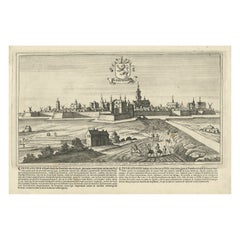
Antique print titled 'Lubecca, Lübeck'. A bird's eye view of Lubeck, the northern German city in Schleswig-Holstein. This print originates from 'Topographia Saxoniae Inferioris'.
Artists and Engravers: Matthäus Merian der Ältere (or "Matthew", "the Elder", or "Sr."; 22 September 1593 – 19 June 1650) was a Swiss-born engraver who worked in Frankfurt for most of his career, where he also ran a publishing house. He was a member of the patrician Basel Merian family.
Condition: Good, age-related toning. Please study image carefully.
Date: c.1650
Overall size: 39 x 29.5 cm.
Image size: 37 x 20 cm.
Antique prints have long been appreciated for both their aesthetic and investment value. They were the product of engraved, etched or lithographed plates. These plates were handmade out of wood or metal, which required an incredible level of skill, patience and craftsmanship. Whether you have a house with Victorian furniture or more contemporary decor an old engraving can enhance your living space. We offer a wide range of authentic antique prints for any budget.
- Dimensions:Height: 11.62 in (29.5 cm)Width: 15.36 in (39 cm)Depth: 0 in (0.01 mm)
- Materials and Techniques:
- Period:
- Date of Manufacture:c.1650
- Condition:Condition: Good, age-related toning. Please study image carefully.
- Seller Location:Langweer, NL
- Reference Number:Seller: BG-067801stDibs: LU3054329224402
About the Seller
5.0
Recognized Seller
These prestigious sellers are industry leaders and represent the highest echelon for item quality and design.
Platinum Seller
Premium sellers with a 4.7+ rating and 24-hour response times
Established in 2009
1stDibs seller since 2017
2,508 sales on 1stDibs
Typical response time: <1 hour
- ShippingRetrieving quote...Shipping from: Langweer, Netherlands
- Return Policy
Authenticity Guarantee
In the unlikely event there’s an issue with an item’s authenticity, contact us within 1 year for a full refund. DetailsMoney-Back Guarantee
If your item is not as described, is damaged in transit, or does not arrive, contact us within 7 days for a full refund. Details24-Hour Cancellation
You have a 24-hour grace period in which to reconsider your purchase, with no questions asked.Vetted Professional Sellers
Our world-class sellers must adhere to strict standards for service and quality, maintaining the integrity of our listings.Price-Match Guarantee
If you find that a seller listed the same item for a lower price elsewhere, we’ll match it.Trusted Global Delivery
Our best-in-class carrier network provides specialized shipping options worldwide, including custom delivery.More From This Seller
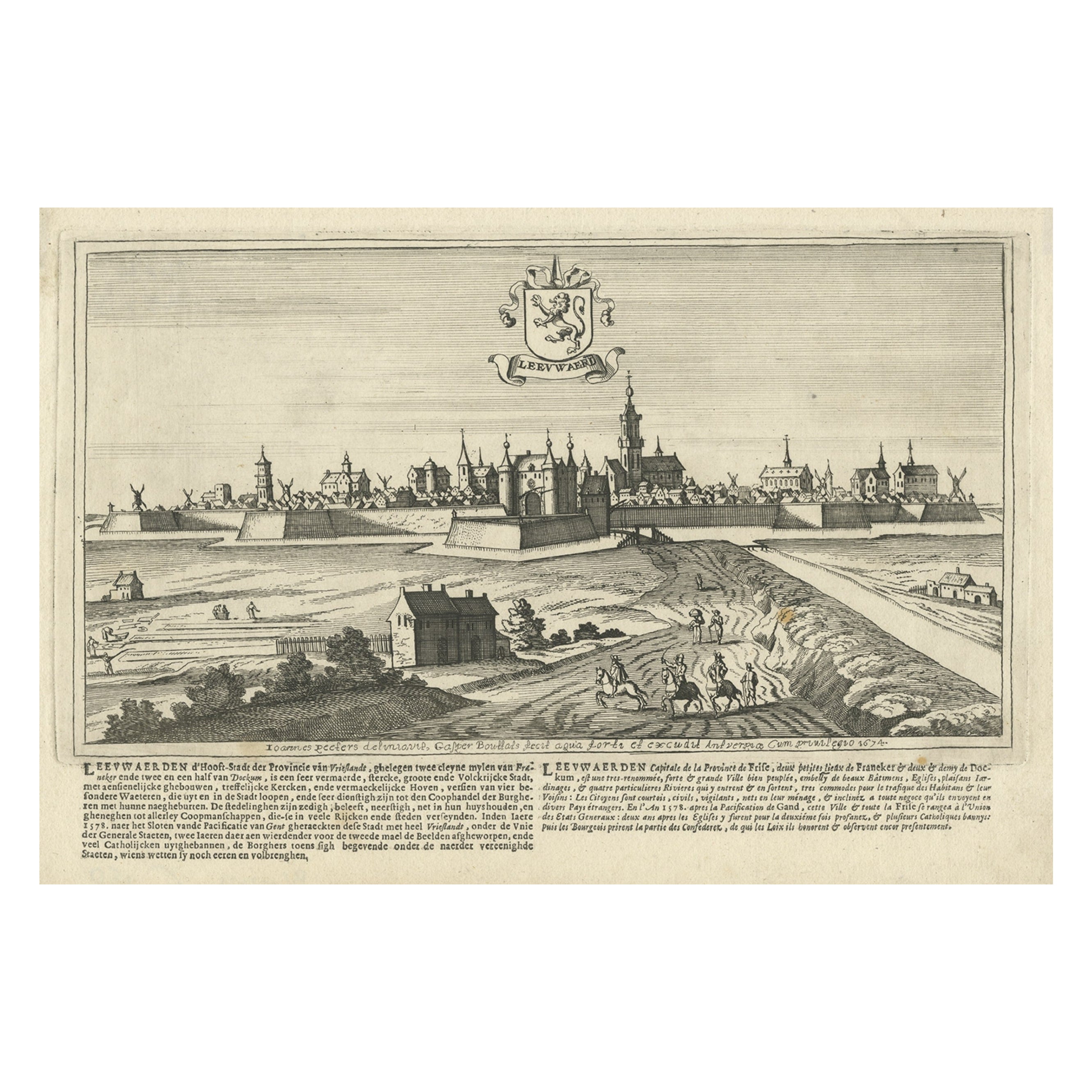
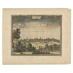
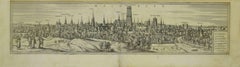
View AllAntique Print of the City of Leeuwarden, Friesland in The Netherlands, 1680
Located in Langweer, NL
Antique print titled 'Leeuwaerd'. Old bird's eye view of the city of Leeuwarden, Friesland. This print originates from 'Thooneel der Steden ende Sterckten van 't Vereenight Nederland...
Category
Antique 17th Century Prints
Materials
Paper
$421 Sale Price
20% Off
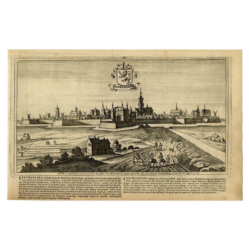
Antique Print of the City of Leeuwarden by Bouttats, 1680
Located in Langweer, NL
Antique print titled 'Leeuwaerd'. Old bird's eye view of the city of Leeuwarden, Friesland. This print originates from 'Thooneel der Steden ende Sterckten van 't Vereenight Nederland...
Category
Antique 17th Century Prints
Materials
Paper

$153 Sale Price
20% Off
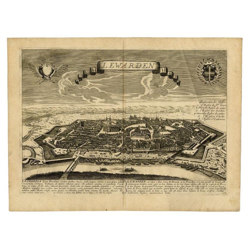
Leeuwarden Friesland City View – Antique Engraving by Jollain, c.1670
Located in Langweer, NL
Antique Bird’s Eye View of Leeuwarden, Friesland, by Jollain, circa 1670
This rare and decorative antique engraving presents a panoramic bird’s eye view of the fortified city of Lee...
Category
Antique 17th Century French Prints
Materials
Paper
$1,653 Sale Price
40% Off
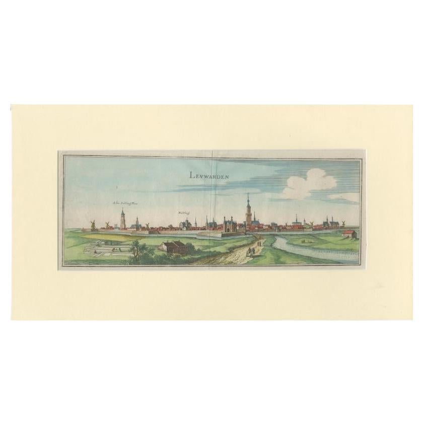
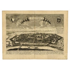
Antique Print of the City of Leeuwarden by Merian, 1659
Located in Langweer, NL
Antique Print titled 'Leuwarden'. A bird's eye view of Leeuwarden, in Friesland. The old city hall tower and city hall are indicated with German caption. This print originates from '...
Category
Antique 17th Century Prints
Materials
Paper
$316 Sale Price
20% Off
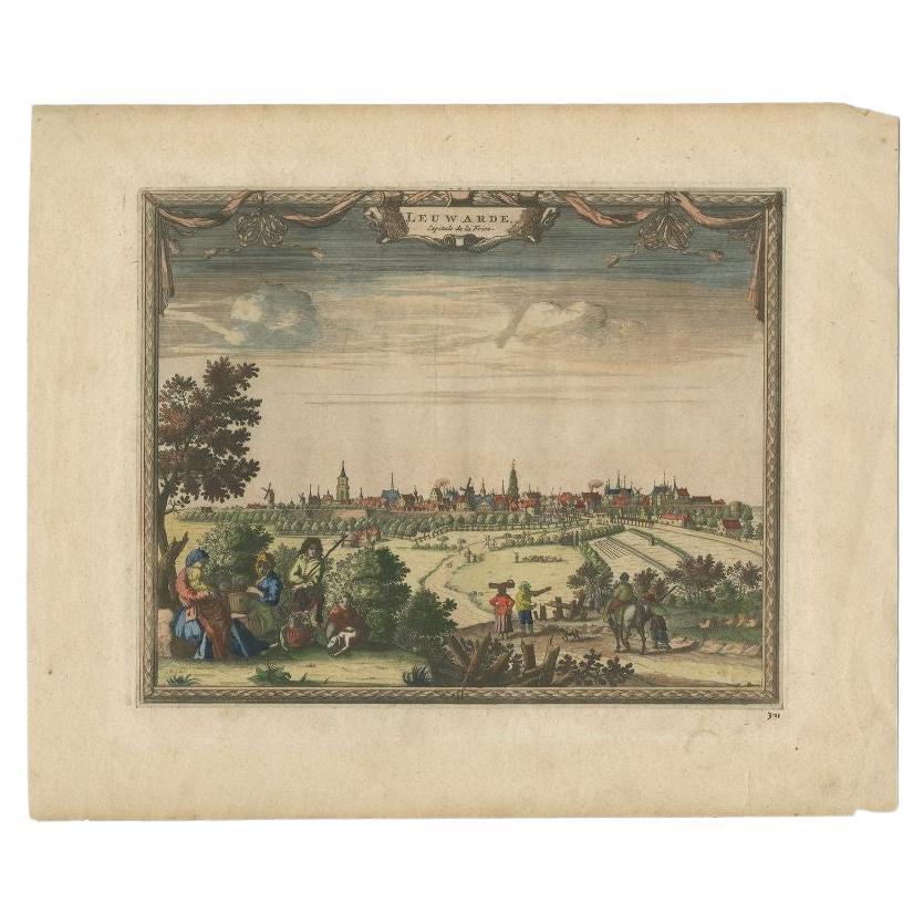
Antique Print of the City of Leeuwarden, the Netherlands, by Van Der Aa, 1726
By Pieter Van Der Aa
Located in Langweer, NL
Antique print titled 'Leuwarde - Capitale de la Frise'. Original antique print of the city of Leeuwarden, Friesland, the Netherlands. This print originates from ' Les Forces de l'Eur...
Category
Antique 18th Century Prints
Materials
Paper
$239 Sale Price
20% Off
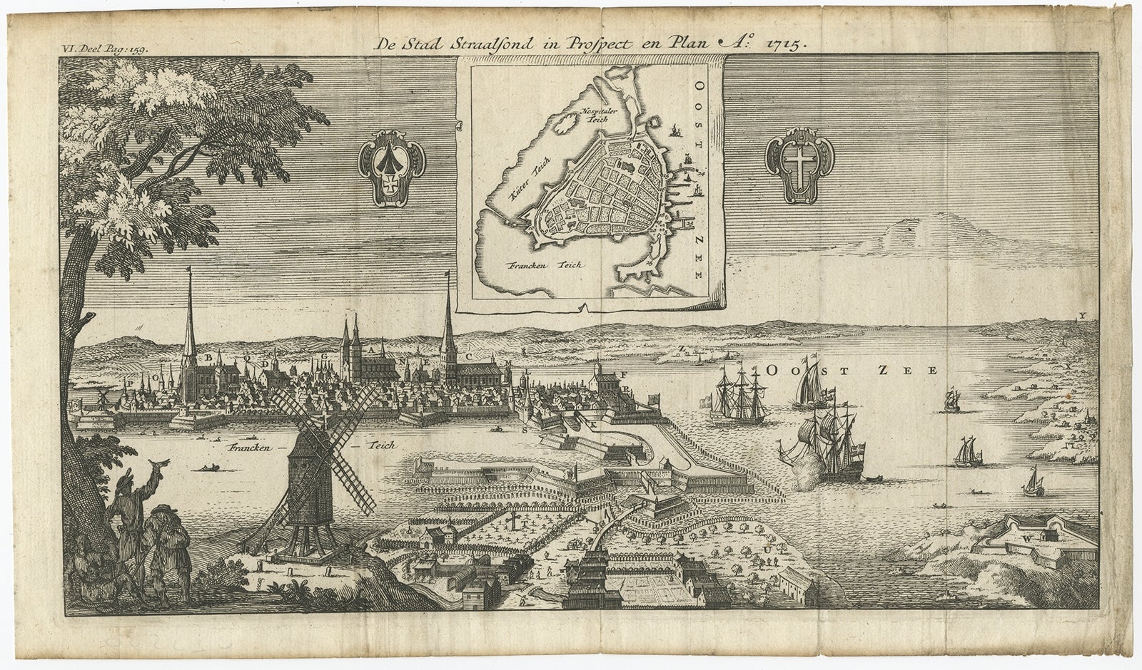
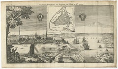
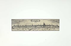
Antique Print of the Fortress and City of Stralsund in Germany, circa 1715
Located in Langweer, NL
Antique map titled 'De Stad Straalsond in Prospect en Plan'. This map shows a plan of the fortified city of Stralsund and surroundings in Germany. Source unknown, to be determined.
...
Category
Antique 18th Century Prints
Materials
Paper
$364 Sale Price
20% Off
You May Also Like
17th Century Topographical Engraving Nantes & St. Malo, France, by Iohan Peeters
Located in New York, NY
The ancient city of Saint Malo in North Western France has long been associated with adventure on the high seas, piracy and exploration. It was the birthplace of several important in...
Category
Antique 17th Century Dutch Maps
Materials
Paper

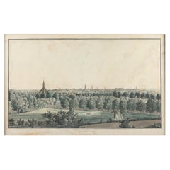
Hand Colored Copperplate Engraving of Copenhagen, Denmark
Located in Kastrup, DK
Hand-colored copperplate engraving depicting an interesting old view of Copenhagen seen from Frederiksberg Castle Gardens, approximate. 1790-1800.
Framed in a mahogany frame from sam...
Category
Antique Late 18th Century Danish Louis XVI Prints
Materials
Glass, Mahogany, Paper
City of Wismaria - Original Etching by F. Hogenberg - 16th Century
By Franz Hogenberg
Located in Roma, IT
Portrait of the City of Wismaria is an original etching realized by Georg Braun and Franz Hogenberg as part of the suite "Civitates Orbis Terrarum".
Precious etching, showing a view...
Category
16th Century Figurative Prints
Materials
Etching
View of Mechelen - Original Etching by G. Braun and F. Hogenberg - 16th Century
By Franz Hogenberg
Located in Roma, IT
This Mechelen is an original etching realized by George Braun and Franz Hogenberg, as part of the famous "Civitates Orbis Terrarum".
The “Civitates Orbis Terrarum” (Atlas of Cities ...
Category
16th Century Modern Figurative Prints
Materials
Etching
City of Neus - Original Etching by F. Hogenberg - Late 16th Century
By Franz Hogenberg
Located in Roma, IT
City of Neus is an original etching realized by Georg Braun and Franz Hogenberg as part of the famous Series "Civitates Orbis Terrarum".
Precious etch...
Category
16th Century Figurative Prints
Materials
Etching
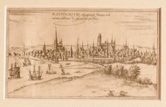
View of Rostock - Etching by G. Braun and F. Hogenberg - 16th Century
By Franz Hogenberg
Located in Roma, IT
The Map of Rostock (ancient name: Rostochivm) is an original etching realized by George Braun (1541 – 1622)
The state of preservation of the artwork is good but aged .
Sheet dimen...
Category
16th Century Figurative Prints
Materials
Etching
More Ways To Browse
Antique Sheet Music Cabinets
Antique Shoe Storage Cabinet
Antique Skeleton Keys
Antique Temple Bell
Antique Temple Doors
Antique Thangkas
Antique Wellington Chest Of Drawers
Art Deco Burl Chest
Art Deco Sterling Teapot
Art Deco Waterfall Table
Asian Demon
Balinese Antique Furniture
Basset Hound
Bd Barcelona Multileg
Belgium Wasmuel
Biedermeier Mahogany Chest Of Drawers
Bonsai Planter
Boulle Corner Cabinets