Items Similar to Antique Print of the Royal Flagship of the English Fleet by P. Mortier, c.1693
Want more images or videos?
Request additional images or videos from the seller
1 of 7
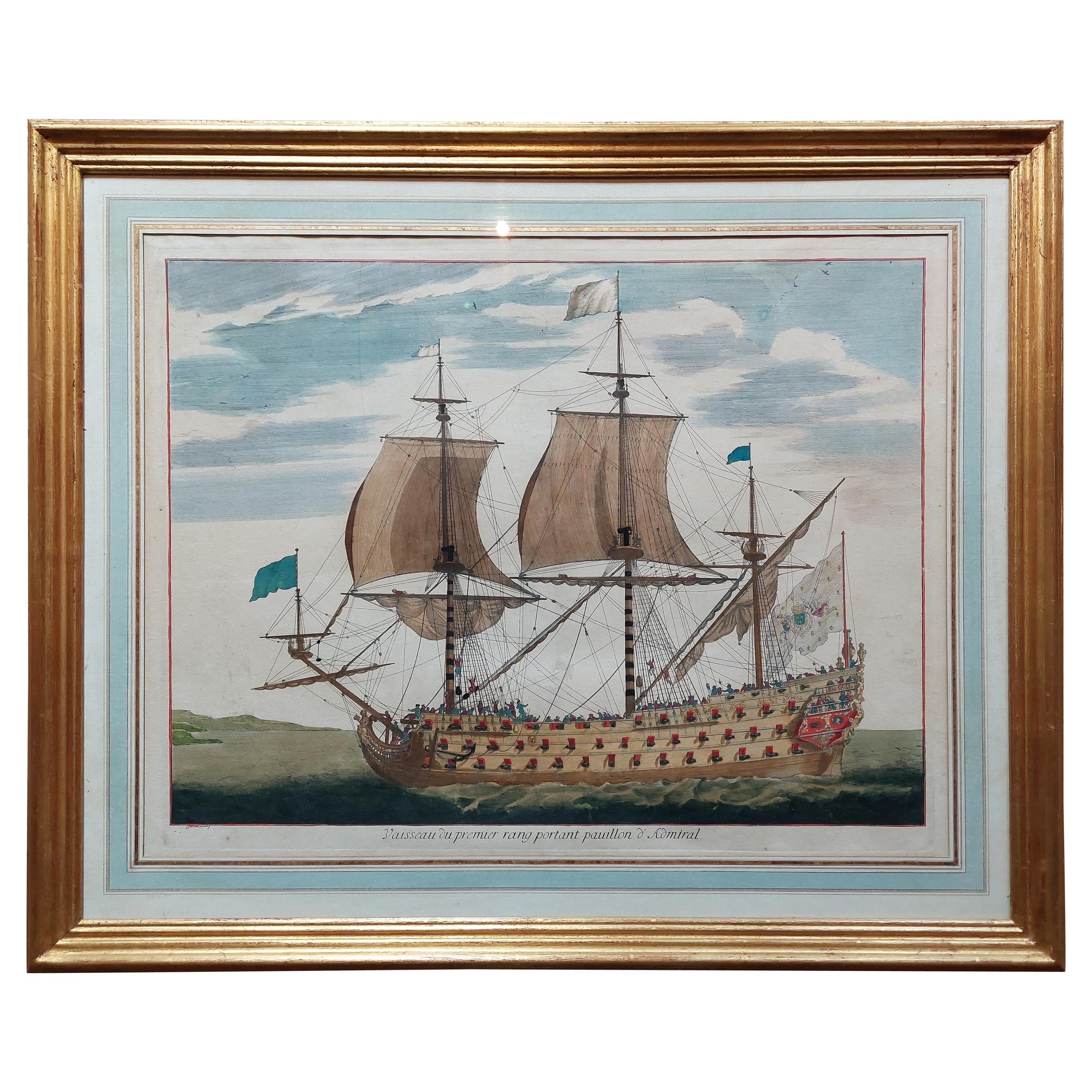
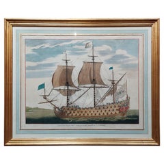
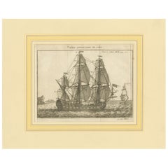
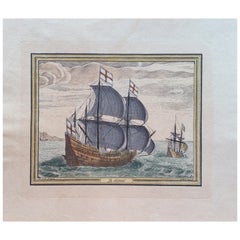
Antique Print of the Royal Flagship of the English Fleet by P. Mortier, c.1693
$2,834.33
$3,542.9120% Off
£2,087.48
£2,609.3520% Off
€2,360
€2,95020% Off
CA$3,855.88
CA$4,819.8520% Off
A$4,284.74
A$5,355.9220% Off
CHF 2,245.25
CHF 2,806.5620% Off
MX$52,544.64
MX$65,680.8020% Off
NOK 28,636.81
NOK 35,796.0120% Off
SEK 26,940.46
SEK 33,675.5820% Off
DKK 17,966.32
DKK 22,457.9020% Off
Shipping
Retrieving quote...The 1stDibs Promise:
Authenticity Guarantee,
Money-Back Guarantee,
24-Hour Cancellation
About the Item
Antique print titled 'Vaisseau Royal de l'Angleterre, Konincklyke Schip van Engeland'. Beautiful hand-coloured engraving of the Royal Flagship of the English Fleet. Originally published in Henri Sbonski de Passebon’s “Plan de Plusieurs Bâtimens de Mer avec leurs Proportions [..]”, circa 1690.
- Dimensions:Height: 26.38 in (67 cm)Width: 30.32 in (77 cm)Depth: 1.19 in (3 cm)
- Materials and Techniques:
- Period:Late 17th Century
- Date of Manufacture:1693
- Condition:Minor foxing, beautiful frame included. Please study image carefully.
- Seller Location:Langweer, NL
- Reference Number:Seller: BG-076341stDibs: LU3054310288553
About the Seller
5.0
Recognized Seller
These prestigious sellers are industry leaders and represent the highest echelon for item quality and design.
Platinum Seller
Premium sellers with a 4.7+ rating and 24-hour response times
Established in 2009
1stDibs seller since 2017
2,494 sales on 1stDibs
Typical response time: 1 hour
- ShippingRetrieving quote...Shipping from: Langweer, Netherlands
- Return Policy
Authenticity Guarantee
In the unlikely event there’s an issue with an item’s authenticity, contact us within 1 year for a full refund. DetailsMoney-Back Guarantee
If your item is not as described, is damaged in transit, or does not arrive, contact us within 7 days for a full refund. Details24-Hour Cancellation
You have a 24-hour grace period in which to reconsider your purchase, with no questions asked.Vetted Professional Sellers
Our world-class sellers must adhere to strict standards for service and quality, maintaining the integrity of our listings.Price-Match Guarantee
If you find that a seller listed the same item for a lower price elsewhere, we’ll match it.Trusted Global Delivery
Our best-in-class carrier network provides specialized shipping options worldwide, including custom delivery.More From This Seller
View AllAntique Print of a Naval Vessel by Mortier '1695'
Located in Langweer, NL
Antique print titled 'Vaisseau du premier rang portant pavillon d'Admiral'. Beautiful copper engraving of a naval vessel. From Mortier's famous maritime Atlas "Neptune François". Eng...
Category
Antique Late 17th Century Prints
Materials
Paper
$1,681 Sale Price
20% Off
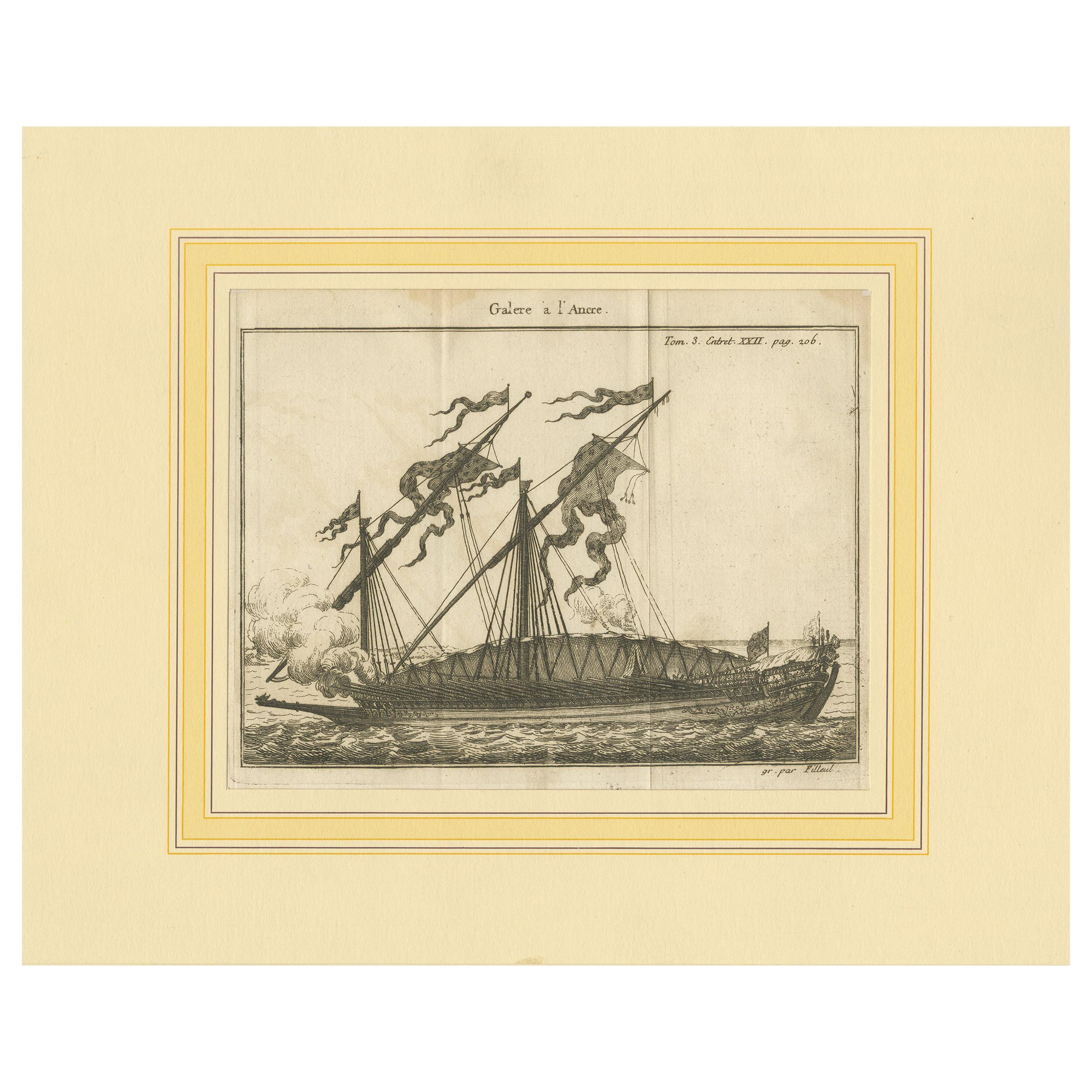
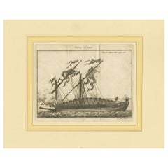
Antique Print of an Anchored Ship by Pluche '1735'
Located in Langweer, NL
Antique print titled 'Galere a l'Ancre'. Original antique print of an anchored ship. This print originates from 'Le spectacle de la nature, ou Entretiens sur les particularités (..)'...
Category
Antique Mid-18th Century Prints
Materials
Paper
$144 Sale Price
20% Off
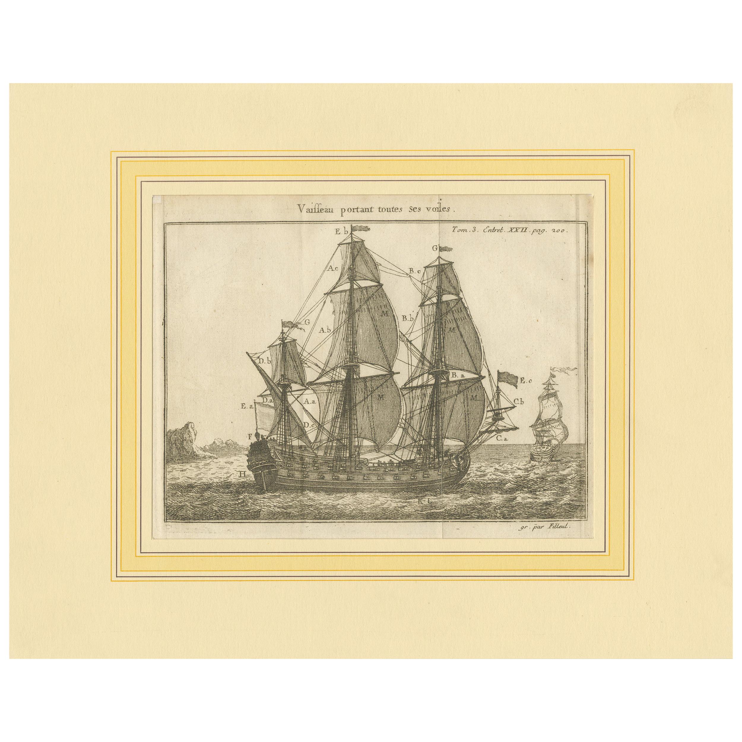
Antique Print of a Vessel with All the Sails by Pluche '1735'
Located in Langweer, NL
Antique print titled 'Vaisseau portant toutes ses voiles'. Original antique print of a vessel with all the sails. This print originates from 'Le spectacle de la nature, ou Entretiens...
Category
Antique Mid-18th Century Prints
Materials
Paper
$192 Sale Price
20% Off
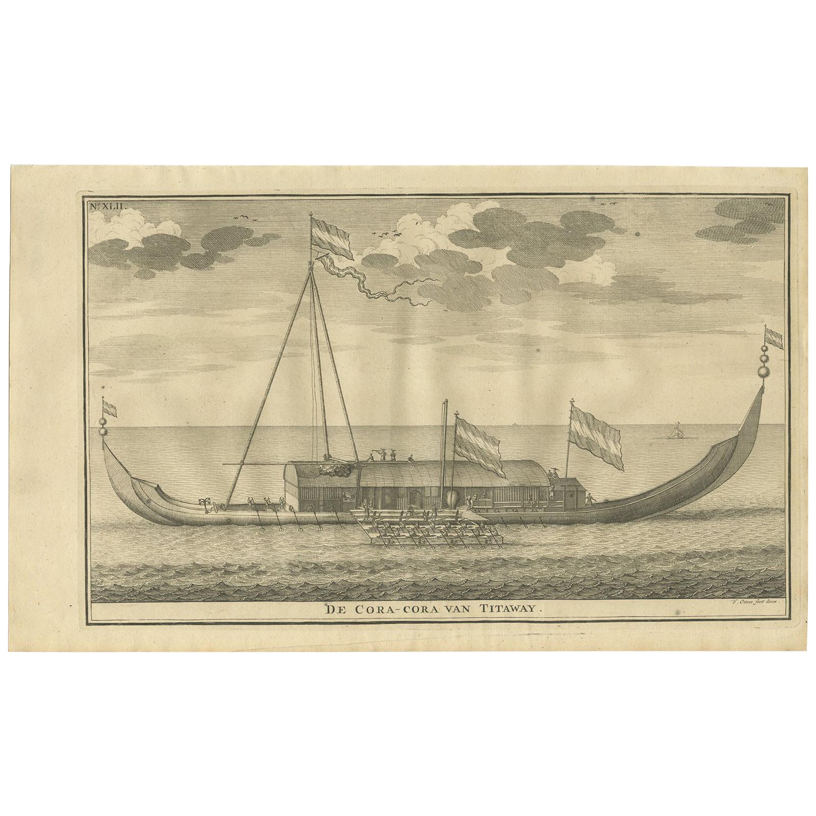
Antique Print of the Coracora Fleet by Valentijn, 1726
By F. Valentijn
Located in Langweer, NL
Antique print titled 'De Cora-Cora van Titaway'. This is an original copper engraving of the Coracora fleet from Titaway. This print originates from 'Oud en Nieuw Oost-Indiën' by F. ...
Category
Antique Early 18th Century Dutch Prints
Materials
Paper

$240 Sale Price
20% Off
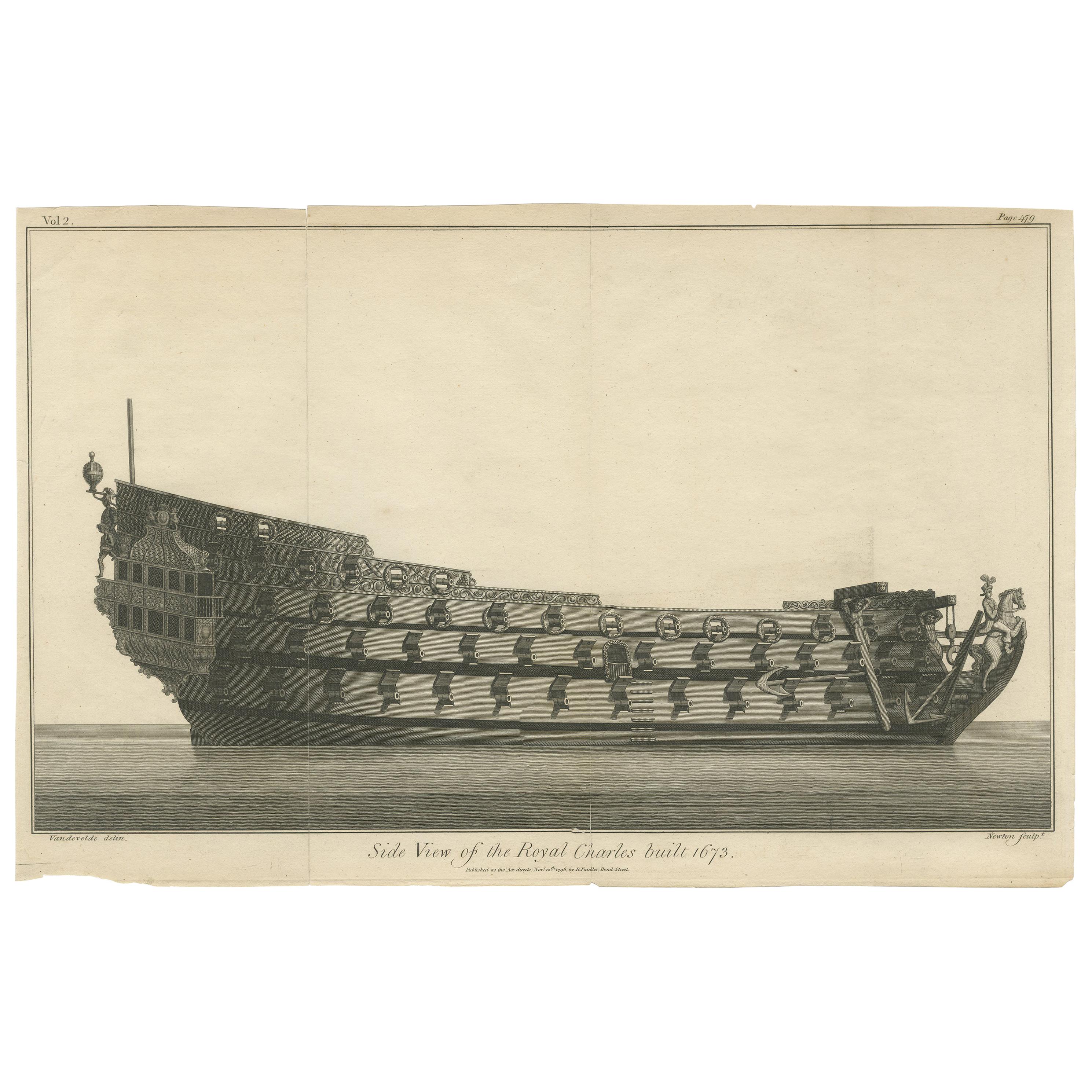
Antique Print with a Side View of the 'Royal Charles' Vessel by Newton '1796'
Located in Langweer, NL
Antique print titled 'Side View of the Royal Charles built 1673'. Original antique print with a side view of the 'Royal Charles' Vessel, built 1673. Engraved by Newton after Van de V...
Category
Antique Late 18th Century Prints
Materials
Paper
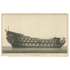
$240 Sale Price
20% Off
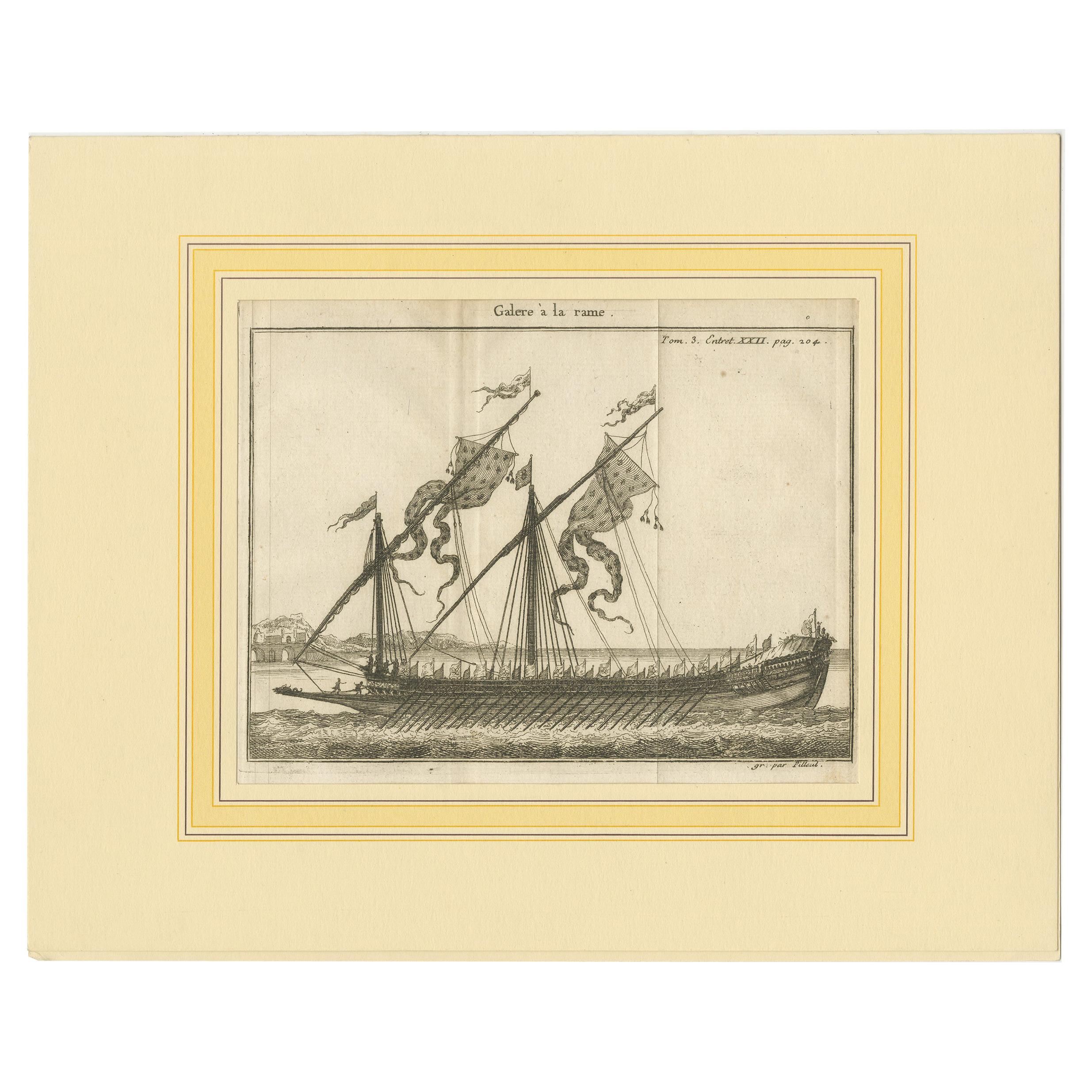
Antique Print of a Galley by Pluche '1735'
Located in Langweer, NL
Antique print titled 'Galere à la rame'. Original antique print of a galley. This print originates from 'Le spectacle de la nature, ou Entretiens sur les particularités (..)' by Anto...
Category
Antique Mid-18th Century Prints
Materials
Paper
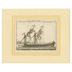
$192 Sale Price
20% Off
You May Also Like
Vintage Nautical Ship Print of First Journey of "Victory"
Located in Miami, FL
Vintage Nautical Ship Print of First Journey of "Victory".
Offered for sale is a print of the first journey of Victory, 1778.W.L. Wyllie, R.A. Harold Wyllie, sculpt. A great revolut...
Category
Early 2000s American Prints
Materials
Wood, Paper
1900 Vintage Lithographic Print of the French Frigate Minerva Oakwood frame
Located in Milan, IT
Lithographic print of the fight of the French frigate Minerva against two vessels and an English frigate on February 2nd, 1779, taken from the book Historical Gallery of Versailles 430. Chacoane is the engraver. Original print by Victor Gilbert Théodore Gudin...
Category
Early 20th Century French Nautical Objects
Materials
Paper
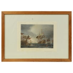
1900s Vintage Lithographic Print of the Naval Battle of Beziers, Oak Wood Frame
Located in Milan, IT
Lithographic print of the Naval Battle of Beziers on 10th July 1690, taken from the book Historical Gallery of Versailles 319bis. Skelton is the engraver. Original print by Victor Gilbert Théodore Gudin...
Category
Early 20th Century French Nautical Objects
Materials
Paper
18th Century Color Engraving Print by Pieter F.H. Bruegel, Le Depart
Located in Miami, FL
Original 18th century color engraving print by renowned artist Pe. F.H. Bruegel.
A fine crisp impression of great rarity; it is particularly unusual to find color engravings of th...
Category
Antique 18th Century French Prints
Materials
Paper
Old Nautical Print by Engraving on Copper Plate from the Panckoucke Encyclopédie
Located in Milan, IT
Print by engraving on copper plate from the Panckoucke Encyclopédie méthodique, end of the 18th century, volume Marine Planches (more than 1,500 figures dealing with all subjects on the marina: planes, construction, carpentry, tree trunks, armaments of maneuvers, ropes, sails, artillery, ship maneuvers and combat tactics). This is the plate n. 149, page. 166 fig. 1209-1212; with frame cm 57.8 x 31.8. The prospect of the side of a ship is depicted. The Print has the "Benard direxit...
Category
Antique 1790s French Prints
Materials
Paper
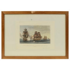
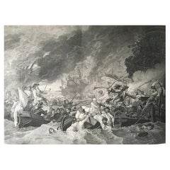
B.West Engraving "Naval Battle, Battle of the Houge" 18th Century
Located in Beuzevillette, FR
This magnificent engraving is entitled "Battle of La Hougue" by the engraver E.C Voysard after Benjamin West.
It depicts the Battle of Barfleur- La Hougue,...
Category
Antique 18th Century French Prints
Materials
Paper
More Ways To Browse
Hand Colored Engraving
Gold Fox
Japanese Wall Plate
Indonesian House
Hunting Engravings
Mid Century Serigraph
Military Hat
Gould Bird
Indonesia Jakarta
Knights Armour
Fruit Botanicals
Large Wall Maps
Knight In Armour
Hand Colored Copper Engraving
Antique Catholic Prints
Medieval Armour
Medieval Knight
Medieval Plate