Items Similar to Antique Print of the World's Time Zones by Johnson, 1872


Want more images or videos?
Request additional images or videos from the seller
1 of 5
Antique Print of the World's Time Zones by Johnson, 1872
$287.46
$359.3220% Off
£213.02
£266.2820% Off
€240
€30020% Off
CA$392.43
CA$490.5420% Off
A$436.57
A$545.7120% Off
CHF 228.85
CHF 286.0720% Off
MX$5,334.74
MX$6,668.4320% Off
NOK 2,914.17
NOK 3,642.7120% Off
SEK 2,743.29
SEK 3,429.1120% Off
DKK 1,827.34
DKK 2,284.1720% Off
Shipping
Retrieving quote...The 1stDibs Promise:
Authenticity Guarantee,
Money-Back Guarantee,
24-Hour Cancellation
About the Item
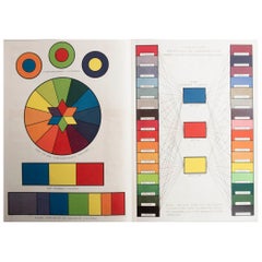
Antique print titled 'A Diagram exhibiting the difference of time between the places shown & Washington'. Original print of the World's time zones. This map originates from 'Johnson's New Illustrated Family Atlas of the World' by A.J. Johnson. Published 1872.
- Dimensions:Height: 17.92 in (45.5 cm)Width: 14.18 in (36 cm)Depth: 0.02 in (0.5 mm)
- Materials and Techniques:
- Period:
- Date of Manufacture:1872
- Condition:General age-related toning, shows minor wear/small defects and creasing. Some soiling. English text on verso. Please study images carefully.
- Seller Location:Langweer, NL
- Reference Number:Seller: BG-12592-611stDibs: LU3054321468832
About the Seller
5.0
Recognized Seller
These prestigious sellers are industry leaders and represent the highest echelon for item quality and design.
Platinum Seller
Premium sellers with a 4.7+ rating and 24-hour response times
Established in 2009
1stDibs seller since 2017
2,494 sales on 1stDibs
Typical response time: 1 hour
- ShippingRetrieving quote...Shipping from: Langweer, Netherlands
- Return Policy
Authenticity Guarantee
In the unlikely event there’s an issue with an item’s authenticity, contact us within 1 year for a full refund. DetailsMoney-Back Guarantee
If your item is not as described, is damaged in transit, or does not arrive, contact us within 7 days for a full refund. Details24-Hour Cancellation
You have a 24-hour grace period in which to reconsider your purchase, with no questions asked.Vetted Professional Sellers
Our world-class sellers must adhere to strict standards for service and quality, maintaining the integrity of our listings.Price-Match Guarantee
If you find that a seller listed the same item for a lower price elsewhere, we’ll match it.Trusted Global Delivery
Our best-in-class carrier network provides specialized shipping options worldwide, including custom delivery.More From This Seller
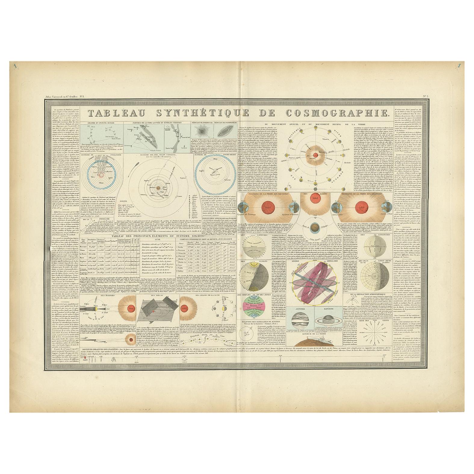
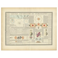
View AllAntique Print of the Planetary Systems of the World by Levasseur, '1875'
Located in Langweer, NL
Antique print titled 'Tableau Synthétique de Cosmographie'. Large print depicting the planetary systems of the world. This map originates from 'Atlas de Géographie Moderne Physique e...
Category
Antique Late 19th Century Prints
Materials
Paper
$479 Sale Price
20% Off
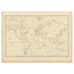
Antique Map of The World in Hemispheres by W. G. Blackie, 1859
Located in Langweer, NL
Antique map titled 'The World in Hemispheres with other projections'. Original antique map of The World. This map originates from ‘The Imperial Atlas of Modern Geography’. Published ...
Category
Antique Mid-19th Century Maps
Materials
Paper

$293 Sale Price
30% Off
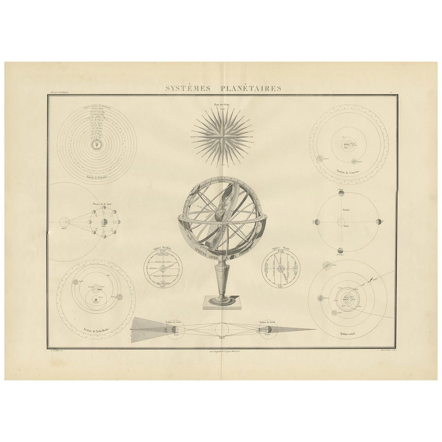
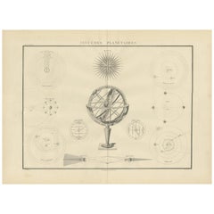
Antique Chart of Celestial and Scientific Models by Lapie, 1842
Located in Langweer, NL
Antique print titled 'Systèmes Planétaires'. Chart of various celestial and scientific models. Includes an armillary sphere and various models of the universe, the season, eclipses, a Copernican, Tycho...
Category
Antique Mid-19th Century French Prints
Materials
Paper
$718 Sale Price
25% Off
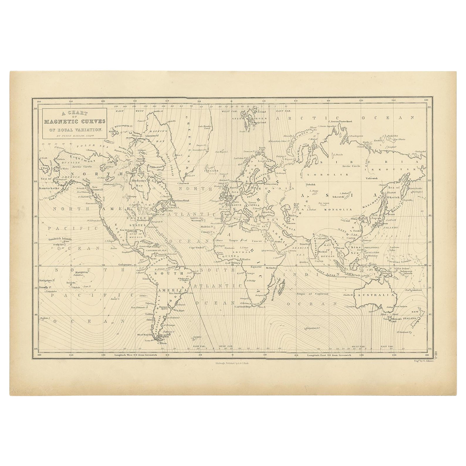
Antique Chart with Isomagnetic Lines by Black, 1854
Located in Langweer, NL
Antique map titled 'A Chart of Magnetic Curves of Equal Variation'. Chart with isomagnetic lines on continents, except for North America. This map orginates from 'General Atlas Of Th...
Category
Antique 19th Century Prints
Materials
Paper
$127 Sale Price
20% Off
Antique Map of the World in Hemispheres by Johnson, '1872'
Located in Langweer, NL
Antique map titled 'Johnson's Globular World. Original world map depicting the Eastern Hemisphere and the Western Hemisphere. This map originates fr...
Category
Antique Late 19th Century Maps
Materials
Paper

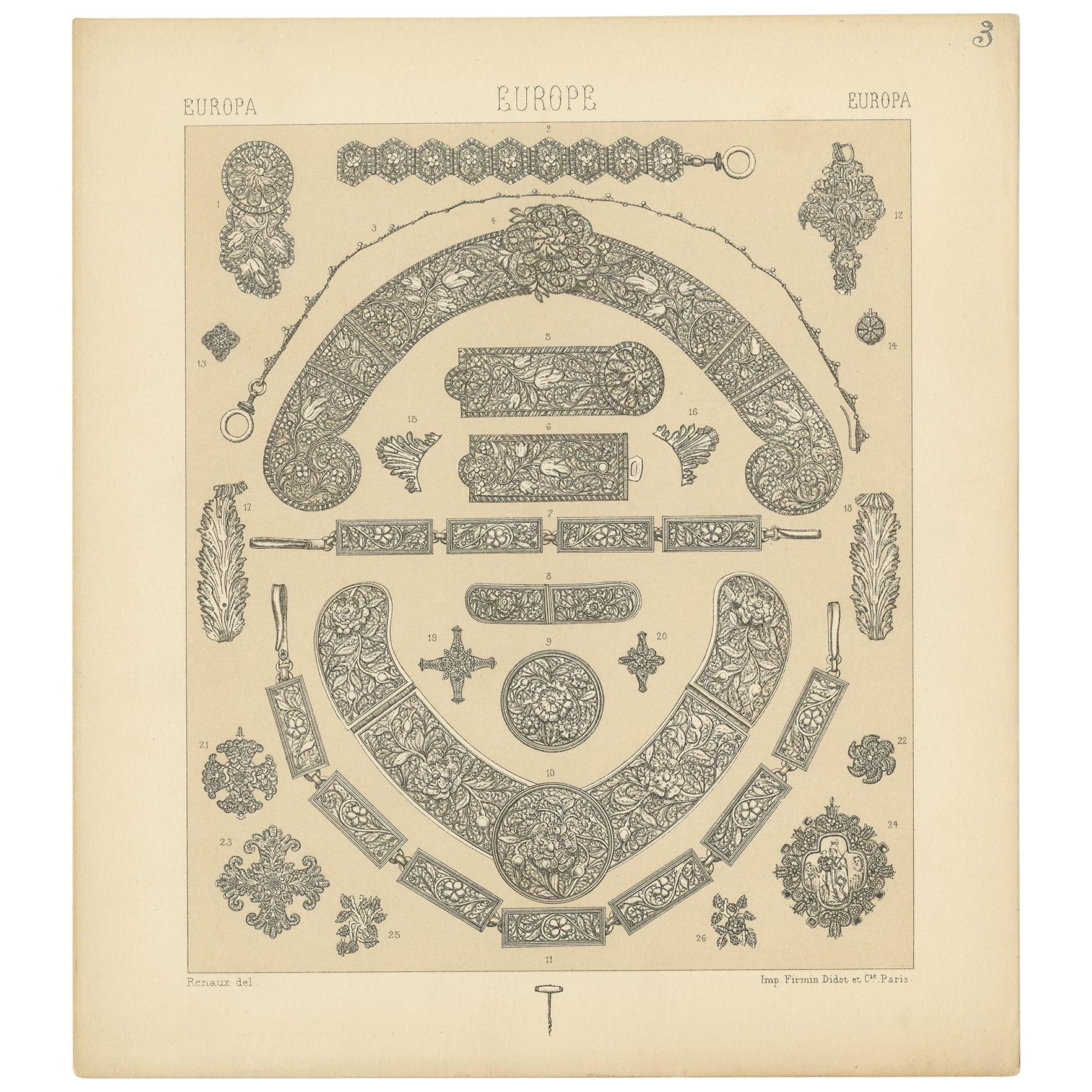
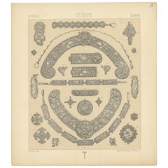
Pl 3 Antique Print of European Decorative Objects by Racinet, 'circa 1880'
Located in Langweer, NL
Antique print titled 'Europa- Europe - Europa'. Chromolithograph of European Decorative Objects. This print originates from 'Le Costume Historique' by M.A. Racinet. Published, circa ...
Category
Antique Late 19th Century Prints
Materials
Paper
$95 Sale Price
20% Off
You May Also Like
Original Antique Map of The World by Thomas Clerk, 1817
Located in St Annes, Lancashire
Great map of The Eastern and Western Hemispheres
On 2 sheets
Copper-plate engraving
Drawn and engraved by Thomas Clerk, Edinburgh.
Published by Mackenzie And Dent, 1817
...
Category
Antique 1810s English Maps
Materials
Paper

1864 Original illustrated planisphere - World Map - Geography
Located in PARIS, FR
Immerse yourself in the epic journey of the past with the Illustrated Historical Planisphere of 1864 by Charpentier! 🗺️ This cartographic treasure transports you through the intrica...
Category
1860s Prints and Multiples
Materials
Linen, Lithograph, Paper

Original Antique Print of A Colour Chart . C.1900
Located in St Annes, Lancashire
Great image of a colour chart
Unframed.
Chromo-lithograph
Published, C.1900
The measurement is the paper size of the print
Free shipping.
Category
Antique Early 1900s English Folk Art Prints
Materials
Paper
1864 Johnson's Map of the World on Mercator's Projection, Ric.B009
Located in Norton, MA
An 1864 Johnson's map of
the World on Mercator's Projection
Ric.b009
About this Item
"This antique map came from Johnson's New Illustrated (Steel Plate) Family Atlas, publ...
Category
Antique 19th Century Dutch Maps
Materials
Paper

Map of the World - Original Etching - 1820
Located in Roma, IT
Map of the World is an Original Etching realized by an unknown artist of 19th century in 1820.
Very good condition on two sheets of white paper joine...
Category
1820s Modern Figurative Prints
Materials
Etching

Old Map Depicting the Entire Earth's Surface Divided into Six Parts France 1850
Located in Milan, IT
Map depicting the entire earth's surface divided into six parts which depicts the position of peoples on Earth based on the assumption that it is impossible for each people to have t...
Category
Antique Mid-19th Century French Maps
Materials
Glass, Wood, Paper

More Ways To Browse
Axel Salto Lithograph
Charley Harper Serigraph
Clam Hat
David Weidman
Dirty Dogs Of Paris
Ernesto Garcia Cabral
Erte Soiree
Giorgio Zennaro On Sale
Herbert Dicksee Etching
Impeyan Pheasant
John James Audubon Cardinal
John Luke Eastman On Sale
Maitland Smith Japanese
Masao Ido
Matisse Serigraph
Maxfield Calendar
Maxfield Parrish Calendar
Maxfield Parrish Garden Of Allah