Items Similar to The Communion of the Lutherans in the Minorite Church in Augsburg, Germany, 1730
Want more images or videos?
Request additional images or videos from the seller
1 of 7
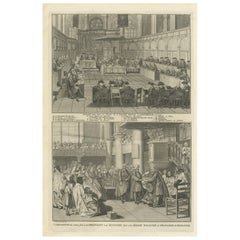
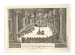
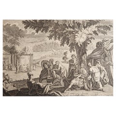
The Communion of the Lutherans in the Minorite Church in Augsburg, Germany, 1730
$510.39
$637.9820% Off
£382.57
£478.2120% Off
€432
€54020% Off
CA$701.19
CA$876.4820% Off
A$782.81
A$978.5120% Off
CHF 410.18
CHF 512.7220% Off
MX$9,582.34
MX$11,977.9220% Off
NOK 5,209.28
NOK 6,511.6120% Off
SEK 4,911.69
SEK 6,139.6220% Off
DKK 3,288.54
DKK 4,110.6820% Off
About the Item
Antique print, titled: 'La communion des Lutheriens dans l'Eglise des Minorites à Augsbourg' -
This original antique print shows the Communion of the Lutherans in the Minorite Church in Augsburg, Germany.
This scarse original old antique print / plate originates from: 'Naaukeurige beschryving der godtsdienst-plichten, kerk-zeden en gewoontens van alle volkeren der waereldt.', a Dutch edition or its French edition 'Ceremonies et coutumes Religieuses...' , by A. Moubach, 1727-1738 (French edition 1721-1725). An English edition called 'Ceremonies and religious Rites of the various nations of the known world....', appeared in 1733. It was the most elaborate history of world religion published up to that time. The plates in this work were adapted by B. Picart and others from various sources including de Bry.
Artists and Engravers: Made by 'Bernard Picart' after an anonymous artist. The author of this work is A. Moubach. The most important engraver of this work is Bernard Picart (1673-1733). He was a French painter and engraver. He received his art education from his father, Etienne (1632-1721), from Le Brun and Jouvenet at the Royal Academy. His talents developed rapidly: at the age of sixteen he gained honors at the Academy of Paris.He was born in Paris and died in Amsterdam. Other engravers worked on this work as well.
- Dimensions:Height: 15.56 in (39.5 cm)Width: 19.89 in (50.5 cm)Depth: 0 in (0.02 mm)
- Materials and Techniques:
- Period:1730-1739
- Date of Manufacture:circa 1730
- Condition:Condition: Good, given age. A few minor crinkles or creases. Original folds as issued. General age-related toning and/or occasional minor defects from handling. Please study scan carefully.
- Seller Location:Langweer, NL
- Reference Number:Seller: PCT-629981stDibs: LU3054327488912
About the Seller
5.0
Recognized Seller
These prestigious sellers are industry leaders and represent the highest echelon for item quality and design.
Platinum Seller
Premium sellers with a 4.7+ rating and 24-hour response times
Established in 2009
1stDibs seller since 2017
2,513 sales on 1stDibs
Typical response time: <1 hour
- ShippingRetrieving quote...Shipping from: Langweer, Netherlands
- Return Policy
Authenticity Guarantee
In the unlikely event there’s an issue with an item’s authenticity, contact us within 1 year for a full refund. DetailsMoney-Back Guarantee
If your item is not as described, is damaged in transit, or does not arrive, contact us within 7 days for a full refund. Details24-Hour Cancellation
You have a 24-hour grace period in which to reconsider your purchase, with no questions asked.Vetted Professional Sellers
Our world-class sellers must adhere to strict standards for service and quality, maintaining the integrity of our listings.Price-Match Guarantee
If you find that a seller listed the same item for a lower price elsewhere, we’ll match it.Trusted Global Delivery
Our best-in-class carrier network provides specialized shipping options worldwide, including custom delivery.More From This Seller
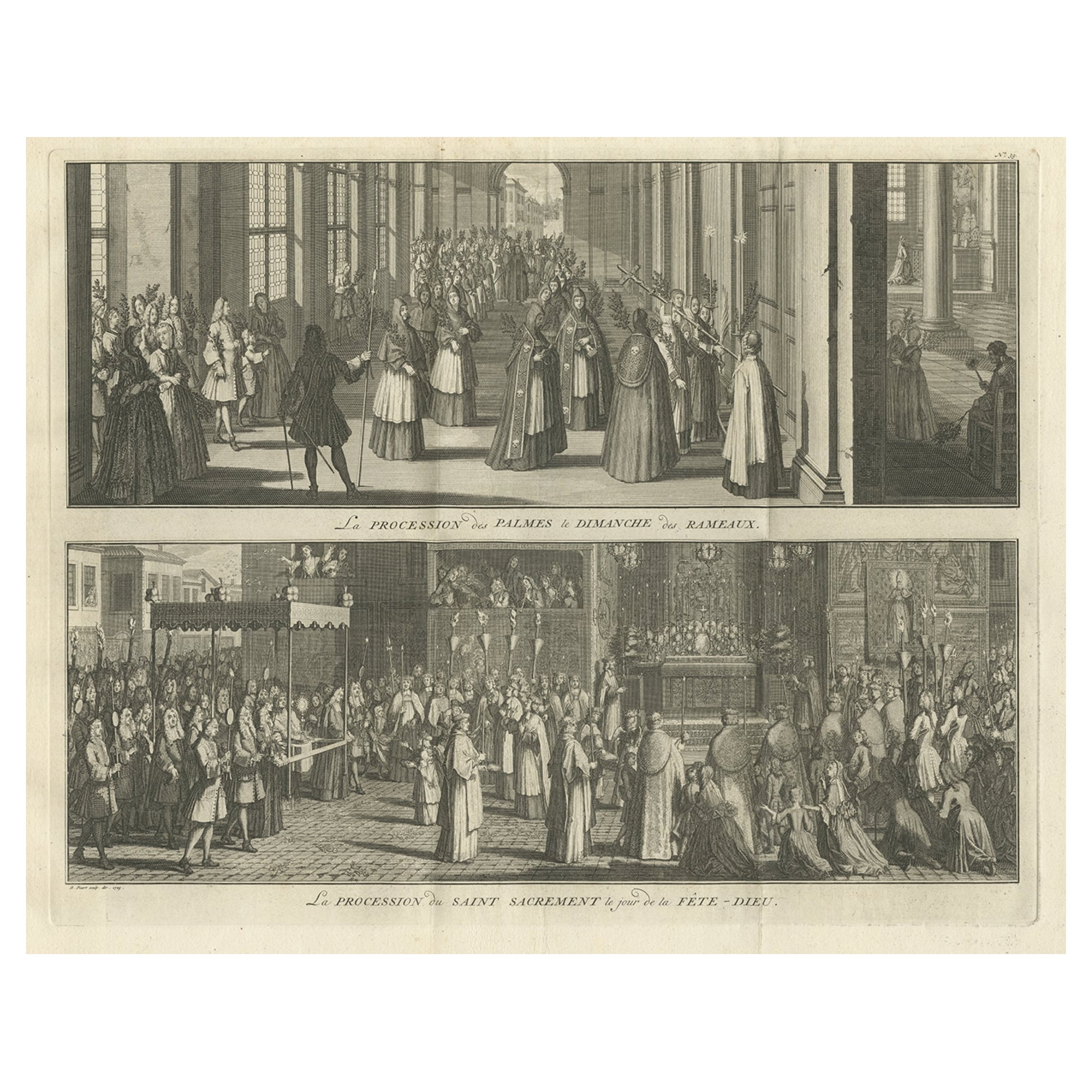
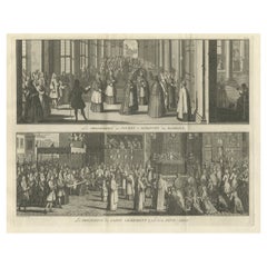
View AllOld Print of a Religious Ceremony for Corpus Christi Day and Palm Sunday, 1725
Located in Langweer, NL
Two images on one sheet titled 'La Procession des Palmes le Dimanche des Rameaux' and 'La Procession du Saint Sacrement le jour de la Dête-Dieu'.
The upper image depicts Palm Sunday...
Category
Antique 1720s Prints
Materials
Paper
$415 Sale Price
20% Off
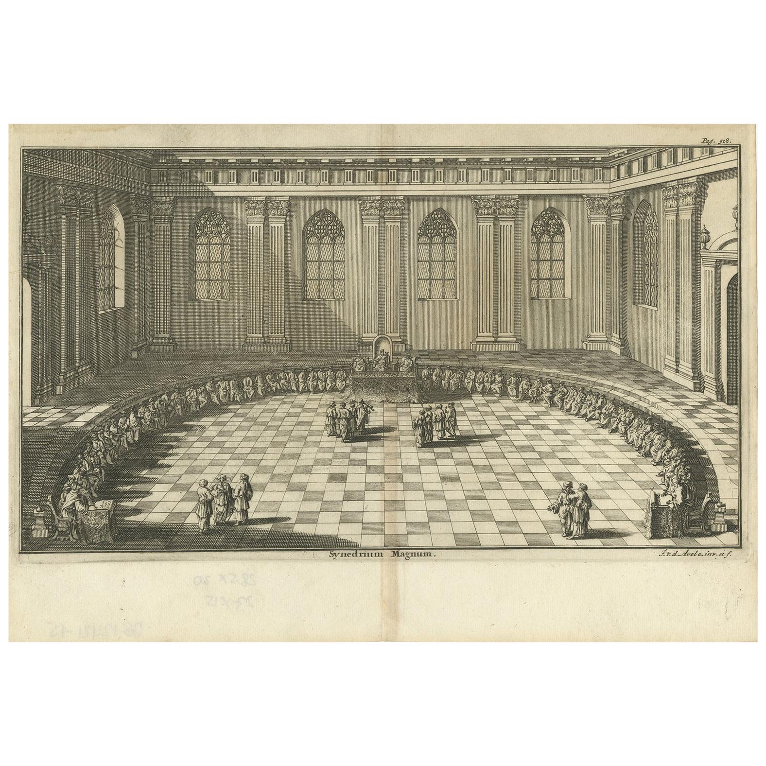
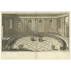
Antique Print of a Council in the Council Chamber by Van den Avele 'circa 1750'
Located in Langweer, NL
Antique print titled 'Synedrium Magnum'. Engraving of a council in the council chamber. Signed by Johannes van den Avele, a Dutch etcher and copper eng...
Category
Antique Mid-18th Century Prints
Materials
Paper
$141 Sale Price
20% Off
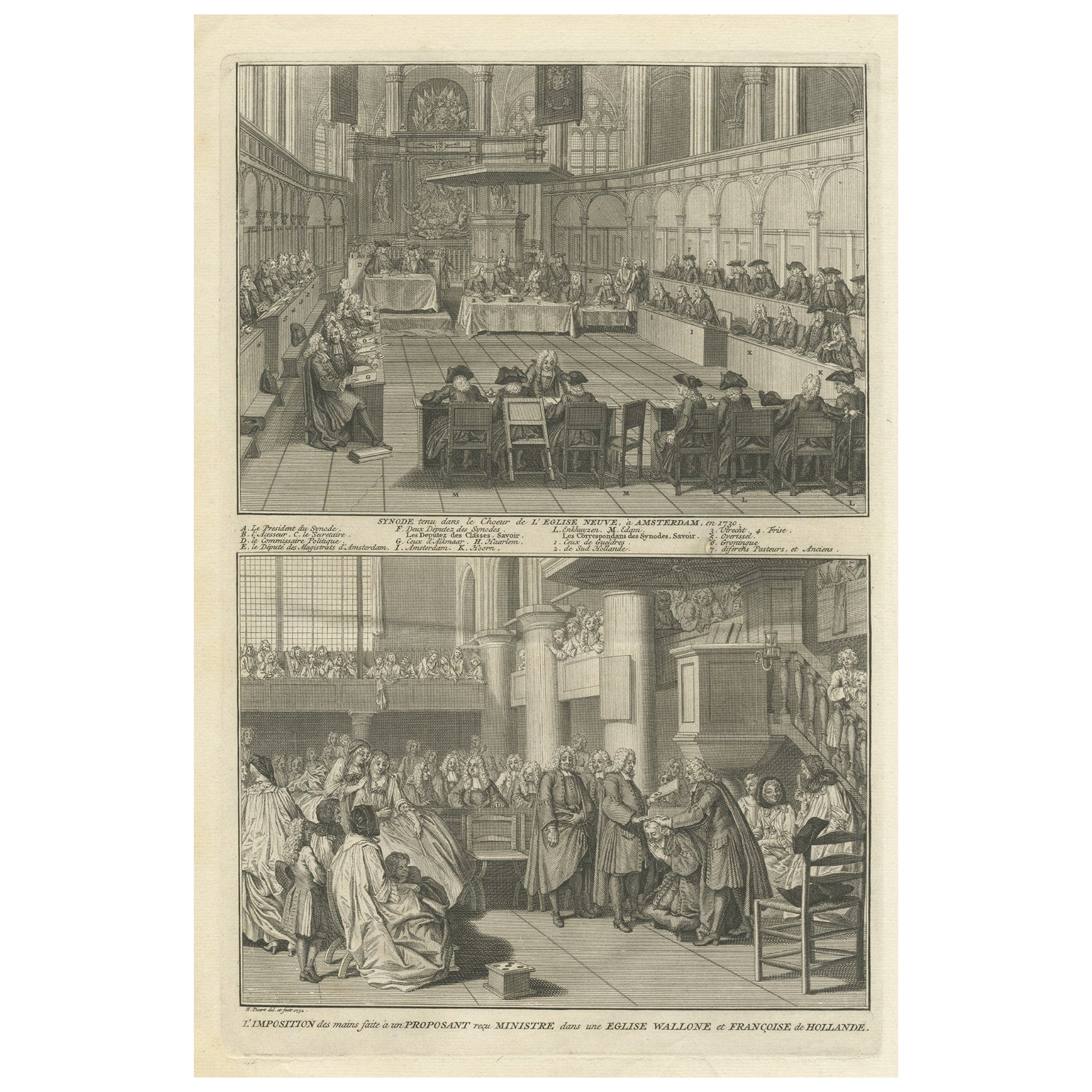
Engraving of a Meeting of the Dutch Synode in Amsterdam, The Netherlands, 1732
Located in Langweer, NL
Antique print titled 'Synode tenu dans le Choeur (..)'. Old print of a meeting of the Dutch Synode in 'De Nieuwe Kerk' in Amsterdam, The Netherlands in 1730. Also depicted the accept...
Category
Antique 18th Century Prints
Materials
Paper
$321 Sale Price
20% Off
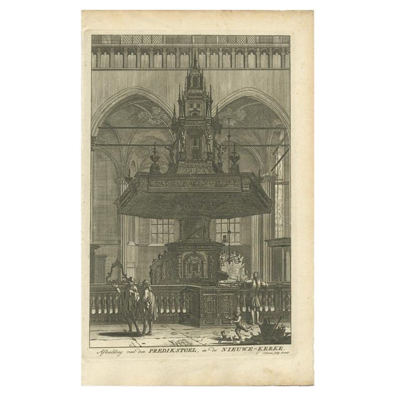
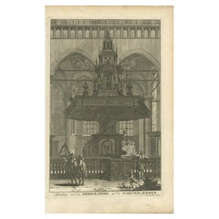
Old Print Depicting the Preacher's Pulpit of a Church in Amsterdam, 1765
Located in Langweer, NL
Antique print titled 'Afbeelding van den Predikstoel, in de Nieuwe-Kerke'. Old print depicting the preacher's pulpit of a Church in Amsterdam (Nieuwe Kerk). This print originates fro...
Category
Antique 18th Century Prints
Materials
Paper
$113 Sale Price
20% Off
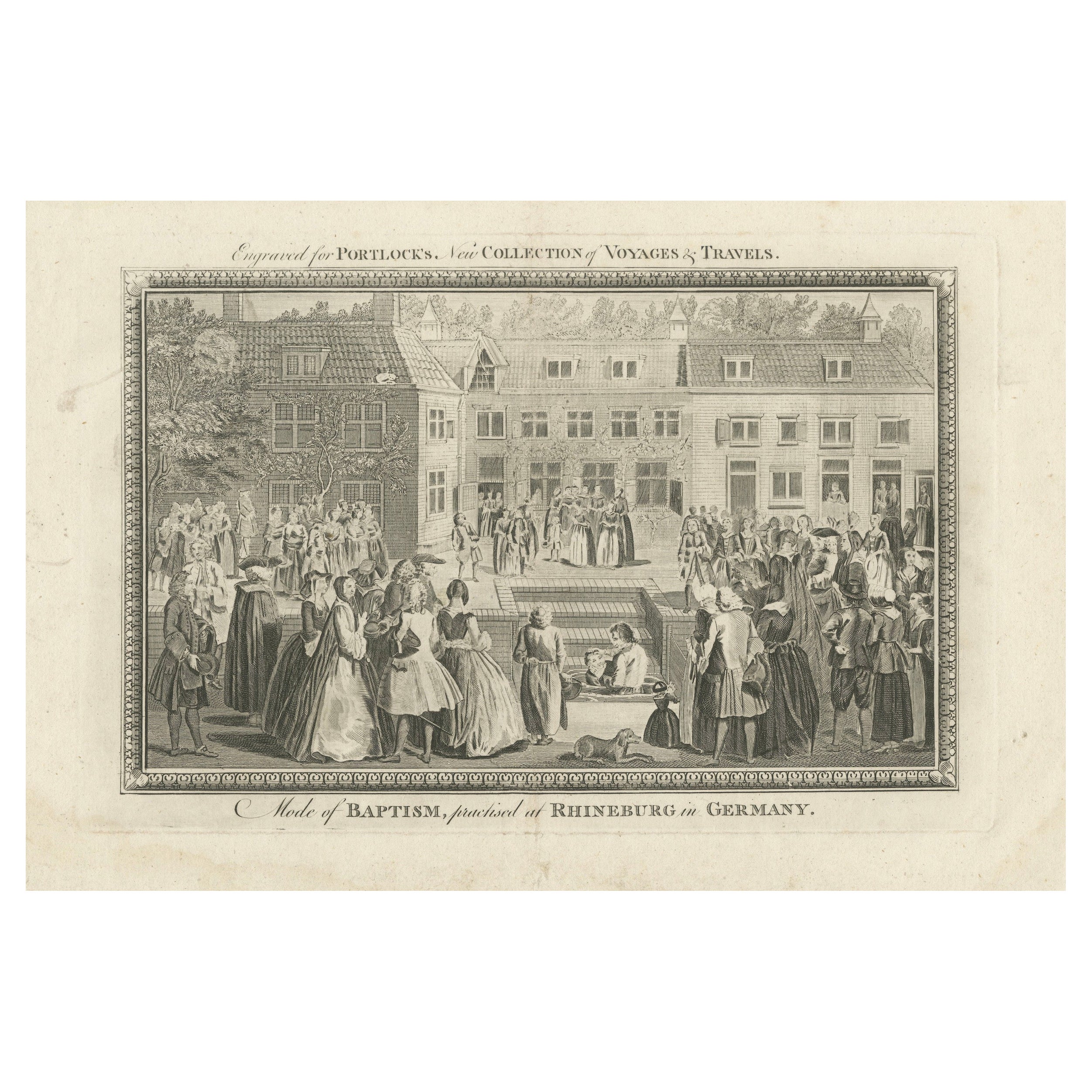
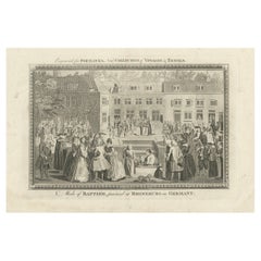
Baptism Ceremony of Rijnsburg Collegiants, Germany, Engraved for Portlock, 1790
Located in Langweer, NL
This copper engraving, titled "Mode of Baptism, Practised at Rhineburg in Germany", was created around 1790 and engraved for "Portlock's New Collection of Voyages and Travels."
The...
Category
Antique 1790s Prints
Materials
Paper
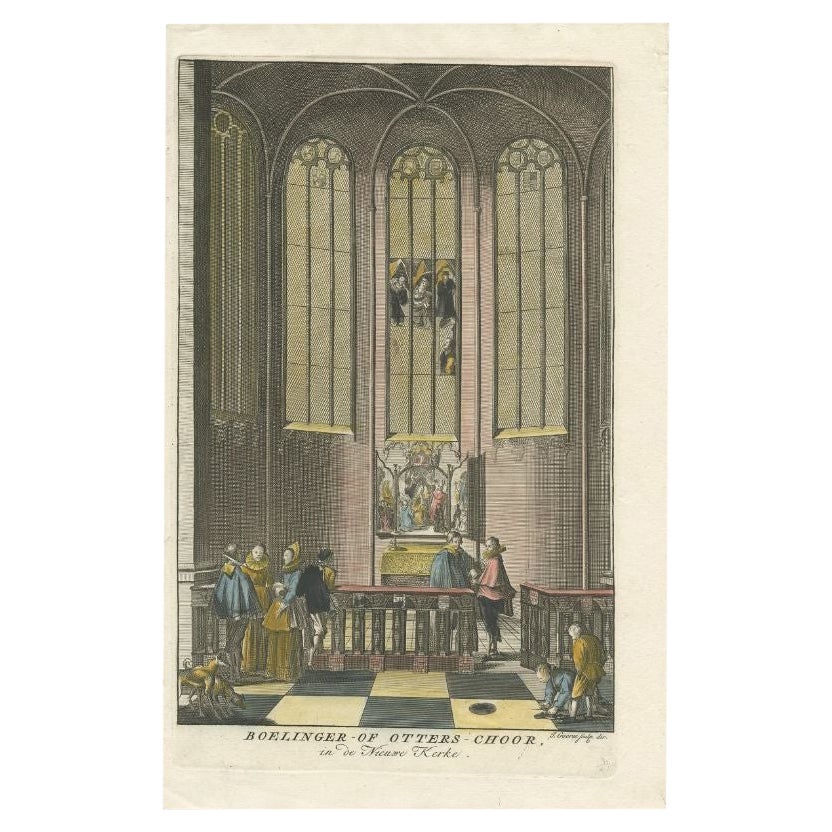
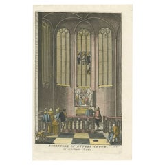
Antique Print of a Church Interior in Amsterdam, The Netherlands, 1765
Located in Langweer, NL
Antique print titled 'Boelinger- of Otters-Choor in de Nieuwe Kerke'. This print depicts a church interior in Amsterdam, The Netherlands. This print originates from ' Amsterdam, In Z...
Category
Antique 18th Century Prints
Materials
Paper
$141 Sale Price
20% Off
You May Also Like
The Holy Council - Original Color Etching by G. Pivati - 1746-1751
By Gianfrancesco Pivati
Located in Roma, IT
The Holy Council - From “New Scientific and Curious Dictionnary concerning the Sacred and the Profane
Etchings, Hand-Watercoloured. Tom.IX, Plate XLIII
Image Dim: cm 25.5 x 18; She...
Category
1740s Old Masters Figurative Prints
Materials
Etching
Interior Meeting - Original Etching by Cornelis Meyssens - 17th Century
Located in Roma, IT
Interior Meeting is an original etching realized by Cornelis Meyssens ( 1640-1573).
Good conditions, except for some foldings.
Included a Passepartout: 34 x 49 cm
The artwork repres...
Category
17th Century Baroque Figurative Prints
Materials
Etching
Antique Print After Rembrandt, The Presentation In The Temple, C.1850
By Rembrandt van Rijn
Located in St Annes, Lancashire
Wonderful image after Rembrandt
Fine Steel engraving.
Published by Blackie & Sons London. C.1850
Unframed.
Category
Antique 1850s English Baroque Prints
Materials
Paper
Engraving in Wooden Frame With Religious Scene - 18th Century
Located in Opole, PL
Engraving in Wooden Frame With Religious Scene - 18th Century
Print based on the painting of the Flemish artist Erasmus Quellin (1607-1678). The matrix was made by Schelte Adams Bol...
Category
Antique 18th Century Belgian Prints
Materials
Wood
$329 Sale Price
20% Off
Original Antique Print After Jan Luyken, Amsterdam. Genesis XVIII. 1724
Located in St Annes, Lancashire
Wonderful copper-plate engraving after Jan Luyken
Published by Marten Schagen, Amsterdam. 1724
Text on verso
The measurement given is the paper size.
Category
Antique 1720s Dutch Renaissance Prints
Materials
Paper
Interior of the Nieuwe Kerk, Amsterdam
Located in Paris, Île-de-France
Jan Goeree (Middelburg 1670 – Amsterdam 1731)
Interior of the Nieuwe Kerk, Amsterdam (c. 1724)
Red chalk for the architecture, pen and black ink, grey wash on paper
Composition reversed in preparation for engraving
25 × 17.5 cm
Watermark: Hunting horn, Churchill 318 (dated 1724)
Unsigned
Provenance
Private collection, France
Context & Attribution
Trained in the studio of Gérard de Lairesse, Jan Goeree was among the finest Dutch engravers of the early eighteenth century, celebrated for his architectural views of Amsterdam. This drawing is a preparatory study for an engraving of the same subject now preserved in a major public collection. The final print—slightly larger—closely follows the reversed composition of this sheet.
Subject
In the center of the Gothic nave, five bearers carry a catafalque toward a freshly dug grave—a tribute to the naval heroes often buried in the Nieuwe Kerk. This funerary motif, familiar from Dutch painting (e.g. Emanuel de Witte, 1657), evokes the vanitas theme and the transience of earthly life.
Technical Analysis
Goeree’s use of red chalk for the architecture and ink for the figures reveals his working method: the chalk lines could be used to produce a counterproof restoring the correct orientation of the architecture, while the inked figures remained adjustable before the design was transferred to the copper plate.
Place within the Oeuvre
Drawings of church...
Category
Early 18th Century Old Masters Interior Drawings and Watercolors
Materials
Ink, Chalk
More Ways To Browse
Communion Plate
Cartier Catalog
Chamois Carved Wood
Cherry Amber
Chest Of Drawers Black Chinoiserie
Chinese Bronze Lantern
Chinese Butterfly Cabinet
Chinese Fish Plate
Chinese Water Bowl
Chinese Woodblock Print
Christophe Come
Civil War Flags
Cloud Dining Chairs
Cock Fighting
Copper Basin
Decorative Ceramic Discs
Dressing Table Chinese
Early American Primitive Antiques