Items Similar to Constellations Engraved Maps Drawn by W. Newton, Published by Baldwin & Grado


Want more images or videos?
Request additional images or videos from the seller
1 of 20
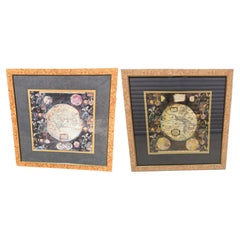
Constellations Engraved Maps Drawn by W. Newton, Published by Baldwin & Grado
$3,800.44
£2,745
€3,247.25
CA$5,230.64
A$5,804.18
CHF 3,061.56
MX$70,856.59
NOK 38,734.73
SEK 36,278.20
DKK 24,233.61
About the Item
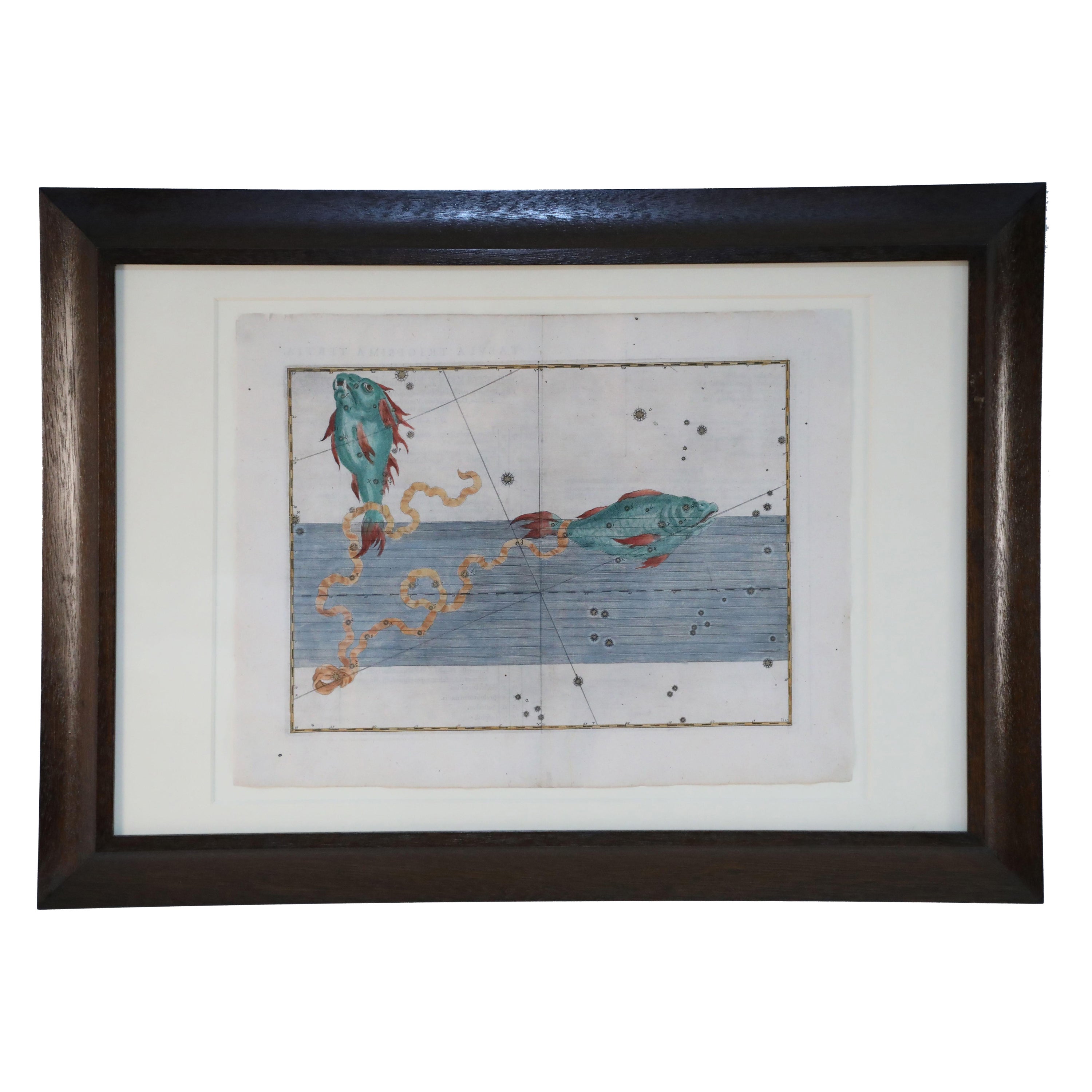
Set of five maps of the constellations numbered 1-5, drawn by W. Newton and published by Baldwin & Gradock in 1830. Framed, in very good condition.
A constellation map is a graphical representation of the celestial sphere, depicting the positions and shapes of constellations as observed from Earth. Constellations are groups of stars that form recognizable patterns or shapes in the night sky, as perceived from our vantage point on Earth.
These maps are often used for stargazing and navigation, helping observers identify and locate specific constellations and celestial objects. Constellation maps typically include lines connecting the stars within a constellation to outline its shape, and the maps may also include labels for individual stars and other prominent celestial objects.
From a private English collection
Free international shipping
About the Seller
4.6
Vetted Professional Seller
Every seller passes strict standards for authenticity and reliability
Established in 2010
1stDibs seller since 2023
143 sales on 1stDibs
- ShippingRetrieving quote...Shipping from: Nottingham, United Kingdom
- Return Policy
Authenticity Guarantee
In the unlikely event there’s an issue with an item’s authenticity, contact us within 1 year for a full refund. DetailsMoney-Back Guarantee
If your item is not as described, is damaged in transit, or does not arrive, contact us within 7 days for a full refund. Details24-Hour Cancellation
You have a 24-hour grace period in which to reconsider your purchase, with no questions asked.Vetted Professional Sellers
Our world-class sellers must adhere to strict standards for service and quality, maintaining the integrity of our listings.Price-Match Guarantee
If you find that a seller listed the same item for a lower price elsewhere, we’ll match it.Trusted Global Delivery
Our best-in-class carrier network provides specialized shipping options worldwide, including custom delivery.More From This Seller
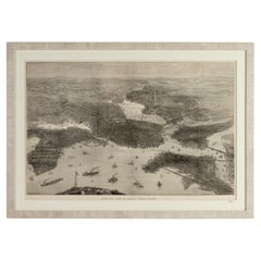
View AllBird's Eye View of Boston Engraving by Illustrated London News 1872
Located in Nottingham, GB
Bird's Eye View of Boston Engraving by Illustrated London News 1872.
Framed.
From a private English collection
Free international shipping
Category
Antique 1870s Prints
Materials
Paper
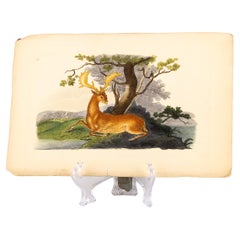
Handcoloured Copperplate E. Donovan & F.C. & J. Rivington Aug 1819 Engraving
Located in Nottingham, GB
Original Handcoloured Copperplate E. Donovan & F.C. & J. Rivington Aug 1819 Engraving
Good overall condition
Free international shipping.
Category
Antique 19th Century Prints
Materials
Paper
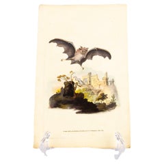
Handcoloured Copperplate E. Donovan & F.C. & J. Rivington July 1815 Engraving
Located in Nottingham, GB
Original Handcoloured Copperplate E. Donovan & F.C. & J. Rivington July 1815 Engraving
Good overall condition
Free international shipping.
Category
Antique 19th Century Prints
Materials
Paper
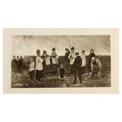
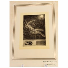
Felicien Rops (1833-1898) Belgian Original Etching 19th Century
Located in Nottingham, GB
Felicien Rops (1833-1898) Belgian Original Etching 19th Century
Good overall condition
Félicien Victor Joseph Rops( 1833-1898) was a Belgian artist associated with Symbolism and th...
Category
Antique 19th Century Belgian Prints
Materials
Paper
Felicien Rops (1833-1898) "Détritus Humain" Belgian Original Etching 19th C
Located in Nottingham, GB
Felicien Rops (1833-1898) Belgian Original Etching 19th Century
Good overall condition
Félicien Victor Joseph Rops ( 1833-1898) was a Belgian artist associated with Symbolism and t...
Category
Antique 19th Century Belgian Prints
Materials
Paper
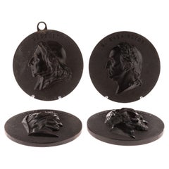
Antique Set of Four Bois Durci Medallion Wall Portrait Plaques 19th Century
Located in Nottingham, GB
Bois durci is a composite material made from fine wood flour mixed with a binding agent, such as a resin or natural gum, which is then subjected to heat and pressure to harden it. It...
Category
Antique 19th Century Decorative Art
Materials
Other
You May Also Like
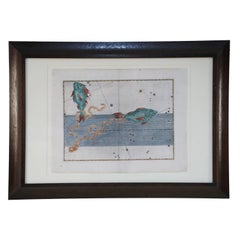
Alexander Mair Renaissance Hand-Colored Engravings of Astronomy Star Charts
Located in Queens, NY
Sst of 20 Renaissance (17th century) engraved, hand-colored etchings for Johann Bayer's book 'Uranometria', a star atlas, in wooden frames with white mat....
Category
Antique 17th Century Renaissance Paintings
Materials
Wood, Paper
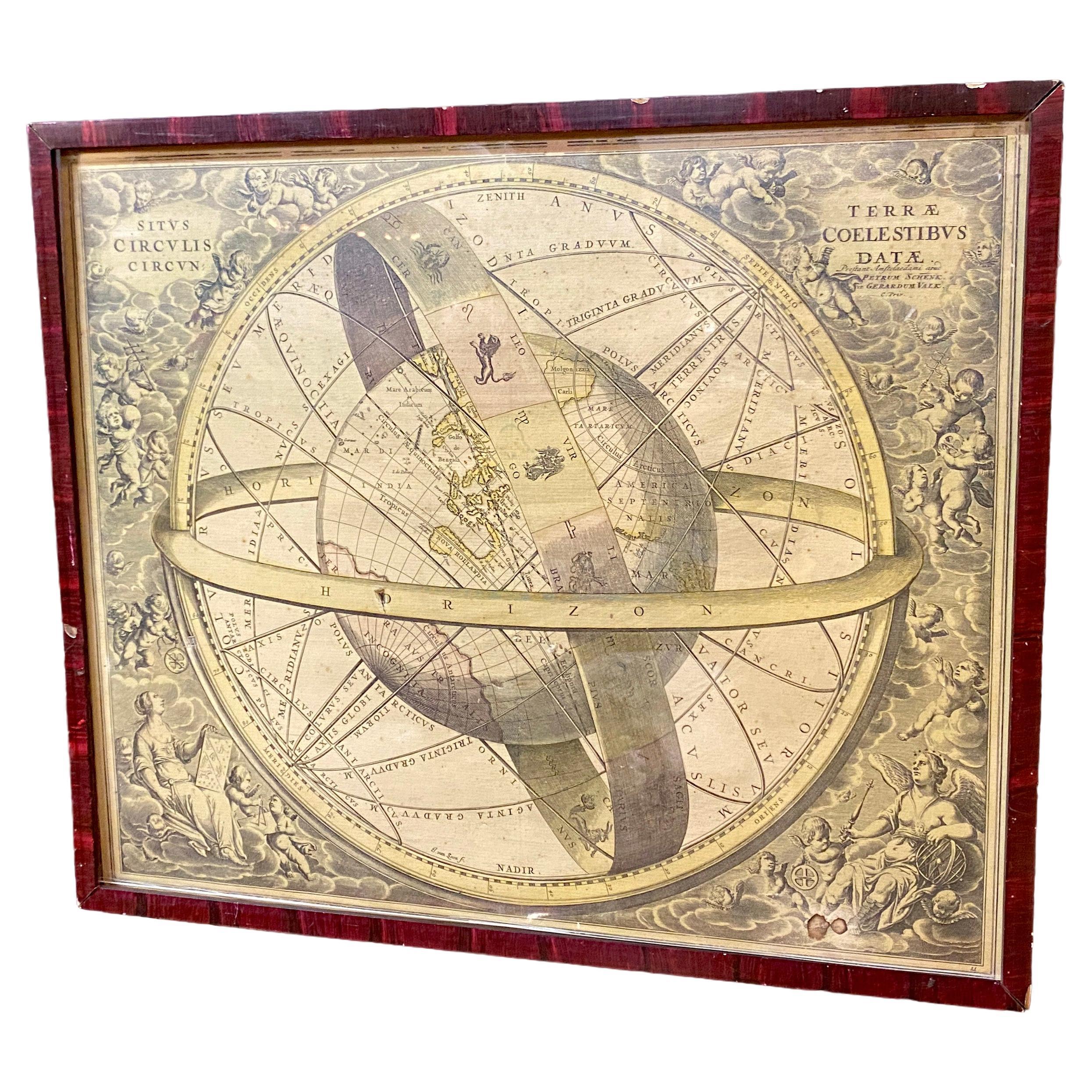
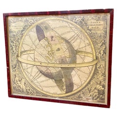
Ancient engraving, map of the earth with circling zodiac
Located in Saint-Ouen, FR
Ancient engraving, map of the earth with circling zodiac "Situs Terrae Circulis Coelestibus Circumnate"
Category
Antique 18th Century European International Style Drawings
Materials
Paper
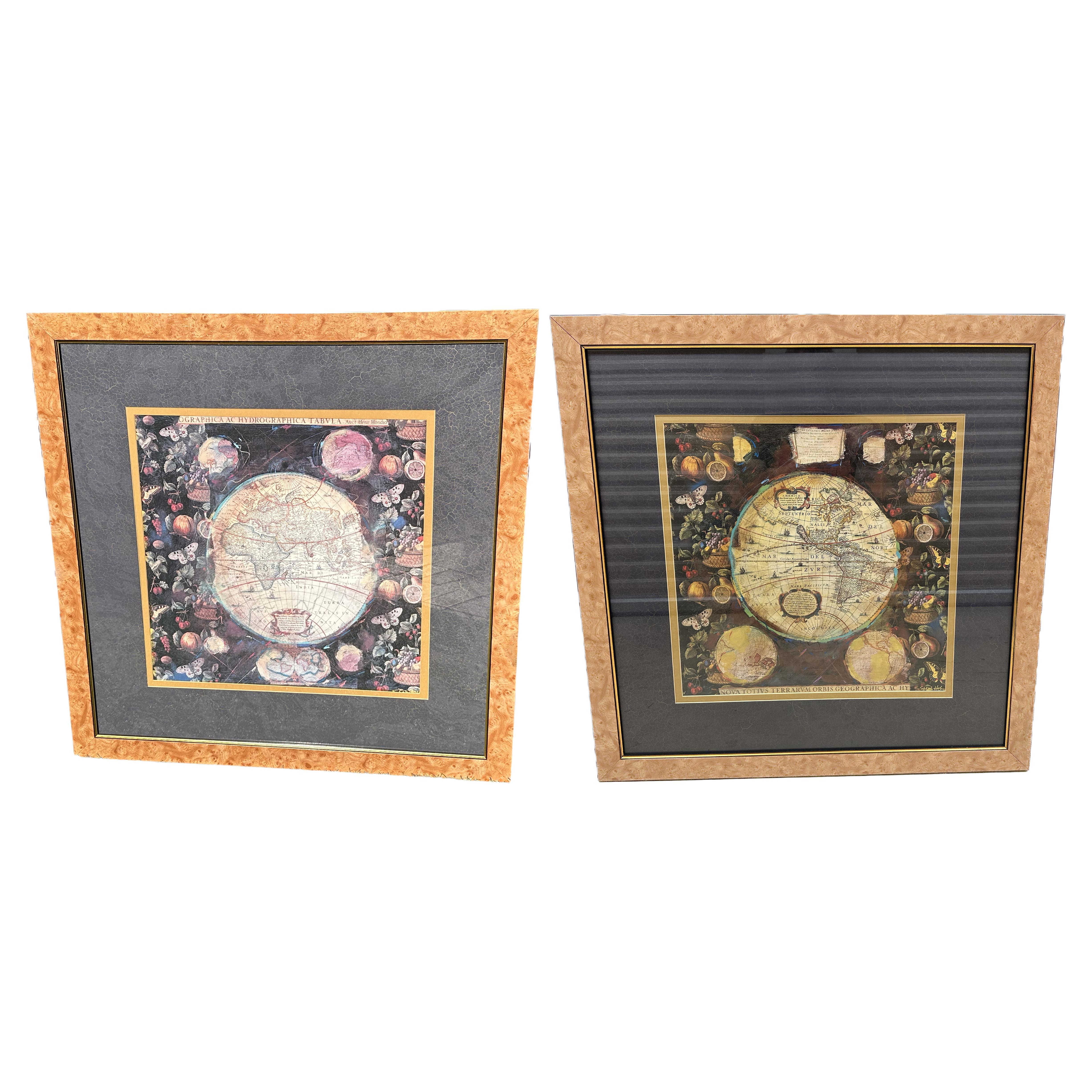
Pair of Prints Depicting Antique World Maps Framed in Burl Wood
Located in Dallas, TX
A pair of prints depicting antique world maps framed in burl wood. One picture contains a depiction of Africa, Europe, and Oceania. The other picture is of North and South America. T...
Category
20th Century American Prints
Materials
Paper
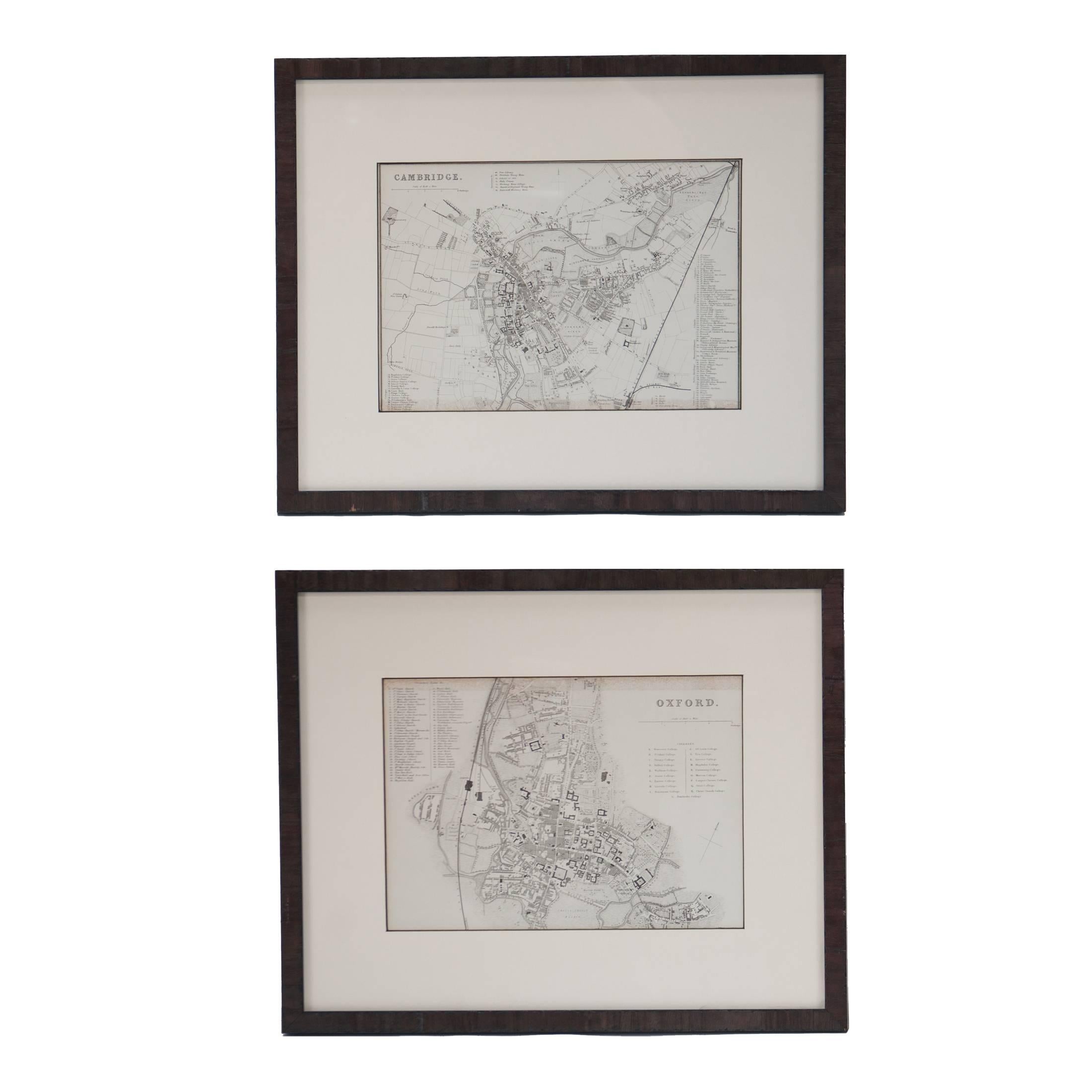
Mid 19th Century Pair of Framed English Maps of Oxford and Cambridge
Located in Los Angeles, CA
This pair of maps featuring Oxford and Cambridge is beautifully preserved in custom black wood frames. These hand-drawn maps showcase exquisite lettering and a remarkable level of de...
Category
Antique 19th Century English Victorian Prints
Materials
Paper, Wood
Antique Lithography Map, West Africa, English, Framed, Cartography, Victorian
Located in Hele, Devon, GB
This is an antique lithography map of Western Africa. An English, framed atlas engraving of cartographic interest by John Rapkin, dating to the early Victorian period and later, circ...
Category
Antique Mid-19th Century British Early Victorian Maps
Materials
Wood

Antique Lithography Map, Gloucestershire, English, Framed Engraving, Cartography
Located in Hele, Devon, GB
This is an antique lithography map of Gloucestershire. An English, framed atlas engraving of cartographic interest, dating to the mid 19th century ...
Category
Antique Mid-19th Century British Victorian Maps
Materials
Wood

More Ways To Browse
Pair Large Ginger Jar
Pair Onyx Columns
Pink Ginger Jar
Porcelain Chickens
Porcelain Perfume Bottles
Porcelain Tazza
Puppets And Marionettes
Rabbit Pottery
Red Buddha Statue
Repousse Brass Box
Retro French Kitchen Posters
Robert John Cabinet
Rococo Dolphin
Rose Tea Cup
Russian Imperial Porcelain
Russian Papier Mache
Sea Captains 19th
Seaweed Table