Items Similar to Daily Life in Atooi: An 18th-Century View of Kauai and Its People, circa 1785
Want more images or videos?
Request additional images or videos from the seller
1 of 6
Daily Life in Atooi: An 18th-Century View of Kauai and Its People, circa 1785
$228.22
$285.2720% Off
£169.95
£212.4420% Off
€192
€24020% Off
CA$315.08
CA$393.8520% Off
A$349.32
A$436.6520% Off
CHF 183.58
CHF 229.4720% Off
MX$4,275.06
MX$5,343.8320% Off
NOK 2,292.72
NOK 2,865.9020% Off
SEK 2,151.95
SEK 2,689.9420% Off
DKK 1,461.82
DKK 1,827.2820% Off
About the Item
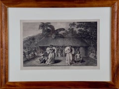
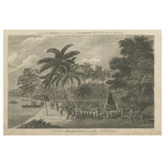
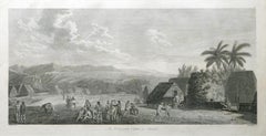
This antique engraving with the caption "Habitations and People of the Island of Atooi," which is an old name for Kauai, part of the Hawaiian Islands. The engraving is captioned to have been engraved for "Bankes's New System of Geography Published by Royal Authority."
The scene is rich with cultural and ethnographic details. It shows several indigenous Hawaiian people engaged in various activities in front of thatched houses. The people are depicted in different poses, including sitting, standing, and engaging in what appears to be a form of communication or social interaction. The attire of the figures is minimal, which reflects the traditional clothing of the time, and some carry tools or weapons that suggest their daily tasks or roles within the society.
The landscape includes palm trees and rugged mountain terrain in the background, giving a sense of the island's topography. The sky is filled with clouds, and the overall impression is of a vibrant community living in a lush environment.
- Dimensions:Height: 9.45 in (24 cm)Width: 14.97 in (38 cm)Depth: 0 in (0.02 mm)
- Materials and Techniques:Paper,Engraved
- Period:1780-1789
- Date of Manufacture:circa 1785
- Condition:Repaired: One small tear in the right margin, touching the image, has been repaired with a small piece of tape on the reverse. Good condition, Aged paper with soiling and foxing due to handling and age, mainly along the edges, but especially on the right site. Study the images carefully.
- Seller Location:Langweer, NL
- Reference Number:Seller: BG-13597-861stDibs: LU3054337989082
About the Seller
5.0
Recognized Seller
These prestigious sellers are industry leaders and represent the highest echelon for item quality and design.
Platinum Seller
Premium sellers with a 4.7+ rating and 24-hour response times
Established in 2009
1stDibs seller since 2017
2,609 sales on 1stDibs
Typical response time: <1 hour
- ShippingRetrieving quote...Shipping from: Langweer, Netherlands
- Return Policy
Authenticity Guarantee
In the unlikely event there’s an issue with an item’s authenticity, contact us within 1 year for a full refund. DetailsMoney-Back Guarantee
If your item is not as described, is damaged in transit, or does not arrive, contact us within 7 days for a full refund. Details24-Hour Cancellation
You have a 24-hour grace period in which to reconsider your purchase, with no questions asked.Vetted Professional Sellers
Our world-class sellers must adhere to strict standards for service and quality, maintaining the integrity of our listings.Price-Match Guarantee
If you find that a seller listed the same item for a lower price elsewhere, we’ll match it.Trusted Global Delivery
Our best-in-class carrier network provides specialized shipping options worldwide, including custom delivery.More From This Seller
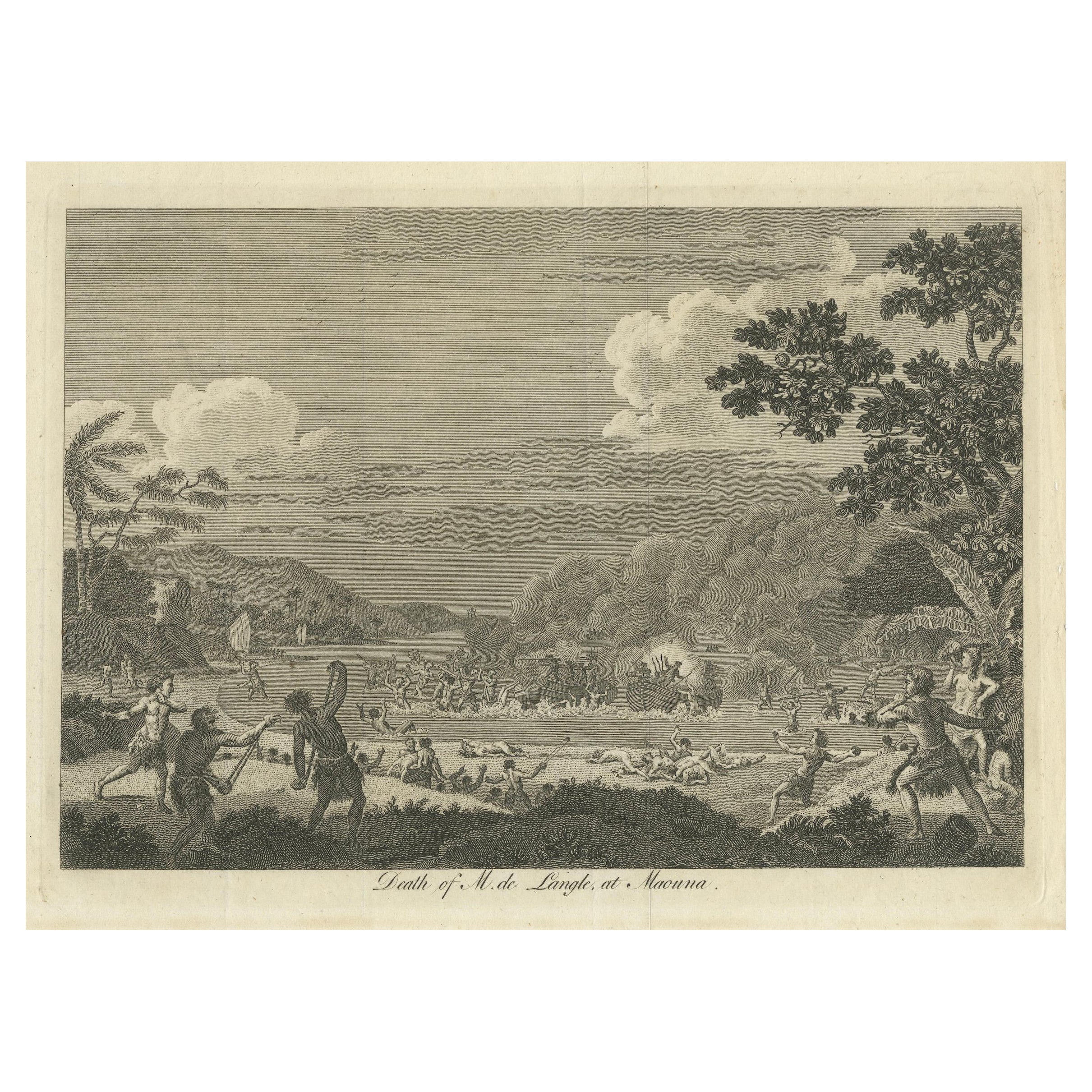
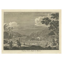
View AllThe Death of Commander Fleuriot de Langle and His Men at Maouna, Samoa, 1797
Located in Langweer, NL
The engraving depicts a harrowing and chaotic scene from an 18th-century exploration, specifically the tragic event involving Commander Fleuriot de Langle and his men. The scene is s...
Category
Antique 1790s Prints
Materials
Paper
$399 Sale Price
20% Off
Free Shipping
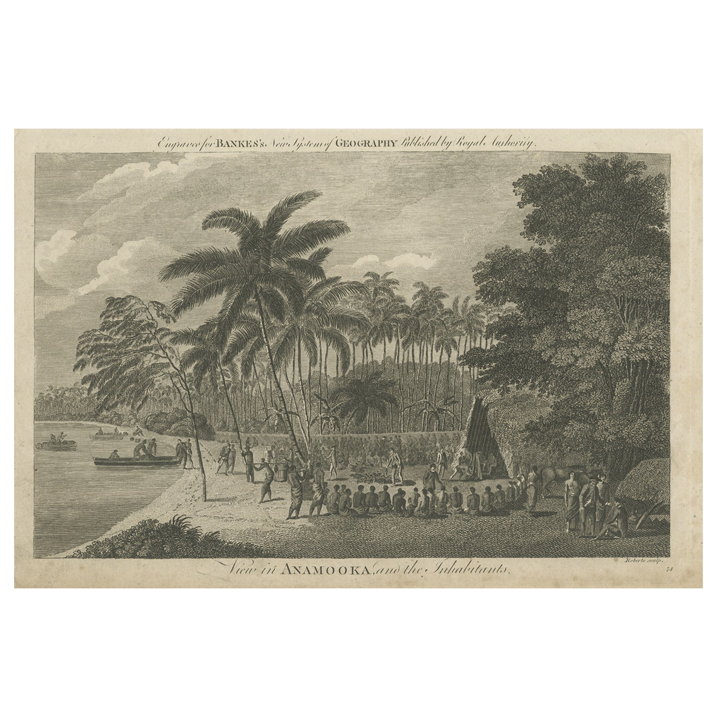
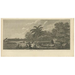
Antique Print of the Marketplace in Anamooka, Tonga Islands, c.1790
Located in Langweer, NL
Antique print titled 'View in Anamooka and the Inhabitants'. Depicts the marketplace that was established in a ring in front of the main house in Anamooka, Tonga - named the Friendly Islands because of his reception when James Cook's third Pacific voyage arrived there in May 1777.
Artists and Engravers: Engraved for Bankes's 'New System of Geography'. Published by Royal Authority.
Condition: Good, age-related toning. Please study image carefully.
Date: c.1790
Overall size: 38.6 x 23.2 cm.
Image size: 30.6 x 21.5 cm.
A View at Anamooka
This engraving after a drawing comes from the official account of Cook's third voyage, 'A voyage to the Pacific Ocean'.
Captain James Cook (1728-1779) made three separate voyages to the Pacific (with the ships Endeavour, Resolution, Adventure, and Discovery) and did more than any other voyager to explore the Pacific and Southern Ocean. Cook not only encountered Pacific cultures for the first time, but also assembled the first large-scale collections of Pacific objects to be brought back to Europe. He was killed in Hawaii in 1779.
Cook was in Nomuka (Annamooka), Tonga or Friendly Isles from May 1-14, 1777.
"On May 2 1777 the expedition reached Nomuka and anchored in the harbour on the north side of the island, which Cook had already used in June 1774. Both ships were in want of refreshments. A camp was erected on shore both as a trading post and a workshop for repairs. Watering, cutting wood...
Category
Antique 18th Century Prints
Materials
Paper
$228 Sale Price
20% Off
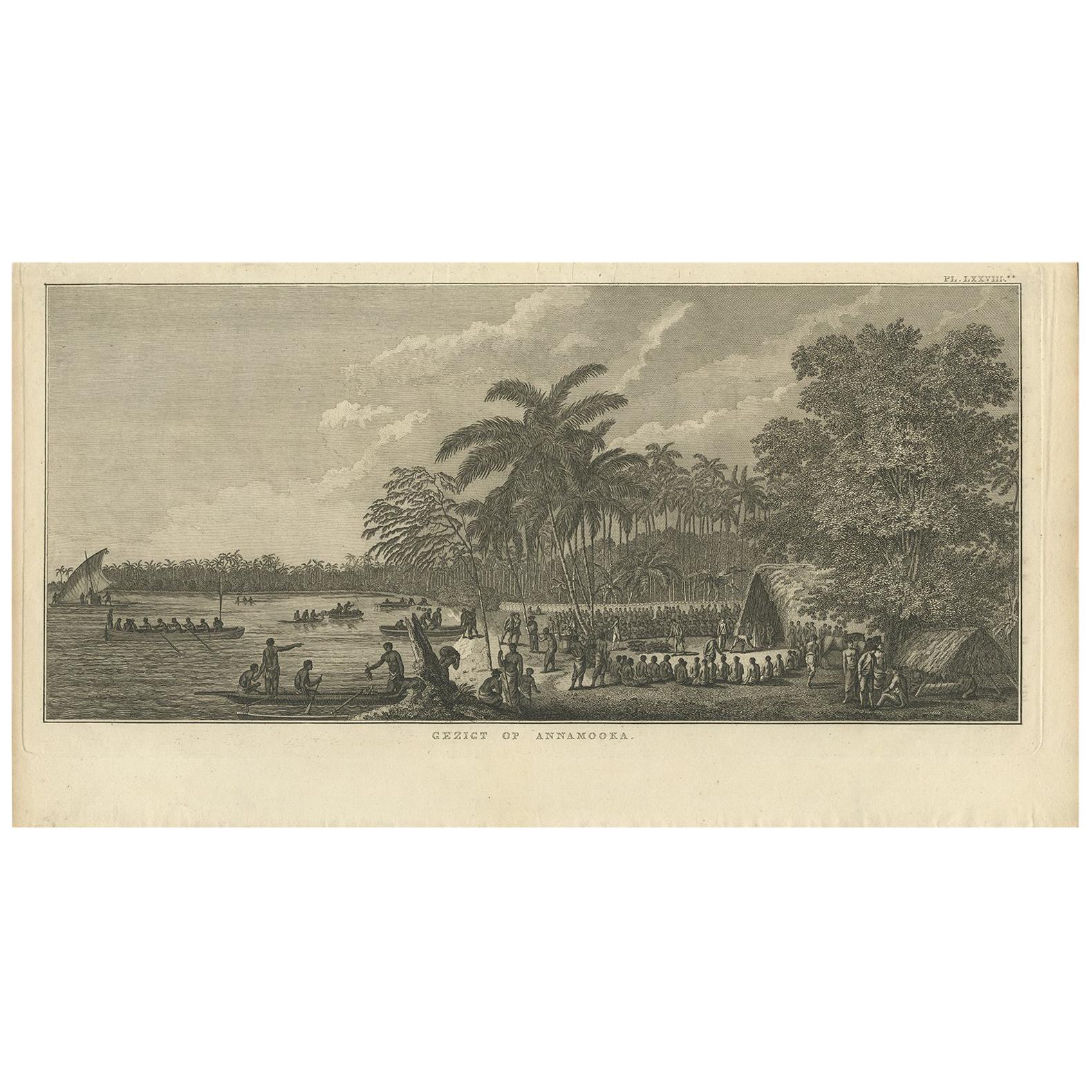
Antique Print of Annamooka, Tonga Islands, by Cook '1803'
Located in Langweer, NL
Antique print titled 'Gezigt op Annamooka'. This print depicts the Harbour of Annamooka, now Nomuka, part of the Ha’apai group of Tonga. Originates from 'Reizen rondom de Waereld' by...
Category
Antique Early 19th Century Dutch Prints
Materials
Paper
$356 Sale Price
20% Off
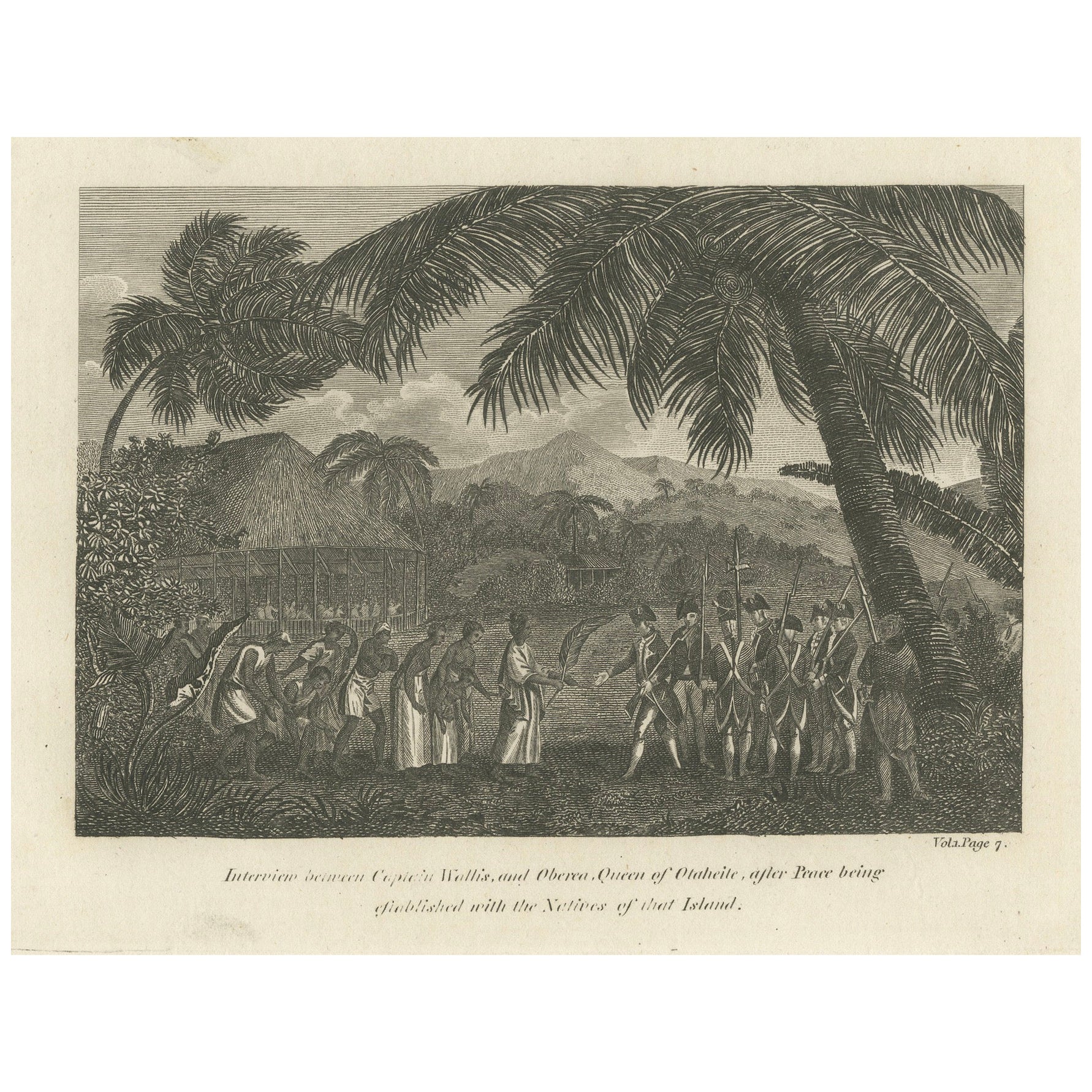
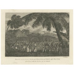
Diplomatic Dawn: The First Encounter of Wallis with Queen Oberea of Tahiti, 1801
Located in Langweer, NL
The engraving titled "Interview Between Captain Wallis And Oberea, Queen Of Otaheite" captures a pivotal moment between British explorer Captain Samuel Wallis and the Tahitian Queen ...
Category
Antique Early 1800s Prints
Materials
Paper
$304 Sale Price
20% Off
Free Shipping
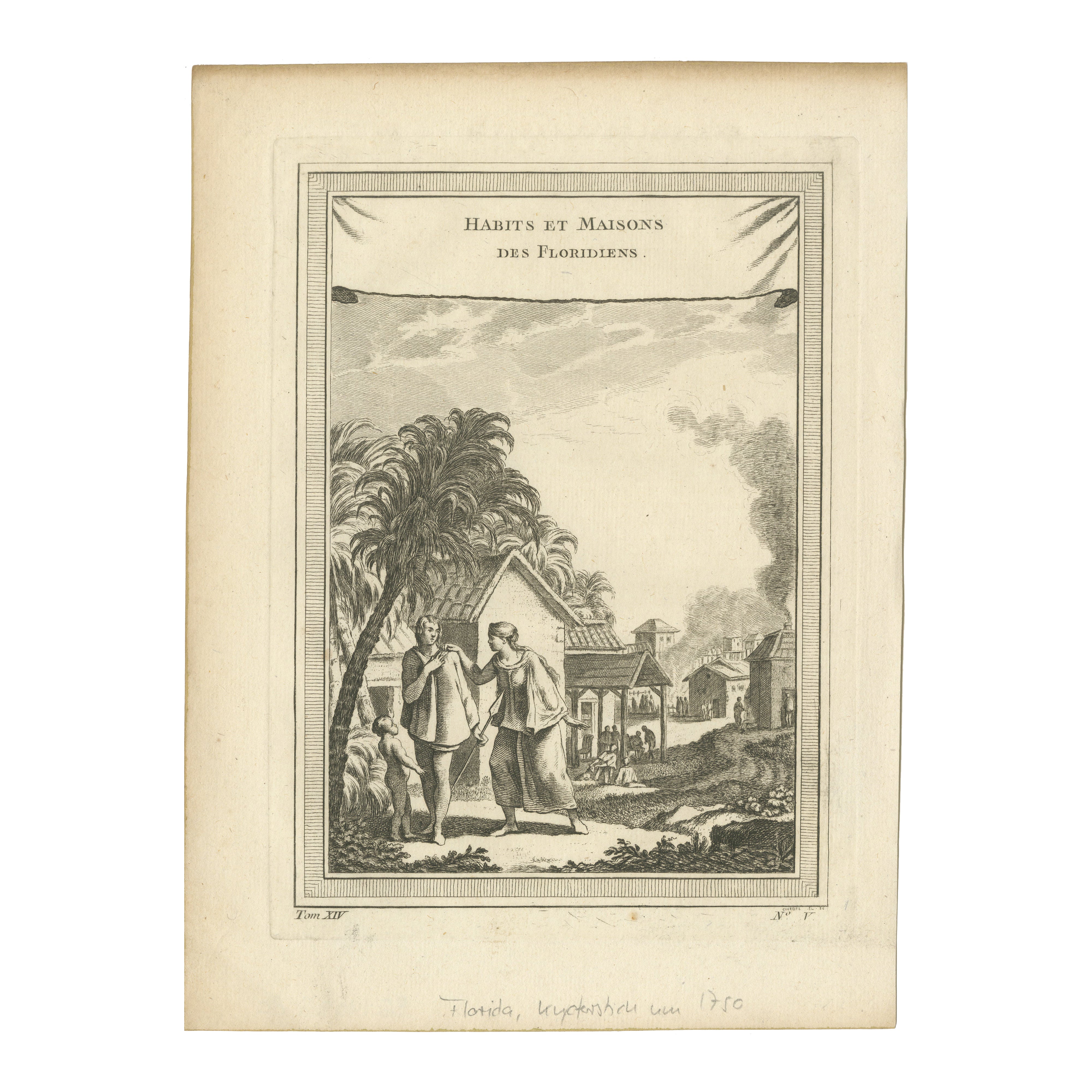
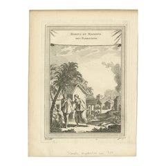
1757 Engraving of Florida Natives – Indigenous Clothing & Village Scene
Located in Langweer, NL
Title: 1757 Engraving of Florida Natives – Indigenous Clothing & Village Scene
Description: This striking 1757 antique copperplate engraving, 'Habits et Maisons des Floridiens', ...
Category
Antique 1750s Prints
Materials
Paper
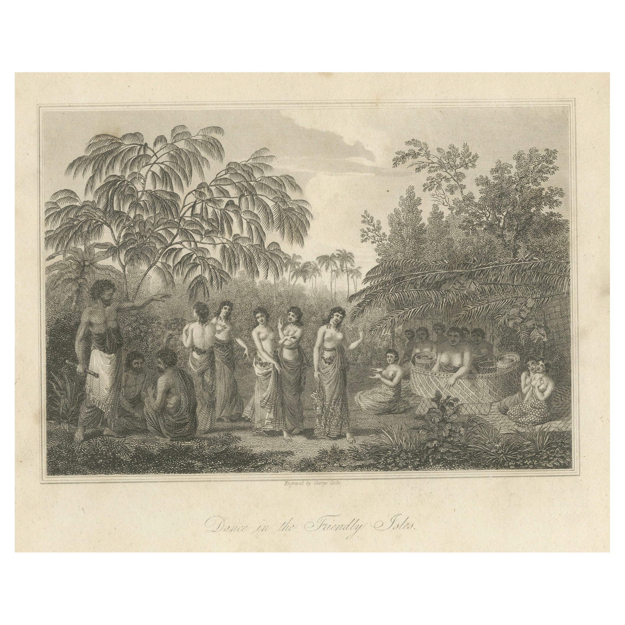
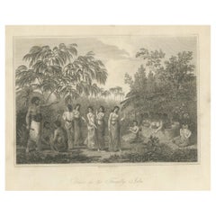
Rhythms of the Pacific: A Communal Dance in Tonga, Engraving Published in 1812
Located in Langweer, NL
The engraving depicts a serene and communal scene labeled as "Dance in the Friendly Isles." The Friendly Isles is an older name for the Kingdom of Tonga in the South Pacific. This pi...
Category
Antique Early 19th Century Prints
Materials
Paper
$247 Sale Price
20% Off
Free Shipping
You May Also Like
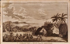
A View of Kauai, Hawaii as Seen by Captain Cook: An Original 18th C. Engraving
By John Webber
Located in Alamo, CA
"An Inland View in Atooi, One of the Sandwich Islands (Kauai, Hawaii)" is an original 18th century engraving from a drawing by John Webber (1751-1793), who was the artist who accompa...
Category
1780s Landscape Prints
Materials
Engraving
An Inland View; in Atooi ( Hawaii ) 1784 Captain Cook engraving by John Webber
By John Webber
Located in Paonia, CO
An Inland View in Atooi ( Hawaii ) is from the 1784 First Edition Atlas Accompanying Capt. James Cook and King; Third and Final Voyage of Captain James Cook. This engraving depicts ...
Category
1780s Realist Landscape Prints
Materials
Engraving
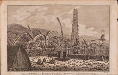
A View of Kauai, Hawaii Discovered by Captain Cook: Original 18th C. Engraving
By John Webber
Located in Alamo, CA
"View of A Morai or Burial Place of Atooi, One of the Sandwich Islands (Kauai, Hawaii)" is an original 18th century engraving from a drawing by John Webber (1751-1793), who was the a...
Category
1780s Landscape Prints
Materials
Engraving
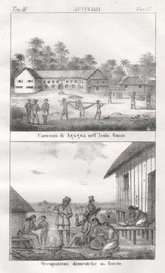
Guam, Convent and native inhabitants, mid 19th century lithograph. Oceania.
Located in Melbourne, Victoria
'Convento di agagna nell' Isola Guam. Occupazioni domestiche in Guam.'
Italian lithograph, c1841. Originally from 'Galleria universale di tutti i popoli del mondo' by Giuseppe Anton...
Category
Mid-19th Century Naturalistic Figurative Prints
Materials
Lithograph
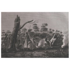
Original Antique Ethnographical Print, Figures, New South Wales, Australia, 1809
Located in St Annes, Lancashire
Wonderful ethnographical print.
A copper-plate engraving after Lesieur
Published by Sherwood, Neely & Jones. Dated 1809
Unframed.
Category
Antique Early 1800s English Folk Art Prints
Materials
Paper
"A Dance in Otaheite" (Tahiti), Engraving from Captain Cook's 3rd Voyage
By John Webber
Located in Alamo, CA
"A Dance in Otaheite" (Tahiti) is an engraving created by William Sharp (1749-1824), from a drawing by John Webber (1752-1793), who was the artist on Captain James Cook's 3rd and final voyage of discovery. It is a plate in the atlas of "A Voyage to the Pacific Ocean Undertaken by the Command of His Majesty, for Making Discoveries in the Northern Hemisphere", the official British Admirality sanctioned journal published upon completion of the voyage in London in 1784 by Strahan & Cadell.
Two women and two men wearing ceremonial costumes, performing a dance outdoors standing on a mat. Three men are playing the drums in the background, in front of a thatched roof building. An audience of men are sitting on both sides of the stage. By the time Webber arrived in Tahiti, 'south sea' imagery had become familiar. Webber gave concentrated attention to dance. He had the opportunity to distinguish the Tahitian dance from the more formalized dancing of Tonga. Whereas they seem to have called to mind the more formal dances of antiquity, the Tahitian dancing aroused memories of peasant and folk dancing.
This engraving is professionally framed in Koa wood. Koa wood is legendary in Hawaii. Not only is this amazing wood native to Hawaii, but it is known for the deep rich colors and varied grain pattern. Koa has an honored heritage in Hawaii and is highly revered and sacred. The word “koa” means “warrior” in Hawaiian. The warriors of King Kamehameha the Great, created canoes and weapons from a wood plentiful on the Big Island of Hawaii. This wood became synonymous with the warriors themselves, and it became known as koa.
The print is in excellent condition.
There are three other engravings listed from the official journal of Captain Cook's 3rd voyage available that are presented in identical Koa wood frames and double mats (LU117324682432, LU117324684052, LU117324684062). They would make a wonderful grouping for a display of 2, 3 or 4 prints. A discount is available for a grouping depending on the number of items included.
Hawaii was discovered by Captain Cook during this voyage. Hawaii was originally called The Sandwich Islands in honor of The Earl of Sandwich...
Category
1780s Realist Landscape Prints
Materials
Engraving