Items Similar to Educational Lithograph of Earth’s Surface from German Geography Book, circa 1885

Want more images or videos?
Request additional images or videos from the seller
1 of 10
Educational Lithograph of Earth’s Surface from German Geography Book, circa 1885
$107.26
£79.43
€90
CA$147.77
A$164.29
CHF 86.51
MX$1,993.36
NOK 1,095.26
SEK 1,023.80
DKK 685.06
About the Item
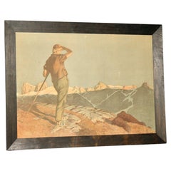
Educational Lithograph of Earth’s Surface from 19th Century German Geography Book
This richly detailed educational print, titled Die Oberfläche der Erde (The Surface of the Earth), comes from the renowned 19th-century German illustrated series Geographische Charakterbilder, published by J. F. Schreiber in Esslingen and Munich. It was issued as part of the third volume of Bilder zum Anschauungs-Unterricht, a visual teaching aid for geography lessons, likely dating from the 1880s to 1890s.
The print depicts an imaginative composite landscape designed to illustrate a wide range of geographical features in a single cohesive scene. It includes snow-covered mountains, a smoking volcano, glacier flows, a high waterfall, a lake draining into a river, and a delta spilling into the sea. Alongside these natural formations are human elements such as a lighthouse, a coastal town, a sailing ship and steamboat, a railway with a viaduct and a tunnel, and a country road with a horse and cart. The print also shows dunes created by sand washed ashore, as well as reefs, islands, and a train winding its way through a mountainous valley.
This lithograph is not based on a real place but was created to visually communicate a broad overview of Earth’s surface formations in a way that could be easily understood by schoolchildren. It reflects the 19th-century ideal of combining art and education, and the accompanying text offers an explanation of each feature. The work is printed in vivid chromolithography, a technique widely used at the time for educational materials because of its clarity and colorfulness.
J. F. Schreiber was one of the most influential publishers of educational wall and book illustrations in Germany, and this print exemplifies the high quality of both their artistry and pedagogy.
Condition report:
The print is in very good condition with strong original colors. Light toning consistent with age. Marginal wear may be present but does not affect the image. No tears or major blemishes are visible.
Framing tips:
This piece would look elegant in a natural wood or walnut frame with a cream or warm off-white mat. For a more formal academic look, a black frame with a gold inner lining would also suit the historical nature of the print.
- Dimensions:Height: 12.29 in (31.2 cm)Width: 15.83 in (40.2 cm)Depth: 0.01 in (0.2 mm)
- Materials and Techniques:
- Place of Origin:
- Period:
- Date of Manufacture:circa 1885
- Condition:The print is in good condition with strong original colors. Light toning consistent with age. Marginal wear may be present but does not affect the image. No tears or major blemishes are visible. Fold as issued.
- Seller Location:Langweer, NL
- Reference Number:Seller: BG-12956-11stDibs: LU3054345620282
About the Seller
5.0
Recognized Seller
These prestigious sellers are industry leaders and represent the highest echelon for item quality and design.
Platinum Seller
Premium sellers with a 4.7+ rating and 24-hour response times
Established in 2009
1stDibs seller since 2017
2,569 sales on 1stDibs
Typical response time: <1 hour
- ShippingRetrieving quote...Shipping from: Langweer, Netherlands
- Return Policy
Authenticity Guarantee
In the unlikely event there’s an issue with an item’s authenticity, contact us within 1 year for a full refund. DetailsMoney-Back Guarantee
If your item is not as described, is damaged in transit, or does not arrive, contact us within 7 days for a full refund. Details24-Hour Cancellation
You have a 24-hour grace period in which to reconsider your purchase, with no questions asked.Vetted Professional Sellers
Our world-class sellers must adhere to strict standards for service and quality, maintaining the integrity of our listings.Price-Match Guarantee
If you find that a seller listed the same item for a lower price elsewhere, we’ll match it.Trusted Global Delivery
Our best-in-class carrier network provides specialized shipping options worldwide, including custom delivery.More From This Seller
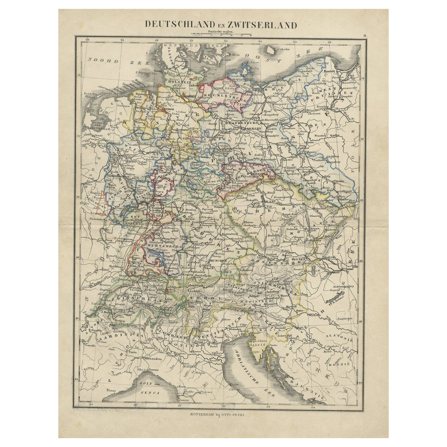
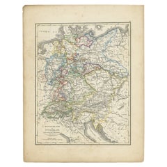
View AllAntique Map of Germany and Switzerland from an Old Dutch School Atlas, c.1873
Located in Langweer, NL
Antique map titled 'Deutschland en Zwitserland'. Old map depicting Germany and Switzerland. This map originates from 'School-Atlas van alle Deelen der Aarde'. Artists and Engravers: ...
Category
Antique 19th Century Maps
Materials
Paper
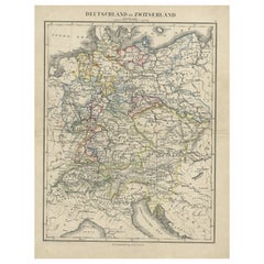
$104 Sale Price
20% Off
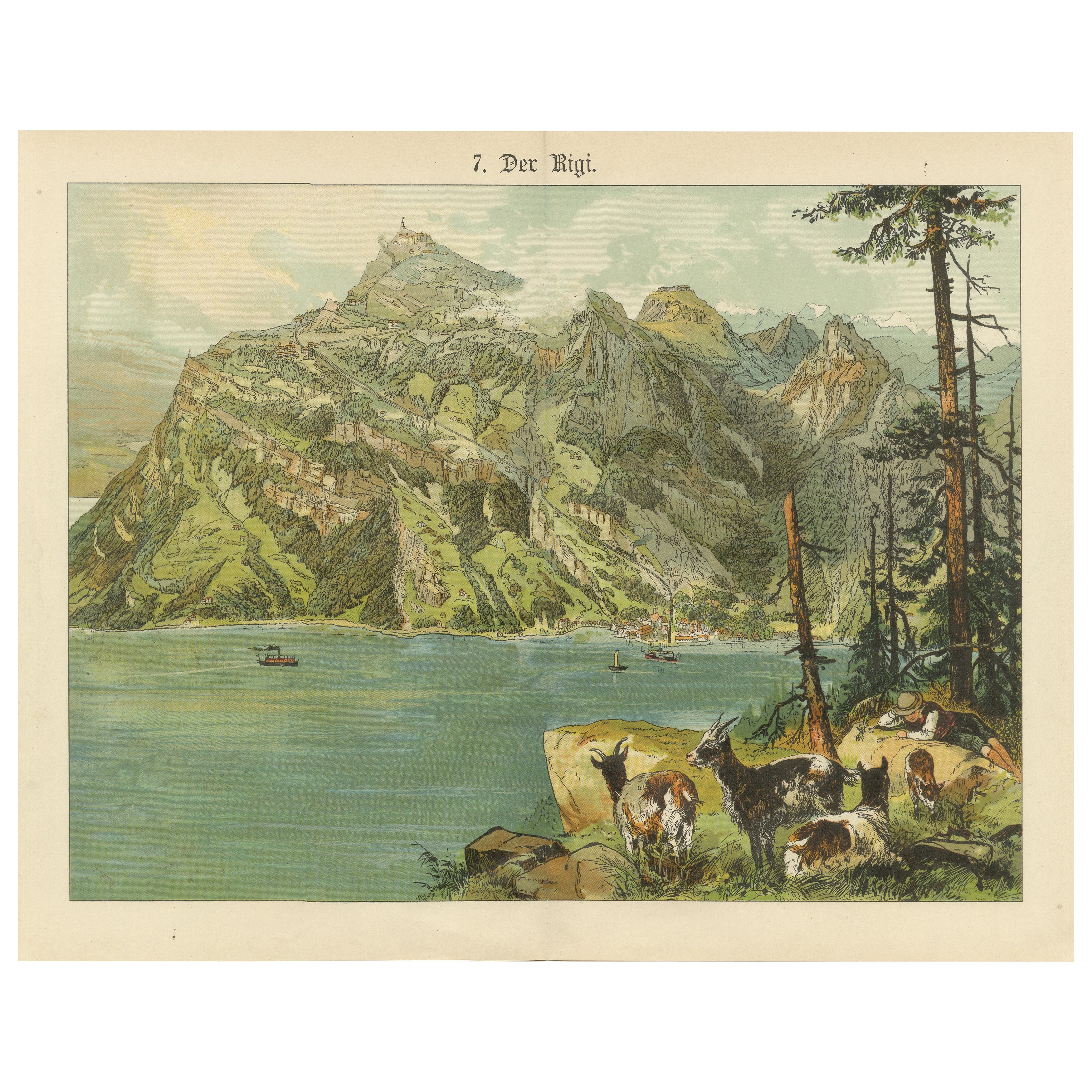
Antique Chromolithograph of Mount Rigi and Lake Lucerne, Switzerland, ca. 1885
Located in Langweer, NL
Antique Chromolithograph of Mount Rigi and Lake Lucerne, Switzerland, ca. 1890
This vibrant chromolithograph, titled “Der Rigi,” offers a sweeping and idyllic view of Mount Rigi ris...
Category
Antique Late 19th Century German Prints
Materials
Paper

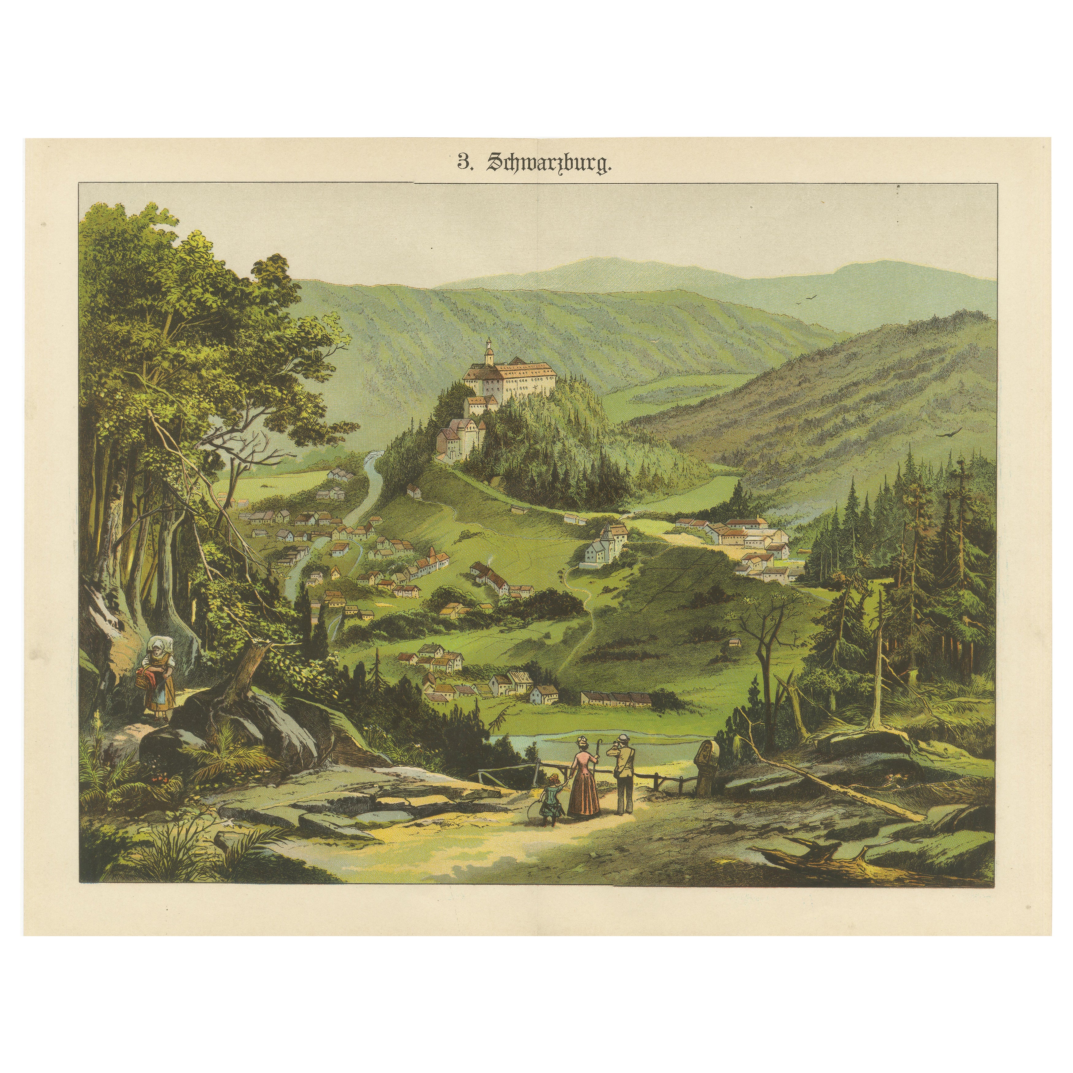
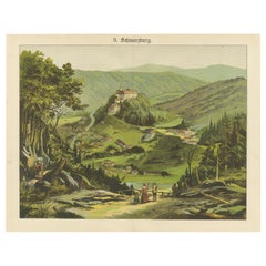
Antique Chromolithograph of Schwarzburg Castle and Village, circa 1885
Located in Langweer, NL
Antique Chromolithograph of Schwarzburg Castle and Village, circa 1890
Description:
This striking antique chromolithograph, dating from around 1890, captures a richly detailed and a...
Category
Antique Late 19th Century German Prints
Materials
Paper
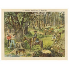
Antique Chromolithograph of German Settlement in America, circa 1890
Located in Langweer, NL
Antique Chromolithograph of German Settlement in America, circa 1890
Description:
This richly detailed chromolithograph, titled “Deutsche Ansiedelung in Amerika” (German Settlement ...
Category
Antique Late 19th Century German Prints
Materials
Paper
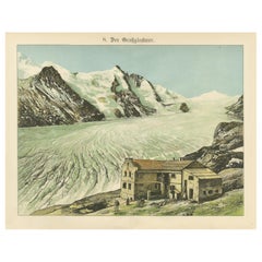
Antique Chromolithograph of the Großglockner Glacier and Alpine Lodge, ca. 1885
Located in Langweer, NL
Antique Chromolithograph of the Großglockner Glacier and Alpine Lodge, ca. 1890
This impressive chromolithograph, titled “Der Großglockner,” captures the dramatic alpine landscape s...
Category
Antique Late 19th Century German Prints
Materials
Paper
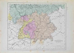
Antique Map of Germany and Switzerland from an Old Dutch School Atlas, 1852
Located in Langweer, NL
Antique map titled 'Duitschland en Zwitersland'. Map of Germany and Switzerland. This map originates from 'School-Atlas van alle deelen der Aarde' by Otto Petri. Artists and Engraver...
Category
Antique 19th Century Maps
Materials
Paper
$114 Sale Price
20% Off
You May Also Like
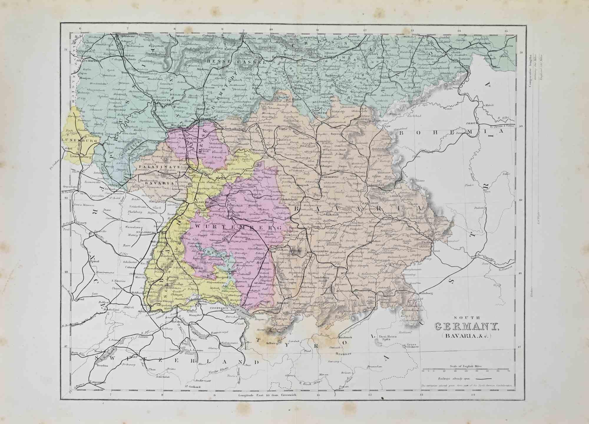
South Germany - Lithograph - 1872
Located in Roma, IT
South Germany is a map realized by an artist during the 19th century.
Lithograph, printed in 1872 by Milliam Mackenzie, London.
Good condition.
Category
1870s Modern Figurative Prints
Materials
Lithograph
South Germany - Lithograph - 1872
Located in Roma, IT
South Germany is an artwork realized by an artist during the 19th century.
Lithograph, printed in 1872 by Milliam Mackenzie, London.
Good condition.
Category
1870s Modern Figurative Prints
Materials
Lithograph

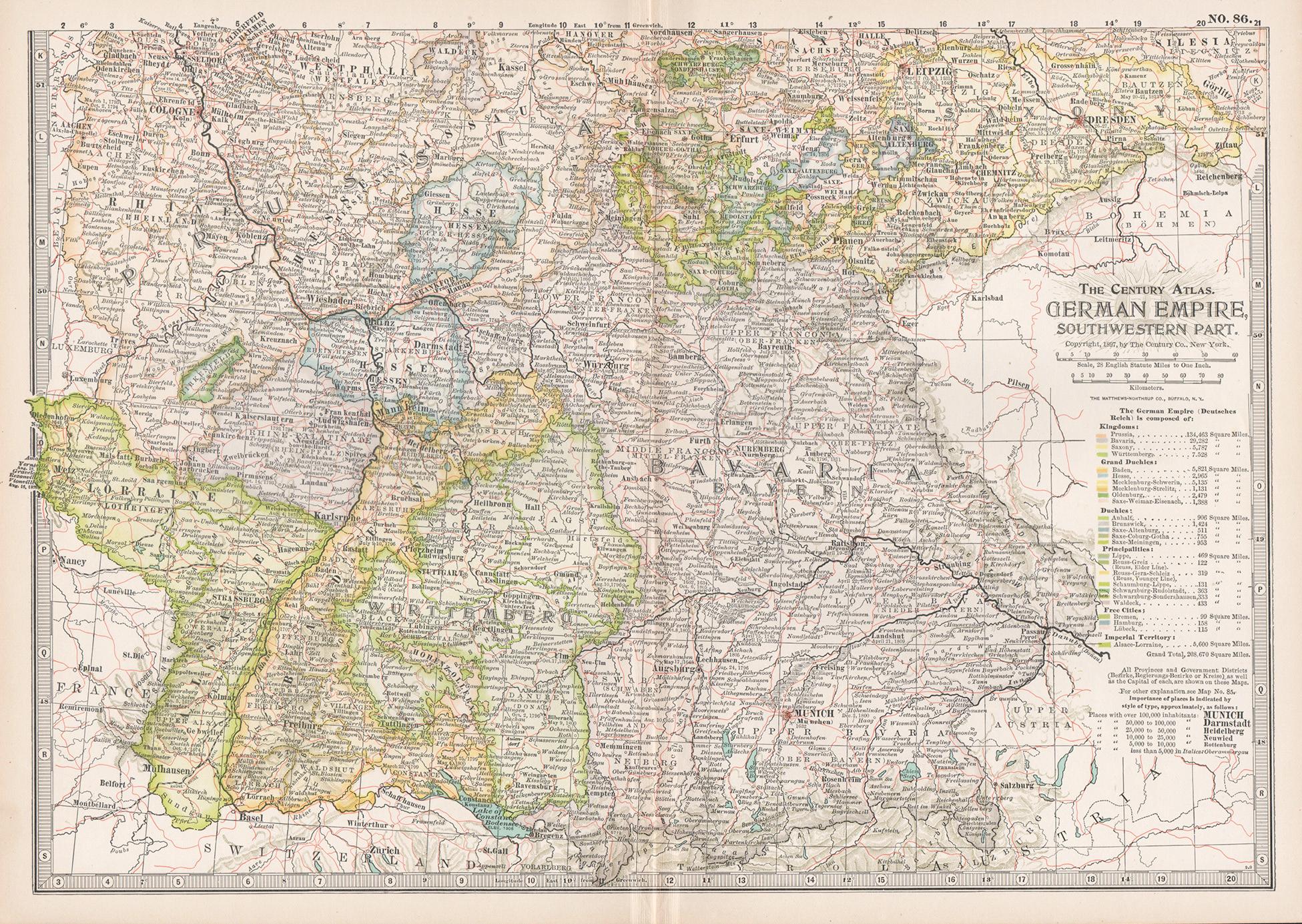
German Empire, Southwestern Part. Century Atlas antique vintage map
Located in Melbourne, Victoria
'The Century Atlas. German Empire, Southwestern Part'
Original antique map, 1903.
Central fold as issued. Map name and number printed on the reverse co...
Category
Early 20th Century Victorian More Prints
Materials
Lithograph

German Empire, Northern Part. Century Atlas antique vintage map
Located in Melbourne, Victoria
'The Century Atlas. German Empire, Northern Part.'
Original antique map, 1903.
Central fold as issued. Map name and number printed on the reverse corne...
Category
Early 20th Century Victorian More Prints
Materials
Lithograph

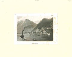
Ancient View of Hallstadt - Original Lithograph - Mid-19th Century
Located in Roma, IT
Ancient View of Hallstadt is an original modern artwork realized in the mid-19th Century.
Original B/W Lithograph on Ivory Paper.
Inscripted on the lower margin in capital Letter...
Category
Mid-19th Century Modern Landscape Prints
Materials
Lithograph
Swiss Oberland landscape lithography circa 1900
Located in grand Lancy, CH
Swiss Oberland alp near Bern lithography signed circa 1900 little scratches on the paper see photo
Category
Early 20th Century Swiss Prints
Materials
Wood, Paper
More Ways To Browse
Lighthouse Antique
Pre Columbian Mayan
Rabbit Carving
Red Crowned Crane
Red Velvet Bed
Retro Suitcase Set
Rings 1600 Century
Roe Deer Mounts
Rolled Gold Germany
Roly Poly Table
Rooster Box
Royale Living Vintage Furniture
Russian Vodka
Salviati Mosaic
Samuel Marti French Clocks
Sevres Tuileries
Silver Hunt Cups
Skull Table