Items Similar to The First Australian Tourist to Visit England: Bennelong of the Eora Nation 1802

Want more images or videos?
Request additional images or videos from the seller
1 of 6
The First Australian Tourist to Visit England: Bennelong of the Eora Nation 1802
$517.60
$64720% Off
£385.25
£481.5620% Off
€432
€54020% Off
CA$708.98
CA$886.2220% Off
A$788.54
A$985.6820% Off
CHF 411.75
CHF 514.6920% Off
MX$9,595.70
MX$11,994.6220% Off
NOK 5,258.69
NOK 6,573.3720% Off
SEK 4,931.73
SEK 6,164.6620% Off
DKK 3,288.67
DKK 4,110.8320% Off
Shipping
Retrieving quote...The 1stDibs Promise:
Authenticity Guarantee,
Money-Back Guarantee,
24-Hour Cancellation
About the Item
The engraving by Samuel Neele, titled "Portrait of Bennilong," is a significant historical representation from G. A. Cooke's "Modern and Authentic System of Universal Geography," published in circa 1802.
It portrays Bennelong, an Eora man from New Holland (now Australia), who learned English and traveled to England with Governor Arthur Phillip in 1792. This image reflects Bennelong's unique position as a cultural intermediary and is a remarkable example of early cross-cultural encounters between Indigenous Australians and Europeans.
Some more interesting facts about Woollarawarre Bennelong from an article in the Independent of March 2011:
The grave of Woollarawarre Bennelong, an Aboriginal leader who played a key role in early Australian colonial history, has been discovered in a suburban front garden – solving a 200-year-old mystery.
One of the first Aborigines to interact with British colonists, Bennelong – a senior member of the Wangal tribe – struck up a friendship with the first governor of New South Wales, Arthur Phillip. When Phillip sailed home to England, he took the Wangal man with him, dressed him in Regency finery and introduced him to London high society. When Bennelong returned to Australia, he was ostracised by the indigenous and European communities. In 1813, having sunk into alcoholism, he died – but exactly where he was buried has been the subject of speculation ever since.
Now, after protracted detective work by an environmental scientist, Peter Mitchell, Bennelong's final resting-place has been found, The Sun-Herald newspaper reported yesterday. The discovery represents the missing link in Bennelong's extraordinary story, and is certain to reignite interest in a man who tried to bridge the gap between black and white – a challenge still facing Australians today.
Dr Mitchell, the honourary associate professor of physical geography at Sydney's Macquarie University, scoured the archives for references to the grave, which he matched against geographical records to place it in the Sydney suburb of Putney. Surveyors from the local Ryde Council then pinpointed its location, between a front lawn and a central reservation.
Before urban sprawl took over, the area was part of the estate of James Squire, Australia's first commercial brewer, who has given his name to a line of popular modern beers. An ex-convict, Squire befriended Bennelong before he died and buried him in his own orchard.
The precise location of the grave is being kept secret, until Aboriginal leaders have been consulted about the next steps. Ryde Council wants to use ground-penetrating equipment to explore the site. A Ryde councillor, Vic Tagg, described the find as "fantastic", saying it would rewrite history.
Relations between Bennelong and Phillip got off to an unpromising start in 1789, nearly two years after the First Fleet arrived in Sydney Cove. Curious to learn more about Aboriginal language and customs, Phillip had a group of men kidnapped while they were fishing in Manly, on the northern side of the harbour.
All escaped within a week, except Bennelong, who spent six months living in Government House. Phillip gave him European clothes, taught him English and introduced him to the finer points of table etiquette. A First Fleet captain, Watkin Tench, described him as "about 26 years old, of good stature and stoutly made with a bold intrepid countenance which bespoke defiance and revenge".
After Bennelong, too, ran away, Phillip tracked him down and the friendship was re-established – despite an unfortunate incident in which Phillip got speared in the shoulder by a fellow tribesmen of Bennelong.
A cultural intermediary, Bennelong encouraged the British to learn the Wangals' language and customs. Phillip had a brick hut built for his friend on a peninsula now known as Bennelong Point, the site of the Sydney Opera House. And when he returned to England in 1792, he took Bennelong and another man, Yemmerrawannie, with him, and – as anecdote has it – presented them to King George III. Whether that happened is contested by historians. But certainly the pair – decked out in the breeches, buckled shoes, ruffled lace shirts and waistcoats of that period – became popular guests in the salons of the rich and famous. And while the idea of them being paraded around seems tasteless now, they reportedly found London as exotic and fascinating as London found them.
The men boarded in Grosvenor Square, in Mayfair, where they were attended by barbers and servants. They saw a play at the Covent Garden Theatre and went to the opera. They visited the Tower of London and St Paul's Cathedral, and looked in on the trial of Warren Hastings, a former governor of Bengal who was being impeached. "They were the first Australian tourists," according to one historian.
Bennelong adopted English manners; he "bowed, toasted, paid the ladies compliments and loved wine", according to one account.
But he grew increasingly ill and homesick, particularly after his friend died of pneumonia. In 1795 he sailed back to Australia. But relations between black and white had deteriorated and he was shunned by Aborigines and Australians. He died a lonely alcoholic, but his legacy survives.
This is a circa 1801 or 1802 copperplate engraving from George Alexander Cooke's "Universal Geography" .
The print is part of George Alexander Cooke's comprehensive work "A Modern and Authentic System of Universal Geography." This book was a significant compilation of geographical knowledge during the late 18th century, offering descriptions and accounts of various parts of the world, influenced by the age of exploration. It includes narratives of famed explorers like Captain James Cook and Ferdinand Magellan, detailing their discoveries and journeys that expanded the European understanding of the globe. Cooke's work served as both a chronicle and reference for the territories and cultures encountered by these voyagers.
- Dimensions:Height: 10.44 in (26.5 cm)Width: 7.88 in (20 cm)Depth: 0 in (0.02 mm)
- Materials and Techniques:Paper,Engraved
- Period:
- Date of Manufacture:circa 1801
- Condition:Good. Aged paper with typically warm, yellowish-brown hue. Some of the text is frayed. This is not a reproduction but an original engraving. Study the image carefully.
- Seller Location:Langweer, NL
- Reference Number:Seller: BG-13597-271stDibs: LU3054337825612
About the Seller
5.0
Recognized Seller
These prestigious sellers are industry leaders and represent the highest echelon for item quality and design.
Platinum Seller
Premium sellers with a 4.7+ rating and 24-hour response times
Established in 2009
1stDibs seller since 2017
2,502 sales on 1stDibs
Typical response time: <1 hour
- ShippingRetrieving quote...Shipping from: Langweer, Netherlands
- Return Policy
Authenticity Guarantee
In the unlikely event there’s an issue with an item’s authenticity, contact us within 1 year for a full refund. DetailsMoney-Back Guarantee
If your item is not as described, is damaged in transit, or does not arrive, contact us within 7 days for a full refund. Details24-Hour Cancellation
You have a 24-hour grace period in which to reconsider your purchase, with no questions asked.Vetted Professional Sellers
Our world-class sellers must adhere to strict standards for service and quality, maintaining the integrity of our listings.Price-Match Guarantee
If you find that a seller listed the same item for a lower price elsewhere, we’ll match it.Trusted Global Delivery
Our best-in-class carrier network provides specialized shipping options worldwide, including custom delivery.More From This Seller
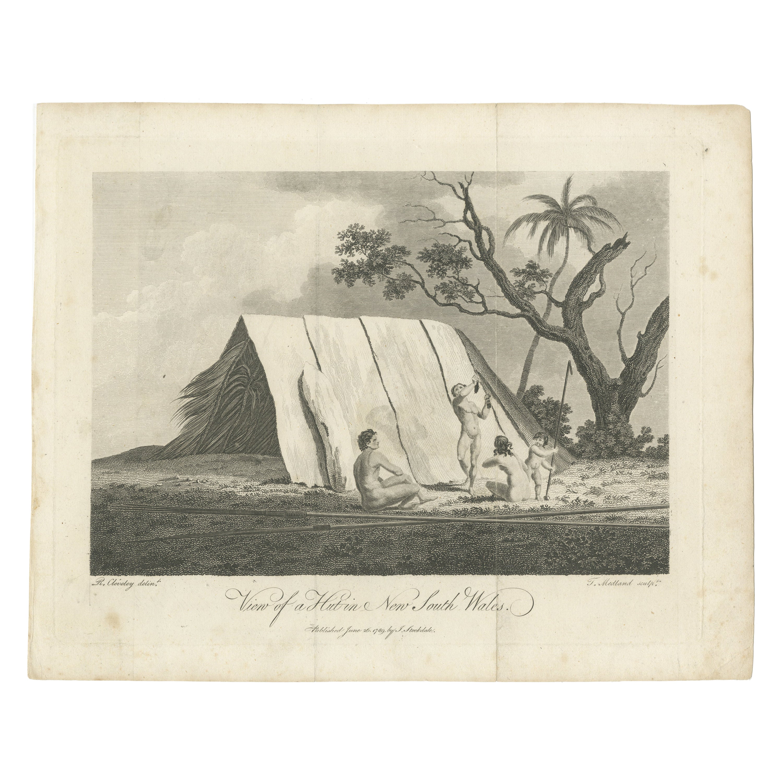
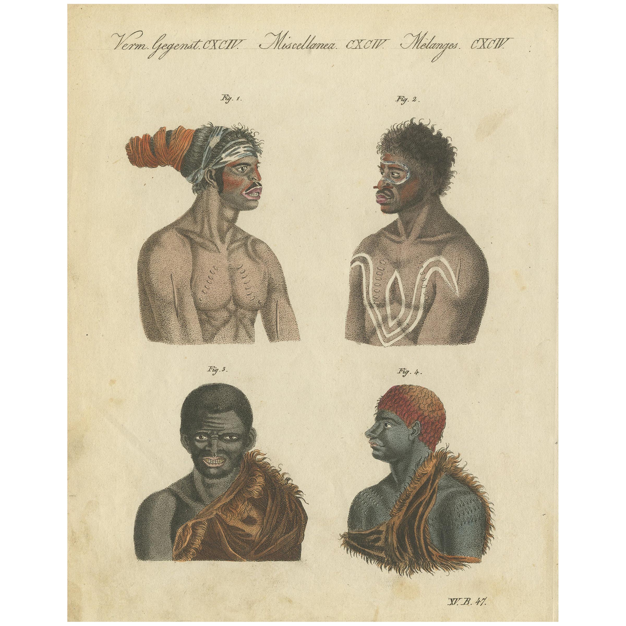
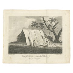
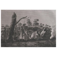
View AllScarce Print of Natives in New South Wales, Australia, c.1789
Located in Langweer, NL
Title: View of a Hut in New South Wales
Description: Scarce c.18th First Fleet period engraving depicting Australian aborigines from the account by Governor Arthur Phillip.
Artist: Robert Cleveley (1747-1809) Third brother of James Cleveley who was famous painting the death...
Category
Antique 1780s Prints
Materials
Paper
$249 Sale Price
20% Off
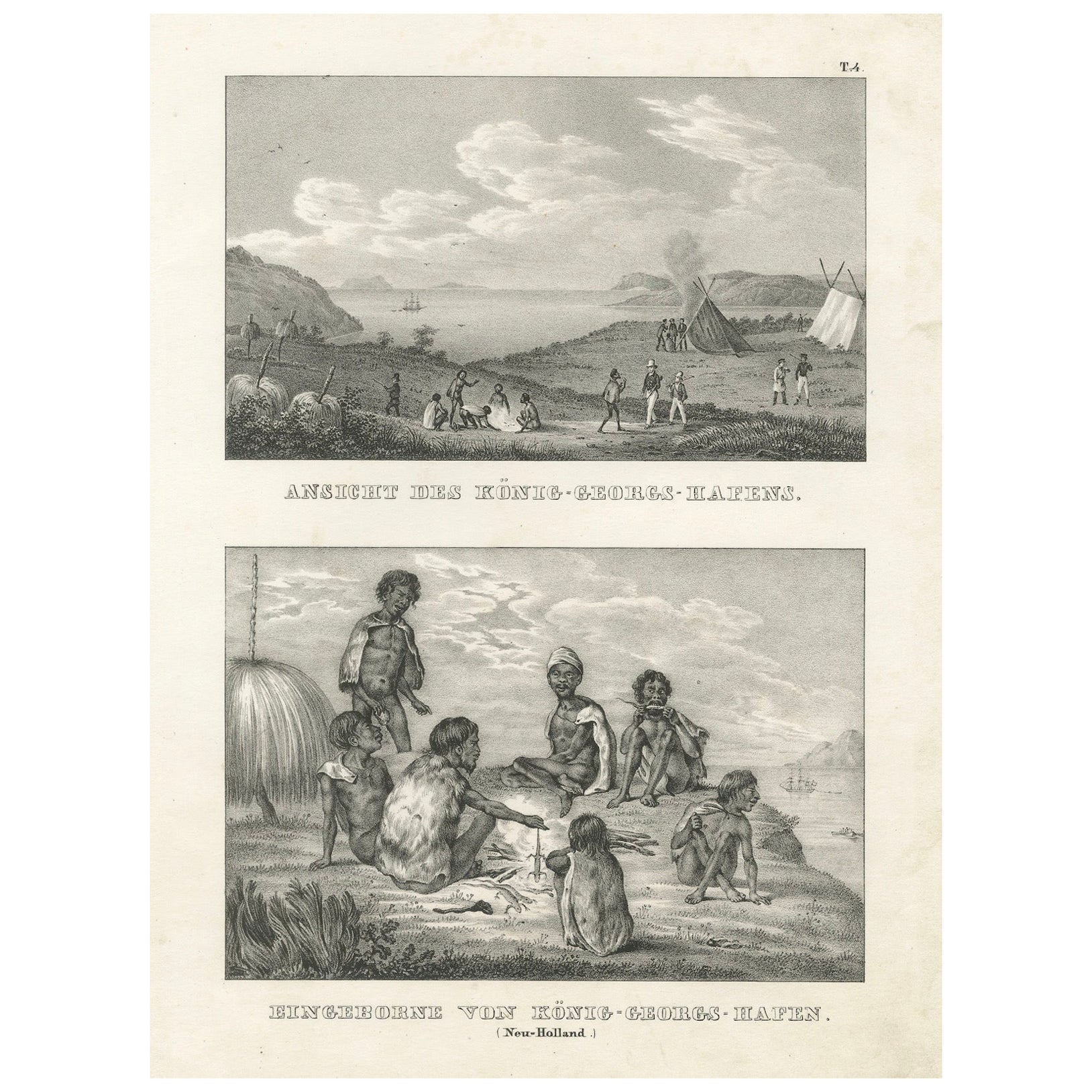
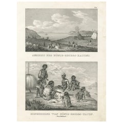
Scenes from King George's Harbour, New Holland (modern-day Australia), 1836
Located in Langweer, NL
Title: Scenes from King George's Harbour, New Holland
Description: This lithograph, circa 1836, offers a fascinating double depiction of life at King George's Harbour (modern-day ...
Category
Antique 1830s Prints
Materials
Paper
Divine Honors Bestowed Upon Captain Cook: A Ceremonial Encounter, circa 1820
Located in Langweer, NL
This is an antique print titled "Onori divini fatti a Cook," which translates to "Divine honors given to Cook." It likely depicts a moment when Captain James Cook, the famed British ...
Category
Antique Early 19th Century Prints
Materials
Paper
$191 Sale Price
20% Off
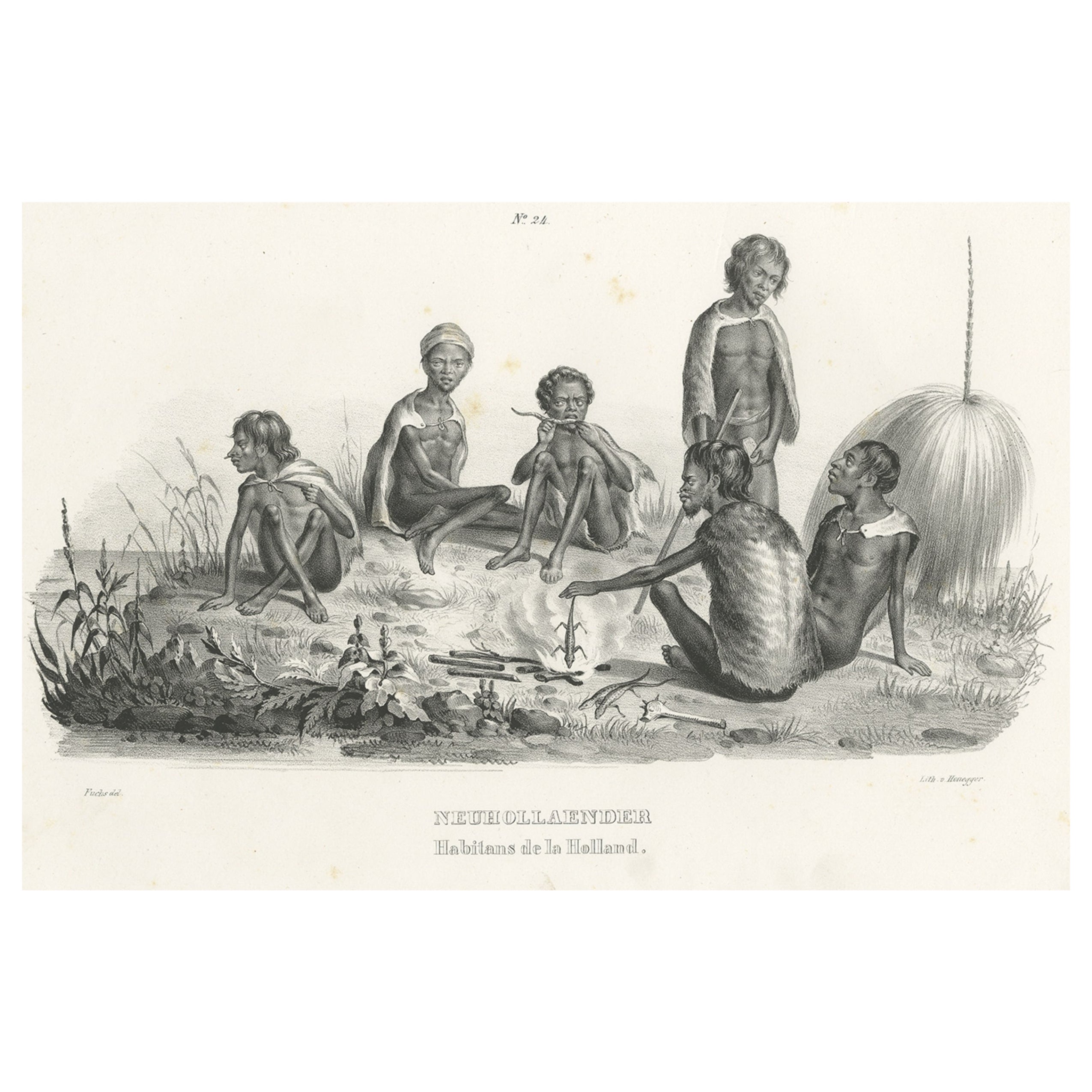
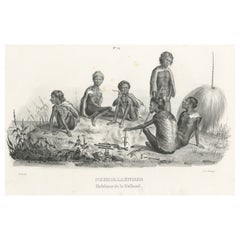
Original Old View of Aboriginals, Inhabitants of New Holland 'Australia', c.1845
Located in Langweer, NL
Antique print titled 'Neuhollaender, Habitans de la Holland'.
This print depicts inhabitants of New Holland, Australia. Originates from 'Naturgeschicht...
Category
Antique 1840s Prints
Materials
Paper
$277 Sale Price
20% Off
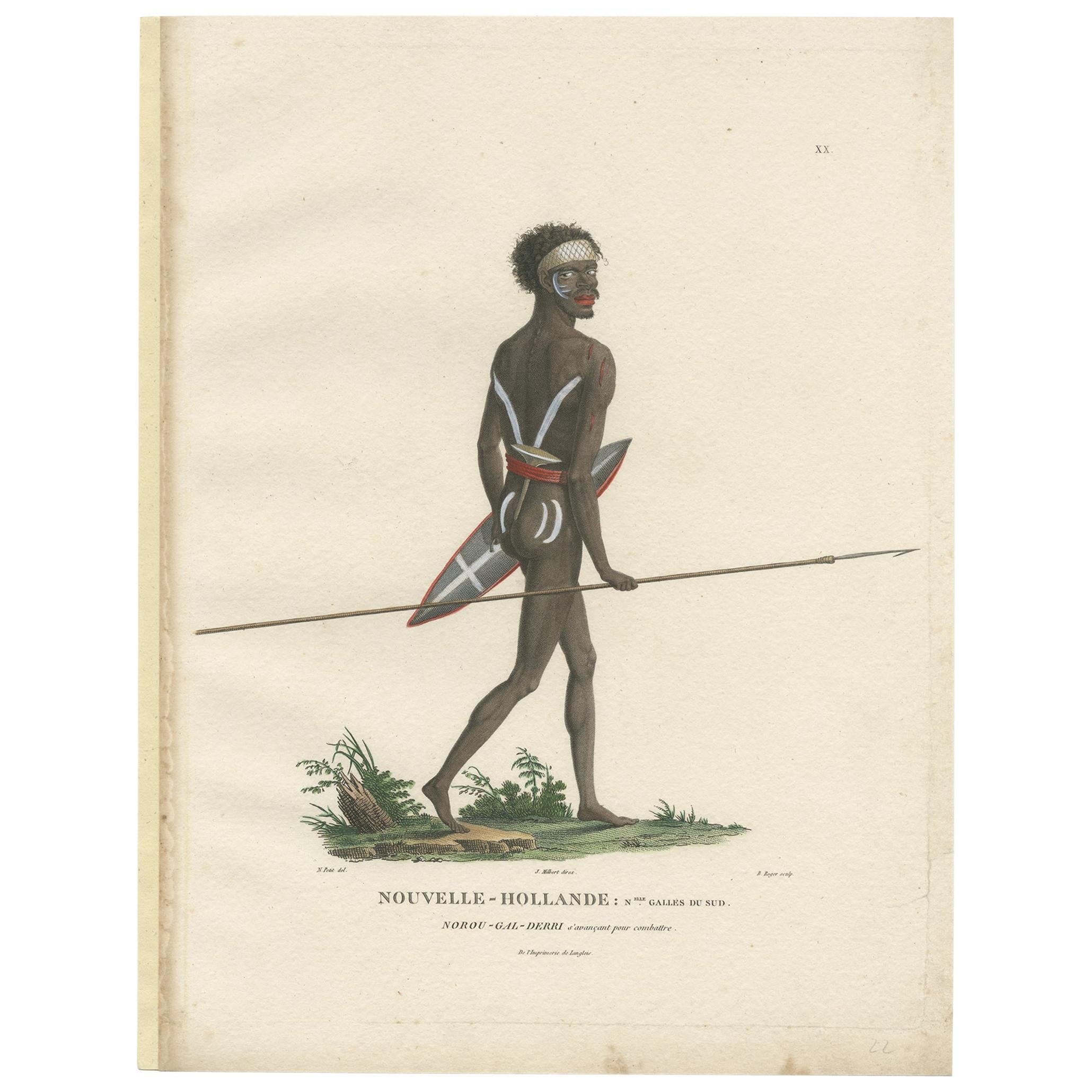
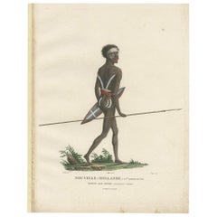
Antique Hand-Colored Print of an Indigenous Australian Man by Peron 'circa 1810'
Located in Langweer, NL
Antique print titled 'Nouvelle-Hollande: Nouvelle Galles du Sud. Nourou-Gal-Derri'. This print shows an Indigenous Australian man named 'Nourou-g...
Category
Antique Early 19th Century Prints
Materials
Paper
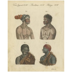
Antique Print of Aboriginals, Inhabitants of Australia, circa 1800
Located in Langweer, NL
Original print of inhabitants of Australia. This print originates from 'Bilderbuch fur Kinder' by F.J. Bertuch. Published, circa 1800.
Category
Antique Early 19th Century Prints
Materials
Paper
You May Also Like
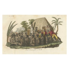
Original Antique Ethnographical Print, Figures, New South Wales, Australia, 1809
Located in St Annes, Lancashire
Wonderful ethnographical print.
A copper-plate engraving after Lesieur
Published by Sherwood, Neely & Jones. Dated 1809
Unframed.
Category
Antique Early 1800s English Folk Art Prints
Materials
Paper
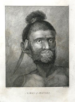
A Man of Mangea 1784 final voyage of Captain Cook by John Webber
By John Webber
Located in Paonia, CO
A Man of Mangea is from the 1784 First Edition Atlas Accompanying Capt. James Cook and King; Third and Final Voyage of Captain James Cook. John Webber (1752-1793) was the official a...
Category
1780s Realist Portrait Prints
Materials
Engraving
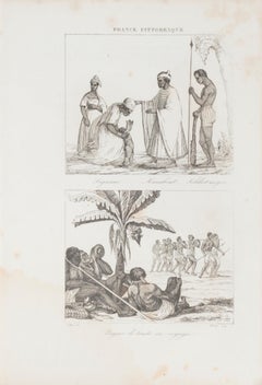
Indigenous Costumes - Original Lithograph - 19th Century
Located in Roma, IT
Indigenous Costumes is an original lithograph realized by an anonymous engraver of the 19th Century.
Printed as part of the series "France Pittoresque", as indicated at the top cent...
Category
19th Century Figurative Prints
Materials
Lithograph
Original Antique Print of Sing Sing, New York. Dated 1837
Located in St Annes, Lancashire
Great print of Sing Sing
Steel engraving after W.H Bartlett
Published by Virtue 1837
Unframed.
The measurement is the paper size.
Free shipping
Category
Antique 1830s English Other Prints
Materials
Paper
"King of the Friendly Islands" (Tonga); Engraving from Captain Cook's 3rd Voyage
By John Webber
Located in Alamo, CA
"Poulaho, King of the Friendly Islands, Drinking Kava" is an engraving created by William Sharp (1749-1824), from a drawing by John Webber (1752-1793), who was the artist on Captain James Cook's 3rd and final voyage of discovery. It was published in the atlas of "A Voyage to the Pacific Ocean Undertaken by the Command of His Majesty, for Making Discoveries in the Northern Hemisphere", the official British Admirality sanctioned journal published upon completion of the voyage in London in 1784 by Strahan & Cadell.
Captain Cook visited Tonga on his 3rd voyage, which he named The Friendly Islands because of the warm welcome he and his crew received, unlike some of the other more hostile Pacific islands. The engraving depicts Cook and his men observed a kava ceremony at the village of Mu’a on Tongatapu. King Paulaho sits in the centre foreground, his back to the spectator with a man kneeling before him. The ceremonial mat depicted behind Paulaho indicates that nobody was allowed to sit behind him. The figure in the centre holds a single cup, referring to the Tongan custom of offering the cup to the king first. Kava is native to the islands of the South Pacific and was first described for English readers in 1768 by Captain James Cook. The kava root has been used for centuries as a central feature of ceremonies and celebrations because it was able to bring about a calming and pleasant social atmosphere. The root was crushed and processed into coconut milk to become the focal ceremonial beverage, simply referred to as kava.
This engraving is presented in a Koa wood frame and a white mat. Koa wood is legendary in Hawaii. There are occasional faint spots, but the print is otherwise in very good condition. This amazing Koa wood is native to Hawaii and it is known for the deep rich colors and varied grain pattern. Koa has an honored heritage in Hawaii and is highly revered and sacred. The word “koa” means “warrior” in Hawaiian. The warriors of King Kamehameha the Great, created canoes and weapons from a wood plentiful on the Big Island of Hawaii. This wood became synonymous with the warriors themselves, and it became known as koa.
There are three other engravings listed from the official journal of Captain Cook's 3rd voyage available that are presented in identical Koa wood frames and mats (LU117324682422, LU117324684052, LU117324684032). They would make a wonderful grouping for a display of 2, 3 or 4 prints. A discount is available for a grouping depending on the number of items included.
Captain Cook is remembered as one of the greatest explorers and navigators in history. His explorations included Australia, New Zealand and islands of the South Pacific and the northwest coast of North America. Hawaii was discovered by Captain Cook during this voyage. Hawaii was originally called The Sandwich Islands in honor of The Earl of Sandwich...
Category
1780s Realist Figurative Prints
Materials
Engraving
Four Koa Wood Framed 18th C. Engravings from Captain Cook's 3rd Voyage Journal
By John Webber
Located in Alamo, CA
A grouping of four framed engravings of Hawaii, Tahiti, Tonga and Vancouver Island from the atlas of the official British Admiralty sanctioned journal of Captain Cook's 3rd Voyage entitled "A Voyage to the Pacific Ocean Undertaken by the Command of His Majesty, for Making Discoveries in the Northern Hemisphere", published upon completion of the voyage in London in 1784 by Strahan & Cadell. These engravings were made from drawings by John Webber (1752-1793), who was the artist on Captain James Cook's 3rd and final voyage of discovery. The set of engravings includes: "A Canoe of the Sandwich Islands, the Rowers Masked", Plate 65 in the atlas; "A Dance in Otaheite" (Tahiti), Plate 28; "King of the Friendly Islands" (Tonga), plate 20; "Inside of a House in Nootka Sound" (Canada), plate 42.
These engravings are professionally framed in Koa wood, the same wood as was used to make the canoes of the ancient Hawaiians. Koa wood is legendary in Hawaii. Not only is this amazing wood native to Hawaii, but it is known for the deep rich colors and varied grain pattern. Koa has an honored heritage in Hawaii and is highly revered and sacred. The word “koa” means “warrior” in Hawaiian. The warriors of King Kamehameha the Great, created canoes and weapons from a wood plentiful on the Big Island of Hawaii. This wood became synonymous with the warriors themselves, and it became known as koa.
These four engravings would make a wonderful grouping for a display of 2, 3 or 4 prints. They may be purchased separately or in groups on 1stDibs. Their listing Reference #'s are: LU117324682432, LU117324682022, LU117324684052 and LU117324684062. A discount is available for a grouping depending on the number of items included.
Hawaii was discovered by Captain Cook (1728-1779) during this voyage. Hawaii was originally called The Sandwich Islands in honor of The Earl of Sandwich...
Category
1780s Other Art Style Landscape Prints
Materials
Engraving
More Ways To Browse
Dior New Look Dress
Dior Shoulder Off
Dior Off The Shoulder
Dior Shoes Black And White
Dior Shirt Dress
Antique Shirt Mens
Antique Shoe Buckle
Ruffle Shoes
George Cooke
Fishing Spears
Antique Lawn Dress
Beer Garden Tables
Dior Shirt Mens
18th Century Shoe Buckle
Aboriginal Spear
Versaille Urns
Vintage Bird Toy
Vintage Chime Clock