Items Similar to Fraeijlemaborg, Christ, 1846

Want more images or videos?
Request additional images or videos from the seller
1 of 5
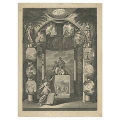
Fraeijlemaborg, Christ, 1846
$81.47
$101.8420% Off
£60.64
£75.8020% Off
€68
€8520% Off
CA$111.60
CA$139.5020% Off
A$124.12
A$155.1520% Off
CHF 64.81
CHF 81.0220% Off
MX$1,510.43
MX$1,888.0420% Off
NOK 827.76
NOK 1,034.7020% Off
SEK 776.29
SEK 970.3620% Off
DKK 517.66
DKK 647.0820% Off
Shipping
Retrieving quote...The 1stDibs Promise:
Authenticity Guarantee,
Money-Back Guarantee,
24-Hour Cancellation
About the Item
Fraeijlemaborg.' (Fraeylema Castle.) This Castle is situated in the province of Groningen in Slochteren. It was built around 1500 and its first known occupant was Remmert Fraeylema. Today it houses a museum, restaurant and is used as a wedding location. This delicate original old antique view originates from: 'Oud-Nederland in de uit vroegere dagen, overgeblevene Burgen en Kasteelen. Geschetst en afgebeeld, door Mr. C.P.E. Robide van de Aa.', published in Nijmegen by C.A. Vieweg, 1846. (Historic Netherlands and its remaining Castles.) Artists and Engravers: The author of this work is Christianus Petrus Eliza Robide van der Aa (1791-1851), a Dutch lawyer/judge and writer. Most of the Lithographs in this work by several lithographers are after Johannes Francisciscus Christ (1790-1845), a painter from Nijmegen.
Artist: The author of this work is Christianus Petrus Eliza Robide van der Aa (1791-1851), a Dutch lawyer/judge and writer. Most of the Lithographs in this work by several lithographers are after Johannes Francisciscus Christ (1790-1845), a painter from Nijmegen.
Condition: Good. General age related toning. Occasional light foxing, mostly in margins.
Date: 1846
Overall size: 8.9 x 5.5 inch
Image size: 6.3 x 4.3 inch
Antique prints have long been appreciated for both their aesthetic and investment value. They were the product of engraved, etched or lithographed plates. These plates were handmade out of wood or metal, which required an incredible level of skill, patience and craftsmanship. Whether you have a house with Victorian furniture or more contemporary decor an old engraving can enhance your living space. We offer a wide range of authentic antique prints for any budget.
- Dimensions:Height: 5.5 in (13.97 cm)Width: 8.9 in (22.61 cm)Depth: 0.001 in (0.03 mm)
- Materials and Techniques:
- Period:
- Date of Manufacture:1846
- Condition:
- Seller Location:Langweer, NL
- Reference Number:Seller: PCT-129961stDibs: LU3054327110562
About the Seller
5.0
Recognized Seller
These prestigious sellers are industry leaders and represent the highest echelon for item quality and design.
Platinum Seller
Premium sellers with a 4.7+ rating and 24-hour response times
Established in 2009
1stDibs seller since 2017
2,508 sales on 1stDibs
Typical response time: <1 hour
- ShippingRetrieving quote...Shipping from: Langweer, Netherlands
- Return Policy
Authenticity Guarantee
In the unlikely event there’s an issue with an item’s authenticity, contact us within 1 year for a full refund. DetailsMoney-Back Guarantee
If your item is not as described, is damaged in transit, or does not arrive, contact us within 7 days for a full refund. Details24-Hour Cancellation
You have a 24-hour grace period in which to reconsider your purchase, with no questions asked.Vetted Professional Sellers
Our world-class sellers must adhere to strict standards for service and quality, maintaining the integrity of our listings.Price-Match Guarantee
If you find that a seller listed the same item for a lower price elsewhere, we’ll match it.Trusted Global Delivery
Our best-in-class carrier network provides specialized shipping options worldwide, including custom delivery.More From This Seller
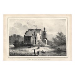
View AllHet Huis Rechteren, Christ, 1846
Located in Langweer, NL
Het huis Rechteren.' (Rechteren Castle.) This Castle is situated in the province of Overijssel in Dalfsen. The castle was built in the 14th century by Herman van Voorst. Other well k...
Category
Antique 19th Century Prints
Materials
Paper
$74 Sale Price
20% Off
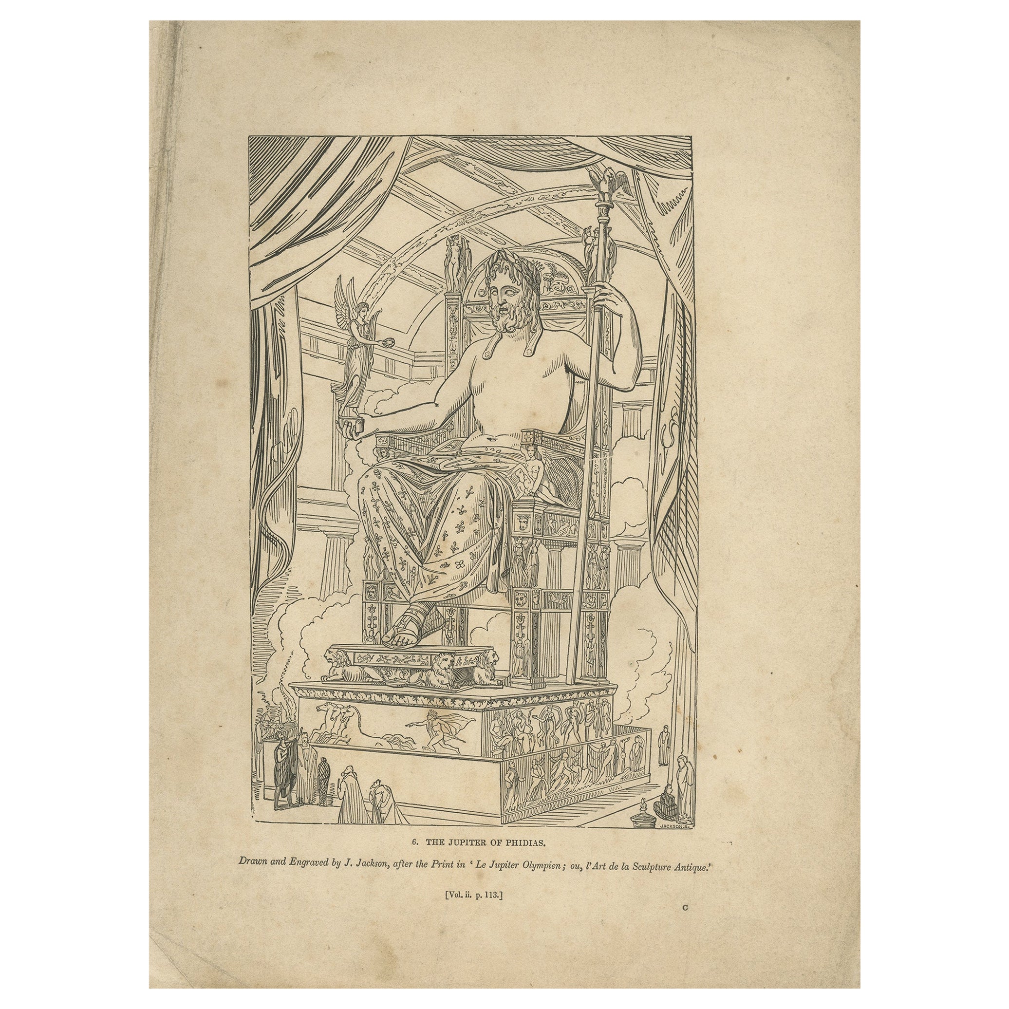
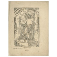
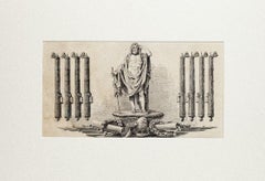
Antique Print of Zeus at Olympia by Knight, 1835
Located in Langweer, NL
Antique print titled 'The Jupiter of Phidias'. Old print of a statue of Zeus at Olympia by Phidias, as imagined by engraver John Jackson. This print ori...
Category
Antique 19th Century Prints
Materials
Paper
$69 Sale Price
20% Off
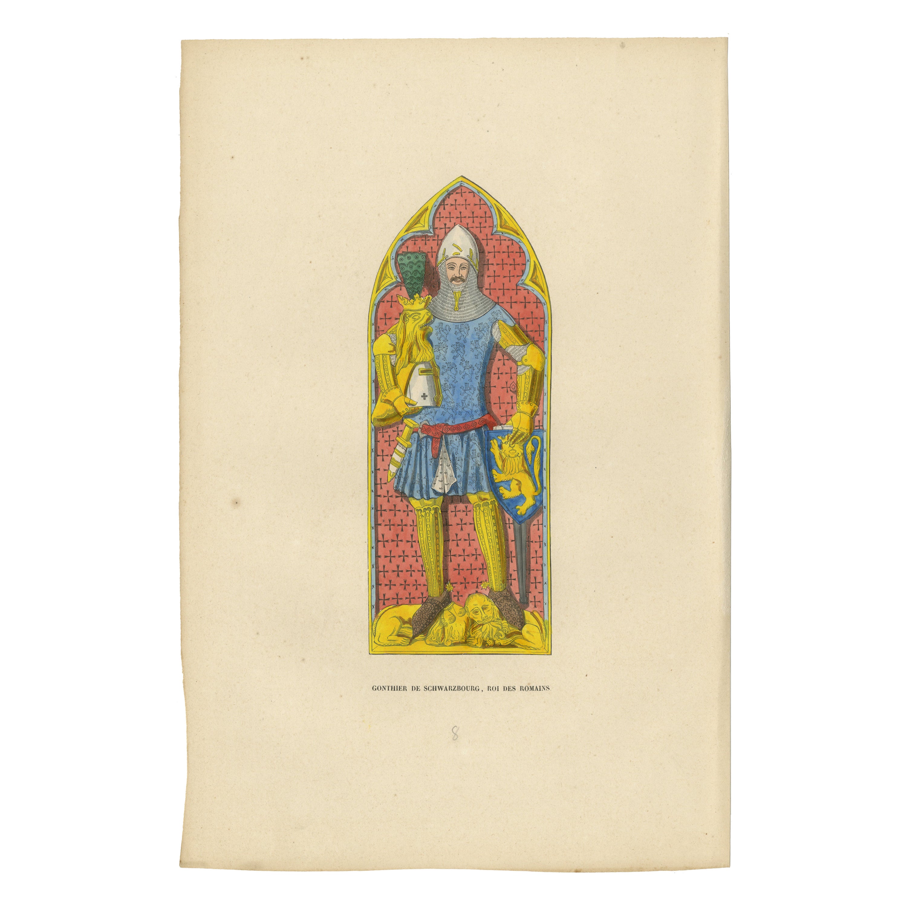
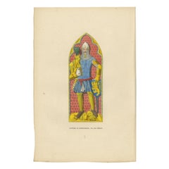
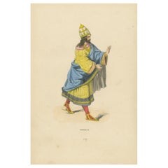
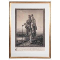
King Günther von Schwarzburg: The Warrior Monarch, 1847
Located in Langweer, NL
This handcolored original antique print features a figure labeled "Gunther de Schwarzbourg, roi des Romains," which identifies him as Günther von Schwarzburg, a German king. He is depicted in a traditional gothic archway that frames the illustration, reminiscent of a church's stained glass window.
In the illustration, Günther is clad in armor, with a chainmail coif and a helmet adorned with a crown, indicating his royal status. The blue tunic worn over his armor is embellished with a pattern of fleur-de-lis, a symbol often associated with royalty. He also has golden arm and leg guards, and his red belt stands...
Category
Antique 1840s Prints
Materials
Paper
$153 Sale Price
20% Off
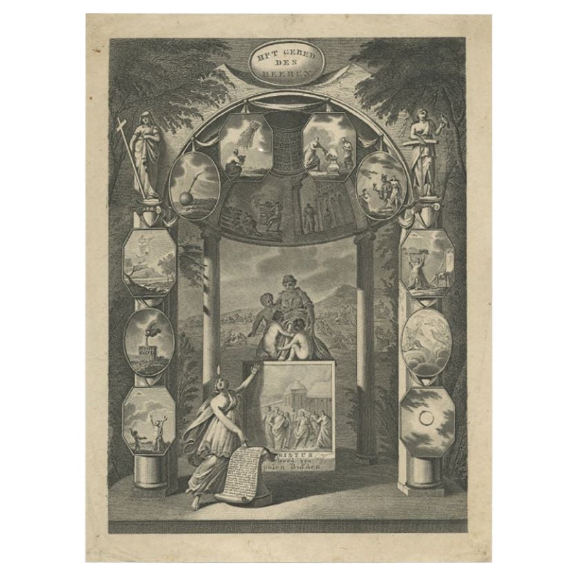
Old Dutch Religion Frontispiece Depicting Christus Teaching How to Pray, c.1880
Located in Langweer, NL
Antique print titled 'Het Gebed des Heeren'. Frontispiece of an unknown source. Stipple engraved title page with miniature scenes surrounding the centr...
Category
Antique 19th Century Prints
Materials
Paper
$105 Sale Price
20% Off
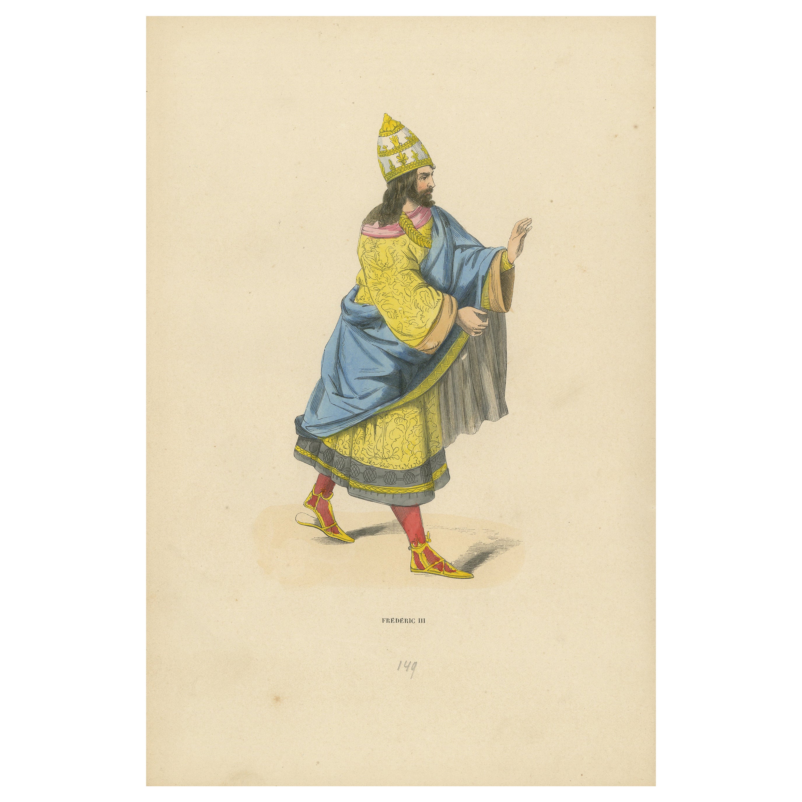
Imperial Majesty: Emperor Frederick III in 'Costume du Moyen Âge, 1847
Located in Langweer, NL
Title: "Imperial Majesty: Emperor Frederick III in 'Costume du Moyen Âge'"
Description: This lithograph from the "Costume du Moyen Âge" collection, printed in 1847, depicts Emperor ...
Category
Antique 1840s Prints
Materials
Paper
$134 Sale Price
20% Off
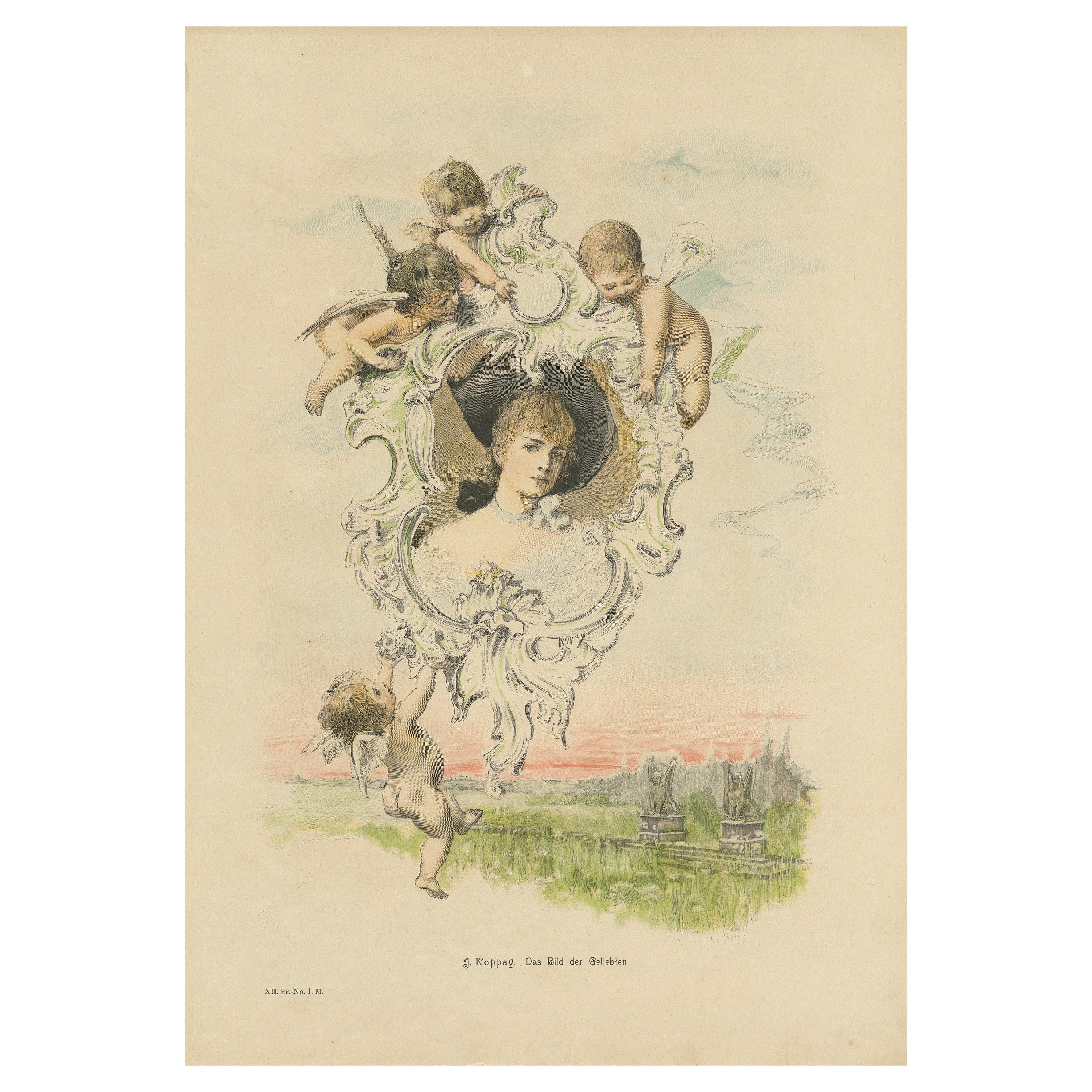
Antique Print 'Das Bild der Geliebten' after Koppay 'c.1850'
Located in Langweer, NL
Antique print titled 'J. Koppay. Das Bild der Geliebten'. Lithograph after a painting by Joszi Arpad Koppay. This print originates from a German magazine, published circa 1895.
Category
Antique Late 19th Century Prints
Materials
Paper
$95 Sale Price
20% Off
You May Also Like
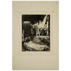
Steel Engraving from the 19th Century of Rembrandt by Francesco Novelisme
Located in Saint-Ouen, FR
Steel engraving from the 19th century of Rembrandt by Francesco Novelisme, 1992.
Measures: H 21cm, L 16cm.
Category
Antique 19th Century French Napoleon III Prints
Materials
Paper
19th Century Engraving Belisaire by Desnoyers, 1806
Located in Richmond, London
Early 19th century engraving, titled Bélisaire, after Baron François Pascal Simon Gérard's (1770 – 1837) painting Belisarius, 1797 [Getty Museum, object number 2005.10]. Engraved by ...
Category
Antique Early 19th Century French Prints
Materials
Paper
19 th century lithographe/print
Located in Los Angeles, CA
A beautiful lithographe, John Knox administerine the first protestant sacrament,
during the siege of the castle of st Andrew 1547,
printed by William Bonner esq. Royal Scottish A...
Category
Antique 19th Century English Prints
Materials
Paper, Wood
Le Impératrice Eugénie Lithograph, c.1850s
Located in Savannah, GA
A large hand-colored lithograph entitled “Le Impératrice, Compiegne,” after the painting by Jean Victor Adam (1801-1866), circa 1850s. Depicted is the Empress Eugénie de Montijo, wi...
Category
Antique Mid-19th Century French Other Prints
Materials
Glass, Wood, Paper

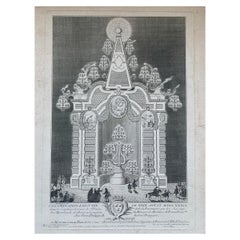
Jacques-Philippe Le Bas "The Illumination" Engraving 18th Century
By Jacques-Philippe Le Bas
Located in Beuzevillette, FR
Interesting engraving by Jacques-Philippe Le Bas depicts the illuminations set up on the evening of 29 August 1739 at the crossroads of St Denys and La Ferronnerie for the wedding of...
Category
Antique 18th Century European Prints
Materials
Paper
Roman Statue - Etching On Paper - 1850
Located in Roma, IT
Roman Statue is an original etching on paper realized by an Anonymous artist of the XIX century in 1850 ca.
In very good condition.
Included a white...
Category
1850s Prints and Multiples
Materials
Etching
More Ways To Browse
Dragonfly Japanese
Drexel Heritage Bedroom Furniture
Drexel Heritage Bedroom
Dutch Renaissance Cabinet
Eden Table
Edme Samson
Elephant Bowl
Empire Secretary Desk
Enamel Silver Compact
English Arts And Crafts Pottery
English Door Knob
English Secretary Glass
Ettore Sottsass Totem
Facto Paris
Fox Terrier
French Inlaid Bombe Chest
French Louis Xvi Style Black Lacquered
French Oil Jars