Items Similar to Historic Print of Blackfeet Council Near Missouri River Trading Posts - 1856
Want more images or videos?
Request additional images or videos from the seller
1 of 6
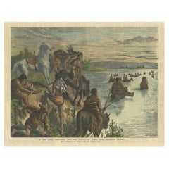
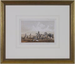
Historic Print of Blackfeet Council Near Missouri River Trading Posts - 1856
$263.50
£195.27
€220
CA$359.73
A$400.19
CHF 209.78
MX$4,890.18
NOK 2,671.32
SEK 2,514.68
DKK 1,675.06
Shipping
Retrieving quote...The 1stDibs Promise:
Authenticity Guarantee,
Money-Back Guarantee,
24-Hour Cancellation
About the Item
Historic Print of Blackfeet Council Scene Near Missouri River Trading Posts**
Description: This captivating 19th-century lithograph, titled "Council with White Man's Horse," offers a window into the critical interactions between Blackfeet Indians and Euro-American settlers or explorers. The setting is likely along the Missouri River, between the prominent trading posts of Fort Union and Fort Benton in Montana—key hubs of trade and diplomacy during the westward expansion. These regions were central to the Blackfeet Nation's territory, known for its rich cultural and historical significance.
The scene depicts a council meeting, where cultural exchange, negotiations, or treaty discussions could have taken place. The Blackfeet individuals are depicted with traditional clothing and gestures, while settlers or explorers observe, highlighting the complex dynamics of coexistence and negotiation. Such councils often served as pivotal moments in the relationships between indigenous tribes and the U.S. government, especially during the mid-19th century when westward expansion was accelerating.
This lithograph was created using the highly detailed chromolithography technique, allowing for vibrant and accurate coloring that brings the landscape and figures to life. The fine lines and meticulous shading emphasize the balance between the natural environment and human activity.
Condition:
This print is in very good condition, with minimal foxing and strong, vibrant colors. A clean margin enhances its framability and aesthetic appeal.
Framing Tips:
Choose a double mat with neutral tones like cream or beige to highlight the historic atmosphere. A dark wooden or antique gold frame would beautifully complement the tones in the artwork while emphasizing its historical importance. Use UV-protective glass to preserve the vivid colors and delicate paper. This piece would make an exceptional addition to any collection focused on Native American history, westward expansion, or historical art.
- Dimensions:Height: 8.15 in (20.7 cm)Width: 11.15 in (28.3 cm)Depth: 0.01 in (0.2 mm)
- Materials and Techniques:
- Period:
- Date of Manufacture:1856
- Condition:This print is in very good condition, with minimal foxing and strong, vibrant colors. A clean margin enhances its framability and aesthetic appeal.
- Seller Location:Langweer, NL
- Reference Number:Seller: BG-14038-541stDibs: LU3054343510752
About the Seller
5.0
Recognized Seller
These prestigious sellers are industry leaders and represent the highest echelon for item quality and design.
Platinum Seller
Premium sellers with a 4.7+ rating and 24-hour response times
Established in 2009
1stDibs seller since 2017
2,494 sales on 1stDibs
Typical response time: 1 hour
- ShippingRetrieving quote...Shipping from: Langweer, Netherlands
- Return Policy
Authenticity Guarantee
In the unlikely event there’s an issue with an item’s authenticity, contact us within 1 year for a full refund. DetailsMoney-Back Guarantee
If your item is not as described, is damaged in transit, or does not arrive, contact us within 7 days for a full refund. Details24-Hour Cancellation
You have a 24-hour grace period in which to reconsider your purchase, with no questions asked.Vetted Professional Sellers
Our world-class sellers must adhere to strict standards for service and quality, maintaining the integrity of our listings.Price-Match Guarantee
If you find that a seller listed the same item for a lower price elsewhere, we’ll match it.Trusted Global Delivery
Our best-in-class carrier network provides specialized shipping options worldwide, including custom delivery.More From This Seller
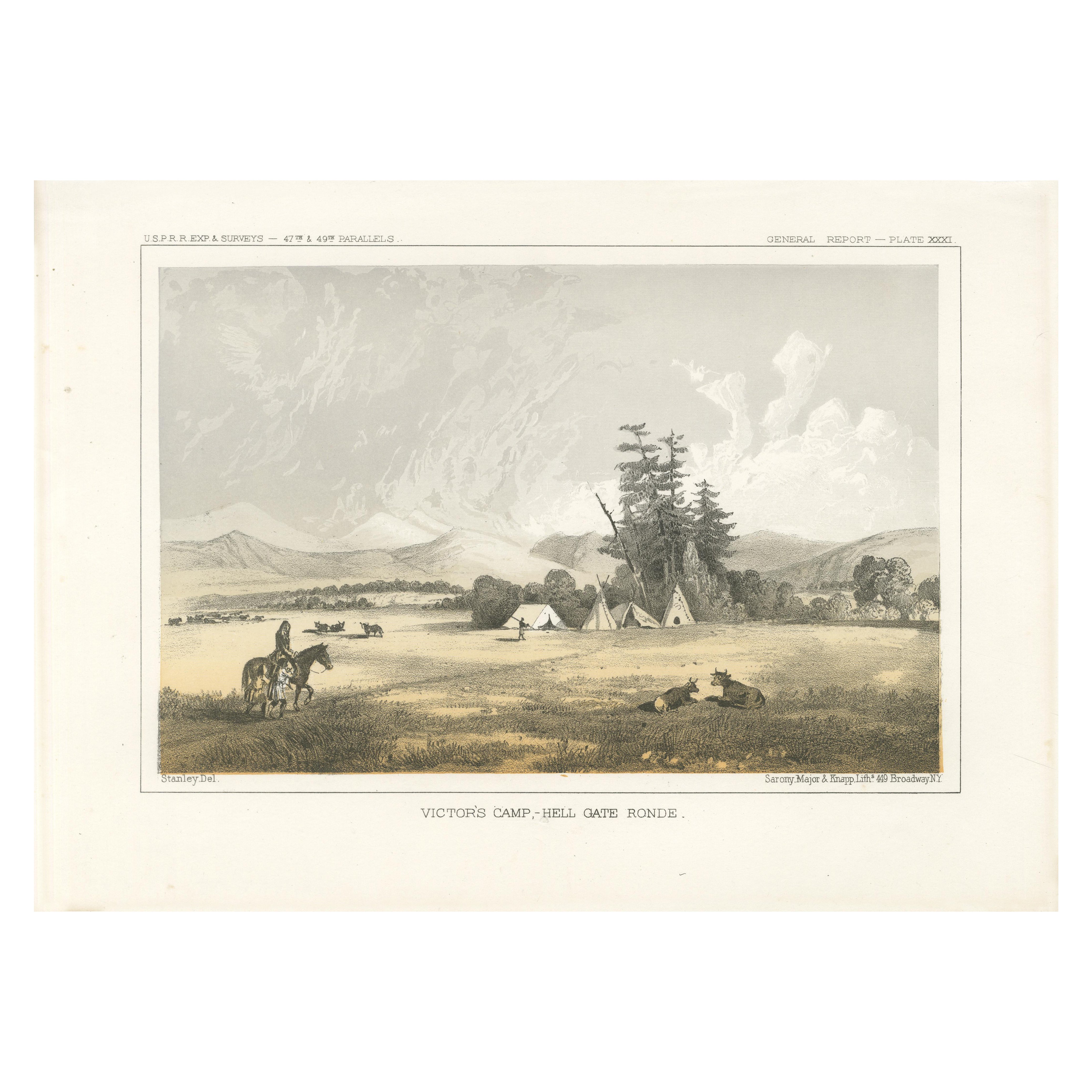
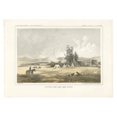
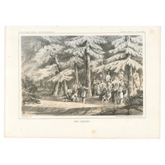
View AllNative American Camp Scene at Hell Gate Ronde – Peaceful Prairie Landscape, 1856
Located in Langweer, NL
Native American Camp Scene at Hell Gate Ronde – Peaceful Prairie Landscape
This exquisite 19th-century lithograph portrays Victor's Camp at Hell Gate Ronde, capturing a tranquil ...
Category
Antique 1850s Prints
Materials
Paper
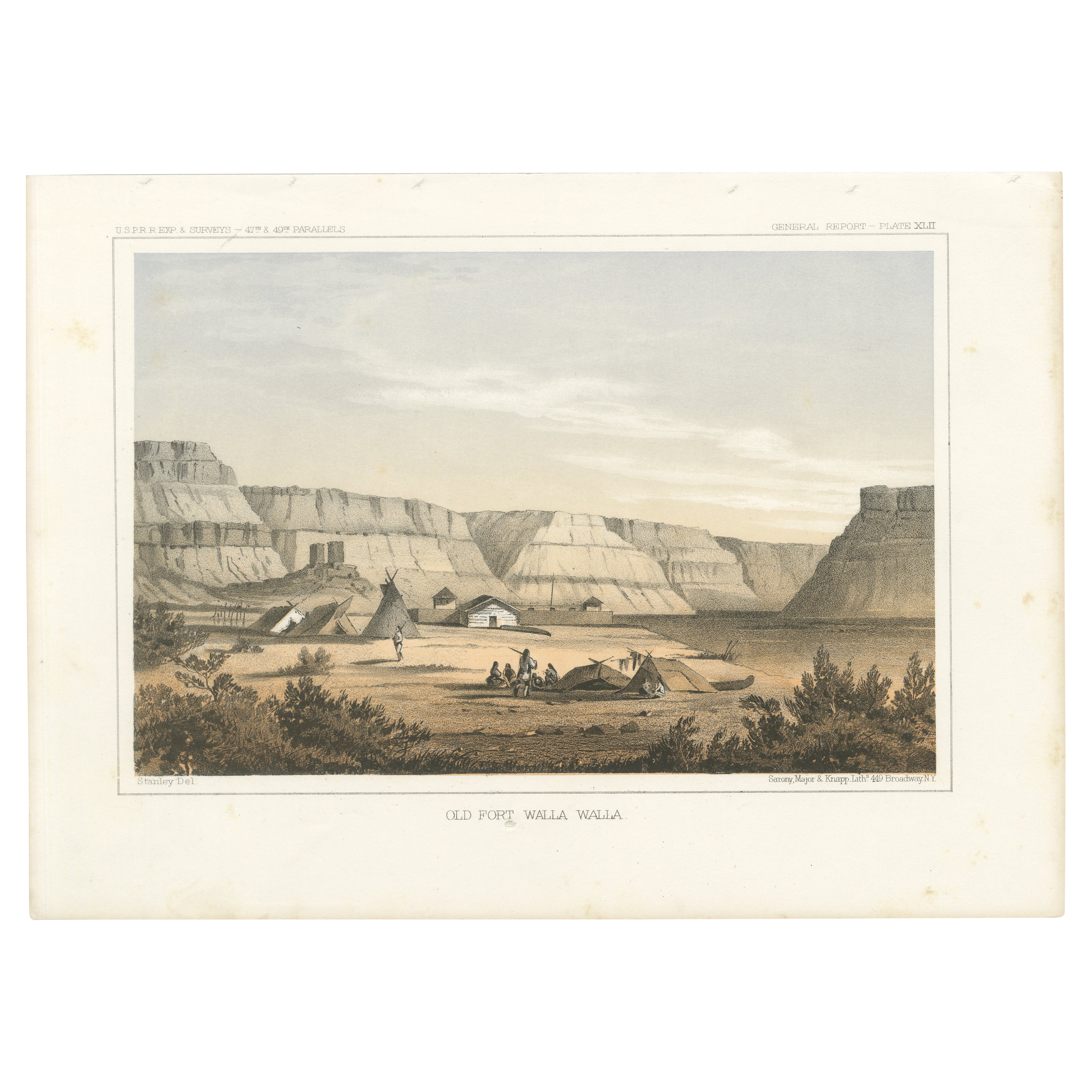
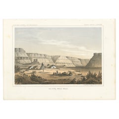
Original Antique Tinted Lithograph of Old Fort Walla Walla in Washington, 1856
Located in Langweer, NL
Title: Tinted Lithograph of Old Fort Walla Walla, 1856
Description: This remarkable lithograph, "Old Fort Walla Walla," provides a vivid depiction of one of the key outposts in t...
Category
Antique 1850s Prints
Materials
Paper
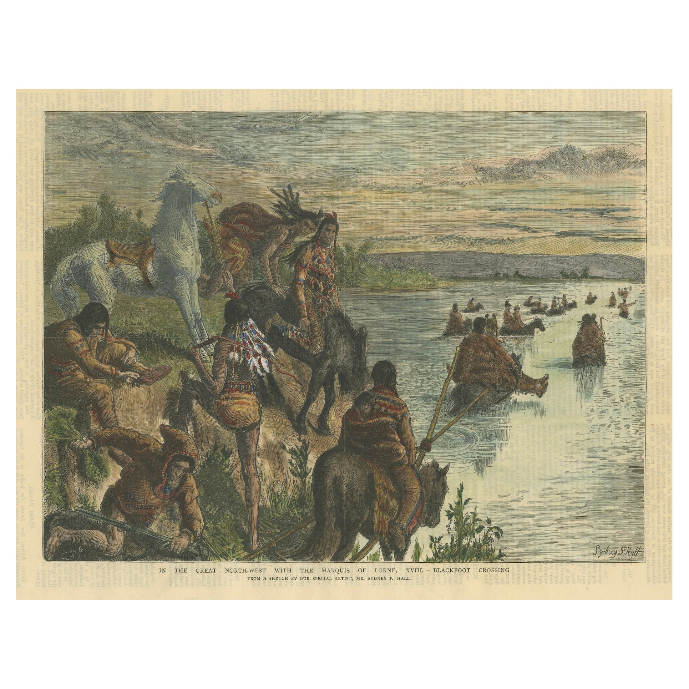
Blackfoot Crossing: Indigenous People in the Great North-West, The Graphic 1882
Located in Langweer, NL
Title: *In the Great North-West with the Marquis of Lorne, XVIII – Blackfoot Crossing* - Published in The Graphic, January 28, 1882.
Description: This hand-colored wood engraving, published in The Graphic on January 28, 1882, is part of a series documenting travels in the North-West territories of Canada with the Marquis of Lorne. The scene, titled *Blackfoot Crossing*, portrays a group of Blackfoot Indigenous people crossing a river with their horses and supplies. The Blackfoot, an Indigenous tribe in the Great Plains, are shown in traditional attire, adorned with feathers and beaded clothing...
Category
Antique 1880s Prints
Materials
Paper
$210 Sale Price
20% Off
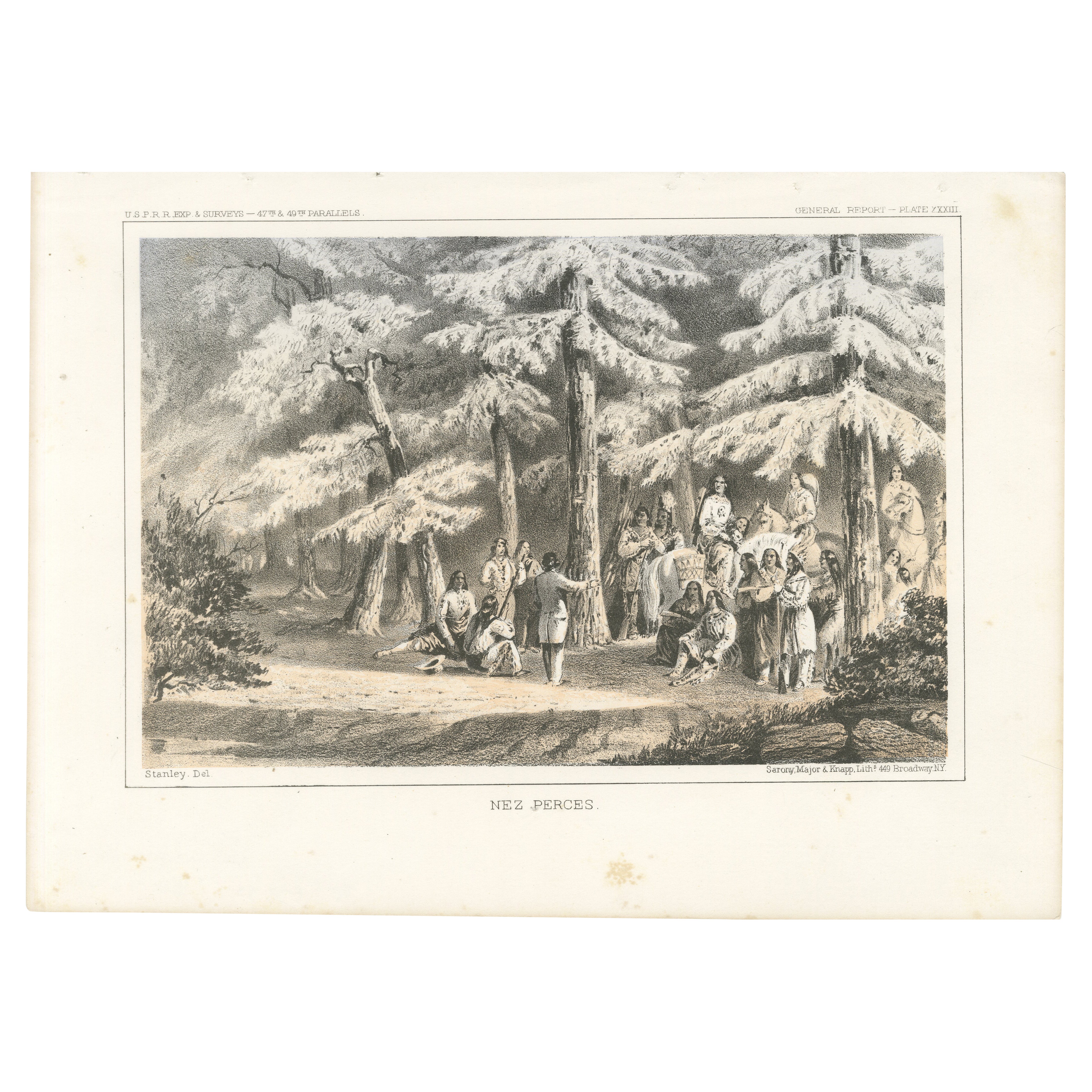
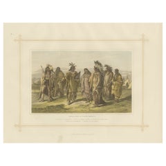
Nez Perces Gathering: A Vivid 19th-Century Lithograph of Pacific Northwest Life
Located in Langweer, NL
Nez Perces Gathering in the Pacific Northwest
This lithograph, titled "Nez Perces," captures a vivid depiction of the Nez Perce people in their natural forested homeland in the Pa...
Category
Antique 1850s Prints
Materials
Paper
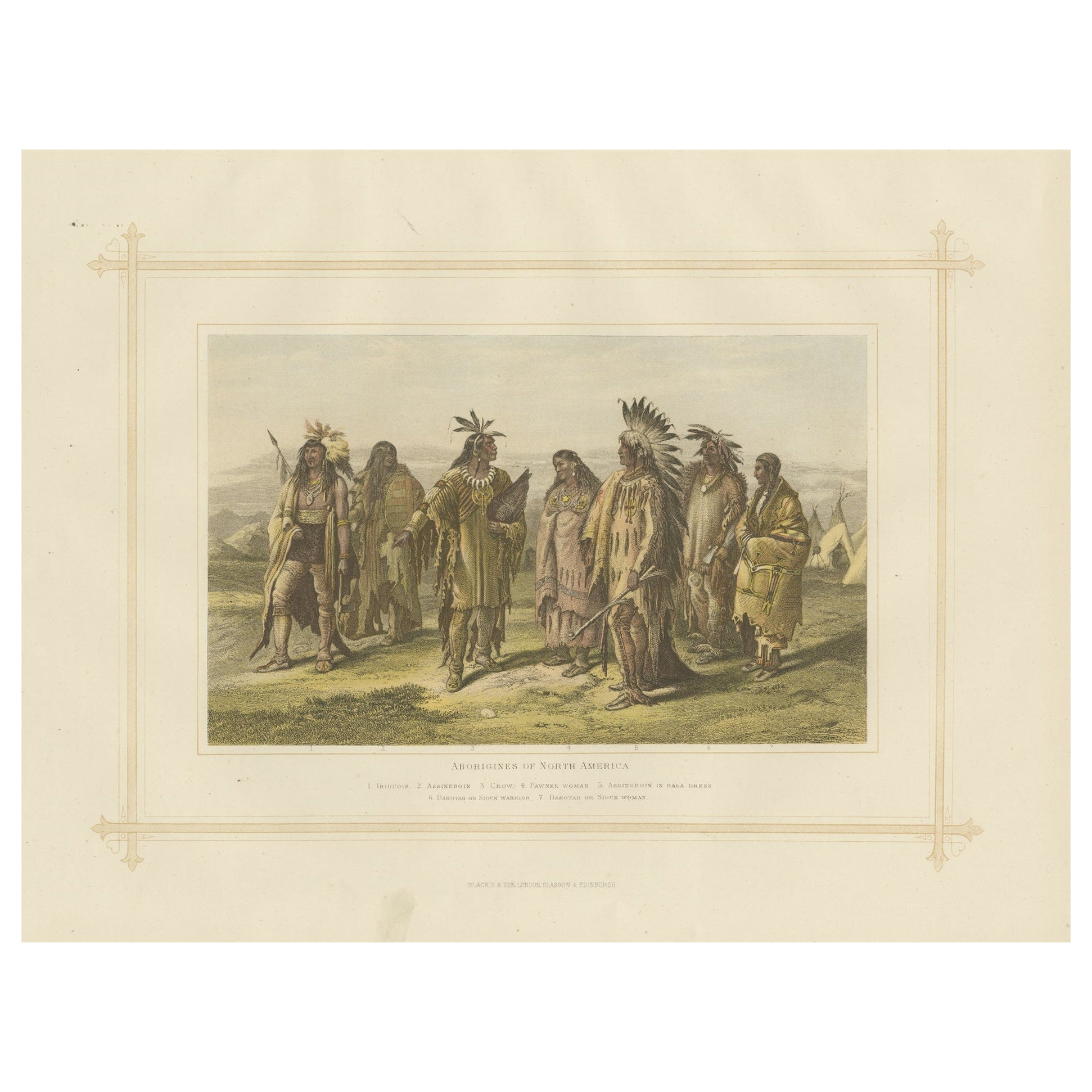
Antique Lithograph of the Aborigines of North America, 1882
Located in Langweer, NL
Experience a captivating glimpse into the world of 19th-century ethnography with the "Aborigines of North America", an antique print from Blackie's Comprehensive Atlas and Geography,...
Category
Antique 1880s Prints
Materials
Paper
$182 Sale Price
20% Off
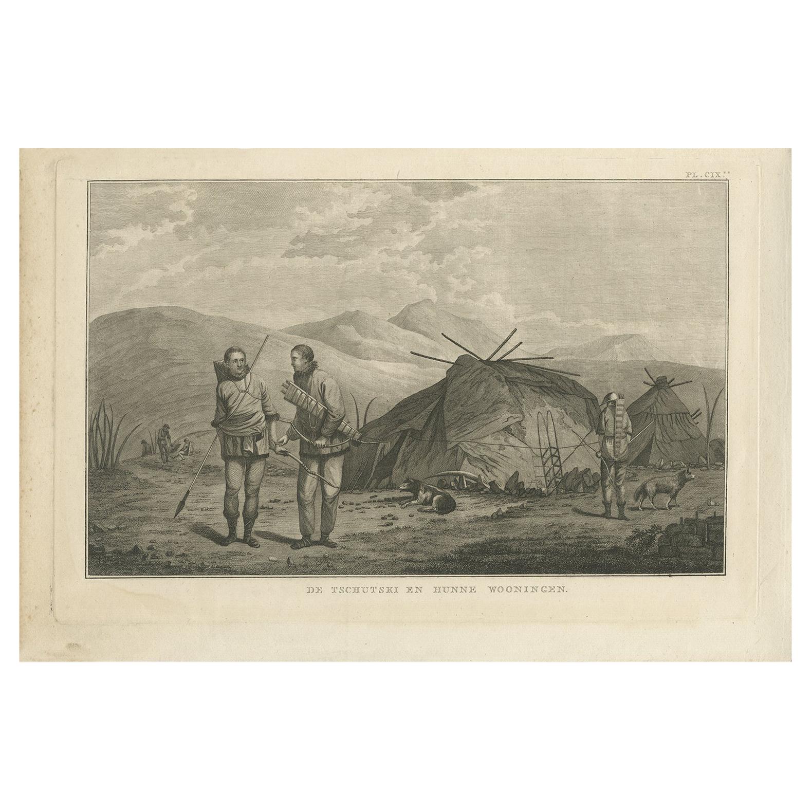
Antique Print of Chukchi People by Cook, 1803
Located in Langweer, NL
Antique print titled 'De Tschutski en hunne Wooningen'. This print depicts Chukchi people preparing to go bow hunting. Originates from 'Reizen rondom de Wa...
Category
Antique Early 19th Century Dutch Prints
Materials
Paper

$268 Sale Price
20% Off
You May Also Like
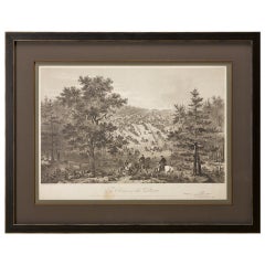
'Camp Red River Hunters' original lithograph by John Mix Stanley
By John Mix Stanley
Located in Milwaukee, WI
In the mid-nineteenth century, the United States government set out to survey and document its newly acquired lands and territories west of the Mississippi. The goals of these surveys were manifold: to produce topographical maps, to document flora and fauna, and to document natural resources to build the emerging US economy. These surveys, and the images from them, also functioned to build the new sense of American identity with the landscape, condensing vistas into the 'picturesque' tradition of European image making. Thus, the entire span of US territory could be seen as a single, cohesive whole.
This lithograph comes from one of six surveys commissioned by the Army's Topographic Bureau in 1853, which sought to find the best route to construct a transcontinental railroad. The result was a thirteen-volume report including maps, lithographs, and technical data entitled 'Explorations and Surveys to ascertain the most practicable and economical route for a Railroad from the Mississippi river to the Pacific Ocean.' In particular, the print comes from the northern survey, commanded by Isaac Stevens, which explored the regions between the 47th and 49th parallels.
In this image, Stanley shows an encampment of the people known as the Red River of the North hunters. They were generations of European and mixed-race trappers who lived on the frontier and had Indian wives and mixed-race children. They had come to the area for bison hunting, as the herds were still vast on the prairies. In the image, the figures and their encampment are dwarfed by the vast landscape around them, indicating the sublimity of these new American territories.
5.75 x 8.75 inches, image
6.5 x 9.25 inches, stone
17 x 20 inches, frame
Artist 'Stanley Del.' lower left
Entitled 'Camp Red River Hunters' lower center margin
Publisher 'Sarony, Major & Knapp. Lith.s 449 Broadway N.Y.' lower right
Inscribed 'U.S.P.R.R. EXP. & SURVEYS — 47th & 49th PARALLELS' upper left
Inscribed 'GENERAL REPORT — PLATE XII' upper right
Framed to conservation standards using 100 percent rag matting with French accents; glazed with UV5 Plexiglas to inhibit fading; housed in a gold reverse ogee moulding.
Print in overall good condition; some localized foxing and discoloration; minor surface abrasions to frame.
John Mix Stanley...
Category
1850s Romantic Landscape Prints
Materials
Lithograph
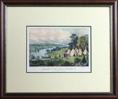
Scenery of the Upper Mississippi Indian Village Currier & Ives lithograph framed
By Currier & Ives
Located in Paonia, CO
Scenery of the Upper Mississippi Indian Village Currier & Ives lithograph is a tranquil scene of an Indian village camped in a meadow next to a be...
Category
Mid-19th Century American Realist Figurative Prints
Materials
Lithograph
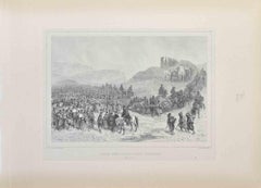
"Army of the Potomac" by John Bachelder, Civil War Era Lithograph, circa 1863
Located in Colorado Springs, CO
Fully-entitled: Army of the Potomac. The Wagon Trains of the Army of the Potomac en Route from Chickahominy to James River VA. During the Seven...
Category
Antique 19th Century American Prints
Materials
Paper
Army Gets Position - Lithograph by Auguste Raffet - 1837
Located in Roma, IT
Army gets position is a Lithograph realized by Auguste Raffet in 1837.
Signed in the plate.
Good condition
Category
1830s Modern Figurative Prints
Materials
Lithograph
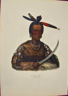
To-Ka-Con, A Sioux Chief: Hand-colored McKenney & Hall Folio-sized Lithograph
By McKenney & Hall
Located in Alamo, CA
This is an original 19th century hand-colored folio-size McKenney and Hall engraving of a Native American entitled "To-Ka-Con, A Sioux Chief", drawn ...
Category
1830s Naturalistic Portrait Prints
Materials
Engraving
'Lieutenant Crovers Despatch – Return of Governor Stevens to Fort Benton'
By John Mix Stanley
Located in Milwaukee, WI
In the mid-nineteenth century, the United States government set out to survey and document its newly acquired lands and territories west of the Mississippi. The goals of these surveys were manifold: to produce topographical maps, to document flora and fauna, and to document natural resources to build the emerging US economy. These surveys, and the images from them, also functioned to build the new sense of American identity with the landscape, condensing vistas into the 'picturesque' tradition of European image making. Thus, the entire span of US territory could be seen as a single, cohesive whole.
This lithograph comes from one of six surveys commissioned by the Army's Topographic Bureau in 1853, which sought to find the best route to construct a transcontinental railroad. The result was a thirteen-volume report including maps, lithographs, and technical data entitled 'Explorations and Surveys to ascertain the most practicable and economical route for a Railroad from the Mississippi river to the Pacific Ocean.' In particular, the print comes from the northern survey, commanded by Isaac Stevens, which explored the regions between the 47th and 49th parallels.
5.75 x 8.75 inches, image
6.5 x 9.25 inches, stone
17 x 20 inches, frame
Artist 'Stanley Del.' lower left
Entitled 'Lieutenant Crovers Despatch – Return of Governor Stevens to Fort Benton' lower center margin
Publisher 'Sarony, Major & Knapp. Lith.s 449 Broadway N.Y.' lower right
Inscribed 'U.S.P.R.R. EXP. & SURVEYS — 47th & 49th PARALLELS' upper left
Inscribed 'GENERAL REPORT — PLATE XXXVII' upper right
Framed to conservation standards using 100 percent rag matting with French accents; glazed with UV5 Plexiglas to inhibit fading; housed in a gold reverse ogee moulding.
Print in overall good condition; some localized foxing and discoloration; minor surface abrasions to frame.
John Mix Stanley...
Category
1850s Romantic Landscape Prints
Materials
Lithograph
More Ways To Browse
Montana Antiques
Wooden Indian Figures
Indian Wooden Horse
Rococo Teapot
Roman Stone Fragment
Rosewood Chiffonier
Rosewood Writing Slope
Sabino Opalescent Glass
Sabino Opalescent
Sage Green Cabinet
Sculptures Of Fist
Seguso Fish
Sevres Egg
Signed French Urn With Cherubs
Silver Potpourri
Single Twin Bed
Sir Christopher Wren
Spode Neoclassical