Items Similar to Original Antique View of the City of Damietta, Egypt, 1774
Want more images or videos?
Request additional images or videos from the seller
1 of 5
Original Antique View of the City of Damietta, Egypt, 1774
$349.71
$437.1420% Off
£262.13
£327.6620% Off
€296
€37020% Off
CA$480.44
CA$600.5520% Off
A$536.37
A$670.4620% Off
CHF 281.05
CHF 351.3120% Off
MX$6,565.68
MX$8,207.0920% Off
NOK 3,569.32
NOK 4,461.6620% Off
SEK 3,365.42
SEK 4,206.7720% Off
DKK 2,253.26
DKK 2,816.5720% Off
Shipping
Retrieving quote...The 1stDibs Promise:
Authenticity Guarantee,
Money-Back Guarantee,
24-Hour Cancellation
About the Item
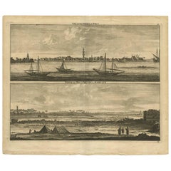
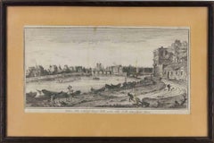
Antique print, titled: 'Prospect der Stadt Damiat.' - Tab VIII.
View of the city of Damietta, Egypt. From 'Reisebeschreibung von Arabien und anderen umliegenden Landern (1774-1778). Carsten Niebuhr (1733-1815) travelled extensively in Arabia, Persia, Palestine and Asia Minor, and became by his descriptions and maps and the richness of his observations the pioneer of a more profound knowledge of the Orient.
Artists and Engravers: Made by G. Haas after Baurenfeind. Author: Carsten Niebuhr.
- Dimensions:Height: 10.52 in (26.7 cm)Width: 16.54 in (42 cm)Depth: 0 in (0.02 mm)
- Materials and Techniques:
- Period:1770-1779
- Date of Manufacture:1774
- Condition:Repaired: A tear in the middle fold, reinforced on the rear. Original middle fold, as issued. A tear in the middle fold, reinforced on the rear. Some soiling in the margins. A stain in the lower margin (left and right of the middle fold).
- Seller Location:Langweer, NL
- Reference Number:Seller: PCT-56665 1stDibs: LU3054326822462
About the Seller
5.0
Recognized Seller
These prestigious sellers are industry leaders and represent the highest echelon for item quality and design.
Platinum Seller
Premium sellers with a 4.7+ rating and 24-hour response times
Established in 2009
1stDibs seller since 2017
2,511 sales on 1stDibs
Typical response time: <1 hour
- ShippingRetrieving quote...Shipping from: Langweer, Netherlands
- Return Policy
Authenticity Guarantee
In the unlikely event there’s an issue with an item’s authenticity, contact us within 1 year for a full refund. DetailsMoney-Back Guarantee
If your item is not as described, is damaged in transit, or does not arrive, contact us within 7 days for a full refund. Details24-Hour Cancellation
You have a 24-hour grace period in which to reconsider your purchase, with no questions asked.Vetted Professional Sellers
Our world-class sellers must adhere to strict standards for service and quality, maintaining the integrity of our listings.Price-Match Guarantee
If you find that a seller listed the same item for a lower price elsewhere, we’ll match it.Trusted Global Delivery
Our best-in-class carrier network provides specialized shipping options worldwide, including custom delivery.More From This Seller
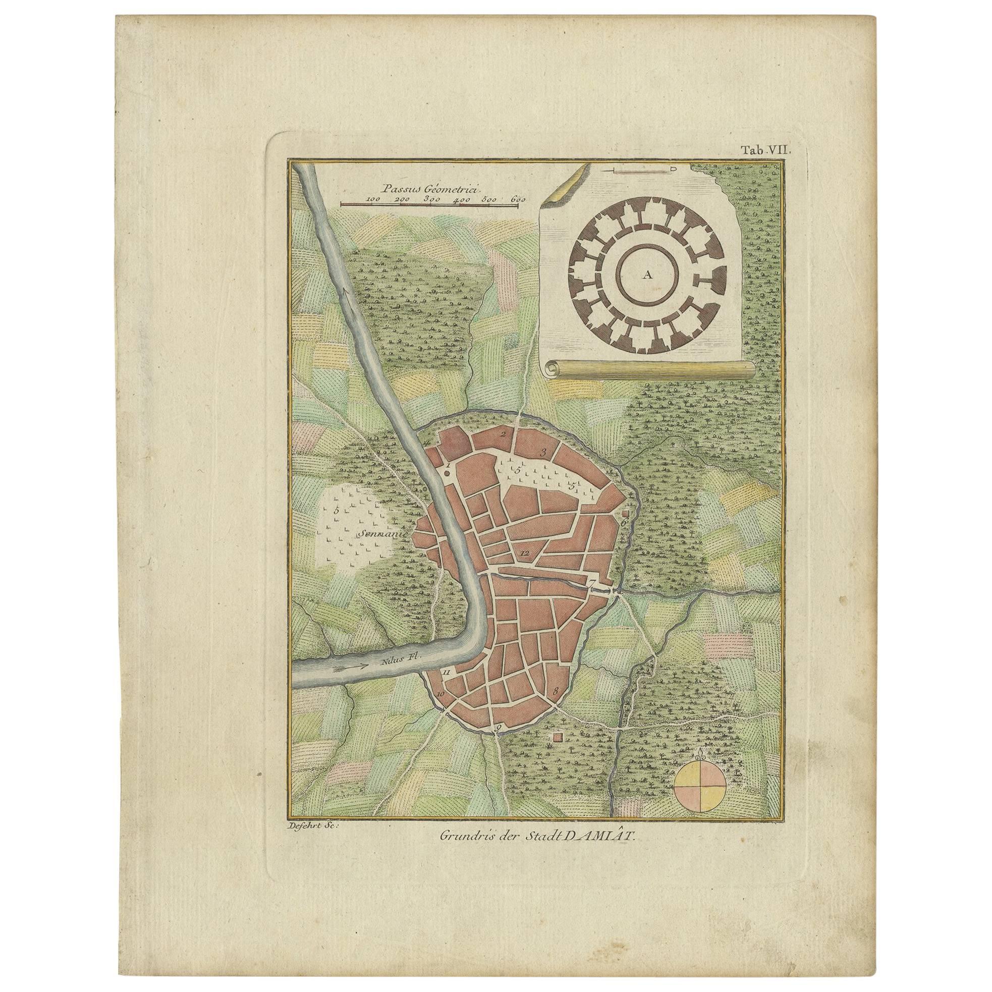
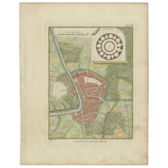
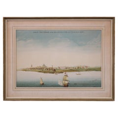
View AllAntique Plan of the City of Damietta Egypt by C. Niebuhr, 1774
Located in Langweer, NL
Antique print titled 'Grundris der Stadt Damiât'. This print originates from 'Reisebeschreibung nach Arabien und andern umliegenden Ländern' by C. Niebuhr, 1774.
Category
Antique Late 18th Century Prints
Materials
Paper
$170 Sale Price
20% Off
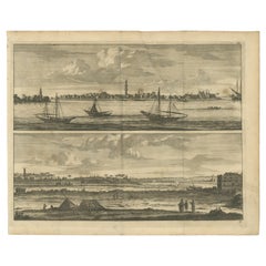
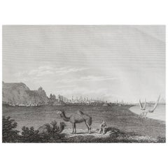
Original Antique Print with Views of the Nile, Egypt
Located in Langweer, NL
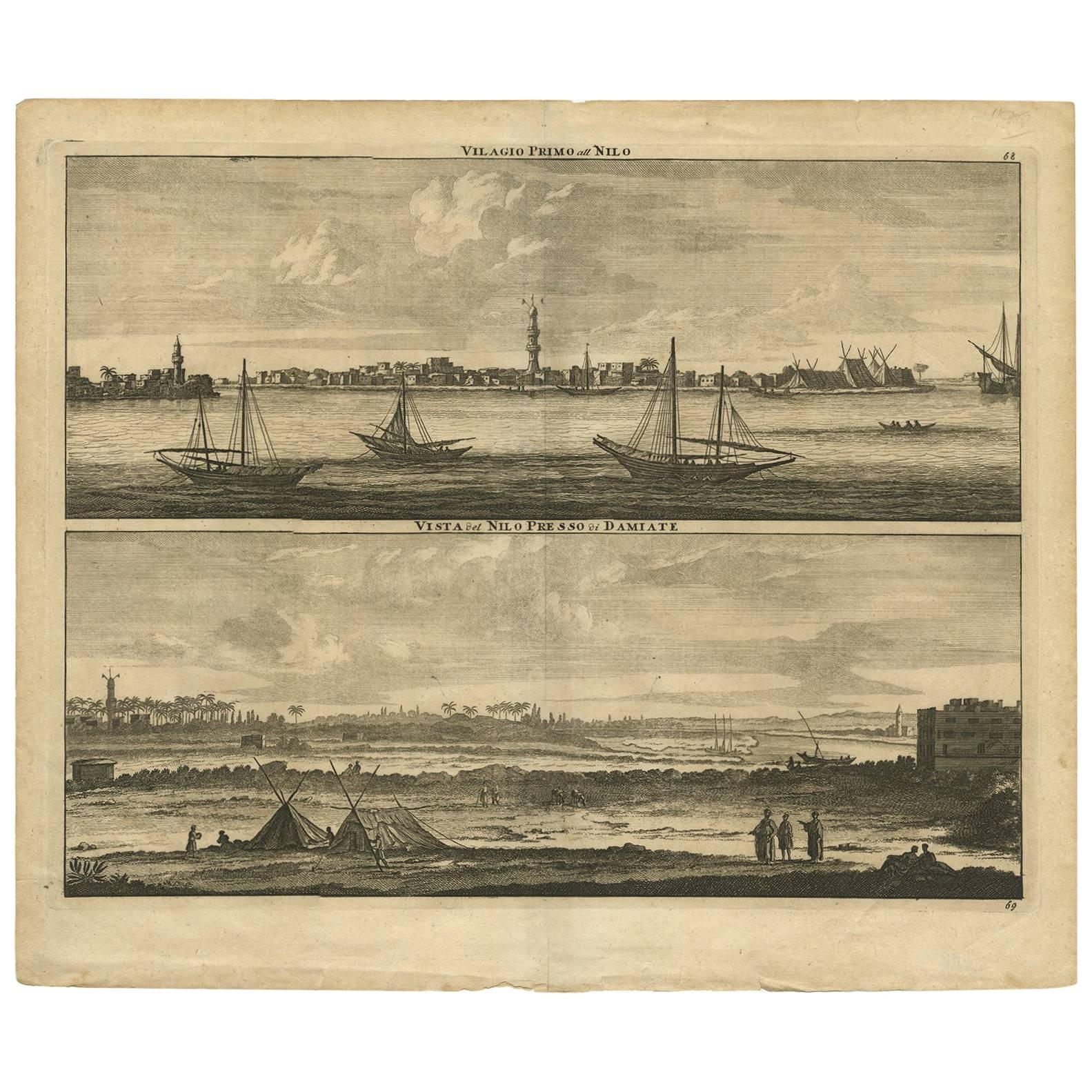
Antique print with views of the Nile, Egypt. Below near Damietta. Published by C. de Bruijn, circa 1700.
Cornelis de Bruijn (also spelled Cornelius de Bruyn, pronounced (1652 – 17...
Category
Antique Early 18th Century Prints
Materials
Paper
Antique Print with Panoramic Views of the Nile 'Egypt' by C. De Bruijn '1700'
Located in Langweer, NL
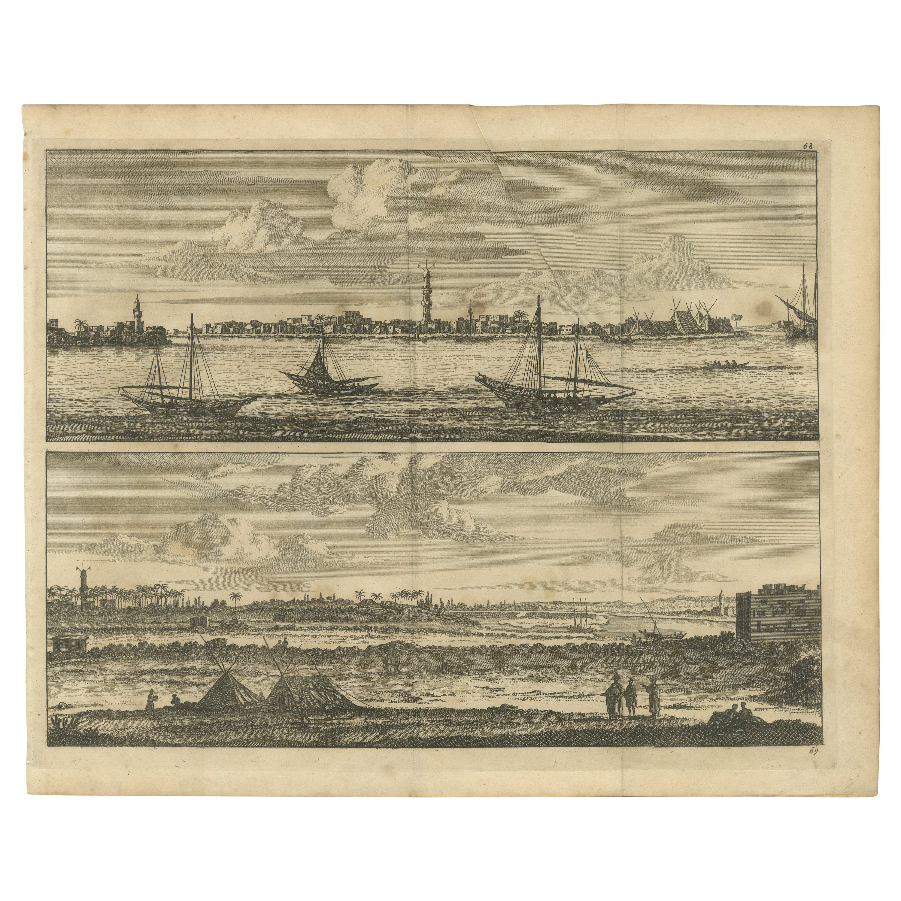
Plate 68-69 : 'Vilagio Primo att Nilo - Vista del Nilo presso di Damiate.' This plate shows panoramic views of the Nile, Egypt. Below near Damietta. This rare print originates from: 'Voyage au Levant c'est a dire dans les principaux endroits de l'Asie Mineure dans les Isles de Chio, de Rhodes, de Chypre &c., de meme que dans les plus considerables villes d'Egypte, de Syrie, et de la Terre Sainte...
Category
Antique Early 18th Century Prints
Materials
Paper
$307 Sale Price
20% Off
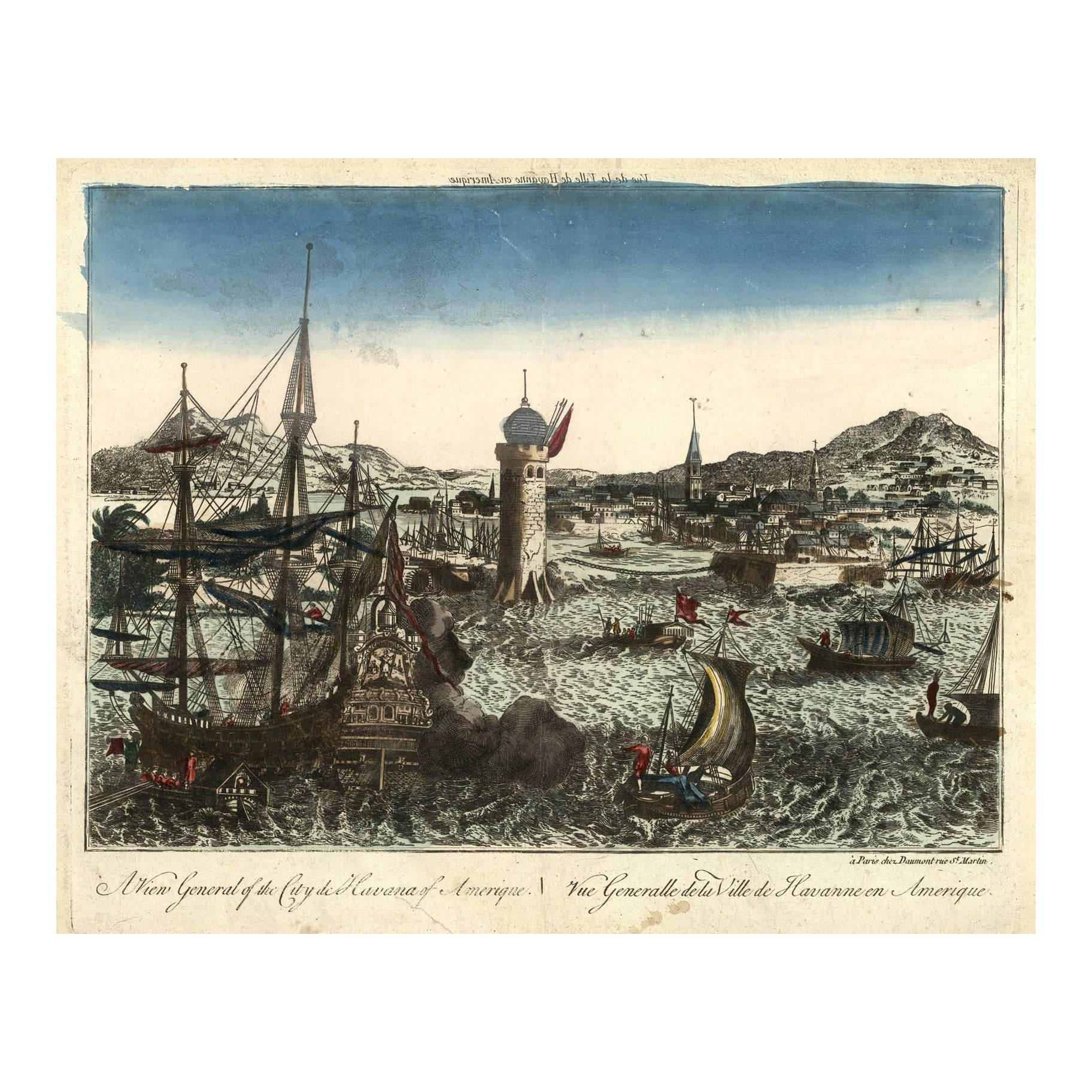
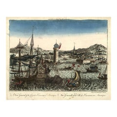
Optical View of Havana, Cuba: A General View of the City from the Sea, ca. 1770
Located in Langweer, NL
"A View General of the City of Havana of Amerique."
Contemporary hand-colored copper engraving, designed as an optical view. Engraved text in French (in reverse) above the image and...
Category
Antique 1770s Prints
Materials
Paper
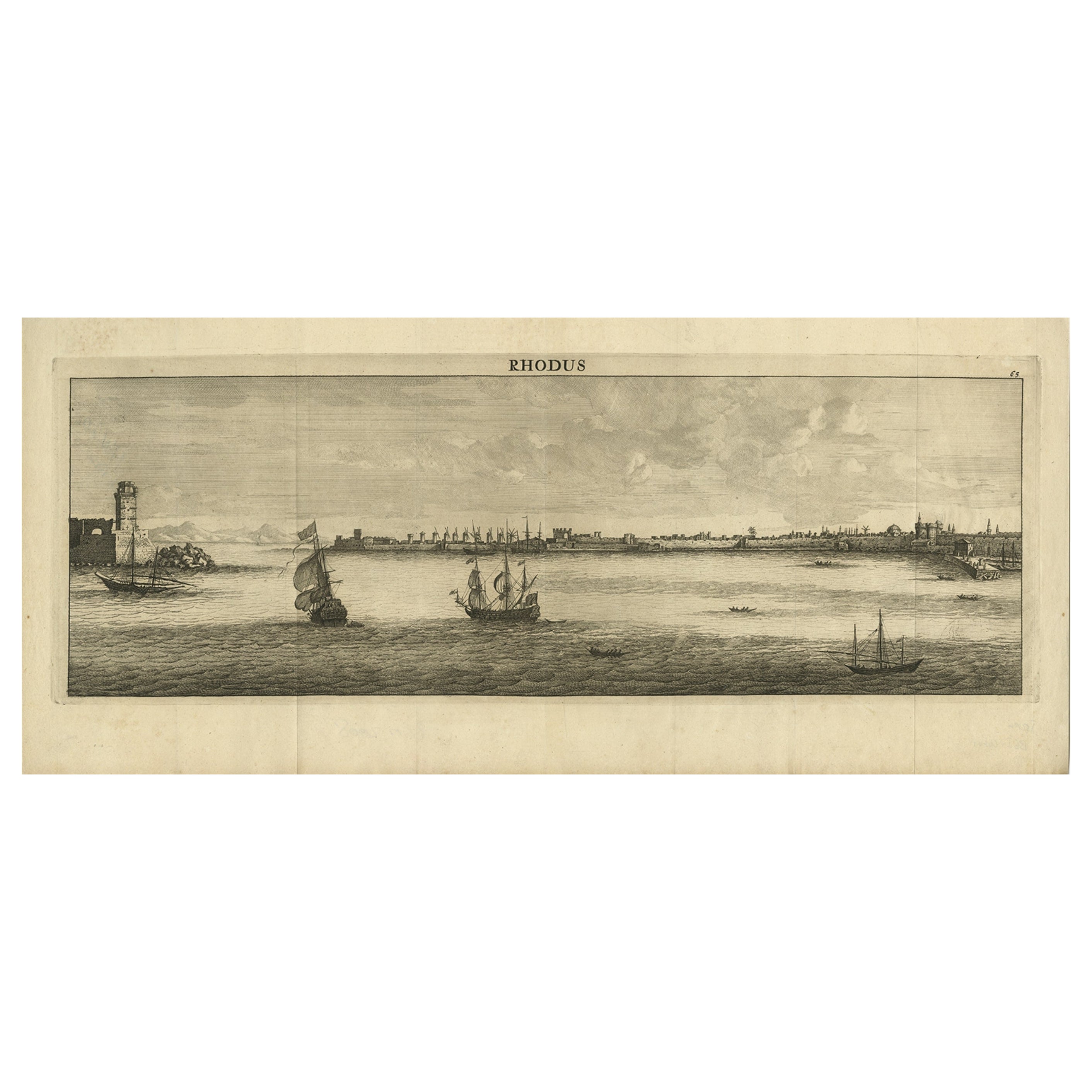
Beautiful View of the Island of Rhodes, Greece, depicting the Old Town with Fort
Located in Langweer, NL
Antique print Greece titled 'Rhodus'. Beautiful view of the Island of Rhodes, Greece, depicting the Old Town with fortifications beside a row of w...
Category
Antique 1690s Prints
Materials
Paper

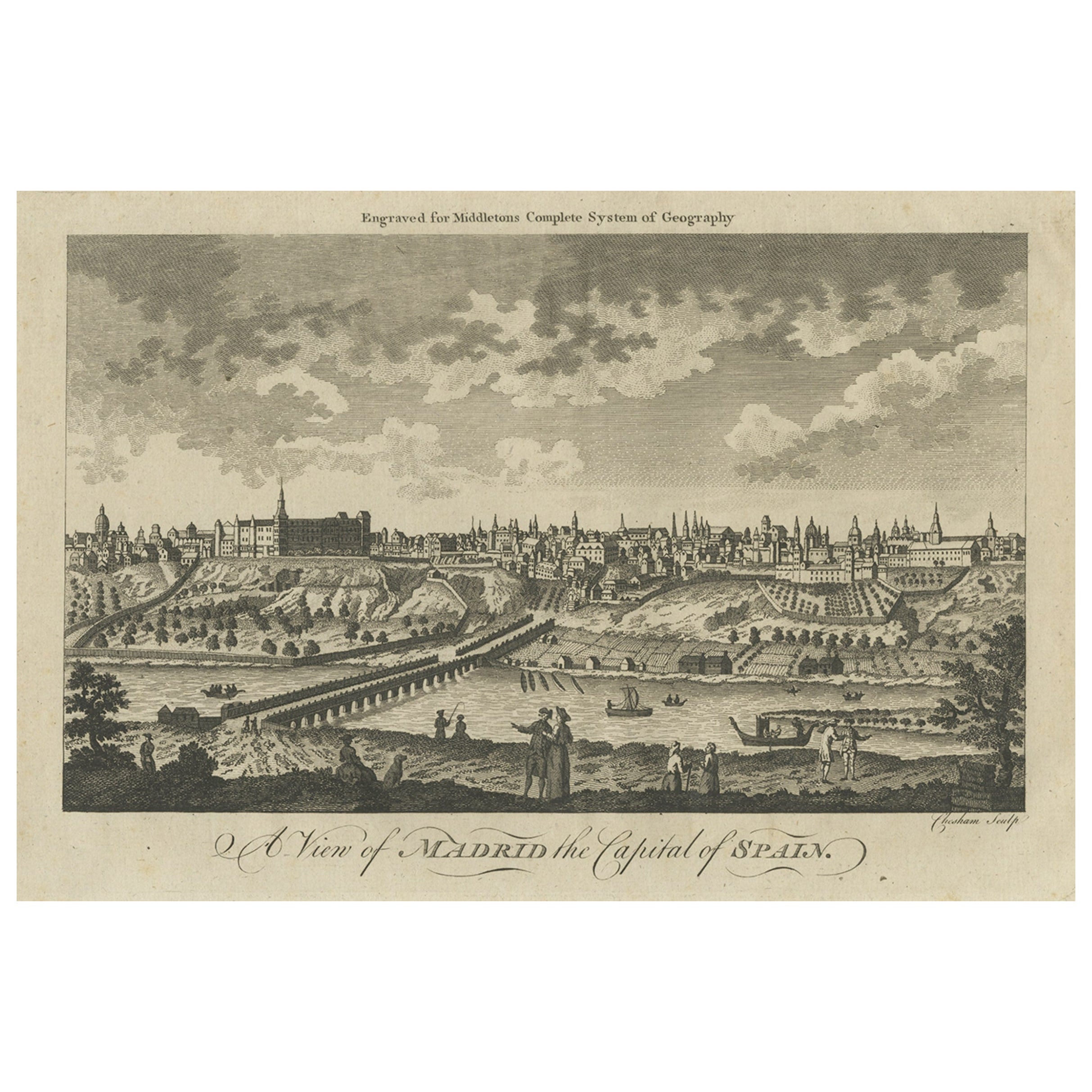
Antique Engraved Print of the City of Madrid, Capital of Spain, c.1780
Located in Langweer, NL
Antique print titled 'A View of Madrid the Capital of Spain'. View of the city of Madrid, Spain. Shows figures in the foreground, pleasure boats, a bridge, the Royal Palace, parkland...
Category
Antique 18th Century Prints
Materials
Paper

$217 Sale Price
20% Off
You May Also Like
Original Antique Print of Cairo, Egypt. Dated 1809
Located in St Annes, Lancashire
Wonderful image of Cairo
Fine copper-plate engraving
Published by Sherwood & Co.
Dated 1809
Unframed.
Free shipping
Category
Antique Early 1800s English Moorish Prints
Materials
Paper
Original Antique Print of Alexandria, Egypt, circa 1850
Located in St Annes, Lancashire
Wonderful image of Alexandria
Fine steel engraving after W.H Bartlett
Published circa 1850
Unframed.
Free shipping
Category
Antique 1850s English Moorish Prints
Materials
Paper

Lithograph View on Nieuw Amsterdam J . Vingboons 1660s
Located in Den Haag, NL
Afther a gouache by J Vingboons 1660s Beautiful Lithograph from 1910/20
Nieuw Amsterdam ofte nue nieuw Lorx opt Teyland Man .
Very nice fresh colors . Comes with a old label on the...
Category
Antique 1650s Dutch American Colonial Prints
Materials
Paper
Ancient View of Alexandria - Original Lithograph - Mid-19th Century
Located in Roma, IT
Ancient View of Alexandria is an original modern artwork realized in the mid-19th Century
Original B/W Lithograph on Ivory Paper.
Inscripted on the lower margin in Capital Letters...
Category
Mid-19th Century Figurative Prints
Materials
Paper, Lithograph

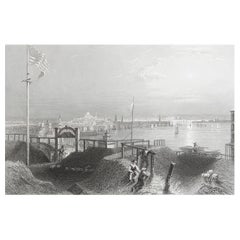
Original Antique Print of Boston, Massachusetts. Dated 1838
Located in St Annes, Lancashire
Great print of Boston
Steel engraving after W.H Bartlett
Published by Virtue 1838
Unframed.
The measurement is the paper size.
Free shipping
Category
Antique 1830s English Other Prints
Materials
Paper
View of the City of Paris from the side of the island called... - Etching - 1748
Located in Roma, IT
Etching on paper realized in 1748.
Very good condition except for some minor foxing.
Includes a wooden frame cm. 27.5x41.5
Category
1740s Modern Abstract Prints
Materials
Etching
More Ways To Browse
Curtis Jere Chrome Sculpture
Dalmatian Dog
Danish Dog
Diamond Inlay Chest
Dollar Pattern
Drop Front Walnut Secretary
Eileen Gray Lacquer
Francois Gerard
French Bulldog Art
French Primitive Cabinet
French Rococo Bed
Furniture Polish For Birdseye Maple
Georgian Chest On Stand
Green Giraffe
Hand Painted Bed Queen
Hexagon Game Table
Naked Figurine
Octopus Sculptures