Items Similar to Pair of Road Maps of England by John Ogilby

Want more images or videos?
Request additional images or videos from the seller
1 of 16
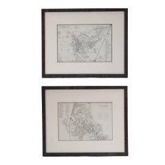
Pair of Road Maps of England by John Ogilby
$1,850per set
£1,403.74per set
€1,605.05per set
CA$2,583.95per set
A$2,873per set
CHF 1,500.12per set
MX$34,971.39per set
NOK 19,140.90per set
SEK 17,934.11per set
DKK 11,978.77per set
Shipping
Retrieving quote...The 1stDibs Promise:
Authenticity Guarantee,
Money-Back Guarantee,
24-Hour Cancellation
About the Item
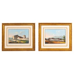
The first road maps of England. London to Holyhead and London to Carlisle. Nicely framed and matted. These are plates removed from a book. These are first editions printed in the late 17th century.
- Dimensions:Height: 23 in (58.42 cm)Width: 27.5 in (69.85 cm)Depth: 1.25 in (3.18 cm)
- Sold As:Set of 2
- Materials and Techniques:
- Place of Origin:
- Period:1690-1699
- Date of Manufacture:1700
- Condition:Print dimensions: 17.38 W x 12.88 H.
- Seller Location:Essex, MA
- Reference Number:1stDibs: LU838128303892
About the Seller
4.9
Vetted Professional Seller
Every seller passes strict standards for authenticity and reliability
Established in 2007
1stDibs seller since 2007
932 sales on 1stDibs
Typical response time: 2 hours
Associations
The Art and Antique Dealers League of America
- ShippingRetrieving quote...Shipping from: Essex, MA
- Return Policy
Authenticity Guarantee
In the unlikely event there’s an issue with an item’s authenticity, contact us within 1 year for a full refund. DetailsMoney-Back Guarantee
If your item is not as described, is damaged in transit, or does not arrive, contact us within 7 days for a full refund. Details24-Hour Cancellation
You have a 24-hour grace period in which to reconsider your purchase, with no questions asked.Vetted Professional Sellers
Our world-class sellers must adhere to strict standards for service and quality, maintaining the integrity of our listings.Price-Match Guarantee
If you find that a seller listed the same item for a lower price elsewhere, we’ll match it.Trusted Global Delivery
Our best-in-class carrier network provides specialized shipping options worldwide, including custom delivery.More From This Seller
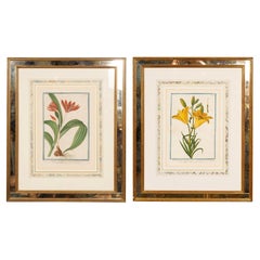
View AllJohann Wilhelm Weinmann Framed Pair Of Botanical Prints
Located in Essex, MA
With strikingly bright images set in a giltwood frame with inset glass. Triple matted with marbled board. Very minor foxing and very minor chipping on outer edge of frame that will ...
Category
Antique Mid-18th Century German Prints
Materials
Mirror, Wood, Giltwood, Paper
Set Of Eight Hand Colored Engravings Of English Country Houses By Johannes Kip
Located in Essex, MA
A Dutch / English engraver born in Amsterdam and settled in London in the late 1680s. These engravings are from his most important work " Brittania Illustrata , a series of etchings ...
Category
Antique 1710s Dutch Prints
Materials
Wood, Giltwood, Paper
Two Italian Grand Tour Gouaches of Ancient Temples
Located in Essex, MA
In quality gilt wood frames one signed "Temple of Giganti in Siracusa the other Temple de Esculapio.
One a scene from Sicily and the other Roman. Temple Esculapio is a ruin of an ancient Roman temple of Asklepios, the Greek god of medical art.
Category
Antique 19th Century Paintings
Materials
Paper
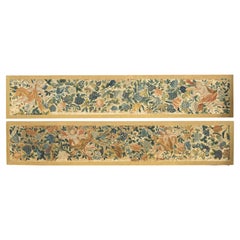
Pair Of European Needlepoint Panels
Located in Essex, MA
Two rectangular panels each featuring a pair of cherubs amongst grape leaves and grapes. Would be great in a dining room.
Category
Antique Early 19th Century European Neoclassical Decorative Art
Materials
Organic Material
$2,850 / set
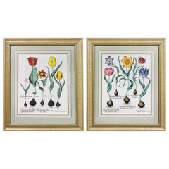
Pair of Framed Hand Colored Engravings of Tulips by Basilius Besler
By Basilius Besler
Located in Essex, MA
Each with crisp vivid colors of the most desirable tulip series.
Category
Antique Mid-17th Century European Prints
Materials
Paper
Pair Of Hand Colored Engravings Of Moths
Located in Essex, MA
Nicely framed with marbled double matting and gilded and painted frames.
Category
Antique 1780s English Prints
Materials
Wood, Paper
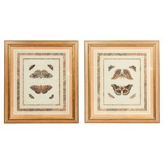
$950 / set
You May Also Like
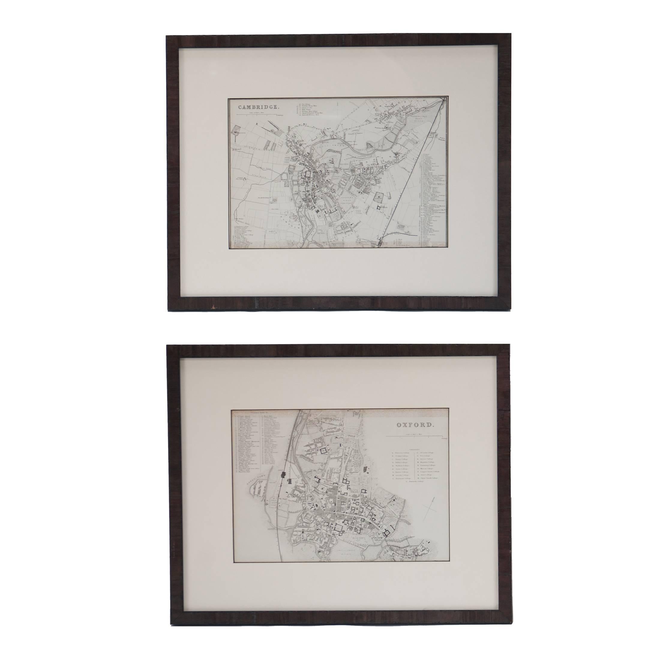
Mid 19th Century Pair of Framed English Maps of Oxford and Cambridge
Located in Los Angeles, CA
This pair of maps featuring Oxford and Cambridge is beautifully preserved in custom black wood frames. These hand-drawn maps showcase exquisite lettering and a remarkable level of de...
Category
Antique 19th Century English Victorian Prints
Materials
Paper, Wood
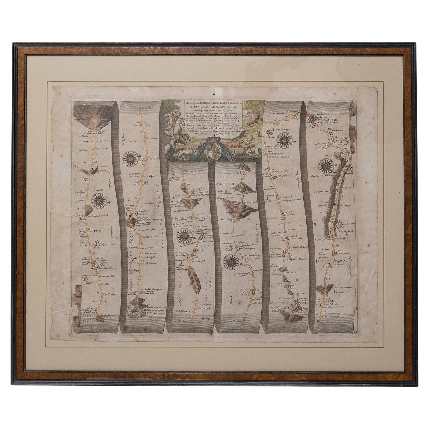
Road Map Britannia No 32 the Road from London to Barnstable John Ogilby Framed
By John Ogilby
Located in BUNGAY, SUFFOLK
A road map from Britannia, by John Ogilby Esq., Cosmographer and Geographick Printer to Charles II. Containing 293 miles. No 32.
From Standard in Cornhill London to Andover thence to Amesbury, to Shruton, to Warminster, to Maiden-Bradley, to Bruton, to Weston, to Ascot and to Bridgewater
Hand coloured, some foxing and creasing, commensurate with age.
Floated in a cream mount with a gilded linear border within a burr walnut, ebonised and gilded frame.
Provenance : purchased as pair from a collector with no 15 London to St Davids. Framed as a pair.
Measures: Black Linear Border around Map Length 44cm., 17 1/8" Height 36cm., 14".
Full Sheet Length 51cm., 20" Height 39cm., 15 1/4"
Frame Length 62cm., 24 1/2 " Height 52cm., 20 1/2"
Literature: In a remarkable life John Ogilby pursued, several careers, each ending in misfortune, and yet he always emerged undeterred, to carry on. His modern reputation is based on his final career, started in his sixty-sixth year, as a publisher of maps and geographical accounts.
Ogilby was born outside Dundee, in 1600, the son of a Scottish gentleman. While he was still a child, the family moved to London. When the elder Ogilby was imprisoned for debt, the young John invested his savings in a lottery, won a minor prize, and settled his father's debts. Unfortunately, not enough money was left to secure John a good apprenticeship; instead, he was apprenticed to a dance master. Ogilby was soon dancing in masques at court but, one day, while executing a particularly ambitious leap, he landed badly. The accident left him with a permanent limp, and ended his dancing career. However, he had come to the attention of Thomas Wentworth, later Earl of Strafford, Charles I's most senior minister. Ever one to exploit his contacts, Ogilby became a dance instructor in Strafford's household.
When Strafford was sent to Ireland, Ogilby accompanied him as Deputy-Master of the Kings Revels, and then Master of Revels. In Dublin, he built the New Theatre, in St. Werburgh Street, which prospered at first, but the Irish Rebellion, in 1641, cost Ogilby his fortune, which he estimated at £2,000, and almost his life. After brief service as a soldier, he returned to England, survived shipwreck on the way, and arrived back penniless.
On his return, Ogilby turned his attention to the Latin classics, as a translator and publisher. His first faltering attempt, in 1649, was a translation of the works of Virgil, but after his marriage to a wealthy widow the same year, his publishing activities received a considerable boost. One means by which Ogilby financed these volumes was by subscription, securing advance payments from his patrons, in return for including their name and coats-of-arms on the plates of illustrations. Another approach was to secure a patron, preferably in the court circle. Ogilby's first patron was Strafford, who found out too late that all leading ministers are dispensable when Charles I assented to his execution in 1641. As he re-established himself, Ogilby sought a new patron, the King himself.
In 1661, Ogilby was approached to write poetry for Charles II's coronation procession; he later published 'The Relation of His Majesties Entertainment Passing Through the City of London', and a much enlarged edition the following year, which included a Fine set of plates depicting the procession. Royal favour was bestowed in 1674 when John Ogilby received the title of 'His Majesty's Cosmographer and Geographick Printer' with a salary of £13.6s.8d per annum.
In 1665, Ogilby left London to avoid the Plague then ravaging the capital. The following year, in the Great Fire of London, Ogilby claimed that he lost his entire stock of books valued at some £3,000, as well as his shop and house, leaving him worth just £5.
As he sought to restore his fortunes, Ogilby was already looking in new directions. The initial opportunity he seized on was the reconstruction of London's burnt-out centre. He secured appointment as a 'sworn viewer', whose duty was to establish the property boundaries as they existed before the Fire. Ogilby was assisted in the project by his step-grandson, William Morgan...
Category
Antique Late 17th Century English Charles II Maps
Materials
Paper
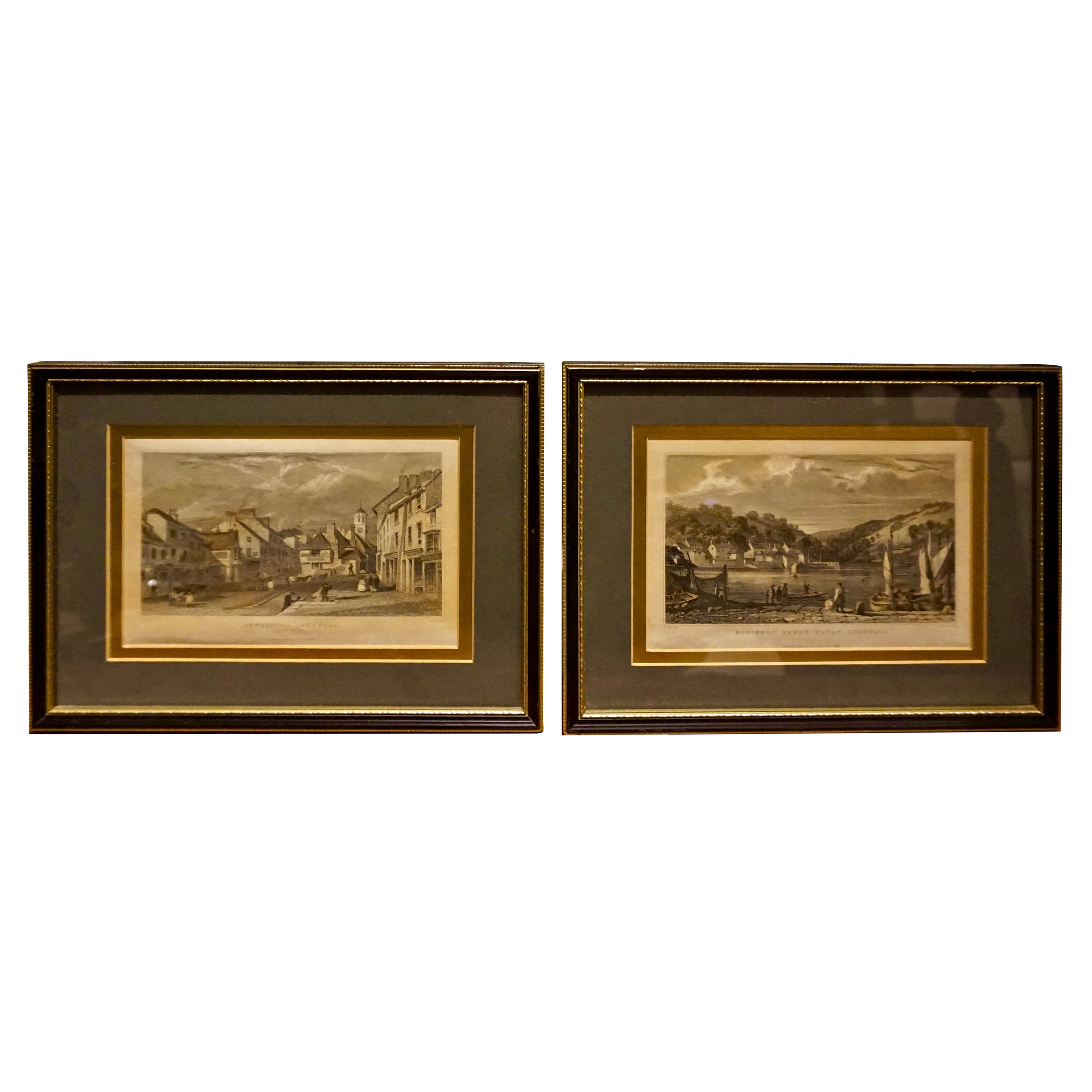
Pair of Early Victorian English Stamped Framed & Mounted Cornwall Aquatints
Located in Vancouver, British Columbia
Fine pair of Fisher & Son London hand coloured engravings from the early Victorian Period. Beautifully framed and mounted and in good condition. Detailed scenes of Cornwall...
Category
Antique 1830s English Early Victorian Decorative Art
Materials
Paper
$1,440 Sale Price / set
20% Off
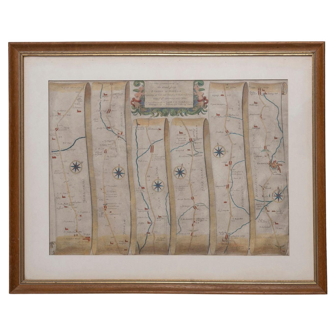
Road Map, John Ogilby, London, Barwick, York, Chester, Darlington, Durham Framed
By John Ogilby
Located in BUNGAY, SUFFOLK
The continuation of the road from London to Barwick beginning at York and extending to Chester in ye Street. Plate ye 4th continuing 76 ½ miles. No 8.
York to Burrowbridge, to Top...
Category
Antique 1670s English Baroque Maps
Materials
Paper

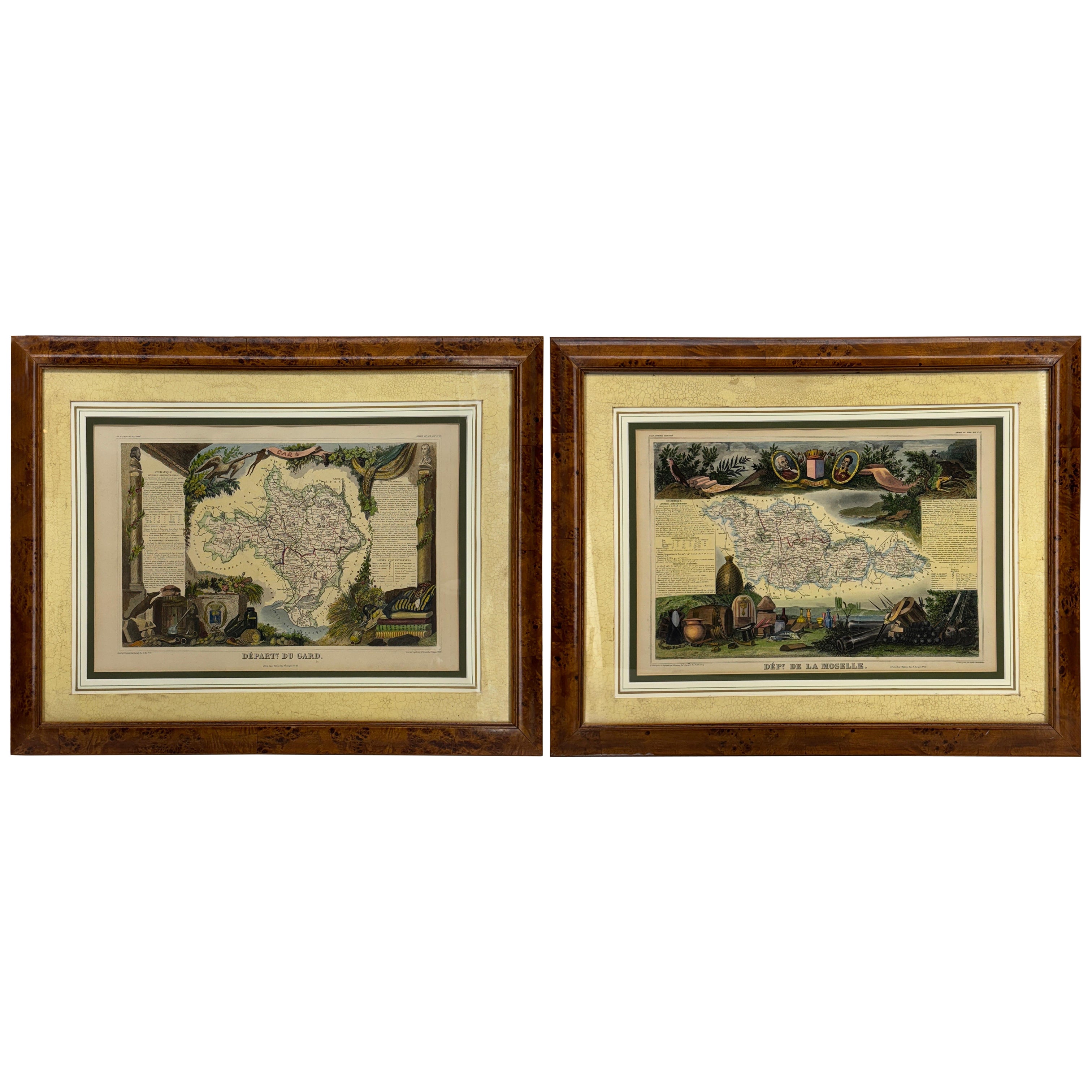
Set of Two 19th Century French Hand-Colored Regional Maps
Located in Haddonfield, NJ
These historical regional maps depict the “Dépt de la Moselle" (Department of Moselle) and the Departement de Gard in France. Both pieces date back to the 19th Century, given their s...
Category
Antique 19th Century French Empire Drawings
Materials
Wood, Paper
Antique Lithography Map, Derbyshire, English, Framed Cartography, Victorian
Located in Hele, Devon, GB
This is an antique lithography map of Derbyshire. An English, framed atlas engraving of cartographic interest, dating to the mid 19th century and later.
Superb lithography of Derby...
Category
Antique Mid-19th Century British Victorian Maps
Materials
Glass, Wood, Paper

More Ways To Browse
Chinese Brass Pagoda
Chinese Dragon Pot
Chinese Drum Stool
Chinese Porcelain Rooster
Chinese Two Drawer Table
Chinese Water Pot
Cinnabar Table
Circle Bed
Clay Olive Jar
Cobalt Glass Jar
Coin Chest
Colonial Style Chest Of Drawers
Danish Tea Pot
De Gournay Wallpaper
Delft Blue Holland Birds
Delft Charger Plates
Dragon Horn
Empire Secretary Mahogany