Items Similar to Portraits of the World: Engraved Illustrations for Payne's Universal Geography
Want more images or videos?
Request additional images or videos from the seller
1 of 10
Portraits of the World: Engraved Illustrations for Payne's Universal Geography
$368.90
$527.0130% Off
£273.38
£390.5430% Off
€308
€44030% Off
CA$503.62
CA$719.4630% Off
A$560.26
A$800.3730% Off
CHF 293.70
CHF 419.5730% Off
MX$6,846.25
MX$9,780.3630% Off
NOK 3,739.85
NOK 5,342.6430% Off
SEK 3,520.55
SEK 5,029.3630% Off
DKK 2,345.08
DKK 3,350.1230% Off
Shipping
Retrieving quote...The 1stDibs Promise:
Authenticity Guarantee,
Money-Back Guarantee,
24-Hour Cancellation
About the Item
An original antique engraving titled "Engraved for PAYNE'S Universal Geography."
This title, along with the note "Vol.II page 648," suggests it is an illustration from a volume of a geographical compendium or encyclopedia. The engraving includes portraits labeled with different latitudes, suggesting that it represents individuals from various parts of the world as understood at the time of the work's publication.
As for the maker, the engraving is noted to be "Published March 1st 1791 by J. Wilkes." John Wilkes is likely the publisher or engraver associated with this piece. Unfortunately, without a more precise context or a visible engraver's mark that is common in such works, identifying the exact artist may require further research into the archives of John Wilkes's published works.
Payne's "Universal Geography" was a well-known work published in multiple volumes at the end of the 18th century and into the 19th century.
The locations associated with the individuals in the engraving are as follows and based on the names given:
1. **Prince William's Sound**: This is likely referring to the indigenous people of the Prince William Sound region of Alaska. The term "Prince William's Sound" would have been used during the time of European exploration and early contact with the native populations of that area.
2. **The Friendly Islands**: This is an archaic name for the Kingdom of Tonga in the South Pacific. European explorers named Tonga the "Friendly Islands" due to the congenial reception they received from the locals when they arrived in the 18th century.
3. **Van Diemen's Land**: This is the historical name for Tasmania, an island state of Australia. It was named by the Dutch explorer Abel Tasman in 1642 and was known as Van Diemen's Land until it was renamed Tasmania in 1856, in honor of Tasman himself.
These locations are spread across different parts of the world and the indigenous peoples of these regions would have been depicted according to the European illustrators' interpretations at the time. The representations were intended to convey the diversity of human societies encountered by explorers and were typical of ethnographic illustrations of that period.
- Dimensions:Height: 11.62 in (29.5 cm)Width: 8.27 in (21 cm)Depth: 0 in (0.02 mm)
- Materials and Techniques:Paper,Engraved
- Period:1790-1799
- Date of Manufacture:circa 1791
- Condition:Good to almost Excellent condition. Very light soiling around the right border. Study the image carefully.
- Seller Location:Langweer, NL
- Reference Number:Seller: BG-13599-41stDibs: LU3054337994892
About the Seller
5.0
Recognized Seller
These prestigious sellers are industry leaders and represent the highest echelon for item quality and design.
Platinum Seller
Premium sellers with a 4.7+ rating and 24-hour response times
Established in 2009
1stDibs seller since 2017
2,502 sales on 1stDibs
Typical response time: <1 hour
- ShippingRetrieving quote...Shipping from: Langweer, Netherlands
- Return Policy
Authenticity Guarantee
In the unlikely event there’s an issue with an item’s authenticity, contact us within 1 year for a full refund. DetailsMoney-Back Guarantee
If your item is not as described, is damaged in transit, or does not arrive, contact us within 7 days for a full refund. Details24-Hour Cancellation
You have a 24-hour grace period in which to reconsider your purchase, with no questions asked.Vetted Professional Sellers
Our world-class sellers must adhere to strict standards for service and quality, maintaining the integrity of our listings.Price-Match Guarantee
If you find that a seller listed the same item for a lower price elsewhere, we’ll match it.Trusted Global Delivery
Our best-in-class carrier network provides specialized shipping options worldwide, including custom delivery.More From This Seller
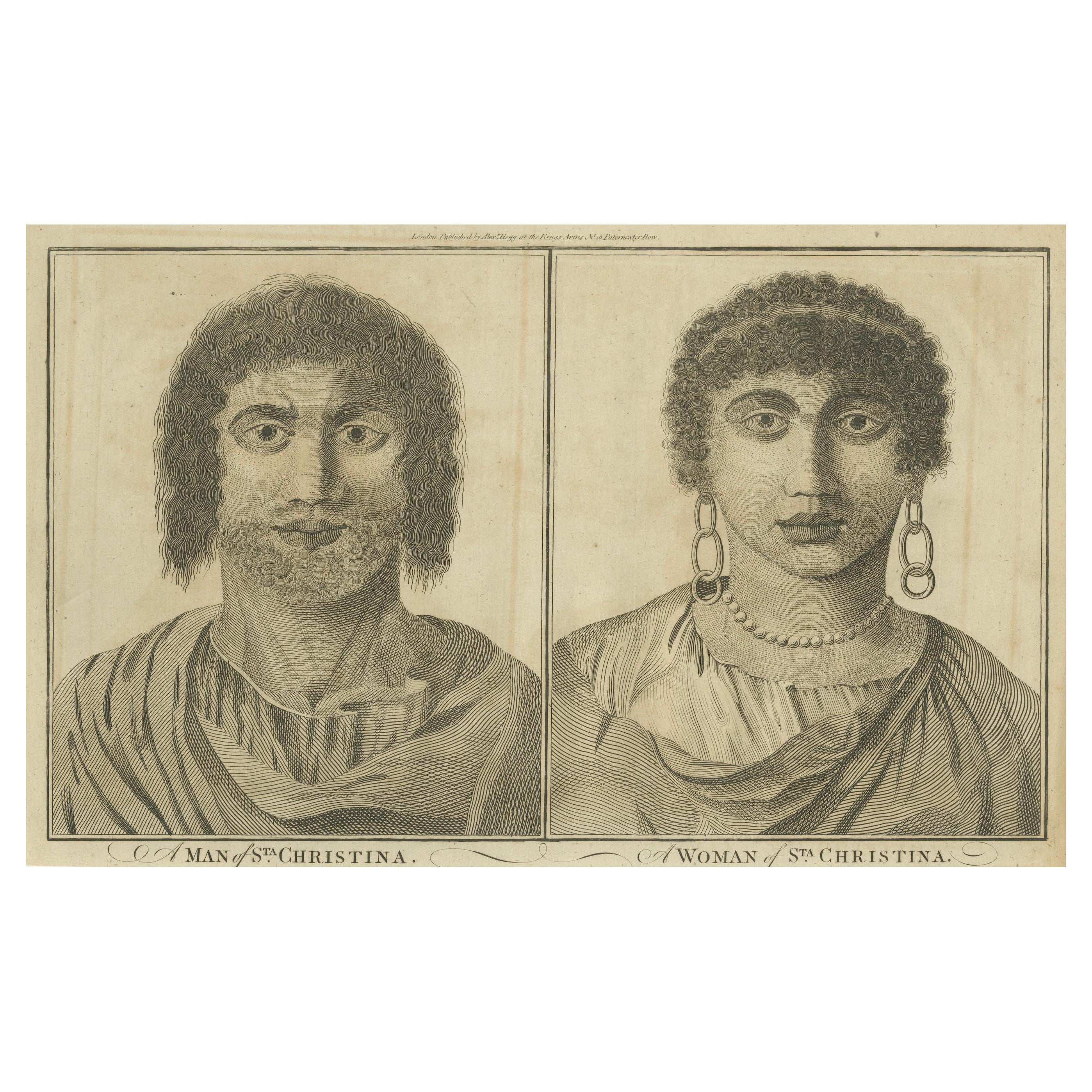
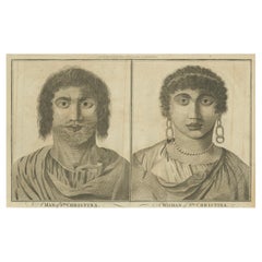
View AllFaces of Santa Cristina: Portraits from the Age of Discovery, Engravings of 1785
Located in Langweer, NL
The engraving shows two individuals labeled as "A MAN of STA CHRISTINA." and "A WOMAN of STA CHRISTINA."
On the left, the man is depicted with a direct gaze, curly hair, and a strip...
Category
Antique 1780s Prints
Materials
Paper
$172 Sale Price
20% Off
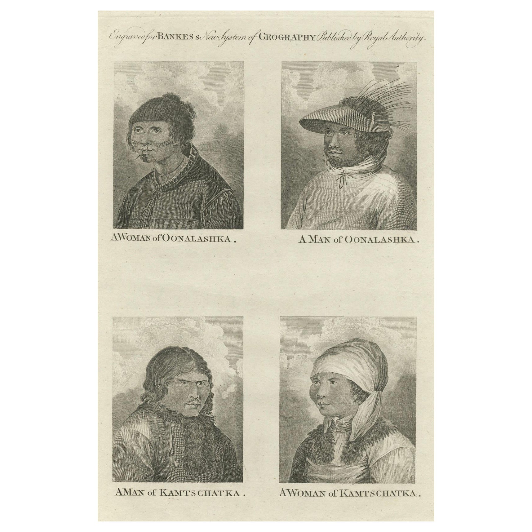
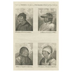
Indigenous Peoples of the Bering Sea: Portraits from the 18th-Century Engravings
Located in Langweer, NL
This original engraving contains four portrait engravings, two each of individuals from Unalaska (Oonalashka) and Kamchatka. These engravings, like the previous ones, are from "Banke...
Category
Antique 1780s Prints
Materials
Paper
$316 Sale Price
20% Off
Free Shipping
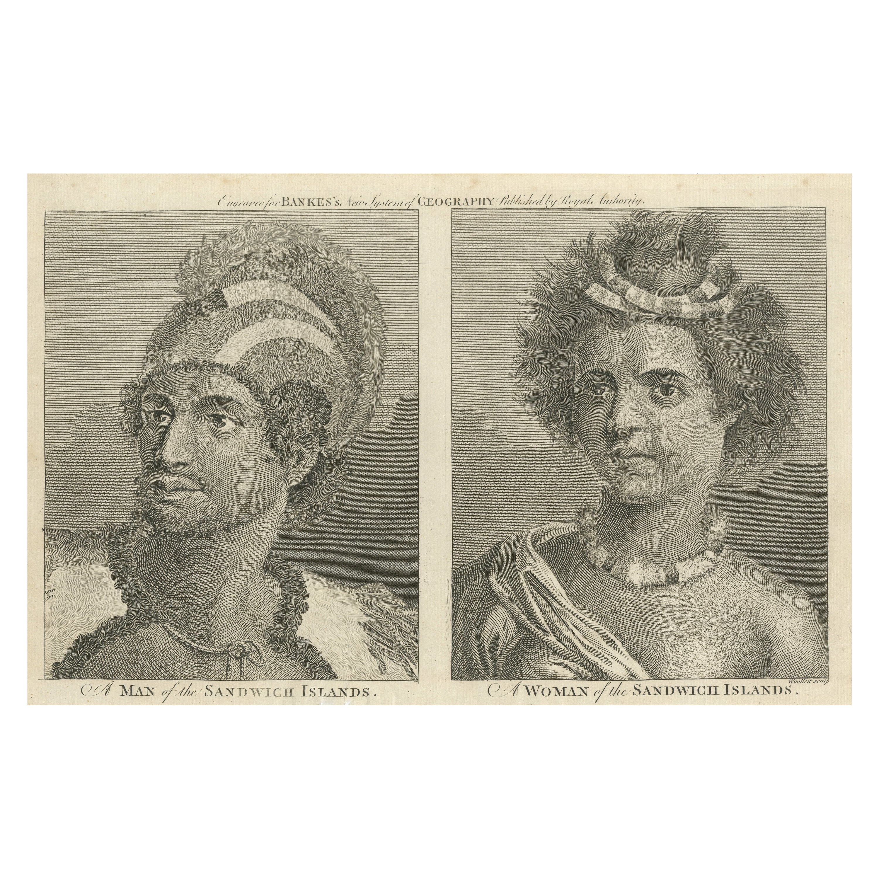
Portraits of Nobility from the Sandwich Islands (Hawaii), Published circa 1790
Located in Langweer, NL
This original antique engraving is a set of two portraits side by side from "A New, Royal, Authentic and Complete System of Universal Geography, Antient and Modern" published by C. C...
Category
Antique Late 18th Century Prints
Materials
Paper

$306 Sale Price
20% Off
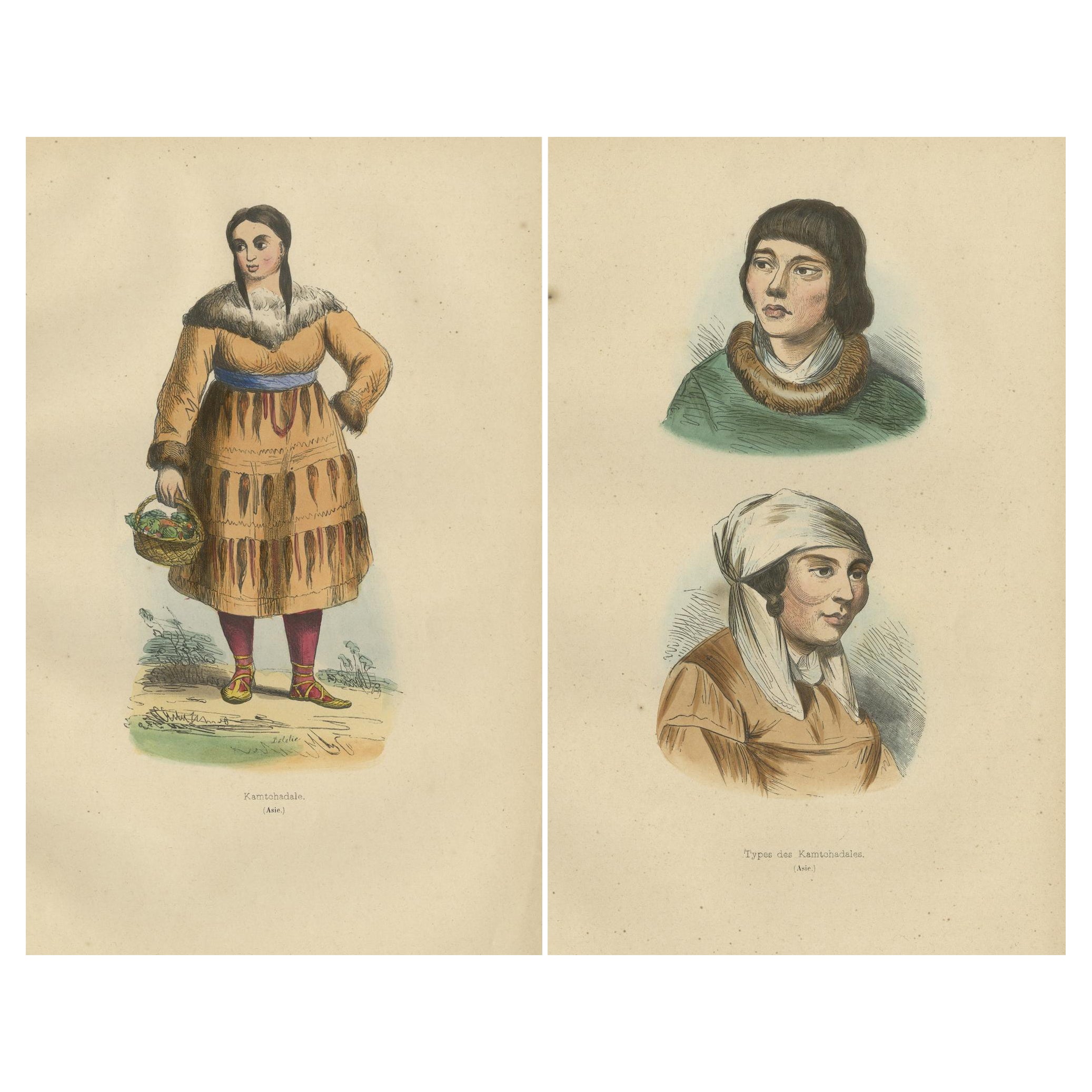
Traditional Kamchatdale Portraits: Engravings from 19th-Century Exploration
Located in Langweer, NL
Title: "Traditional Kamchatdale Portraits: Engravings from 19th-Century Exploration"
These two prints showcase individuals from the Kamchatka Peninsula, illustrating the rich cultur...
Category
Antique 1840s Prints
Materials
Paper

$210 Sale Price / set
20% Off
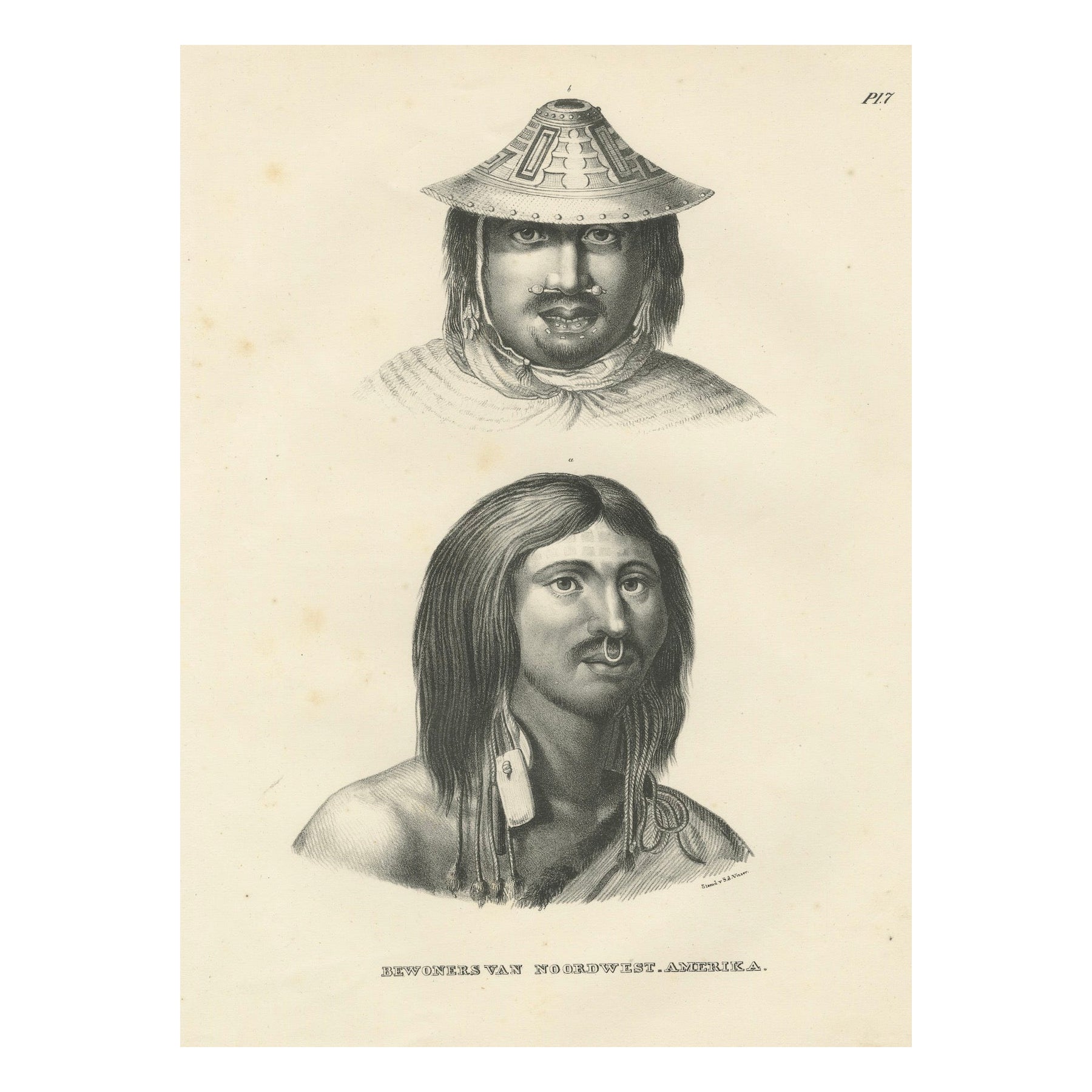
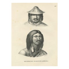
Portraits of Inhabitants of Northwest America by Karl Joseph Brodtmann, 1836
Located in Langweer, NL
This lithograph, by Karl Joseph Brodtmann, is labeled "Bewoners van Noordwest-Amerika" (Inhabitants of Northwest America). It depicts two individuals from indigenous groups likely li...
Category
Antique 1830s Prints
Materials
Paper
$344 Sale Price
34% Off
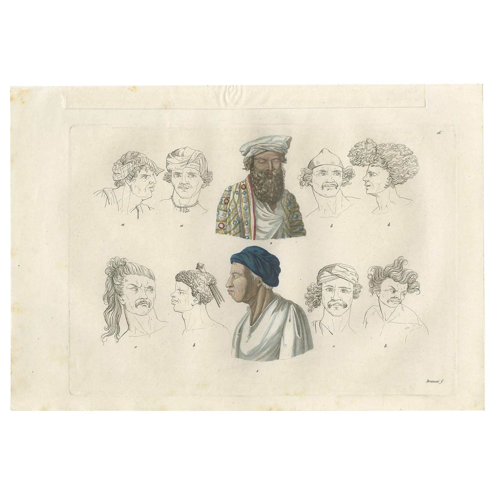
Antique Print of Various Natives of Southeast Asia by Ferrario, '1831'
Located in Langweer, NL
Original antique print of various natives of Southeast Asia ('Guébé', 'Vegiù' and Malaysia). This print originates from 'Costume Antico e Moderno: Palestine, China, India, Oceania' b...
Category
Antique Mid-19th Century Prints
Materials
Paper
$191 Sale Price
20% Off
You May Also Like
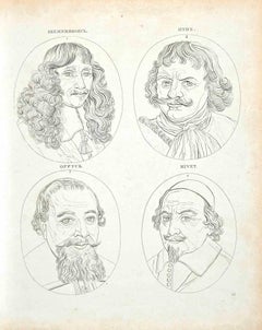
Portraits - Original Etching by Thomas Holloway - 1810
By Thomas Holloway
Located in Roma, IT
Portraits is an original etching artwork realized by Thomas Holloway for Johann Caspar Lavater's "Essays on Physiognomy, Designed to Promote the Knowledge and the Love of Mankind", L...
Category
1810s Modern Figurative Prints
Materials
Etching
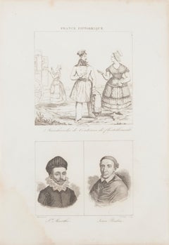
Ancient Costume - Lithograph - Late 19th century
Located in Roma, IT
Ancient Costume is a lithograph print on paper made in Late 19th century.
Good conditions with slight foxing and a yellowish stain on the lower right.
From the suite of "France Pit...
Category
Late 19th Century Modern Figurative Prints
Materials
Lithograph
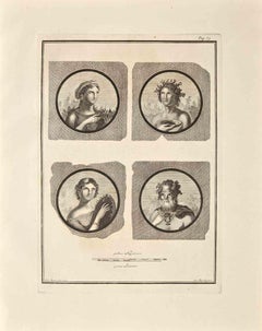
Ancient Roman Portraits - Etching by Giovanni Morghen - 18th Century
Located in Roma, IT
Ancient Roman Portraits from the series "Antiquities of Herculaneum", is an etching on paper realized by Giovanni Morghen in the 18th Century.
Signed on the plate.
Good condition...
Category
Late 18th Century Old Masters Figurative Prints
Materials
Etching
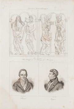
Christian Art and Portraits - Original Lithograph - 19th Century
Located in Roma, IT
Christian Art and Portraits is an original lithograph realized by an anonymous engraver of the 19th Century.
Printed in series "France Pittoresque", as indicated at the top center.
Titled in France on the lower center. Included three images on a sheet.
The state of preservation of the artwork is good except for diffused foxing due to timing.
A fascinating piece of art represents portraits on the lower and Christian grotesque art...
Category
19th Century Figurative Prints
Materials
Lithograph
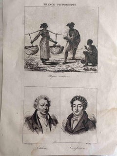
Portraits - Original Etching - 19th Century
Located in Roma, IT
Portrait is an original etching artwork realized by an anonymous engraver of the XIX century.
Printed in series of "France Pittoresque" at the top center.
Titled in France on the l...
Category
19th Century Modern Portrait Prints
Materials
Etching
The Portraits of Masters - Original Etching by Thomas Holloway - 1810
By Thomas Holloway
Located in Roma, IT
The Portraits of Masters is an original etching artwork realized by Thomas Holloway for Johann Caspar Lavater's "Essays on Physiognomy, Designed to Promote the Knowledge and the Love...
Category
1810s Modern Figurative Prints
Materials
Etching