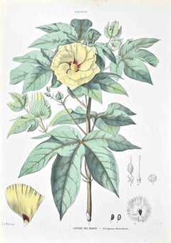
Items Similar to Scarlet Rosemallow from The Native Flowers and Ferns of the United States, 1879


Want more images or videos?
Request additional images or videos from the seller
1 of 6
Scarlet Rosemallow from The Native Flowers and Ferns of the United States, 1879
$103.97
$129.9620% Off
£77.93
£97.4120% Off
€88
€11020% Off
CA$142.83
CA$178.5420% Off
A$159.46
A$199.3320% Off
CHF 83.56
CHF 104.4420% Off
MX$1,951.96
MX$2,439.9520% Off
NOK 1,061.15
NOK 1,326.4420% Off
SEK 1,000.53
SEK 1,250.6620% Off
DKK 669.89
DKK 837.3620% Off
Shipping
Retrieving quote...The 1stDibs Promise:
Authenticity Guarantee,
Money-Back Guarantee,
24-Hour Cancellation
About the Item
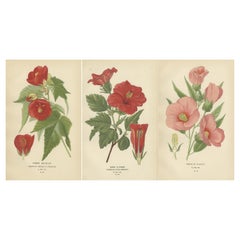
The image is a colored chromolithograph of the Hibiscus coccineus, commonly known as the American Scarlet Rosemallow, from the work 'The Native Flowers and Ferns of the United States' by Thomas Meehan, published in 1879 (Volume 2).
The illustration features a large, vibrant red flower with five distinct petals, a prominent central stamen column with yellow anthers, and a green stem with leaves. The flower is shown in a side view, displaying its radial symmetry and the overlapping arrangement of the petals. Below the main image, there are two smaller illustrations in ink: on the left, a bud of the Hibiscus coccineus is depicted before bloom, and on the right, a detailed drawing of a leaf showing its veination pattern.
The chromolithograph technique involves layering several lithographic prints, each with a different color, to create a rich, painterly effect. This image is a fine example of the art, capturing the vivid hues and delicate textures of the plant. The detail in the stamen and the subtle shading of the petals suggest the flower's natural beauty and the artist's attention to botanical accuracy.
- Dimensions:Height: 9.85 in (25 cm)Width: 7.09 in (18 cm)Depth: 0 in (0.02 mm)
- Materials and Techniques:
- Period:
- Date of Manufacture:1879
- Condition:Good condition. The right side with some dry glue remains along the edge. Left side a bit chipped but leaving enough margins on both sides to frame this print nicely. Study the image carefully. Includes a few text leaves .
- Seller Location:Langweer, NL
- Reference Number:Seller: BG-12277-2-11stDibs: LU3054337858762
About the Seller
5.0
Recognized Seller
These prestigious sellers are industry leaders and represent the highest echelon for item quality and design.
Platinum Seller
Premium sellers with a 4.7+ rating and 24-hour response times
Established in 2009
1stDibs seller since 2017
2,511 sales on 1stDibs
Typical response time: <1 hour
- ShippingRetrieving quote...Shipping from: Langweer, Netherlands
- Return Policy
Authenticity Guarantee
In the unlikely event there’s an issue with an item’s authenticity, contact us within 1 year for a full refund. DetailsMoney-Back Guarantee
If your item is not as described, is damaged in transit, or does not arrive, contact us within 7 days for a full refund. Details24-Hour Cancellation
You have a 24-hour grace period in which to reconsider your purchase, with no questions asked.Vetted Professional Sellers
Our world-class sellers must adhere to strict standards for service and quality, maintaining the integrity of our listings.Price-Match Guarantee
If you find that a seller listed the same item for a lower price elsewhere, we’ll match it.Trusted Global Delivery
Our best-in-class carrier network provides specialized shipping options worldwide, including custom delivery.More From This Seller
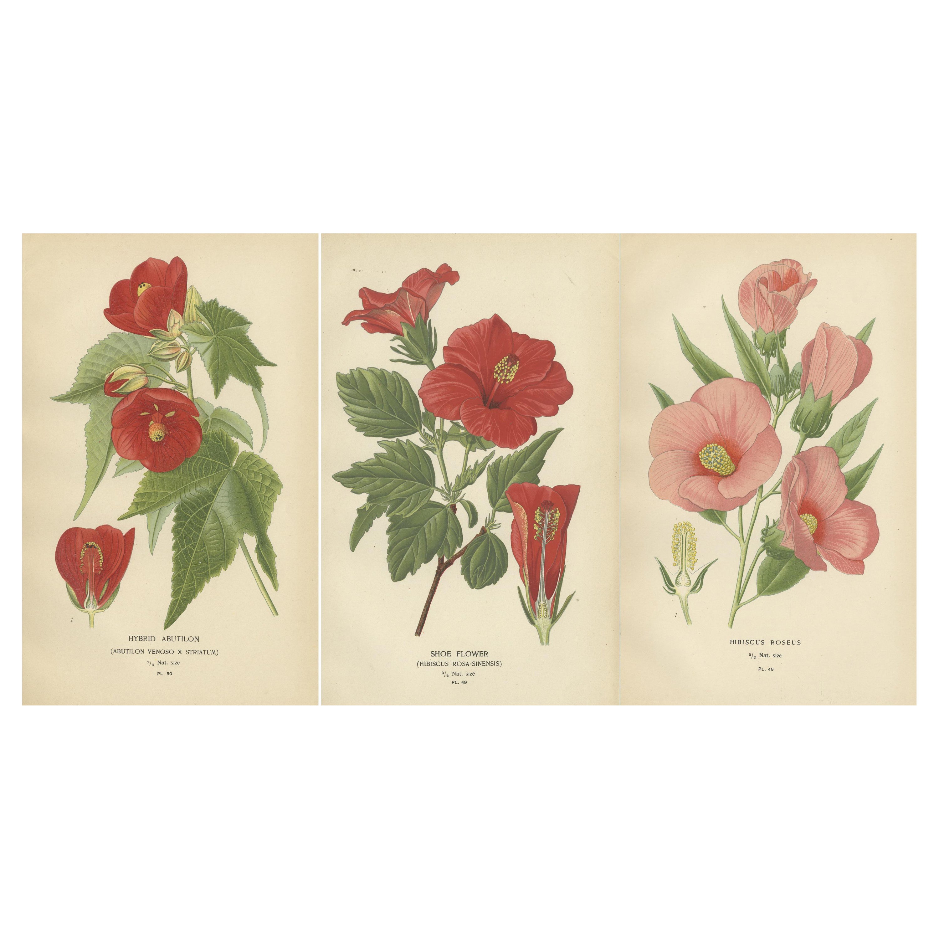
View AllFloral Masterpieces: A Collection of 19th-Century Horticultural Art, 1896
Located in Langweer, NL
"Floral Masterpieces: A Collection of 19th-Century Horticultural Art"
Introducing "Floral Masterpieces," a curated collection of six original antique prints from "Favourite Flowers of Garden and Greenhouse," authored by the renowned Edward Step and published in 1896. This collection represents a pinnacle of horticultural illustration, capturing the nuanced beauty of popular 19th-century floral species with exceptional chromolithographic artistry.
1. Hybrid Abutilon (Abutilon venoso x striatum): This print highlights the rich, velvety reds of the Hybrid Abutilon, complemented by intricate foliage detail.
2. Shoe Flower (Hibiscus rosa-sinensis): Renowned for its flamboyant blooms, this illustration depicts the Shoe Flower with its striking crimson petals and contrasting yellow stamen.
3. Hibiscus Roseus: The subtle pink shades of Hibiscus Roseus are rendered with a soft, delicate touch, inviting the viewer to appreciate its understated elegance.
Each print in this series exemplifies the meticulous attention to detail and the vibrant coloration that chromolithography afforded artists of the era. These illustrations not only served as a visual delight for Victorian society but also contributed significantly to the scientific study and classification of plants.
Presented with a white border that accentuates their detail, these prints are a testament to the enduring legacy of Victorian botanical exploration. They offer collectors and enthusiasts an opportunity to own a piece of botanical and illustrative history, perfectly suited for display in any setting that values both aesthetic and historical significance.
"Floral Masterpieces" stands as a tribute to Edward Step's contribution to botanical sciences and art, as well as to the time-honored craft of chromolithography. These prints are sure to enchant anyone with an appreciation for antique botanical art...
Category
Antique 1890s Prints
Materials
Paper
$321 Sale Price / set
20% Off
Free Shipping
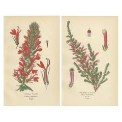
1897 Antique Botanical Prints – A Red Cardinal Flower and Wilmore's Heath
Located in Langweer, NL
Title: 1897 Antique Botanical Prints – Bellflowers and Lobelias Trio
These two original 1897 botanical prints feature the cardinal flower (Lobelia cardinalis) and Wilmore's heath...
Category
Antique 1890s Prints
Materials
Paper
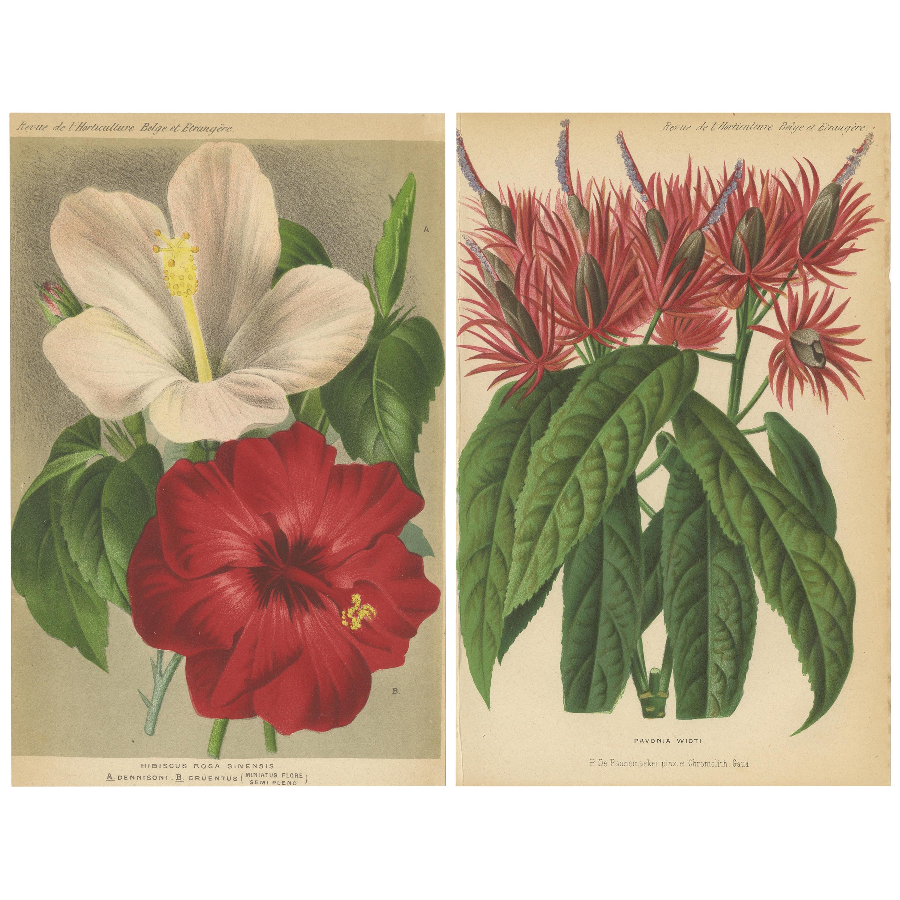
Set of 2 Antique Botany Prints, Hibiscus Rosa-Sinensis, Pavonia 'circa 1890'
Located in Langweer, NL
Set of two antique botany prints titled 'Hibiscus Rosa Sinensis - Pavonia Wioti'. It shows the Hibiscus rosa-sinensis and pavonia plant. These prints originate from 'Revue de l'Horti...
Category
Antique Late 19th Century Prints
Materials
Paper

$94 Sale Price / set
20% Off
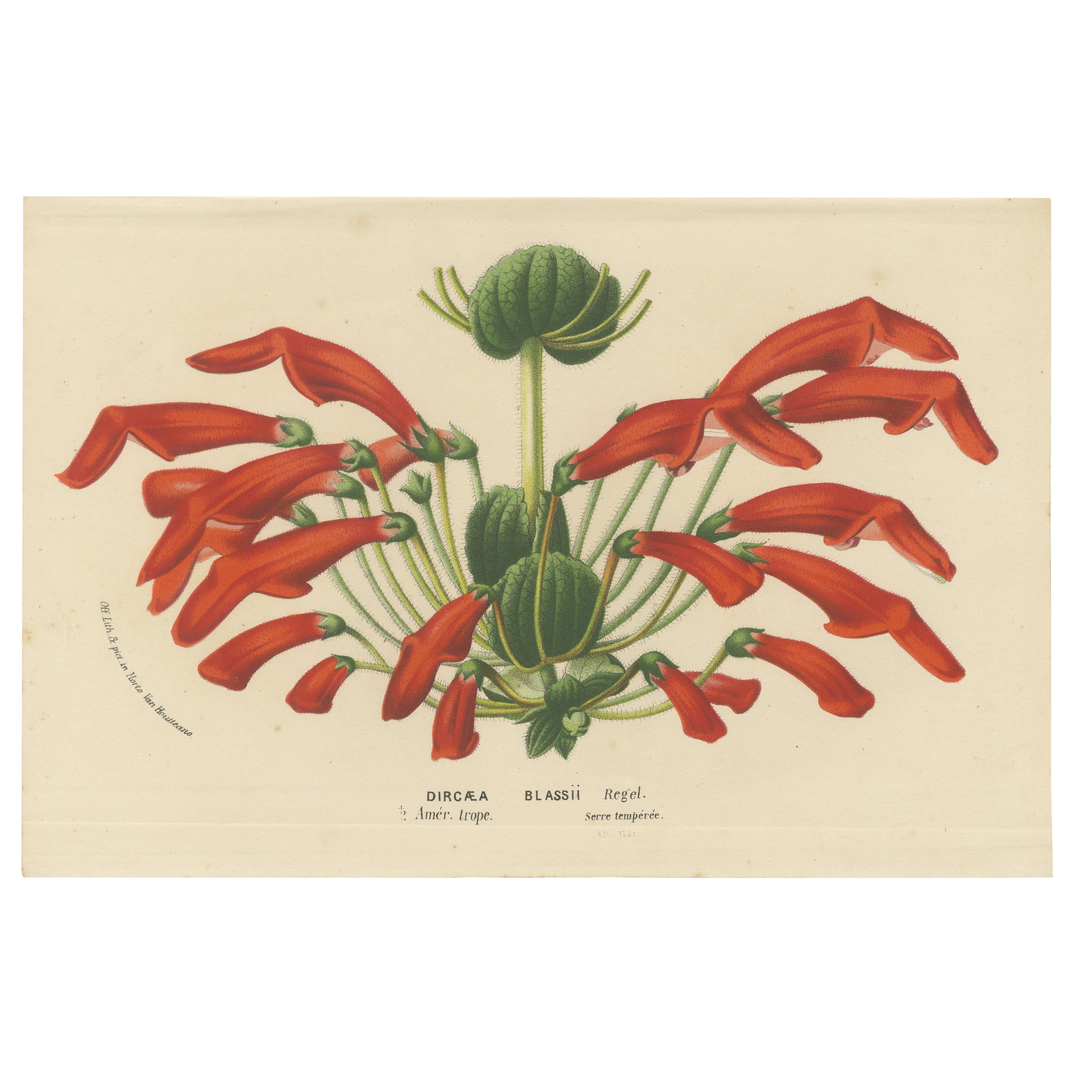
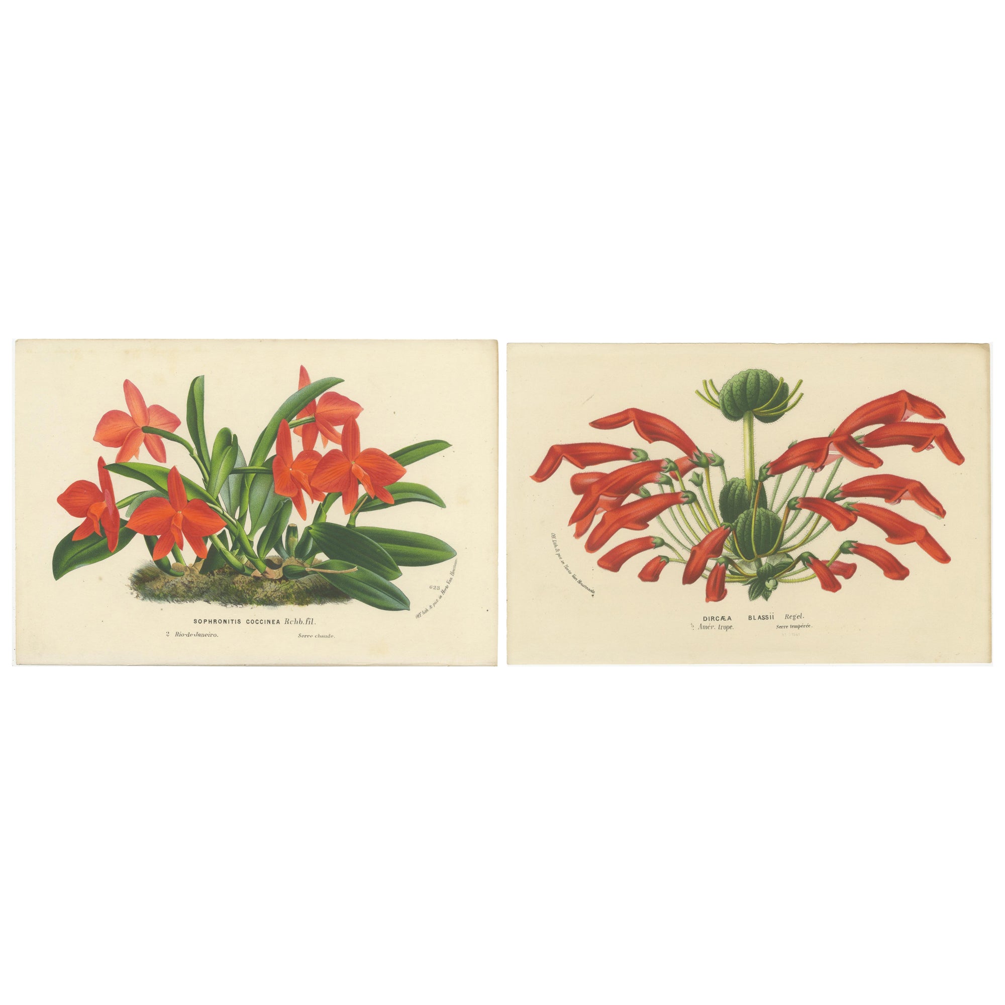
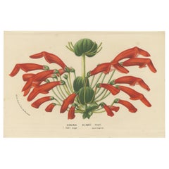
Leatherwood Splendor: A Tropical Display of Dircaea Blashii, Published in 1875
Located in Langweer, NL
The botanical print depicts Dircaea blashii (sometimes labeled as Dircaea or Dirca), a unique flowering plant known for its distinctive, red, tube-shaped flowers which are grouped in...
Category
Antique 1870s Prints
Materials
Paper
$170 Sale Price
20% Off
Botanical Vintage Prints of Scarlet Sophronitis and Tropical Bloom, c.1845
Located in Langweer, NL
The prints are from Louis Van Houtte's and Charles Lemaire's "Flore des Serres et des Jardins de l'Europe," a detailed collection of botanical lithographs showcasing plants grown in ...
Category
Antique 1840s Prints
Materials
Paper
$226 Sale Price / set
20% Off
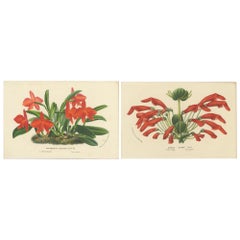
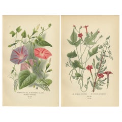
1897 Botanical Prints – Morning Glory and Red Ipomoea Varieties
Located in Langweer, NL
Title: 1897 Botanical Prints – Morning Glory and Red Ipomoea Varieties
Description: This pair of original botanical prints from 1897 feat...
Category
Antique 1890s Prints
Materials
Paper
You May Also Like
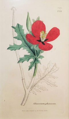
Glaucium Phoenicium (Red Horned-Poppy) /// James Sowerby Botanical Flower Plant
By James Sowerby
Located in Saint Augustine, FL
Artist: James Sowerby (English, 1757-1822)
Title: "Glaucium Phoenicium (Red Horned-Poppy)" (Vol. 7, Plate 1433)
Portfolio: English Botany; or, Coloured Figures of British Plants
Year...
Category
Early 1800s Victorian Still-life Prints
Materials
Watercolor, Engraving, Intaglio
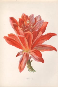
Cactus, English antique red flower botanical chromolithograph, 1895
By Frederick William Hulme
Located in Melbourne, Victoria
'Cactus'
Process print from Frederick William Hulme’s ‘Familiar Wild Flowers’, circa 1890.
Hulme was known as a teacher and an amateur botanist. He was the Professor of Freehand an...
Category
Late 19th Century Naturalistic Still-life Prints
Materials
Lithograph
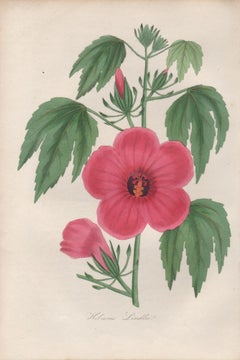
Hibiscus Lindlei, antique botanical pink flower engraving
Located in Melbourne, Victoria
Engraving with original hand-colouring. 1834. 230mm by 155mm. From Paxton's 'Magazine of botany and register of flowering plants' by Sir Joseph Paxton.
Category
Mid-19th Century Naturalistic More Prints
Materials
Engraving
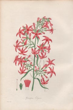
Ipomopsis Elegans, antique botanical red flower engraving
Located in Melbourne, Victoria
Engraving with original hand-colouring. 1834. 230mm by 155mm. From Paxton's 'Magazine of botany and register of flowering plants' by Sir Joseph Paxton.
Category
Mid-19th Century Naturalistic More Prints
Materials
Engraving
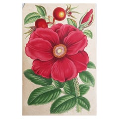
Original Antique Botanical Print - Red Rose, circa 1870
Located in St Annes, Lancashire
Lovely botanical print
Chromo-lithograph
Original color
Published, circa 1870
Unframed.
Chipped top left corner
Free shipping
Category
Antique 1870s English Victorian Prints
Materials
Paper
The Hollyhocks - Lithograph by Vincenzo Tenore - 1870s
Located in Roma, IT
Lithograph hand watercolored.
Belongs to the Series "Atlante di Botanica popolare ossia Illustrazione di Piante Notevoli di ogni famiglia" (Atlas of popular botany or illustration o...
Category
19th Century Modern Figurative Prints
Materials
Lithograph
More Ways To Browse
Vintage Tea Poster
Vintage Wet Bar
Vintage Yellow Teapot
Walnut Hairy Paw
Walter Lambert
Wind Up Doll
Wood Dowry Chest
Wooden Monkey Sculpture
Wrought Iron Balconies
Wrought Iron Balcony
18th Century London Delft
18th Century French Enfilade
1920s Sewing
1930s Black Doll
1970 Owl Ceramic
Acorn Clocks
Acrylic Cube Table
American Biedermeier