Items Similar to Temple and Buildings of the Labyrinth, Hawara – Floor Plan Engraving, Egypt 1776
Want more images or videos?
Request additional images or videos from the seller
1 of 10
Temple and Buildings of the Labyrinth, Hawara – Floor Plan Engraving, Egypt 1776
$283.55
£212.54
€240
CA$389.55
A$434.89
CHF 227.88
MX$5,323.52
NOK 2,894.05
SEK 2,728.72
DKK 1,826.97
About the Item
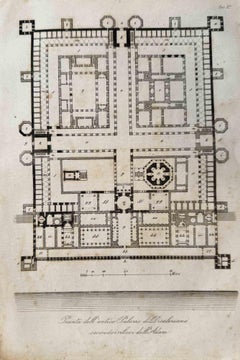
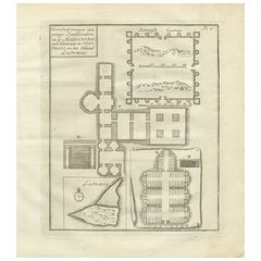
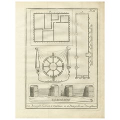
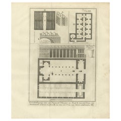
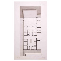
Title: Temple and Buildings of the Labyrinth at Hawara – Floor Plan Engraving, Egypt 1776
Description:
This 1776 architectural engraving presents a detailed floor plan of the legendary Egyptian Labyrinth near Hawara, believed to have once stood near the Fayum region. Numbered Plate XXIII, this engraving comes from the Dutch edition of Richard Pococke’s influential travel account documenting his exploration of Egypt and the Middle East.
The main structure, occupying the central portion of the plan, is a vast rectangular temple complex laid out with symmetrical corridors, columned halls, and chambers. Labeled areas include structural features such as walls, inner courtyards, sanctuaries, and freestanding elements like columns and statues. Numerous parts of the plan are identified with letters for reference, such as A, B, D, F, and M, likely corresponding to a legend in the accompanying text.
This plan reflects the enduring fascination with the Egyptian Labyrinth described by ancient Greek historians like Herodotus, who considered it one of the most astonishing architectural feats of antiquity. Thought to be part of the mortuary temple of Pharaoh Amenemhat III (12th Dynasty, c. 19th century BCE), the complex was mostly destroyed by the time of Pococke’s visit. Still, its ruins were of significant interest to early travelers and antiquarians, who sought to reconstruct its former grandeur based on surviving walls and foundations.
The Dutch caption reads, "De Platte-Grond van den Tempel en andere Gebouwen des Labyrinths," which translates to "The ground plan of the temple and other buildings of the Labyrinth."
This engraving was published in *Beschryving van het Oosten en van eenige andere landen* (Description of the East and Some Other Lands), translated and annotated by Ernst Willem Cramerus, and published in Utrecht, Rotterdam, and Amsterdam in 1776.
Condition report:
Excellent condition. Slight toning at the edges, with minimal spotting. Central vertical fold from original binding. Strong plate mark and crisp detail. Verso blank.
Framing tips:
This plan suits a black or dark oak frame with a wide ivory mat to emphasize the geometric design. An ideal piece for display in a library, office, or collection focused on ancient architecture or early Egyptology.
Technique: Engraving
Maker: Unknown engraver after Richard Pococke, Netherlands, 1776
- Dimensions:Height: 10.75 in (27.3 cm)Width: 9.85 in (25 cm)Depth: 0.01 in (0.2 mm)
- Materials and Techniques:Paper,Engraved
- Place of Origin:
- Period:
- Date of Manufacture:1776
- Condition:Excellent condition. Slight toning at the edges, with minimal spotting. Central vertical fold from original binding. Strong plate mark and crisp detail. Verso blank.
- Seller Location:Langweer, NL
- Reference Number:Seller: BG-14102-151stDibs: LU3054346043732
About the Seller
5.0
Recognized Seller
These prestigious sellers are industry leaders and represent the highest echelon for item quality and design.
Platinum Seller
Premium sellers with a 4.7+ rating and 24-hour response times
Established in 2009
1stDibs seller since 2017
2,513 sales on 1stDibs
Typical response time: <1 hour
- ShippingRetrieving quote...Shipping from: Langweer, Netherlands
- Return Policy
Authenticity Guarantee
In the unlikely event there’s an issue with an item’s authenticity, contact us within 1 year for a full refund. DetailsMoney-Back Guarantee
If your item is not as described, is damaged in transit, or does not arrive, contact us within 7 days for a full refund. Details24-Hour Cancellation
You have a 24-hour grace period in which to reconsider your purchase, with no questions asked.Vetted Professional Sellers
Our world-class sellers must adhere to strict standards for service and quality, maintaining the integrity of our listings.Price-Match Guarantee
If you find that a seller listed the same item for a lower price elsewhere, we’ll match it.Trusted Global Delivery
Our best-in-class carrier network provides specialized shipping options worldwide, including custom delivery.More From This Seller
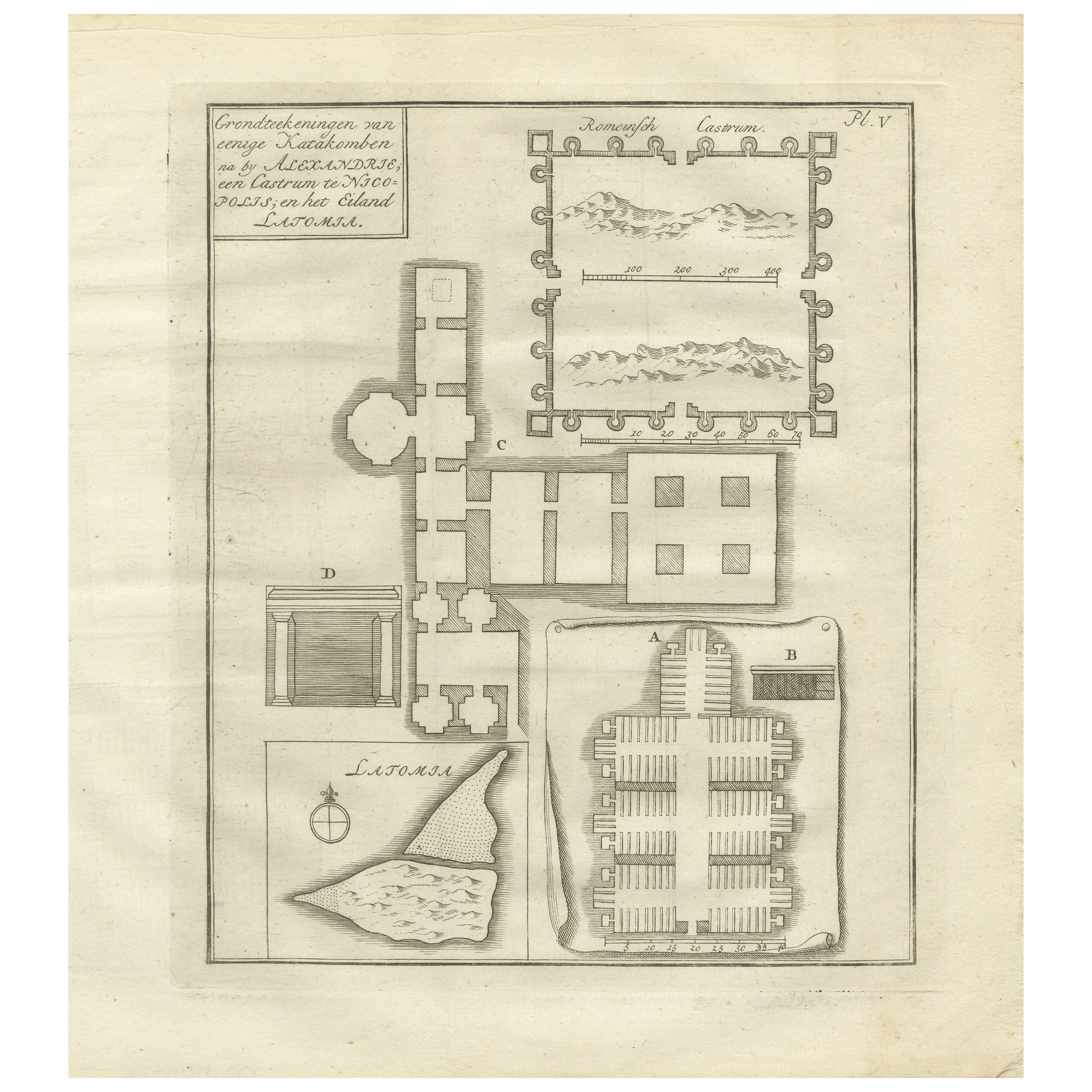
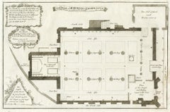
View AllAntique Plan of Egyptian Catacombs Alexandria Necropolis Latomia, 1776
Located in Langweer, NL
Antique Plan of Egyptian Catacombs Alexandria Necropolis Latomia 1776
This original 18th-century engraving presents a detailed architectural plan of several catacombs and ruins in a...
Category
Antique Late 18th Century European Prints
Materials
Paper
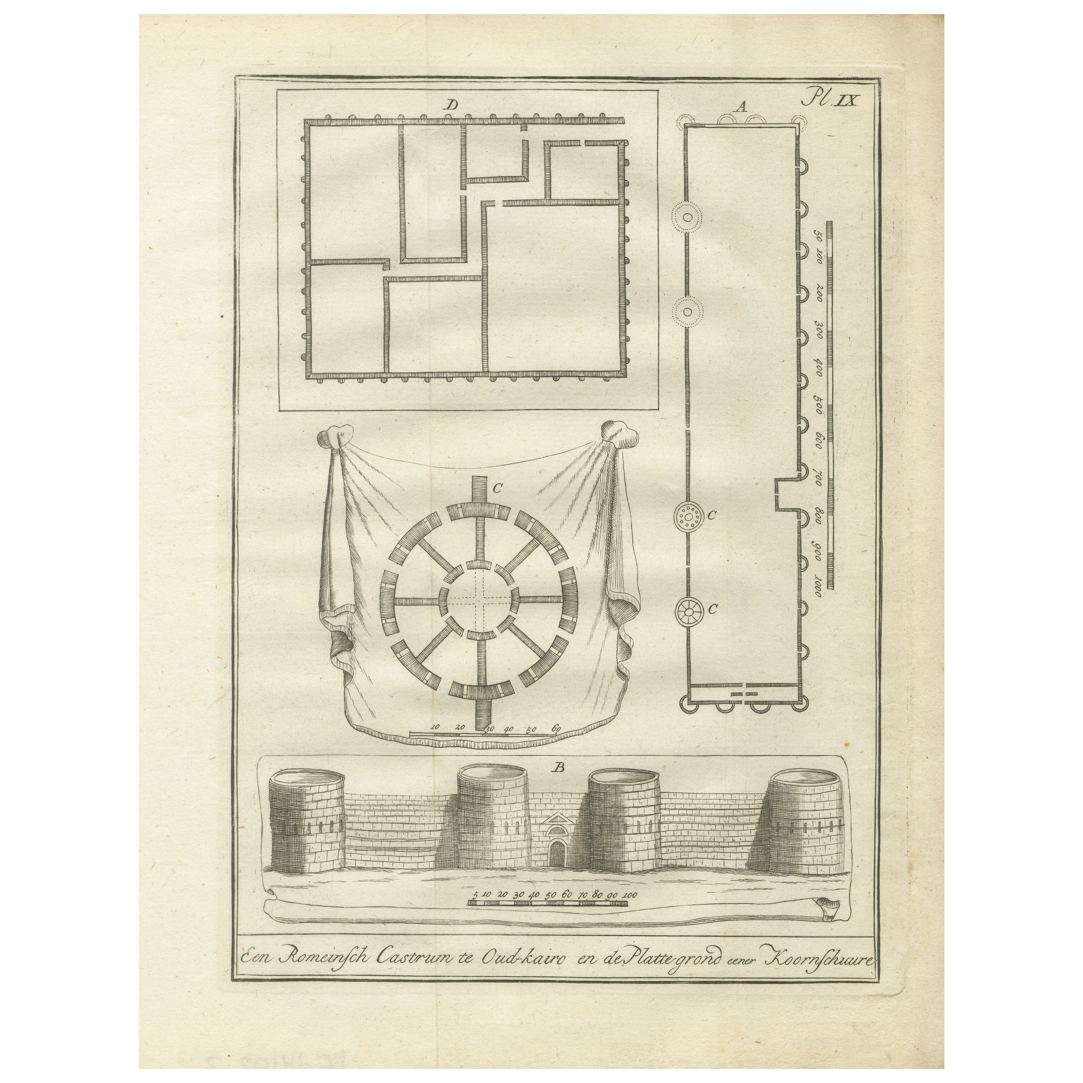
Roman Fortress, Old Cairo and Ancient Granary Plans – Egypt Engraving, 1776
Located in Langweer, NL
Roman Fortress, Old Cairo, and Ancient Granary Plans – Egypt Engraving, 1776
Description:
This original 1776 architectural engraving presents detailed plans and an elevation of a Ro...
Category
Antique Late 18th Century Dutch Prints
Materials
Paper
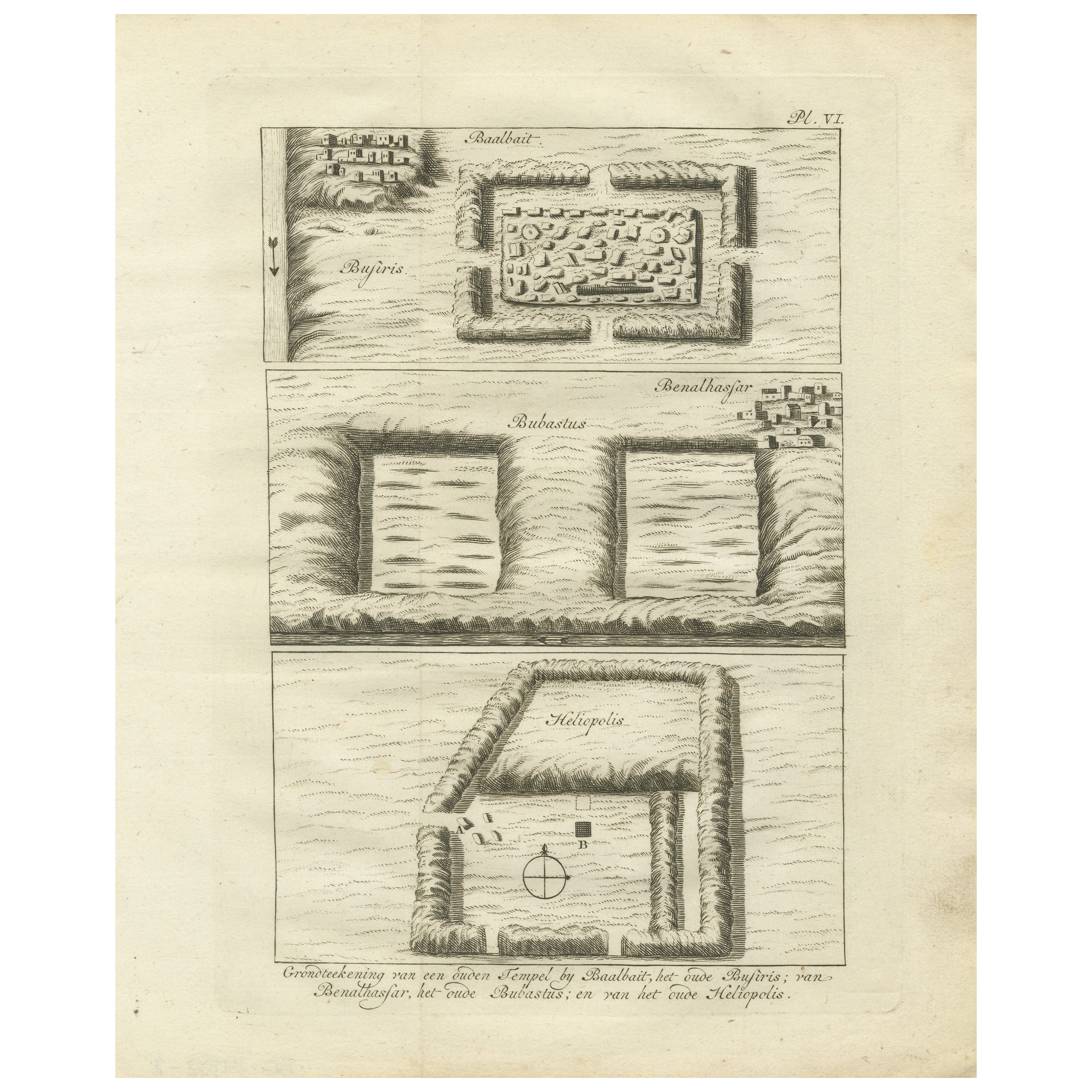
Ancient Temple and Ruin Plans – Egypt, Baalbek, Bubastus, Heliopolis 1776
Located in Langweer, NL
Title: Temple and Ruins Plans Egypt Baalbait Bubastus Heliopolis 1776
Description:
This original engraving from 1776 illustrates schematic plans of ancient Egyptian temple sites and...
Category
Antique Late 18th Century Dutch Prints
Materials
Paper
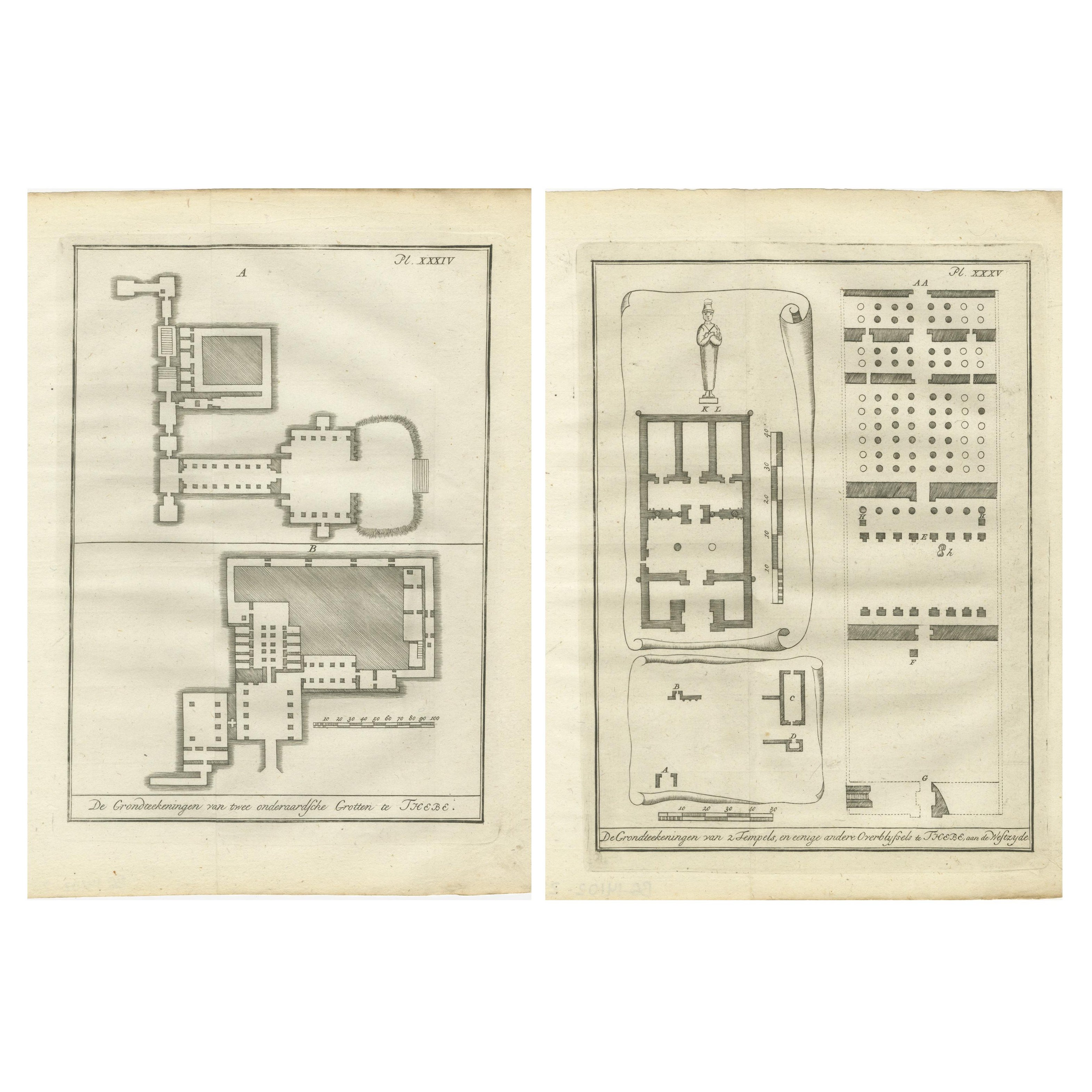
Ancient Egyptian Temple & Tomb Ground Plans – Thebes, c.1790 Engravings
Located in Langweer, NL
Ancient Egyptian Temple & Tomb Ground Plans – Thebes, c.1790 Engravings
Description:
This pair of antique engravings presents meticulously detailed architectural ground plans of an...
Category
Antique Late 18th Century Dutch Prints
Materials
Paper
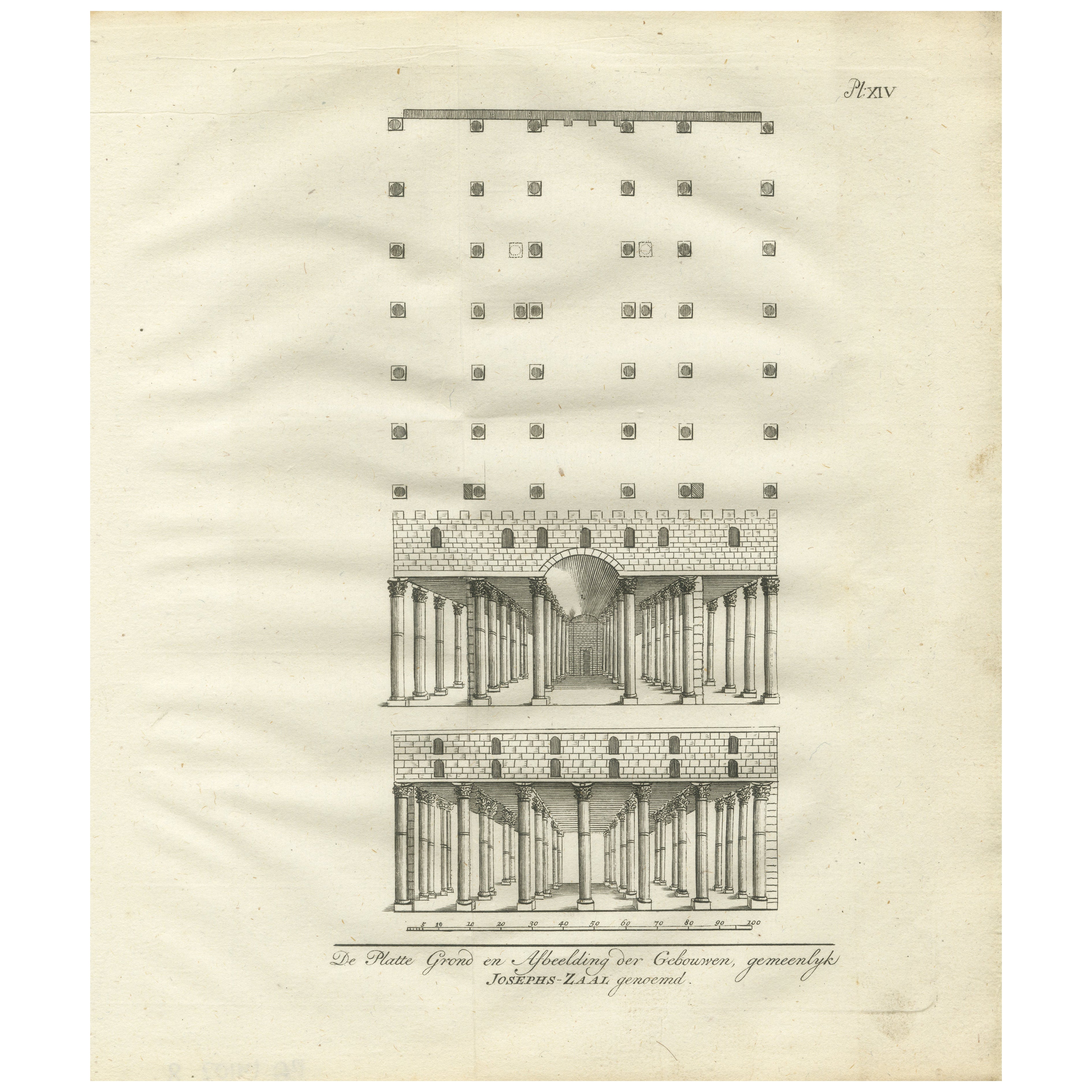
Hall of Joseph’s Granaries in Egypt – Floor Plan and Elevation Engraving, 1776
Located in Langweer, NL
Hall of Joseph’s Granaries in Egypt – Floor Plan and Elevation Engraving, 1776
Description:
This antique architectural engraving from 1776 shows the floor plan and structural elevat...
Category
Antique Late 18th Century Dutch Prints
Materials
Paper
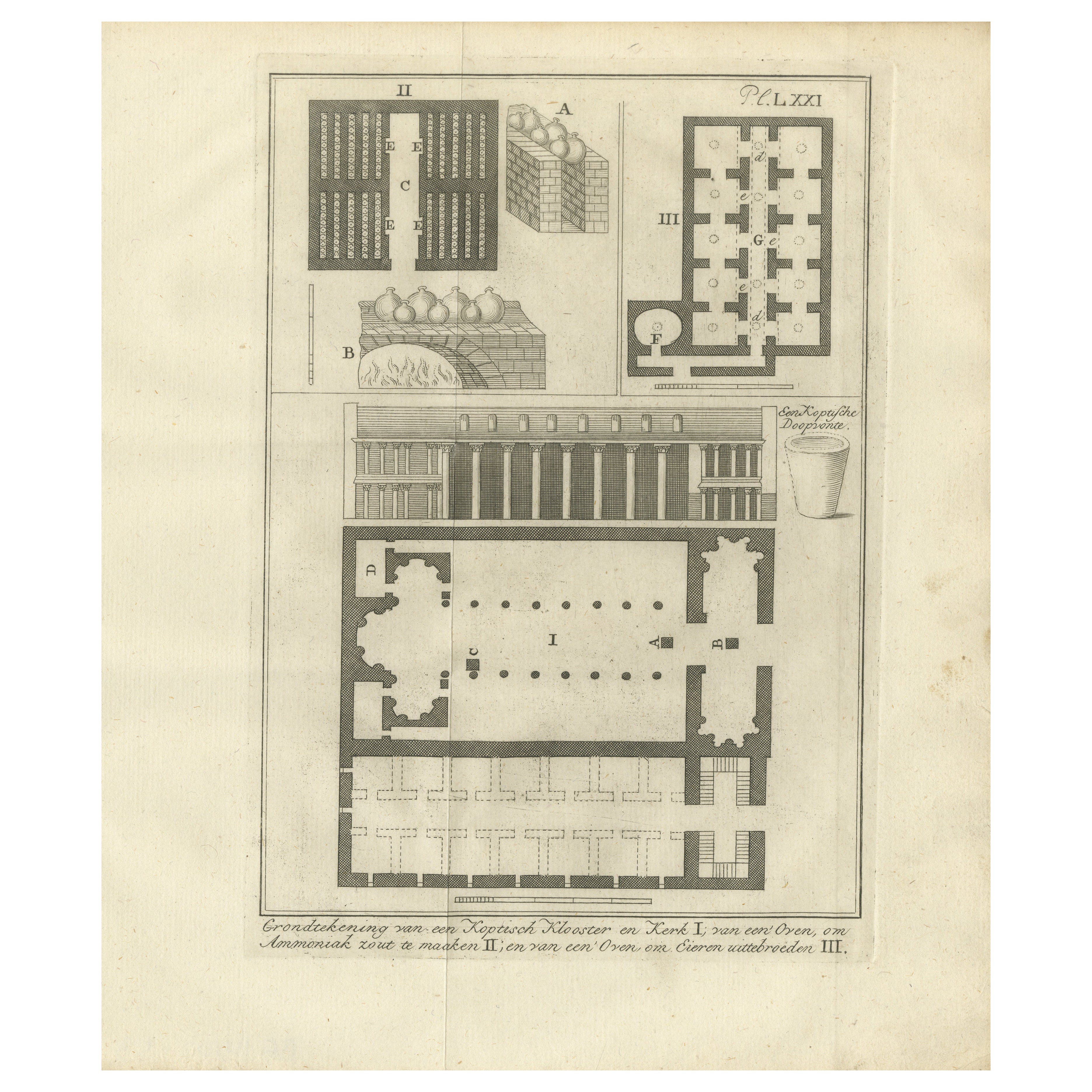
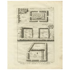
Coptic Monastery Plan, Ammonia Oven & Egg Incubator, Egypt c.1776
Located in Langweer, NL
Coptic Monastery Plan, Ammonia Oven & Egg Incubator, Egypt c.1776
Description:
This fascinating antique engraving, dating from circa 1776 presents a detailed architectural and techn...
Category
Antique Late 18th Century Dutch Prints
Materials
Paper
You May Also Like
The plan of St. Martin's Church, St. Martin in the Fields
By George Vertue
Located in Middletown, NY
London: Society of Antiqauries London, 1744. Engraving on buff wove paper with a large heraldic watermark with Strasbourg lily with a crown and shied and the letters LVG, 9 1/2 x 14 ...
Category
Mid-18th Century English School Landscape Prints
Materials
Handmade Paper, Engraving
Interior Plan - Original Etching by François Mazoit - 19th century
Located in Roma, IT
Interior Plan is an original etching realized by François Mazoit in the 19th century.
Plate-signed on the lower right.
Good conditions with diffused foxing spots.
Category
19th Century Modern Interior Prints
Materials
Etching
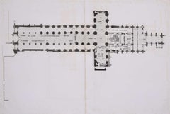
Floor plan of St Albans Cathedral (1810), engraving by James Basire
Located in London, GB
James Basire & John Carter
Floor plan of St Albans Cathedral
Engraving
61 x 95 cm
This engraving was originally published by the Society of Antiquaries of London, an organisation ...
Category
1810s Realist Landscape Prints
Materials
Engraving
Interior Plan - Original Etching by François Mazoit - 19th century
Located in Roma, IT
Interior Plan is an original etching realized by François Mazoit in the 19th century.
Plate-signed on the lower right.
Very good conditions.
Category
19th Century Modern Interior Prints
Materials
Etching
Architectural Roman Map - Etching by Vincenzo Scarpati - 18th Century
Located in Roma, IT
Architectural Roman Map from "Antiquities of Herculaneum" is an etching on paper realized by Vincenzo Scarpati in the 18th Century.
Signed on the plate.
Go...
Category
18th Century Old Masters Figurative Prints
Materials
Etching

Map of Palace of Diocletian- Lithograph - 1862
Located in Roma, IT
Uses and Customs - Map of Diocletian's Palace is a lithograph on paper realized in 1862.
The artwork belongs to the Suite Uses and customs of all the peoples of the universe: " Hist...
Category
1860s Modern Figurative Prints
Materials
Lithograph