Amsterdam Maps
to
3
5,436
241
6
3
3
5
1
1
3
1
1
1
1
6
6
6
Item Ships From: Amsterdam
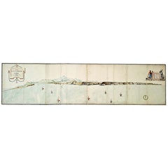
Very Large Hand-Drawn View of St Iago Cape Verde, by Frederici, 1783
Located in Amsterdam, NL
Johann Christian Friderici [= Frederici] (Heldburg 1766 - Cape Town 1804)
Prospect van het eyland, en de rheede van St. Iago. Geteekend van Johann Christian Friderici / Verbeelding van de inwoonders op St Iago
(View of the island, and the roadstead of St. Iago. Drawn by Johann Christian Friderci / Depiction of the inhabitants on St Iago)
?Porto Praia, Cape Verde...
Category
Late 18th Century Cape Verdean Dutch Colonial Antique Amsterdam Maps
Materials
Paper
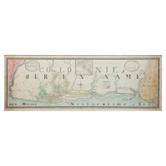
Extremely Large Hand-Drawn Manuscript Map of Surinam, 1830, History of Slavery
Located in Amsterdam, NL
A unique large hand-drawn map of Surinam by Albrecht Helmut Hiemcke (German, 1760-1839)
?
'Colonie Surinaame', 1830
A large hand-drawn and coloured map of the colony of Suri...
Category
Mid-19th Century Surinamer Antique Amsterdam Maps
Materials
Paper
Antique French Map of Asia Including China Indoneseia India, 1783
Located in Amsterdam, Noord Holland
Very nice map of Asia. 1783 Dedie au Roy.
Additional information:
Country of Manufacturing: Europe
Period: 18th century Qing (1661 - 1912)
Condition: Overall Condition B (Good Used)...
Category
18th Century European Antique Amsterdam Maps
Materials
Paper
$648 Sale Price
20% Off
Antique 1803 Italian Map of Asia Including China Indoneseia India
Located in Amsterdam, Noord Holland
Antique 1803 Italian Map of Asia Including China Indoneseia India
Very nice map of Asia. 1803.
Additional information:
Type: Map
Country of Manufacturing: Europe
Period: 19th centu...
Category
19th Century European Antique Amsterdam Maps
Materials
Paper
$584 Sale Price
20% Off
Super Rare Antique French Map of Chine and the Chinese Empire, 1780
Located in Amsterdam, Noord Holland
Super Rare Antique French Map of Chine and the Chinese Empire, 1780
Very nice map of Asia. 1780 Made by Bonne.
Additional information:
Type: Map
...
Category
18th Century European Antique Amsterdam Maps
Materials
Paper
$584 Sale Price
32% Off
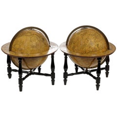
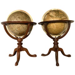
Pair of Fine Desk Globes by J. Cary, 1816 and 1824
Located in Amsterdam, NL
A pair of desk globes by J. Cary
“Cary’s New Terrestrial Globe delineated from the best Authorities extant; exhibiting the late discoveries toward the North Pole and every improve...
Category
Early 19th Century Antique Amsterdam Maps
Materials
Other
$29,482 / set
Related Items
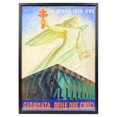
Italy 1939s Sketch Futurist Poster "Day of Two Crosses" Against Tuberculosis
By Fortunato Depero
Located in Milan, IT
Sketch of the futurist poster "Day of two crosses, 16th April 1939, XVII", mixed technique of pastel and water-color, for an Italian campaign against tuberculosis, to inform people a...
Category
1930s Italian Futurist Vintage Amsterdam Maps
Materials
Paper
$1,415
H 20.48 in W 14.57 in D 0.12 in
Pair of 19th Century English J & W Cary Celestial/Terrestrial Table Model Globes
By John & William Cary
Located in Milford, NH
A fine assembled pair of 12-inch English table model globes on stands manufactured by J & W. Cary, the left globe with cartouche labeled “The New Celestial Globe, on which are correc...
Category
Early 19th Century English Antique Amsterdam Maps
Materials
Brass
$18,900 / set
H 25 in Dm 16.5 in
Pair of Early 19th C Cary Celestial & Terrestrial Tabletop Globes
By John & William Cary, George & John Cary
Located in Milford, NH
A fine pair of tabletop globes on stands, the left hand colored Celestial globe with cartouche which reads “Cary's New Celestial Globe on which are corr...
Category
Early 19th Century English Antique Amsterdam Maps
Materials
Mahogany
Fine Pair of Cary’s Floor Standing Library Globes
By Cary’s
Located in Lymington, Hampshire
The terrestrial with cartouche printed “Cary’s new terrestrial globe exhibiting the tracks and discoveries made by Captain Cook; also those of Captain Vancouver on the North West Coa...
Category
1810s British Antique Amsterdam Maps
Materials
Oak
Antique Hammond's 6-Inch Terrestrial Globe on Stand
By C.S. Hammond & Co.
Located in Philadelphia, PA
Offered here for your consideration is, A fine antique 6-inch terrestrial globe.
Additional Details:
By C.S. Hammond & Co.
The globe likely dates from 1927 to 1930 due to the ...
Category
20th Century Unknown Art Deco Amsterdam Maps
Materials
Wood, Paper
19th Century German Miniature Pocket Terrestrial Globe
By C. Abel-Klinger
Located in Essex, MA
A miniature 19th century 3.5 inch diameter pocket terrestrial globe by C. Abel-Klinger, Nuremberg, Germany, in English for the English speaking markets. Signed with cartouche reading...
Category
1880s German Antique Amsterdam Maps
Materials
Brass
Large and Extremely Rare Terrestrial Globe by Newton
By Newton Globes - Planer & Newton
Located in Lymington, Hampshire
A large and extremely rare 24-inch terrestrial globe by Newton
Our most magnificent and rare globes were a pair of 24-inch Newton globes.
These too were updated in 1852 (terre...
Category
Mid-19th Century English Antique Amsterdam Maps
Materials
Mahogany
Original Drawing, Circle of Giovanni Battista Tiepolo 1696-1770 Venice, Italy
By Giovanni Battista Tiepolo
Located in Vero Beach, FL
Original Drawing, Circle of Giovanni Battista Tiepolo 1696-1770 Venice, Italy
Although we offer this old master drawing as circle of Tiepolo, we are convinced, based on the composi...
Category
18th Century Italian Rococo Antique Amsterdam Maps
Materials
Paper
$8,200
H 19.25 in W 20.25 in D 0.5 in
Antique Map of the Island of Tahiti, Polynesia, 1803
Located in Langweer, NL
Antique map Tahiti titled 'Kaart van het Eiland Otahiti'.
Antique map of the Island of Tahiti, Polynesia. Originates from 'Reizen Rondom de Waereld door James Cook (..)'.
Artists...
Category
Early 1800s Dutch Antique Amsterdam Maps
Materials
Paper
The Devonshire Collection of Italian Drawings Roman & Neapolitan Schools 1st Ed
Located in valatie, NY
The Devonshire Collection of Italian Drawings: Roman and Neapolitan Schools by Michael Jaffe. Published by Phaidon Press, London, 1994. 1st Ed hardcover with dust jacket. The Collection of Old Master drawings at Chatsworth House, Derbyshire, home of the Dukes of Devonshire, ranks with the Royal Collection at Windsor Castle as the finest privately owned group of such drawings in Britain and as one of the great princely collections of Europe. It contains outstanding drawings by the great masters from every artistic school. The book is devoted to the Italian drawings have detailed entries for nearly 1,000 works from the fifteenth to the eighteenth centuries, among them numerous reattributions and discoveries. This volume includes the works of Pietro da Cortona, Giulio Romano...
Category
1990s English Amsterdam Maps
Materials
Paper
$165
H 11.75 in W 10 in D 1.25 in
Floor Model Light Up Globe by Replogle Ca. 1950/1960's
By Replogle Globes
Located in New York, NY
Exceptional light up floor model globe, by Replogle Globes Inc. The globe is 16 in. in diameter, it features an interior light, and restrain a solid mahogany frame. This example is i...
Category
Mid-20th Century American Mid-Century Modern Amsterdam Maps
Materials
Glass, Mahogany, Paper
World Globe With Wooden Foot, and Brass 20th Century
Located in Mombuey, Zamora
Beautiful and elegant ball of the world to decorate any studio, living room or bedroom, it is small, with the base about 26 cm high and 10 wide.
Category
20th Century Italian Other Amsterdam Maps
Materials
Brass
$651 Sale Price
20% Off
H 14.57 in W 8.08 in D 8.08 in
Previously Available Items
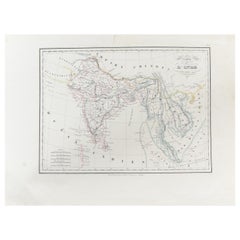
Antique Carte de L'Inde Myanmar, Malaysia Vietnam Map of Asia the Chinese Empire
Located in Amsterdam, Noord Holland
Antique Carte de L'Inde Myanmar, Malaysia Vietnam Map of Asia the Chinese Empire
Very nice map of Asia.
Additional information:
Type: Map
Country of Man...
Category
18th Century European Antique Amsterdam Maps
Materials
Paper
H 12.09 in W 16.15 in D 0.04 in
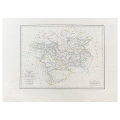
Antique Carte de De la Perse Saudie Arabia UAE Turkey Qatar Bahrein, 1836
Located in Amsterdam, Noord Holland
Antique Carte de De la Perse Saudie Arabia UAE Turkey Qatar Bahrein, 1836
Very nice map of Middle East.
Additional information:
Material: Paper
Typ...
Category
18th Century European Antique Amsterdam Maps
Materials
Paper
H 12.09 in W 16.15 in D 0.04 in
Rare and Fine Terrestrial Table-Globe by Johann Gabriel Doppelmayr '1671-1750'
Located in Amsterdam, NL
A rare and fine terrestrial table-globe by Johann Gabriel Doppelmayr (1671-1750)
Nuremberg, 1728
Globus Terrestris in quo locorum situs terraeque facies, secundum praecipuas celebe...
Category
1720s German Antique Amsterdam Maps
Materials
Other
H 17.72 in W 17.72 in D 17.72 in
Framed Hand Colored Map of Asia by Nicolas de Fer for Le Dauphine
Located in Amsterdam, NL
Nicolas de Fer (PARIS 1647-1720)
L’Asie divisée selon letendu de ses principales parties, et dont les points principaux sont placez sur les observati...
Category
Late 17th Century French Antique Amsterdam Maps
Materials
Other
Recently Viewed
View AllMore Ways To Browse
Emile Galle Pottery
Faience Miniature
Faux Stone Cabinet
Federal Tilt Top Table
Flair Firenze
French Cast Iron Bench
French Chinoiserie Sculptures
French Cicada
French Tilt Top Round Table
French Walnut Enfilade
French Washstand
French Wicker Bar Cart
Frosted Glass Figurines
Georg Jensen Teapot
George Nelson For Herman Miller Basic Cabinet Series
German Corner Shelf
German Music Box
Ginger Jars And Stands
