Ohio Maps
to
7
5,466
195
7
1
1
2
4
1
1
7
1
1
1
1
7
7
7
1
Item Ships From: Ohio
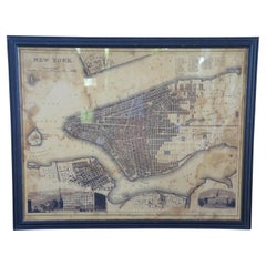
Vintage Oversized New York City Lower Manhattan 1840s Map Print
Located in Dayton, OH
Vintage late 20th century reproduction print of New York City featuring lower Manhattan in 1840.
Category
Late 20th Century Victorian Ohio Maps
Materials
Paper
$800 Sale Price
20% Off
20th Century Large Vintage Oval Wall Map of the World Globe Conference Table 13'
Located in Dayton, OH
Monumental oval classroom map of the world / wall globe from the second half of the 20th century. A two piece sculpture design made with heavy wood and metal trim paneling. Can be ...
Category
20th Century Ohio Maps
Materials
Metal
$2,400 Sale Price
20% Off
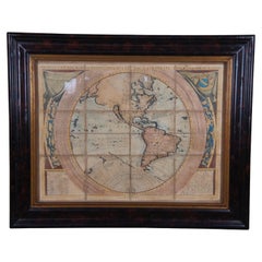
Vincenzo Coronelli's Colored Map of the New World Western Hemisphere Framed 47"
By Vincenzo Coronelli
Located in Dayton, OH
A Framed Reproduction of Coronelli's Map of the New World, Attributed to Trevor James Company. The map shows the Western Hemisphere including the discoveries made by Abel Tasman in A...
Category
20th Century Ohio Maps
Materials
Paper
$1,080 Sale Price
20% Off
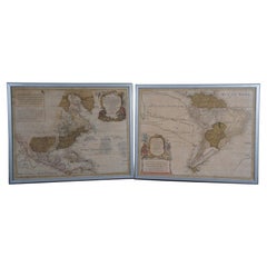
18th Century Antique Conrad Lotter Septentrionalis Meridionalis American Maps
Located in Dayton, OH
Pair of rare hand colored maps from the 1770's, depicting "America Septentrionalis" (North America), engraved by Georg Friedrich Lotter and America Meridionalis (South America), engr...
Category
18th Century Antique Ohio Maps
Materials
Paper
$2,400 Sale Price
20% Off
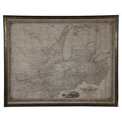
Antique 1844 J Calvin Smith JH Colton Midwest United States Survey Map 27"
By J.H. Colton
Located in Dayton, OH
Antique framed black and white map of seven Midwestern American states. Guide Through Ohio, Michigan, Indiana, Illinois, Missouri, Wisco...
Category
1840s Antique Ohio Maps
Materials
Paper
$940 Sale Price
20% Off
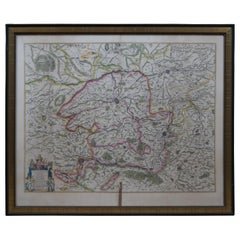
Antique Colored Belgium Map Flandria Gallica Flanders Henricus Hondius
Located in Dayton, OH
Antique hand colored map of Flanders, Belgium, engraved by Henricus Hondius.
Sans frame - 21.25” x 18”.
Category
19th Century Renaissance Antique Ohio Maps
Materials
Paper
$280 Sale Price
20% Off
Antique Chicago Illinois National Map Commercial Rollup Classroom Census Map 47"
Located in Dayton, OH
Antique early to mid 20th century double sided hanging map titled the New Commercial and Census Map of Illinois, Edition 1073. Verso shows the National Map of Chicago and Suburbs - O...
Category
Early 20th Century North American Ohio Maps
Materials
Paper
$940 Sale Price
20% Off
Related Items
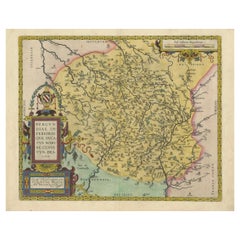
1584 Abraham Ortelius Map of Lower Burgundy, France
Located in Langweer, NL
1584 Abraham Ortelius Map of Lower Burgundy, France
Description of the Map:
This antique map by Abraham Ortelius, titled "Bvrgvndiae Inferioris Qvae Dvcatvs Nomine Censetur Des," w...
Category
16th Century Antique Ohio Maps
Materials
Paper
$1,208 Sale Price
20% Off
H 17.13 in W 21.66 in D 0 in
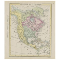
Small Map of the United States
Located in Langweer, NL
Antique map titled 'Amérique septe. Physique'. Small map of the United States. lithographed by C. Callewaert brothers in Brussels circa 1870.
Category
Mid-19th Century Antique Ohio Maps
Materials
Paper
Antique Map of the North Pole by V.M. Coronelli, circa 1692
By Vincenzo Coronelli
Located in Langweer, NL
Globe gore by Vincenzo Maria Coronelli shows the North Pole with the coasts of Canada, Greenland, Scandinavia and Siberia, and is decorated with pictorial scenes of bear, seal and wh...
Category
Late 17th Century Antique Ohio Maps
Materials
Paper
$1,332 Sale Price
20% Off
H 19.3 in W 26.78 in D 0.02 in
Four 18th Century Engraved and Hand-Colored Maps by Weigel
By Christoph Weigel
Located in Copenhagen, K
Small collection of four engraved maps of Italy, Balkan and of Central Asia.
Two are of Italy, one Corsica and Northern Italy and the other of the Southern Italian boot...
Category
18th Century German Antique Ohio Maps
Materials
Paper
$450 / item
H 15.75 in W 18.12 in D 0.79 in
Rare Antique Map of Southwestern Europe and West Africa by V.M. Coronelli, 1692
By Vincenzo Coronelli
Located in Langweer, NL
Antique Globe Gore: Southwestern Europe and West Africa by Vincenzo Coronelli
This exquisite, hand-colored globe gore by Vincenzo Coronelli, one of the most renowned 17th-century cartographers, represents Southwestern Europe and West Africa. A segment of Coronelli's monumental 42-inch terrestrial globe, this gore is a remarkable example of the artistry and geographical knowledge of the late 1600s. Covering France, the Iberian Peninsula, and all of Africa west of a line extending from Algeria to the Bight of Benin, it also includes the Canary Islands and Madeira.
Coronelli’s globe gores are celebrated for their exceptional engraving and accuracy, and this piece is no exception. The coastline of Africa is depicted with remarkable precision for its time, reflecting the latest geographical knowledge of European explorers. In contrast, the interior of Africa—still a mystery to European mapmakers—features mythical elements such as fantastical mountain ranges and exotic fauna. Giraffes, elephants, lions, and mysterious giant birds populate the landscape, offering a glimpse into the imagination and curiosity of the era. One notable detail is the Gambia...
Category
Late 17th Century Antique Ohio Maps
Materials
Paper
$2,331 Sale Price
20% Off
H 19.3 in W 13.59 in D 0.02 in
Mid-Century World Map Globe Table Light or Lamp
Located in Miami, FL
Good quality world map globe lamp.
If you are looking for stylish and beautiful quality item to upgrade your interior (whether at home or in your office) then this Parisian globe...
Category
Mid-20th Century French Mid-Century Modern Ohio Maps
Materials
Chrome
Map Exploring The World, Midi Format
Located in New York, NY
A compelling exploration of the ways that humans have mapped the world throughout history - now in a compact new edition
Map: Exploring the World brings together more than 250...
Category
21st Century and Contemporary Ohio Maps
Materials
Paper
Antique Map of The United States of North America, Pacific States, 1882
Located in Langweer, NL
The map is from the same 1882 Blackie Atlas and focuses on the Pacific States of the United States of America during that period. Here are some details and historical context about t...
Category
1880s Antique Ohio Maps
Materials
Paper
$237 Sale Price
20% Off
H 14.97 in W 11.03 in D 0 in
Antique Map of North America, 1821
Located in Langweer, NL
Antique map of America titled 'Carte de l'Amerique septentrionale'. Scarce map of North America, shortly after the Louisiana Purchase and the first ...
Category
19th Century Antique Ohio Maps
Materials
Paper
Black Forest Antler Arm Chair by J. A. K. Horn, Turingen 1840s
Located in Berghuelen, DE
Black Forest Antler Arm Chair by J. A. K. Horn, Turingen 1840s
An elaborate antique Black Forest antler arm chair with real stag and deer antlers as legs, arm- and backrests, seat w...
Category
Mid-19th Century German Black Forest Antique Ohio Maps
Materials
Antler, Wood
$4,225
H 38.98 in W 23.63 in D 19.69 in
Antique Map of the United States by Balbi '1847'
Located in Langweer, NL
Antique map titled 'Etats-Unis'. Original antique map of the United States. This map originates from 'Abrégé de Géographie (..)' by Ad...
Category
Mid-19th Century Antique Ohio Maps
Materials
Paper
$190 Sale Price
20% Off
H 9.06 in W 11.23 in D 0.02 in
Gorgeous 18th Century Baroque South American Floral Shrine
Located in Rio De Janeiro, BR
Lovely 18th Century shrine in polychrome cedar. Rectangular box, topped by a cut pediment carved with flowers, flanked by a pair of tips – like simplified obelisks. Sides and pair of...
Category
Late 18th Century Brazilian Baroque Antique Ohio Maps
Materials
Cedar
Previously Available Items
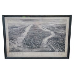
Restoration Hardware Old Manhattan New York 1867 Panoramic Etched Map
By Restoration Hardware
Located in Dayton, OH
A large and impressive Restoration Hardware framed library map of Old Manhattan, New York. Features a panoramic view, after the original eng...
Category
Late 20th Century Victorian Ohio Maps
Materials
Paper
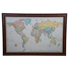
Frontgate Rand McNally World Classic Magnetic Travel Map with Burlwood Frame
Located in Dayton, OH
Frontgate Magnetic Travel Map by Rand McNally. Allows you to chart your journeys around the globe and even plan that “someday” trip of a lifetime. Printed ...
Category
Late 20th Century Modern Ohio Maps
Materials
Burl, Paper
Mid Century Brandt Cherry Replogle World Classic Series Floor Library Globe
By Replogle Globes, Brandt
Located in Dayton, OH
Mid Century Brandt Replogle world globe. Made of cherry featuring turned fluted column supports with triangular base and castors with Replogle 16"" globe Cartiographed by LeRoy M. To...
Category
Mid-20th Century Ohio Maps
Materials
Cherry, Paper
1857 Antique Coltons General Atlas World State Country Map Description Book
Located in Dayton, OH
"19th century (1857) J.H. Colton and Company General Atlas, Geographical, Statistical and Historical, Richard Fisher, MD, New York, London, Trubner and Company,
Jumbo size 18” x 15”, weighs almost 10lbs, original Condition.
Hand coloured maps of U.S. States, plans of the major U.S. cities, and the countries of the world. The Atlas includes individual maps by continent, country, state, territory and city. Each regional map is accompanied by: Astronomical Position, Boundaries, Dimensions, Physical Aspects, Political, Population, Industry, Agriculture, Religion, Education, and History. The Atlas was published five years prior to the Civil War, the statistics include slaves and the ""free colored population."" Approximately half of the maps are devoted to the United States with state maps and city plans. Western Americana maps include: ""Nebraska and Kansas Territories,"" ""Oregon and Washington,"" ""Utah and New Mexico,"" etc. Double page jumbo maps of United States...
Category
1850s Victorian Antique Ohio Maps
Materials
Leather, Paper
H 17.75 in W 15 in D 2 in
17th Century 1630 Nova Anglia Colored Map Engraving Belgium Virginia Jan Jansson
By J. Jansson
Located in Dayton, OH
17th century 1630 Nova Anglia colored map engraving Belgium Virginia Jan Jansson
Nova Anglia by Jan Jansson
This map is the first accurate depiction of the East Coast. One of t...
Category
17th Century American Colonial Antique Ohio Maps
Materials
Paper
H 23 in W 26.75 in D 0.125 in
Adrian Pearsall Globe
By Adrian Pearsall
Located in Cincinnati, OH
A light up Pearsall globe sitting on a solid sculptural walnut base, brass ring surrounds the globe which can be adjusted. The base is made by Craft Ass...
Category
Mid-20th Century American Mid-Century Modern Ohio Maps
Materials
Walnut
Globe with Brass Tripod Base
By Replogle Globes
Located in Cincinnati, OH
A library styled world globe with brass base, this 16" World Classic series globe was manufactured by Replogle and just perfect for today's clean look .
Category
20th Century American Ohio Maps
Materials
Brass
Recently Viewed
View AllMore Ways To Browse
Teak Hairpin
Terracotta Horse Head
Thai Goddess
Tiffany Stained Glass Windows
Tiffany Studios Antiques
Tiffany Vase With Sterling Silver
Tiger Bowl
Tole Painting
Toyo Japan Vase
Travertine Elephant
Triangle Dish
Tubular Etagere
Turquoise Buddha
Used Dorm Furniture
Used Ethan Allen Furniture
Used Furniture Elgin
Used Henry Link Wicker Furniture
Used Jockey Box
