Texas Maps
to
1
5,432
239
5
1
1
4
1
2
3
3
1
1
1
3
1
1
1
1
5
5
5
Item Ships From: Texas
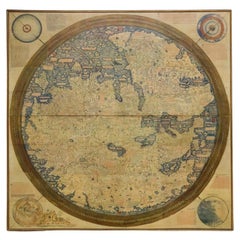
Monumental Framed Medieval Facsimile Map Of The World Fra Mauro Wood Wall Panel
Located in Forney, TX
A remarkable palatial nearly 7.5ft x 7.5ft facsimile of the important Map of the World (circa 1450) by Fra MauroFra Mauro (Italian; circa 1400–1464), featuring a solid wood framed hi...
Category
Early 20th Century Medieval Texas Maps
Materials
Linen, Wood, Paper
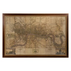
Large Scale Map of the London Metropolis
Located in Dallas, TX
The product is a large scale map of the London Metropolis, specifically focusing on the city in intricate detail. It would be a valuable collectible for those interested in maps and ...
Category
Mid-20th Century English Texas Maps
Materials
Paper
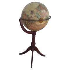
Vintage Globe on Regency Pedestal Stand
Located in Pasadena, TX
This is a nice vintage globe. It sits on a pedestal tripod base. The base is constructed in a regency style. This globe comes from the office of Roger Rolke of Shell Oil Co.
A nice ...
Category
20th Century American Texas Maps
Materials
Wood
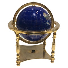
Globe, Solid Rotating Brass Frame with Spinning Globe
Located in Dallas, TX
Globe, solid rotating brass frame with spinning globe, faux hardstone.
Category
Mid-20th Century French Texas Maps
Materials
Brass
$2,144 Sale Price
20% Off
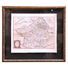
17th Century Framed Map of Ancient France Titled "Typus Galliae Veteris"
Located in Dallas, TX
Decorate an office or a library with this elegant historic map. Crafted in the Netherlands circa 1630, this beautifully framed antique map with pr...
Category
17th Century Dutch Baroque Antique Texas Maps
Materials
Glass, Giltwood, Paper
Related Items
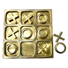
Solid Brass Tic-Tac-Do Board with Brass X's and O's
Located in Los Angeles, CA
A beautifully styled Tic-Tac-Do Board in solid brass. A perfectly designed piece to play, but even better, the piece can sit on a console, cocktail table or great icebreaker for the...
Category
20th Century Modern Texas Maps
Materials
Brass
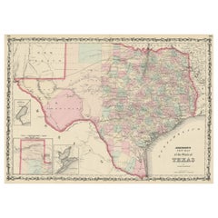
Large Antique Map of the State of Texas, 1861
Located in Langweer, NL
Antique map titled 'Johnson's New Map of the State of Texas' Large map of Texas, shows railroads, wagon roads, the U.S. Mail Route, rivers, ports, ...
Category
Mid-19th Century American Antique Texas Maps
Materials
Paper
Vintage Rotating Gambling Chip Holder
Located in San Francisco, CA
C. 20th century
Somewhere in the 1920's / 1930's These were created
Vintage rotating gambling chip holder.
Category
20th Century Texas Maps
Materials
Plastic
Antique World Globe From Fleet Street London 1923 on Wooden Stand
Located in Reading, Berkshire
Antique Terrestrial Geographia of Fleet Street London 12"inch World Globe on handcrafted Wooden Three Legged Base 1923
Made 55 Fleet Street, London
Beautiful desktop globe, sho...
Category
1920s British Art Deco Vintage Texas Maps
Materials
Wood, Paper
$1,318 Sale Price
25% Off
H 18.51 in Dm 11.82 in
Antique Hammond's 6-Inch Terrestrial Globe on Stand
By C.S. Hammond & Co.
Located in Philadelphia, PA
Offered here for your consideration is, A fine antique 6-inch terrestrial globe.
Additional Details:
By C.S. Hammond & Co.
The globe likely dates from 1927 to 1930 due to the ...
Category
20th Century Unknown Art Deco Texas Maps
Materials
Wood, Paper
Solid Brass Ships Onion Lantern
Located in Norwell, MA
Large size glass globe onion lamp from a ship well made european style oil lantern with original burner and chimney shade. The Glass globe is protected by Brass bars. There is a vent...
Category
1920s European Vintage Texas Maps
Materials
Brass
Carl Auböck Model #5615 'Star' Solid Brass Keyring with Signature
By Werkstätte Carl Auböck
Located in Glendale, CA
Carl Auböck Model #5615 'Star' solid brass keyring with signature. Designed in the 1950s, this incredibly refined and sculptural object is hand fabricate...
Category
21st Century and Contemporary Austrian Mid-Century Modern Texas Maps
Materials
Brass
$109 / item
H 1.75 in W 0.75 in D 0.163 in
XL Ammonite fossil on stand
Located in MILL, NL
Gigantic Ammonite fossil on custom black stand.
Approx. 150-200 Million Years Old.
An ammonite is an extinct marine animal belonging to the class of squid. Ammonites lived in the ...
Category
15th Century and Earlier Antique Texas Maps
Materials
Stone
Original 17th-Century Antique Map of Nanjing Province, China – by Blaeu
Located in Langweer, NL
Title: 17th-Century Antique Map of Nanjing Province, China – "Nanking sive Kiangnan" by Blaeu, with Decorative Details
Description: This captivating 17th-century map of Nanjing Pr...
Category
1650s Antique Texas Maps
Materials
Paper
$1,580
H 18.9 in W 23.04 in D 0.01 in
Vintage Replogle World Globe On Stand
By Replogle Globes
Located in San Carlos, CA
For Sale: Vintage 1980s 16" Replogle World Globe on Wooden Stand
Discover a piece of history with this beautifully crafted vintage Replogle globe, perfect for any collector or world...
Category
1980s American Neoclassical Vintage Texas Maps
Materials
Wood
Map Exploring The World, Midi Format
Located in New York, NY
A compelling exploration of the ways that humans have mapped the world throughout history - now in a compact new edition
Map: Exploring the World brings together more than 250...
Category
21st Century and Contemporary Texas Maps
Materials
Paper
Vintage Boho Brass Horse on Stand
Located in West Palm Beach, FL
Add a touch of vintage charm to your space with this exquisite Vintage Boho Brass Horse on Stand, a striking piece that blends artistry and history. Cra...
Category
Late 20th Century American Mid-Century Modern Texas Maps
Materials
Bronze
Previously Available Items
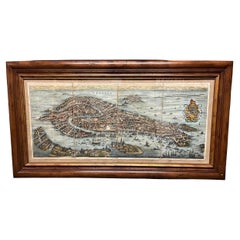
17th Century Hand Colored Prospect Map of Venice Engraving
Located in Houston, TX
A nice engraved, hand colored view of Venice, originally engraved in 1635. Highly detailed showing the important buildings, the course of the Grand Canal, the Rialto bridge, All in a...
Category
19th Century Italian Other Antique Texas Maps
Materials
Wood, Paper
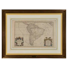
Important 17th Century Nicholas Sanson French Royal Presentation Map
Located in Forney, TX
An important original 17th century presentation map titled "Amerique Meridionale" by Nicholas Sanson. Circa 1690, France.
Sanson was royal geographer, teaching both Louis XIII and...
Category
17th Century French Antique Texas Maps
Materials
Wood, Paper
Cram World Globe on Wood Floor Stand
By George F. Cram
Located in Houston, TX
This lovely vintage 12" cram world globe on wood floor stand will be a great addition to your home, office or library. The globe is 12" inch diameter...
Category
20th Century American Texas Maps
Materials
Wood, Paper
G.W. & C.B. Colton Map of Michigan
By G.W. & C.B. Colton
Located in Round Top, TX
A framed rare G.W. & C.B. Colton of New York map of Michigan depicting counties, cities, railroads, and canals, circa 1874.
Category
Late 19th Century American Antique Texas Maps
Materials
Paper
19th Century Map of Paris
Located in Round Top, TX
A folding pocket map of Paris from the French war department, 1839, mounted on silk in a new frame.
Category
Early 19th Century French Antique Texas Maps
Materials
Paper
French Vintage Map of Paris 1940s in Giltwood Frame
Located in Dallas, TX
Collectible extra large framed map of Paris.
Nice giltwood frame.
Map reflects age.
Measure: 42 inches wide x 41 inches height.
Category
Mid-20th Century French Texas Maps
Materials
Paper, Giltwood
Antique Globe on Stand by J.Forest
Located in Houston, TX
A French terrestrial globe, pre-1924, by J.Forest. The globe is mounted offset with a brass half meridian and is set on an ebony wooden Stand. Though it was produced during the golde...
Category
Early 20th Century French Texas Maps
Framed Map of Paris
Located in Round Top, TX
A wonderful French large-scale framed map of Paris, circa 1940.
Category
Mid-20th Century French Texas Maps
Materials
Wood, Paper
A New Map of the World
Located in Dallas, TX
a new map of the world with Captain Cook's tracks, his discoveries and those of other circunavigators. London, 1794 Laurie and Whittle, original wash ...
Category
18th Century and Earlier Antique Texas Maps
18th Century Map of Cambridgeshire
Located in Austin, TX
A handsome 18th century English map of Cambridgeshire, mounted and framed under glass.
Printed in 1722 - From an edition of Camden's Britannia (Map by Robert Morden)
Great as a gif...
Category
18th Century English Antique Texas Maps
Materials
Glass, Wood, Paper
19th c. French maps of suburbs of Paris
Located in Houston, TX
French maps of suburbs of Paris recently framed in gold. Set of 4 priced separately.
image 2- 27"x 39.2" commune de Ville St. Denis 1864
image 3- 39.25"x 27" Naterre, Fort du Mont Valerien (sold)
image 6- 39.25"x 27" Commune de Pierrefitte 1869
image 8- 39,25"x 27" Commune de St Mande...
Category
19th Century French Antique Texas Maps
Vintage French schoolhouse map
Located in Houston, TX
This large map is paper on linen with original wood dowel rods intact.
Category
1950s French Vintage Texas Maps
Recently Viewed
View AllMore Ways To Browse
Colonial China Cabinet
Communist Sculpture
Convertible Game Table
Copper Amphora
Copper Pyramid
Coronation Crystal
Corrugated Vase
Country Store Counter
Coupe Schneider
Covered Potpourri
Cox And Sons
Crotch Mahogany Chest Of Drawers
Crystal Cocktail Shakers
Crystal Horse Sculpture
Ct Porcelain
Cut Crystal Old Fashion Glass
Cut Glass Trumpet Vase
Danish Modern Wall Unit With Desk
